
Good aerial photos can be hard to come by. They’re often obstructed by wings or clouds or Instagram. Sure there’s satellite imagery, but I’m talking about deliberately framed photos, that give you a sense of place.

That’s why I found these photos by Lucie Maru particularly striking. They offer a rare glimpse of the city from a point of view that’s close enough to recognize large landmarks, yet distant enough to get a good sense of their larger spatial relationships. Take a look at the Cedar-Riverside neighborhood:
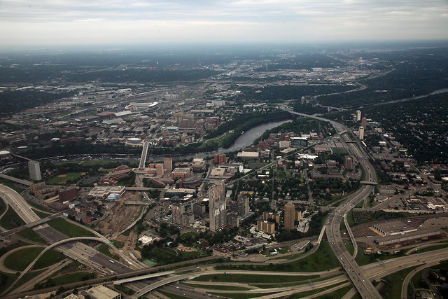
Really drives home the way it was islanded by highways. And South Minneapolis:

There’s a tidiness to the landscape at this distance. The number of cars on 35W seems appropriate for its berth. Everything’s running smoothly in our green, leafy city. Maybe freeways look their best from this distance because this was the scale on which they were conceived. Maybe being a person on the freeway is like looking at someone’s face with a microscope, and seeing every oozing pore.
On that note, stay tuned in 2 weeks for a nitty gritty Friday Photo featuring an excerpt from an essay entitled “Commuters”.