
Editor’s Note: Through an ongoing partnership with the Minnesota Historical Society, Streets.mn is republishing stories from MNopedia, the digital encyclopedia of Minnesota history published by the Minnesota Historical Society. The original text is reproduced here through a Creative Commons license (CC BY-NC-SA 4.0); photos are used with permission.
In 1905, efforts by a group of West Side residents enabled the St. Paul Park Board to purchase the first portion of the West Side Boulevard. The land is situated on a high bluff of the Mississippi River, with outstanding views of downtown St. Paul and the expanding city. The area later became known as Cherokee Park.
Origins
Situated on a high bluff along the western bank of the Mississippi River, Cherokee Park sits amid a landscape of Dakota sacred sites, including Bdote (the confluence of the Mississippi and Minnesota Rivers) and Wakan Tipi (Carver’s Cave). For thousands of years, the area’s proximity to the river, floodplains, Pickerel Lake and upland bluffs offered a variety of resources for Indigenous inhabitants of the area. In 1851, the Treaty of Mendota resulted in the Dakota transferring a vast swath of land to the United States government, including the area that is now Cherokee Park. The United States government has yet to deliver much of the promised payment under the treaty. By the mid-1850s, the area that is now Cherokee Park was owned by various private citizens.
By the 1890s, the land that is currently Cherokee Park was platted, with streets and homes planned for the area. Some homes and other structures had already been built on the current parkland. Nevertheless, the St. Paul Park Board was eager to use this land for a public boulevard, which was proposed to begin around the intersection of Cesar Chavez Street and Isabel Street West, head along the bluff toward the High Bridge, and then stretch another four miles to the town of Mendota. The Park Board had difficulty in securing this land, as it was all already privately owned.
Development and Early History
In 1905, however, donations of land and money from West Side residents resulted in a 10-acre section of land east of the High Bridge being designated as a park, which was called the West Side Boulevard. In 1906, a subsequent monetary donation made by James J. Hill enabled another nine-acre expansion of the park to the west of the High Bridge. The Park Board acquired the southern portion of the park in 1915, and around this time the park was renamed Cherokee Heights Park. Beyond grading a dirt road, few park “improvements” were made during these years.
The 1920s marked the beginning of more extensive development in the park, including a widened and paved road, and construction of recreational facilities such as horseshoe, tennis and kitten-ball courts. In 1920, a municipal tourist campground was established that hosted approximately 10,000 travelers each summer. Facilities at the campground included tables, permanent stoves, water, lights, a pavilion, and a bathhouse with hot showers. The campground was initially located along Chippewa Avenue. After a few years, the campground was moved to the western boundary of the park, away from the residential area and neighbors who considered it an eyesore.
The campground was shuttered in the early 1930s, and the park became a popular destination for picnics. In the following decades, the park hosted band concerts, an ice-skating rink, a toboggan slide, community sings, horseshoe and tennis leagues, annual West Side Fourth of July celebrations, and countless community and family gatherings.

Expansion and Restoration
In the late 1960s, several development projects were proposed in the vicinity of the park. The St. Paul Port Authority attempted to purchase 50 acres of land adjacent to the park owned by the Twin Cities Brick Company with the goal of establishing an industrial zone and scrapyard. This plan was ultimately rejected, and 25 acres of the Twin Cities Brick Company land along the bluff were eventually incorporated into Cherokee Park. Around this time, a private company presented an offer to lease a portion of the bluff within the park for a ski-racing run. This plan was dismissed due to overwhelming community opposition.

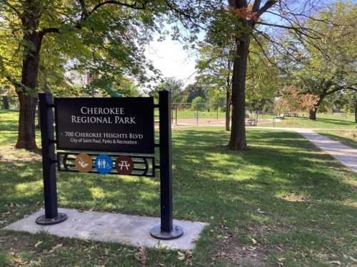
In the early 21st century, park managers made efforts to restore native vegetation and increase accessibility to picnic facilities. In 2024, the spectacular views that first inspired the St. Paul Park Board to establish this area as public land continue to be enjoyed by park visitors.
Chronology
- 1851: With the Treaty of Mendota, Dakota leaders cede the land that will become Cherokee Park to the United States government.
- 1905: The St. Paul Park Board establishes the first section of the West Side Boulevard.
- 1906: A donation by James J. Hill enables the St. Paul Park Board to purchase a second section of the West Side Boulevard.
- 1915: The St. Paul Park Board expands the park to the south and begins referring to it as Cherokee Heights Park.
- 1921: A free municipal tourist campground is established at Cherokee Heights Park.
- 1925: The campground begins charging tourists for using the site.
- 1931/32: The tourist campground closes.
- 1950s: The St. Paul Park Board and community leaders establish an annual neighborhood Fourth of July celebration at the park.
- 1967: St. Paul Port Authority proposes buying 25 acres of land adjacent to the park from the Twin Cities Brick Company for the Pickerel Lake Industrial Park.
- 1972: Cherokee Park is enlarged by 25 acres of land purchased from the St. Paul Brick Company.
- 1973: The St. Paul City Council rejects a proposal to convert a section of Cherokee Park’s bluff to a ski run after West Side residents mobilize to protest the idea.
- 2013: A tragic landslide on the bluff kills two schoolchildren collecting fossils on a school field trip.