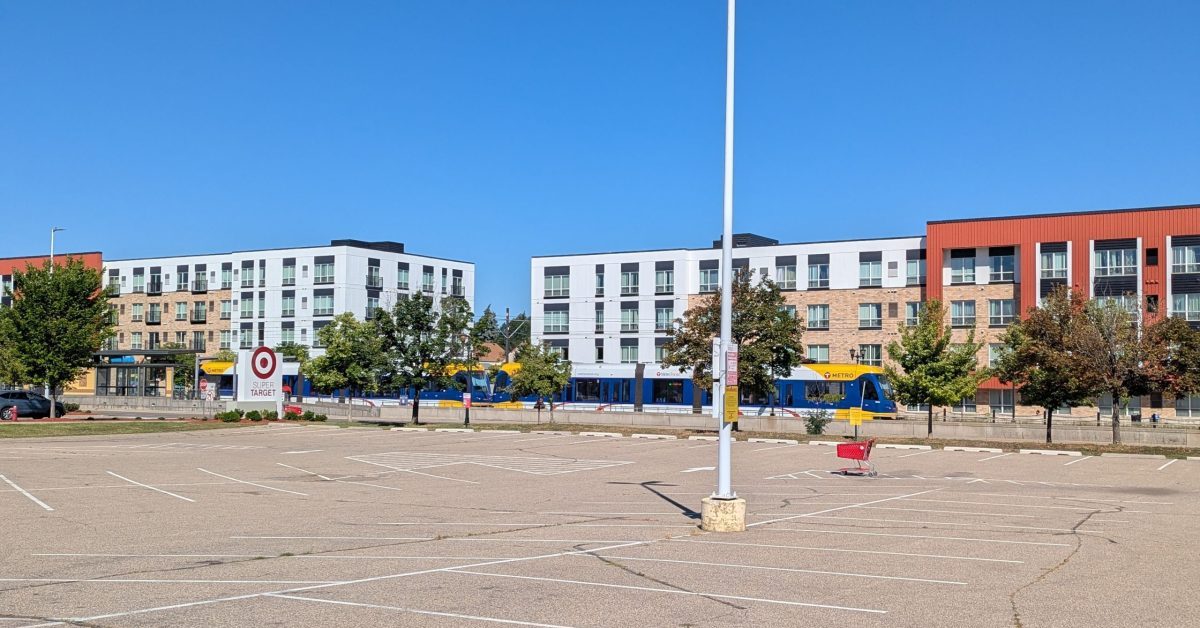
Last summer, I published three articles showing how St. Paul’s zoning rules have prohibited neighborhood-scale commercial spaces since 1975, and how this has negatively impacted our city’s livability, walkability, tax base and climate resiliency.
In those articles, I asked you to join Sustain Saint Paul in calling on the City to study expanding the use of Traditional Neighborhood zoning. I believe that expanding Traditional Neighborhood zoning is one of the most powerful things the City can do to create new housing and businesses, expand the tax base, and facilitate the evolution of more walkable, transit-rich neighborhoods.
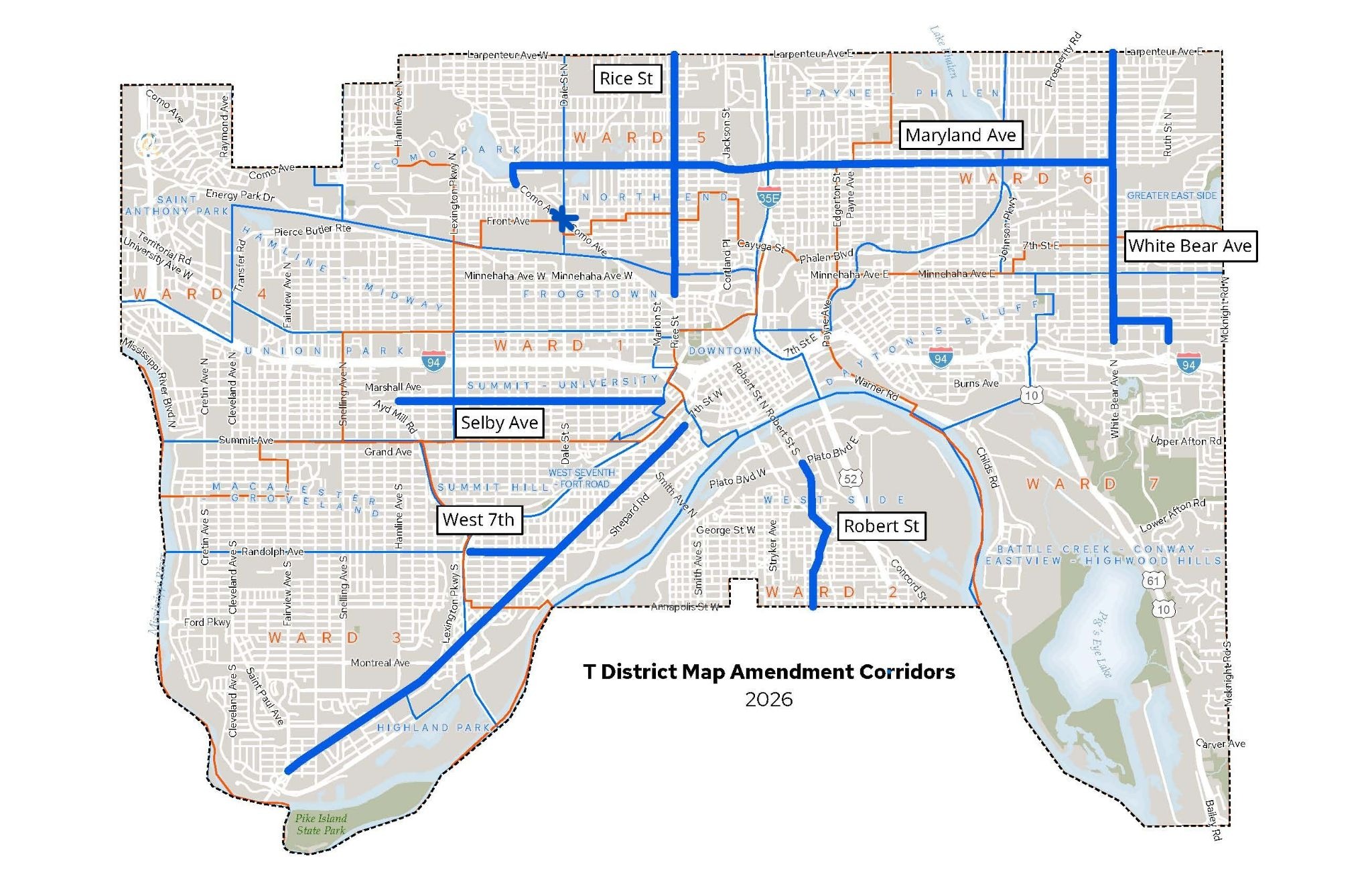
I have great news: we did it! Back in November, the Saint Paul City Council directed the Planning Department to initiate the “T District Implementation Study,” to “evaluate the use of T Districts and other needed Zoning Map amendments along transit corridors within the city.”
The City’s webpage for the study indicates a focus on the six corridors with existing or planned Arterial Bus Rapid Transit (aBRT) routes shown below:
If you’re a St. Paul resident who would like St. Paul to become a more walkable, vibrant city with a greater abundance of small businesses, this article (and another one to be published next week) is for you!
Now, let’s dive in!
Why rezone into the T Districts anyway?
Here are three key qualities of the T Districts that make them different from other zoning districts in the Saint Paul Zoning Code.
#1. T Districts allow both residential and commercial uses. This was the subject of the three articles I published last summer. The Residential districts in the Saint Paul Zoning Code (RL, H1, H2, RM1-RM3) don’t allow commercial uses of any kind. The Business districts are only slightly more permissive: they allow both commercial spaces and apartment buildings, but they don’t allow single-family homes and duplexes. The effect is to force property owners to navigate a series of arcane bureaucratic processes to use their land for a different purpose. Most ordinary people cannot afford the time and money to overcome these obstacles. I think it’s reasonable to assume that these zoning categories have been a drag on local business creation, slowed our City’s economy and property tax base and impeded our neighborhoods from becoming more walkable and vibrant places. Everyone wants to live close to a coffee shop, but we’ve made it less and less possible.
T Districts remove these barriers by giving residents a wide variety of choices about what to build (commercial spaces, residential buildings of all kinds, “mixed-use” buildings with street-level retail and apartments above, etc.). Rezoning St. Paul’s major streets will make it possible for them to mature into vibrant, walkable clusters of neighborhood commerce and community.
#2. The T Districts don’t allow suburban-style parking. Whereas the 1970s-era Business districts in the Zoning Code allow for parking lots to be located in the front of buildings, suburban strip-mall style, the T Districts require that car parking spaces be located behind buildings. (In circumstances where that’s impractical or insufficient, it can be located in a sideyard or on another lot, with conditions.) The result is places where the safety, comfort, and pleasure of pedestrians is prioritized, and where cars are guests.
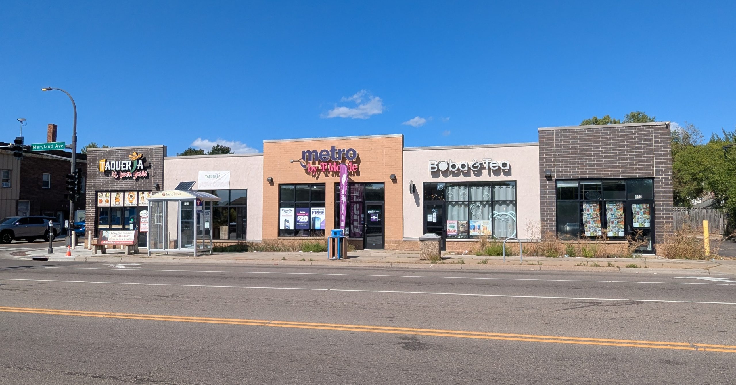
#3. The T Districts enable (and even encourage) the fronts of buildings to touch or come close to the sidewalk. In technical jargon, the T Districts do not require “front yard setbacks.” As the word implies, a setback is the distance that a side of a building must be set back from the parcel’s boundaries (e.g. the property lines at the front, sides, and rear of the lot). The T Districts have a minimum front setback of 0 feet — except for 1- and 2-family dwellings, which must be set back from the sidewalk by at least ten feet.
So, if the City of Saint Paul were to rezone land along aBRT streets into the T Districts, they could begin to expect that those streets would gradually evolve into classic Main Streets, where storefronts and facades hug the sidewalk.
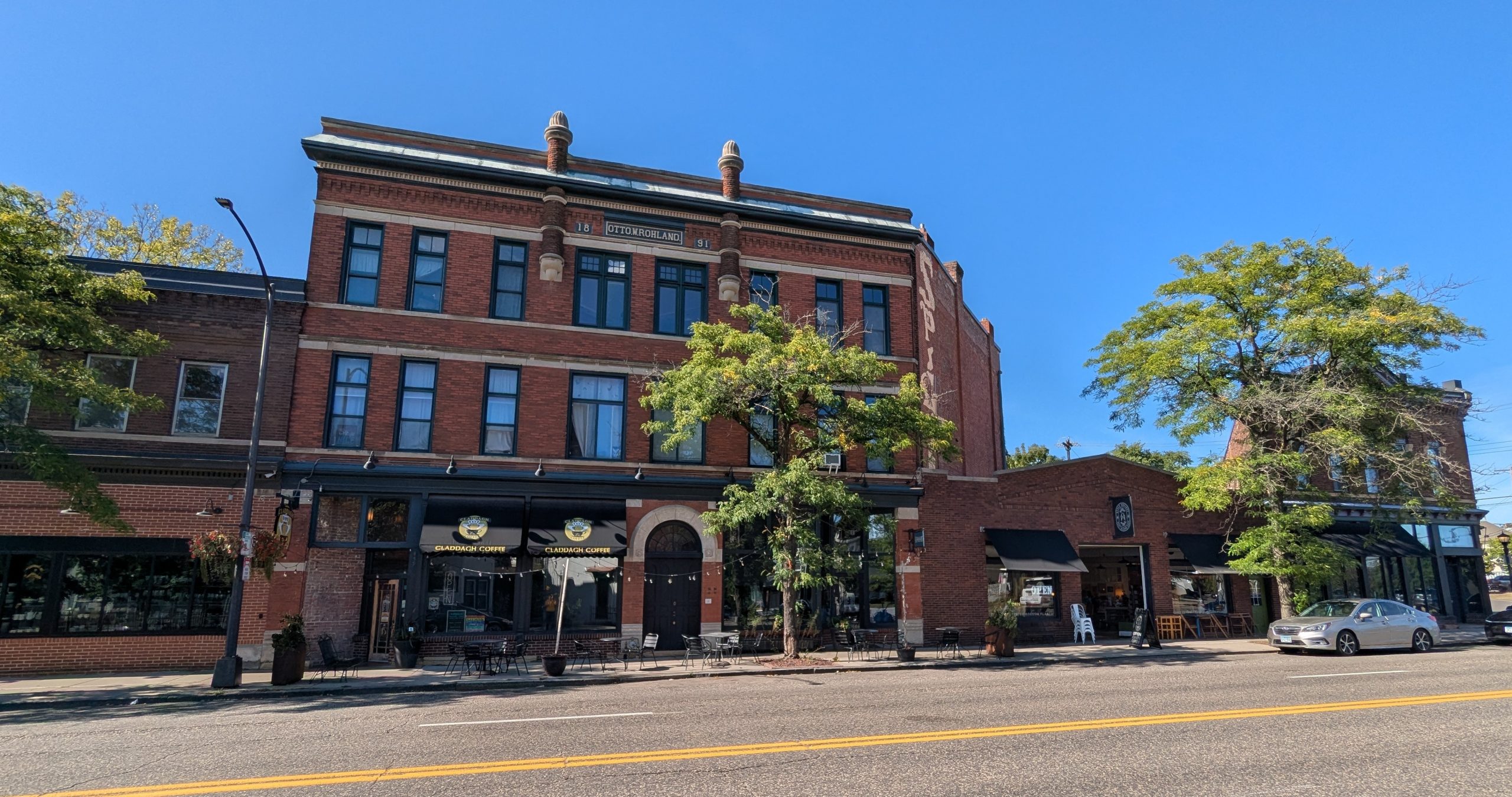
If these distinctive elements of the T Districts sound familiar, they should! St. Paul already has several “neighborhood Main Streets” of this kind — beloved stretches of Grand Avenue, Como Avenue, Payne Avenue, West Seventh Street (pictured above), and others. For me, these are the most vibrant and “walkable” places in our city.
Importantly, these urban places all came of age before the 1950s, when the automobile age and suburban sprawl began in earnest. Over the past several decades, “car-oriented” styles of real estate development have become prevalent throughout the United States — not just in suburbs around cities, but within cities as well. St. Paul is no exception to this trend: in the absence of design standards that prioritize walkability, St. Paul’s zoning rules have allowed the proliferation of fundamentally “sub-urban” development across the city: big box stores, strip malls, drive-through restaurants surrounded by massive surface parking lots, apartment buildings located far from the nearest streets and the like. They have made many places in St. Paul more car-oriented and less hospitable to people who walk, bike, roll and use transit.
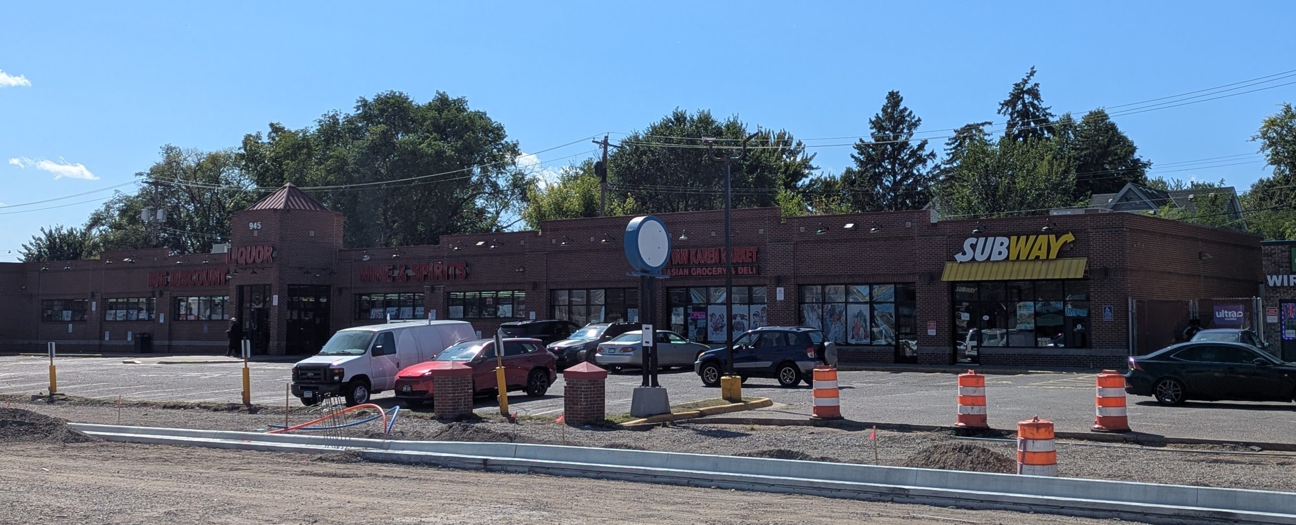
For me, the goal of becoming a less car-oriented and more walkable city is reason enough to rezone land into the T Districts. But there’s another reason to favor compact, pedestrian-oriented land use over car-oriented, sub-urban land use: it contributes far more to our City’s tax base relative to the amount of land it consumes. I wrote about this at length in an essay last week.
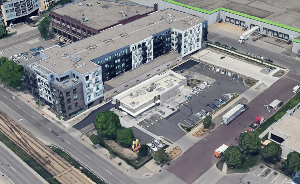
The Midline Apartments and a McDonald’s on University Avenue provide a stark example of this. The apartment building exemplifies a compact, urban, pedestrian-oriented use of land; the McDonald’s exemplifies a wasteful, sub-urban, car-oriented use of land. In 2025, the assessed market value of the Midline Apartments was $24,523,600; the McDonald’s assessed market value was only $1,729,600. Although they take up approximately the same amount of land, the Midline Apartments generate more than fourteen times as much tax revenue as the McDonald’s does.
When you account for the cost a City incurs to provide infrastructure and municipal services to those parcels, many suburban-style buildings drain more city resources in a year than they pay in property taxes. (Here’s a brief video explainer on the subject, and an article from Strong Towns.)
Here’s a quick recap of the good reasons why St. Paul should rezone lots of land into the T Districts:
- They give property owners more choices and reduce the amount of time and money expended by residents and City staffers on unnecessary rezoning processes.
- They encourage more compact, less car-oriented land use. This makes places safer and more pleasant to walk, bike, roll, or take transit, and can help to reduce our collective carbon footprint from vehicular pollution.
- They encourage compact buildings that yield more Tax Value Per Acre and use less land and municipal infrastructure than land-wasteful suburban-style development.
A look at the differences between the T Districts
Now that we’ve considered the qualities that make all four T Districts different from other zoning districts in St. Paul, let’s look at what makes each T District different from the other three.
The first key dimension of difference between each of the T Districts is the list of “uses” permitted in each district. The general principle is that the number of purposes for which you can use a piece of land increases as you progress from the “lowest-intensity” zoning district (e.g. T1) to “higher-intensity” ones (e.g. T2, T3, T4). With few exceptions, T2 allows all of the same uses that T1 does, plus a few more; T3 allows everything that T2 does and a few more; and T4 allows the greatest number of uses.
Here’s an example: in the T1 zoning district, Coffeehouses and Teahouses are allowed, but Restaurants are not. This means that if you own a piece of land zoned T1, you can open a coffeeshop there, but you can’t open a restaurant. (Notably, a coffeeshop is allowed to sell “a limited number of food items as allowed under a limited food menu license.” It’s also worth noting that anyone looking to open a coffeeshop larger than 1,500 square feet in the T1 district must first obtain a Conditional Use Permit.)
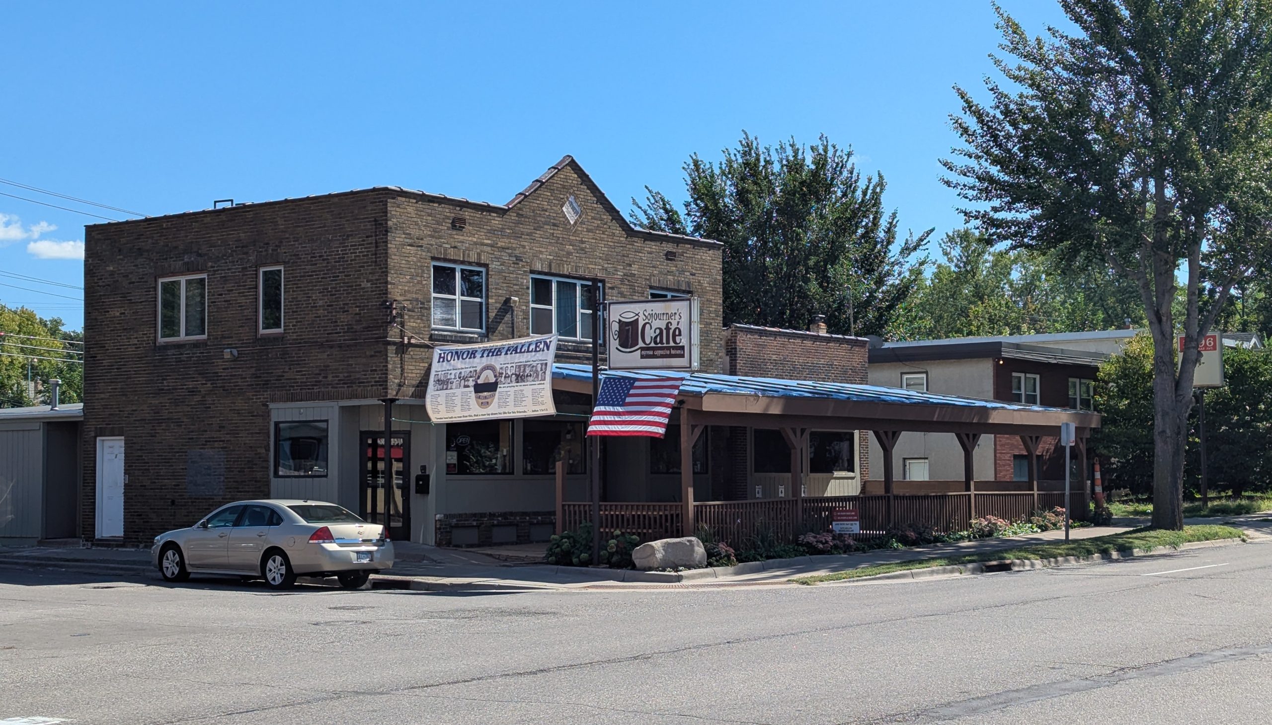
For example, the building that houses the Sojourners’ Cafe at 1406 White Bear Avenue would almost certainly be legal to build in T1: it conforms to T1’s height and lot coverage rules (discussed below), and coffeehouses are a permitted use in T1. However, if this lot were zoned T1, the building could not house a restaurant.
Here are some other uses which are not allowed in the T1 district, but which are allowed in T2-T4:
- Bars, Breweries, Wineries, and Distilleries
- Indoor Recreation Facilities (e.g. a pickleball court), reception/rental halls, or theaters
- Laundromats and Dry-Cleaning facilities
- Outdoor garden centers
- Funeral homes
- Veterinary clinics
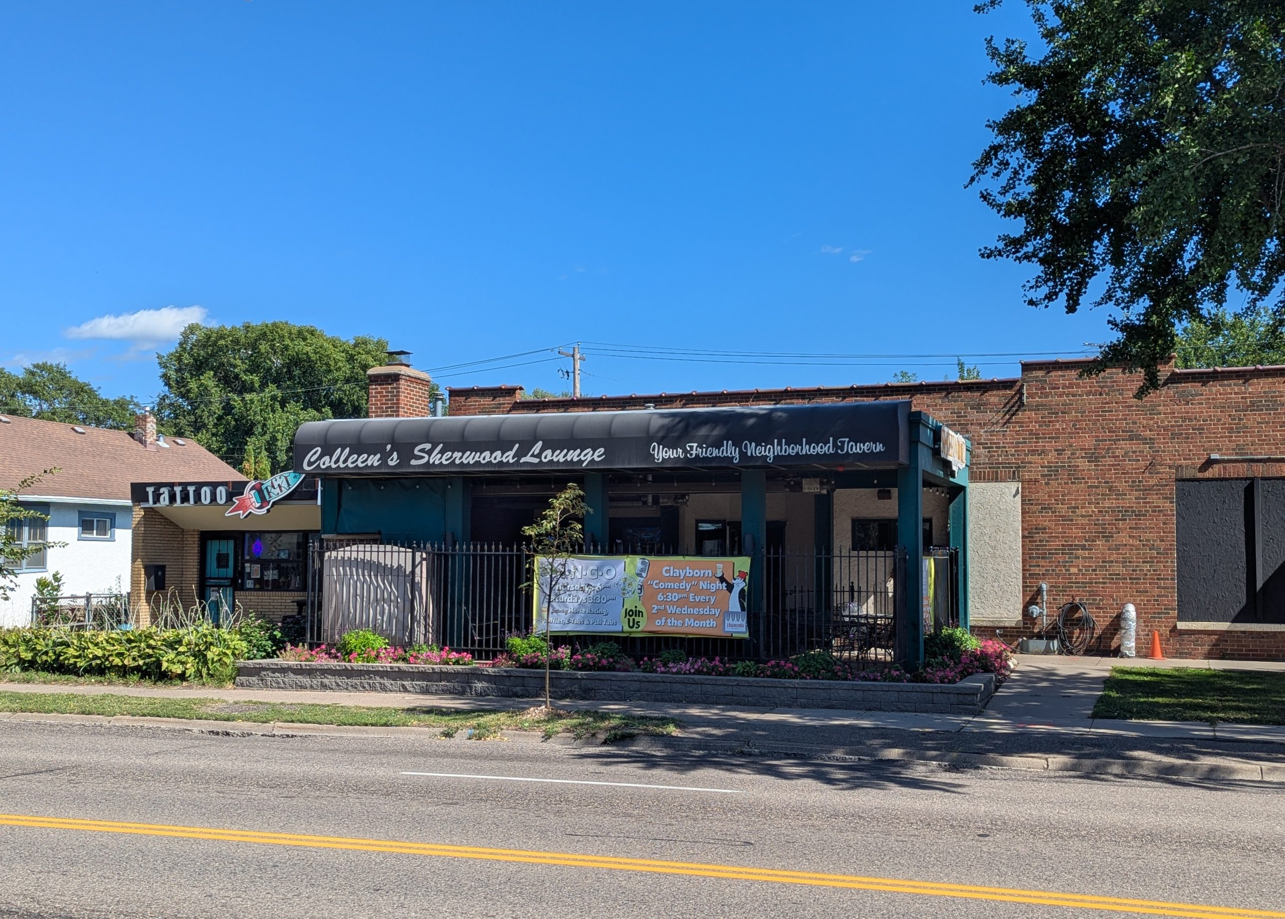
The Sherwood Lounge at 1418 White Bear Avenue (less than a block from the Sojourner’s Cafe) provides a helpful example of what these rules mean in practice. The building itself would be legal to build in the T1 district, because it conforms with T1’s regulations for building heights and lot coverage (discussed below). But restaurants and bars are not “permitted uses” in T1. If the City rezoned this lot into the T1 district, the restaurant would be allowed to remain open as a “non-conforming use”; but if it ever closed for more than a year, a new restaurant would not be allowed to take its place.
The second key dimension of difference between the T Districts is the size of buildings they allow: how tall they can be, and how “thick” (e.g. how much of the lot can be covered by the footprint of the building). In turn, each T District’s dimensional regulations directly impact how many square feet of indoor space they can supply for different uses: offices, ground-floor restaurants and retail stores, and (last but definitely not least) housing.
The two foundational sets of rules that regulate the size of buildings are the Building Height limits and the maximum Floor Area Ratios. The Building Height limits require no explanation:
Building height limit in the T1 district: 35 feet
Building height limit in the T2 district: 45 feet (for 1- and 2-family dwellings, the limit is 35 feet)
Building height limit in the T3 district: 55 feet
Building height limit in the T4 district: 75 feet
The Floor Area Ratio (FAR) is a number that defines the maximum (or minimum) square footage that a building can have relative to the size of the land it occupies. (I briefly introduced Floor Area Ratios in my essay last week.)
In the T1 zoning district, for example, the maximum Floor Area Ratio is 1.0. This means that a building on a T1-zoned lot could be a building with two equally-sized stories whose footprint covers half of the lot it occupies, a three-story building whose footprint covers one-third of the lot, et cetera (provided that the building’s design meets the other zoning requirements). Put differently, it means that a building on an ordinary 6,000 square-foot city lot could be no larger than 6,000 square feet across all floors.
Check out the chart below for another way of understanding how Floor Area Ratio rules limit the size of buildings. It shows the theoretical maximum percentage (or fraction) of a lot’s area that a building’s ground floor could cover, depending on how many stories tall the building is. For simplicity, this chart assumes that we’re talking about buildings with equally-sized floors: for example, a two-story house with 400 square feet on the main level and 400 square feet upstairs.
| 1- story (~12-15 ft) | 2-story (~22-25 ft) | 3-story (~32-35 ft) | 4-story (~42-45 ft) | 5-story (~52-55 ft) | 6-story (~62-65 ft) | |
| T1 (max. FAR 1.0) | 100% (minus setbacks) | 50% (½) | 33% (⅓) | N/A | N/A | N/A |
| T2 (max. FAR 2.0) | 100% (minus setbacks) | 100% (minus setbacks) | 66% (⅔) | 50% (2⁄4) | N/A | N/A |
| T3 (max. FAR 3.0) | 100% (minus setbacks) | 100% (minus setbacks) | 100% (minus setbacks) | 75% (¾) | 60% (3⁄5) | 50% (³⁄₆) |
| T4 (no max. FAR) | 100% (minus setbacks) | 100% (minus setbacks) | 100% (minus setbacks) | 100% (minus setbacks) | 100% (minus setbacks) | 100% (minus setbacks) |
Let me emphasize that this chart is very simplistic. For one thing, the Zoning Code’s definition of Floor Area excludes “basements, unfinished attics, attached garages, or space used for off-street parking or loading, breezeways, and enclosed and unenclosed porches, elevator or stair bulkheads and accessory structures.” There are also footnotes beneath the Density and Dimensional Standards table that add complexity. For example, footnote (d) provides that the “heights of structures [in all four of the T Districts] may exceed the maximum if set back from side and rear setback lines a distance equal to additional height.” And footnote (j) requires that the buildings on a parcel be at least 6 feet away from the side and rear lot lines if it’s next-door to a residential building (unless both property owners sign an easement agreement).
These complexities aside, I think the key takeaway is this: it is often impractical to build taller than two stories in the T1 district, or above three stories in the T2 district, because of how much land you’d be required to leave undeveloped. Generally speaking, buildings with four, five, and six stories are more realistic in the T3 and T4 districts.
Below are some examples of buildings around St. Paul that I believe represent the scale of buildings that can be built in each of the T Districts, based on what I estimate their heights and Floor Area Ratios to be. To my knowledge, there is no reliable set of public data that specifies the floor area of buildings around St. Paul. In absence of that information, the best I could do is to estimate based on aerial images of buildings on Google Maps to see how far their edges are from property lines, how many stories tall they are, and so on. Admittedly, this is an imprecise method, but I hope it’s a decent approximation.
I have included the address of each building and the lowest-intensity T District in which I believe it would be legal to build today. The T1 example was built before the T Districts existed; the T2, T3, and T4 examples were built in the past decade on lots that were already zoned in the corresponding T Districts.
168 George Street East: T1
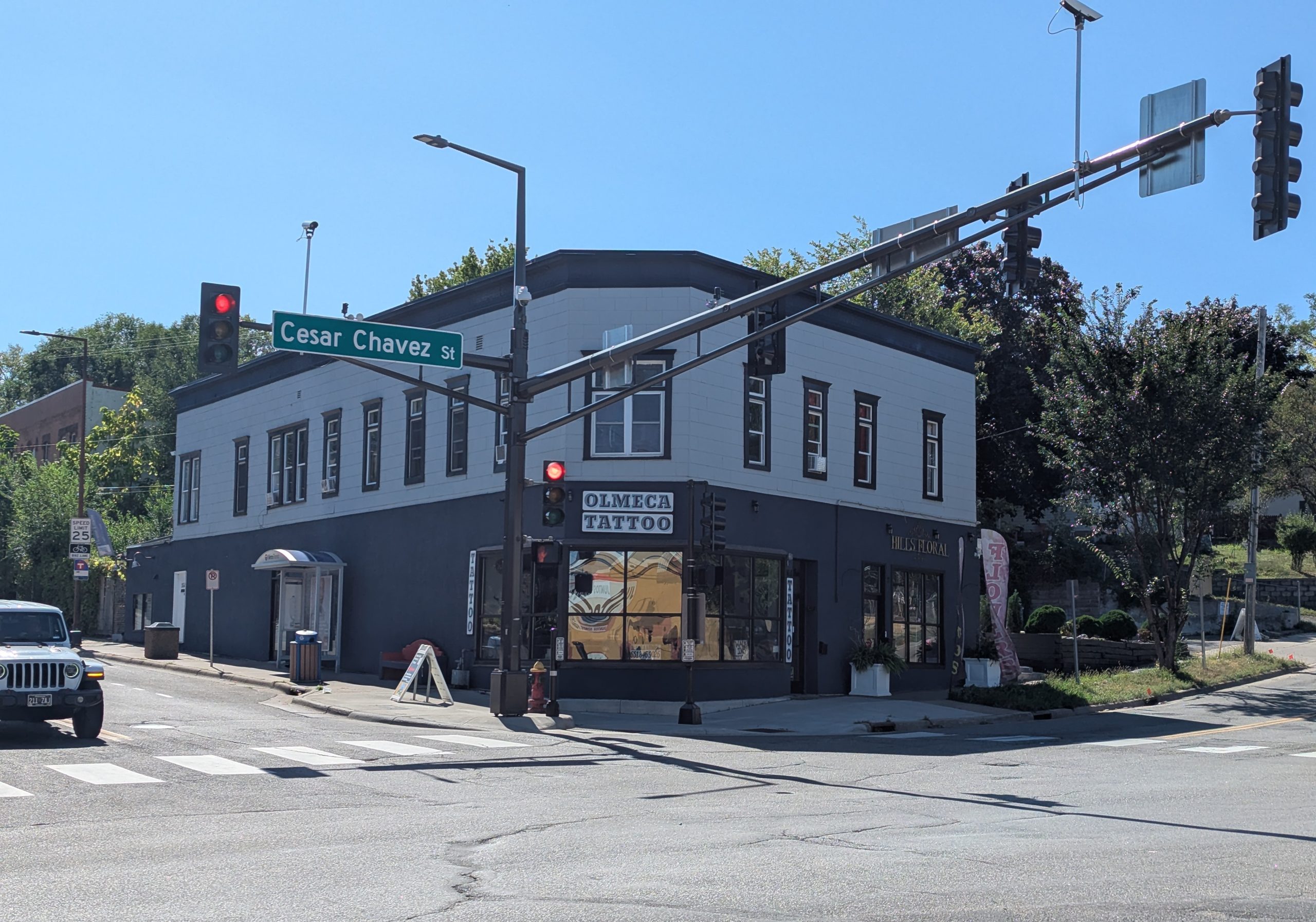
Lot Area: 0.33 acres
Building’s estimated footprint: ~4,500 square feet (0.1 acres)
Number of floors: 2
Estimated Floor Area Ratio: 0.6
2025 assessed Taxable Market Value: $450,800
Tax Value Per Acre: $1,366,060
1554 Grand Avenue: T2
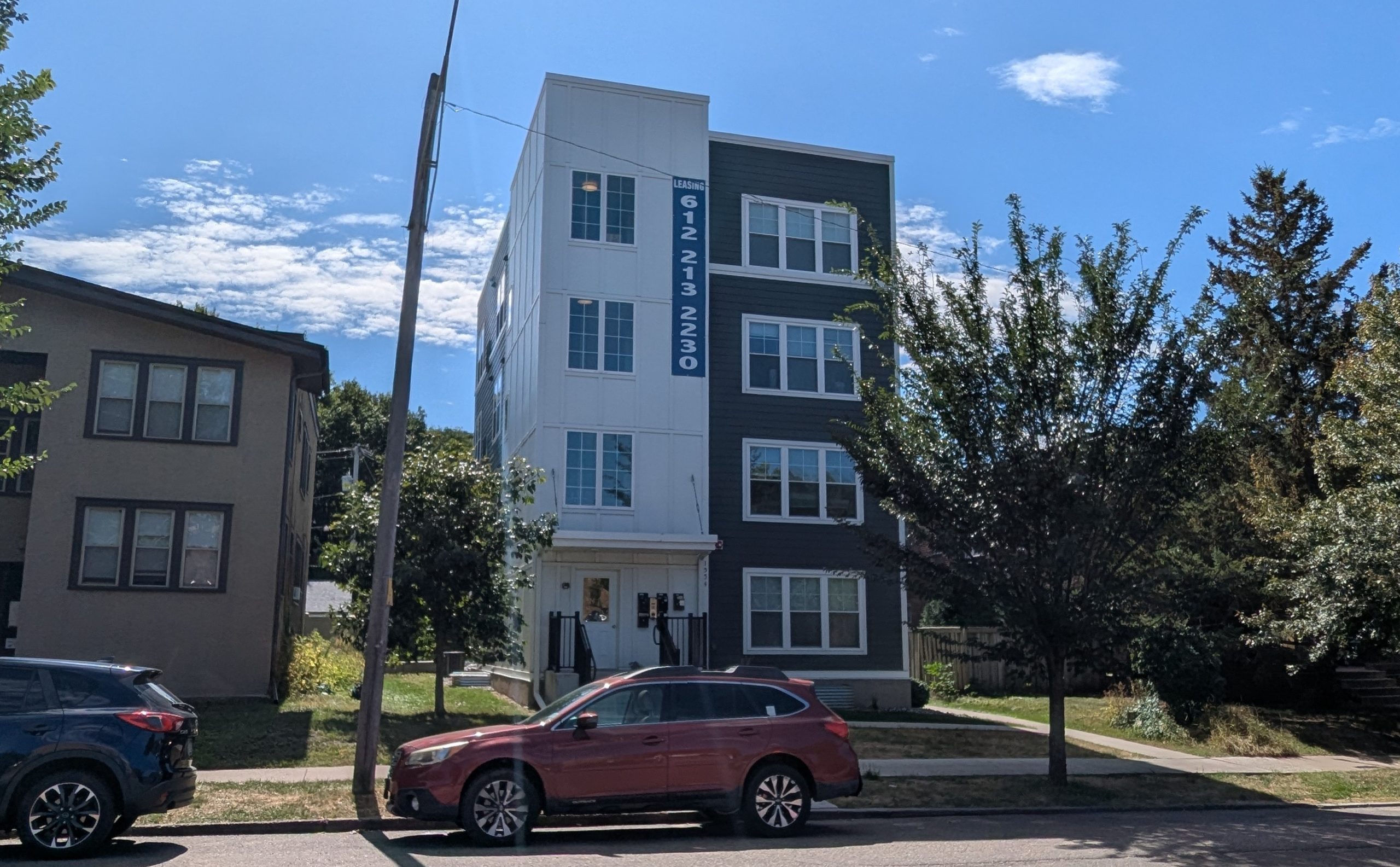
Lot Area: 0.1722 acres
Building’s estimated footprint: 2,500 square feet (0.057 acres)
Number of floors: 4
Estimated Floor Area Ratio: 1.3
2025 assessed Taxable Market Value: $1,200,000
Tax Value Per Acre: $6,968,641
2061 Marshall Avenue (“The Lucy”): T3
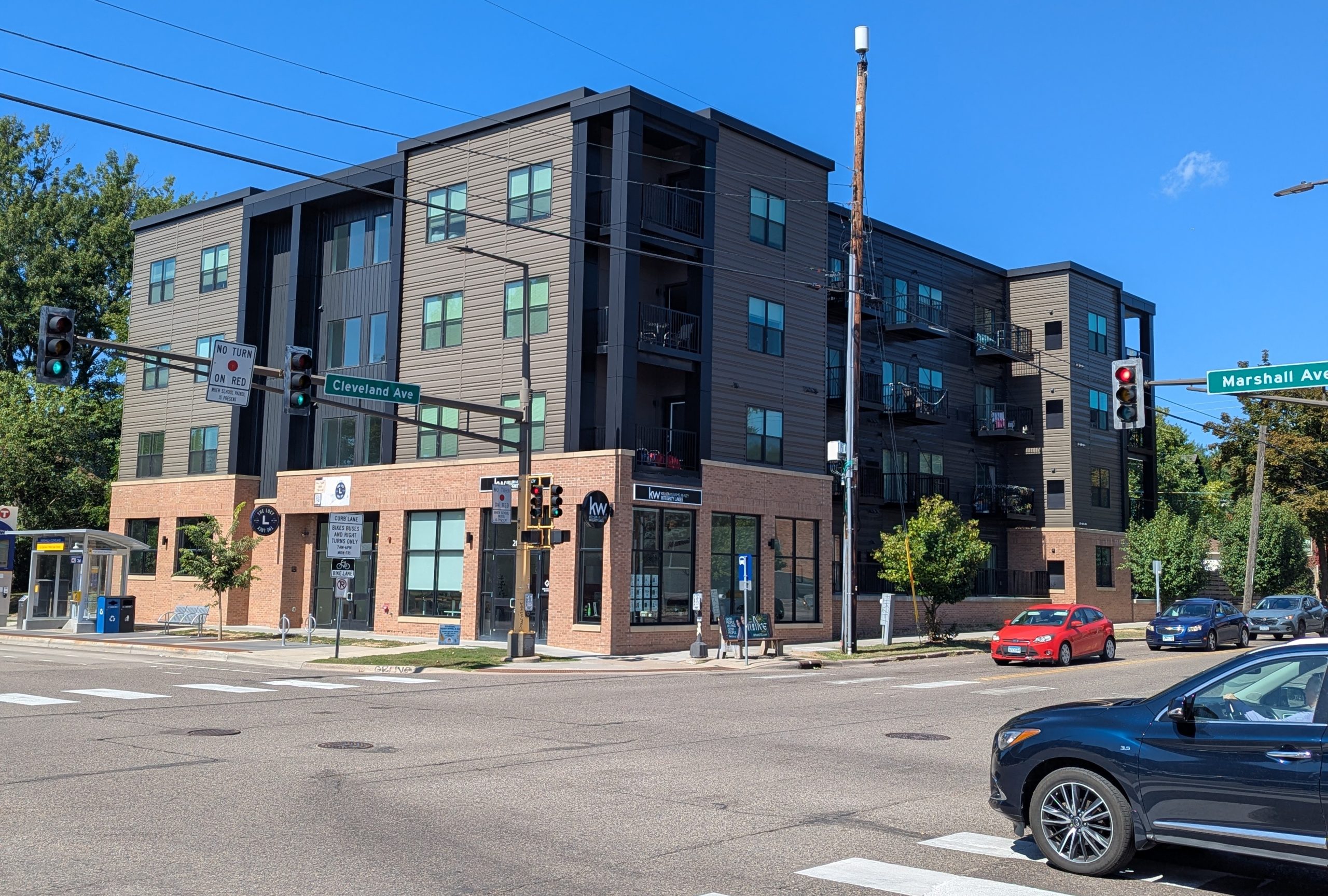
Lot Area: 0.4132 acres
Building’s estimated footprint: ~11,000 square feet
Number of floors: 4
Estimated Floor Area Ratio: 2.4
2025 assessed Taxable Market Value: $5,500,000
Tax Value Per Acre: $13,310,745
411 Lexington Parkway North (“The Nine” at Lexington Station): T4
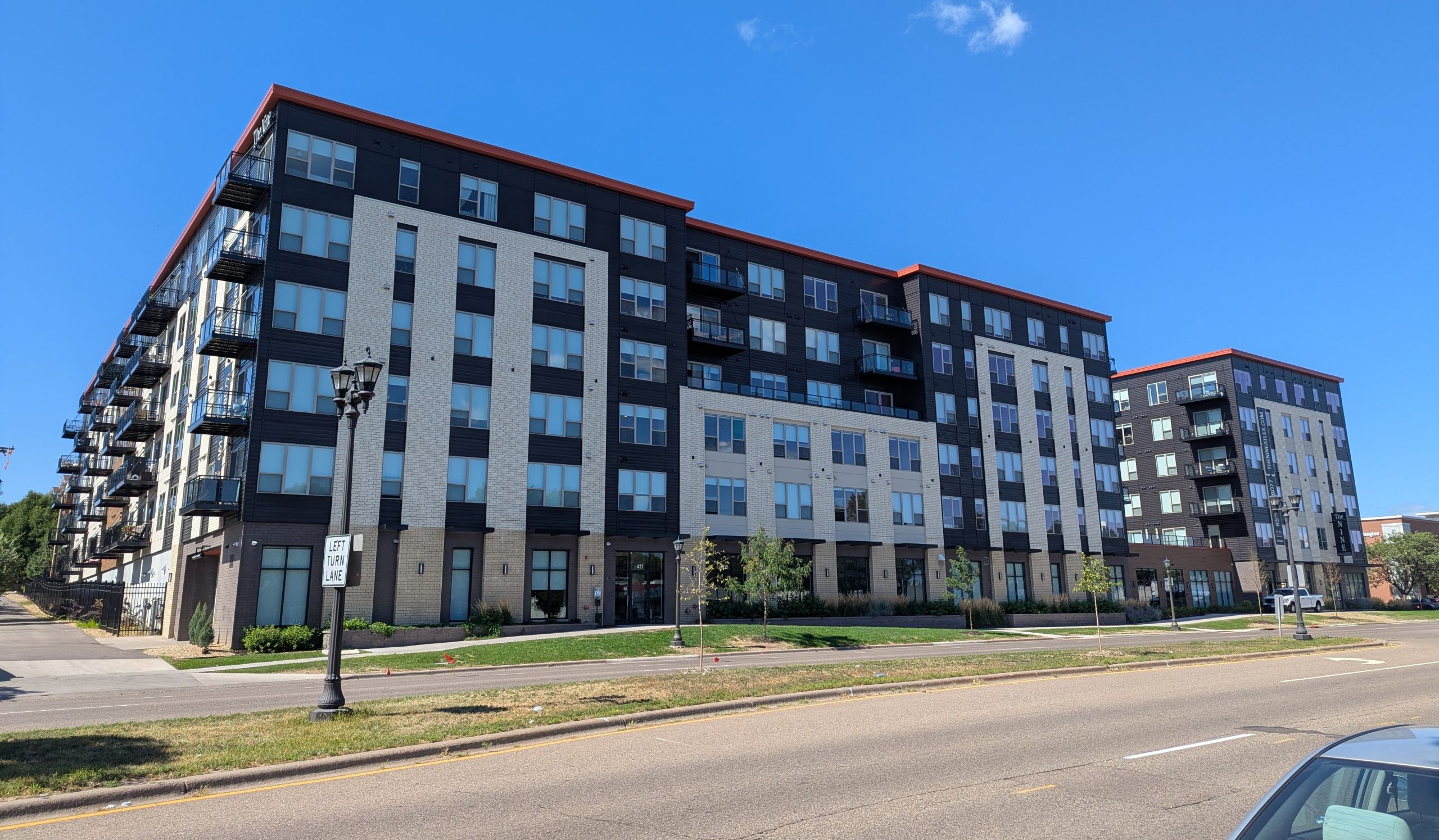
Lot Area: 2.0415 acres
Building’s estimated footprint: ~57,000 square feet (~1.3 acres per floor)
Number of floors: 6
Estimated Floor Area Ratio: above 3.8
2025 assessed Taxable Market Value: $27,111,800
Tax Value Per Acre: $13,280,333
To be continued
I hope this article equips readers with a better understanding of the T Districts — how they differ from other zoning districts, and how they differ from each other. More generally, I hope this article helps readers to better understand the effect that zoning rules have on the size and shape of new buildings. In another article to be published soon, I’ll offer my opinions about where each one should be implemented along each of the streets being evaluated in the T District Implementation Study.
In the meantime: if you’d like to join others in advocating for better zoning policy in St. Paul, please fill out this form to get connected with Sustain Saint Paul’s Housing, Zoning, and Development Committee! We’d love to connect. (Also be sure to subscribe to Sustain Saint Paul’s email newsletter.)