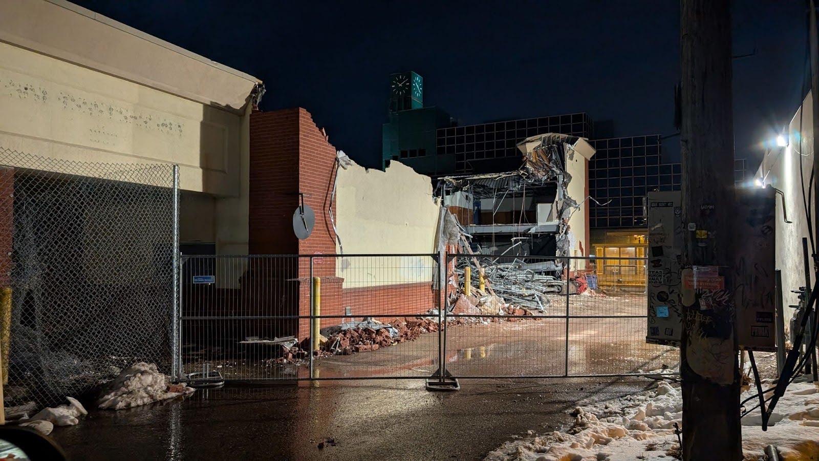
Discussions on the ‘Decline of the Midway’
A recent opinion piece about the development challenges in St. Paul’s Midway neighborhood misses a few key points, says one neighborhood resident.
Refresh | This website streets.mn/category/land-use/ is currently offline. Cloudflare's Always Online™ shows a snapshot of this web page from the Internet Archive's Wayback Machine. To check for the live version, click Refresh. |
A recent opinion piece about the development challenges in St. Paul’s Midway neighborhood misses a few key points, says one neighborhood resident.
A survey of registered voters shows that Minnesotans prioritize housing affordability — and support the state Legislature acting on housing and land use policy.
What could be more convenient than big-box shopping in the heart of the city, easily accessible by car for suburban drivers?
The Blue Line extension’s route through the northwestern suburbs is more or less settled. Let’s look at the existing and future land use on that corridor.
A St. Paul city planner helps us unpack the East Grand Avenue Overlay District Study!
Most of Lyndale Avenue’s right of way is devoted to cars. An upcoming reconstruction is the perfect time to reimagine this as a space for people.
We used storytelling as an engagement tool to make sense of the decline of St. Paul’s fancy-schmanciest shopping street. Could it inform work in other places, too?
Union Park District Council gathered the neighbors who live closest to Interstate 94 and asked: What do you want for the freeway?
A geographic visualization of new duplexes and triplexes since the Minneapolis 2040 Plan passed shows what can work — or not — with local regulatory policy.
St. Paul is considering zoning changes to legalize more housing in our neighborhoods. Testify in person on October 4 or email the City Council.