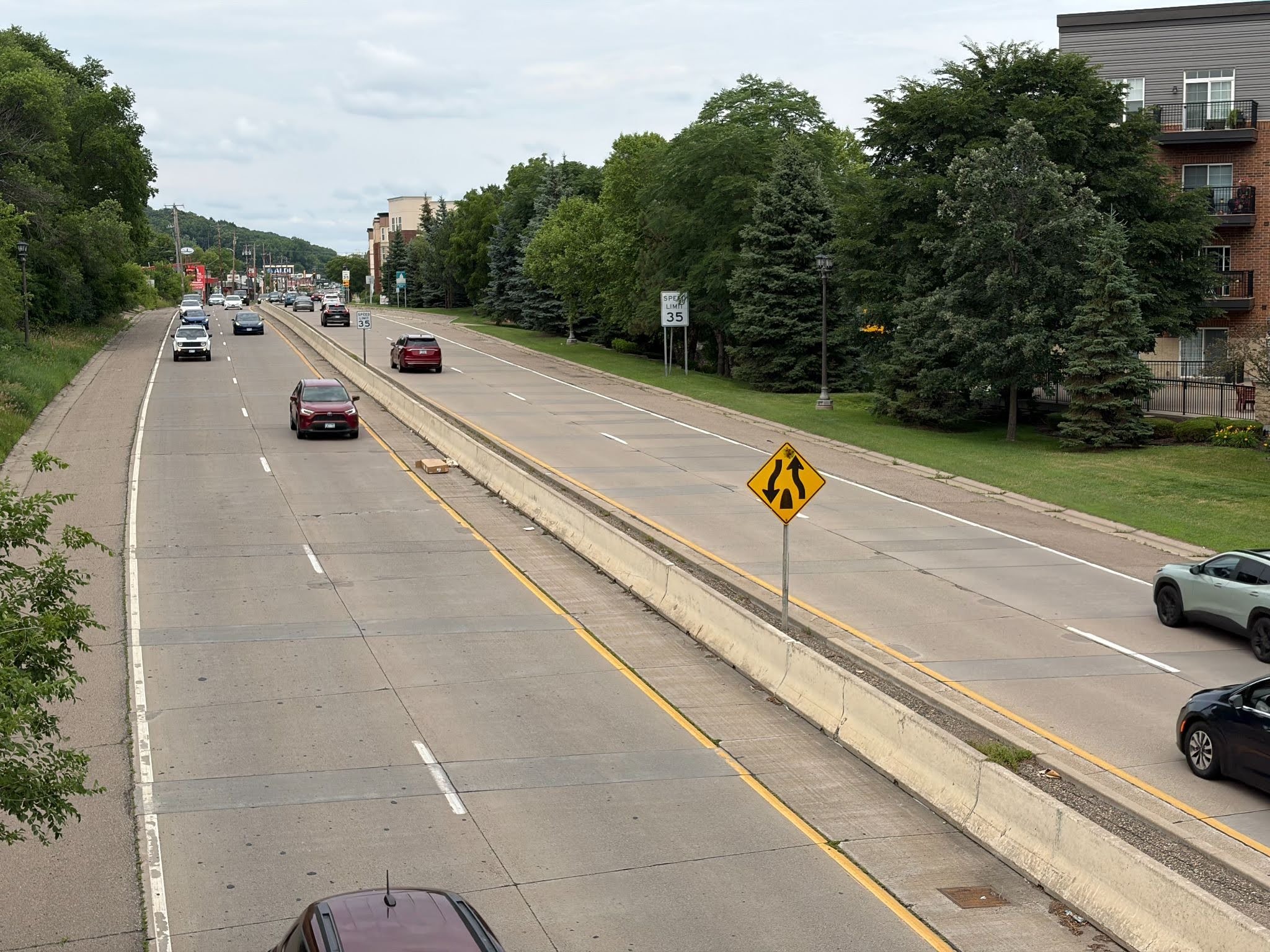
Around the core cities of Minneapolis & St. Paul, there are many nodes of freeway like intersections and terminations that are historical relics. “Freeway node” is a self defined term meaning a highway interchange or exit and all of the surrounding space that these take up. These nodes waste incredible amounts of space and tend to be over engineered towards concrete and automobiles and void of people and nature.
This article is not proposing wholesale freeway removal, but rather asking: “how can the large amounts of space these nodes consume be made more in harmony with people and nature in an urban environment?”
Photo 1 below (from Hiawatha and Franklin in South Minneapolis) shows a clear example of the excessive space these nodes can consume to the detriment of pedestrian safety, community connectivity, and nature.
Throughout the Twin Cities there are many nodes that offer the opportunity for re-engineering towards a better balance of people, housing, nature, and transit. We will review two such Twin Cities examples in this article (I 394 & Penn, Minneapolis, and W. 7th St. as it exits St. Paul). These examples were chosen because change is attainable in these areas due to proposed public infrastructure improvements. They also both have existing surrounding neighborhoods and business districts; in other words, they are not barren industrial districts.
Possible benefits of freeway node recovery:
- Return land to uses that benefit people and the planet (housing, commercial, transit, parks, natural space, etc.).
- Allow people to live closer to jobs and other opportunities with reduced automobile dependence.
- Pollution reduction and buffering.
- Increased utilization of transit investments.
- Traffic calming.
- More pleasant transitions from freeway zones to neighborhoods.
These changes could be accomplished via either a complete redo of a given node or a gradual evolution. The complete redo is faster but more difficult due to the need to coordinate many different organizations and funding streams (neighborhood associations, municipalities, counties, MNDOT, MetroTransit, housing, parks, etc.). The gradual evolution could be accomplished via periodic upgrades to trails, sidewalks, roads, parks, transit, housing, etc.
It is important to remember that each node is different and there is no “one size fits all” solution. Local community needs and wants vary.
EXAMPLE 1 – I-394 and Penn Av. S., Minneapolis, MN. See Map 1.
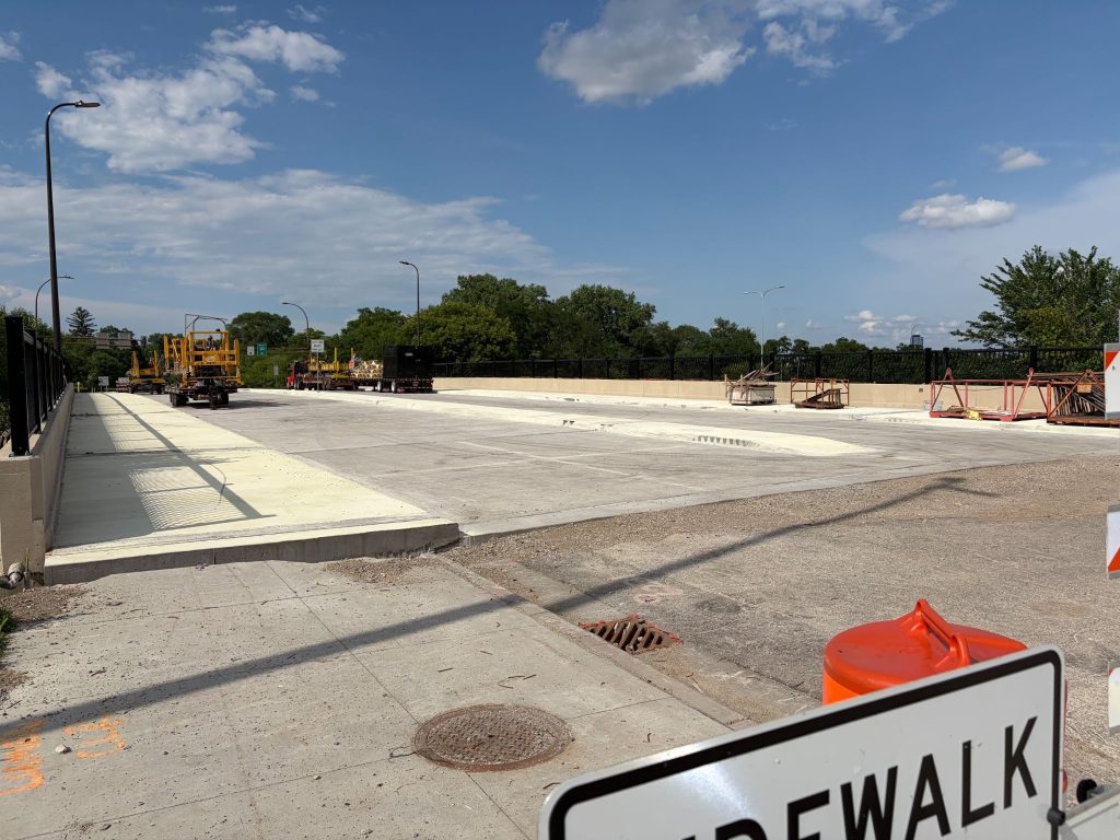
Today– Standard interstate highway interchange with I-394 passing under Penn Ave. S. The area nearby and south of this bridge is currently a pedestrian dead zone. Penn Ave. over I-394 is currently being redecked. Part of this project includes a wider sidewalk which could be beneficial for pedestrians and bicyclists. See photo 2.
What could come next? – reduced automobile and highway impact in and near this interchange (including the frontage road south of 394). The Southwest Light Rail opening in 2027 (with a Bryn Mawr Station) could be a catalyst for positive change*. From the Bryn Mawr Active Transportation Committee (ATC): “For too long, the I-394 corridor has acted as a barrier that cuts right through the heart of Bryn Mawr. The arrival of light rail next year should be the catalyst for healing this divide through intentional, human-scale infrastructure. True activation means creating a delightful, stress-free environment for walking and biking alongside welcoming storefronts, allowing us to stitch the neighborhood back together into a cohesive, thriving destination.” The committee whole heartedly welcomes collaboration on activating these spaces**. Another upgrade is scheduled for the node in 2030***.
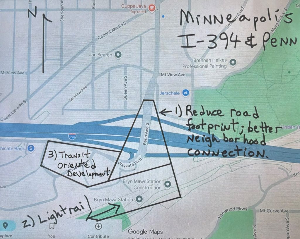
Map 1 (above) shows a top / down view of the node. Three possible areas of improvement are marked in blocks 1, 2, and 3:
1 – highway and traffic calming and safer pedestrian access (possibly including nature / landscaping, trails/sidewalks, public art, etc.).
2 – New Southwest LRT station (friendly pedestrian, transit, and bike access, and inviting connection to Bryn Mawr business district to the north).
3 – Transit Oriented Development (some vacant or underutilized lots very close to the LRT station).
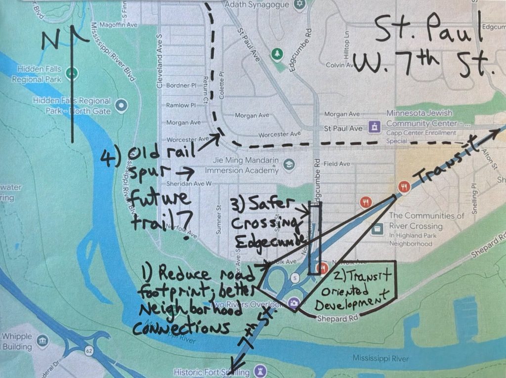
EXAMPLE 2 – 7th (Hwy 5) & Davern to Mississippi River, St. Paul, MN. See Map 2.
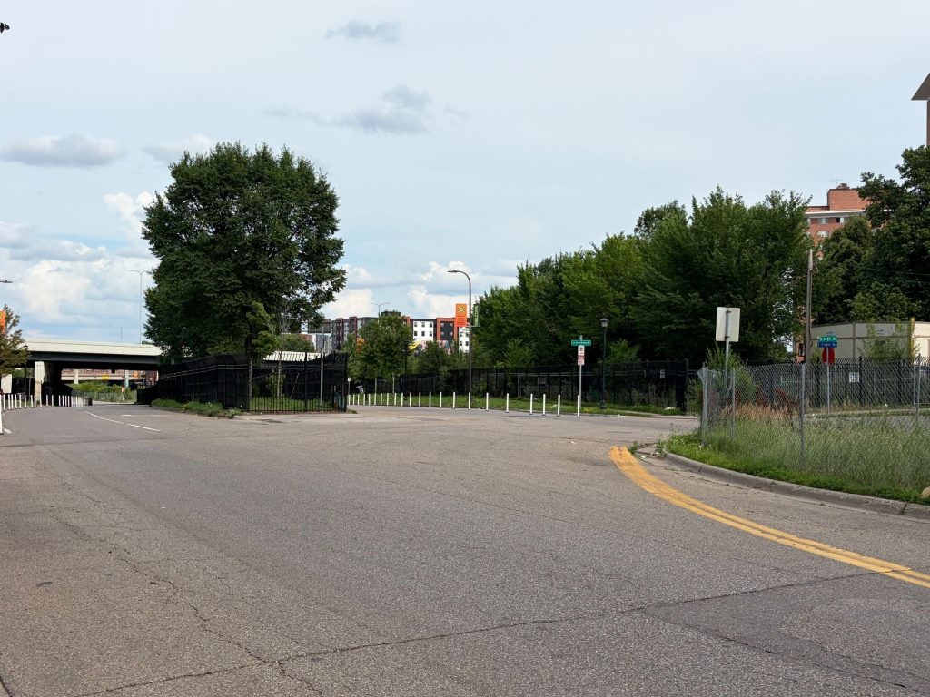
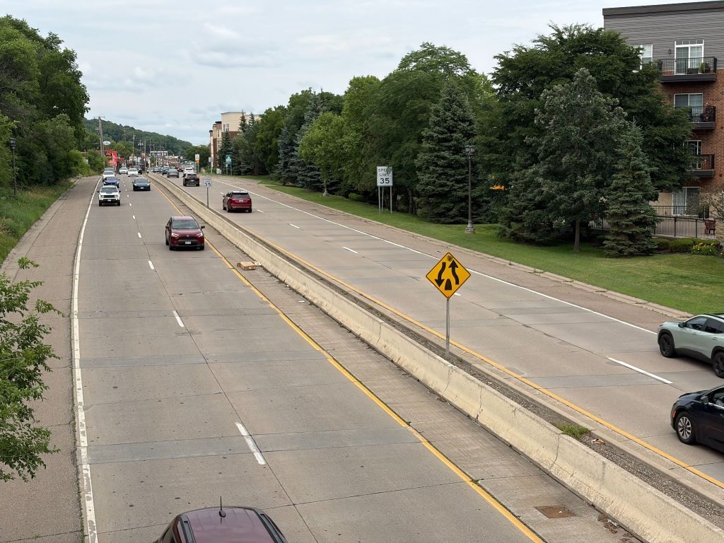
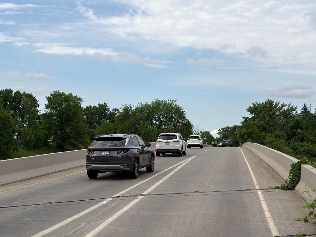
Today – West of Davern St., 7th St. (Hwy 5) rapidly turns into a freeway exiting St. Paul. In this area, the road becomes noisier and unsafe to cross at grade. There is no safe human crossing between Davern and the river. Even the Davern / 7th St. intersection (at grade) is questionable for pedestrians or bikers. See pictures 3 and 4.
What could come next?
Map 2 above points to several opportunities for improvement:
1 – Recovery of the core Highway 5 / W. 7th St. corridor from Davern St. to the Mississippi River. This could include: Planned 7th St. upgrades and installation of Bus Rapid Transit (BRT) with pedestrian friendly stops and safe crosswalks, reduction of space devoted to highway infrastructure around the area where 7th St. meets the Mississippi River, and better linkages to existing Mississippi River parkland.
2 – Redevelopment of the vacant commercial land, in a transit friendly manner, where Shepard Rd. meets Highway 5.
3 – Reconfiguring how Edgecumbe Rd. crosses Hwy 5 (picture 4) to make it much more friendly to pedestrians and bikes.
4 – Eventual reuse of the former Ford Plant rail spur to the north of 7th St.
The 7th Street improvement project and potential installation of BRT are the most immediate opportunities. An arterial (non-dedicated lane) right of way (ROW) study for BRT is scheduled to be done later in 2026****. Land parcel redevelopment and rail spur recovery are longer term projects.
Freeway node recovery offers many benefits to the Twin Cities. Including: job access near the urban cores, possibly more affordable housing (if cities make positive choices to prevent gentrification and displacement on these newly reclaimed public lands), trails, and transit oriented development (TOD). It also reduces the impact of highway noise and pollution on communities close to the interchanges, and encourages better utilization of the investments in our transit systems. The ability to heal a portion of nature and to conduct some future metro development in a more inclusive and less carbon intensive manner are also important benefits.
Good candidates for freeway node recovery are areas relatively close to the urban core (building on existing sidewalks, trails and transit), yet as you look at them you wonder “why is all this space taken, noisy, fenced off, and the community divided by a highway?” Can you think of other areas where reduction of the highway infrastructure would be beneficial?
References:
* Southwest light rail opening updates: https://metrocouncil.org.
** Quote from Bryn Mawr Active Transportation Committee: E mail to author August 7, 2026.
*** I 394 and Penn Av. 2030 upgrades: Email to author from Bryn Mawr Active Transportation Committee of MNDOT proposal dated June 25, 2025.
**** From meeting of author with Michael Krantz, Metro Transit, Senior Manager, Transit Oriented Development, June 26, 2026. Also www.metrotransit.org, Arterial BRT plan.