How can you tell if a neighborhood is safe, friendly, walkable, & successful? Advocates for great streets & neighborhoods look for clues as to what makes neighborhoods great, so what are some clues?
Kids are often used as an “indicator species”–meaning, if kids use it, it must be great–and a common test is the Trick-or-Treat Walkability Test. Brent Toderian, an urban planner in Vancouver, BC, had an article a few years ago on this Trick-or-Treat Test, and as my partner and I handed out over 300 pieces of candy last night, despite 29ºF weather, I decided our neighborhood hits the nail on the head.
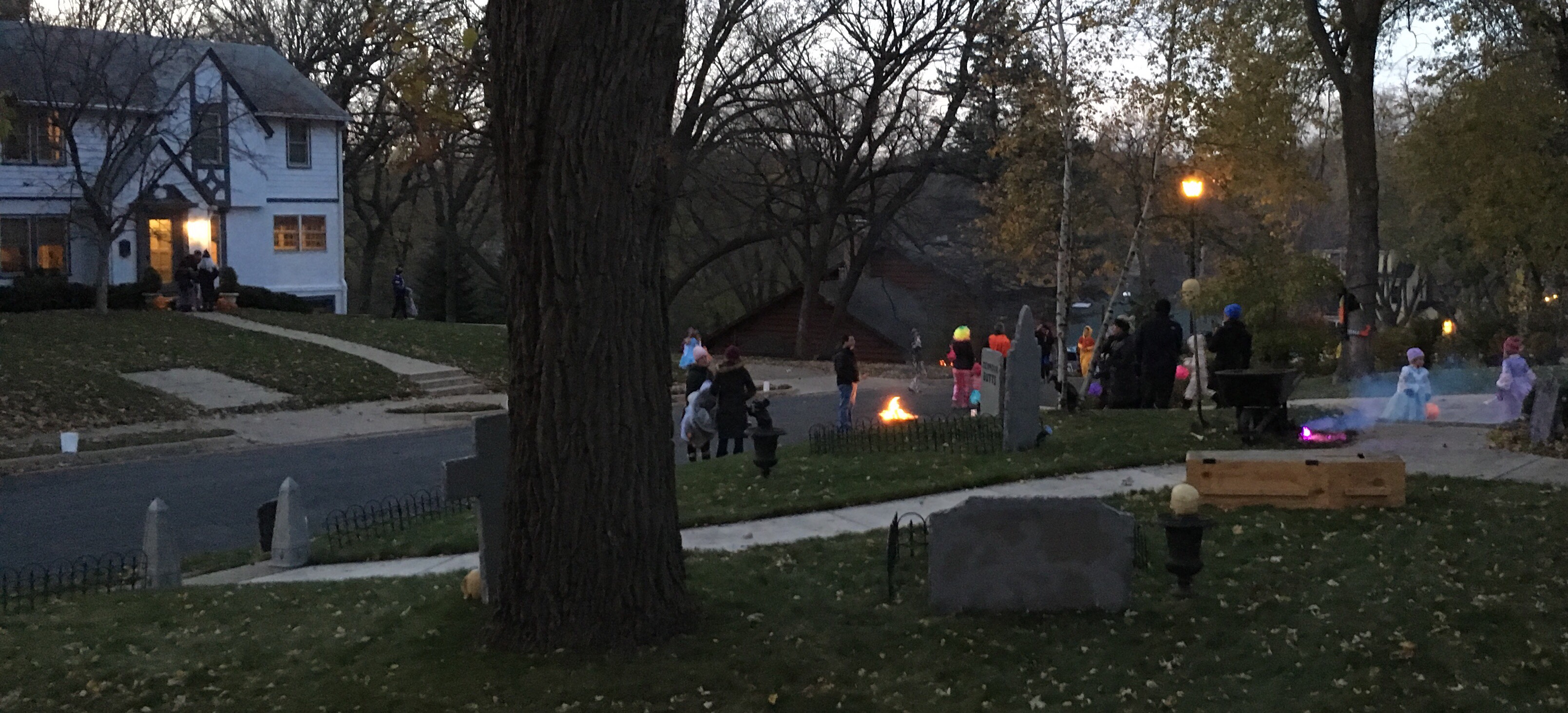
Our street is somewhat of a special case, in that it is blocked off from car traffic for Halloween. We also recruit a food truck, which means whole families and even single adults are drawn to our block. But while these things help, there is no way we’d get hundreds of kids if our houses were unapproachable or the density were too low or the street didn’t feel safe.

By any account, the Morningside neighborhood of Edina, MN, is a curious place. Platted as Minneapolis’ first streetcar suburb, it was at one point its own incorporated village. In fact, some of the very reasons it broke off from Edina have to do with what makes it so great today: sidewalks and street lights, which the farmers in the rest of Edina thought were too urban in 1920.
When you look at a map of Edina, Morningside is that rectangular little blip that sticks out of the northeast corner.
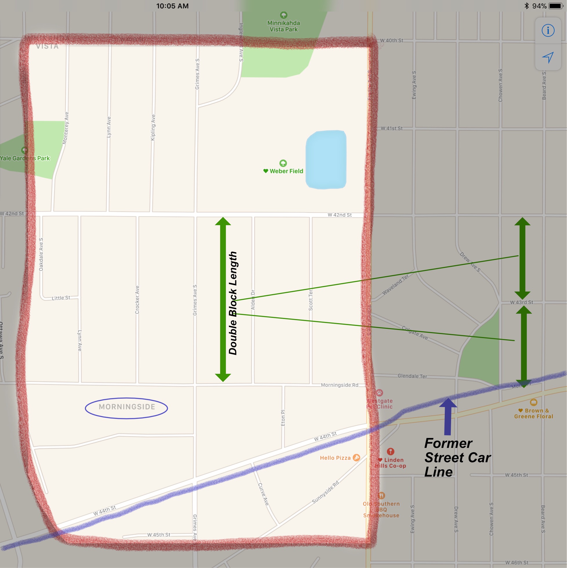

As a very old suburb, the neighborhood is more akin to an urban grid than to suburban cul-de-sacs, with mostly straight streets that meet at 90º angles. One distinguishing characteristic is that each block is twice the length of a Minneapolis block, which may have to do with maximizing the number of houses within walking distance of the streetcar line. So our Halloween block party is the equivalent of 2 Minneapolis blocks.
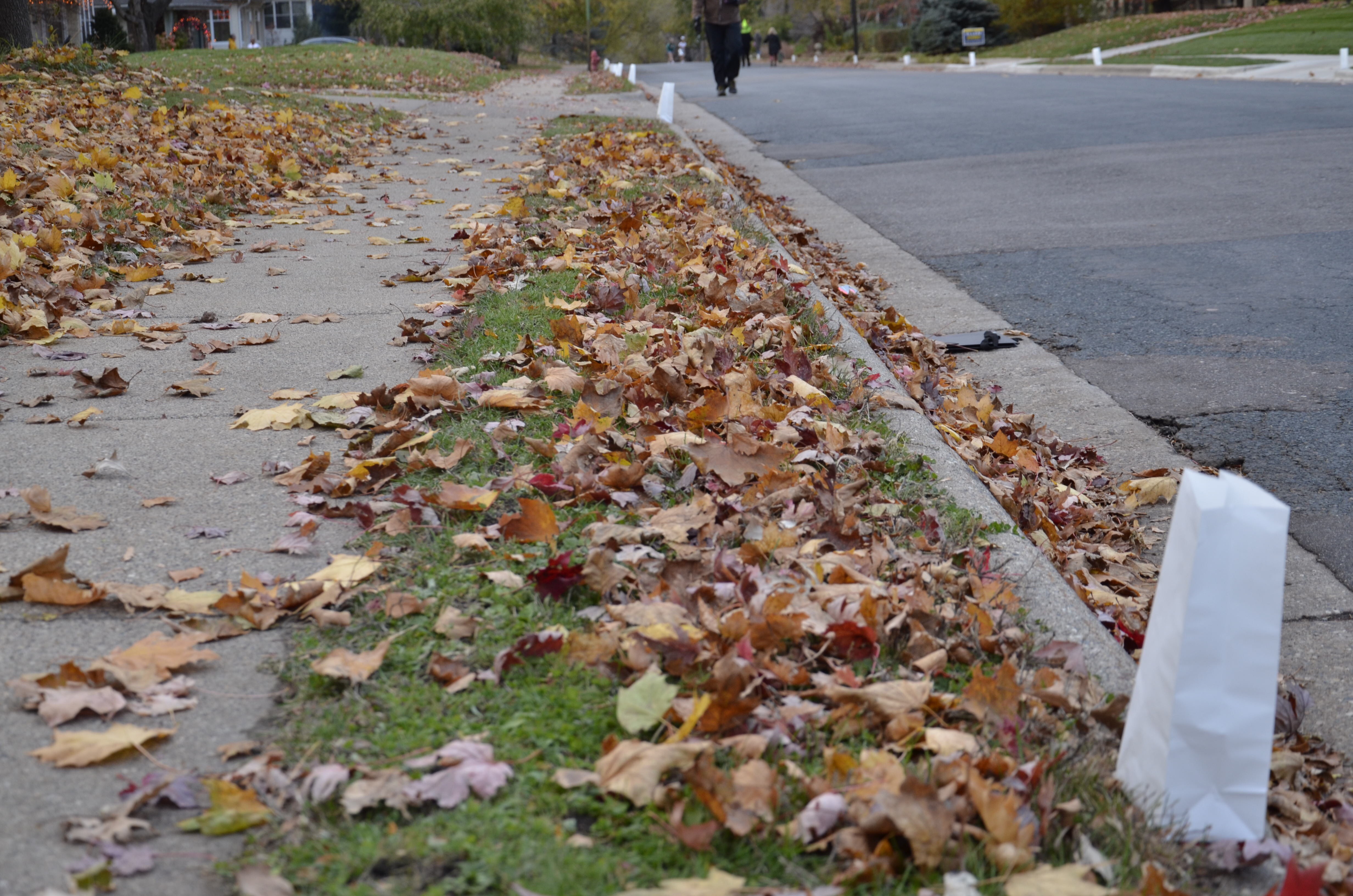
Morningside has mostly narrow streets, enough for one car in each direction, and parking on only one side. All streets have the state default 30 mph speed limit. Except for breaks due to topography, all north-south streets have sidewalks on both sides. These attributes make the streets safe & comfortable for pedestrians to cross, especially compared to a 45 mph suburban “stroad”.
North-south streets also have pedestrian-friendly streetlamps and mostly tree-lined streets. The fact that the boulevards (the space between the sidewalk and the curb) are so narrow means that “street trees” can’t go there and are thus at the mercy of each homeowner; and since tear-downs have become rampant in the neighborhood, we have lost quite a bit of sidewalk shade in the past decade. Overall, though, sidewalks are a pleasant experience.
As I watched kids & adults parade up & down the street, it was interesting to notice how parents generally kept little kids on the sidewalks, even though the street was closed. Teenagers more often than not frolicked in the middle of the street, not unlike Edina’s Open Streets on 50th event a few weeks ago.
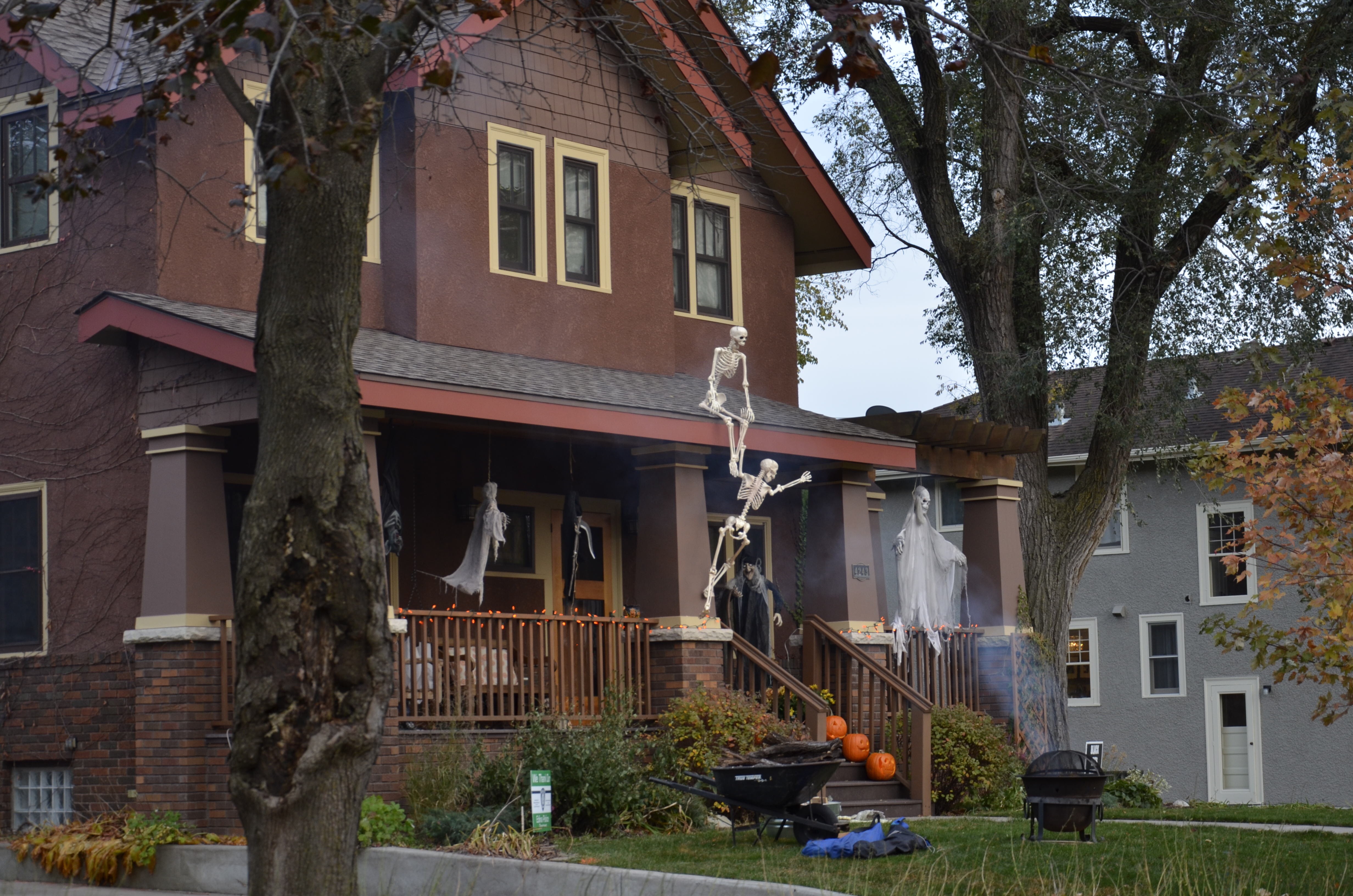
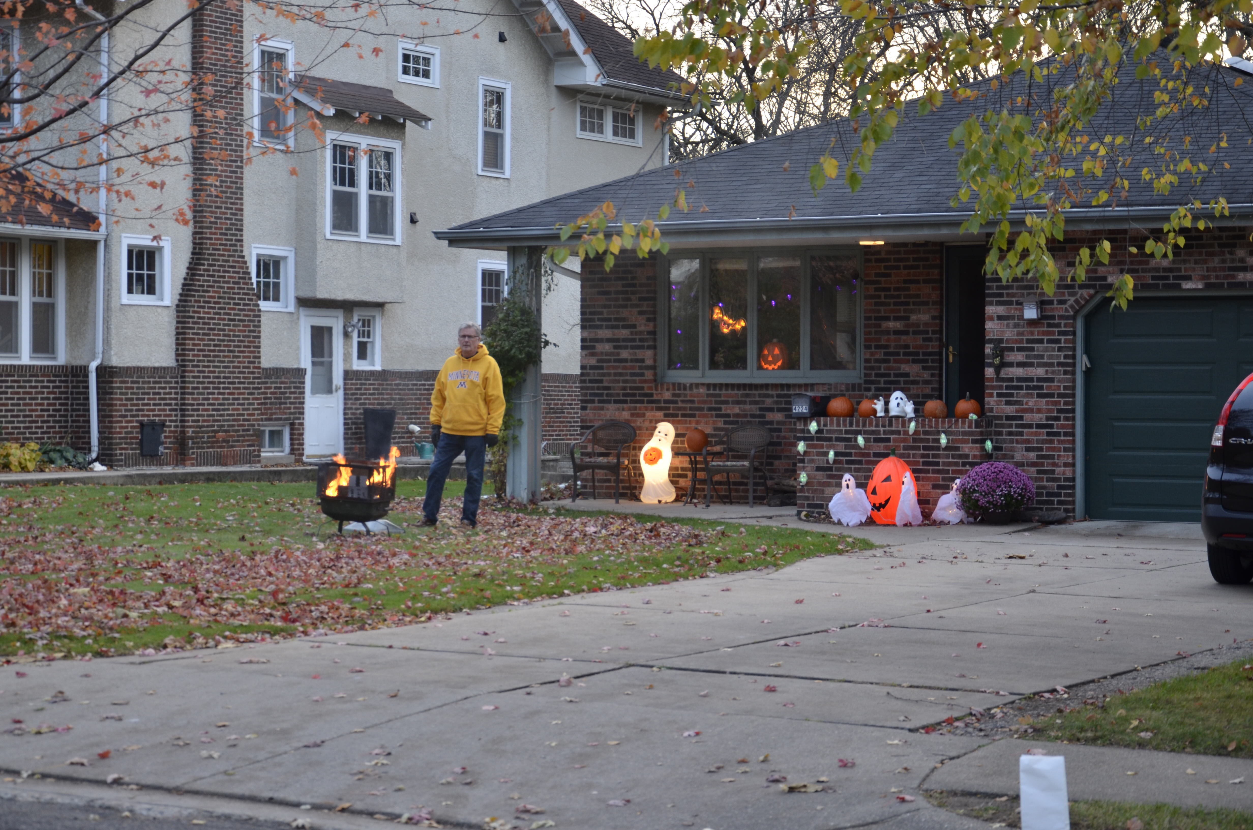
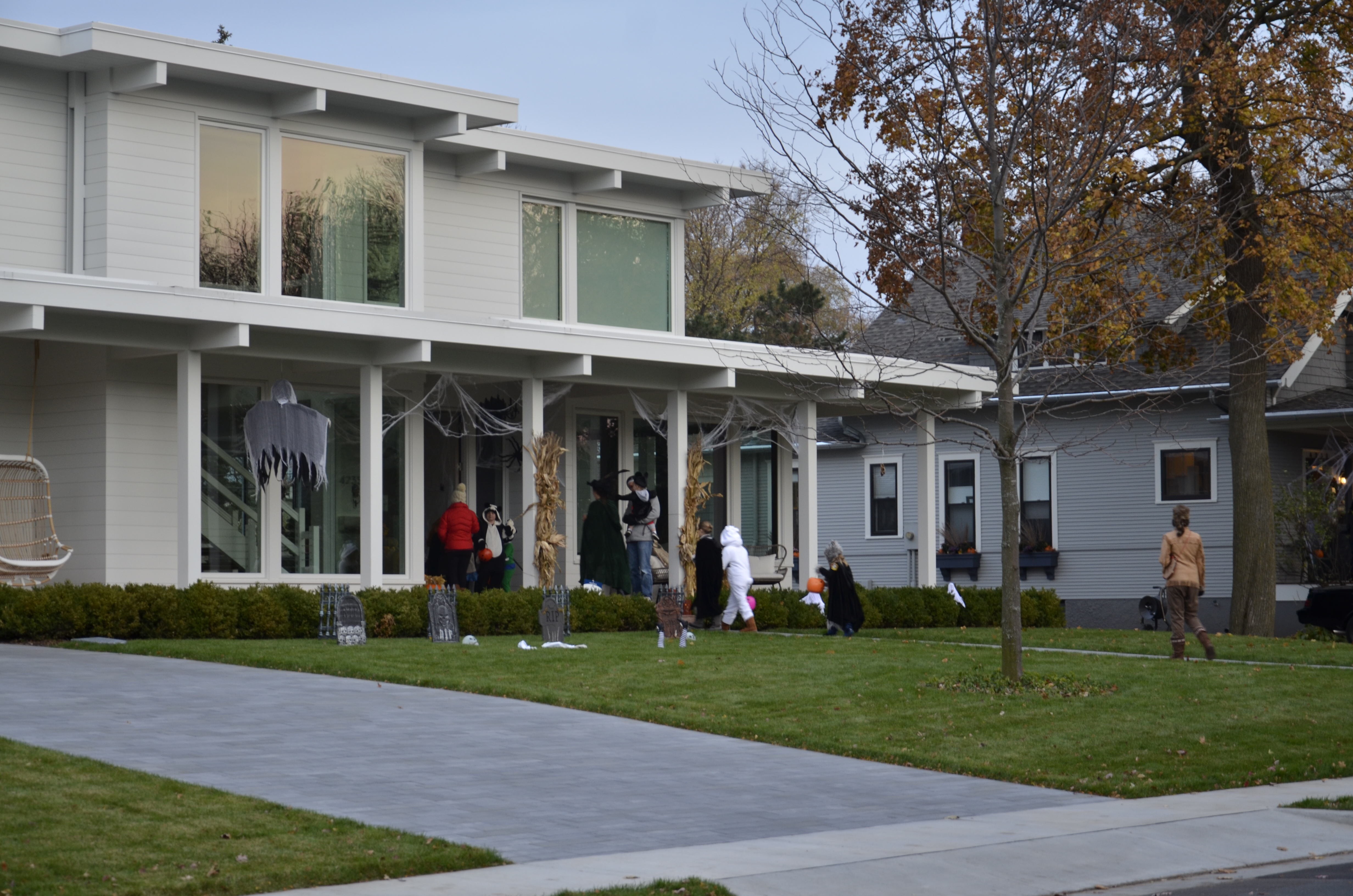
With Halloween now reportedly America’s second most-decorated holiday, and with participation not tied to any religion or ethnicity, virtually every house on the block participates. It’s a great community-building event, with decorations running the gamut from paper decorations in the windows to fire pits in the front yard & street to full-bore horror centers at two of the houses, including themed music, fog machines, and even a garage of horrors!
One thing that makes it so great for kids is that, while the lots are deep, they are only 50 feet wide, narrower than in many suburbs. The deep lots allow garages to be tucked back behind the houses, especially the older ones. There is an interesting mix of housing styles, ranging from cozy bungalows & foursquares (not unlike much of Minneapolis & St. Paul), to mid-century ranches & cape cods, to brand new houses on double lots. On our block, at least, new houses tend to be architect-designed, so there are no so-called snout houses, dominated by a prominent garage and a recessed front door, so anathema to street friendliness. One did just go up around the corner, however, so we’re not immune. These attributes make it a quick jaunt for kids to go from house to house, and leave plenty of living-space windows facing the street, increasing Jane Jacobs’ “eyes on the street” and thus comfort & safety.
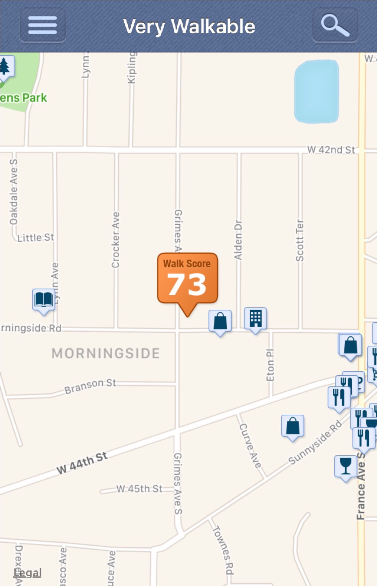
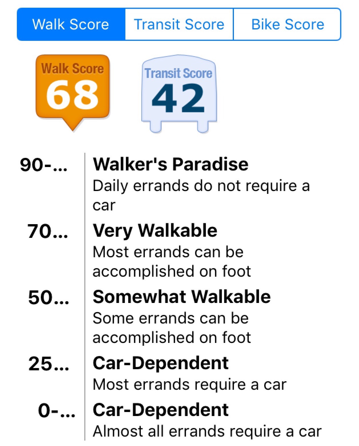
All this anecdotal data is backed up by an excellent, by suburban standards, Walk Score. A testament to just how long the blocks are, the Walk Score varies from 73 (Very Walkable) to 61 (Somewhat Walkable) at opposite ends of the block. This good score is due not only to the short distance between houses, but also that our nearby neighborhood commercial node at 44th St. & France Ave. is a former streetcar intersection. It also happens to be our border with Minneapolis which, with its denser lots and “missing middle” housing, supports a large variety of small businesses along 44th St. east to Linden Hills.
Narrow streets & lots, plentiful sidewalks & lighting, a tree canopy, street-friendly housing, and a great walk score add up to a very pedestrian-friendly neighborhood that kids of all ages go trick-or-treating on. Morningside passes the Trick-or-Treat Walkability Test with flying colors.
Lou Miranda resides in Morningside, and is Vice-Chair of the Edina Transportation Commission