
West End, West Side
24 Miles
October 7, 2021
In the post Taking A New Path, I raved about the new Robert Piram Bike Trail. It’s a fascinating dedicated bike and walking trail between Harriet Island Regional Park and Kaposia Landing in South St. Paul. That adventure fostered in me many questions about the creation of the trail and artifacts along its route. This ride, I went back to learn about the history, features and importance of the Robert Piram Trail from the project manager. But first, the ride there via the West Side.
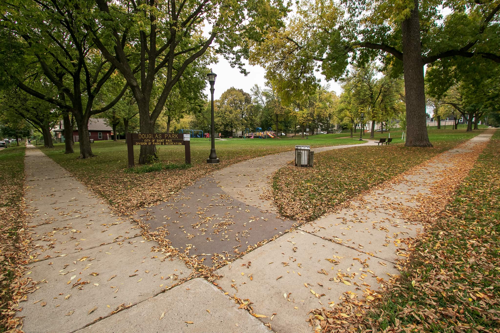
Douglas Park, a grassy, slightly hilly neighborhood gathering area, takes up the western half of one block. It is bounded by Stevens and King Streets on the north and south, respectively, Orleans Street on the west, and two homes on the east. Mostly grass with two meandering sidewalks that criss-cross near the middle, the park has a playground with the standard fare. For nearly 90 years beginning in 1885, the Douglas School building overlaid much of this block.


Although condemned by the city in 1972 (along with 16 other frame elementary school buildings) students attended Douglas School through the 1972-73 school year. The wrecking ball took down the Douglas building in 1974 and the cleared land given to the city.

Douglas School, and the park are named for Stephen A. Douglas, a senator from Illinois, who in 1850 introduced a bill to organize the Minnesota Territory.

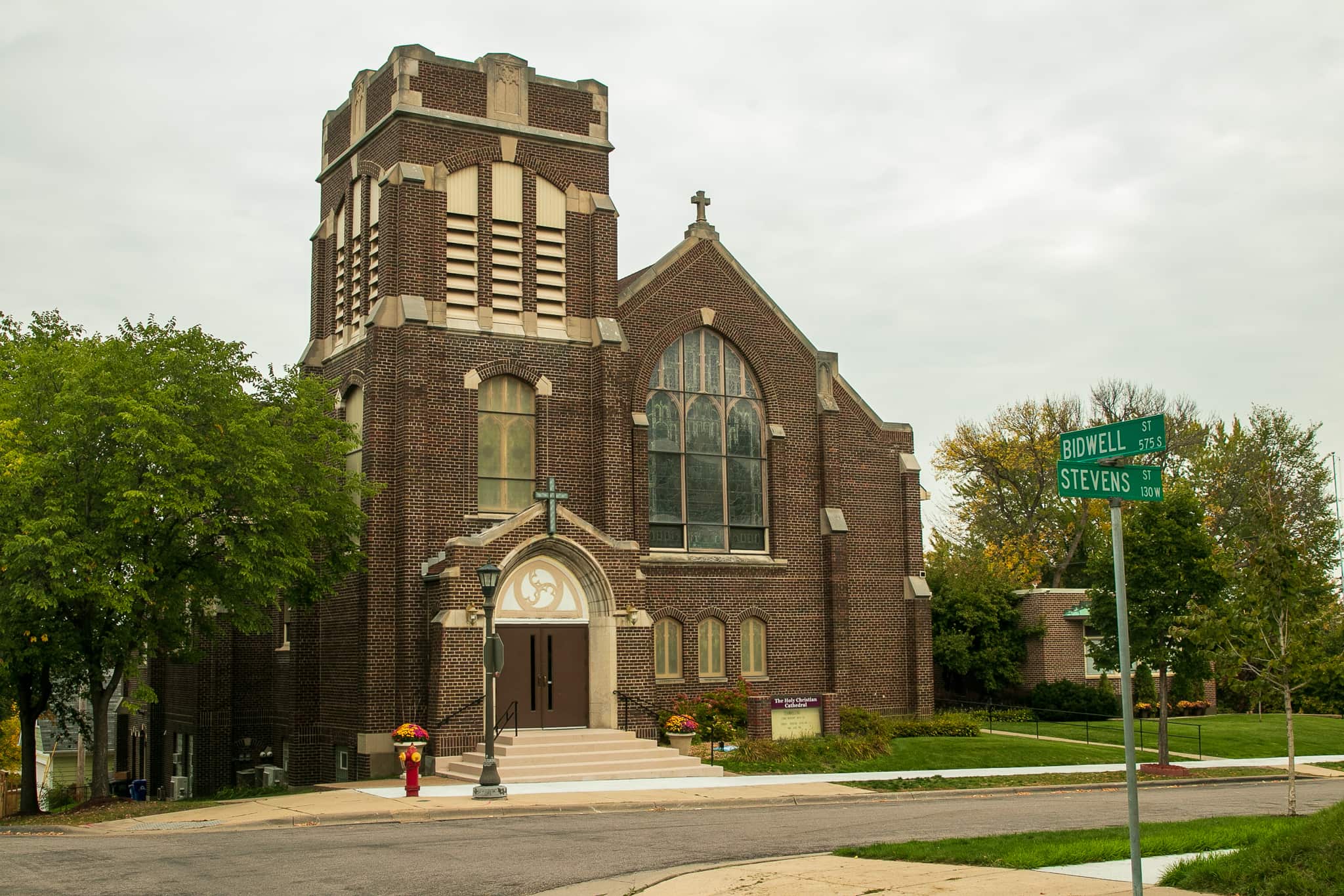
You may have noticed the prodigious number of neighborhood churches in Saint Paul. I can’t think of a ride in which I haven’t passed at least one active house of worship, and usually it’s several. That’s not taking into account converted churches or synagogues that are now apartments, condos or theaters. This time, several blocks east on Stevens at Bidwell I came to the the Holy Christian Cathedral, constructed in 1923. Previously, it was home to Holy Trinity Lutheran Church.
Being a weekday, the light traffic on the West Side streets I rode and the thick, close grey of the sky, created a muted feeling.


Less than four blocks east, another church. This sturdy stone structure on the corner of Humboldt and Stevens opened in 1936 as Emmanuel Lutheran. The congregation’s merger with Trinity Lutheran led to the sale of the building in 2004. St. Paul Believers Fellowship, An interdenominational Church, moved into the building in 2006.
I continued east, rolling down to Cesar Chavez Street, (which becomes Concord Street as the road passes under the Highway 52 bridge) and ultimately, to the Robert Piram Trail. This route probably seems like an odd choice since the Piram Trail replaced Cesar Chavez/Concord as the preferred bike route between the West Side and Downtown. However, riding to the Piram Trail via Barge Channel Road allowed me to pick up some West Side streets I’d never ridden.
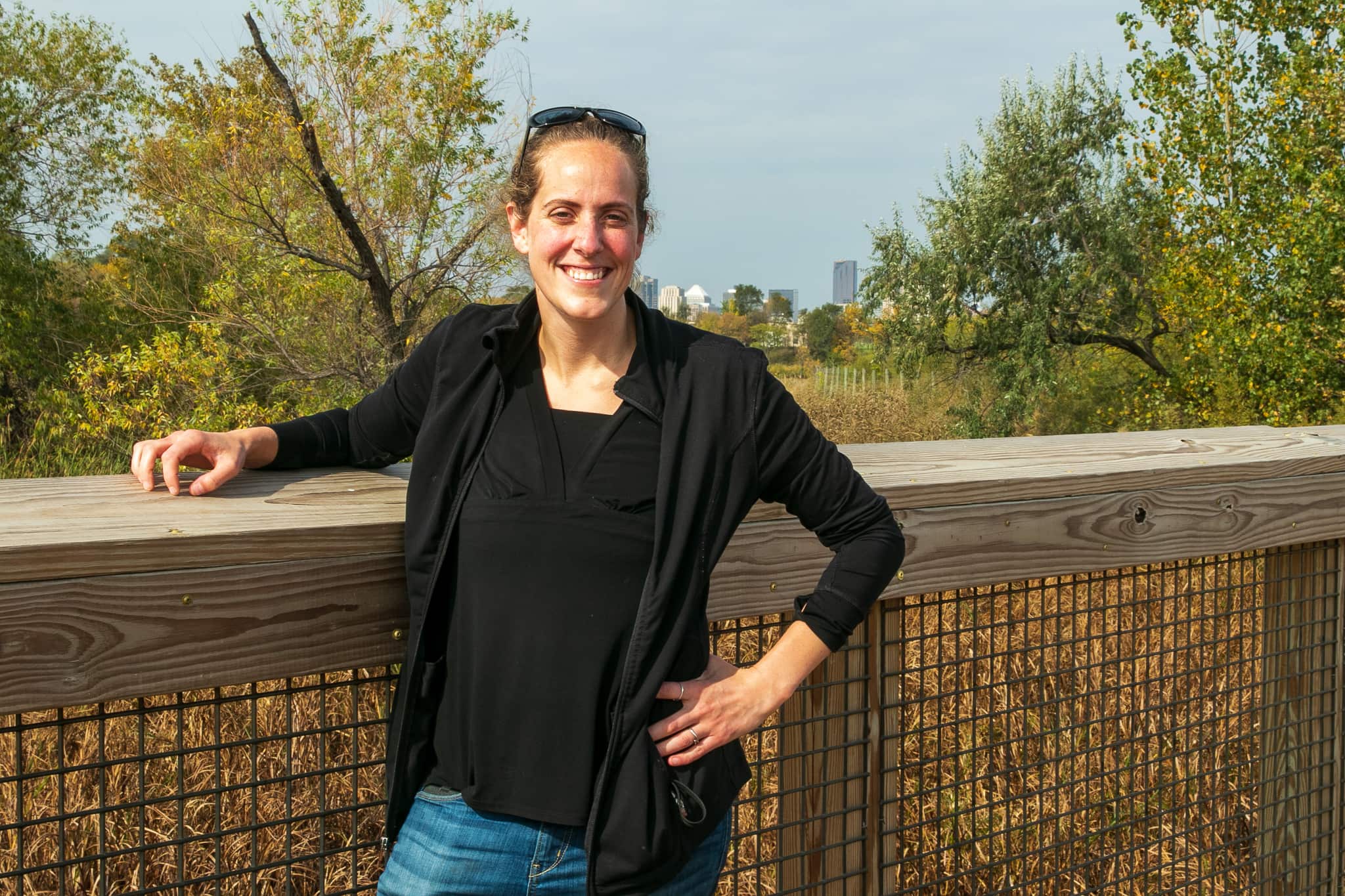
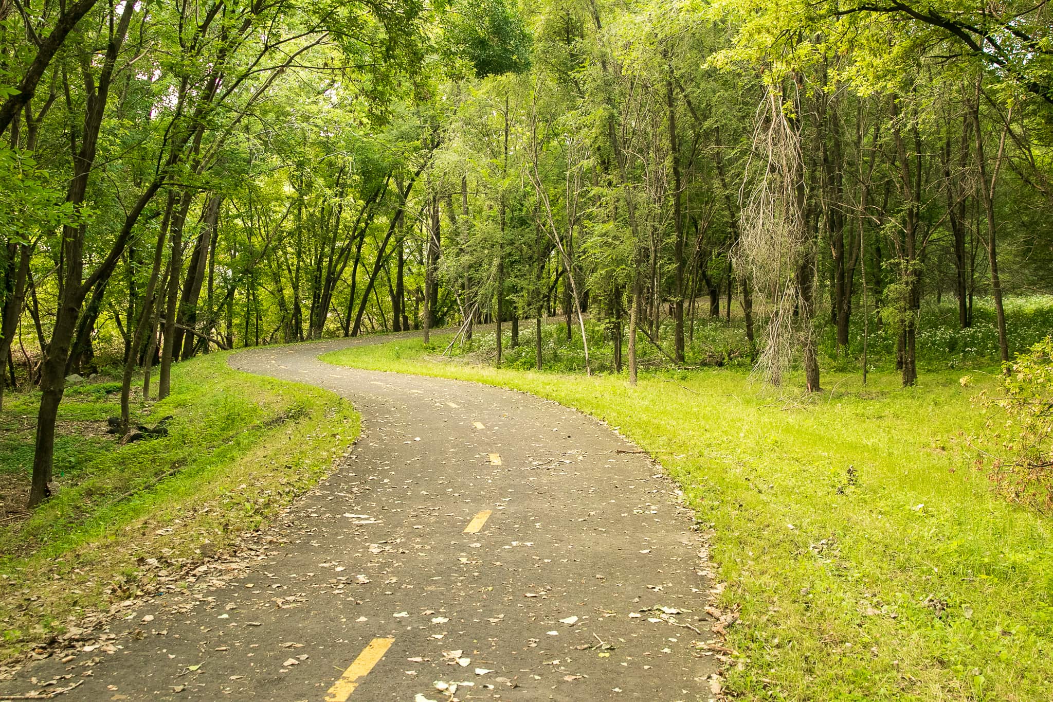
I arrived a bit early for my meet up with Mary Norton, a City of Saint Paul landscape architect and project manager for the Robert Piram Trail, so I cruised south on the trail to near Kaposia Landing in South St. Paul. Then I turned right around and rode north on the trail to the driveway of the Metropolitan Airports Commission building at 652 Eaton Street, where Mary and I met. We walked south a few hundred feet to the trail’s northern boardwalk to talk.
The trail, named in honor of a former Saint Paul Parks and Recreation director, is a key piece of the regional and national trail systems, according to Mary. “Even though it’s a small little stretch — 3.7 miles doesn’t sound like much on paper, but I think the spider web of connections that it provides to other regional facilities are really exciting for the city.”

Regional facilities that include the Big Rivers and Lilydale Regional Trails, and River to River Greenway in South St. Paul. And the Piram Trail expands Minnesota’s portion of the Mississippi River Trail, or MRT.
There’s been a strong recognition of this as such an important regional link for so many years that there’s a lot of champions in many different agencies and willingness to support it.
Mary Norton, City of Saint Paul landscape architect and Piram Trail project manager
The Mississippi River Trail more or less follows the river from its headwaters at Lake Itasca some 3,000 miles to Venice, LA , near the mouth at the Gulf of Mexico.

Most importantly, the Robert Piram Trail vastly improved safety for bikers and walkers. “The MRT had this link but it was on Concord Street. You would go on-road on Concord from South St. Paul to Harriet island. What’s great about this is obviously we’ve now separated pedestrians and bicycles from vehicular travel.”
The idea for what became the Robert Piram Trail originated informally 20 or more years before construction started. After speaking with Mary and looking over planning documents, it’s a wonder trail proponents managed to overcome the litany of obstacles to get it built!
Mary was a late-comer to the project; she joined the City of Saint Paul in 2018, replacing the retiring Don Varney as the project manager. Varney, Mary told me, led the creation of the master plan which guided all aspects of trail design and construction. When Mary started, planning was around 90% complete.“I came in at the end and got to wrestle through some of the fun stuff with project partners and agencies and getting those final legs ready to be able to construct, and then work through construction.”
Mary hinted at the elaborate and, what I suspect were, at times, delicate efforts required to plan and build the Piram Trail. First, the route traveled through land owned by a couple dozen private and public entities. “A big challenge and opportunity was getting through the right-of-way, making sure we have land rights to the different pieces [of property] and parties.”
“If the trail was out outside of public right-of-way,” said Mary, “we would have to get a temporary easement for it for construction.” Construction along East Lafayette Frontage Road, meanwhile, required a permanent easement.
Money to build the $8.6 million trail came from a variety of local, state and federal sources. Some of that money hinged upon the timely approval of easements. “We had an amazing opportunity with federal funding, but we had to get through property rights for the trail in a certain amount of time to make sure that we could still keep that opportunity, the federal funding. Otherwise, you don’t have your ducks in a row, they’re [federal government grantors] not gonna wait forever.”

One right-of-way easement that proved to be unobtainable was a half-mile section atop the earthen flood levee on the west side of Holman Field. “The first [2012] version had the route along the levee. So then the [2017] amendment adjusted it to be along East Lafayette [Frontage Road]. That was before my time but what they found is that… the feasibility of the alignment came into some technical issues with building upon the levee.” While the route change is understandable, riding on the levee would have offered some unique and interesting views.

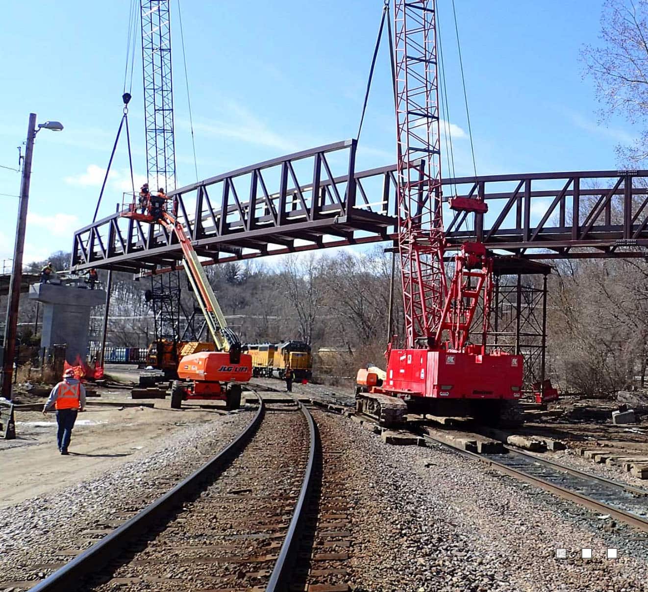
Getting construction equipment into some of the narrowest spots proved to be another hurdle, Mary said. “Access on the project was difficult. Building the bridge was complicated because we were right between Union Pacific railroad and going over the railroad. Then we had to meet the needs of industry and maintaining operations.”

Mary mentioned that some trail lighting was out of the ordinary. “The lighting in front of the boardwalks and the head bridge are solar area lights. That was a kind of a pilot. Obviously we would love to be able to do that more. Trenching utilities and whatnot can be expensive and logistically prohibitive.”
The southern portion of the trail, Mary said, required significant clean up despite its remote location. “There was a lot of tires and debris in the stretch from Barge Channel Road to Kaposia Landing Park. So that’s been cleaned out. The Port Authority did an incredible job.”
The trail officially opened in July 2021 with a ribbon cutting, which Mary called “a pinch myself moment.”

The trail namesake, Robert Piram worked for the City of Saint Paul Parks and Recreation department for 38 years, including 26 as superintendent. According to an obituary, Piram was instrumental in forming partnerships that led to the creation of Saint Paul’s regional park system and the merger of Como Park Zoo and Como Conservatory into one nonprofit entity.
Mary went on to say, “It was really special, recognizing Robert Piram, a former director of the city Parks and Recreation department, whose daughter works within our group. She was there. It was really a special moment for their family and the legacy of Robert Piram.”
During our conversation Mary modestly credited many others, starting with coworkers at the City, for the success of the trail project. “There were so many champions in public works. We have a great transportation planning division in the City of St. Paul public works. They were integral in working through those right-of-way issues.”
“ I’m just so grateful for the team I work with. When you do get into those spots, trying to problem solve and navigate, how do we get through this? How do we keep it going? ‘Cause we have to, it’s so important and they were great for that.”
Mary Norton
The praise Mary offered extended to other governmental and private sector entities, including.:
• Ramsey County
• Dakota County
• The City of Lilydale
• Metropolitan Airports Commission
• MnDOT
• The Saint Paul Port Authority
• Union Pacific Railroad
• The City of South St. Paul
• Many small businesses along Plato Boulevard;
• TKDA
Mary likely knows the Piram Trail better than anyone so I asked about her favorite spot. “How do you pick your favorite?” she responded, paused, and said, “I’ll say the boardwalk areas, so right through this wetland here. It’s a part of St. Paul that was previously inaccessible to the public, or unknown. There wasn’t a path through here. What’s exciting about that is that it’s publicly accessible, but it’s also a cool moment because behind you, you can see the skyline. You turn the other direction, you can see planes and there’s a view into the river area and the wetlands. So it’s a beautiful moment and, and a really interesting juxtaposition of industry and nature.”
All the major construction was completed in 2021 but bikers and walkers are likely to occasionally see Port Authority workers along what is known as the Southport section of the trail. “Between Barge Channel and the boardwalks, they will be doing some invasive species and native habitat restoration over the next couple of years in that stretch, which is great.”
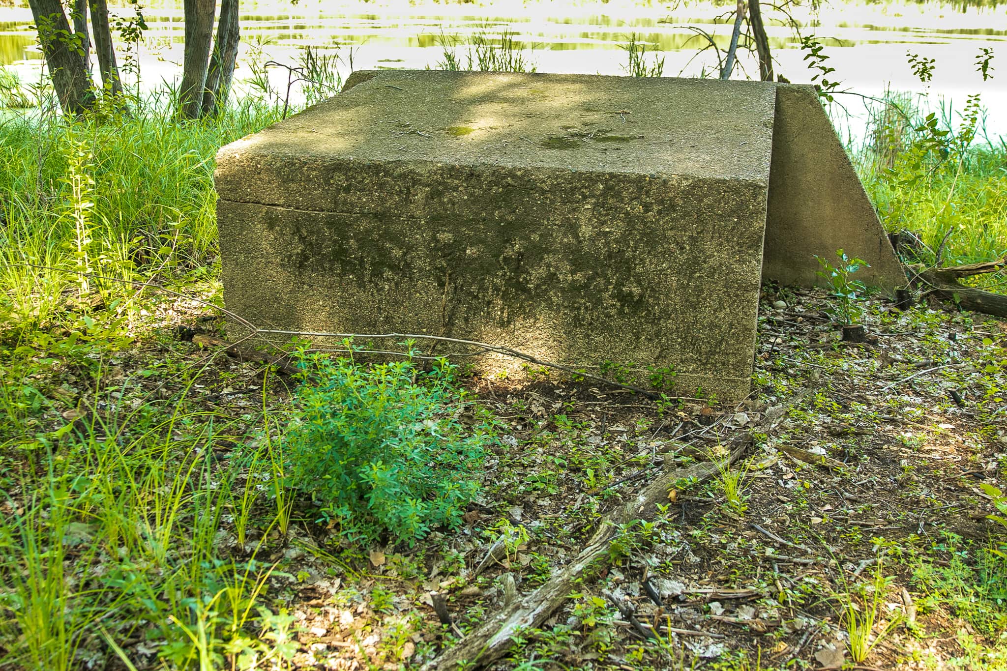
Tentative plans call for placement of some interpretive signs here and there along the trail. Among those spots are the concrete structures in the woods facing the Mississippi River. A Saint Paul Port Authority report determined Southport had a trap shooting range from at least 1940 through 1958. The report goes on to say the small concrete structures housed trap shooting launchers (above).

Two items remain unanswered. First, nothing in the Port Authority information mentioned the two larger structures to the south of the launchers.

The other unknown is the origin of the vehicle left on the west side of the trail. And so my investigation continues.
As usual, the ride home yielded a minimum of stops. In this case, took a break for a delicious coconut ice cream cone at La Michoacana Pink Ice Cream on Cesar Chavez Street.

Then, a final pause at one of my favorite small homes on the West Side, an 1885 beauty at the corner of King Street East and Robert Street. This home has obviously been lovingly restored and stands out, even on a gray October afternoon.
