
Editor’s note: This is the third story in an occasional series we’re calling Let’s (St)roll There, describing ways to get to unusual or out-of-the-way places by foot, bus, train or bike. Zack Mensinger wrote in June about riding his cargo bike to Stillwater to pick blueberries, and Pat Thompson described a Saturday bus trip in August from St. Anthony Park to Nicollet Island.
In September 2022, on the final weekend, I decided to ride my bike the 32 miles to the Minnesota Renaissance Festival. I had always thought about riding the entire way but often other people whom I was with insisted they preferred to drive for various reasons — like being tired after the festival, wearing restrictive clothing or having to carry things.
This year, spur of the moment, I decided to go solo to the festival since I wanted time by myself to process some recent deaths in my family, plus I could go at my own pace. I chose to bicycle since, at the time, the shuttle to the festival was getting stuck in traffic repeatedly, causing delays.
Trip Narrative
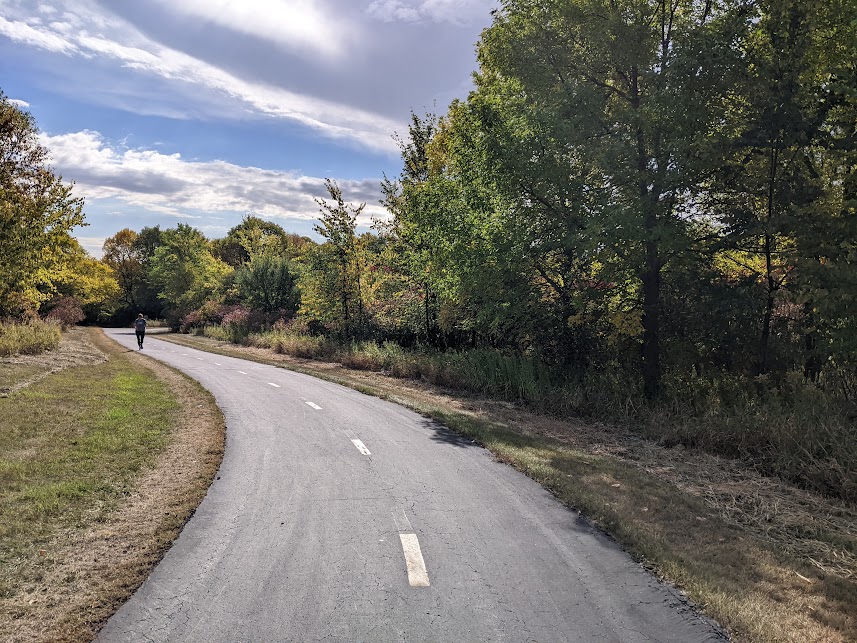
I decided to ride my normal route from the Highland Park neighborhood of St. Paul, the same one I would take to Hyland Park Reserve. That is the route I like best: crossing the 46th Street Bridge, then using Godfrey Parkway, Minnehaha Creek Parkway, 39th Avenue, 50th Street, East Nokomis Parkway, Nokomis–Minnesota River Regional Trail, Bloomington Avenue, Diagonal Road, 12th Avenue, 86th Street, Queen Avenue, 90th Street, Poplar Bridge Road and 94th Street to enter the park.
I developed this route with the help of Google Maps but had used most of it in the past, so I was somewhat familiar with it. Luckily most of this route is separated bikeways, quiet neighborhood streets or roads that have a paved shoulder. Bloomington’s bike infrastructure has been written about before in Streets.mn.
I stopped and enjoyed the leaves just turning a hint of fall colors in the park and sauntered along the paved trails through the park.
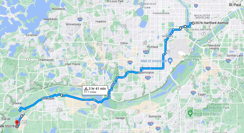
After a lengthy break in the park, I used the Hyland Trail and then the Bloomington Ferry Bridge to the Minnesota Valley State Trail.
The Minnesota Valley State Trail connected the entire way through downtown Shakopee with only minor road crossings and access to drinking water and reasonably clean restrooms at Huber Park. The trail then follows the Minnesota River on the south side. Then I turned off of the trail at the Chestnut Boulevard parking lot and followed the driveway to Chestnut Boulevard.

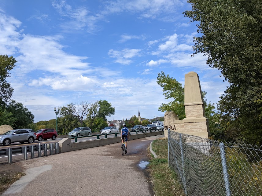
At the junction of Chestnut Boulevard, I saw that motor vehicle traffic was backed up all the way into Chaska. This backup of motor vehicles in every direction inhibited access to and from neighboring businesses and residences.
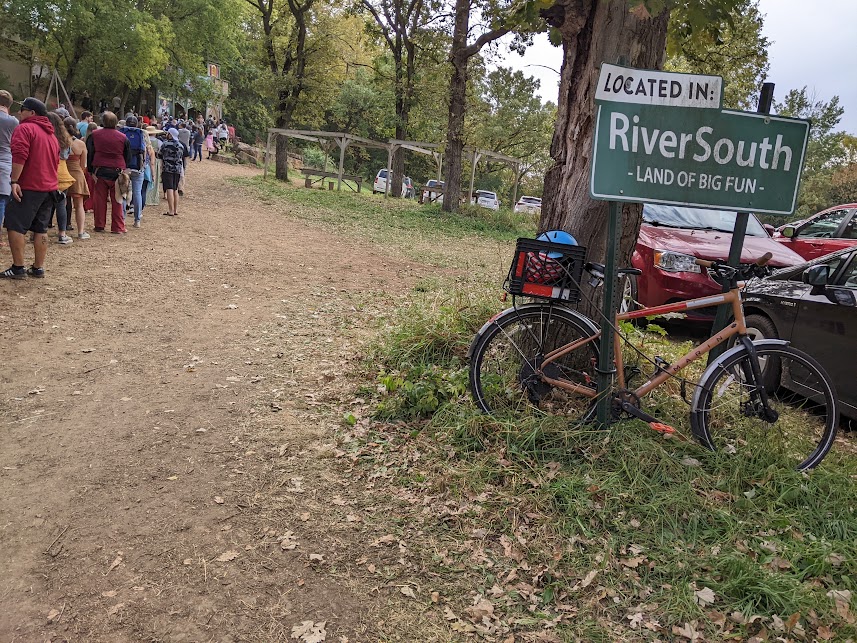
At that point I rode on the shoulder up to the point where the line of motor vehicles was blocking it and then I moved over into the right lane of the road. Once I turned onto the driveway, I filtered through the two lines of stopped traffic until the traffic merged into one lane each direction. Then I rode on the shoulder when there was one and went in the opposing lane to pass when there was no shoulder and it was safe to do so. After I got through the parking area, I found a sign post near the Queen’s Gate to lock to and where the crowd would not likely mess with my bike.
Even with the gentle rain that fell partway through the festival, I was not anxious about what it would be like leaving the festival whenever I decided to go.

When I left, I went out, unlocked my bike, and just made my way on any driveway I could find in a northerly direction, riding on the grass as needed until the point where the merging was done and motor vehicles were moving again. At that point, I took the lane (traffic was going slow enough I could fully keep up). Since it was near the end of the festival there was very little head-on traffic so I could use the opposing lane to pass in those areas. After I filtered through the traffic stopped at the intersection with Chestnut Boulevard, I used the paved shoulder to ride to the trail access and parking lot and then the Minnesota Valley State Trail back toward home using an version of my preferred route but taking Old Shakopee Road since it angles toward home and isn’t as desolate as going through Hyland Park Reserve.
Now you know the route. But how was the ride?
Joyful
The lovely ride to and from the festival brought me so much joy. Although modern celebrations of the Renaissance era are not completely accurate, I felt like I got a better feeling of traveling and then arriving at a Renaissance-era town of Western European style. Bicycles were invented closer to the Renaissance era than automobiles were.
I arrived feeling really relaxed and ready to enjoy the festival instead of flustered from having to sit in a car roasting in the sun, going slower than walking speed, inching along for almost as long as it took for me to ride from St. Paul on a route that had shade along a lot of it. I enjoyed only having to be near heavy motor vehicle traffic for the last two miles. Some people even seemed to smile as I went by.
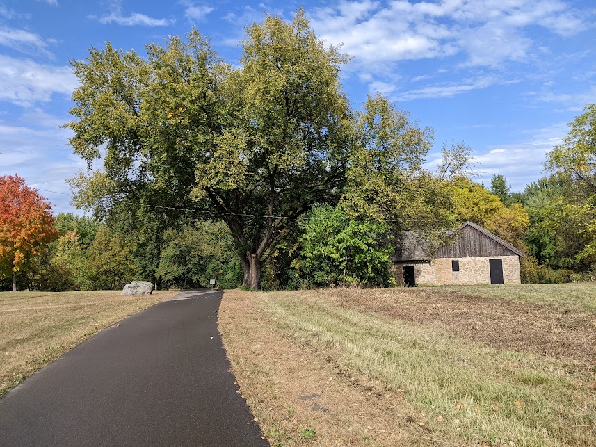
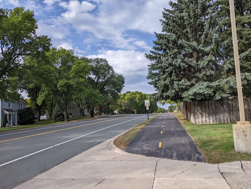
On the street and trail portion of the ride, I saw many other people on bike, walking, and rolling, all while enjoying the woods of the river bottoms and some restored prairie. There’s a historic kiln from a brick yard and a heritage park along the trails that were neat to see. It’s also fun going by the modern amusement park as it is in operation.
Challenging
It’s not always easy biking somewhere new. I’ve heard about very few people who had biked to the Renaissance Festival even though it was only 15 minutes from downtown Chaska and 30 minutes from downtown Shakopee on a mostly paved trail away from motor vehicles.
The 30-mile distance from the edge of St. Paul could be daunting to some. Attending a festival involves walking and standing on already tired legs, but there were plenty of opportunities to sit for a bit here and there. It also started to rain while I was at the festival but having a bike adapted to riding in inclement weather by adding fenders and good brakes and experience handling it in those conditions gave me peace of mind.
I could also see the last 1.5 miles where I turned off of Chestnut Boulevard into the festival being very daunting for anyone who is not confident handling their bike around dense stopped motor vehicle traffic with no bicycle infrastructure. Even when I got to the area where people were directing motor vehicles to park, I was directed along the same routes even though there would have been a shorter and less crowded way to bike to the gate taking a different way through the field everyone was parking in. Leaving the festival, I filtered through about 0.75 miles of stopped traffic and went with the flow for another 0.75 miles of slow-moving traffic.
Also, there were plenty of random fixtures I could lock to, but nothing that was designated as bike parking.
Adaptive
There are many ways I see that could shorten the bike ride if the distance is daunting, a multimodal trip would work for that. I noticed for 2023 that there will be multiple park-and-rides with shuttles to the festival.
On the other side, last year I noticed that most of the parking lots and street parking along the trails had ample space for motor vehicle parking for those who like to drive to the trails and then bike places. Those parking areas should be far enough away not to annoy neighbors enough to complain about it.
Additionally, all Minnesota Valley Transit Authority (MVTA) and Metro Transit buses have free bike racks. Once the Green Line extension opens, it should be closer to bike to high-frequency light rail where bikes can be rolled directly onto the train. Of course, no bike is needed to take transit to the shuttle.
I appreciate that the “Bus Bucks” voucher reimburse for the cost of the bus fare and that a paid parking reservation system has been set up to lessen the massive traffic jams of the past couple of years. I really wish they had a better way to bike the last 1.5 miles, especially since bikes are spatially efficient to ride and park and seem to work pretty well at other extremely crowded events, like the Minnesota State Fair.
I saw the festival website mentions bike racks at the King’s Gate at the bottom of the “Frequently Asked Questions” this year, but nothing else and I have not biked to or from that end of the festival since it was farther from home to go that way and the trails don’t connect as well from that way yet.
Ultimately, I really hope that this can reduce the motor vehicle modal share from the high 90th percentile that it was in 2022 so the festival can be a better experience for all, especially as the later weekends have increased attendance compared with earlier weekends. Perhaps it’s time for you to consider a trip to the festival by bike!
The Minnesota Renaissance Festival runs weekends through Sunday, October 1.