
Last Friday, streets.mn published Part 1 of author Wolfie Browender’s adventures exploring the now-defunct Ramsey County jail. If you missed it, go check it out and learn about inmate moonings and buttonless elevators! This post continues his journey exploring the jail from the outside and chronicles his journey home.
June 16, 2015 – Highland Park, West End/West 7th, Downtown – 16.2 miles
After my release from the Adult Detention Center, my jaunt continued Downtown with a stop at 345 Cedar Street, the soon-to-be the former home of the Pioneer Press newspaper.

The entrance to 345 Cedar Street.
Originally built as the headquarters of Minnesota Mutual Life Insurance Company, 345 Cedar was constructed in 1955. The Pioneer Press replaced Minnesota Mutual as the tenant in 1984.(1)

Pioneer Press Building

Two skyways over Cedar Street. The skyway in the foreground connects the Pioneer Press building with the St. Paul Athletic Club. Nearly all the skyways in Saint Paul are identical to these two.

The College of St. Scholastica, based in Duluth, has a satellite site at 340 Cedar Street.

340 Cedar is also the address of the St. Paul Athletic Club and Hotel 340, the east metro’s first boutique hotel, according to its website.

A close look at the ornate awning over the entrance of the St. Paul Athletic Club/Hotel 340.

The original part of the St. Paul Athletic Club building.
From Cedar Street, I went south to Shepard Road to look at the old jail from ground level.

The entire former Ramsey County Adult Detention Center is best seen from Shepard Road. The pillbox is the upper-most part of the ADC, above the tree farthest to the right.

The ‘pillbox’, again, from Shepard Road.

The former office of the sheriff is behind the widows in the middle of the picture.

The damaged window of the cell from which two inmates tried to escape in the early 2000s is plainly visible.

At least three of the bygone Ramsey County West (and before that, West Publishing) buildings are evident, while a corner of the jail is visible on the far right of the picture.

Now looking northeast from the Samuel Morgan Trail (which parallels Shepard Road), the size of the closed government center, previously West Publishing, is more easily seen.

Here’s a similar view from 1965. Notice the space to the right of Booth Cold Storage. That’s where the ADC was built. Nearly every building in this picture still stands. Courtesy Minnesota Historical Society.

At one time this lower parking lot was used for the Government Center West and the Jail; now it has been all but forgotten. It’s located just north of Shepard Road.

Although West Publishing moved to Eagan in 1991, one of the company’s signs remains nearly 25 years later. Only when the building comes down will the sign do so.
Weeds reach skyward from cracks in the pavement at a vacated entrance.

These arches haven’t always been sealed with bricks. Were they loading docks to move ink, paper and other supplies into and finished law books out of the plant?

The old jail induces an ominous feeling from this angle.
–
Resuming my eastward travel, I saw some grocery carts parked amidst some bushes growing out of the bluff.

Almost certainly the belongings of some homeless folks, authorities have “red tagged” them, a warning to move them or lose them.

A clear and concise warning from authorities.
Continuing east in the parking lot, it merged with 2nd Street as I neared Jackson Street. As I explored, I went the wrong way on two one-way streets, first Jackson and then 2nd. My reasoning–turning around and riding the correct direction would add at least a mile and some valuable time to my ride. I was unwilling to sacrifice time with the sky portending rain.

In the lower left corner of this picture you can just make out where the parking lot meets 2nd Street. Running along the edge of the building (the Ramsey County Government Center East), it seems to disappear into darkness as it dips under the viaduct.
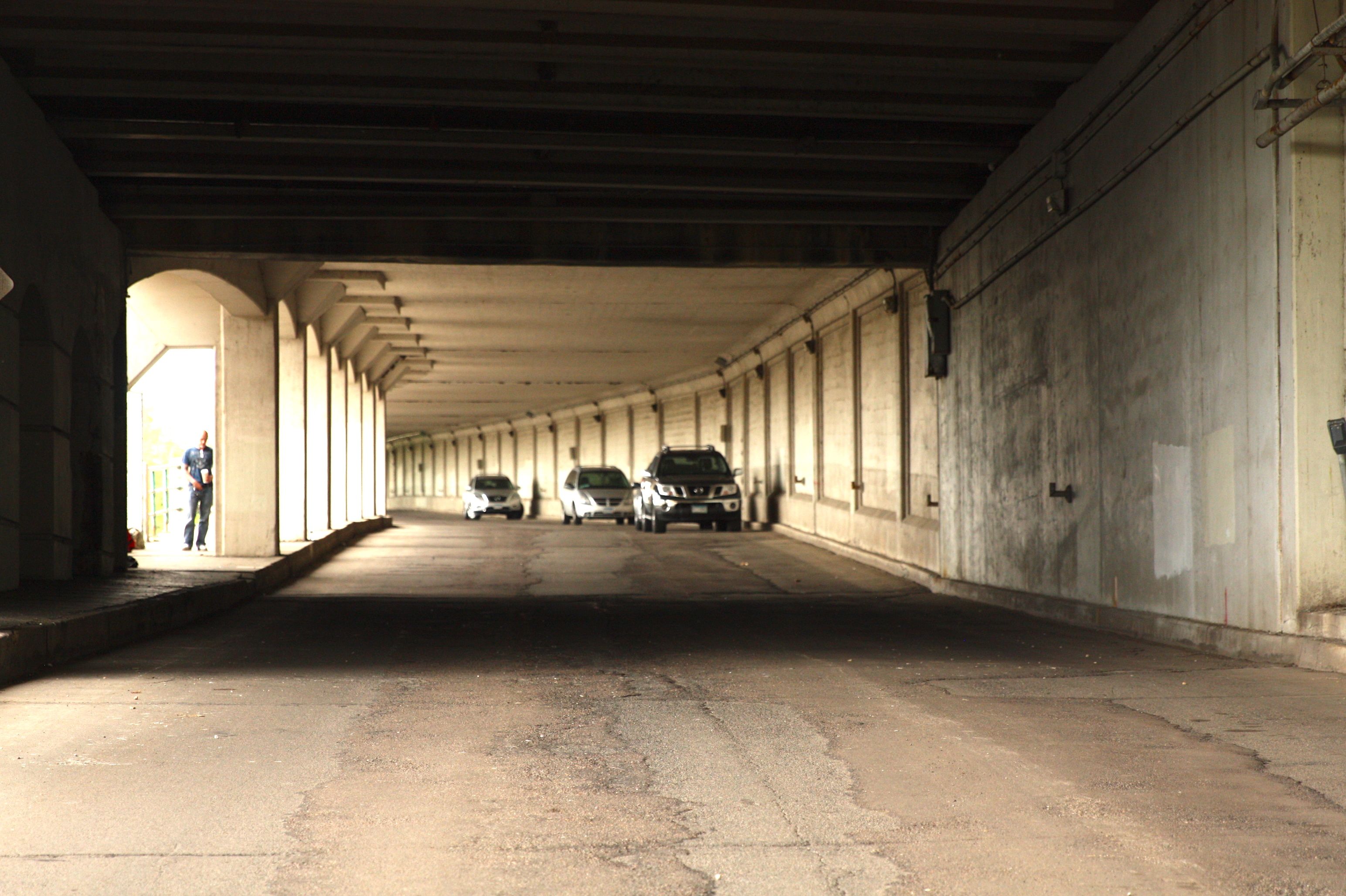
In reality, there is plenty of light as 2nd Street passes under the viaduct.

The pitch of Jackson Street is obvious in this shot. It must have been an unusually difficult assignment for the bricklayers and masons who built the building.
Determining the exact history of the building that is now the Ramsey County Government Center East has been elusive.

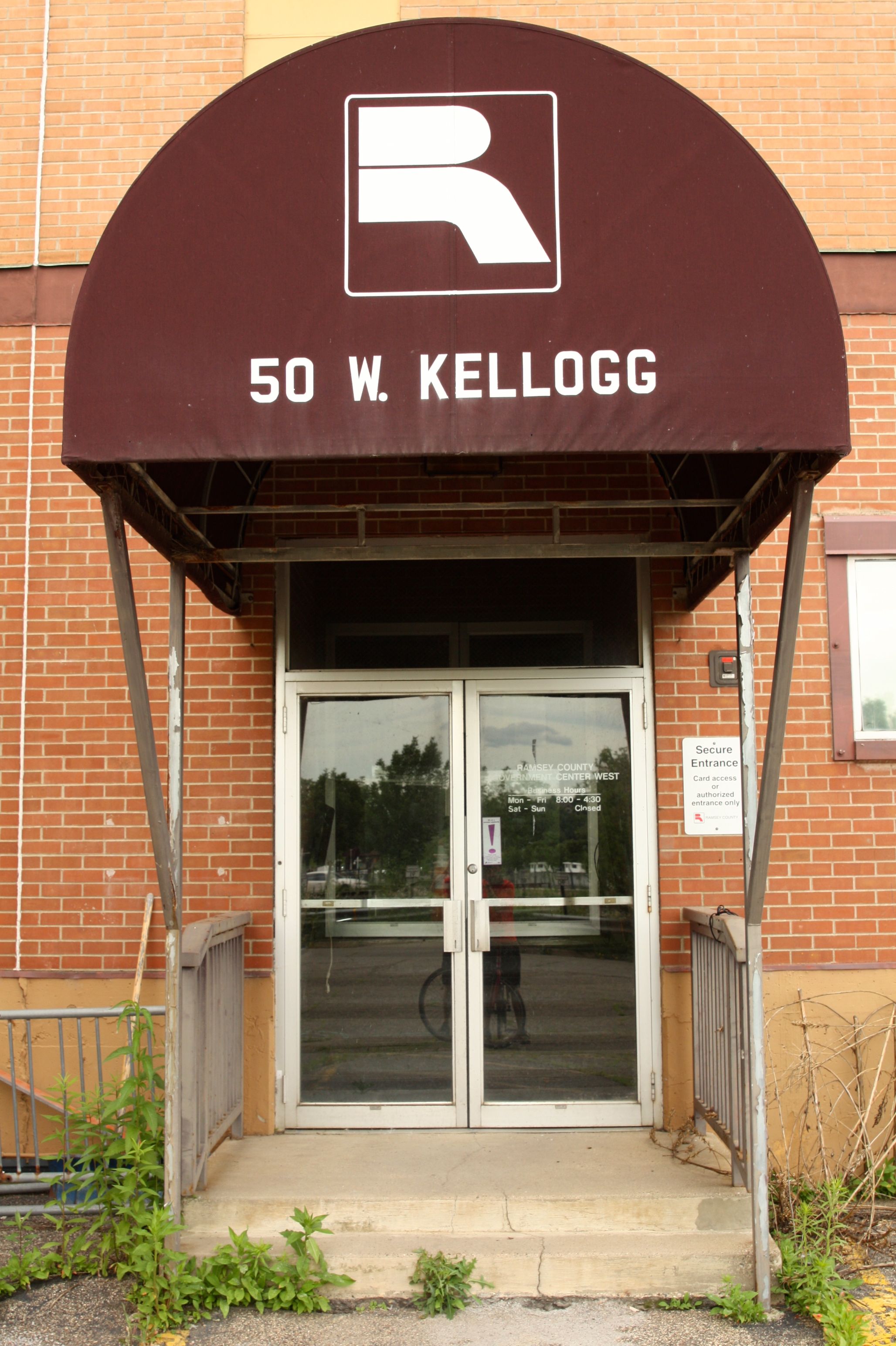
This is the front of the Ramsey County Government Center East, which is at 160 East Kellogg Boulevard. While I’m nothing near an architectural expert, something about the windows at the Government Center doesn’t feel right.

A better view of the entrance to the Government Center.

The west side of the Government Center: there’s an expansive lawn here, most of which is not visible in this photo.
The landscape on the west side of the Government Center is a public area, part of which is The Saint Paul Cultural Garden. There is no prominent signage pointing that out, only a granite block with a metal marker. Dedicated in 1993, the Saint Paul Cultural Garden was created by 10 artists(2) for the 150th anniversary of the naming of the City of Saint Paul.
(click on any thumbnail to enlarge the images and see the captions.)
-

- Grass, trees, art and comfortable places to sit make this a great green haven in nice weather. The Government Center is to the right.
-

- Created long before the Cultural Garden, a memorial marker honoring the first Swede to settle in Minnesota…
-

- …has a prominent spot on the lawn.
-

- This is the only explanation of the Cultural Garden that I found.
-

- This colorful conic sculpture with an embedded poem about the Mississippi River is my favorite.
-

- According to the Saint Paul Foundation, the garden consists of six separate displays of sculpture and poetry featuring historically significant cultural groups.
-

- The Dakota word for Mississippi River(4), Ha-ha wa-kpa (literally ‘river of the falls’), is carved into granite blocks, images representing the Mississippi and native plants, are in the fence and the Mississippi itself flows in the background.
-

- I mni za ska, the Dakota name for Saint Paul, or white bluff (3)
-

- The Saint Paul Cultural Garden looking northwest.
–
Leaving Downtown, I saw how drastically the demolition of 7 Corners Hardware alters the area.

Seven Corners without 7 Corners Hardware is like someone without their front teeth.

A portion of one building is all that remains of the iconic hardware store.

Girders from the store are piled to the side in preparation for recycling.
Nearly every bike ride is an adventure. This one stands out because of the visit to the former Ramsey County jail. It was a fun and educational experience, one that I was very lucky to have. I hope you’ve felt some of my enthusiasm as you read this post.
Wolfie
Click HERE to see the map of this ride.
Bibliography
- Minnesota Mutual Building and Saint Paul Urban Renewal Historic District: National Register Evaluation; Metropolitan Council website; http://www.metrocouncil.org/METC/files/92/92bc5727-84d3-4256-84a5-469209a57fe2.pdf
- St. Paul Foundation website; http://www.saintpaulfoundation.org/_asset/wz4n0b/
- Grammar and Dictionary of the Dakota Language: Collected by the Members of the Dakota Mission; Minnesota Historical Society ©1832
- Ibid