Map Monday: 1901 Dual City Blue Book Map of Minneapolis and Saint Paul

Via @neomischa on Twitter, here’s a beautiful old map of the Twin Cities, published especially for the Dual City Blue Book in 1901.

streetcar tc dual city map


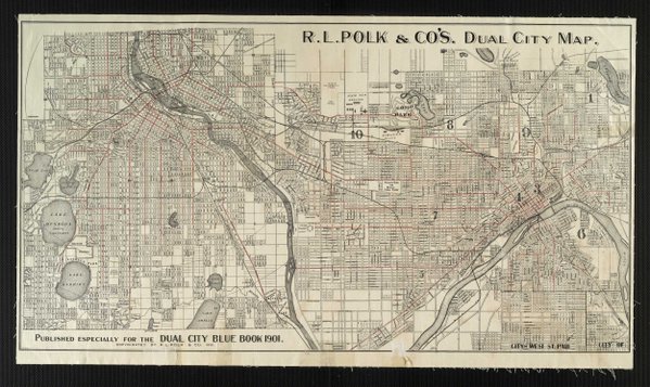
The “Dual City Blue Book” was a kind of map and guide, sort of a combination of Yellow Pages, street atlas, and Happenings’ book of its era. It describes itself as a “private address directory, ladies calling and shopping guide, for St. Paul and Minneapolis  [with] names of eighteen thousand householders, arranged alphabetically and classified by streets.”

I totally want one of these! You can page through them online at the Digitial Public Library of America archive.

3 thoughts on “Map Monday: 1901 Dual City Blue Book Map of Minneapolis and Saint Paul

  1. David

    I think it’s interesting how much of both cities hadn’t been developed at this time (Howe, Hiawatha neighborhoods in MPLS, much of Highland Park in St. Paul.). Makes sense when you look at the age of most housing in these areas.

    1. Moe

      I think my block is one of those in the Hiawatha area that was developed. Most of the hosues on the block were built in the 191x, but there is a house from 1898. So cool

Comments are closed.