
Here are a pair of maps from the Institute on Metropolitan Opportunity report called “Why Are the Twin Cities So Segregated?” They shows the Northern first-ring Twin Cities’ suburbs along the borders of Minneapolis and Saint Paul, and the change in time over the thirty-year period when the Twin Cities’ percentage of people of color, in general, increased from roughly 5% to 25%:
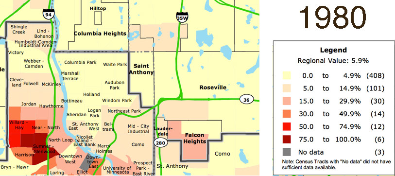
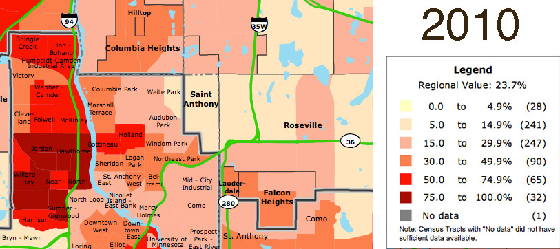
Both maps from the Institute for Metropolitan Opportunity. Data source, US Census Bureau, Minnesota Population Center.
These are illustrative maps in light of the current jurisdictional complexity around the shooting of Philando Castile on Larpenteur Avenue in the town of Falcon Heights by an officer from the Saint Anthony Police Department. The report itself attributes much of the racial segregation of the Twin Cities to structural issues around affordable housing location and education policy. There are probably other factors as well having to do with zoning.
Whatever the reason, Saint Anthony is one of the few first-ring Twin Cities’ suburbs that has not significantly increased in diversity over the past thirty years, at least relative to the surrounding cities.