Although this walk covered about the same number of miles of street as the previous one, it covered several times as many square miles of area. That’s because I walked the perimeters of two large, roadless areas. The northern part of this walk looped around Columbia Park itself, that is, the park (largely a golf course) rather than the neighborhood of the same name. The southern part of the walk traversed the eastern and southern sides of the region containing the Shoreham Yards rail area and St. Anthony’s Cemetery. And then I needed to backtrack along those two sides because 27th Avenue NE doesn’t cross the tracks. That large spur, as well as two smaller ones, are shown in red on the route map.
I started and ended my walk on Central Avenue at 33rd Avenue NE, a stop on the number 10 bus. That positioned me outside the Columbia Manor Reception Hall, a 1925 structure in the Colonial Revival style that sits at the entry to the golf course and serves not only as the course’s clubhouse but also as a rental facility for events.
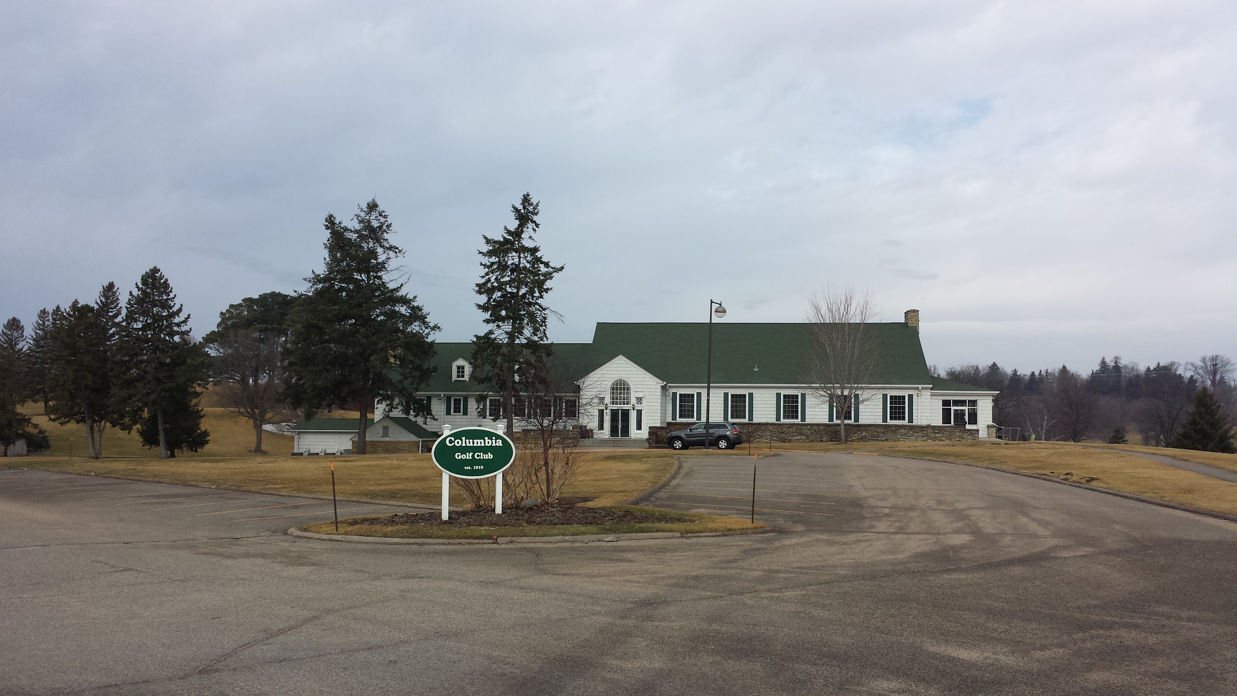
Columbia Manor Reception Hall
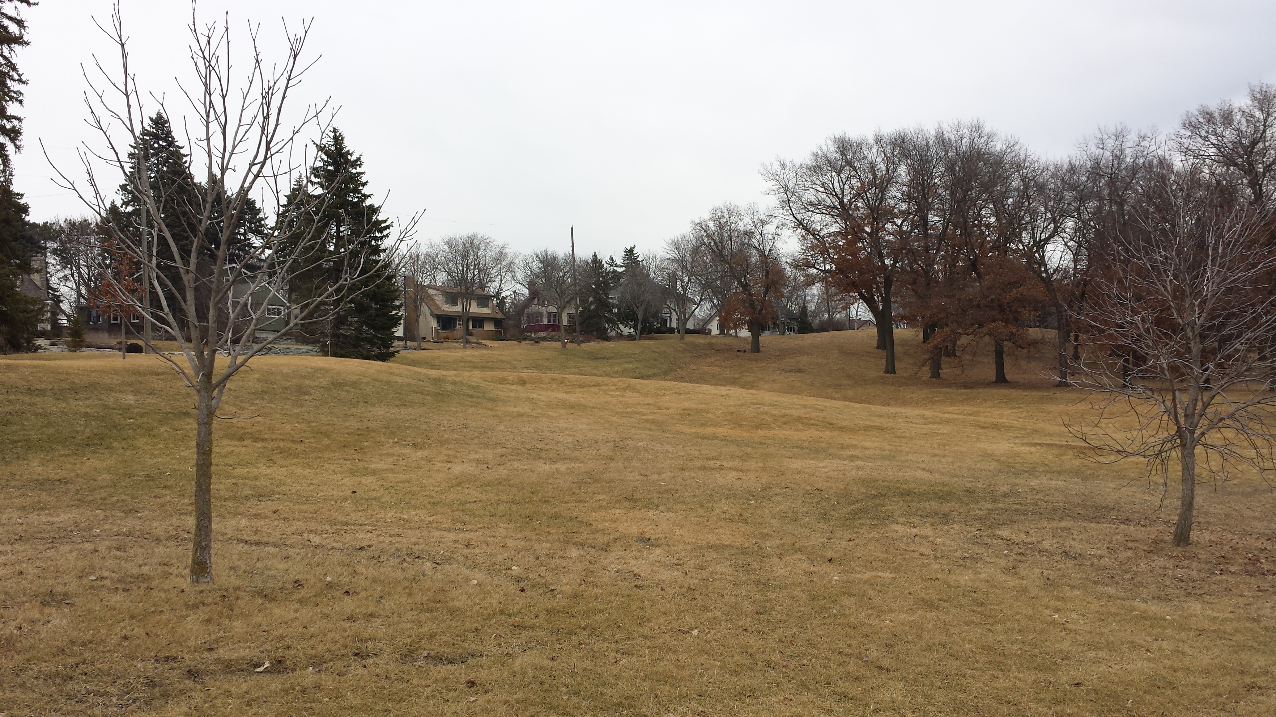
Walking south on Central Avenue, I was able to see both major aspects of the area in a single view as a trainload of intermodal containers crossed St. Anthony Parkway from Shoreham Yards and headed into the golf course.
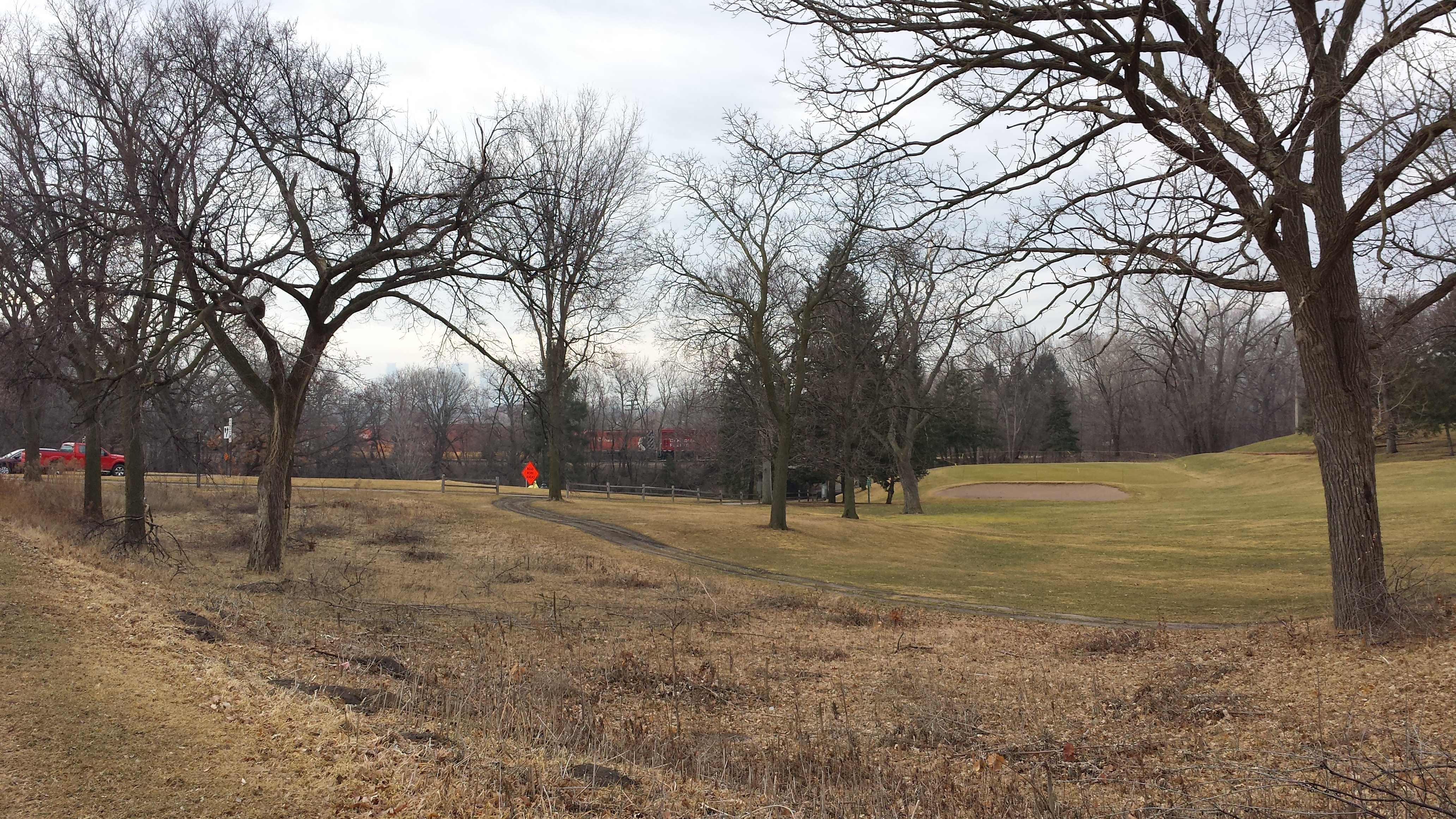
Columbia Golf Club with Container Train in Background
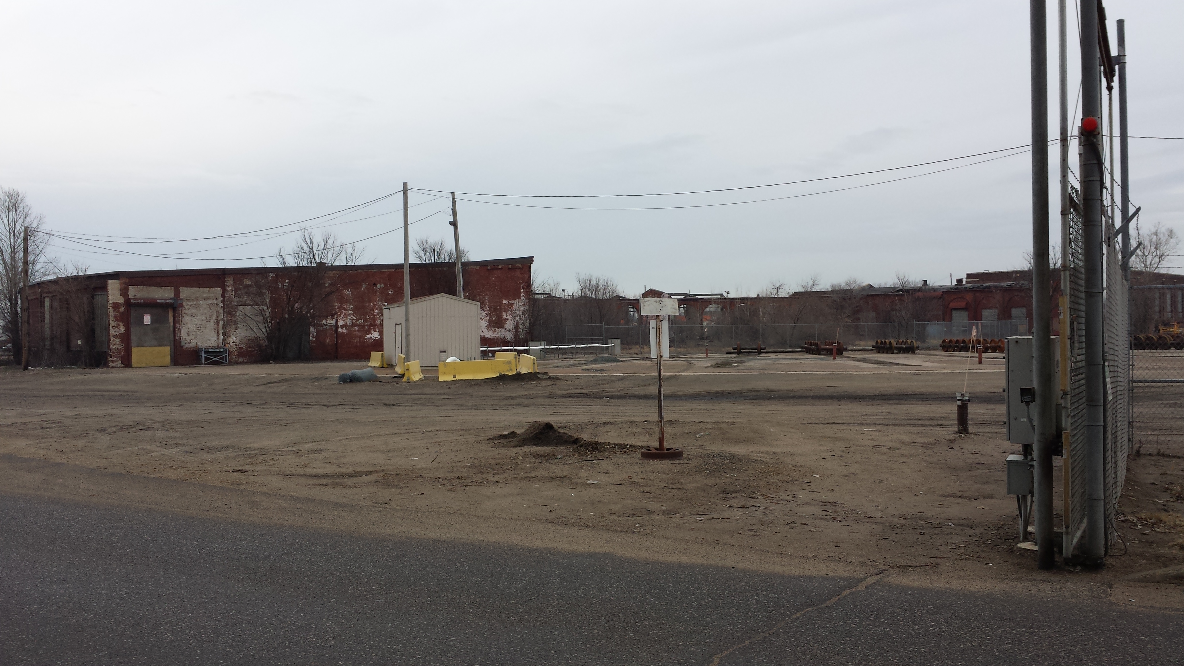
Once I crossed the parkway and was separated from the rail yard by little more than a fence, I was able to see a number of its features. The following photo might be worth clicking on to see full sized, it contains so much. In the foreground, a train carrying containers is being separated into segments by being run forward and back over switching points, with a staff person (not shown) unfastening the appropriate couplings. The middle ground illustrates the intermodal nature of the operation with a mobile crane, stacks of containers, and waiting semi-trailers. In the background, grain bins indicate that the Shoreham Yards also loads bulk commodity trains, though the majority of the operation seems to involve the containers. Finally, to the left of the grain bins, you might see a cellular phone tower and in the distance, the distinctive basket-handle arches of the Lowry Avenue Bridge.
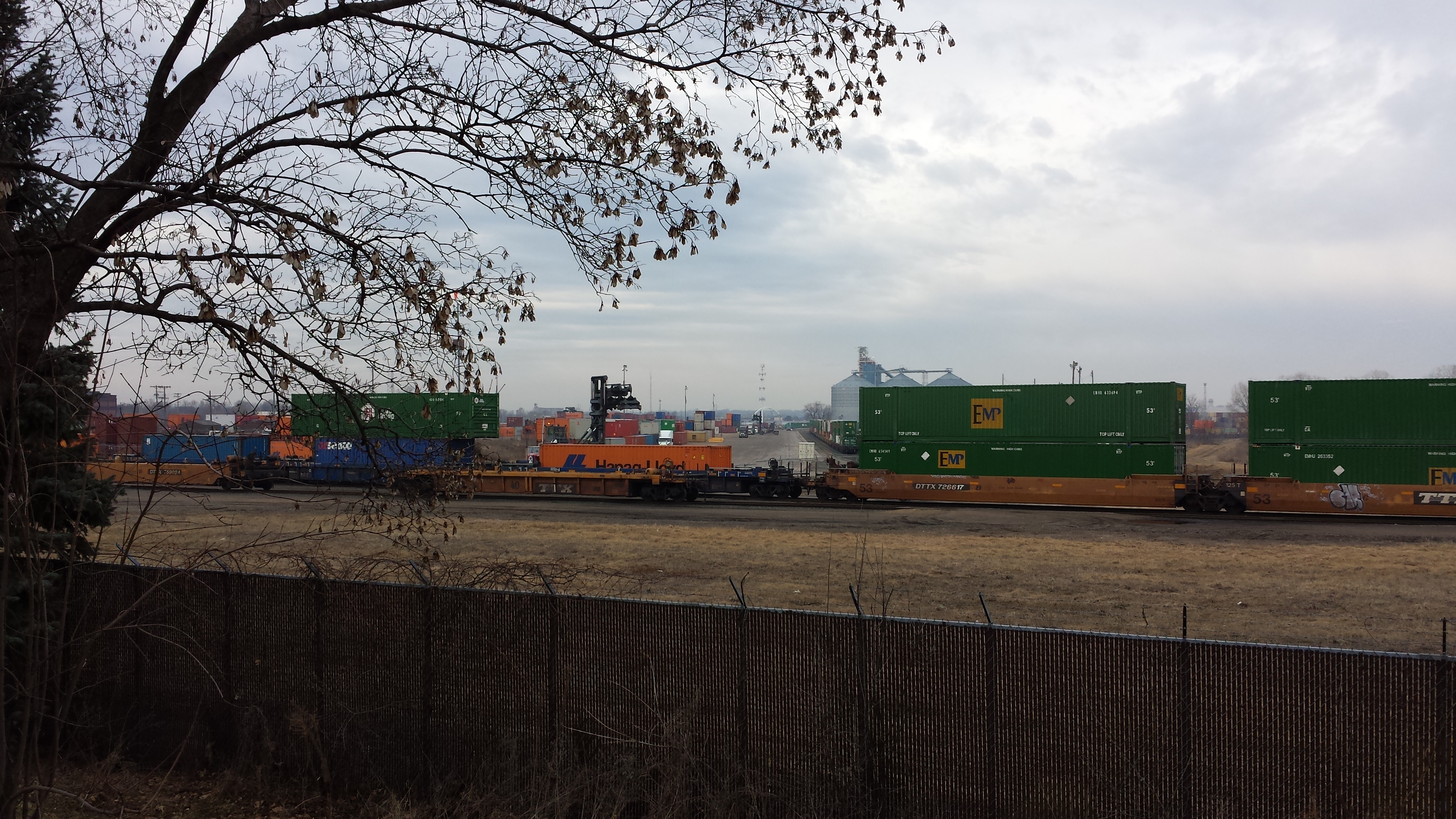
Shoreham Yards
I was able to walk a short distance west on 28th Avenue before encountering the gate that marks the boundary of Canadian Pacific property. (Canadian Pacific is the successor to the Soo Line, which historically developed this facility.) Straight ahead I could see the large former diesel shop that now houses the rebar fabrication operations of Harris Rebar, which acquired them from Ambassador Steel and was itself acquired by Nucor.
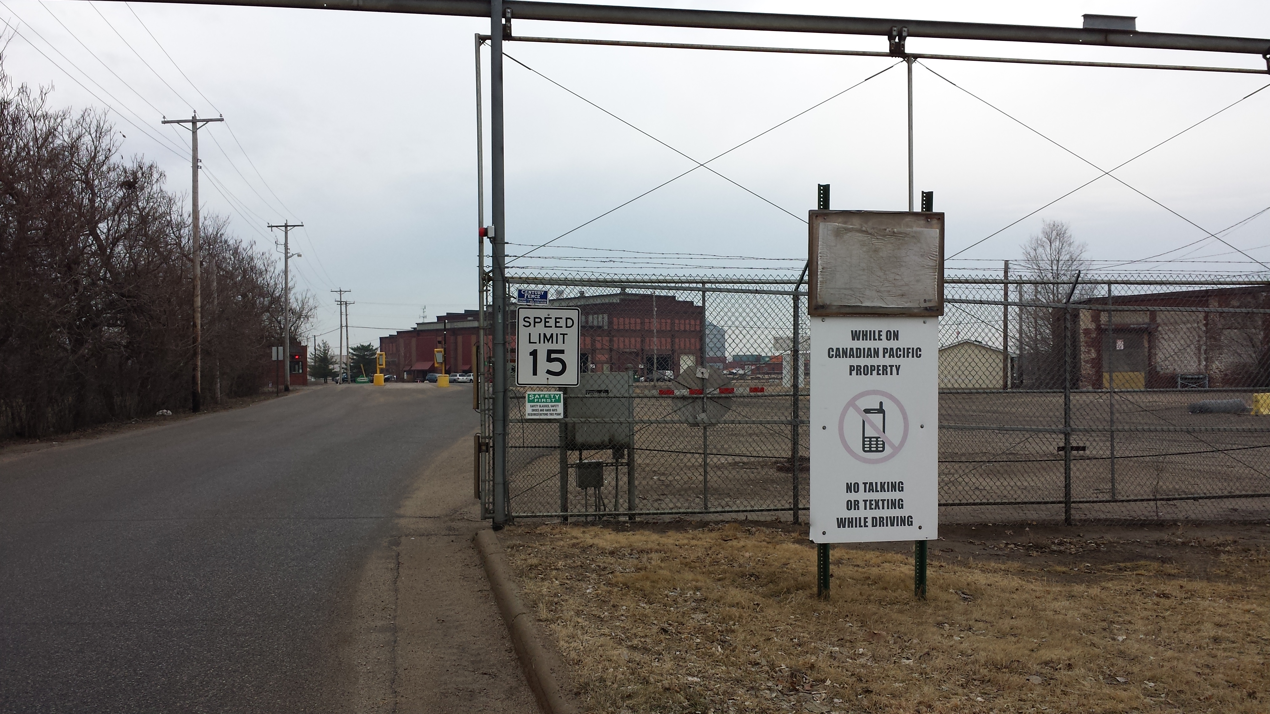
Canadian Pacific Property — No Talking or Texting While Driving
Looking past the gate at an oblique angle, I could see the roundhouse, a historic landmark dating to 1887.
Shoreham Yards Roundhouse
Returning to Central Avenue and continuing south, most of the 2700 block is occupied by even deeper 19th century history: St. Anthony’s Cemetery, a Catholic cemetery, dates all the way back to 1857.
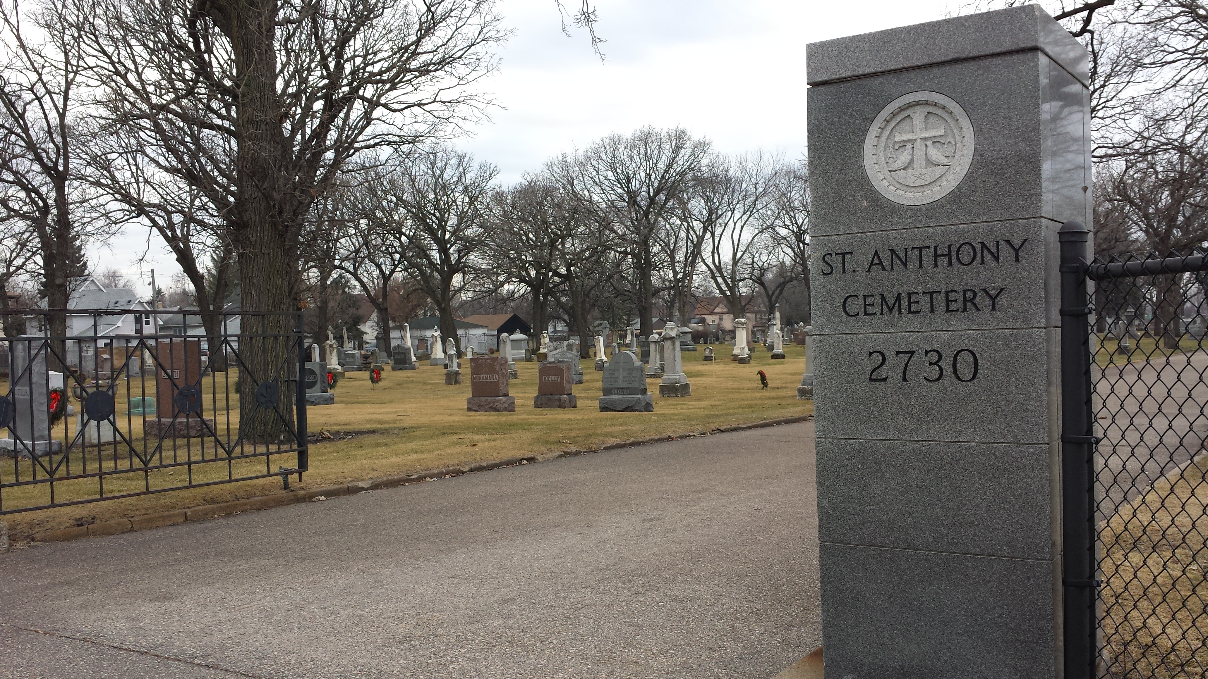
St. Anthony’s Cemetery, 2730 Central Ave NE
The southern border of the Columbia Park neighborhood lies along 27th Avenue NE. As I turned onto that avenue from Central Avenue, I noted that the most southeasterly lot in the neighborhood holds the recently constructed Pet Central Animal Hospital. After that corner property, the next building on 27th Avenue is an older eight-unit apartment building, the only dwelling with more than two units that I saw in my first two days in the neighborhood.
As I crossed Monroe Street NE, I spotted a colorful tot lot on the Columbia Park side of 27th Avenue, on a narrow strip of land outside the Canadian Pacific fence. Closer examination revealed that this playground area is known as “Train Park.” It was created by the Holland Neighborhood Improvement Association, which represents the area to the south, whose residents have easier access than most of Columbia Park’s do. However, the tot lot was created with the cooperation of the Columbia Park Neighborhood Association as well as Canadian Pacific, who made the land available.
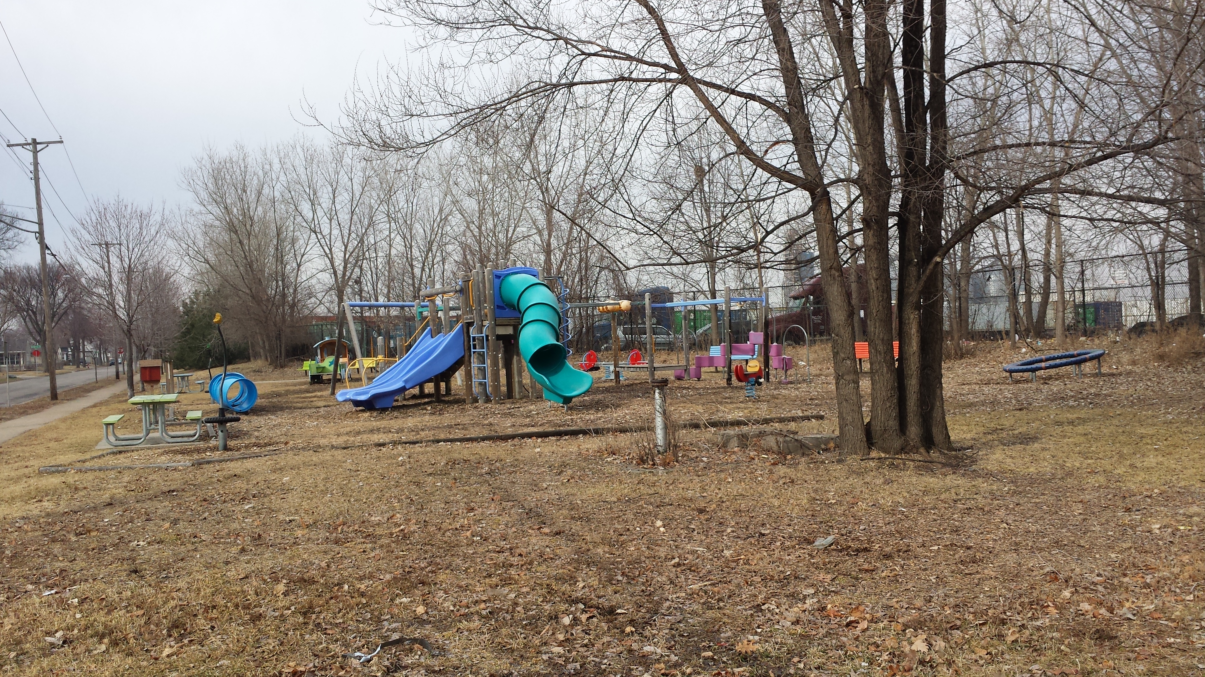
Looking South on 27th Ave NE at Monrose St NE
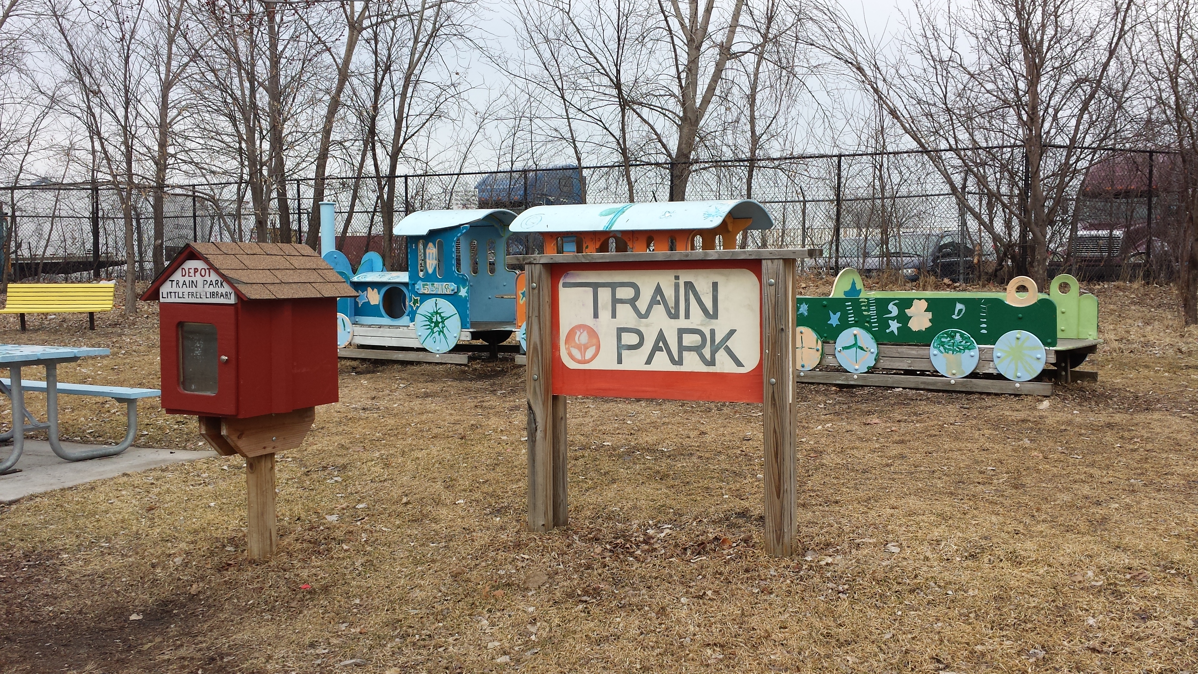
Train Park
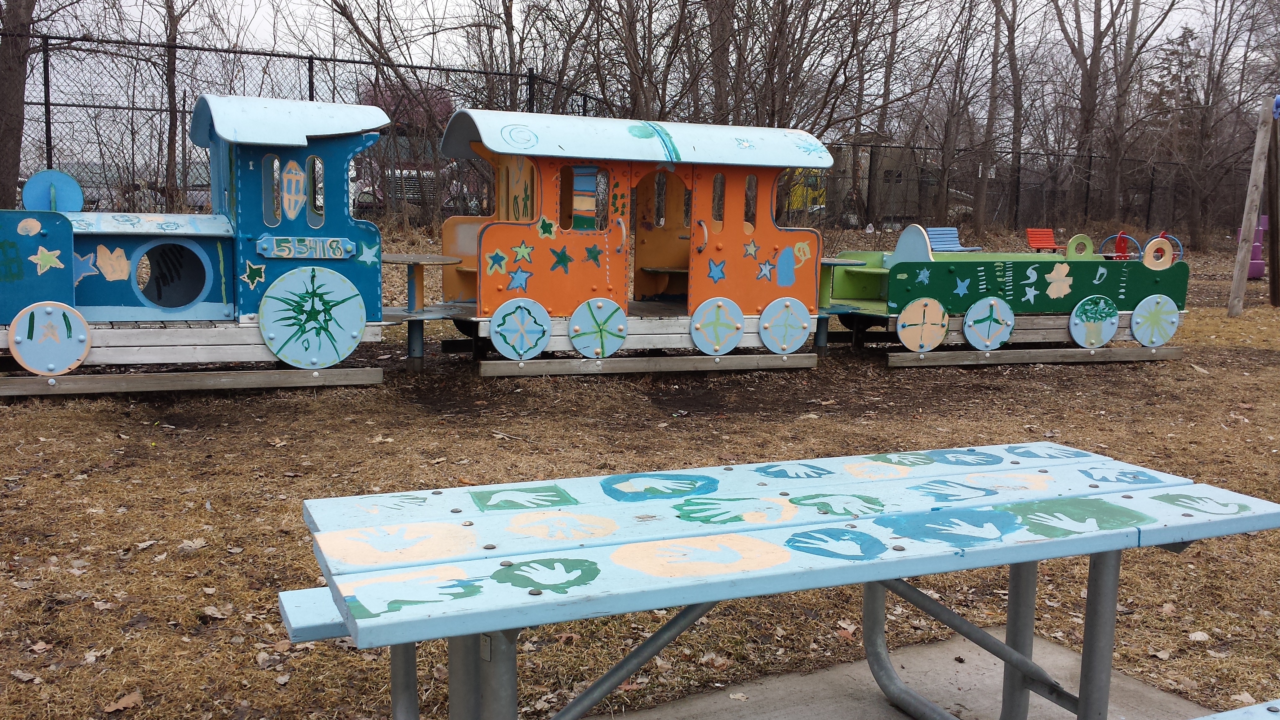
Train Park with Painted Picnic Table and Train
Train Park itself runs only from Monroe to Howard Streets, but the amenities on the northern (Columbia Park) side of the avenue continue beyond this. At Jefferson Street and again at 7th Street, there are pairs of park benches matching those at Train Park. Finally, the block between 7th and 6th Streets is home to Shoreham Community Garden.
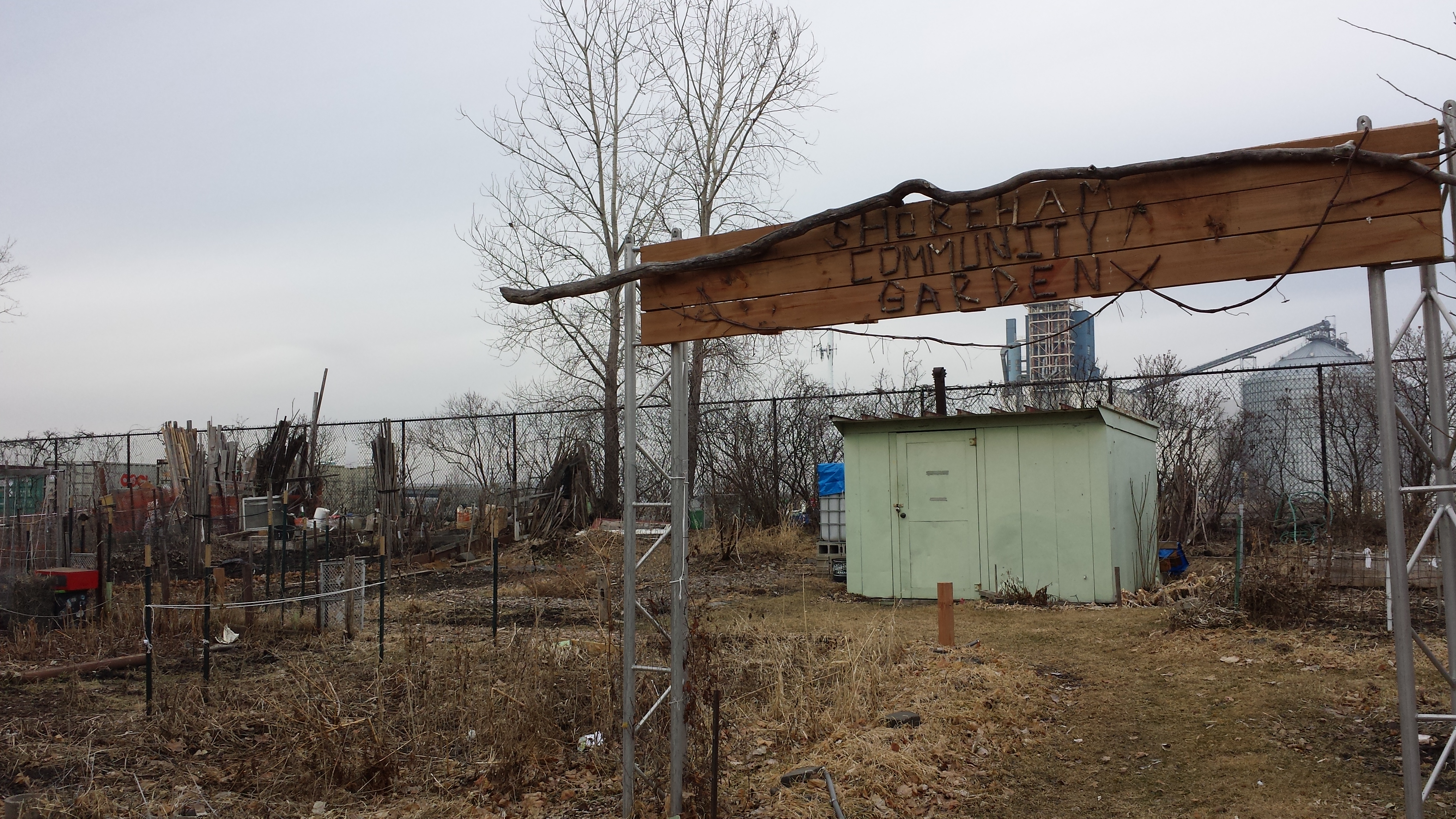
Shoreham Community Garden
Where 27th Avenue ended at 6th Street, I was able to look through the fence and see another of the ways in which Canadian Pacific is putting their large land area to use for non-railroad purposes: arrays of solar photovoltaic cells.
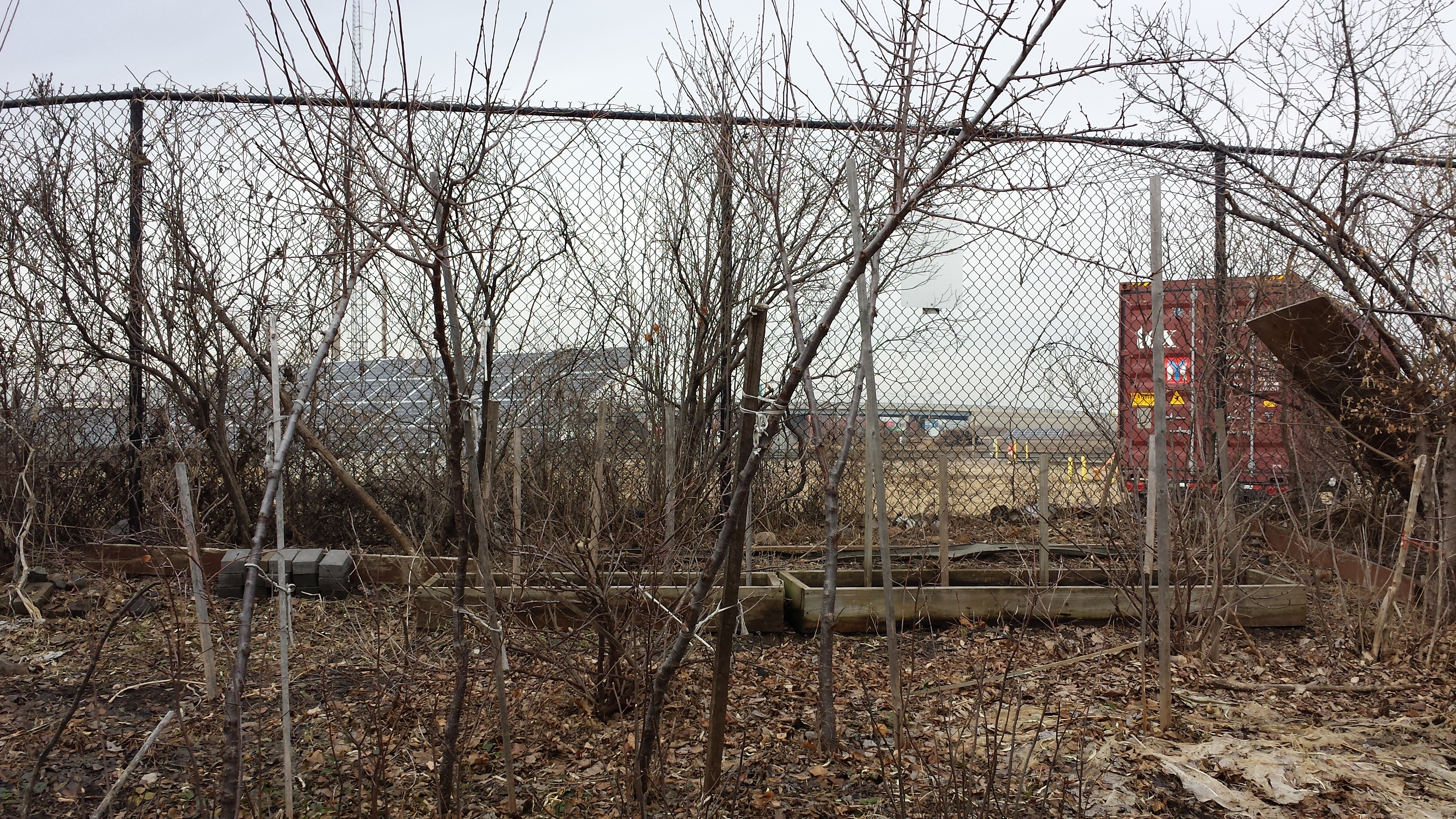
Solar Photovoltaic Arrays at Shoreham Yards
Returning eastward along 27th Avenue, I noticed the mix of housing. The photo below shows two single-story (or 1.2-story) homes followed by four two-story homes, with ages ranges from 1957 back into the 1890s.
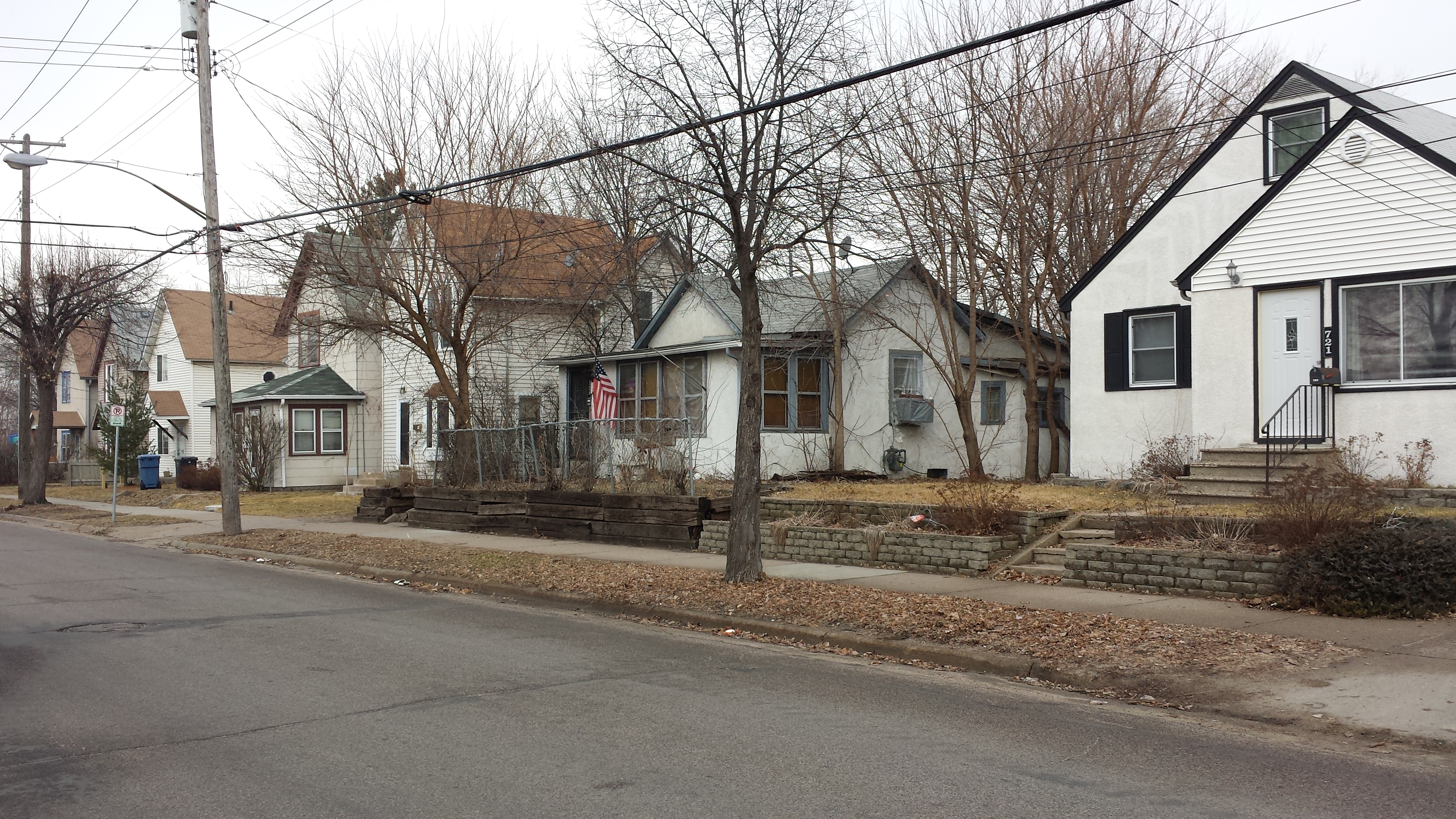
North SIde, 700 Block of 27th Ave NE
I also took the opportunity to photograph some iridescent decorative tiles, set diagonally above the entryway to 905 27th Avenue NE.
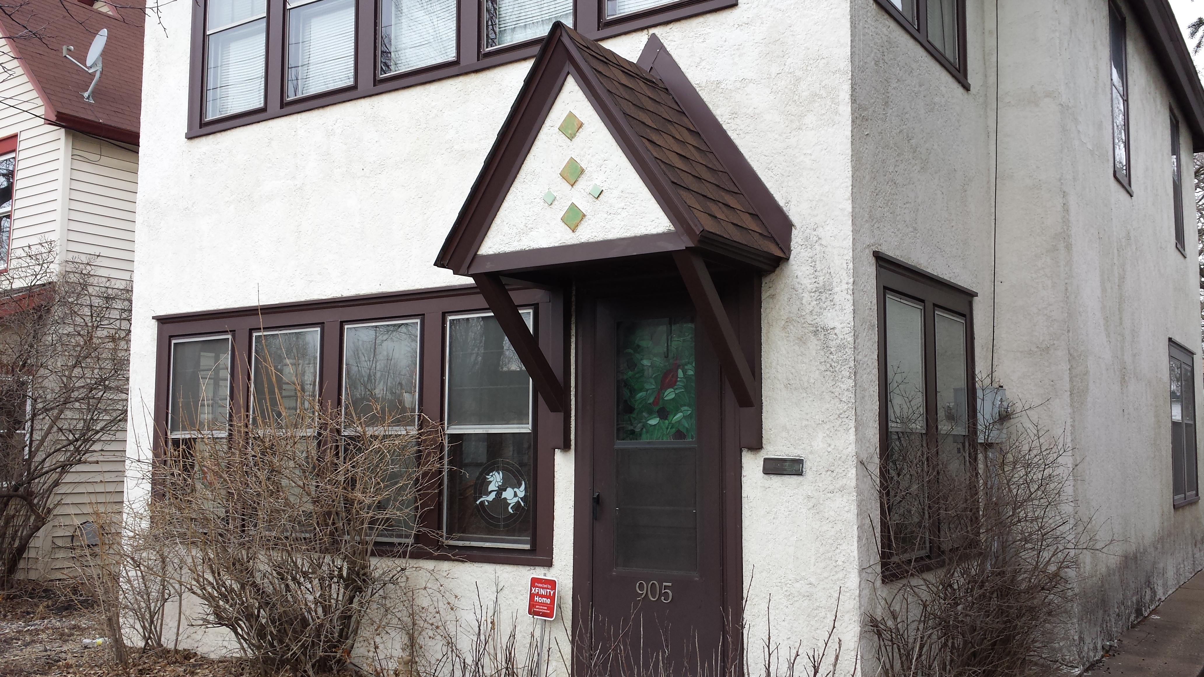
Decorative Tile Accent, 905 27th Ave NE
I backtracked north on Central Avenue to St. Anthony Parkway, which I then used to skirt around the southern edge of the park and halfway up the western edge. Heading in this direction, almost all of the park facilities were to the right of the parkway, where the golf course lies, but there were two exceptions that. First I saw an archery range on the rail yard side, and then a fenced-in dog park that lies just opposite the golf driving range and learning center. Somewhat surprisingly for February 22nd, the driving range and learning center were open and operating. Just beyond the dog park, I also got another view of how the rail facility contains stacks and stacks of containers.
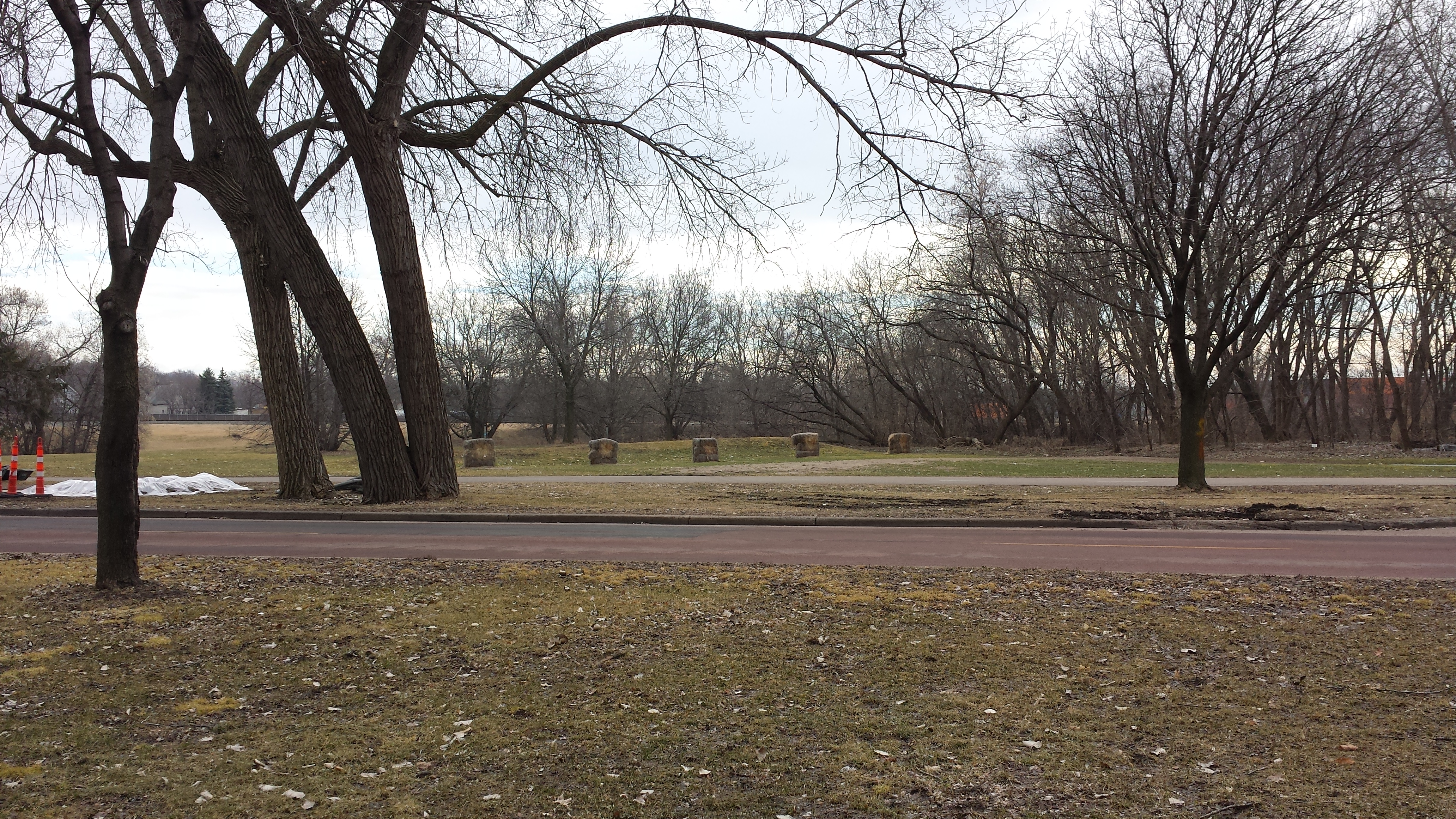
Archery Range on St. Anthony Parkway
Columbia Driving Range and Learning Center
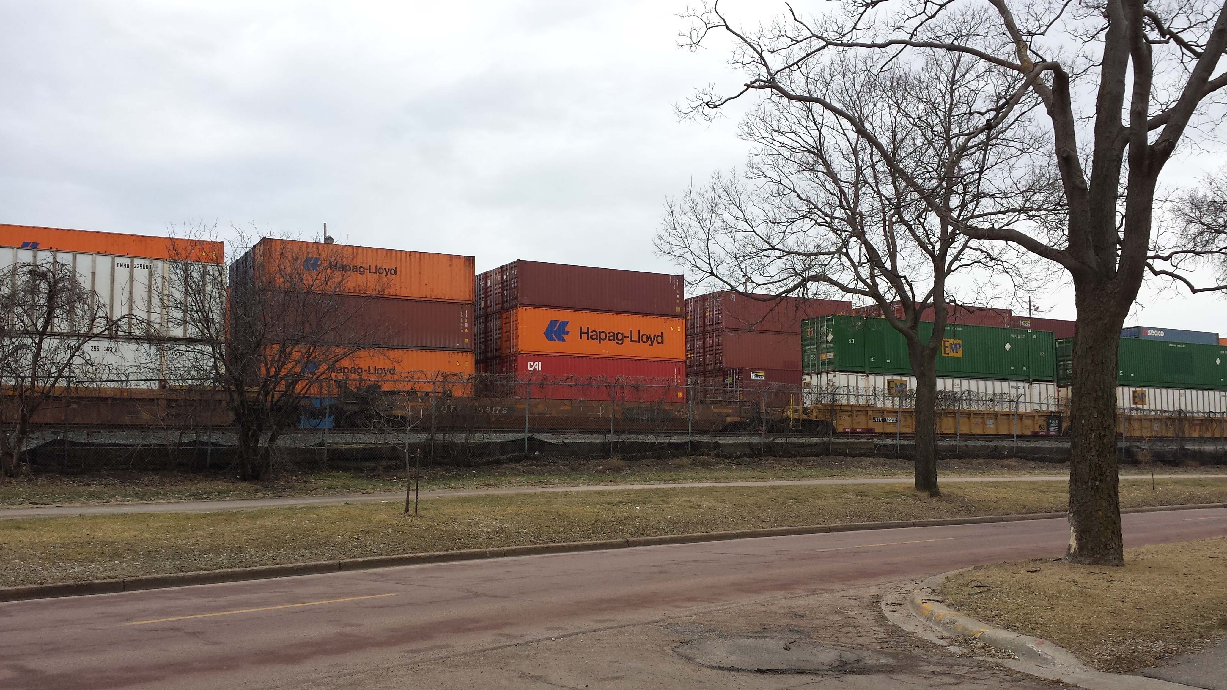
Some of the Many, Many Containers
In the middle of the park’s western side, the parkway takes a 90-degree turn, heading westward away from the park. One can instead continue northward along the park’s edge, but that changes names to 5th Street NE. Before I continued onto 5th Street, I took a spur down the westward part of the parkway as far as 4th Street. (Everything from 4th Street onward will wait until I return to Columbia Park another day.)
The corner of St. Anthony Parkway and 5th Street NE is home to two large industrial (or at least originally industrial) facilities located in proximity to the railroad. AZZ Galvanizing is on the southwest corner, while the southern (5th Street) end of the building on the northeast corner holds Total Export — though there’s more to the building than that.
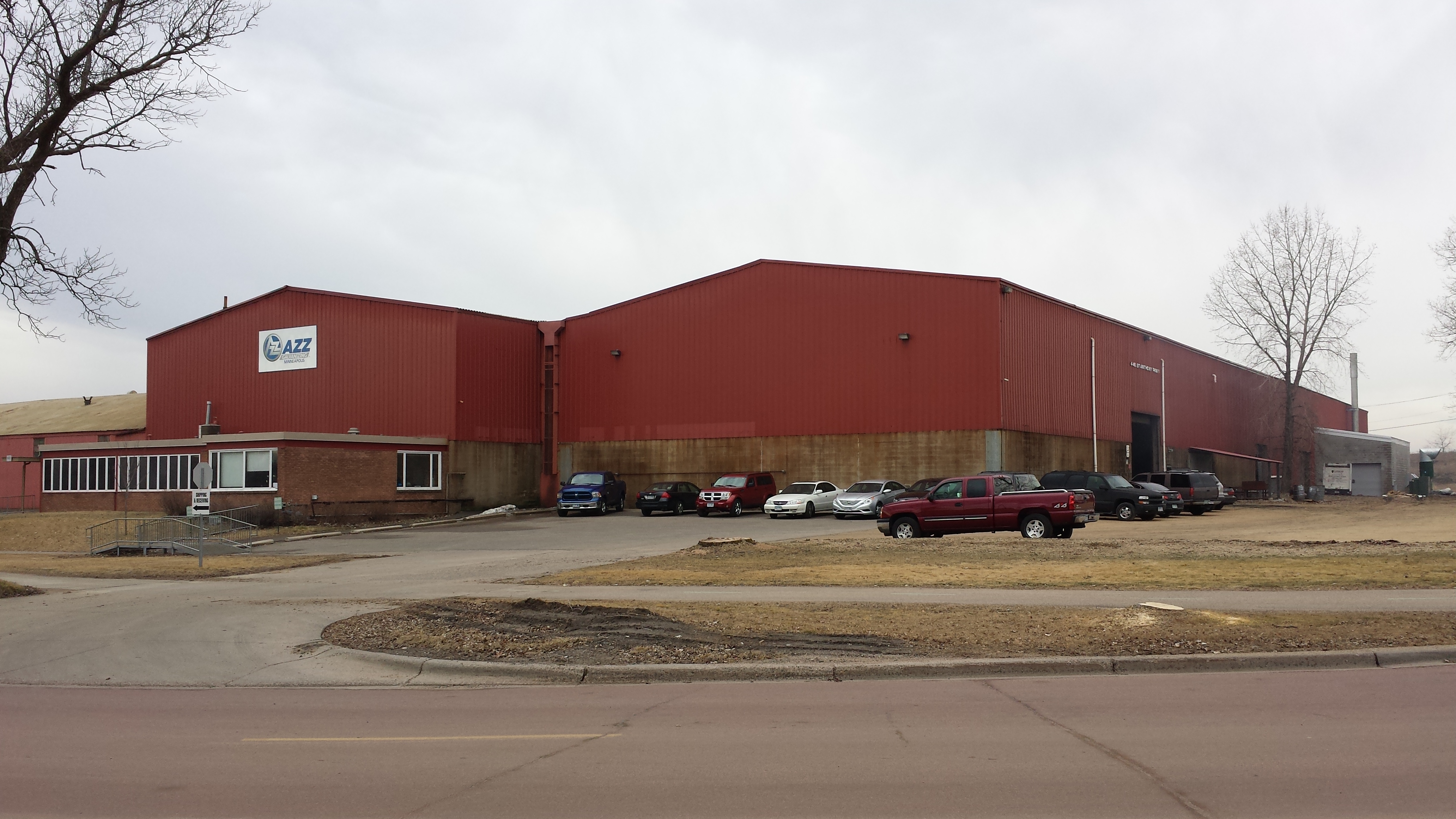
AZZ Galvanizing, 446 St. Anthony Pkwy
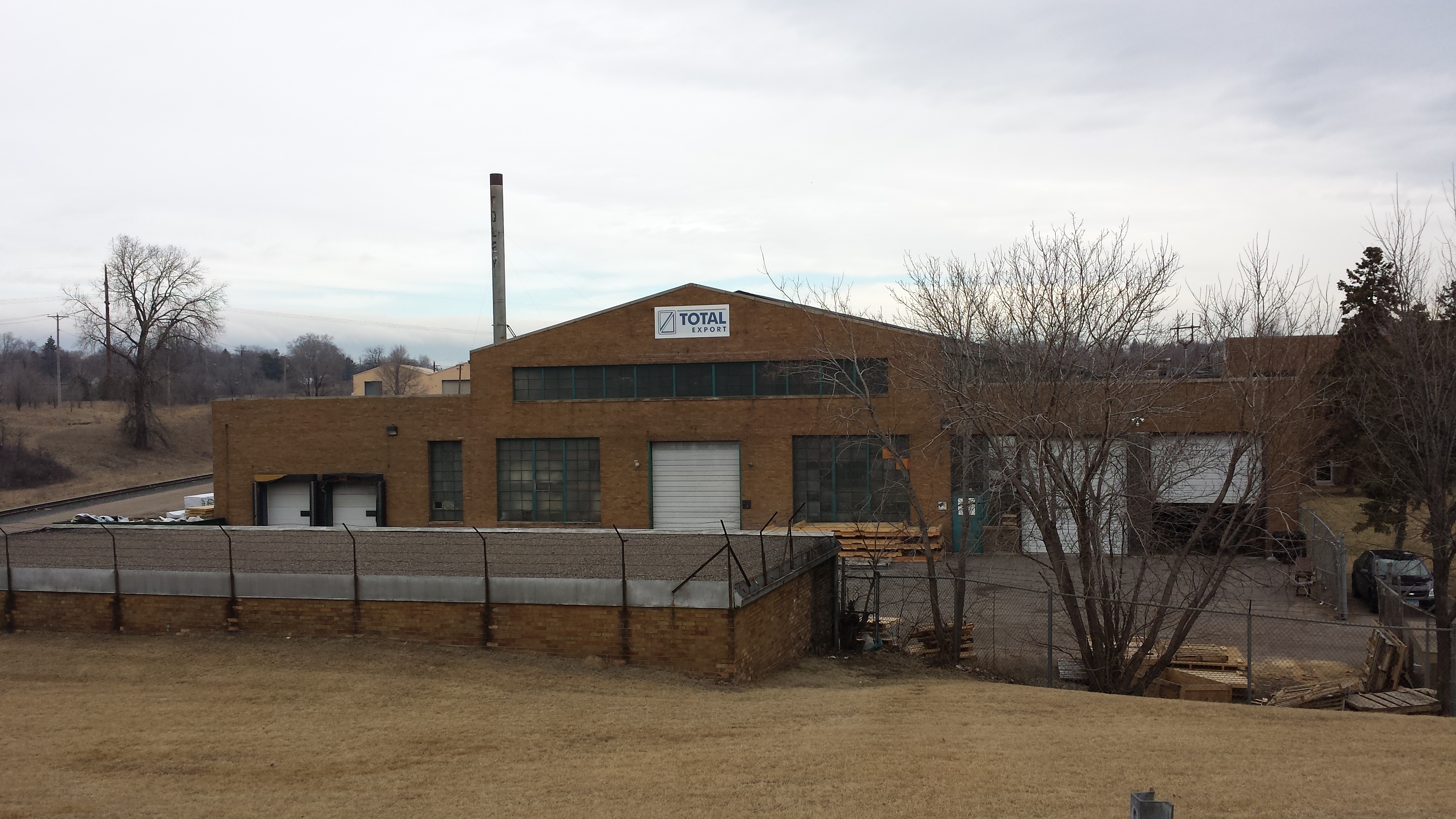
Total Export, 3300 5th St NE
The smokestack in the background is painted with “FOLEY.” That’s because this building previously housed the Foley Manufacturing Company. And what did the Foley Manufacturing Company manufacture? Quite a variety of items, apparently. They manufactured sander/grinders that let you sharpen almost anything. But they also manufactured food mills. And it looks like they also manufactured rug cleaning equipment.
In any case, the building they left behind is itself multi-faceted. The southern and northern ends are industrial in character. However, in the middle is an area that must have held the Foley Manufacturing Company’s corporate offices and now is home to the Learning for Leadership Charter School. I zoomed in on the entryway because the curved overhang clad in horizontally ribbed metal and the vertically arrayed glass blocks above that reminded me of something I read in Legacy of Minneapolis: Preservation Amid Change. Namely, from a glance at such architectural details, one can more readily ascertain the age of a building than whether its function was manufacturing or movie theater.
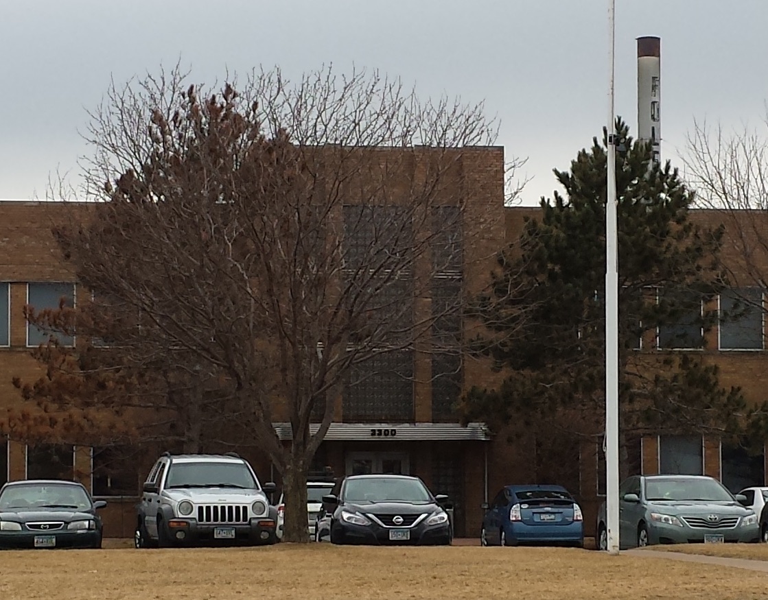
Foley Building Entrance, 3300 5th St NE, Now the Learning for Leadership Charter School
From 5th Street, I turned east on Columbia Parkway, which runs along the park’s northern edge. This part of the park has a few facilities other than the dominant golf course, in particular a tot lot and picnic area.
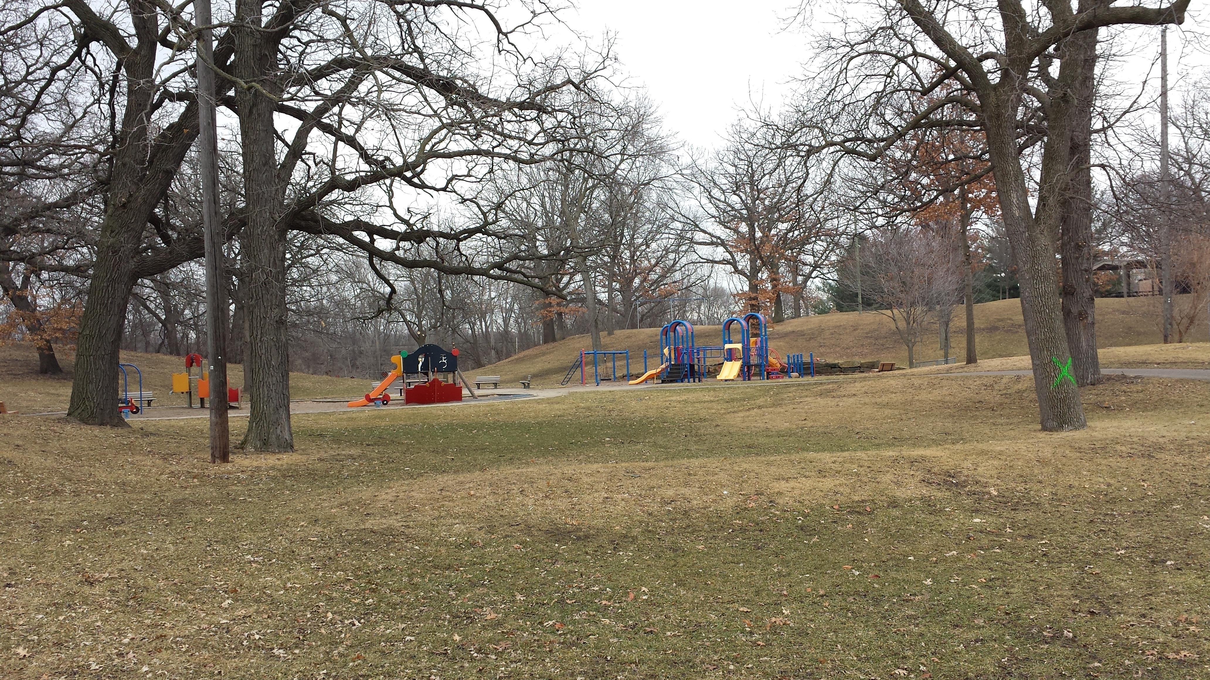
Columbia Park Tot Lot and Picnic Area
The pedestrian path strays rather far from the parkway at points, allowing a view across the rolling hills to the house-lined parkway beyond. Conversely, the trail sticks pretty close to the power line and railroad tracks
Columbia Parkway, from the Pedestrian Trail
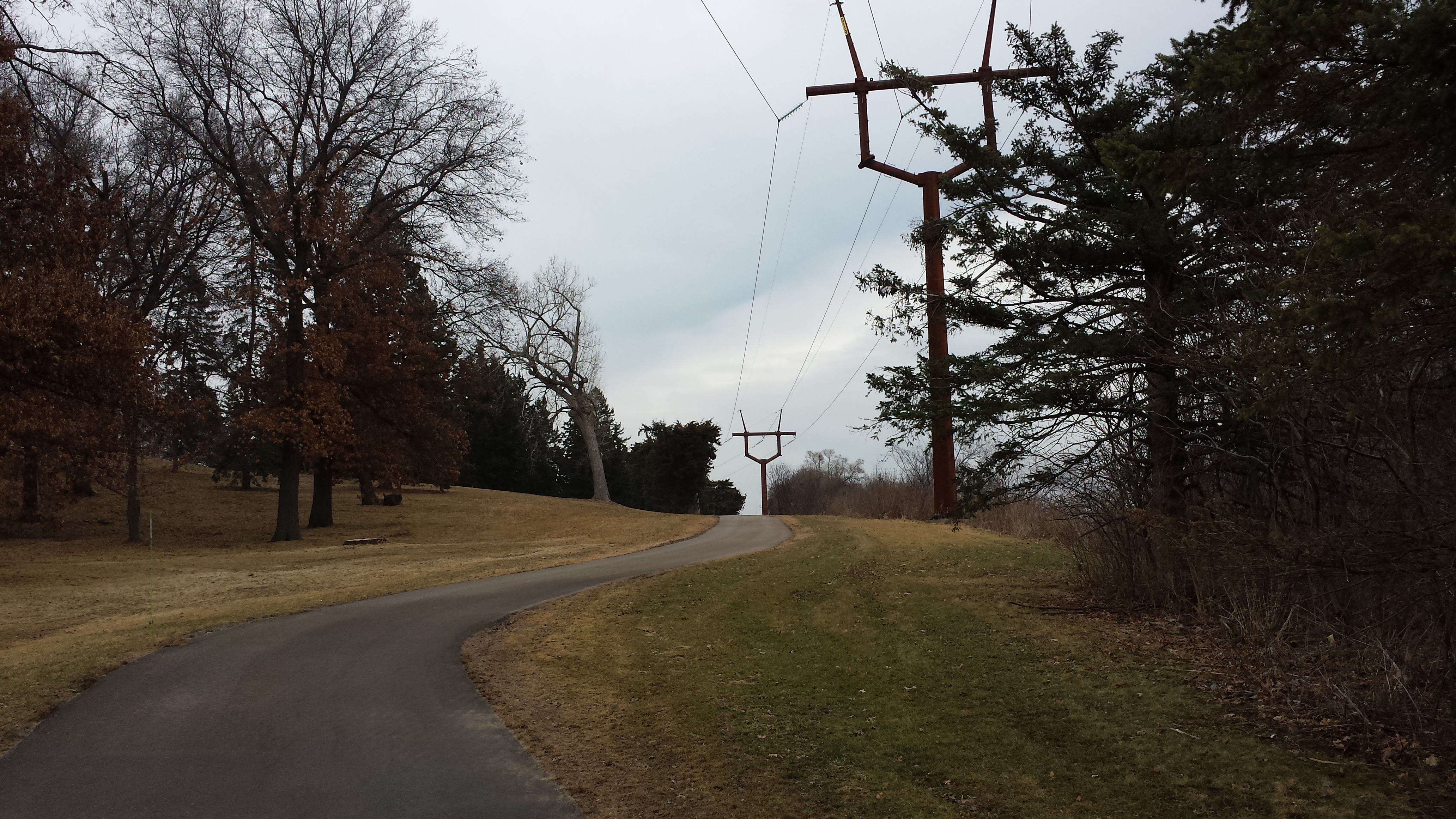
Pedestrian Path Near Power Line and Railroad Tracks
Finally, I ended my loop by turning south on Central Avenue and returning to my starting point. Along this section of the avenue are two interesting Stelae by Foster Willey, Jr. The northern one at 35th Avenue is topped with a flying wheat stalk, while the southern one at 33rd Avenue is topped with a curved 4200-class locomotive. Each stele also includes other coordinated elements; for example, the cast bronze plaque visible in my photo of the 4200 stele shows the form of the roundhouse. The artist also included the zig-zag benches in his design.
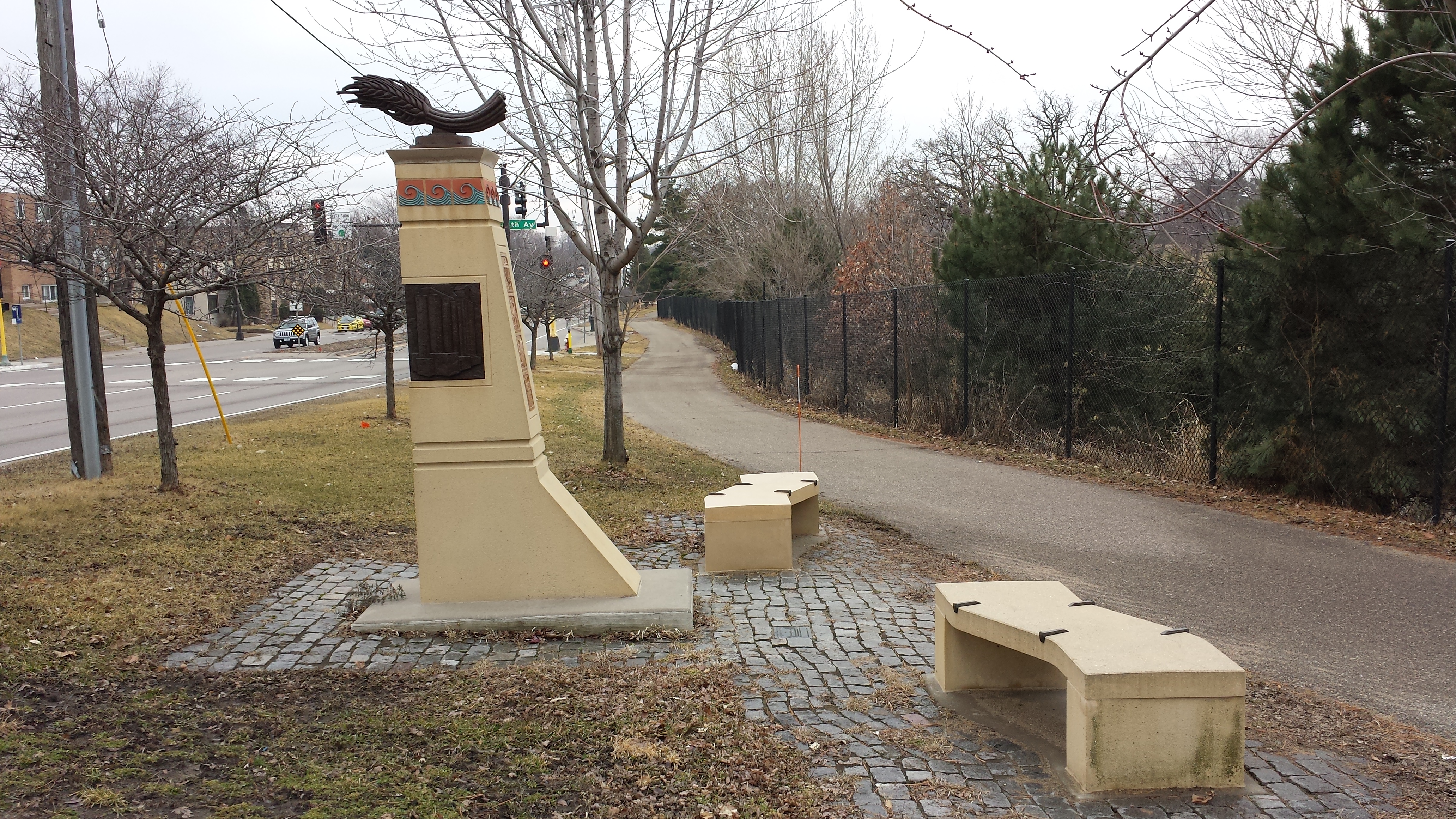
Flying Wheat Stele, Foster Willey, Jr. (2006)
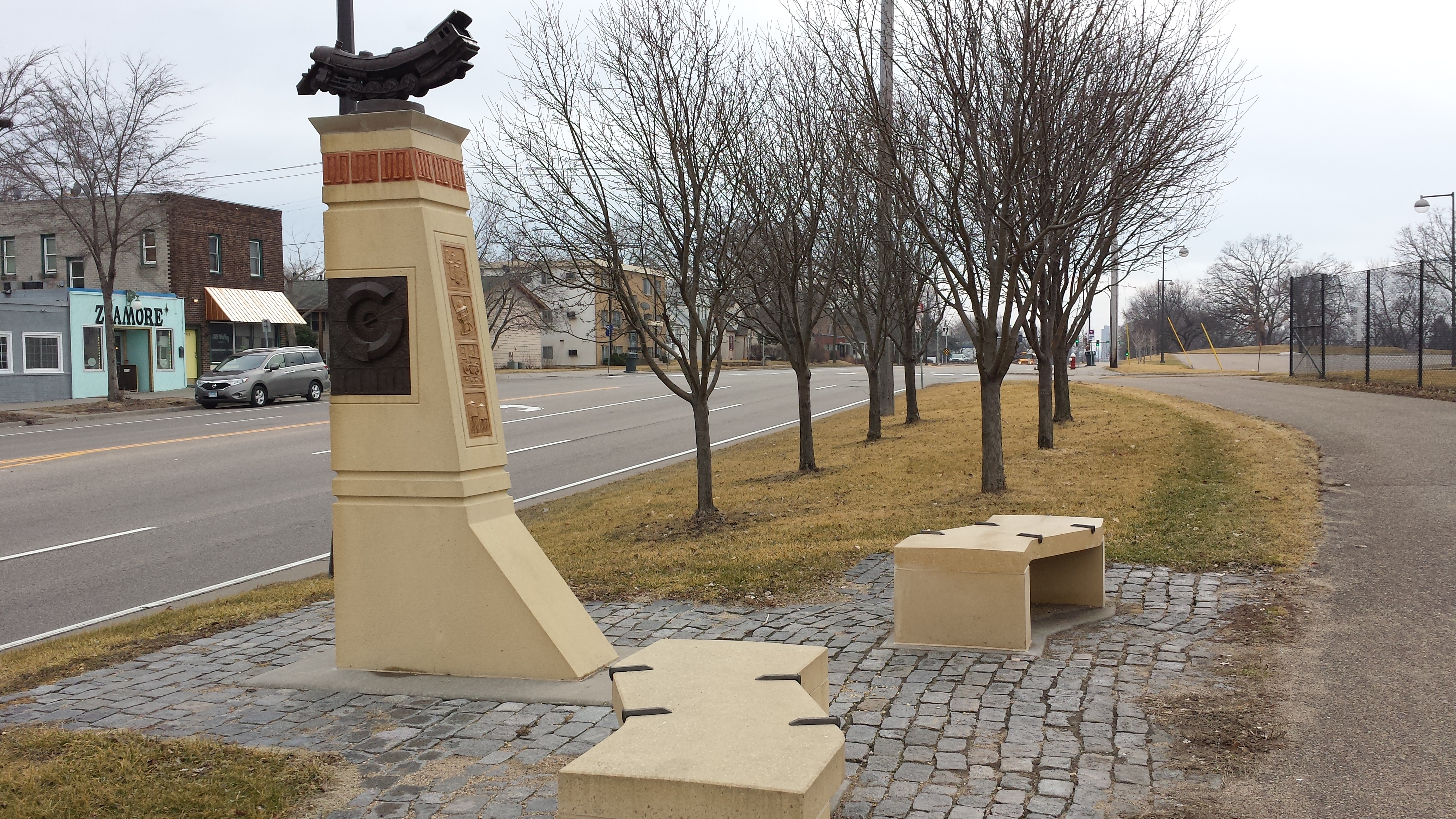
4200 Stele, Foster Willey, Jr. (2006)
Editor’s Note: Max Hailperin is walking each of Minneapolis’ 87 neighborhoods, in alphabetical order. He chronicles his adventures at allofminneapolis.com, where the original version of this article was published February 24, 2017. We’re sharing them here at streets.mn, at a pace of one or two walks per week.