Several acquaintances, knowing that I’m walking Minneapolis’s neighborhoods, expressed confusion when I announced that Como was up next: “In Minneapolis??”
Apparently the name brings St. Paul more readily to mind. St. Paul was where the name first immigrated to Minnesota, when Charles Perry in 1848 named Como Lake after Lake Como, despite the substantial differences between the two lakes. From the lake, the name spread to the park and its surrounding neighborhood in St. Paul.
However, the Como name also spread to the avenue running past the lake, and Como Avenue is one of those streets that doesn’t change names when crossing the city line, aside from gaining an SE to designate the Southeast portion of Minneapolis. And from Como Avenue SE, the name finally spread to the surrounding neighborhood, which I walked. That neighborhood is mostly within Southeast Minneapolis, although a few blocks are in Northeast. Southeast Minneapolis lies south of Hennepin Avenue on the east side of the Mississippi River, nowhere near the southeast corner of the city.
The southern portion of the neighborhood, from Elm Street to the railroad tracks, lies within the Southeast Minneapolis Industrial (SEMI) area and has access only via several long dead-end streets. These contributed substantially to the miles I had to plan to walk twice, which in turn lead me to divide the neighborhood over three days. The map below shows my route for the first day, which covered everything west of 18th Avenue. The red lines are the spurs I had to walk both directions, while the blue shows my main route. My starting point (A) at the corner of 15th and Como Avenues is a stop on the number 3 bus.
I initially headed south on 15th Avenue, which meant I was walking along the eastern border of Van Cleve Park, seeing its wading pool, playground, and recreation center. The markings visible in my photo just say “2 feet 0 inches,” but others were more explicit: “no diving.”
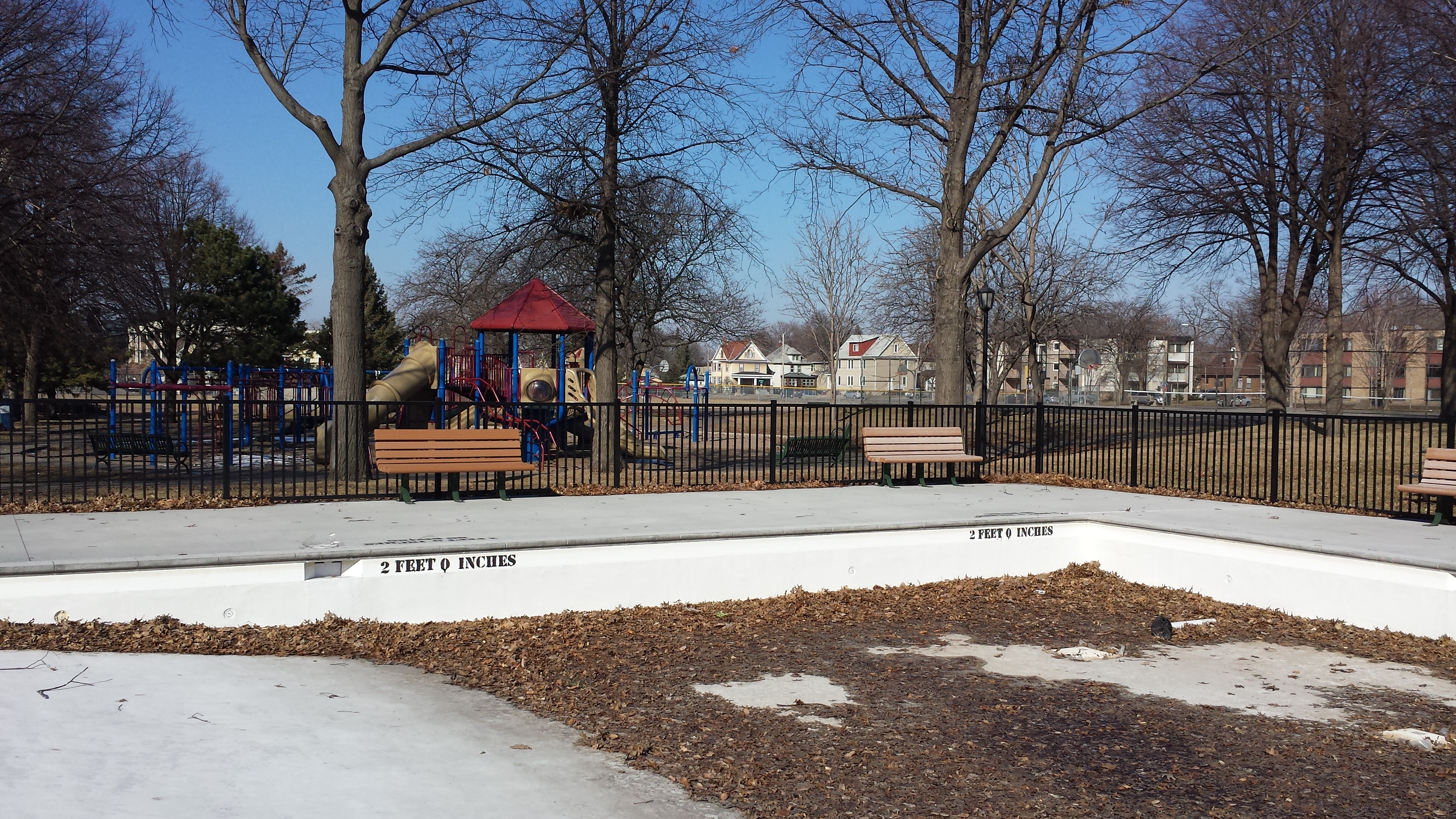
Van Cleve Park Wading Pool and Playground
Once past the park, 15th Avenue slopes downward in order to pass under the railroad tracks at the southern border of the neighborhood. This requires a retaining wall, which provided a suitable site for the Gateway Community Mural Project, in which artists Sara K. Udvig and Carly Schmitt collaborated with community members and neighborhood and university groups.
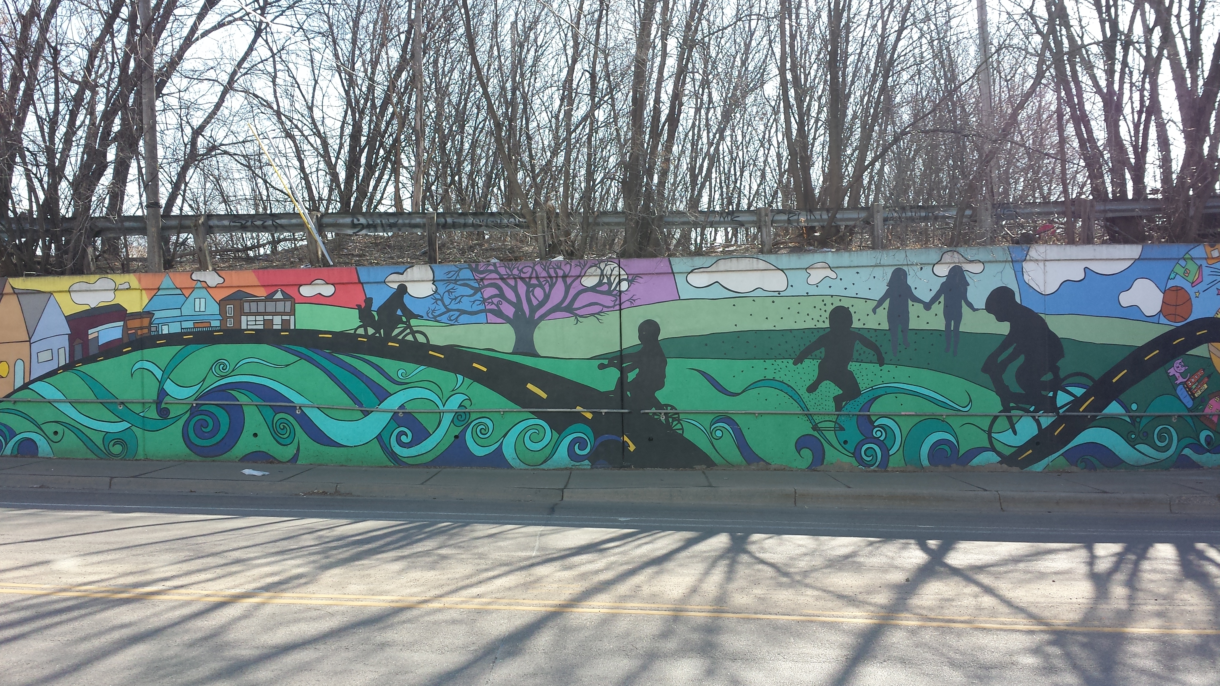
Part of Gateway Community Mural Project (2012)
One block east of 15th Avenue, Rollins Avenue curves into 17th Avenue, wrapping around two sides of the University of Minnesota’s Child Development Center. Though north of Elm Street, this center is actually the start of the SEMI area. Beyond it, 17th Avenue bends to the southwest, largely running alongside the train tracks and providing access to the first more substantial portion of SEMI, which is a modern industrial park lying between Elm Street and 17th Avenue. The street addresses are all on Elm Street, but the primary access is via 17th Avenue.
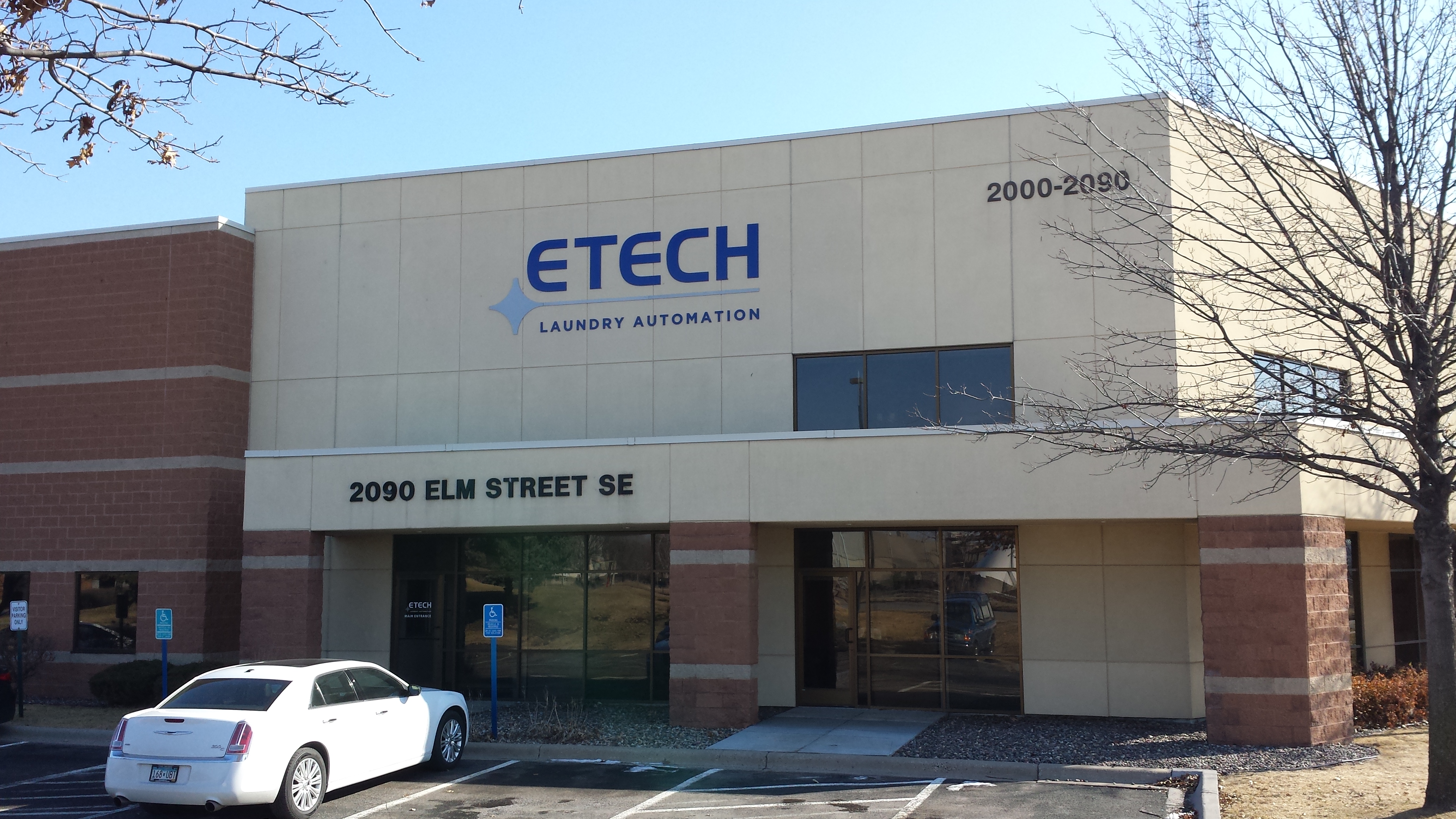
E-Tech Laundry Automation, “2090 Elm Street SE” but Actually on 17th Ave. SE
Returning to Elm Street itself, I initially only went a single block east to 18th Avenue. There I encountered a very helpful two-sided interpretive sign. After poring over its information, I used 18th and Rollins Avenues to return to 17th, which I took north to where it tees into Hennepin Avenue near the northern border of the neighborhood.
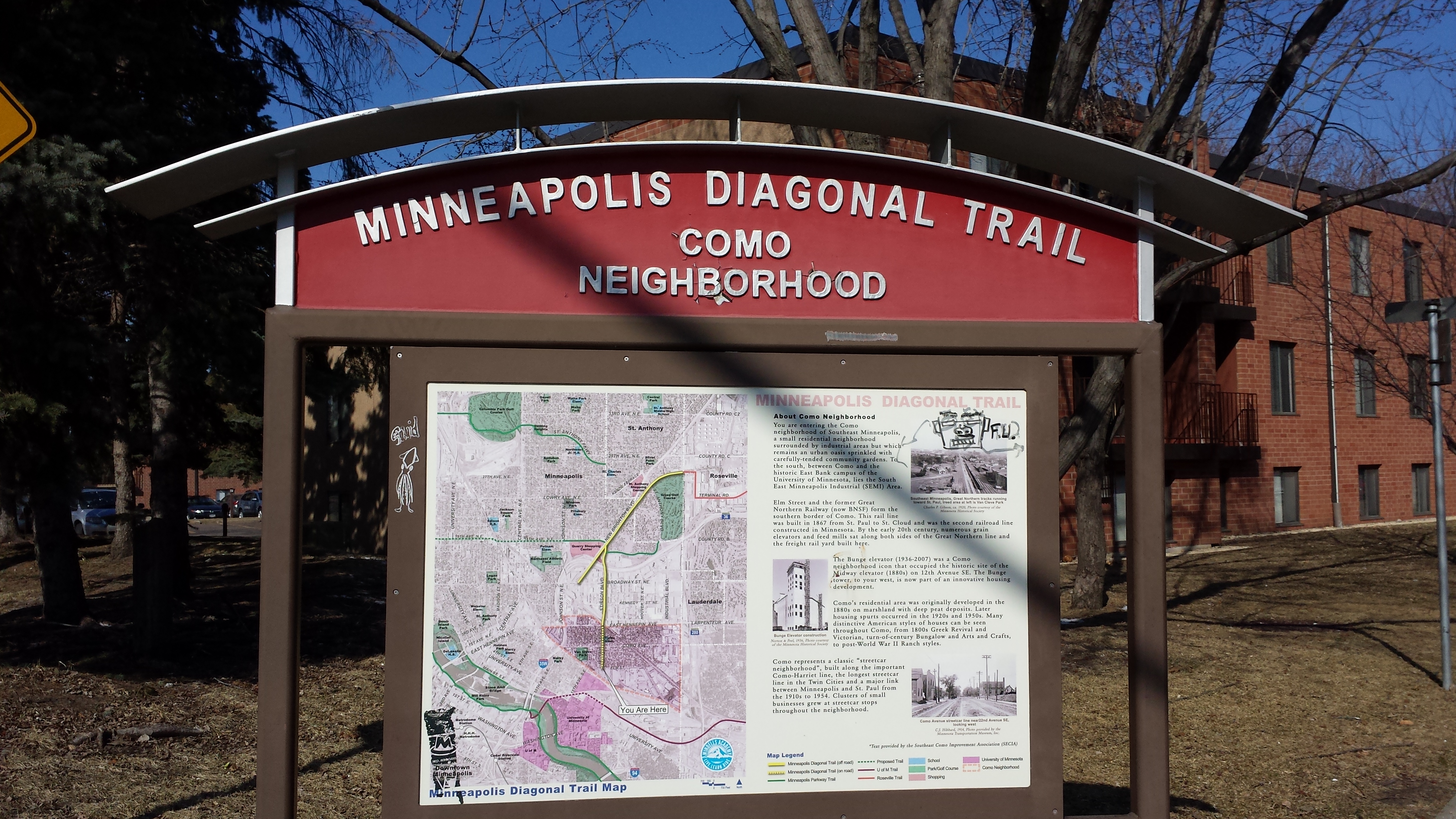
Minneapolis Diagonal Trail, Como Neighborhood Sign (Southeast Side)
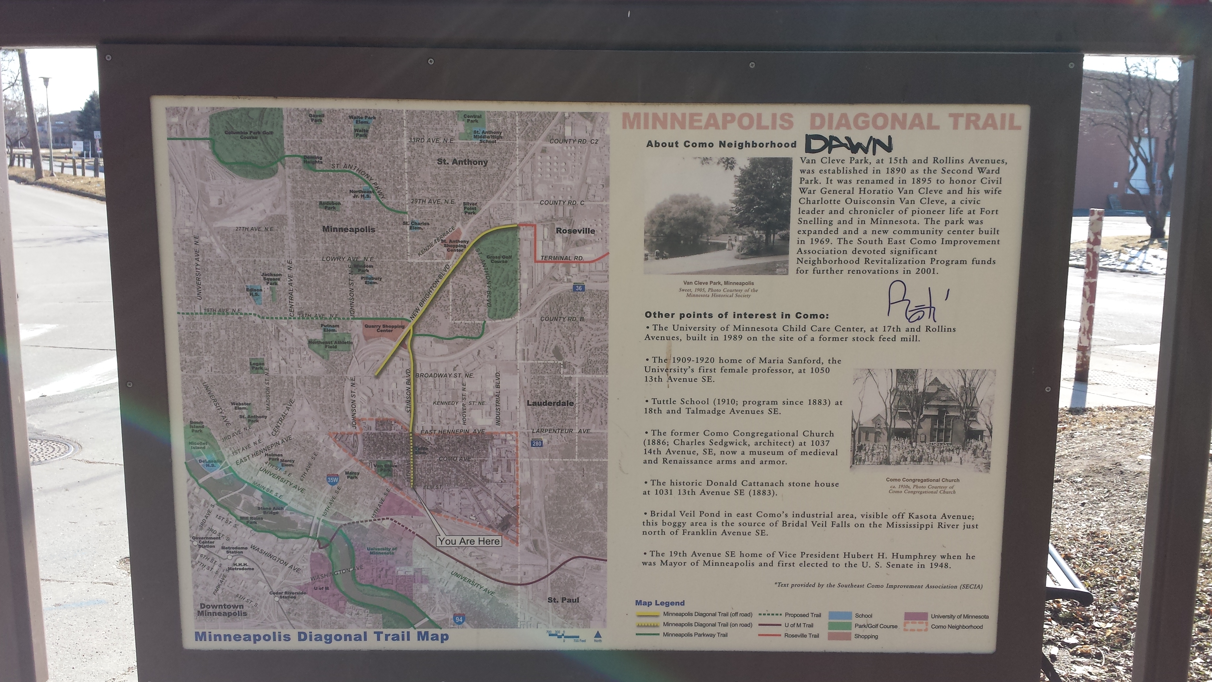
Minneapolis Diagonal Trail, Como Neighborhood Sign (Northwest Side)
Like many of the streets I walked, 17th Avenue is a quiet residential street with diagonal dividers to prevent automotive through-traffic. The housing spans quite a wide gamut of ages and densities, including a number of buildings that seem to have started life as large single-family detached houses and then later been subdivided into multiple units. Contrary to current practice, this housing was constructed within walking distance of industrial employment, which was concentrated at the northern and southern borders of the neighborhood. In particular, when I reached Hennepin Avenue and briefly explored westward on it to 16th Avenue, I saw the recently renovated Fisk Building, which began its life in 1919 as a shoe factory and was repeatedly expanded during the World War II years for the Cornelius Company, which temporarily side-tracked from beverage dispensers into military aviation.
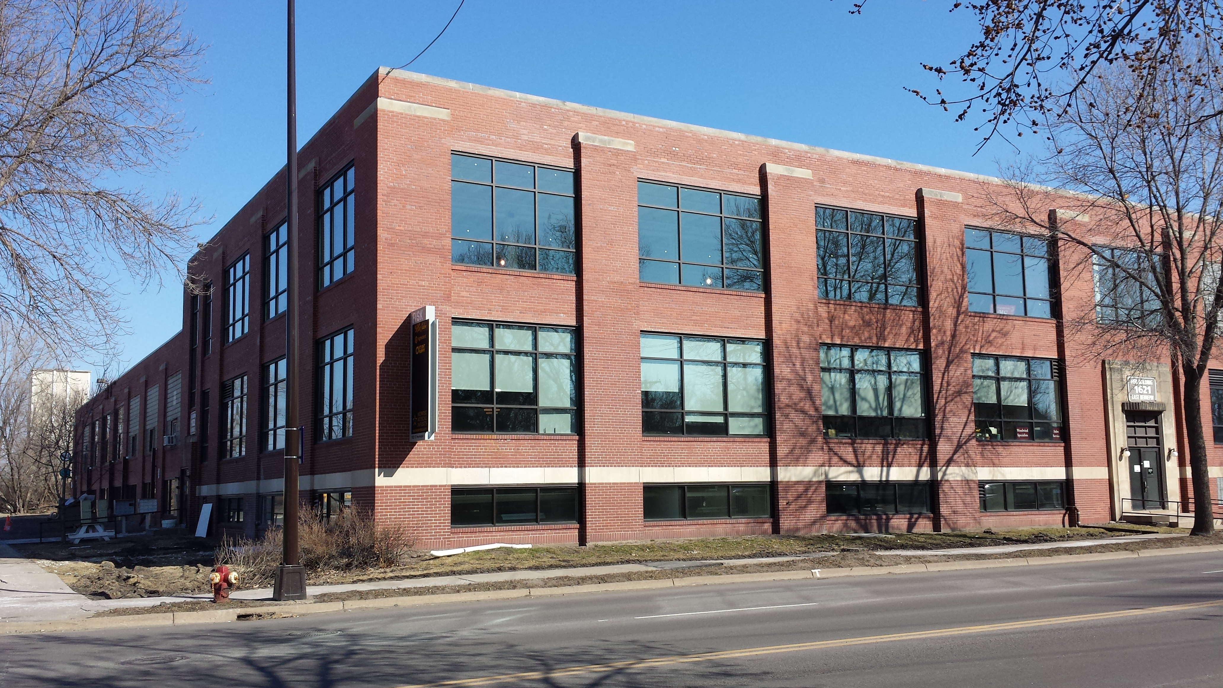
Fisk Building, 1621 East Hennepin Ave
Turning back eastward on Hennepin to 18th Avenue, I wrapped around to Talmage Avenue, which I followed westward to 11th Avenue, which runs alongside Interstate 35W. First I walked a block north on 11th to Hennepin, then back south to Como, which took me along the northern edge of Van Cleve Park. Both the northern and the southern portions of this excursion provided distinctive views. Looking north across Hennepin, I saw the boldly painted Hoover Wheel Alignment. Then looking south across Como as I neared the park, I saw the landmark Bunge Elevator towering over the residences.
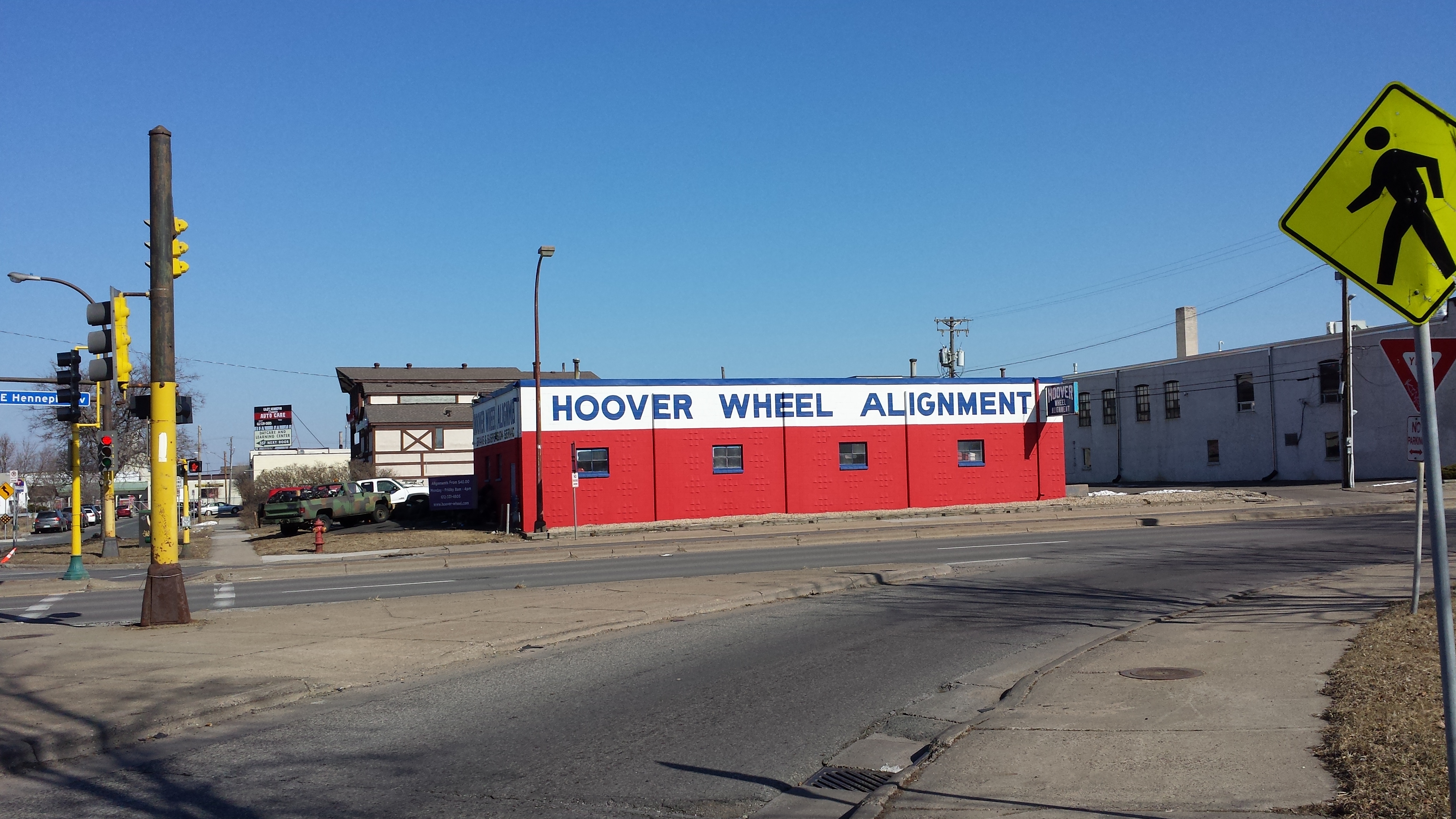
Hoover Wheel Alignment, 1101 East Hennepin Ave

Bunge Elevator (Looking Southwest from Como and 13th Avenues SE)
Como Avenue was home to the Como-Harriet Streetcar Line from 1898 until 1954. As such, it has clusters of storefronts every few blocks. I encountered the first of these as soon as I was past the park and my 15th Avenue starting point. On the north side of the 1500 block, establishments include Oaks Hardware and the Afghan-American Football Pizza (shown here) as well as Bobby’s Corner Market (to be shown subsequently). The south side has Black Coffee and Waffle Bar, Craig’s Como Barber Shop, Obento-Ya, and the Blue Door Pub.
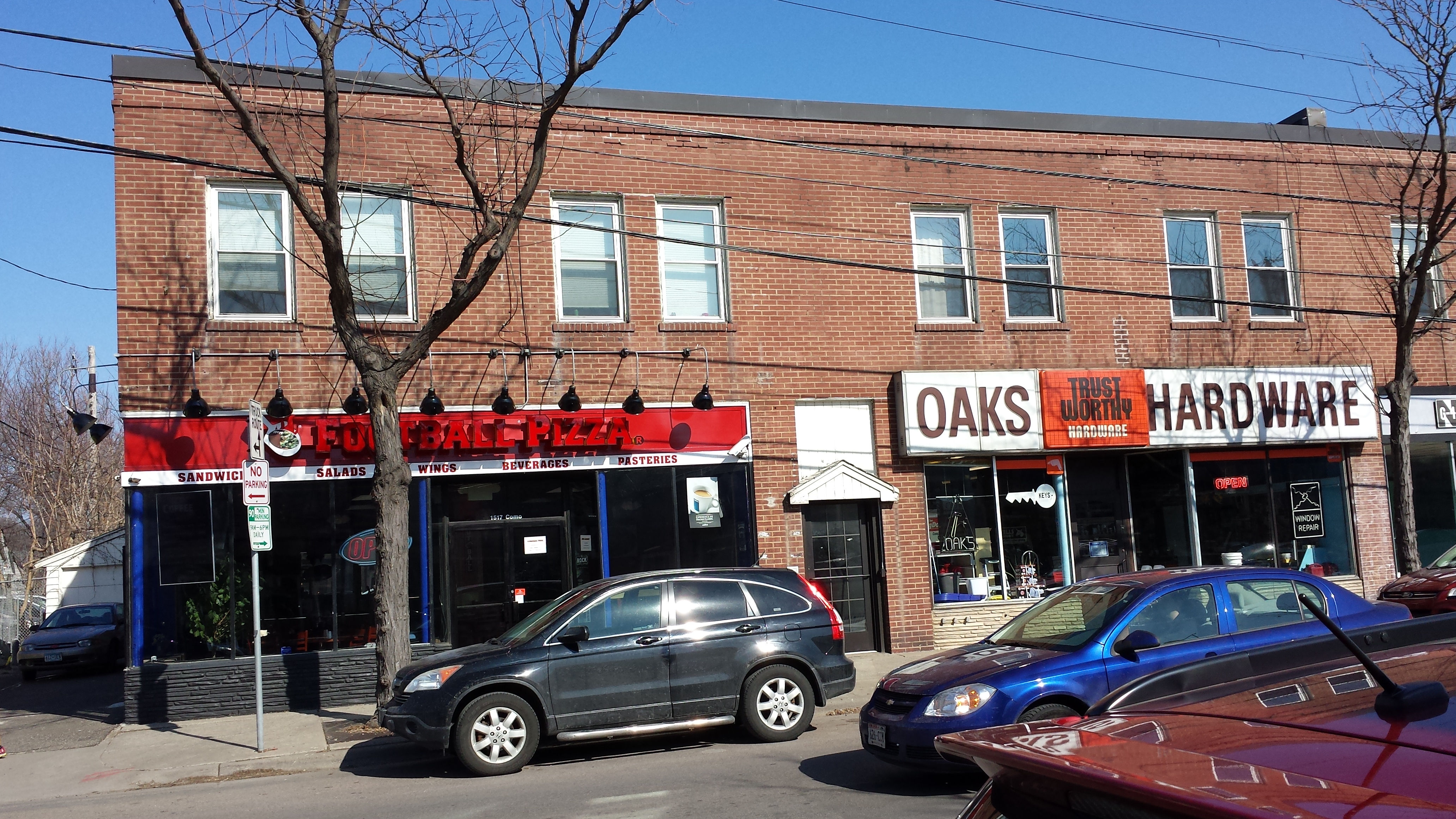
1500 Block of Como Ave SE
I opted to stop at Obento-Ya for lunch. The menu is daunting but the waiter helped me zero in on the spicy miso ramen with kimchi and saba (mackerel). At his suggestion, I added an egg. The broth was really good, rich and tasty in subtle ways, not just a big blast of salty-and-hot. The saba was nicely grilled, and the gentle acidity of the kimchi did a good job of cutting the fish’s inherent oiliness. The egg, with its soft yolk, provided a nice creamy counterpoint.
Indeed, my lunch was sufficiently tasty that I went back for dinner a couple days later along with my Less Pedestrian Half. We started by sharing the Poke Muse appetizer. The poke was fresh tasting and well balanced with its sauce, and it got a nice additional dimension from spending a little time under a glass dome with some hickory smoke from a smoke gun — just enough to accent it rather than dominating. The wanton-skin chips were as they should be — crisp and free of off-flavors. This dish was truly exceptional. Then we each had a bento, particularly enjoying the miso soup, grilled salmon, shumai, wakame salad, egg custard, and sautéed burdock root.

Spicy Miso Ramen with Kimchi and Saba (Egg Added), Obento-Ya
After lunch, I headed north on 15th Avenue, crossed Hennepin into Northeast Minneapolis, and continued one block further to Winter Street NE, which took me to 14th Avenue (after briefly detouring to 13th) for a return back southward to Como. As I walked this hairpin portion of my route, I took particular note of repurposed buildings. On the northeast corner of 15th and Hennepin, the interactive design and technology company Clockwork occupies what clearly was an automotive service station (built as a filling station in 1932 and then expanded by a garage addition in 1949). Nearby at 1325 Winter Street NE, a 1946 Streamline Moderne factory in which Noiseland Industries now produces audio recordings is revealed by the sign over the door to be the former home of the Paul E. Hawkinson Company, makers of tire-retreading machines. And in the block of 14th Avenue that is immediately north of Como, The Oakeshott Institute is “promoting the interest in ancient arms and armor through hands-on educational experience” in what was the Como Congregational Church, built in 1886 with 1909 and 1919 additions.
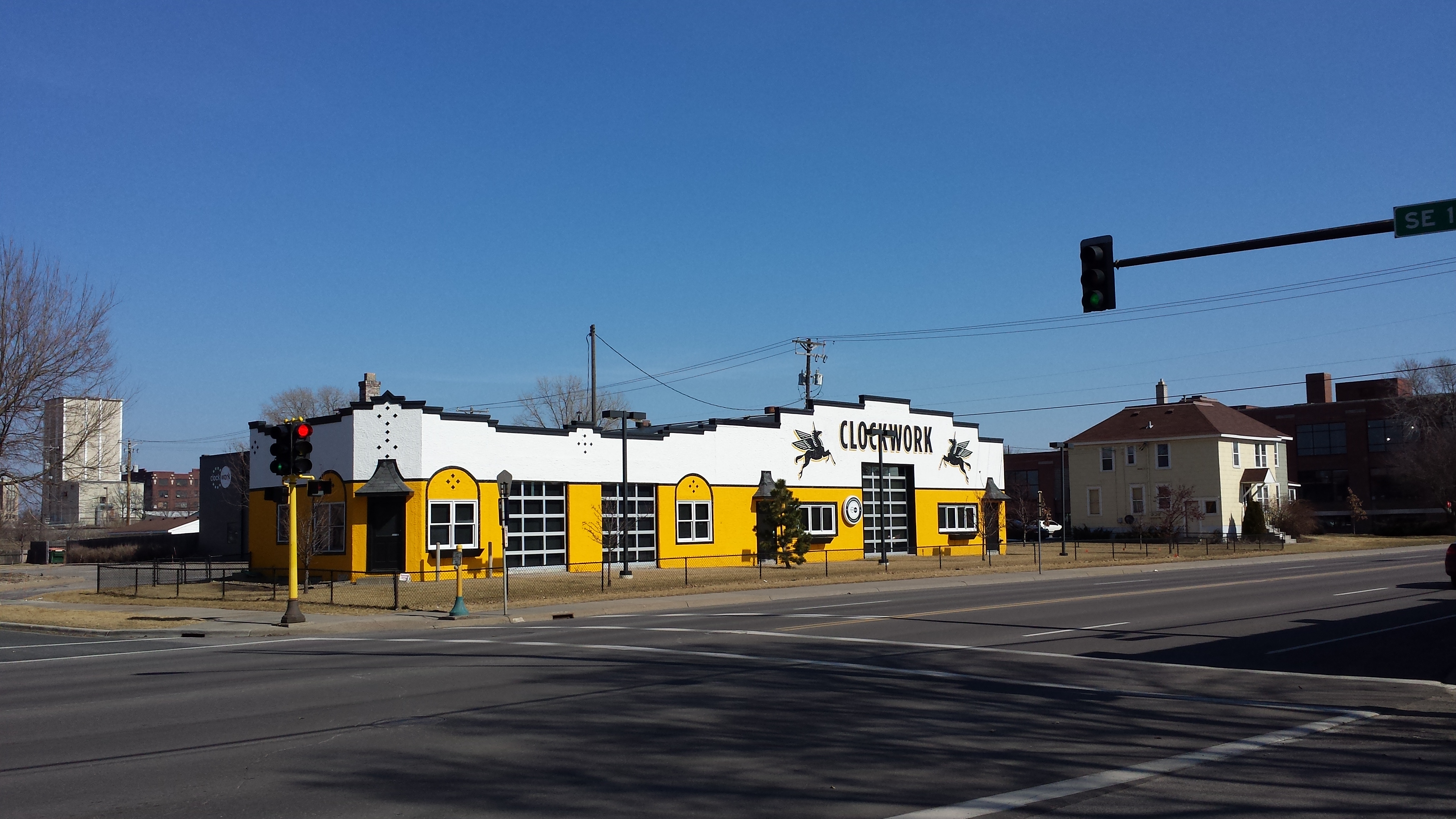
Clockwork, 1501 E Hennepin Ave
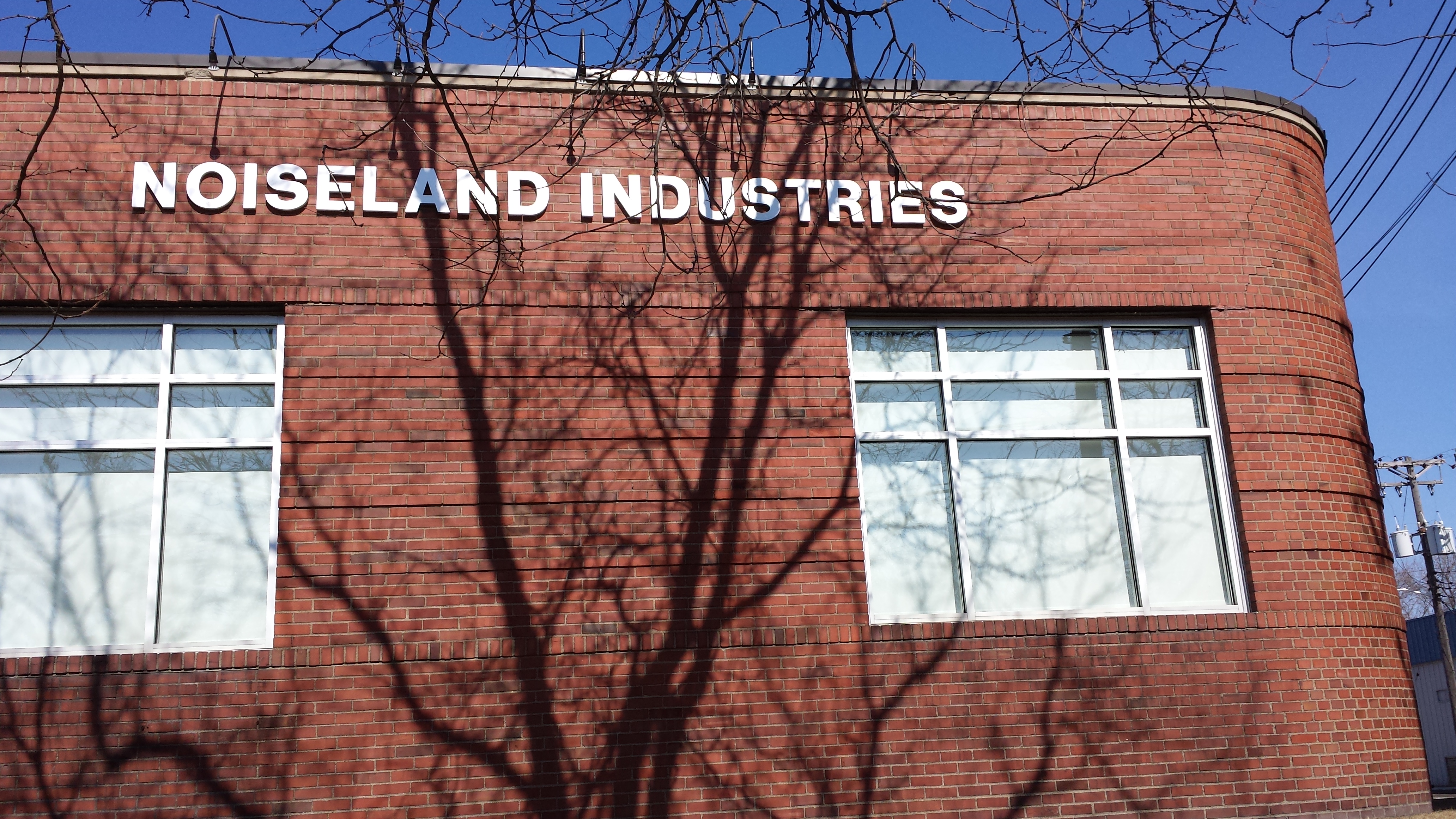
1325 Winter St NE (1946) with Name of Present Occupant
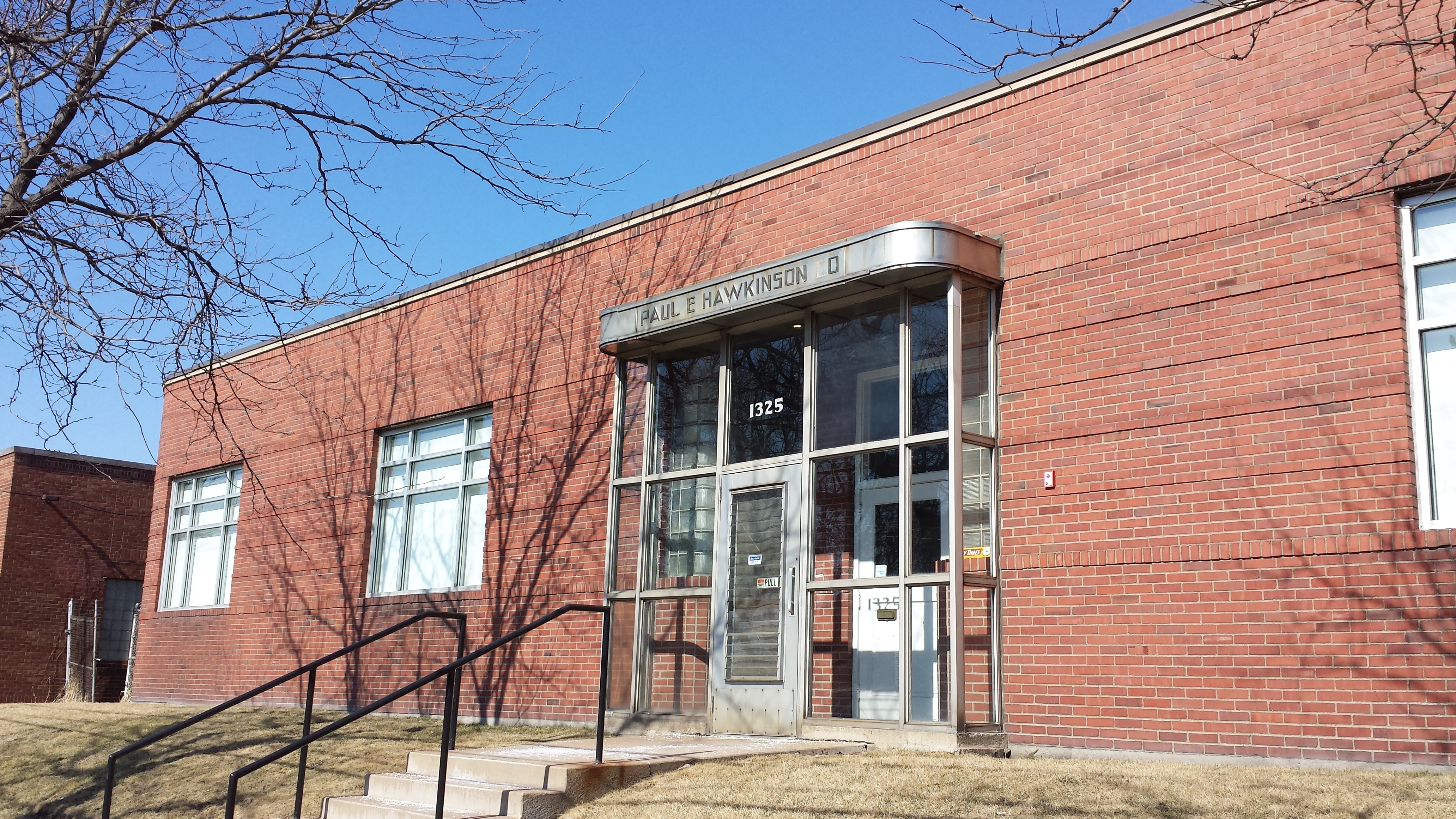
1325 Winter St NE (1946) with Name of Former Occupant
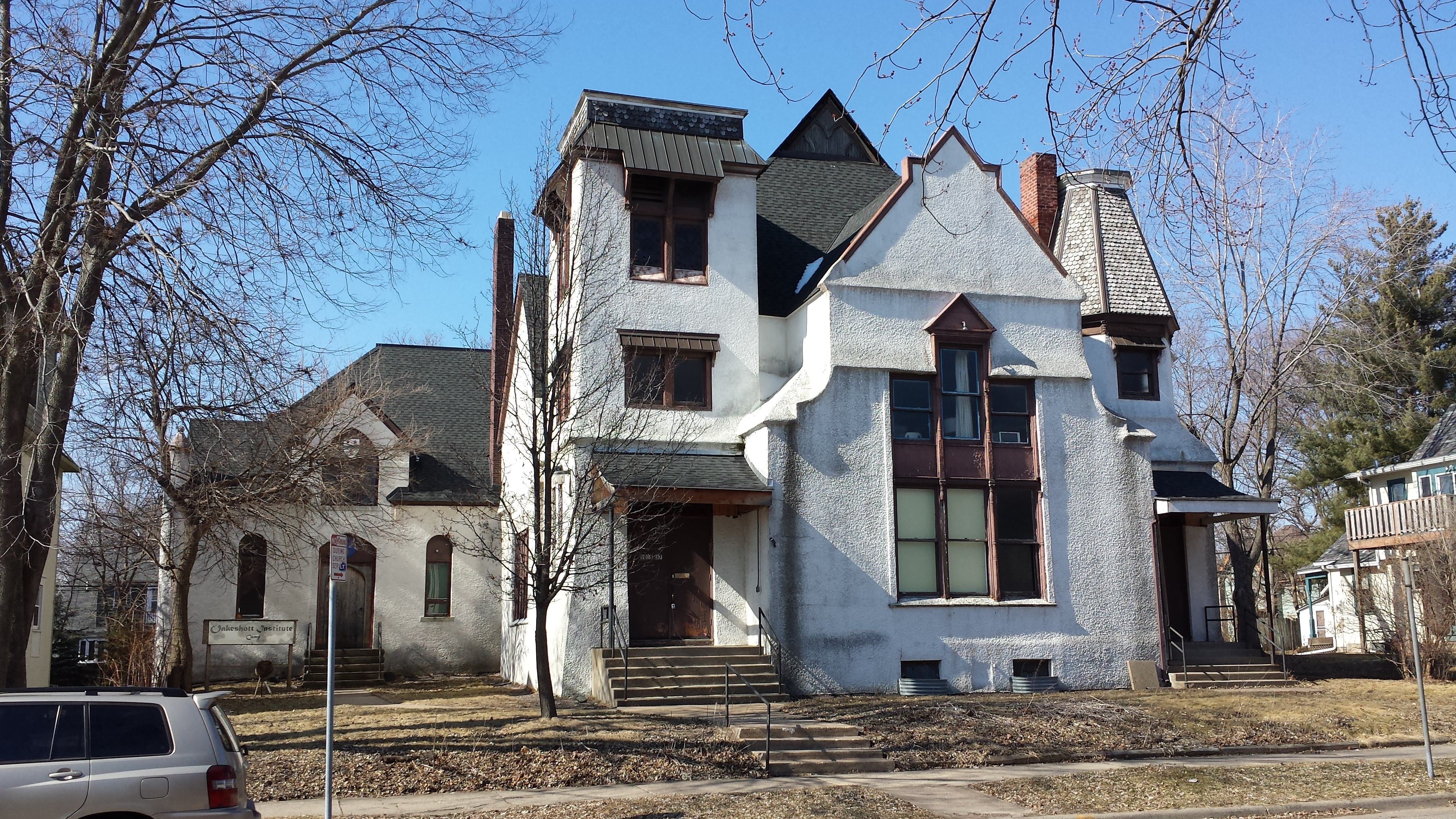
Oakeshott Institute (Former Como Congregational Church), 1035 14th Ave SE
A pedestrian path allowed me to get from the north side of the park, at 14th Avenue, to the east side at Brook Street. Along the way, I stopped to photograph another portion of the playground, this one with structures in the form of a ship and a train.
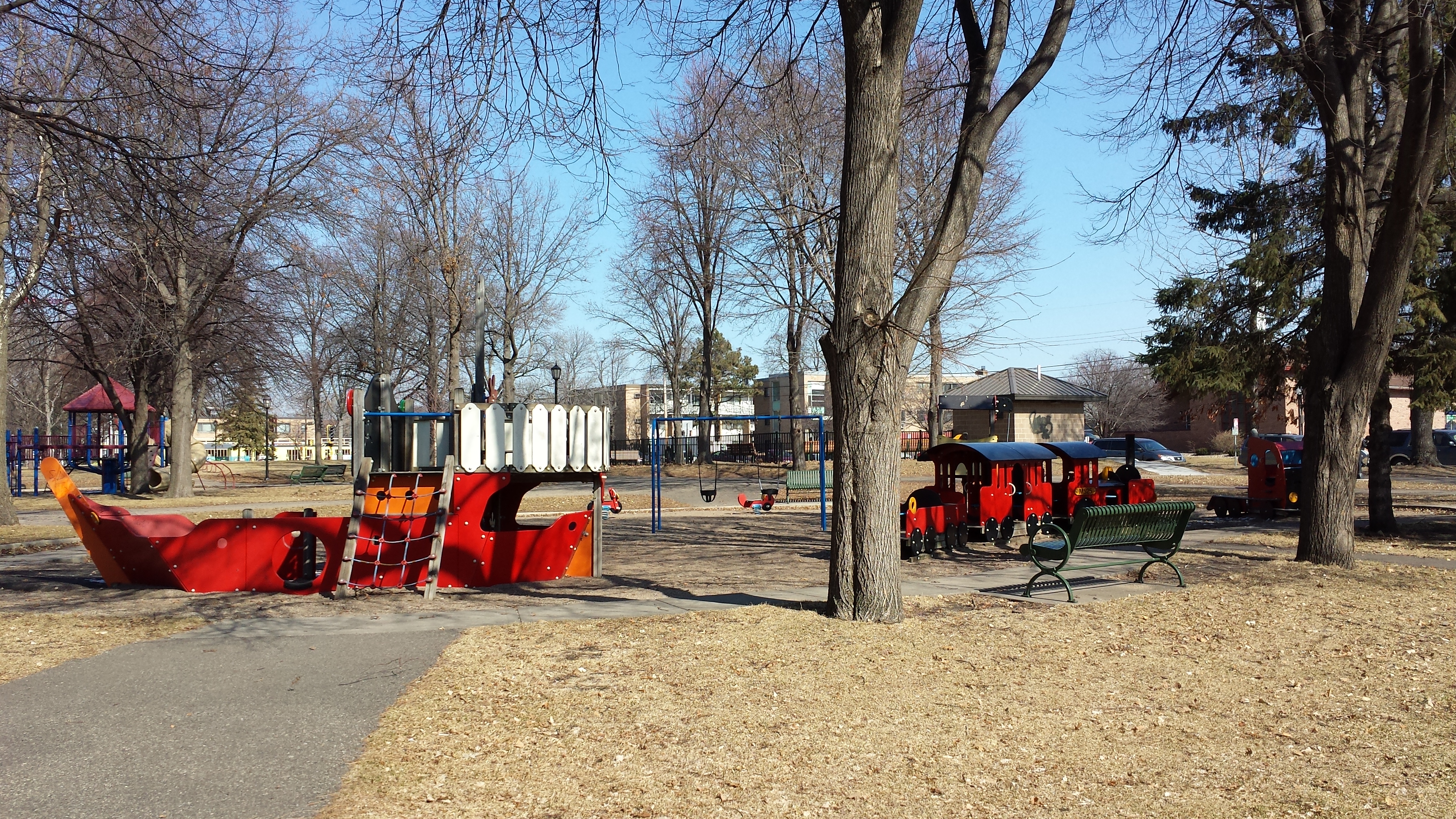
Ship and Train Play Structures at Van Cleve Park
Somewhat at odds with my interest in repurposed buildings, I found myself impressed by the continuity of use for the building standing on the northeast corner of 16th and Como Avenues. Built as a dental clinic in 1963, and looking every inch a product of that time period, it still serves the same function today.
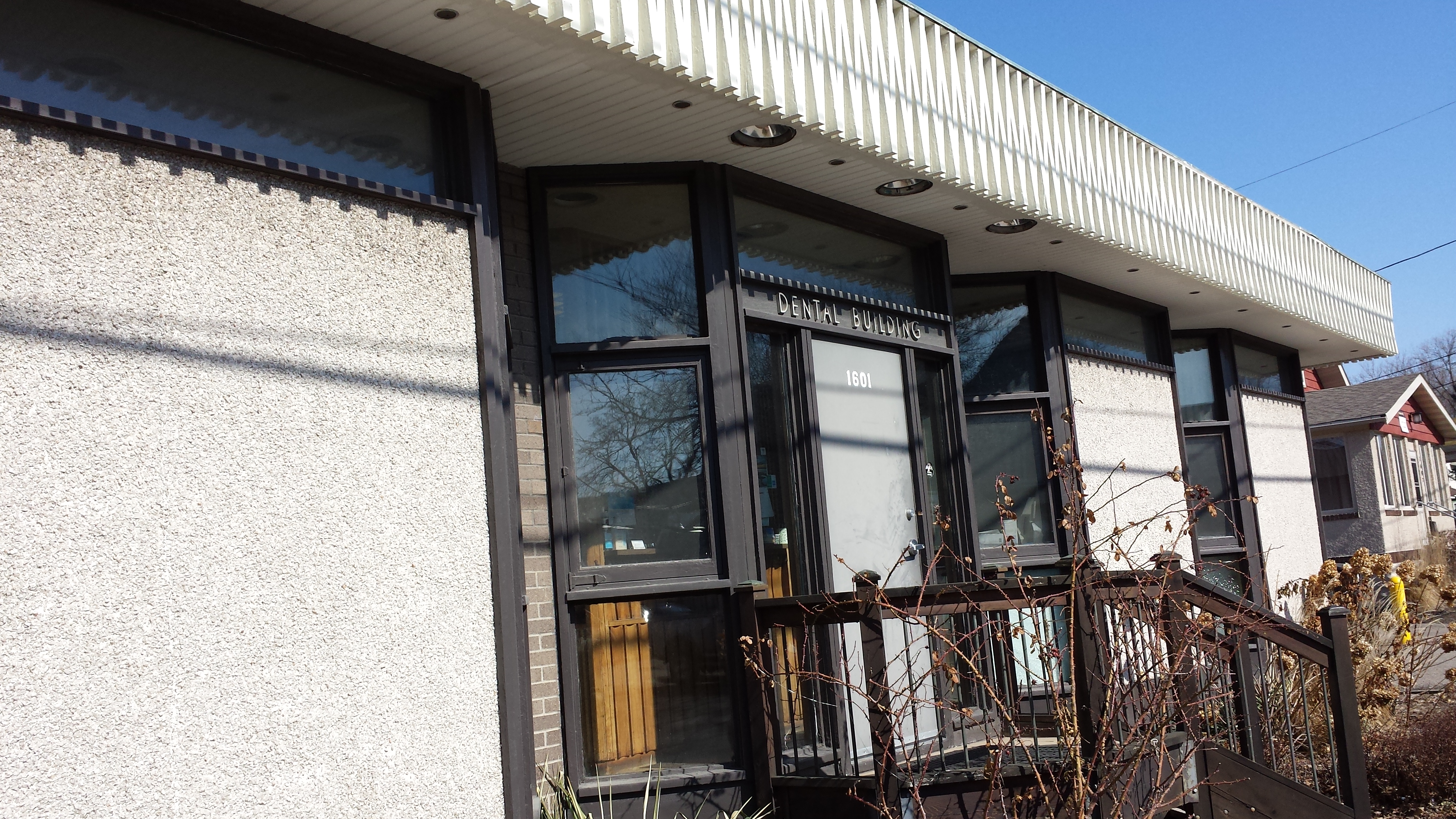
Dental Building, 1601 Como Ave SE (1963)
On the other side of 16th Avenue is the block containing Football Pizza and Oaks Hardware, which I had previously photographed. This end of the building houses Bobby’s Corner Market and sports an upbeat mural.
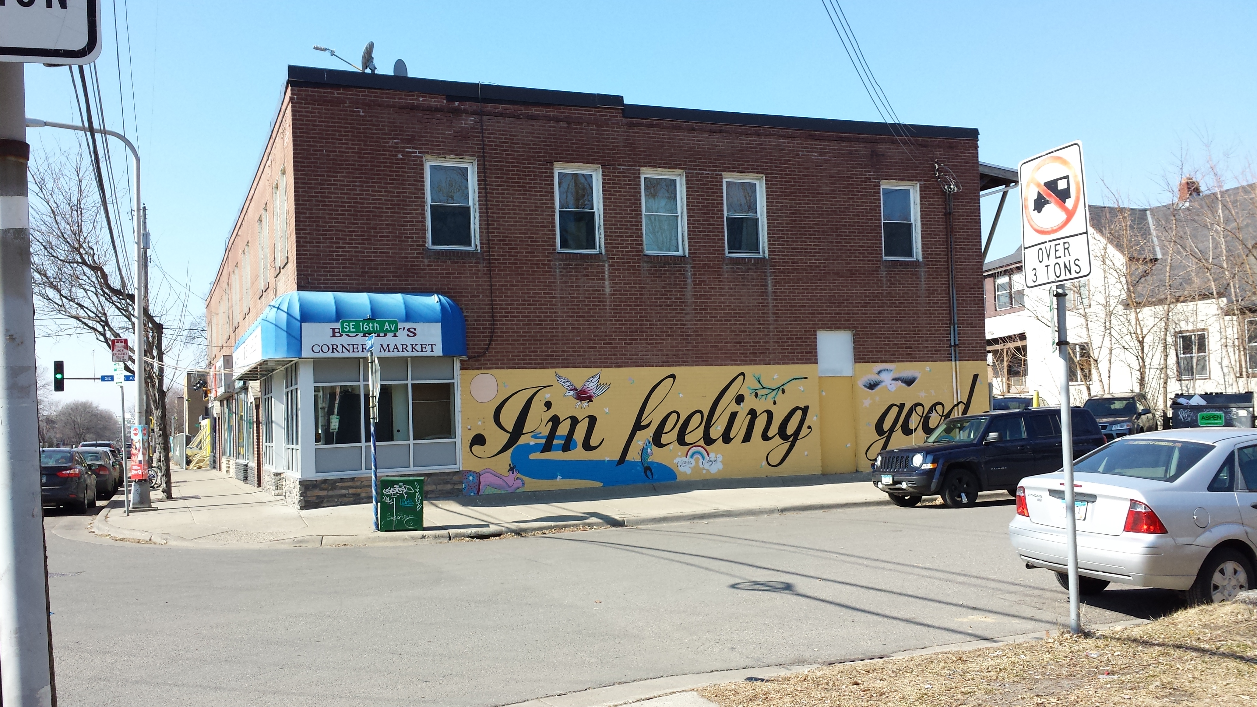
“I’m Feeling Good,” Bobby’s Corner Market, 1523 Como Ave SE
Another storefront strip lies two blocks further north in the 1500 block of Hennepin Avenue. The eastern half of that building is currently vacant and available for lease; its three storefronts are colorfully painted but retain a certain slit-windowed look that cries out “dive bar” to me. Online sources suggest the most recent occupant was Goal Line Cafe. I was more interested in the current paint job, though. In addition to the colorful backgrounds and cartoon-like figures, the three segments are inscribed “Accept me. Take me. See me.” Can it be a coincidence that these are the English translation of the first six words of the concluding stanza of a poem by Antwerp’s poet laureate, Tom Lanoye? They appear (in the original) as the top three lines of an excerpt hung on a building in that city. Whether coincidental or not, the Minneapolis version takes these lines in a different direction; the east side of the building (not shown) is painted with “Watch me. Like me. Mention me. Friend me.” (I’m guessing a bit on the last two, as they are incomplete.)
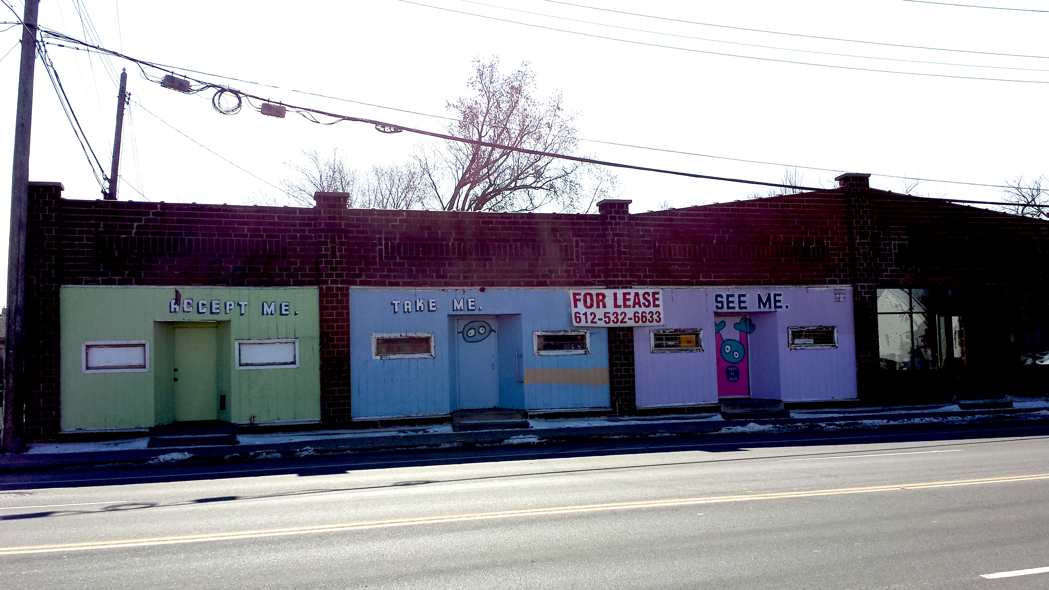
1510–1506 (and Part of 1504) E Hennepin Ave
The western half of this 1925 retail strip is occupied by ChinDian Cafe and a connected gallery. In contrast to the former Goal Line, it has plenty of windows to let in lots of light. The cafe wasn’t open when I walked by, but never fear: I had seen that obstacle coming and so had pre-visited the evening before along with my Less Pedestrian Half. We had a pleasant meal of chicken and chive dumplings, vegetable samosas, zesty green beans, and kwe tieu goreng (a noodle stir-fry). All the flavors were subtle but interesting. They represented the owners’ ethnicities (Chinese and Indian) as well as the national origin of one of them (Malaysian). Afterward we went into the gallery, where Aldo Moroni was closing a 40-year retrospective of his work with a performance of destroying (and auctioning chunks of) the large mountain-scape he had built over the course of the show.
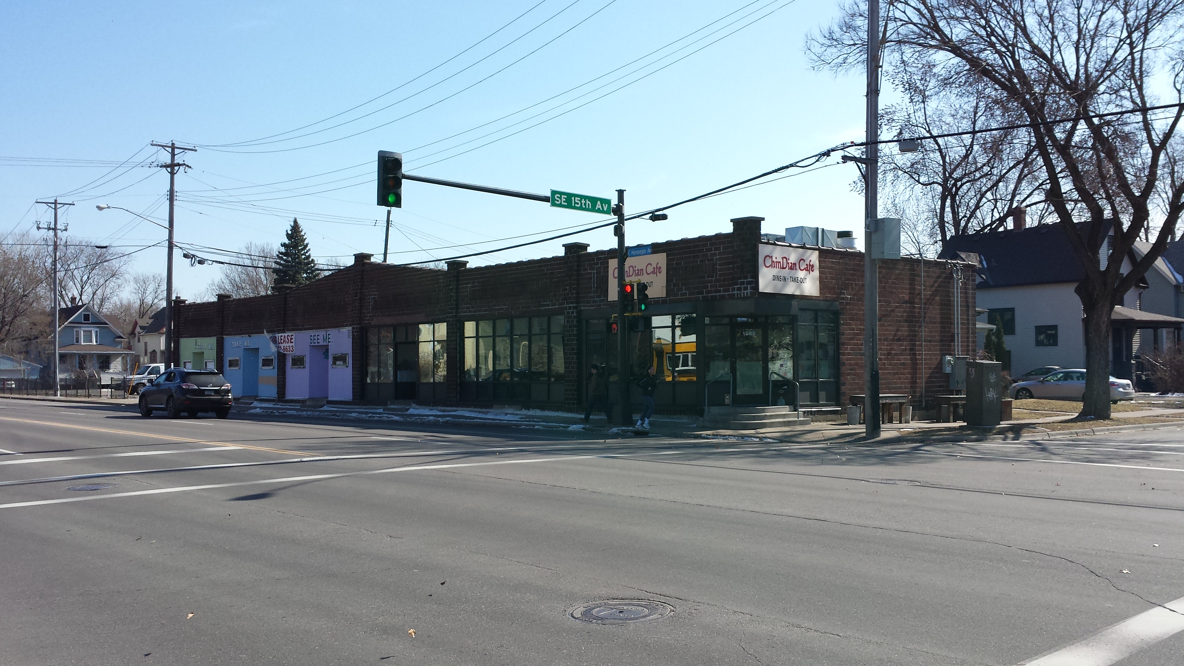
ChinDian Cafe, 1500 E Hennepin Ave
Unlike Como Avenue, where the residential neighborhood is broken only by storefronts, Hennepin Avenue has a dual status. The northern side is industrial in character, even in this western portion where the formal boundary with the Mid-City Industrial Area lies a block further north, at Winter Street NE.
An earlier example of this industrial development of Hennepin’s north side was the renovated Fisk Building. An example a few blocks west of the ChinDian Cafe is the factory building (dating from 1920, with subsequent additions) that a modest sign on the glass door reveals to be home of the famous Minnetonka Moccasin Company. The web site discloses that they manufacture their shoes in the Dominican Republic and China, so this building must now just house headquarters functions and the warehouse.
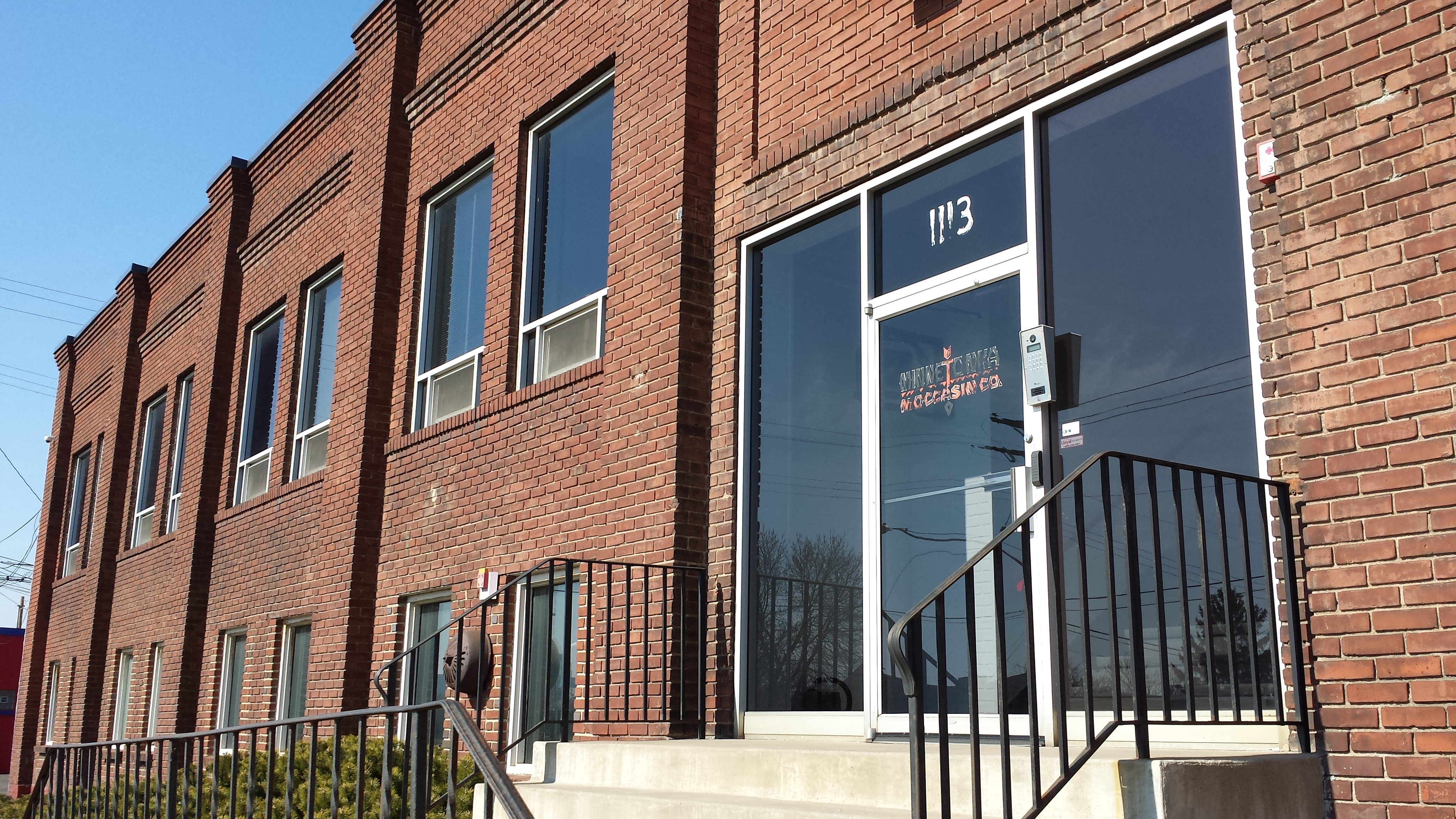
Minnetonka Moccasin Company, 1113 E Hennepin Ave
Heading south on 13th Avenue, the Donald Cattanach House stood out because of the “atypical use of roc-faced limestone for a single-family house” that caused it to be listed as a historic landmark. Cattanach, who built the house in 1893, was a mason, which presumably explains his choice.
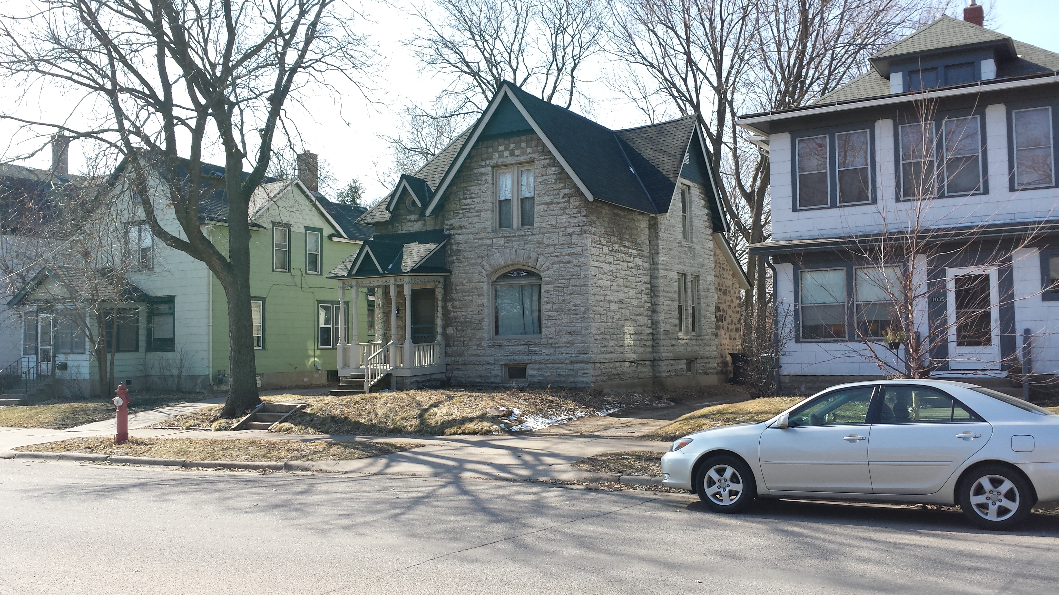
Donald Cattanach House, 1031 13th Ave SE
Most of the residences, in contrast, were built with wood-frame construction. Almost directly across the street from the Cattanach House, at 1014, I got to see a good example of how a wood-frame house can be revised to a new size and shape. The darker boards show where the walls of the original gambrel-roofed Dutch colonial revival were retained, with lighter wood squaring it out to the new, boxier shape and filling in the obsolete windows.
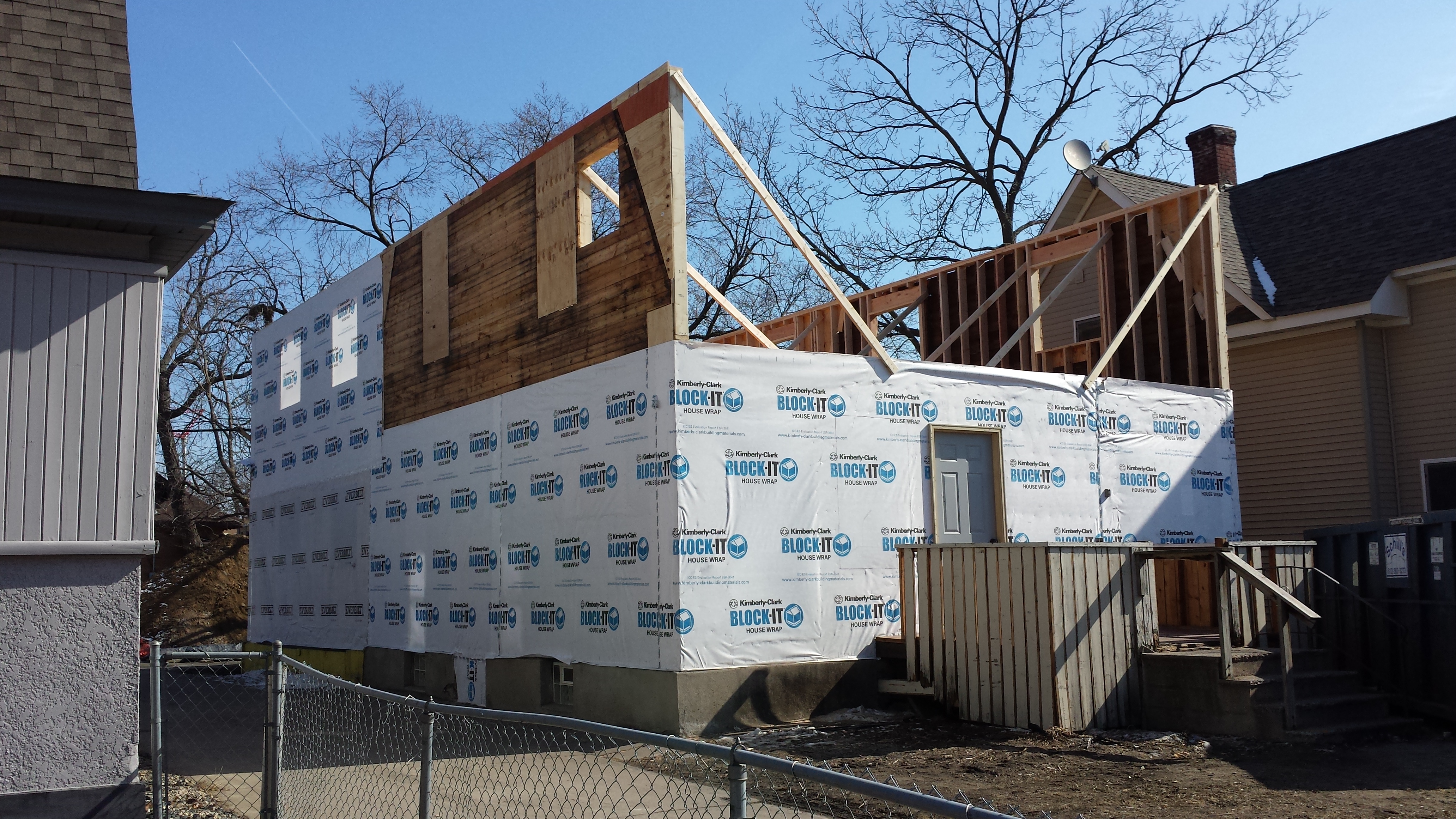
1014 13th Ave SE (1905; Remodeling in Progress, 2017)
I only could follow 13th Avenue a little further south before it dead-ended at the railroad tracks between Van Cleve Park and the Bunge Elevator. At that point, Brook Street took me to 12th Avenue for a final northward return to Hennepin Avenue (final aside from the 10th Avenue spur). I felt very much like I was already heading home, having seen what there was to see. And indeed, I didn’t wind up seeing any major new categories of structure. But there are always new details. I couldn’t help but smile at seeing how someone had beautified the base of a utility pole at the northeast corner of 12th and Como Avenues. They had “planted” flowers around it painted on corrugated cardboard.
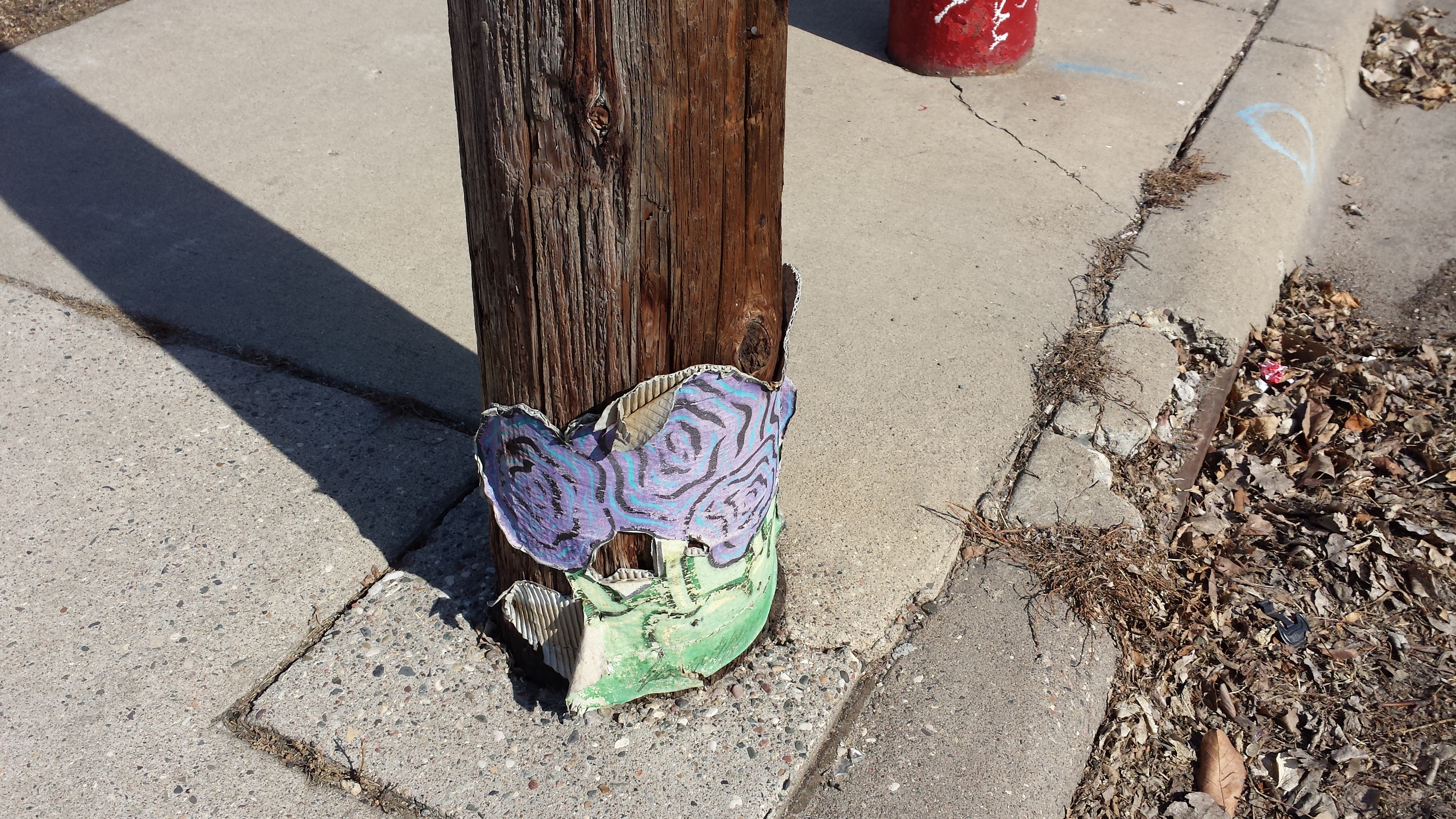
Cardboard Flowers, 12th and Como Avenues
My walk ended at point B on the route map, where Hennepin Avenue passes under the railroad tracks west of Interstate 35W. Looking back southeast and upward from this underpass, I got my final view of this portion of Como. Lift trucks reached their booms to the sky on the lot of Sunbelt Rentals, seemingly in imitation of the utility and light poles around them.
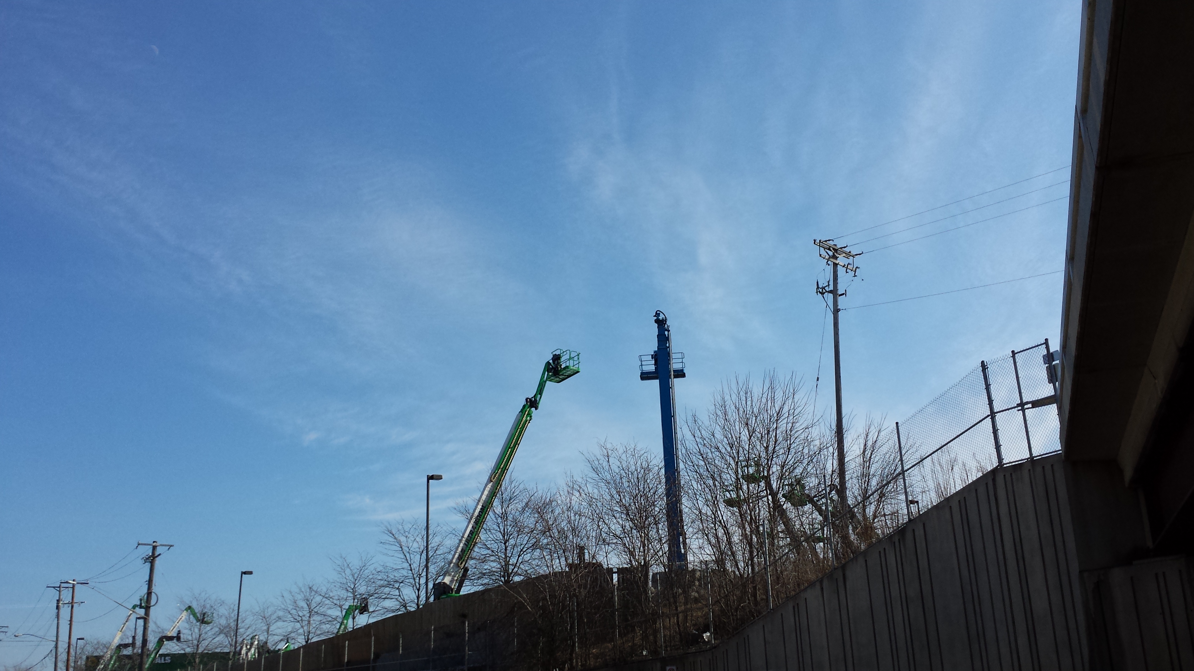
Sunbelt Rentals, 900 E Hennepin Ave
Allow me to close this first segment of my Como travelogue with a mea culpa. Were you observant enough to notice that the Noiseland Industries / Paul E. Hawkinson Company building is on the north side of Winter Street? (The shadows provide a clue, as does the odd street number, 1325.) That, I now realize, means it is on the wrong side of this boundary street to be in the Como Neighborhood. I ought to have waited to photograph it as part of the Mid-City Industrial Area. Oh well.
Editor’s Note: Max Hailperin is walking each of Minneapolis’ 87 neighborhoods, in alphabetical order. He chronicles his adventures at allofminneapolis.com, where the original version of this article was published March 9, 2017. We’re sharing them here at streets.mn.