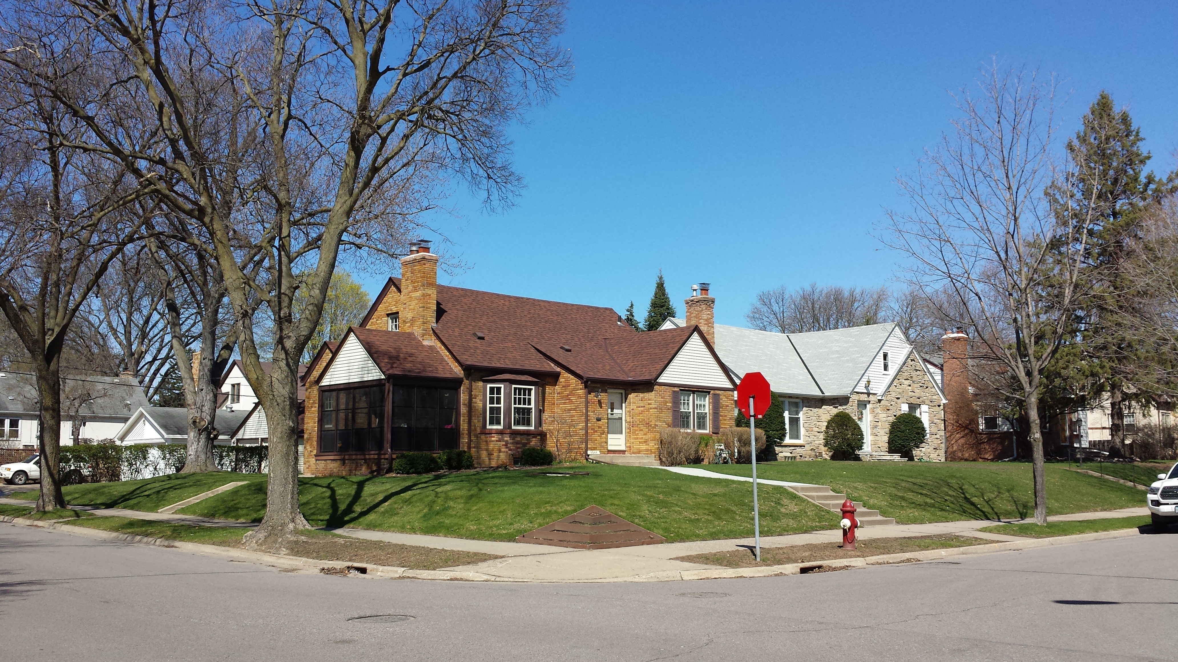
Returning to the Diamond Lake neighborhood for a third day, I took a circuitous loop (shown in blue, with supplemental spurs shown in red) through the northeastern corner of the neighborhood. In addition to the neighborhood boundaries of 55th Street and Cedar Avenue, this area is shaped by two parks: Lake Nokomis Park on the northeast and Edward C. Solomon Park on the south.
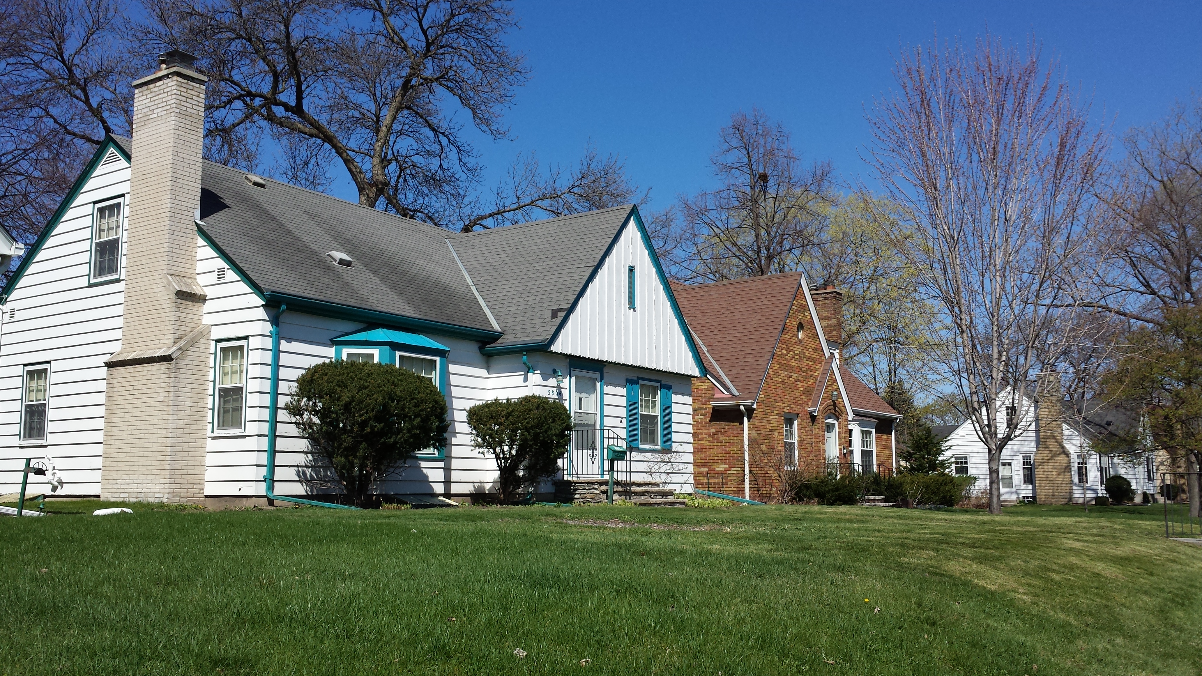
Initially, as I turned south on 14th Avenue, I noted the traditional look of the houses in the 5500 block.
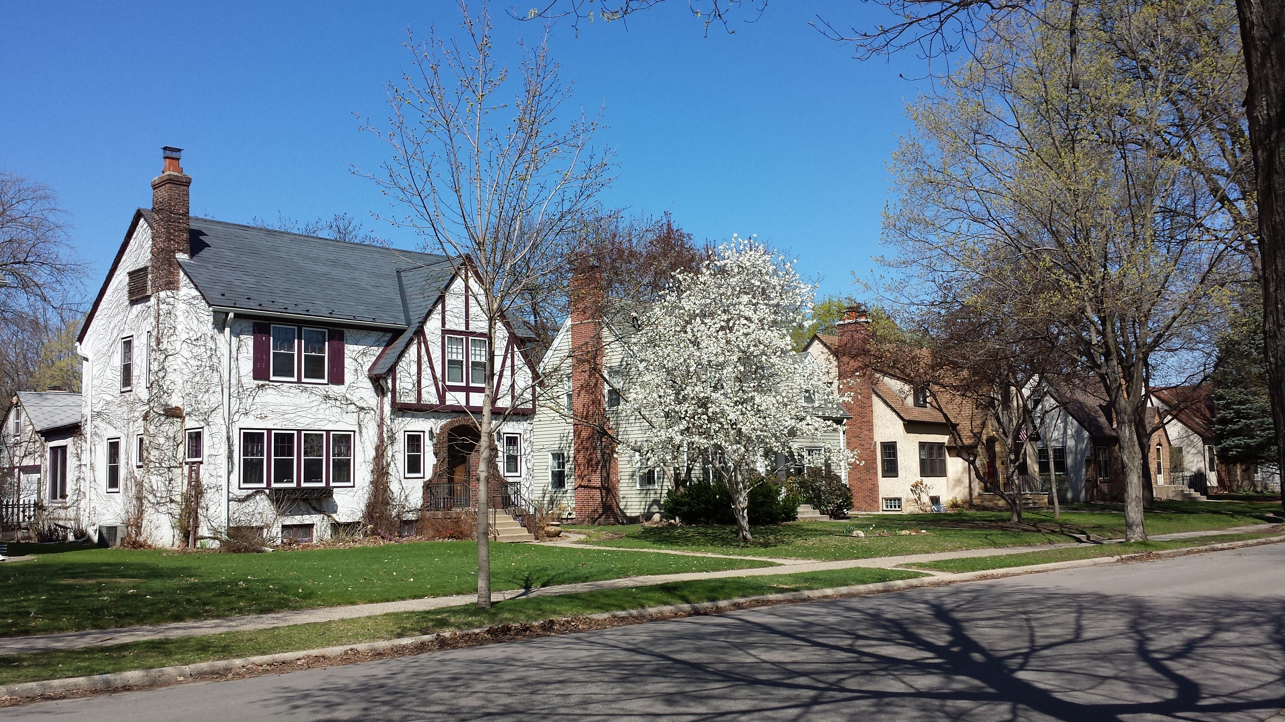
5520–5504 14th Ave. S.
5544 and 5540 14th Ave. S.
In subsequent blocks, my focused narrowed to details. For example, the two-story brick Georgian at 5608 was mere background for the tire swing in the front yard, made inviting the by the “PLEASE DO SWING” sign on the tree.
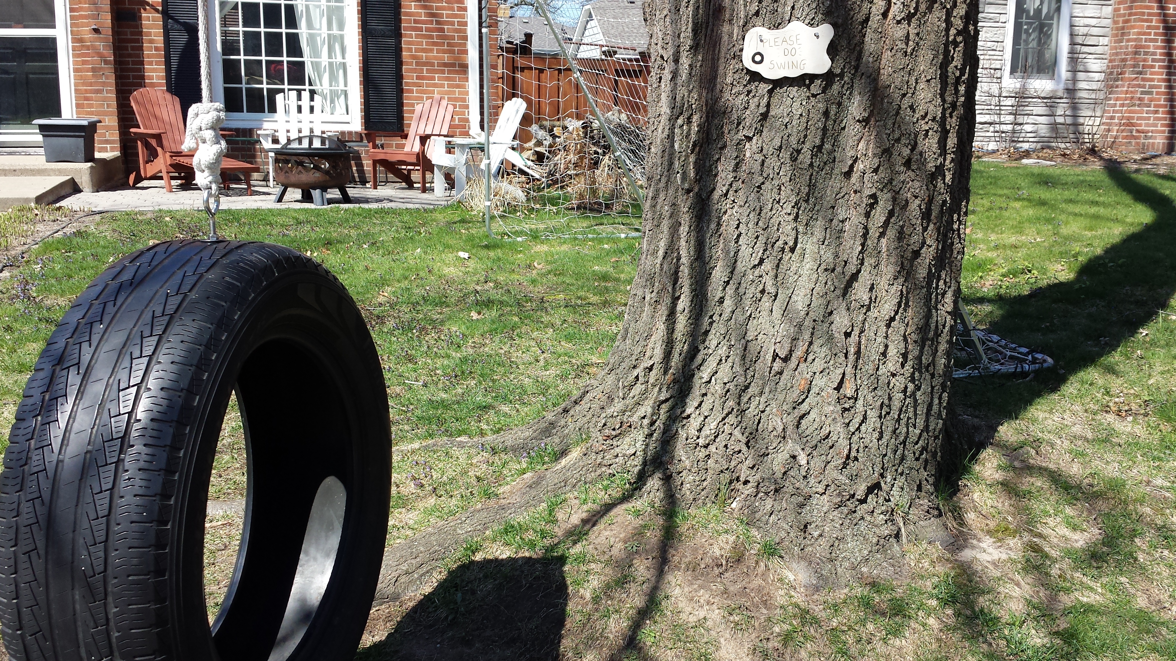
“Please Do Swing,” 5608 14th Ave. S.
Likewise, after skirting around Solomon Park into the 5800 block of 12th Avenue, I might have considered the houses to be just more of the same, were it not for such decorative details as floral painting on shutters or as brightly colored trim.
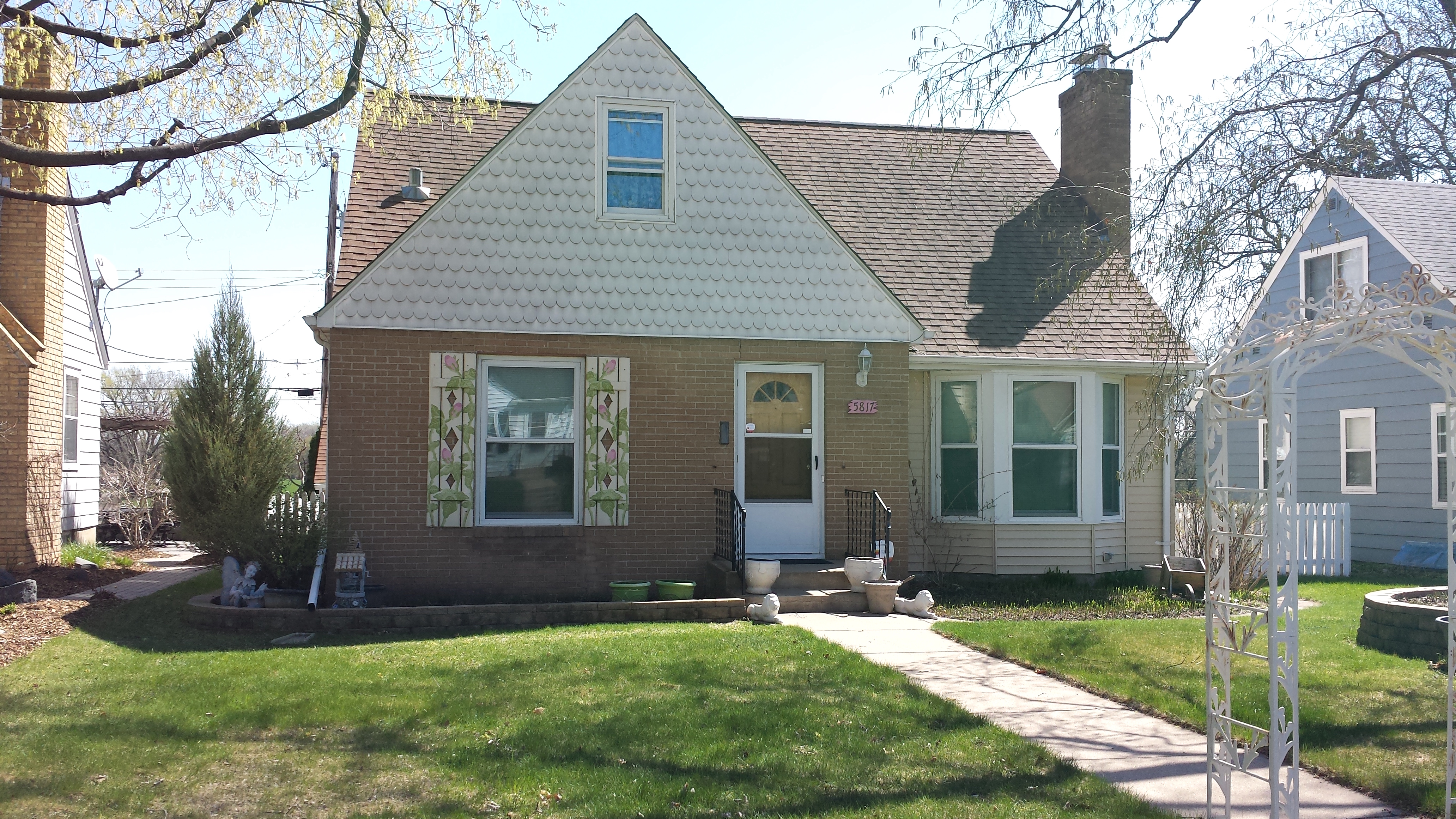
5817 12th Ave. S.
5804 12th Ave. S.
Although tire swings and paint are not long-lasting parts of the property, even the more durable design choices are as apt to show up in details as they are in the overall form of the structure. Take the house on the southwest corner of 13th Avenue and 57th Street, for example. Although the main frontal view is from the avenue, the side facing 57th Street caught my attention. From this photo, you can’t tell what the roofline looks like or how many stories the house has, but you can see that the mason interrupted the running bond of the fireplace chimney with a section of basketweave.
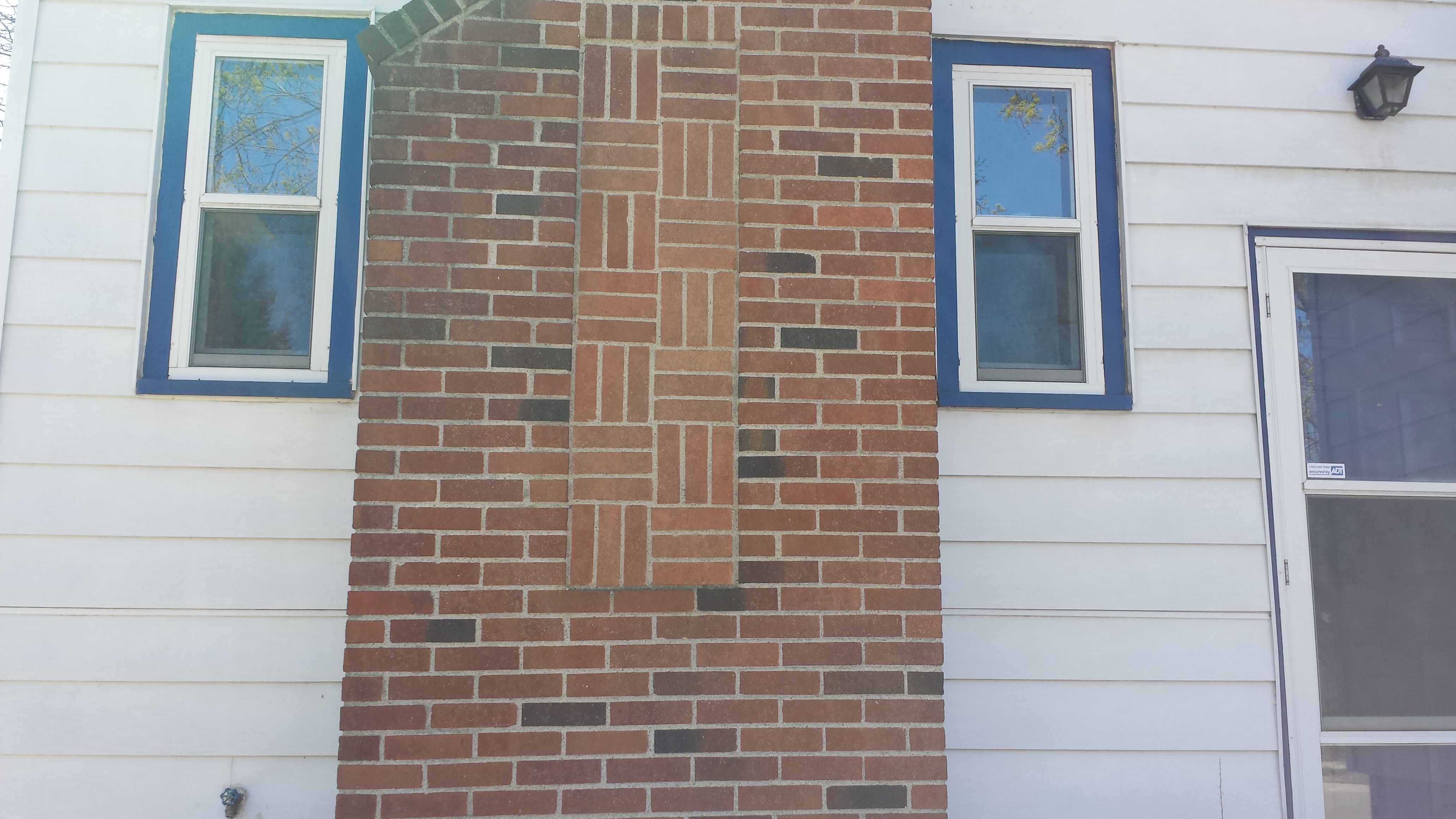
5700 13th Ave. S., Viewed from 57th St. E.
I continued west on 57th Street until it crossed 16th Avenue, at which point I bore off toward the lake on Nokomis Lane, which leads to Edgewater Boulevard. This boulevard is the outer of two roads bordering this part of the lake, the inner one being the West Lake Nokomis Parkway. Residences line the inland side of the boulevard, facing out toward the lake. This is the “Edgewater on Nokomis” development, which predates other parts of the Diamond Lake neighborhood. For example, the two-and-a-half-story Georgian at the corner with 16th Avenue dates from 1931; contrast it with the smaller and more recent homes that lie behind it along the avenue.
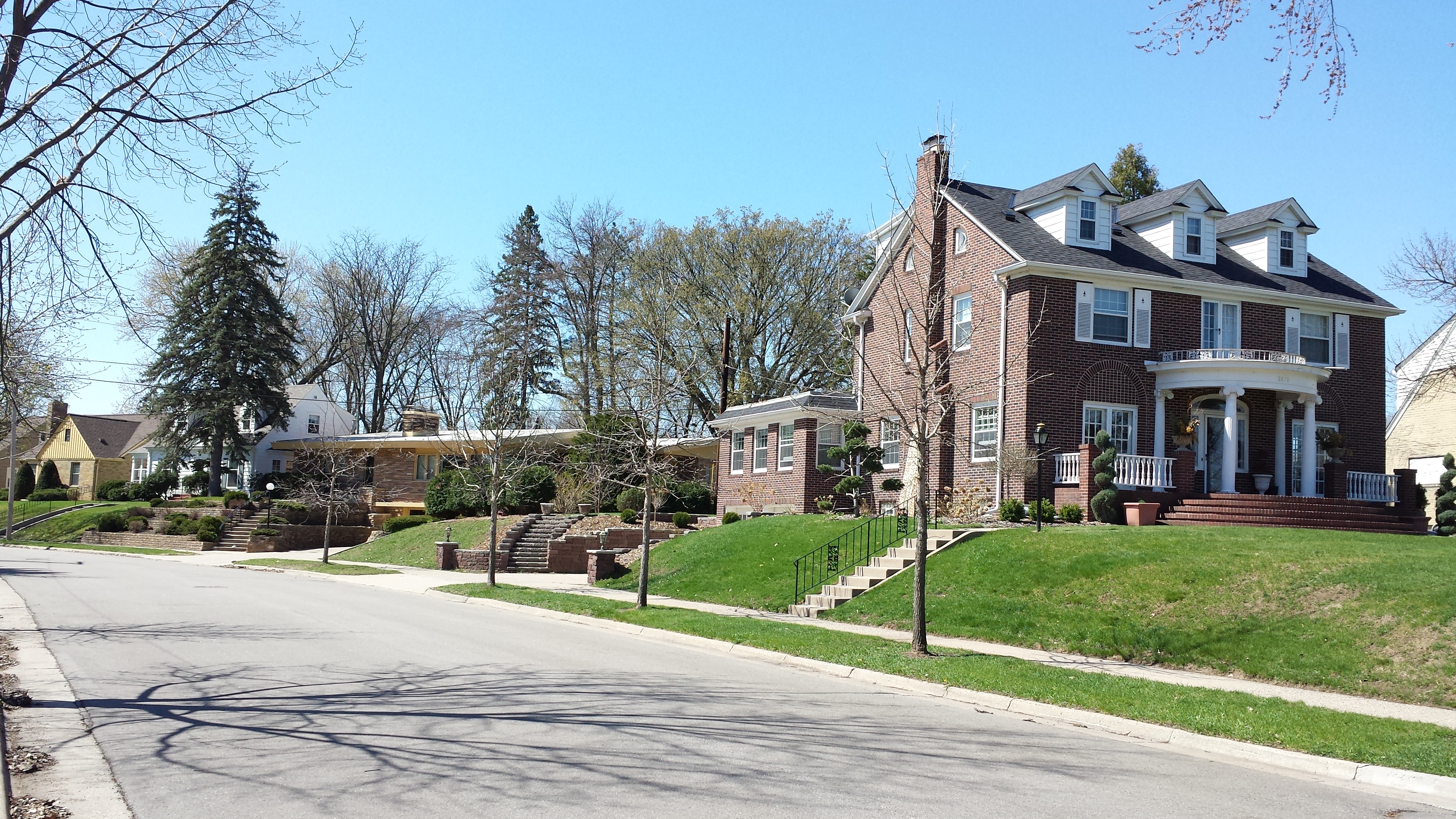
5620 Edgewater Blvd. (with 5620–5612 16th Ave. S.)
After the spur on Edgewater as far as 16th, I turned around and headed toward Cedar Avenue. As I approached the corner, I came up on Fat Lorenzo’s restaurant from the rear. Befitting the kitchen entrance, the mural on the back of the building shows the delivery of such ingredients as red and green peppers, a tomato, and a mushroom.
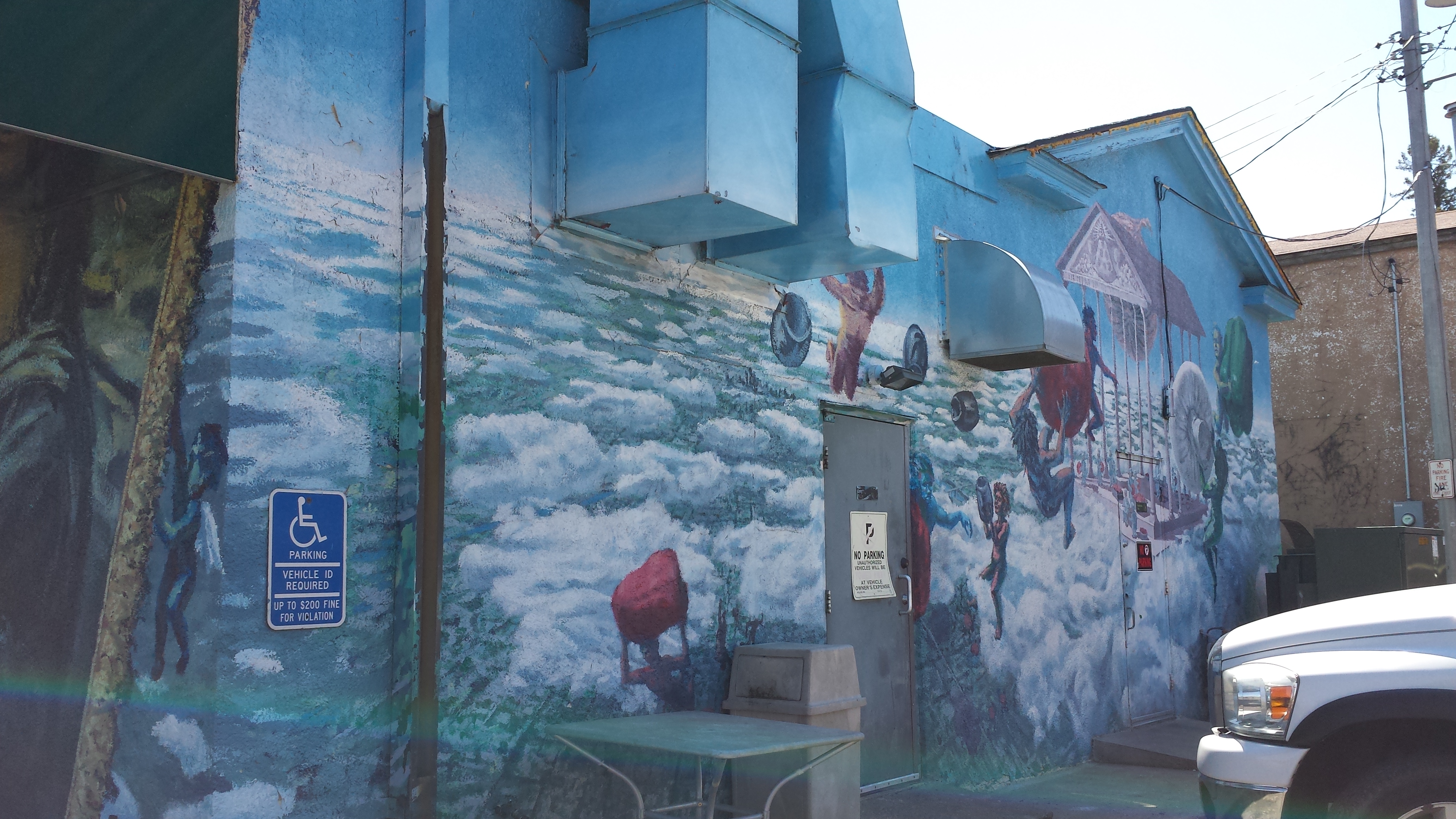
Fat Lorenzo’s Rear
Continuing to the side of the building, cherubim are raising a framed portrait so familiar that even with an awning obscuring the face, one can fill in the missing part from memory. I wasn’t able to photograph the front (facing Cedar Avenue), but that side too has a mural, in this case featuring the banner “Benvenuto a South Minneapolis” with initials of the two neighborhood organizations, HPDL and NENA (the Hale-Page Diamond Lake Neighborhood Community Assocication and the Nokomis East Neighborhood Association).
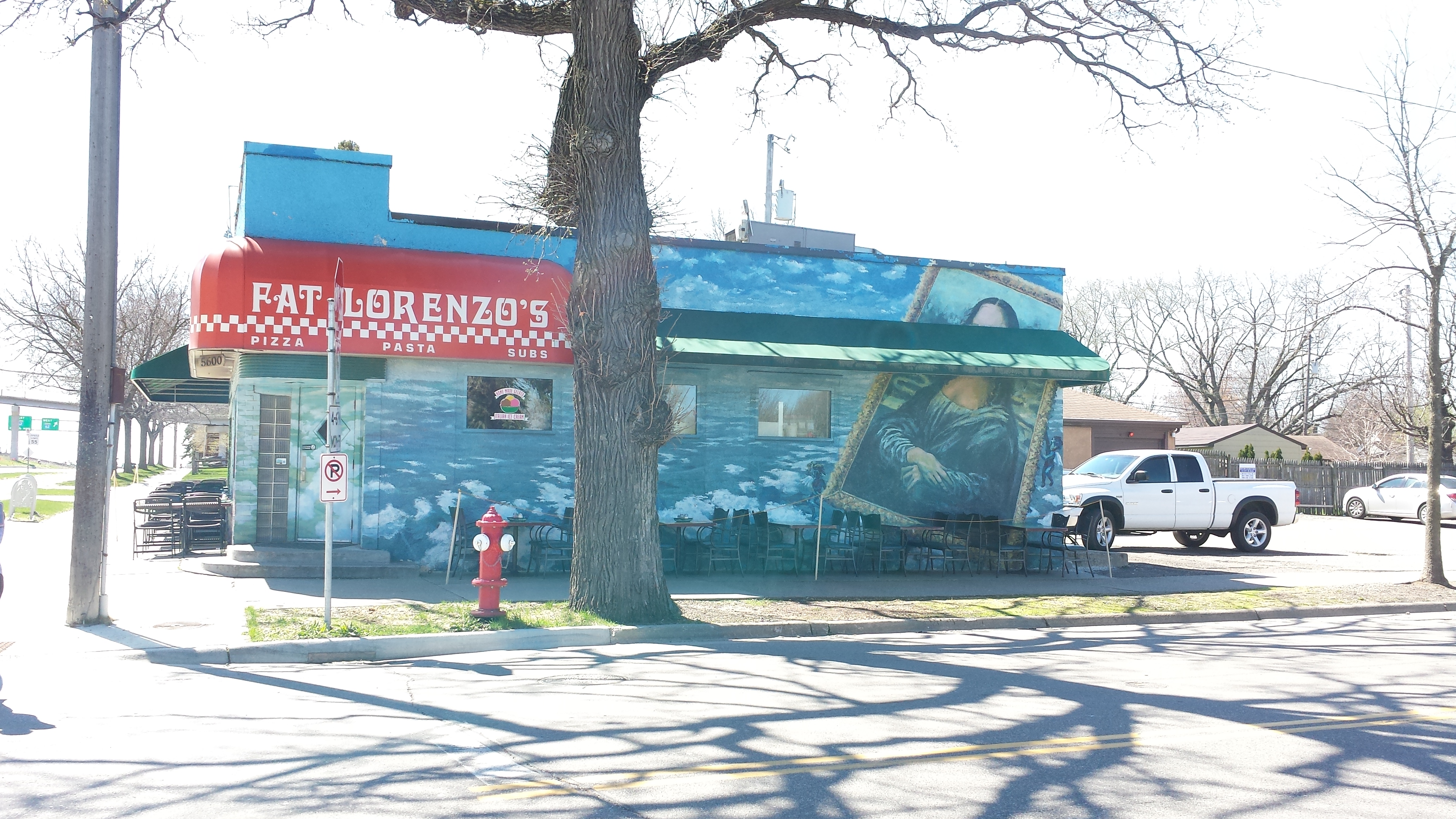
Fat Lorenzo, 5600 Cedar Ave. (Viewed from Edgewater Blvd.)
Turning north and crossing the parkway, a pleasant path leads into the park past a bee hotel, meandering gracefully between areas of cattails before dividing into a portion that crosses over a small tributary of the lake and one that curves back toward Cedar Avenue. Not visible in the photos are the red-winged blackbirds that were in the trees.
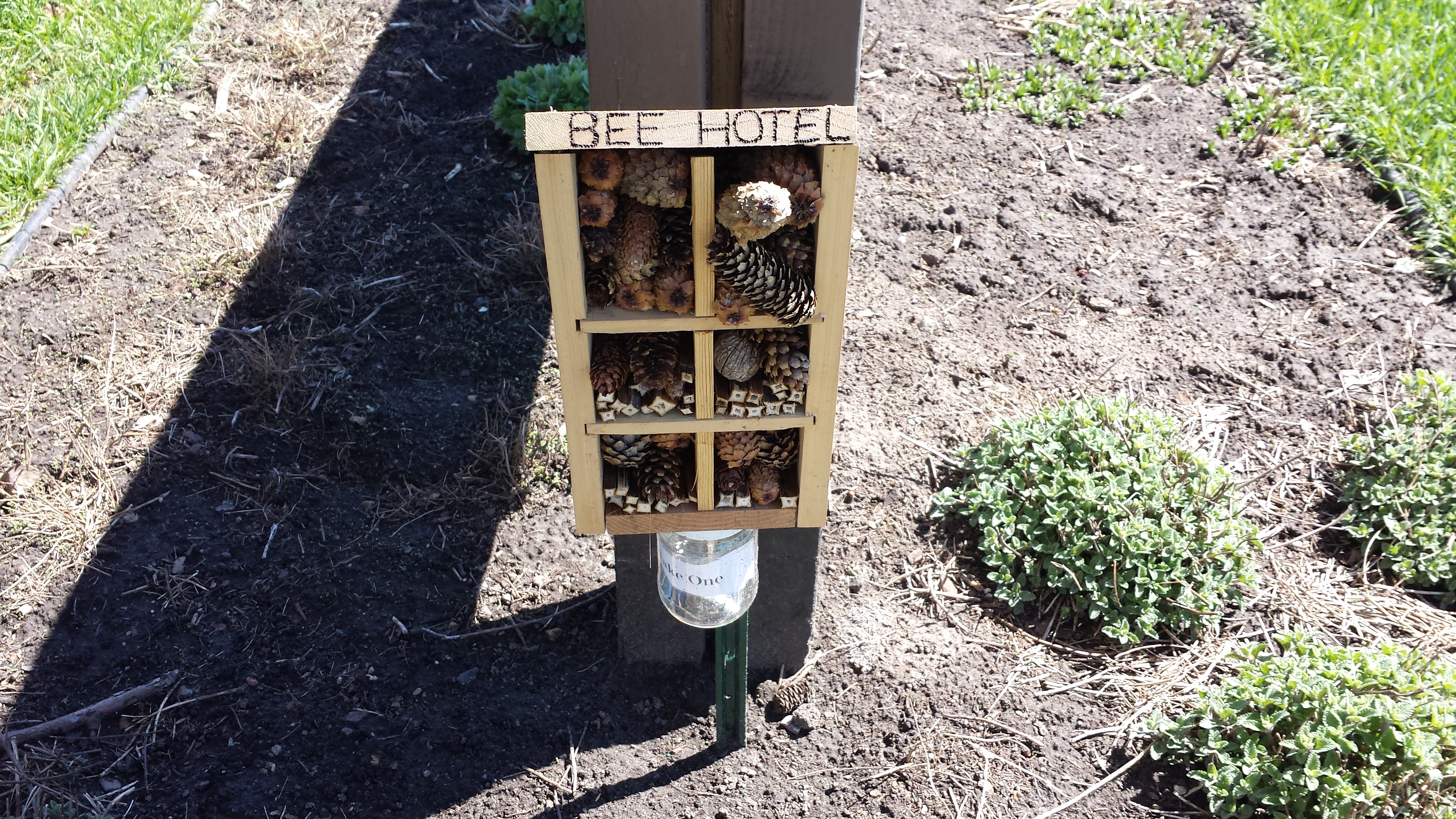
Bee Hotel, Lake Nokomis Park

Path in Lake Nokomis Park
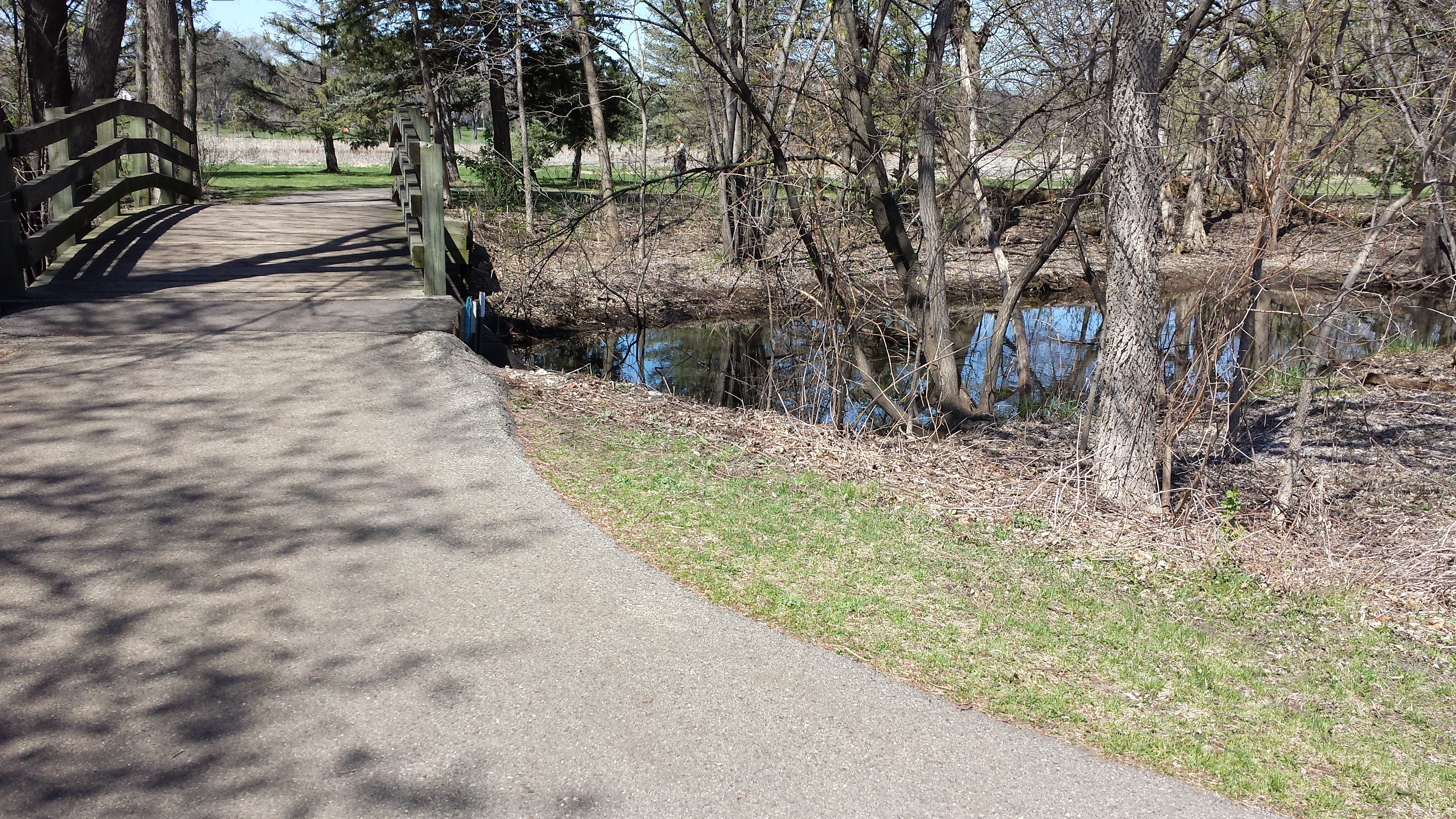
Bridge in Lake Nokomis Park
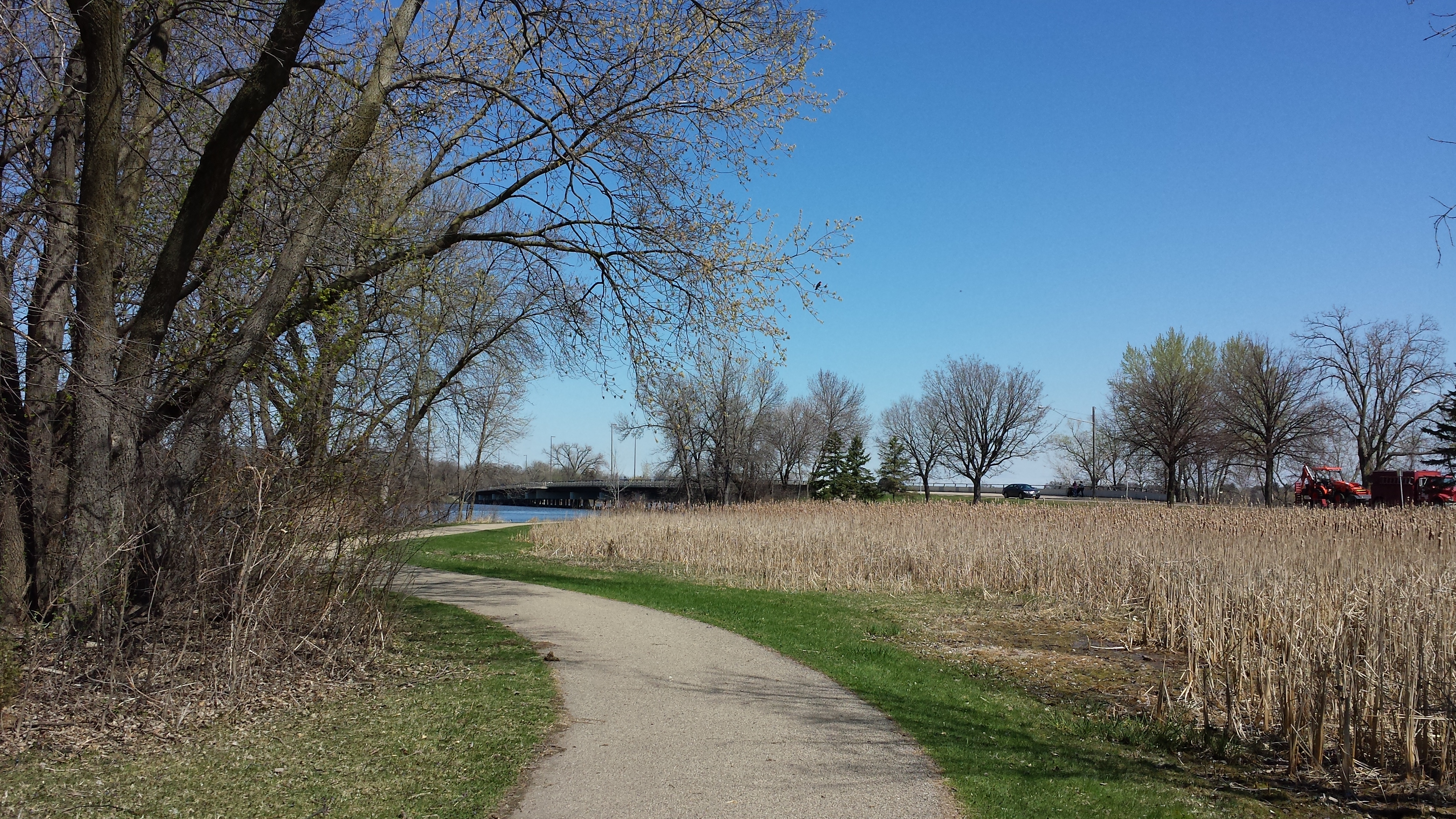
Path Toward Cedar Avenue in Lake Nokomis Park
Returning to Fat Lorenzo’s and heading south past it on Cedar Avenue, the remaining buildings span a rather remarkable range of ages and functions. First comes a building that began life as a 1928 filling station, was expanded in 1948, and continued to serve in auto service roles. Then comes a substantial house in Dutch Colonial style, apparently dating to 1901 (Richfield days) with alterations in 1936 and a rear addition in 1956, followed immediately by a much smaller house from 1948.
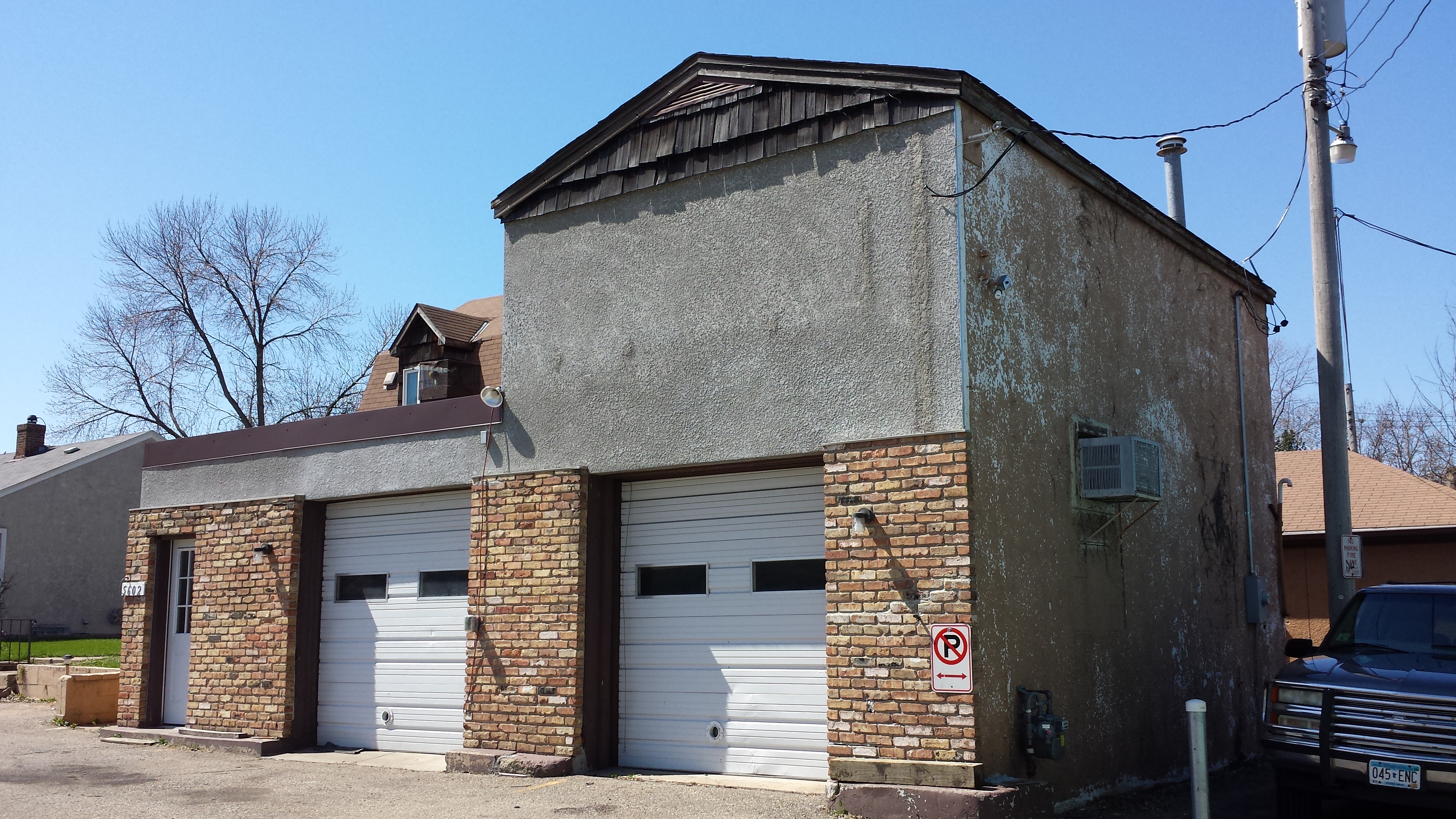
5602 Cedar Ave. (1928 and 1948)
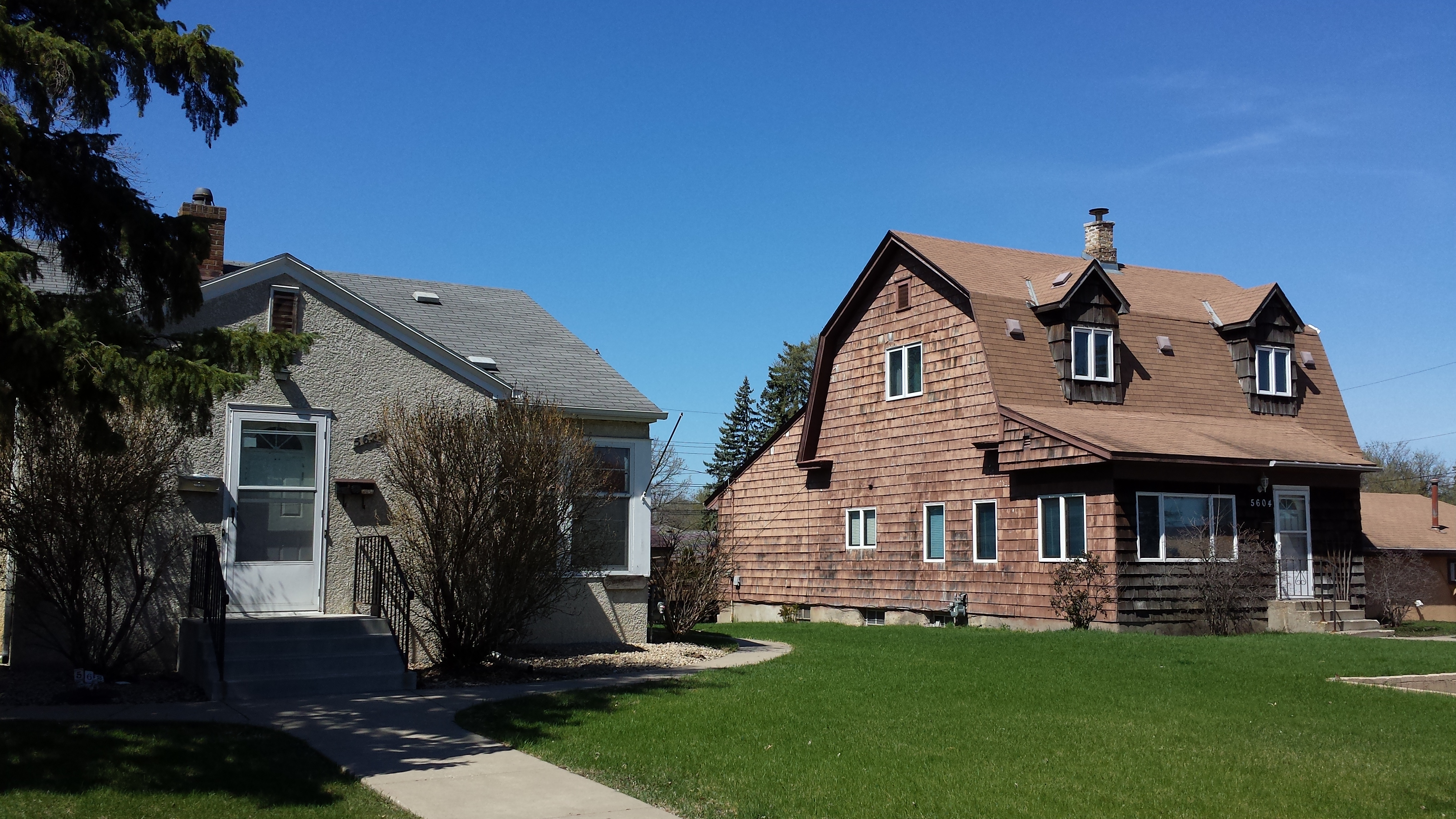
5624 and 5604 Cedar Ave. (1948 and 1901)
Skipping ahead, a 1958 two-story institutional building houses Hope Preschool and Childcare, while its neighbor to the south is a charming stone-faced house from 1942.
Hope Preschool and Childcare, 5712 Cedar Ave. (1958)
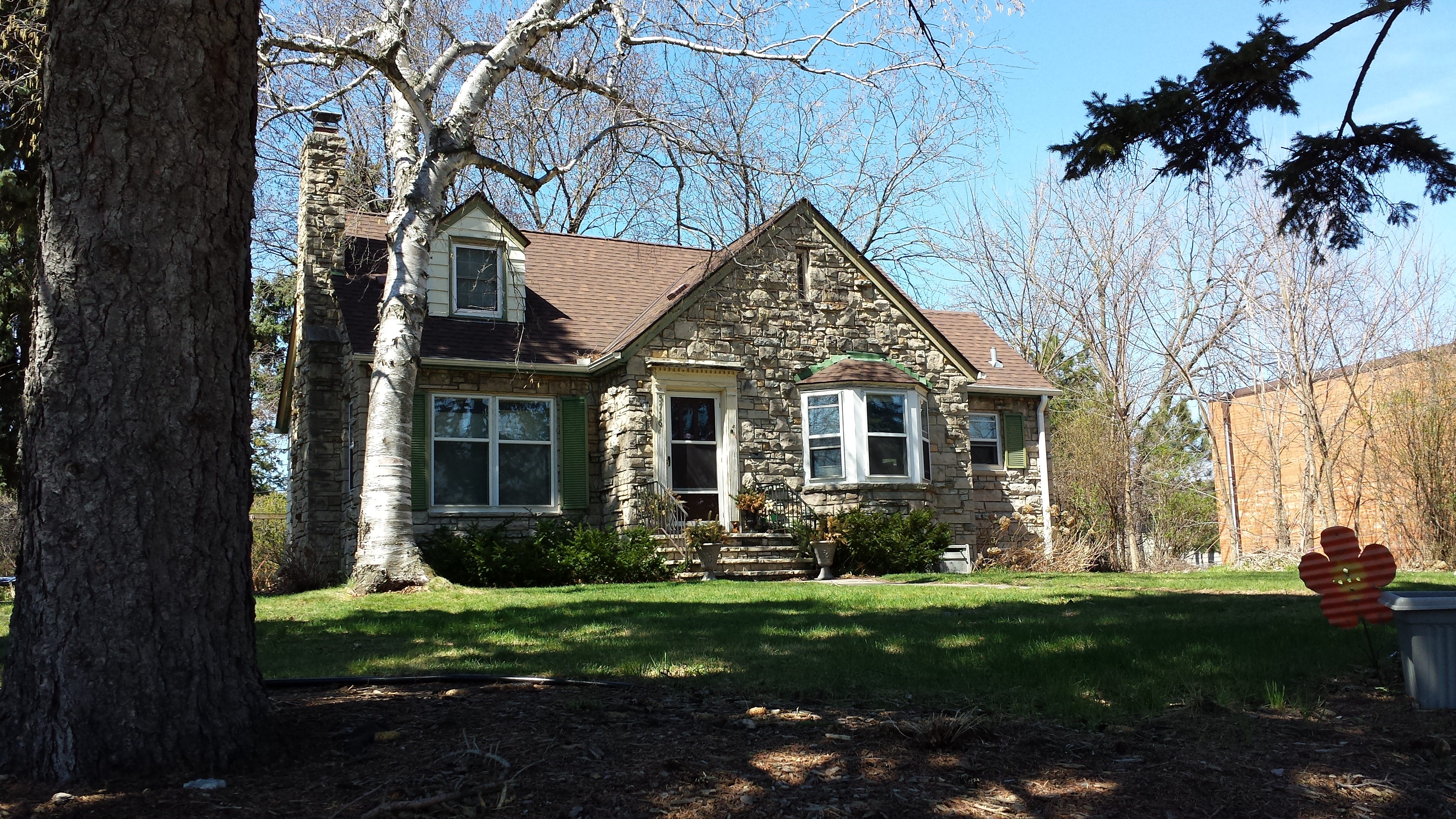
5716 Cedar Ave. (1942)
There’s more to this block, and indeed I’ll show more of it later, but it was 12:30 and I was eager to get across 58th Street to my lunch stop, The 5–8 Club, which forms a small protrusion of Minneapolis into what is otherwise airport property. The sign announces two key facts: that they date their founding to a 1928 speakeasy and that they consider themselves to be “home of the Juicy Lucy” (at an unspecified date in the 1950s).
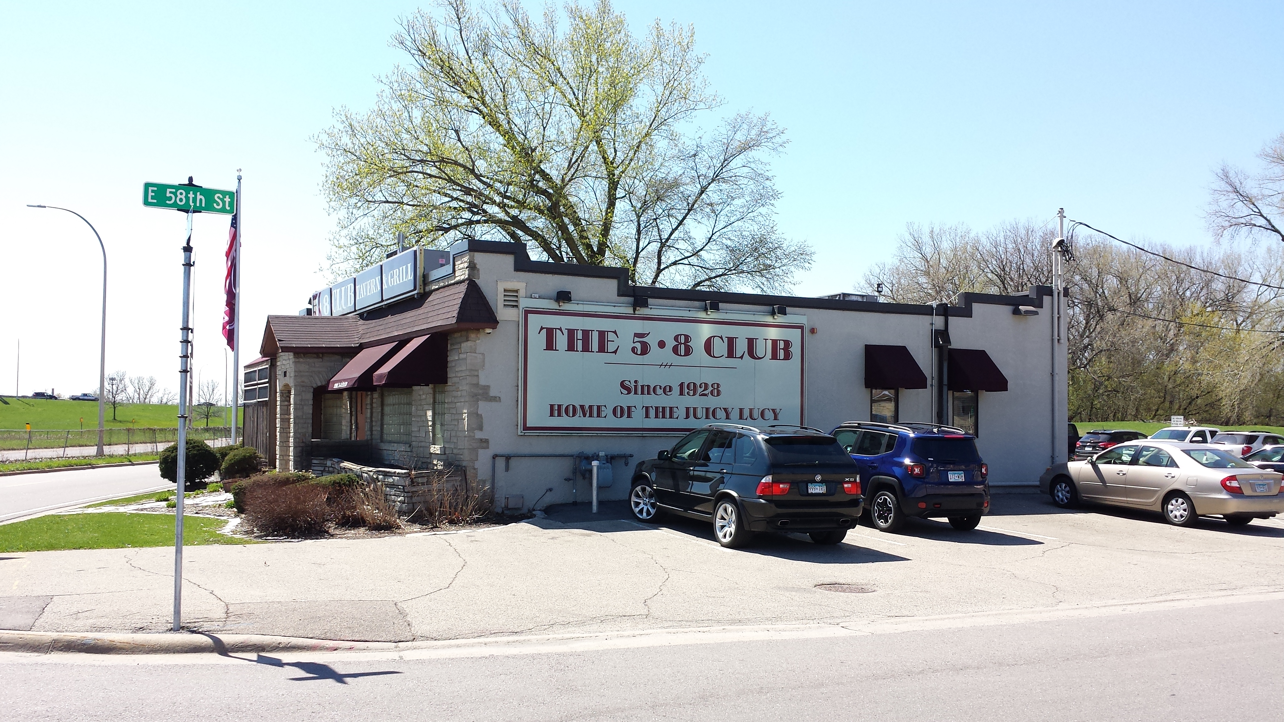
The 5–8 Club, 5800 Cedar Ave.
The contentiousness of the Juicy Lucy claim is rather well known. More to my interest, the 1928 date is also hard to document. The current structure only dates to 1934, after the end of prohibition, and there was nothing in the city directory until 1935, not even a residence or some cover business like a store. On the other hand, the size of the 1934 construction is smaller than the size of what’s there now, so that would be consistent with its having been an extension to some earlier, undocumented structure. Intriguingly, the foundation was laid in August of 1933, when ratification of the 21st amendment reached its midway point, but it was then left with just a cellar and roof, deferring the framing until spring of 1934, after the December completion of ratification. In any case, by 1935, Serene Wagner was operating a tavern there.
All of which contemplation of history was still in the future for me. I was more concerned with the food and drink. The drink part was comparatively non-stressful; the tap list was modest in size by contemporary standards, consisting of familiar brands of wide appeal: Finnegans, Summit EPA, Newcastle, Alaskan Amber, Leinie’s Honeyweiss, Mich. Golden Light, Miller Light, Loon Juice Cider, Shocktop, Surly Furious, and Surly Hell.
As to the food, I tried to navigate a fine line between adhering to tradition and accommodating my own preferences. I recognized that I couldn’t very well go to a “home of the Juicy Lucy” without ordering one. On the other hand, it didn’t have to be a total 1950s throwback.
The 5–8 club has started offering cheeses other than the American processed kind. Some might reject this, not only on grounds of tradition, but also because the whole point of processed cheese is that it melts more thoroughly, creating the tantalizing risk of a sudden, mouth-burning gush if you aren’t careful how you bite. Personally, I don’t feel any need to demonstrate that particular skill, so I opted for the AmaBlu blue cheese from Faribault, which adds a nice tangy flavor.
The burger comes with a small cup of coleslaw and your choice of fries or carrot sticks. That is to say, I was able to get the carrot sticks at no extra charge — other options exist but cost more. I consider the carrot sticks to be an excellent choice and am rather baffled why so few restaurants offer them. After all, carrots are easy and cheap, so why not? And while they may not be traditional for a 1950s burger joint, they still do harken to that era: crinkle-cut carrot sticks would be right at home on a relish tray.
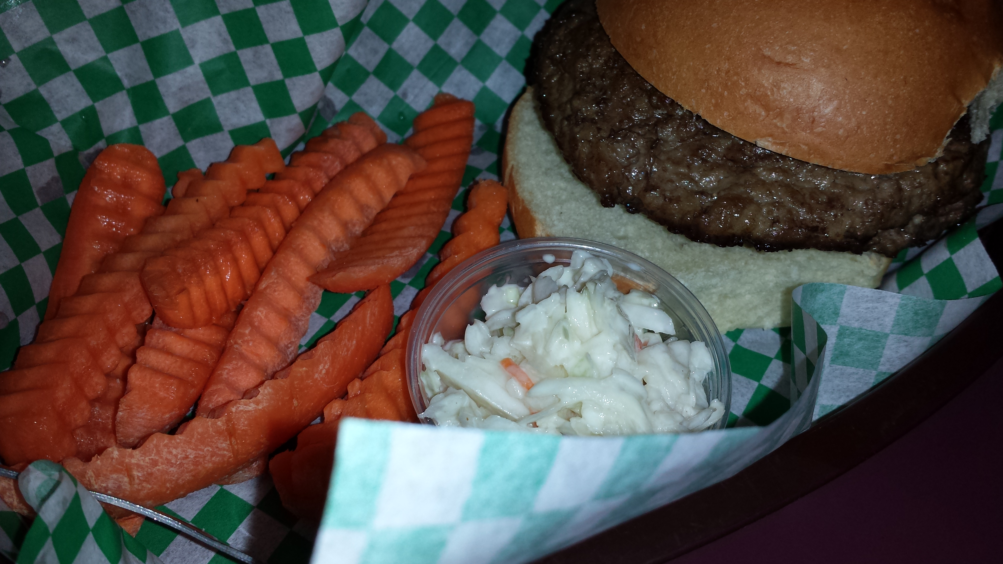
Juicy Lucy with Carrot Sticks and Coleslaw
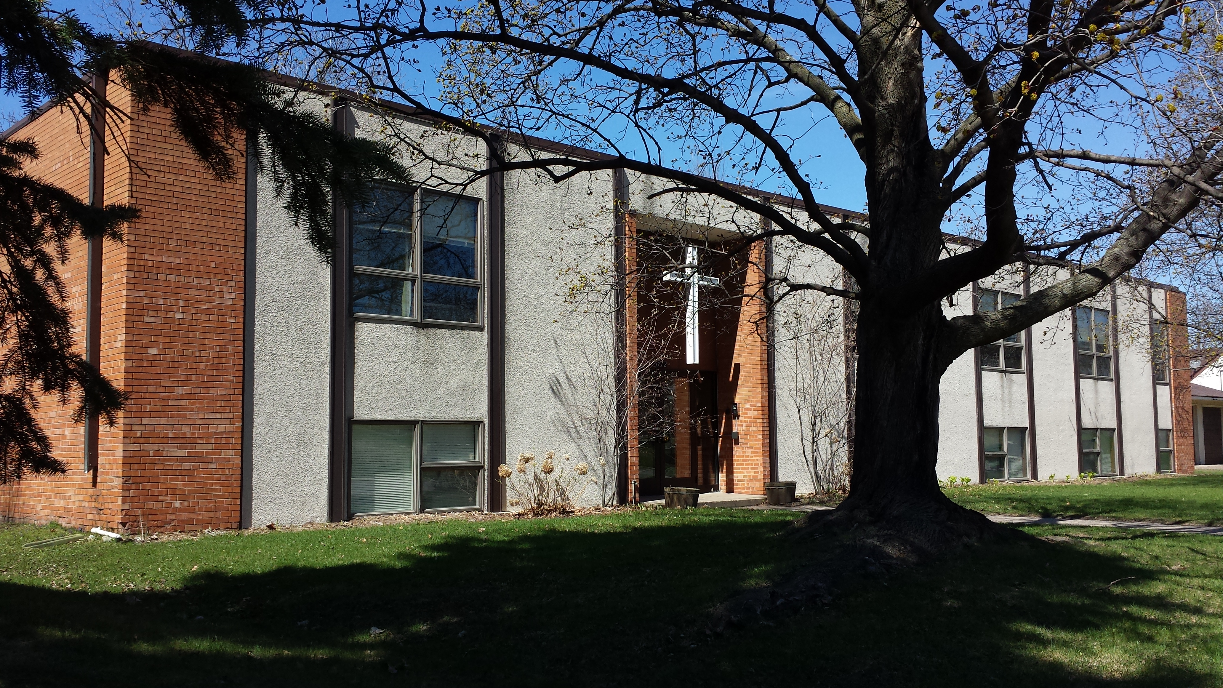
Upon leaving the 5–8 club, I was able to fill in the most important photo I was missing from the 5700 block, which was directly on the other side of 58th Street: Hope Lutheran Church. I’m sure there is some explanation for why the church is in a building 11 years more recent than the one its preschool occupies, as well as why the are not adjacent, but rather are separated by a couple intervening residences.
In any case, the 1969 church building is a modernist showpiece. It proclaims: the God worshipped here is not dead, embalmed in the age when artisans fit individual panes of stained glass together with lead frames and piled stone blocks on one another. No, He lives in the present age, in the bright light pouring in through big, clear windows and in the sharp geometric forms of cast concrete. Or at least, that’s what I imagine it saying. Not that I’m a Lutheran or anything.
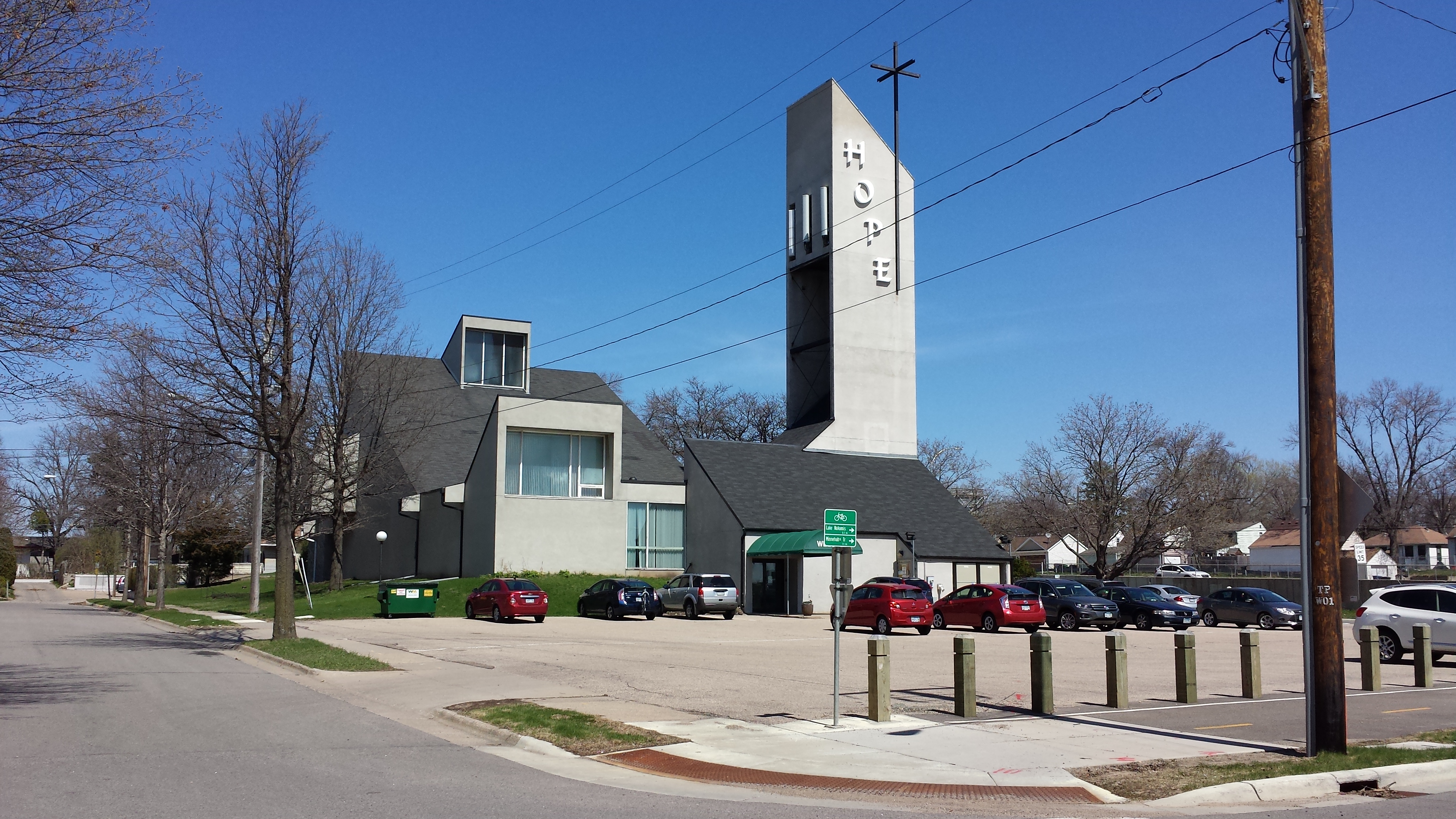
Hope Lutheran Church, 5728 Cedar Ave. (1969)
After those florid reflections on the church building, I mellowed out with a stroll generally westward and northward, back toward my starting point, looking once again at the overall texture of the residential area. This scene, for example is the view eastward on Nokomis Court from 16th Avenue.
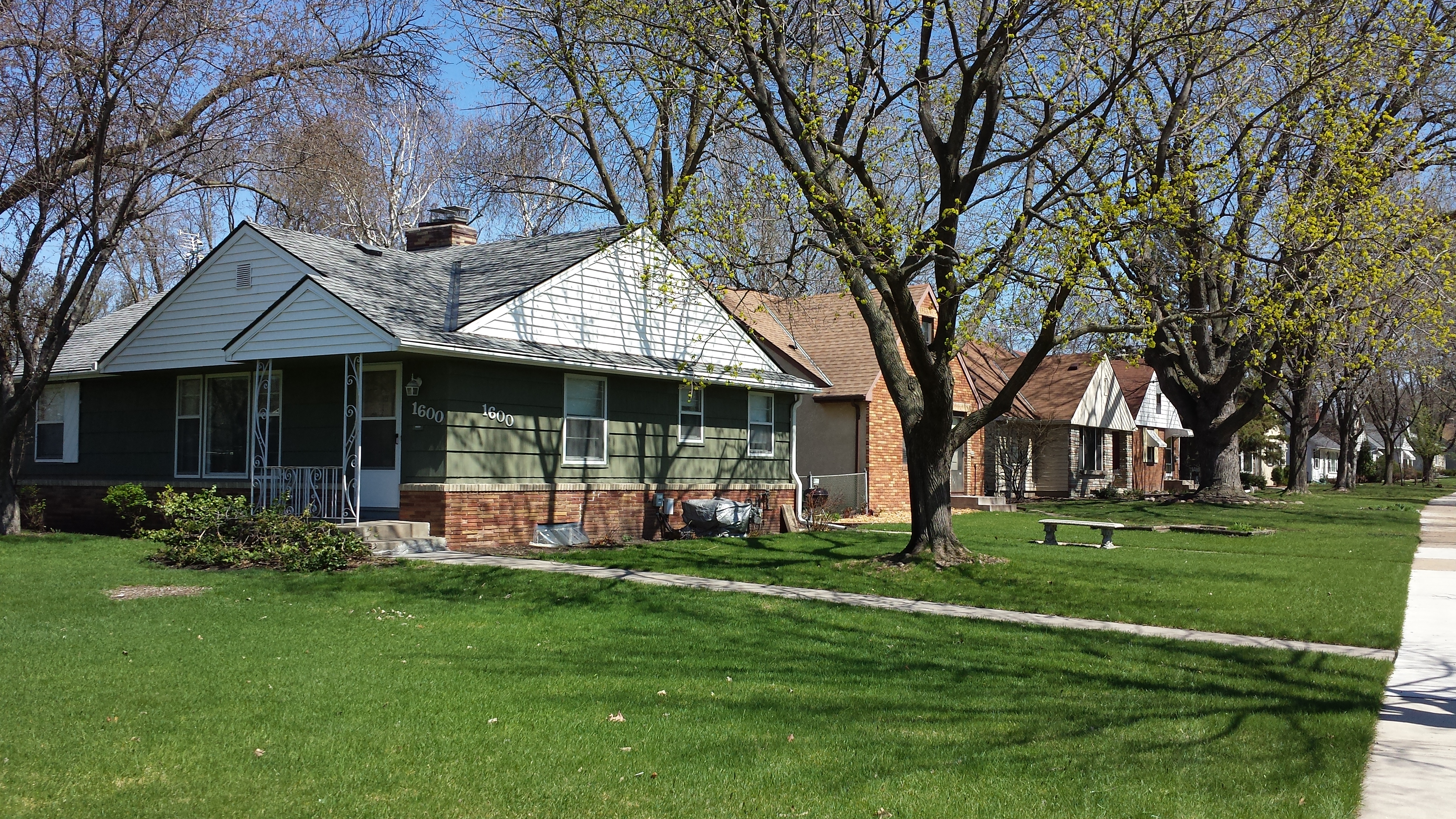
North Side of 1600 Block of Nokomis Ct., Looking East from 16th Ave. S.
I also took more of a look at Solomon Park than had previously been possible. Although the park is managed by the Minneapolis park board, most of it is airport property outside the city limits. For example, the wetland east of 16th Avenue and the hillside in the area between 16th and Bloomington Avenues both are outside the city. On the hillside, I saw a whole collection of white plastic tubes sticking up. This was sufficiently puzzling to me that I went up the hill for a closer look, at which point I saw a seedling sticking out of the nearest tube. Presumably the other tubes have seedlings inside them as well, which they are protecting.
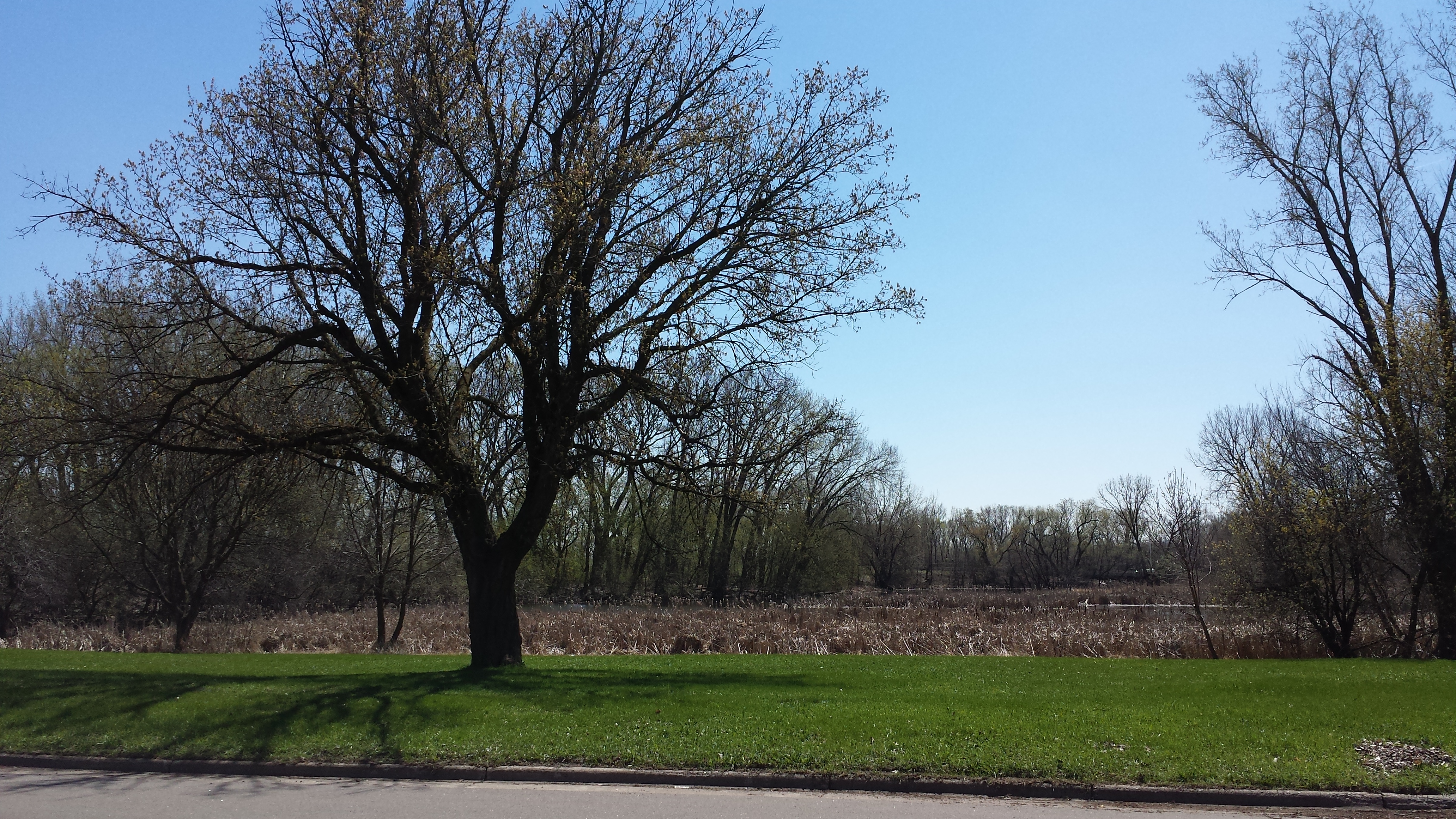
Solomon Park Wetland East of 16th Av.
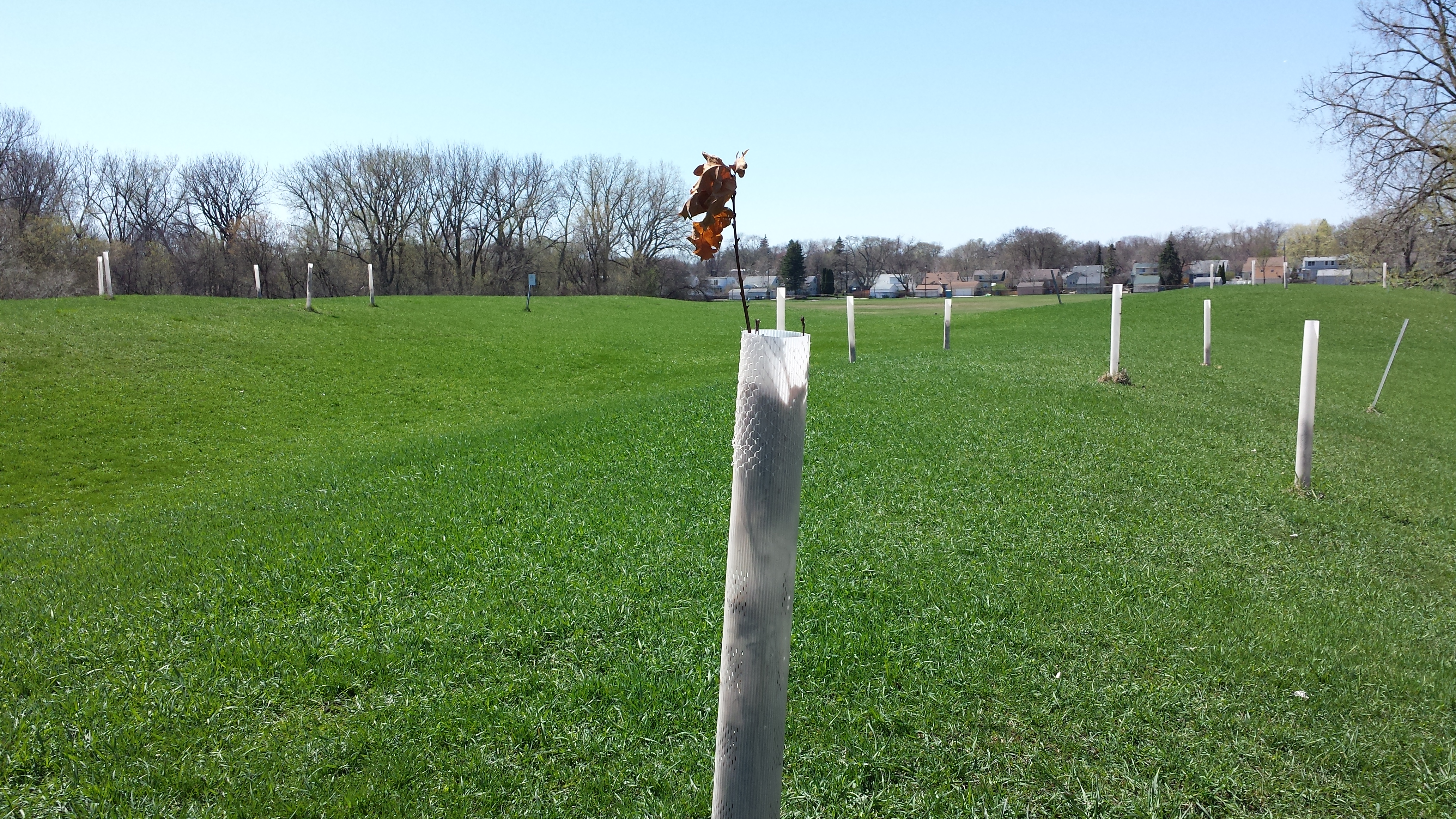
Hillside in Solomon Park with Seedlings
Back down in the residential area, I continued my serpentine course back to the start. In particular, I used Bloomington Avenue to return northward from 58th Street to 56th. As I was nearing the end of this segment, I had to stop for one last photo. If you are a returning reader, you’ll recall that on my first day in Diamond Lake, I vowed that I would no longer take photos of every little library, instead sticking to those that are “out of the ordinary in some way.” I wonder if the owner of this house read that phrase and took it as a personal challenge. Either that, or they just wanted to fabricate a metal library in the shape of a rocket ship. Either way, intentionally or otherwise, it made my cut.
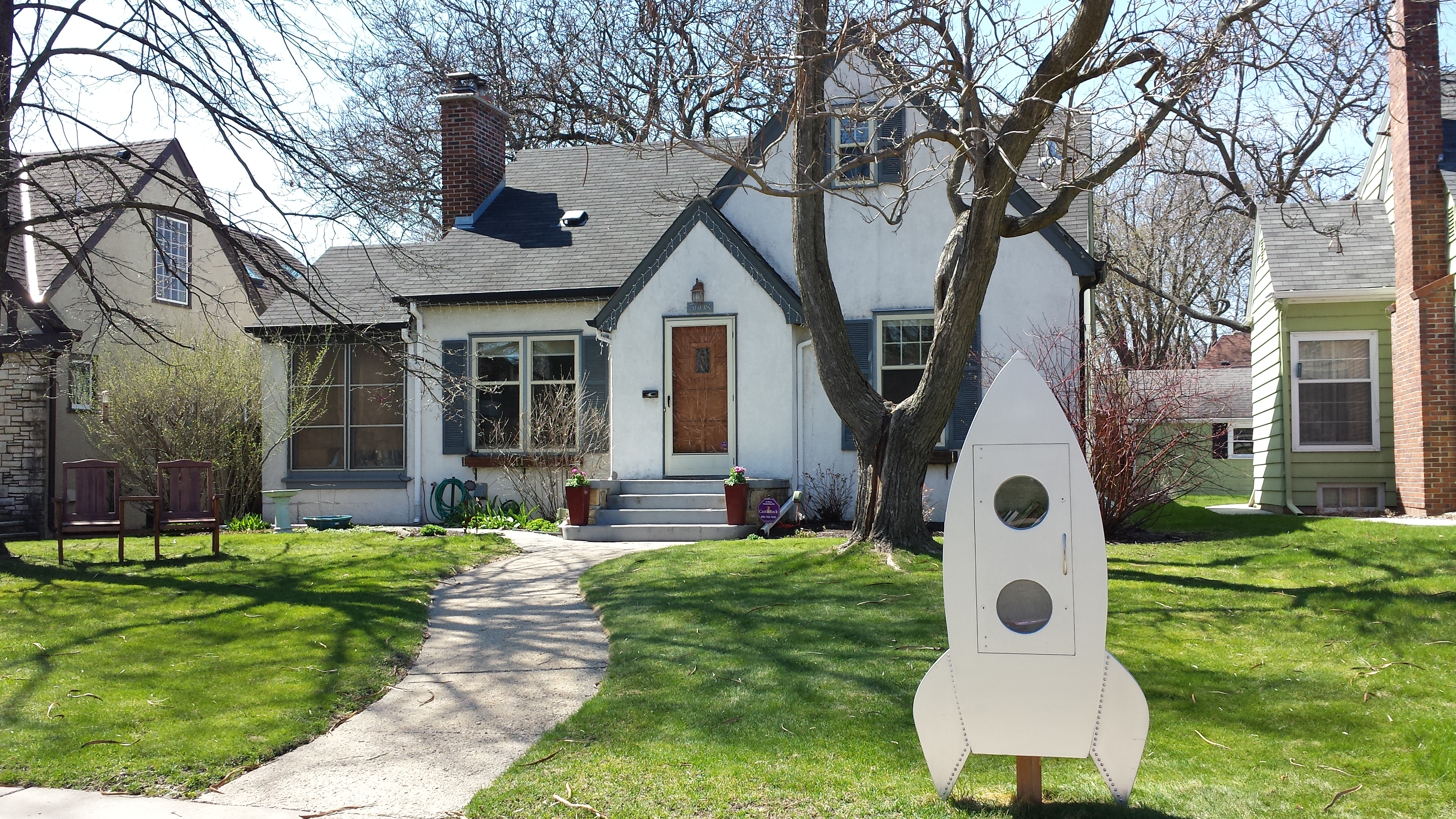
Little Library, 5608 Bloomington Ave.