Logic and nomenclature are uneasy bedfellows, but for the East Isles neighborhood they get along passably well. The neighborhood generally lies to the east of the Lake of the Isles, extending as far west as Hennepin Avenue. True, that doesn’t explain why the northern boundary is 22nd Street rather than Franklin Avenue. Nor, more consequentially, does it explain why the neighborhood extends south to Lake Street, encompassing the northwestern corner of the Hennepin-Lake (Uptown) commercial node. Still, East Isles is the neighborhood to the east of the Isles, and aside from the commercial buildings on Lake Street and Hennepin avenue, it really is a very lake-influenced residential neighborhood. As one moves away from those commercial border streets and toward the lake, one sees a decrease in the number of residential units per lot and an increase in the number of square feet per unit.
In order to use the number 6 bus, I started and ended my walk on Hennepin Avenue at the points marked A and B below, taking a rather indirect route between them. The main path (shown in blue) was 6.6 miles in length, and the various spurs off of that route (shown in red) contributed in aggregate 1.4 miles forward and another 1.4 back again, for a total of 9.4 miles. That’s one of my longer walks, but thankfully the neighborhood has lots of places to stop for refreshment.
Heading initially north on Hennepin, the intersection with 28th Street provides a contrast in sizes, ages, and styles of buildings. On the south side, the seven-story Kenwood Isles condominium dates from the mid 1980s, when it replaced West High School. (In front of it, the single-story Allina Isles Clinic, which is of the same age, is rendered nearly invisible by its shroud of ivy.) Meanwhile on the north side, the single-story 1927 retail building makes up for its smaller stature with greater ornamentation.

Kenwood Isles Condominium and Allina Isles Clinic

Retail Building, Northwest Corner of Hennepin Ave. and 28th St. W. (1927)
A block and a half north of there, my eyes were drawn almost simultaneously to a small detail down and to my right (on the street) and a broad roofline up and to my left. That’s truly one of the joys of this project, learning to pay attention in all directions and at all scales.
On the street, amid the cigarette butts next to the curb, was a horseshoe. Maybe it fell off a truck hauling demolition debris from a nearby cowboy-themed bar being remodeled. Or maybe a horse trotting down Hennepin Avenue lost one of its shoes for want of a nail. I’ll never know.

Horseshoe, 2600 Block of Hennepin Ave.
On the other side of the sidewalk, I spotted one of the more interesting apartment buildings. Many of the buildings from the first half of the 20th century have “revival” detailing of one sort or another, whether to evoke a Spanish mission or a Tudor manor. However, in the teens and especially the 1920s, this often went only veneer-deep. Not uncommonly, I see two or more identical-sized rectangular boxes side by side, with identically-arranged windows suggesting that the floor plans are the same, but with somewhat different combinations of red-tile rooflets, wrought-iron railings, and whatnot stuck onto the facade. By comparison, the 1910 La Casa stands out because its styling extends to the overall shape of the building, rather than just its surface details.

La Casa, 2616–2620 Hennepin Ave. (1910)
Before turning west on 26th Street, I temporarily continued north on Hennepin as far as 25 1/2 Street. Beyond its contribution to completeness, this spur provided an opportunity for my first refreshment stop, visiting a Dunn Brothers outlet. Although I had my usual iced decaf americano, this particular location offers more than the usual coffee-shop choices. They serve wine and beer, small-plate food items, and on Sundays (such as when I visited) also brunch choices including Belgian waffles.
Just after 26th Street crosses Irving Avenue, it crosses Euclid Place, a short diagonal interpolation into the normal street grid that exists as part of that grid’s accommodation to the contour of the lake. These three streets bound a 0.3-acre park named in honor of Joanne R. Levin, a neighborhood activist who in the 1970s spearheaded the addition of a totlot playground. (The park was renamed from Euclid Triangle in 1988, following Levin’s death at age 43.) A 2012 refresh to the playground equipment includes some interestingly undulating structures.

Joanne R. Levin Triangle Park, Looking Northwest from 26th St. W. and Irving Ave. S.
I initially followed 26th Street all the way to its T intersection with Lake of the Isles Parkway. That allowed me to see some of the large houses on the parkway, such as the Tudor-style one shown below. However, even quite close to the lake, the neighborhood does have more modest houses as well. For example, almost directly across 26th Street, a 1949 single-story, stone-veneer rambler of about 2000 square feet looks like it would be equally at home in any mid-century subdivision.

2601 Lake of the Isles Parkway, Seen from 26th St. W. (1931)

Lake of the Isles Parkway at 26th St. W.
Retreating a block from the parkway on 26th Street, I turned northeast on Lake Place, a street that like Euclid Place parallels the lakeshore until it angles into Irving Avenue. This took me past the Purcell-Cutts House, a landmark of prairie-school architecture that is administered by the Minneapolis Institute of Arts. From prior experience, I can heartily recommend the public tours of this house.

Purcell-Cutts House, 2328 Lake Place (1913)
After walking the portion of Irving Avenue between 24th and 22nd Streets (which are consecutive, aside from the angled intersection with Lake Place), I turned back toward the lake on 22nd Street. The house on the corner has an entryway framed by graceful tile inlay, the simple geometric shapes of the individual tiles and their seemingly casual arrangement belying the artistry of the composition.

1601 22nd St. W.
The same spur that lead me past this house also included a portion of the lakeshore between 22nd and 25th Streets. Thanks to walking this section twice (south and then north), I was able to use both the pedestrian path along the lake and the sidewalk between the parkway and houses. The park area along the path gave me the opportunity to become acquainted with the Minneapolis Good Chair Project, based on the simple premise that seats are more useful if they can be moved, for example into shade or to face someone else. On the sidewalk, I was able to appreciate the flowers planted in front of the houses.

Minneapolis Good Chair Project, East Shore of Lake of the Isles

Flowers, 2400 Block, Lake of the Isles Pkwy.
After seeing this portion of the lakeshore and returning to 22nd Street, which I initially explored as far as Girard Avenue, I turned south on Humboldt Avenue, which I was to follow all the way to Lake Street. Thanks to Hennepin Avenue’s angled course, once south of 25 1/2 Street, Humboldt Avenue becomes just one block from Hennepin. At this point the single-family houses give way to apartment buildings, such as the E-shaped Claridge and a couple blocks later the Illyricun. (Like a number of the others, these two have meanwhile been converted to condominiums.)

Claridge Condos (Originally Apartments), 2517–2531 Humboldt Ave. S. (1922)

Illyricun Condos (Originally Apartments), 2719 Humboldt Ave. S. (1913)
Beyond their architectural detailing, I was interested in these buildings’ names. Indeed, throughout my walk, I made something of an inventory of apartment building names. Some, like La Casa and the Granada (which I show later) are named for their exotic styling. Others, like the Claridge and the Chesterfield evoke the high-class hotels of London’s Mayfair. The name Illyricun is a bit of a mystery to me; I suspect it is a variant of Illyricum, the Roman name for Illyria. It seems to appeal to a similar spirit as Venetia and Francia, a pair of near-identical buildings. The Belvedere is probably named for the palace in Vienna, though it has other associations as well. And then there are some more domestic, prosaic, or personal names: the Vermont, Humboldt Terrace, Isles, Inter-Lake, Marlys, Nessa.
By the good fortune of doing my walk on a Sunday morning, I passed by Grace-Trinity Community Church at time when its doors to Humboldt Avenue were open. (Somewhat later in the walk, after I finished Humboldt Avenue and Kenwood Isles Drive, I’ve also got a photograph from the 28th Street side of the church.) The hyphenated name of the church refers to its unusual bi-denominational roots in Grace Presbyterian Church and Trinity Baptist Church.

Grace-Trinity Community Church, 1430 28th St. W. (Viewed from Humboldt Ave. S.), 1928
After 28th Street, as I neared Lake Street I crossed in close succession the Midtown Greenway, the Mall, and Lagoon Avenue. In the space between the Mall and Lagoon Avenue, two apartment buildings line the east side of Humboldt Avenue, and in the gap between them, the neighborhood association has constructed the East Isles Demonstration Rain Garden.

East Isles Demonstration Rain Garden, 2800 Block, Humboldt Ave. S.
The apartment building to the south of the garden, on the corner with Lagoon Avenue, is another bit of Spanish fantasy, the Granada. Oddly, this particular name had two applications within the space of a few blocks and a few years. Just south of Lake Street on Hennepin Avenue, in the East Calhoun neighborhood, the Granada Theater was built in 1927, just two years before these Granada Apartments. (The theater changed names to Suburban World in 1954, whereas the apartments retain the name to the present.) This photograph is taken looking north across the Lunds & Byerlys parking lot and Lagoon Avenue.

Granada Apartments, 1456 Lagoon Ave. (1929)
Returning to 28th Street, I didn’t need to retrace Humboldt Avenue the whole way. Instead, just north of the Midtown Greenway, I diverted onto Kenwood Isles Drive, a small road serving the Kenwood Isles Citihomes. This group of townhouses shares the former West High School campus with the high-rise condominium building I had seen at the start of my walk; they were built at the same time, following the school’s demolition. By walking through the townhouse development, I saw the common yard and garden area that sits behind them, backing up against the Hennepin Avenue YWCA.

Kenwood Isles Citihomes Common Area
Coming out onto 28th Street, between Humboldt and Hennepin Avenues, I was facing the side of Grace-Trinity Church. In particular, I could see a well-used sandbox between the sidewalk and the building. Understandably enough, many churches fence their play areas in so that kids don’t run into traffic. Grace-Trinity appears to have prioritized being open and inviting; I saw neighborhood kids using the sandbox on their way home from the adjoining Isles Bun & Coffee shop, without having entered the church building.

Sandbox, Grace-Trinity Community Church, 1430 28th St. W.
The aforementioned Isles Bun & Coffee Company is one of the tenants in the 1927 retail building at the corner of 28th Street and Hennepin Avenue, which I photographed at the start of my walk. The side of that building that faces toward the church has a ghost sign for Chas. Wilkins Plumbing & Heating, as well as signs for the current occupants. If you look back at the photograph of the building’s facade, it makes quite a contrast with this backside. That’s another recurrent theme I’ve noticed not only in this walk, but across all the neighborhoods predating the middle of the 20th century. Someone could do a really interesting coffee table book pairing fronts and backs of buildings.

West Side of Building at Hennepin Ave. & 28th St. W.
After 28th Street, I walked some more of Lake of the Isles Parkway as well as taking a spur along Euclid Place, which brought me back past the Levin Triangle Park. Ultimately I turned east from the parkway onto 25th Street, which I followed all the way to Hennepin Avenue. Two sights of note along 25th street were a particularly colorful rock wall and an unusually recent (2014) house.

Rock Wall, 25th St. Side of 2500 Humboldt Ave. S.

2449 Girard Ave. S., Viewed from 25th St W. (2014)
North of 25th Street on Hennepin, Kowalski’s Market is currently expanding, while to the south, Osman Cleaners occupies a distinctive wedge-shaped building on the corner with multi-colored, streamlined metal fascia. Arif Osman has owned this property since 1988, but I would bet that the fascia dates from the shop’s construction in 1956 as an addition to the 1908 frame dwelling seen in the right rear of the photo. (The fact that they are one connected property is not immediately apparent.) The dwelling was at that same time converted to a duplex; it now houses a barber shop.

Osman Cleaners, 2500 Hennepin Ave. (1956 Addition to Earlier Dwelling)
Turning from Hennepin Avenue back westward on 25 1/2 Street, I got to see the side view of the building where I had earlier patronized Dunn Brothers. Typical of many 1920s buildings on commercial streets, it is a mixed-use development with the ground-floor shop on Hennepin topped by apartments that extend all the way back along 25 1/2 Street. However, something is different about this building, something that was manifest by the garage doors and single story story extension in the back, which have a decidedly commercial appearance. Judging by the building records, it looks like the ground floor of this building was originally home to a bakery, which presumably had production areas in the back behind a storefront on Hennepin.

1325–1327 25 1/2 St. W. (Side of 2528 Hennepin Ave.)
Looking down the alleyway behind this building (down in the literal, vertical sense as well) reveals yet another garage door. It also shows the backside of the building to the south, which is a bit older (1917 versus 1926). I didn’t include a photo of the front, but anyone who has been down Hennepin Avenue has seen it. Unlike the Dunn Brothers building, which retains its historical character, the 1917 building has been given a modern facade that you would never associate with this back. It is the strip-mall that contains Soho Cafe, India Palace, and some other shops.
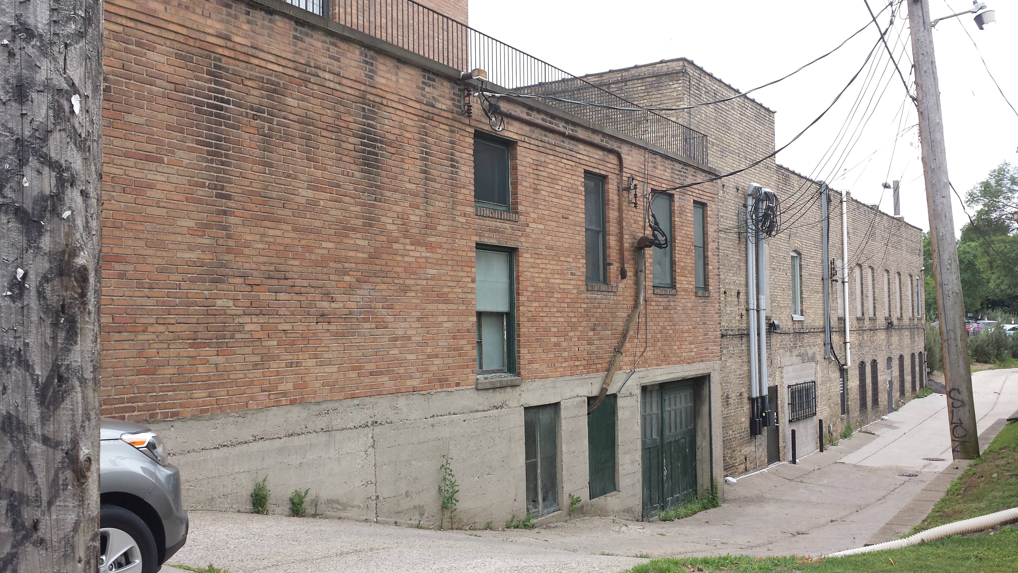
Rear of 2528–2546 Hennepin Ave. (1926, 1917)
After 25 1/2 Street, I went north on Girard Avenue, then took 22nd Street as far east as Emerson Avenue before retreating to Fremont Avenue, which I took south (and at the end west-southwest) back to Hennepin Avenue. While still on 22nd Street, I got my first view of The Bridge for Youth, an important organization serving runaway and homeless youths, as well as families in crisis, which occupies a house on the west side of Emerson as well as a larger (and more recently extended) building on the east side.
Fremont Avenue took me behind Temple Israel, which allowed me to see the 2016 addition described by the Star Tribune’s Claude Peck. It includes the one-story Rabbi Marcia A. Zimmeran Beit Kehillah (house of community) facing Fremont Avenue with a screened-in playground, as well as a two-story portion named for Max Shapiro on 24th Street and a reception area facing the parking lot to the north. As one sign of the care taken with this project, it’s clear that the playground fence is designed to foster the children’s joy rather than merely their safety.

Rabbi Marcia A. Zimmerman Beit Kehillah at Temple Israel, 2323 Fremont Ave. S. (2016)
At the northern corner of Fremont and Hennepin Avenues, the boxy US Bank branch has art deco details typical of its 1934 construction, including pilasters carved in relief on the Kasota-stone veneer.

US Bank Branch, 2420 Hennepin Ave.(1934)
At the northern end of of that block, the intersection of Hennepin Avenue with 24th Street is interesting because the angle of Hennepin makes it nearly intersect with Emerson Avenue at the same point. Instead of all three converging on a common intersection, Emerson intersects with 24th just to the west of Hennepin. What fascinated me is the impact of this on the building just south of this intersection, which houses a Spyhouse Coffee shop. Rather than the front of that building being aligned parallel to Hennepin, it is aligned parallel to Emerson, notwithstanding that Emerson doesn’t actually run in front of it. In the photo below, you can see that Spyhouse’s front is in the same plane with the front of Temple Israel (to its right), and Temple Israel is on Emerson. Based on a 1914 map, it appears that the three streets did originally come together in a common intersection, which included the now-landscaped area in front of the now-Spyhouse building.

Spyhouse Coffee Front Garden, 2404 Hennepin Ave.
To the north of 24th Street, the area between Emerson and Hennepin Avenues is Smith Triangle Park, notable since 1967 as the home of the Thomas Lowry memorial, which had up until that point resided in Virginia Triangle. (Virginia Triangle had been a park where Hennepin and Lyndale Avenues converge at Groveland. It was lost in the construction of Interstate 94.)

Thomas Lowry Memory (Karl Bitter, 1915), Smith Triangle Park
The triangle also provides a good vantage point for the formal (but now generally unused) main entryway of the neo-classical Temple Israel. The five bays between its columns correspond in number to the five books of the Torah, and the inscription above them reads “My house shall be a house of prayer for all peoples.” (Isaiah 56:7) This original building was designed by the architectural firm Liebenberg and Kaplan and built in 1927, or alternatively in 5687. (The cornerstone lists the dates in both calendars, fittingly for an institution “building new bridges between contemporary Judaism and its tradition-filled past.”)

Temple Israel, 2324 Emerson Ave. S.
Before leaving Smith Triangle, I took note of one other quirky detail. The Lowry memorial has two ornate lamp posts in front but also two more in back. Does anyone but me stand in the small area behind the memorial’s wall, admiring the vines curling up the posts and the cluster of lions at their bases? My best guess is that these made more sense when the memorial was in its original location and were simply moved along with it in 1967.

Rear of Thomas Lowry Memorial, Smith Triangle Park
In the single block of Hennepin between Smith Triangle and 22nd Street, I passed a Caribou Coffee and a Starbucks, as well as Tao Natural Foods and Organic Cafe. Those are distinct from the Starbucks advertised as “coming soon” to Kowalski’s and the Caribou already in Lunds & Byerlys. Together with Dunn Brothers, Spyhouse Coffee, Isles Bun & Coffee, plus the Holiday Station Store and Bruegger’s Bagels, they seem to have the East Isles neighborhood well caffeinated.
I wrapped around this triangular block using 22nd Street and Emerson Avenue and then walked 24th Street from Smith Triangle to Irving Avenue. In the final block of 24th Street, between Humboldt and Irving Avenues, I photographed some boulevard flowers clustered around a florally painted utility box. The vinyl-wrap technology has made decorated utility boxes so ubiquitous that I don’t generally photograph them, but I appreciated this one both for its more hands-on technique and for its integration with its surroundings.

1500 Block of 24th St. W.
Irving Avenue took me all the way south to Lake Street, where lunch was awaiting me at Barbette. Along the way, I again stopped for some pretty flowers. Once I got to Barbette, I ordered the Seasonal Vegetable Hash, which turned out to be quite interesting. Rather than being fried with potatoes, the vegetables were cooked only until crunchy and showed char marks from a grill. They were served hot in a bowl above a small puddle of very tasty smoked vegetable broth, topped with a poached egg and a slice of toast.

2600 Block of Irving Ave. S.

Seasonal Vegetable Hash at Barbette
Across Irving Avenue from Barbette, at the corner of Irving and Lake Street, the Citadel Building has recently been renovated and is being leased to commercial tenants. The name dates from the building’s former life with the Salvation Army, as does the seal at the apex of its Lake-street facade, which includes the motto “Blood and Fire.”

Citadel Building, 1516 Lake St W. (1925)
Further east on Lake Street, Greta McLain’s 2015 mural “Sing a Song of Uptown” brings life to the alley side of the Rainbow Building, which stands on the corner of Lake Street and Hennepin Avenue. (I had previously seen McLain’s work as lead artist for the Central Identity Project when I walked the western part of the Central neighborhood.)

Sing a Song of Uptown (Greta McLain, 2015)
Around the corner on Hennepin, the most notable building is the Uptown Theater. Although its roots date back to 1916, and it has been renovated as recently as 2012, the principal features of the exterior appearance (and some of the interior) date from a 1939 rebuilding after a fire. The architects at that point, Liebenberg and Kaplan, chose to use the streamline moderne style, with a sense of horizontal motion captured not only in the grooves in the facade but also in the streaming hair of the two dancing women. (And yes, this is the same Liebenberg and Kaplan that a decade before had designed the neo-classical Temple Israel. The contrast is rather striking.)

Uptown Theater, 2906 Hennepin Ave. (Rebuilt 1939, Renovated 2012)
In addition to the theater itself, the building includes two shops, Goorin Bros. Hat Shop and John Fluevog Shoes. The shoe store’s entry, on the corner of Hennepin and Lagoon Avenues, is prominently framed by a pillar decorated by the Knitteapolis Yarnbomber. Across Lagoon Avenue, the recently rebuilt Walker Library is esthetically pleasing as well as functional. On a Sunday, I wasn’t able to go inside, but I’ve done so on other occasions and so can recommend it. Be sure to look up to see the translucent banners in the clerestory windows, which spell out “WALKER LIBRARY” in colorful geometric shapes.

John Fluevog Shoes Entryway, 2900 Hennepin Ave. (Knitteapolis Yarnbomber, 2017)

Walker Library, 2880 Hennepin Ave. (2014)
The driveway behind the library has an interesting sign consisting of separate large hollow metal letters spelling out “LIBRARY.” Although the sign’s current location is quite low-visibility, there’s a reason why such a bold sign was commissioned in the first place. It was installed in 1995 at the previous Walker Library, which had been built underground, in the same location, in 1981. The bold signage helped make the underground library more visible.

Driveway Behind Walker Library with Sign from Previous Building
The Mall took me to the neighborhood’s western edge at Knox Avenue, after which I walked the remaining segment of Lake of the Isles Parkway and used James Avenue and the remaining blocks of Lake Street and Knox Avenue to wrap around to Lagoon Avenue. Lagoon Avenue allowed me to finish off the neighborhood from west to east, all the way from Knox Avenue to Hennepin Avenue.
All of that was pleasant enough and included a number of interesting details, but I’ll spare you most of it. Instead, I’ll just offer two views of apartment buildings of differing age. The first, on the northeast corner of James Avenue and Lake Street, is a stylish modern mixed-use building. The second is a cluster of buildings from nearly a century earlier (1915 versus 2014). Beyond their representativeness of the early-20th-century housing boom (which corresponded to a boom in Minneapolis’s population), I find this cluster interesting for its addresses, as shown on the sign facing Lagoon Avenue. The buildings are 2870–2883 Holmes Avenue. Yet there is no Holmes Avenue north of Lake Street. Apparently the courtyard between the buildings is a vestige of a now-vacated stretch of Holmes. (The same 1914 map I previously cited shows Holmes Avenue running north all the way to the Mall, just before the apartments were built.)

1620 Lake St. W., Seen from James Ave. S. (2014)

2870–2883 Holmes Ave. S. (1915)
Editor’s Note: Max Hailperin is walking each of Minneapolis’ 87 neighborhoods, in alphabetical order. He chronicles his adventures at allofminneapolis.com, where the original version of this article was published July 30, 2017. We’re sharing them here at streets.mn.