
The Jordan neighborhood in Minneapolis’s Near North community forms a herniated right triangle thanks to the role of West Broadway Avenue as its southwestern border. In the route map, the light blue tint indicates the full extent of the neighborhood. My first day’s walk was restricted to the western tip of the triangle. The darker blue lines indicate the main loop, with the red lines indicating forward-and-back spurs off of it.
The starting and ending point of the main loop is the intersection of Washburn and Lowry Avenues North, effectively the northwestern vertex of the neighborhood. (West Broadway itself passes over Lowry rather than intersecting it at ground level.) This is the location of Parkway United Church of Christ, the first of several churches I passed on this Sunday-morning walk. The main portion and boxy two-story education wing both date from 1953.
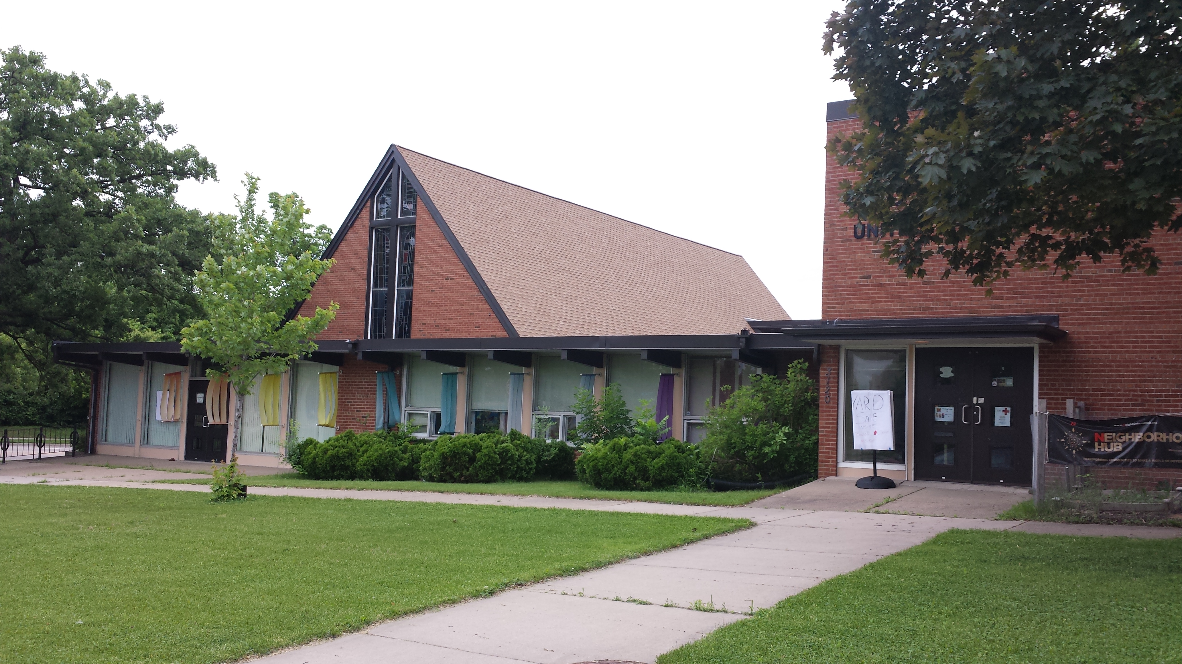
Parkway United Church of Christ, 3120 Washburn Ave. N.
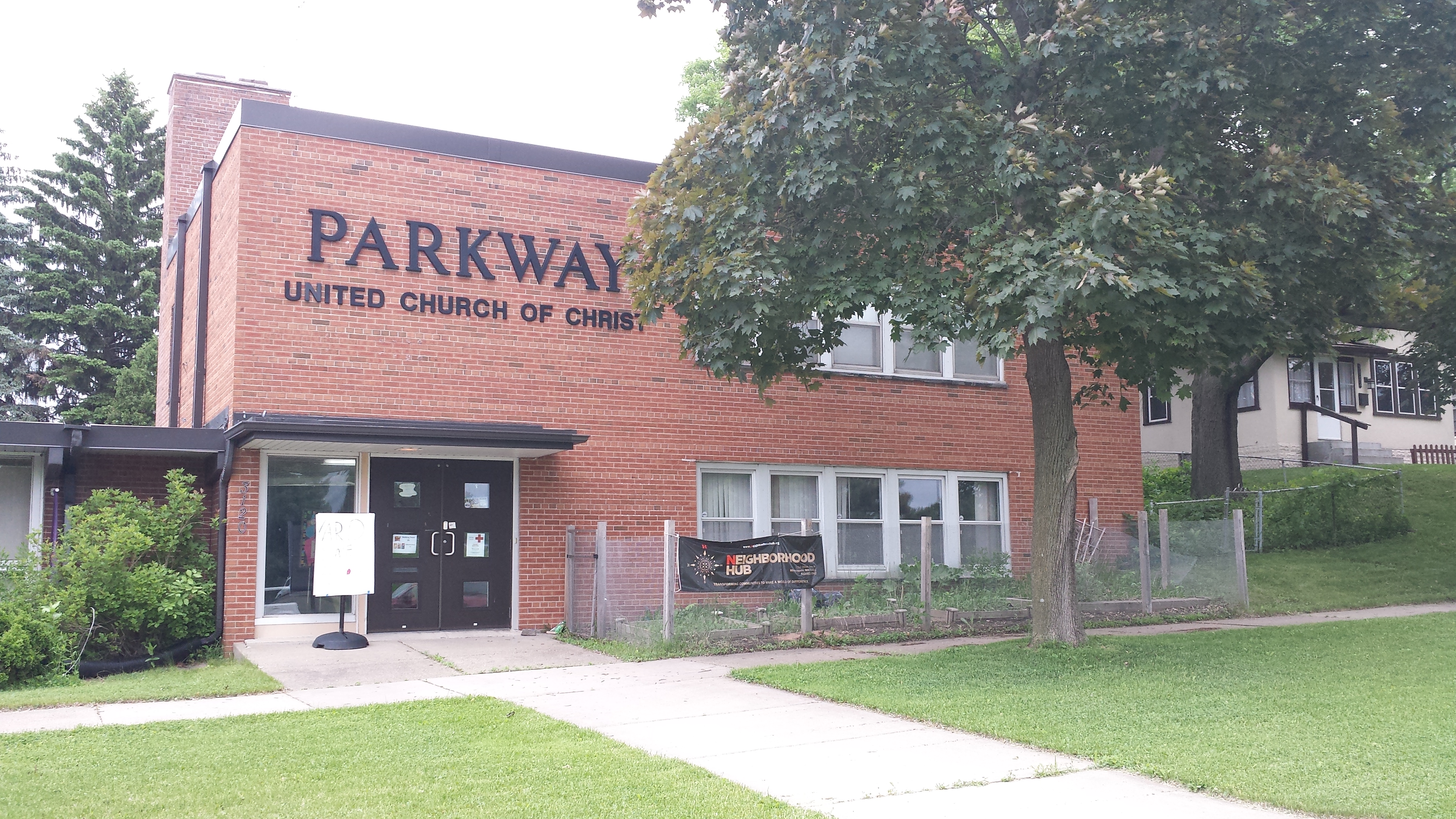
Parkway United Church of Christ, 3120 Washburn Ave. N.
Certainly I didn’t need the prominent signage to recognize that Parkway UCC is a church, but matters aren’t always so simple. One of my hobbies is recognizing buildings’ functions from their architecture, which often diverts me into trying to guess what a repurposed building’s original purpose was. A case in point came up shortly after I left Parkway UCC.
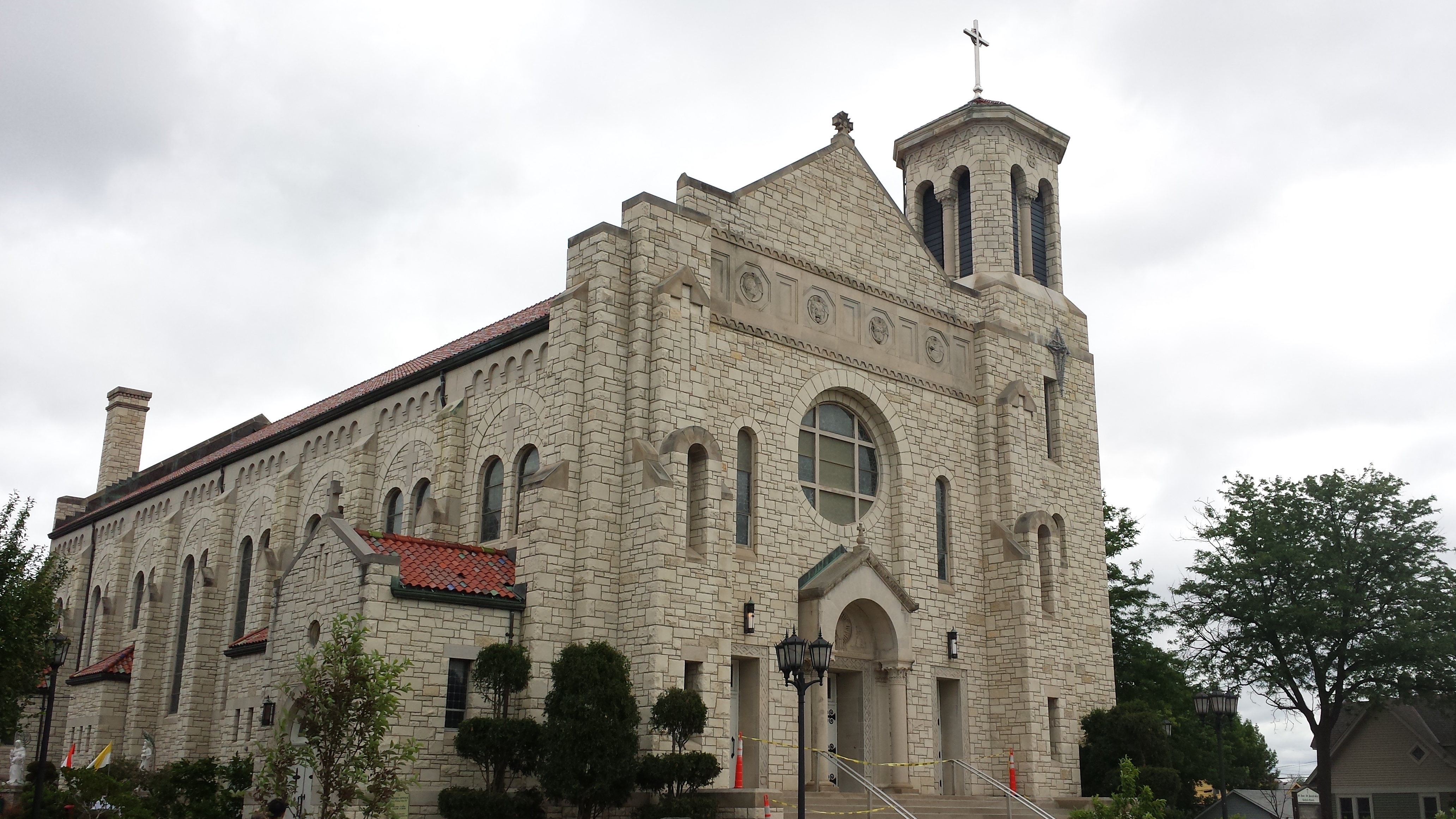
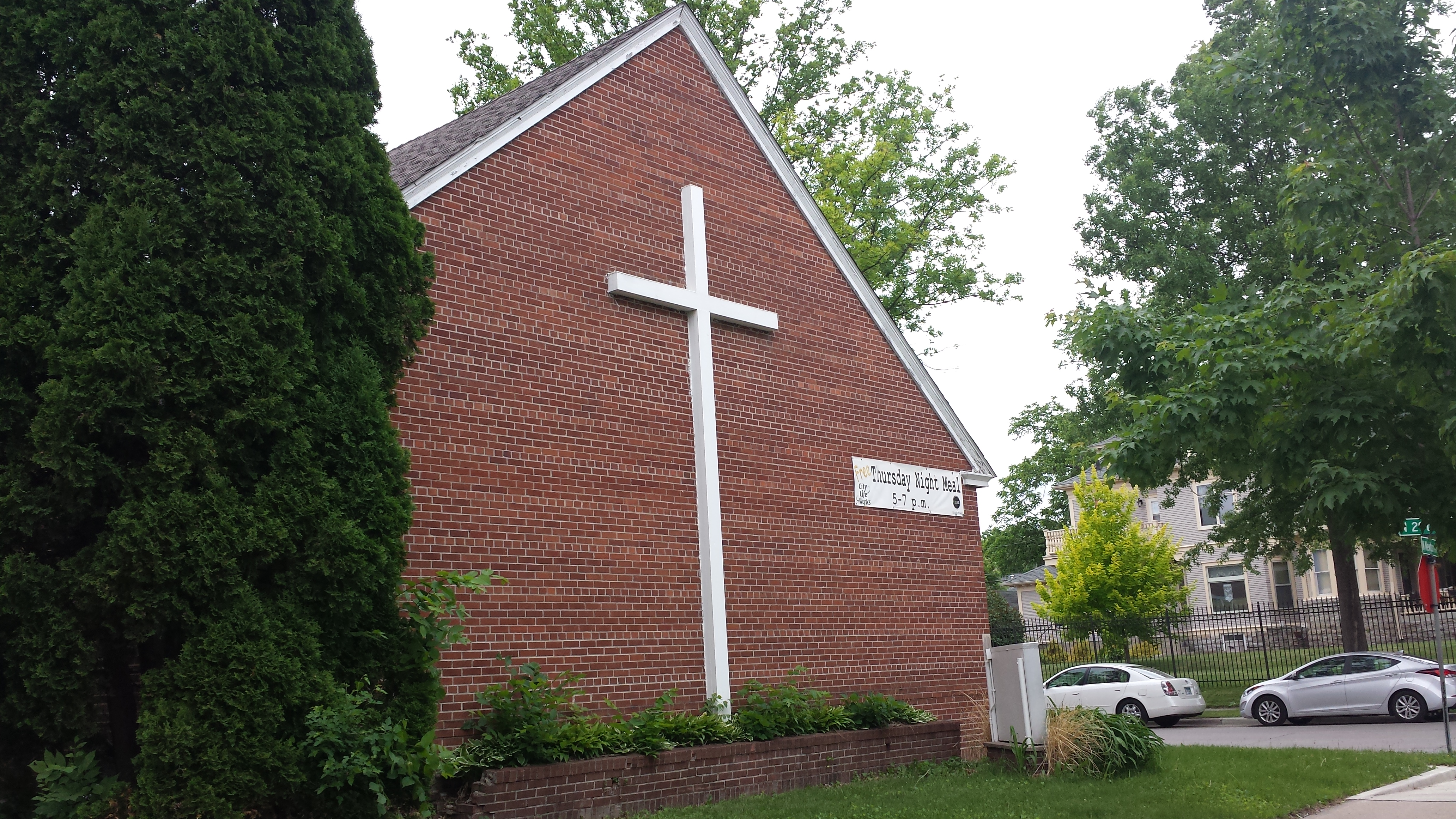
Heading south on Vincent Avenue, as I approached 30th Avenue North I passed in back of a building. The address is 3000 West Broadway, but the front of the building is actually on Washburn Avenue North. In any case, I couldn’t yet see that front. Judging by the side elevation, the style is a 1960s revival of colonial-era neoclassicism. When I eventually saw the main facade later in the walk, I confirmed that impression and was able to see the sign identifying the current occupant as a church. A church in a neoclassical building is not surprising, but in this case, there’s more to the story. Even from the front, I might have been able to guess the building’s original purpose. (You can scroll ahead to the end if you want to test yourself.) But the big clue was here in the back.
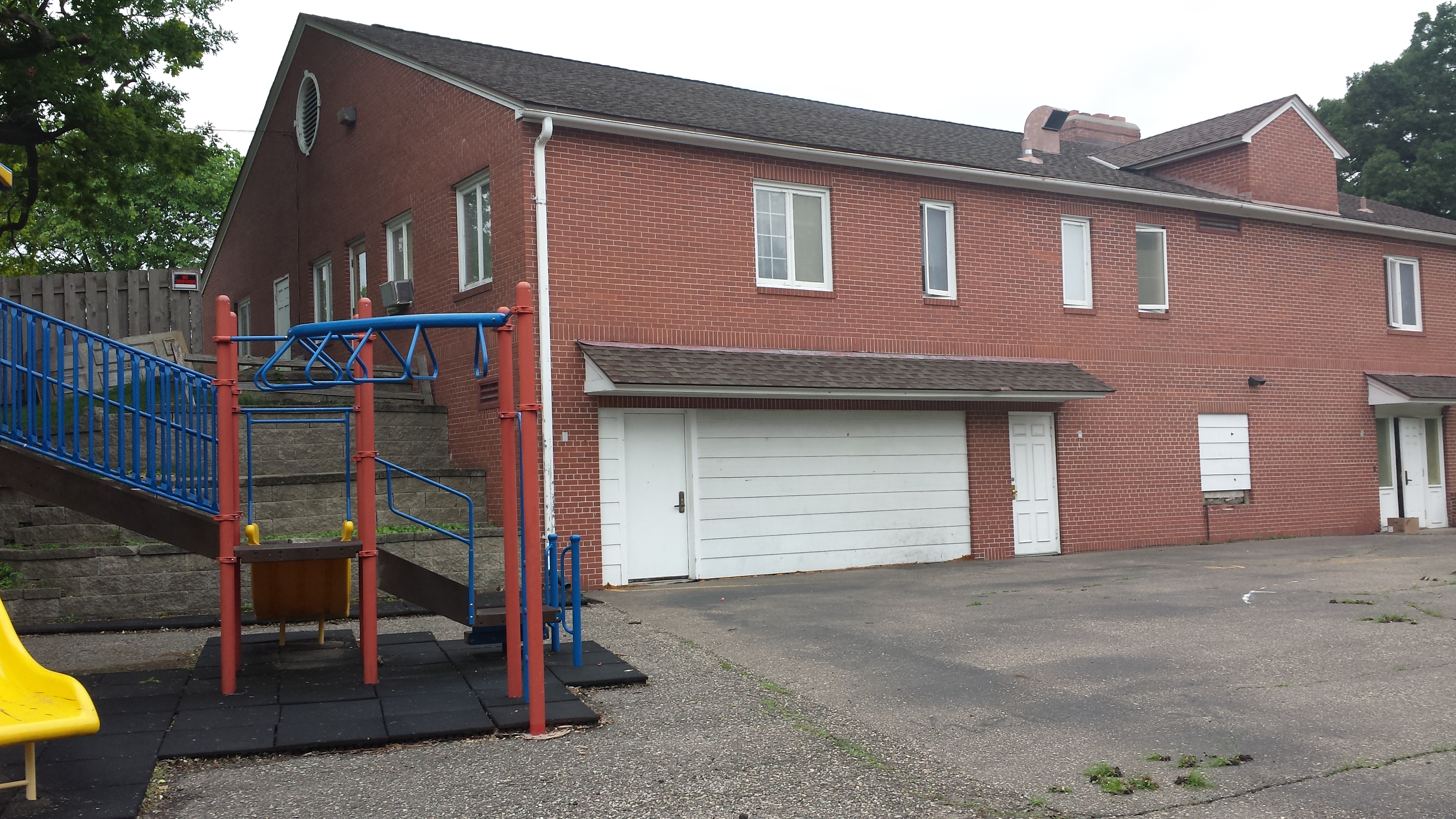
Good News Minneapolis Church, 3000 West Broadway Ave. (Rear View from Vincent Ave. N.)
Clearly there had once been a garage, which was now closed off with white siding aside from the inset human-sized door. Putting that garage together with the building’s overall form and style, I was pretty sure the building permit index would show a mortuary. And sure enough it did, once I figured out the original address was 2818 West Broadway. (The number 2818 pretends West Broadway runs east–west, whereas 3000 pretends it runs north–south. Really it takes a diagonal course in this area.)
South of 30th Avenue, a small triangular area is formed where Vincent Avenue meets the diagonally oriented Washburn. (Once again, the street number is on West Broadway rather than Washburn.) A classic 1926 storefront building has a couple less common features. In particular, although I’ve seen round medallions on some residential buildings of this period, I don’t normally see them on storefront buildings—lozenges are more typical.
2808 West Broadway Ave.
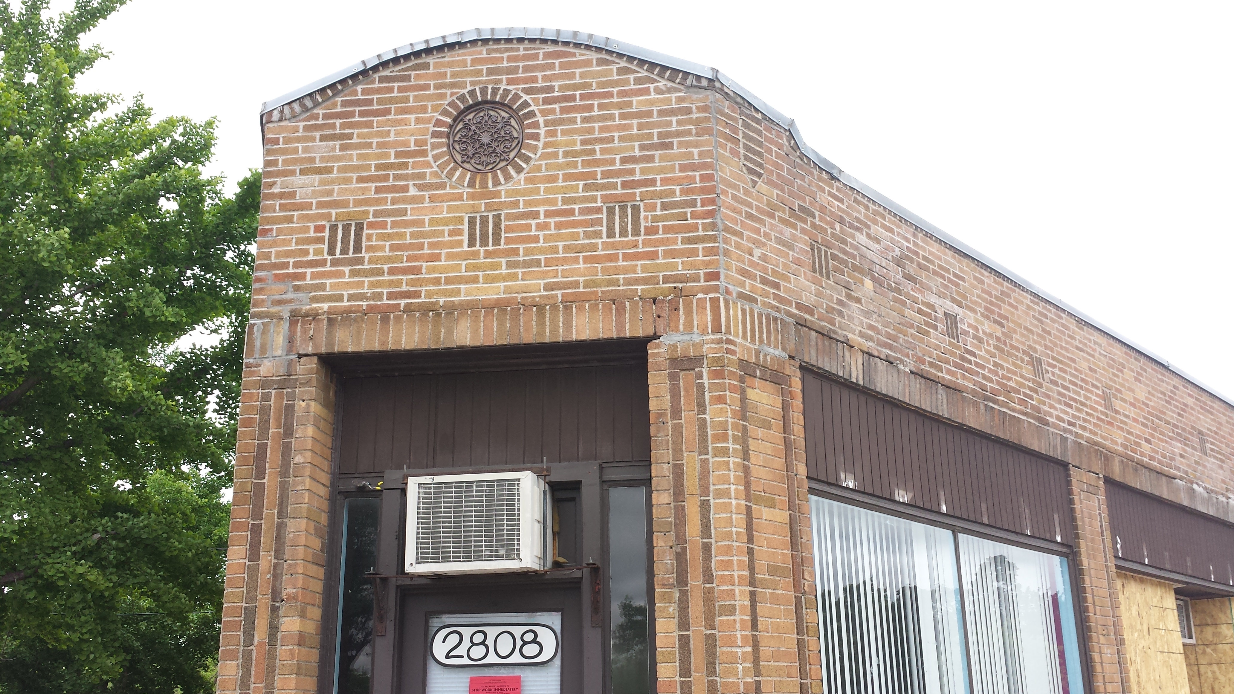
2808 West Broadway Ave.
Turning back southward on Washburn and West Broadway, I encountered another interesting building on the southeast corner with 29th Avenue North. The current occupant is the Lao Cultural Center operated by LAOA, or LAO America, a nonprofit organization with a clever recursive acronym: LAO stands for Lao Advancement Organization. Although the organization started with a focus on youth, it has since broadened its mission to other age groups. One overt sign of that was visible as I walked past: a nicely tended “Senior Garden” next to the building. As to the building—ignore the Asian-embellished portico and the other uses of red, and what do you see? Another mortuary, this one from 1953.
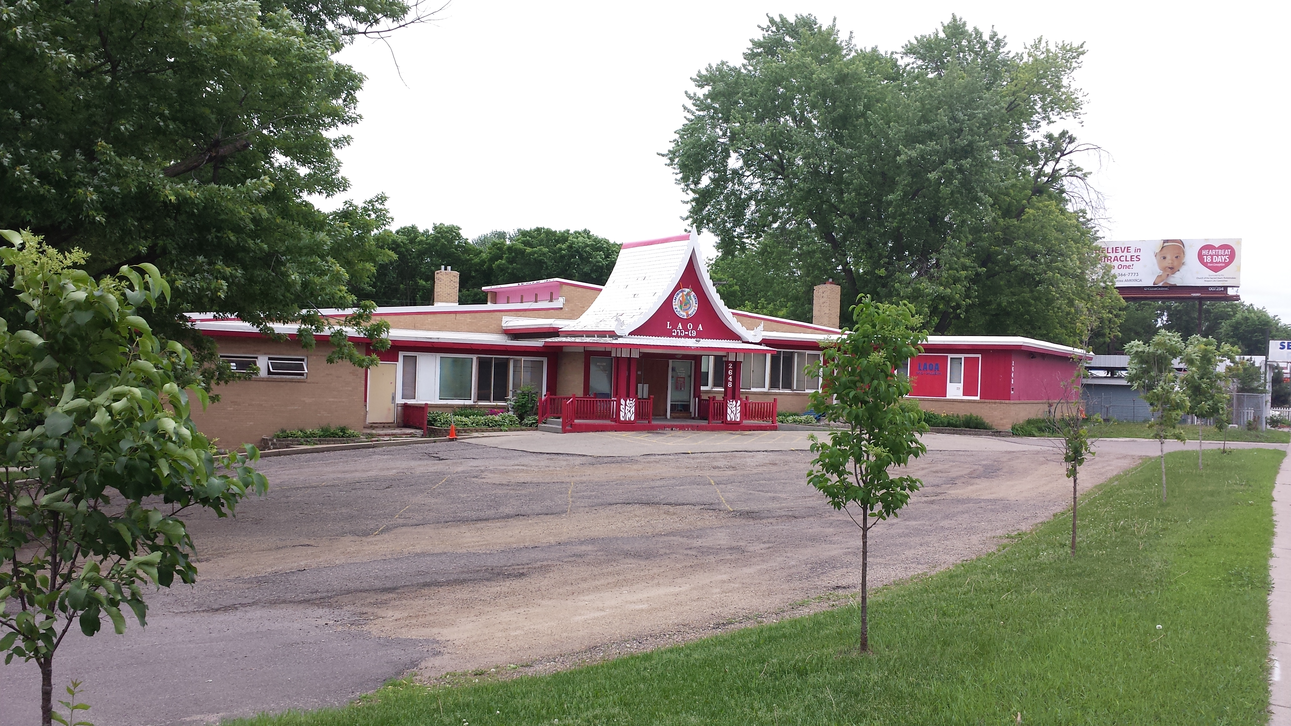
LAOA, 2648 West Broadway Ave.
The next intersection on West Broadway has an interesting geometry, with Thomas Avenue North exiting to the north at the same spot as 29th Avenue North exits to the east. I turned north up Thomas. This gave me a chance to see more of the neighborhood’s housing. Many of the buildings are small-scale single-family detached houses such as the two in the first photo below. However, quite a few are larger, whether to provide more space for a single family or to serve as a duplex. The second photo shows an example of each: the blue building is a single-family detached house whereas the tan building to its right is a duplex.
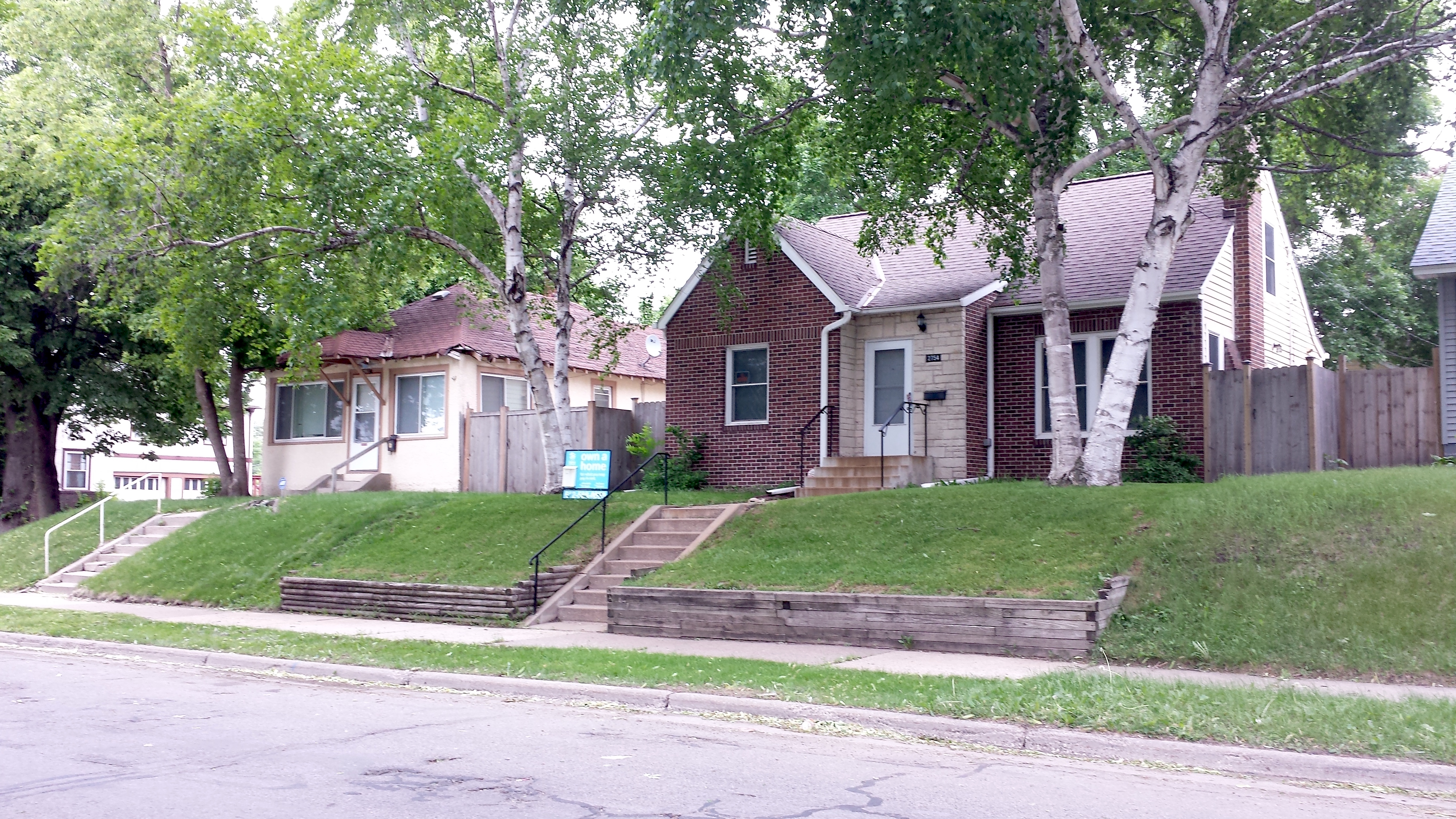
2758 and 2754 Thomas Ave. N.
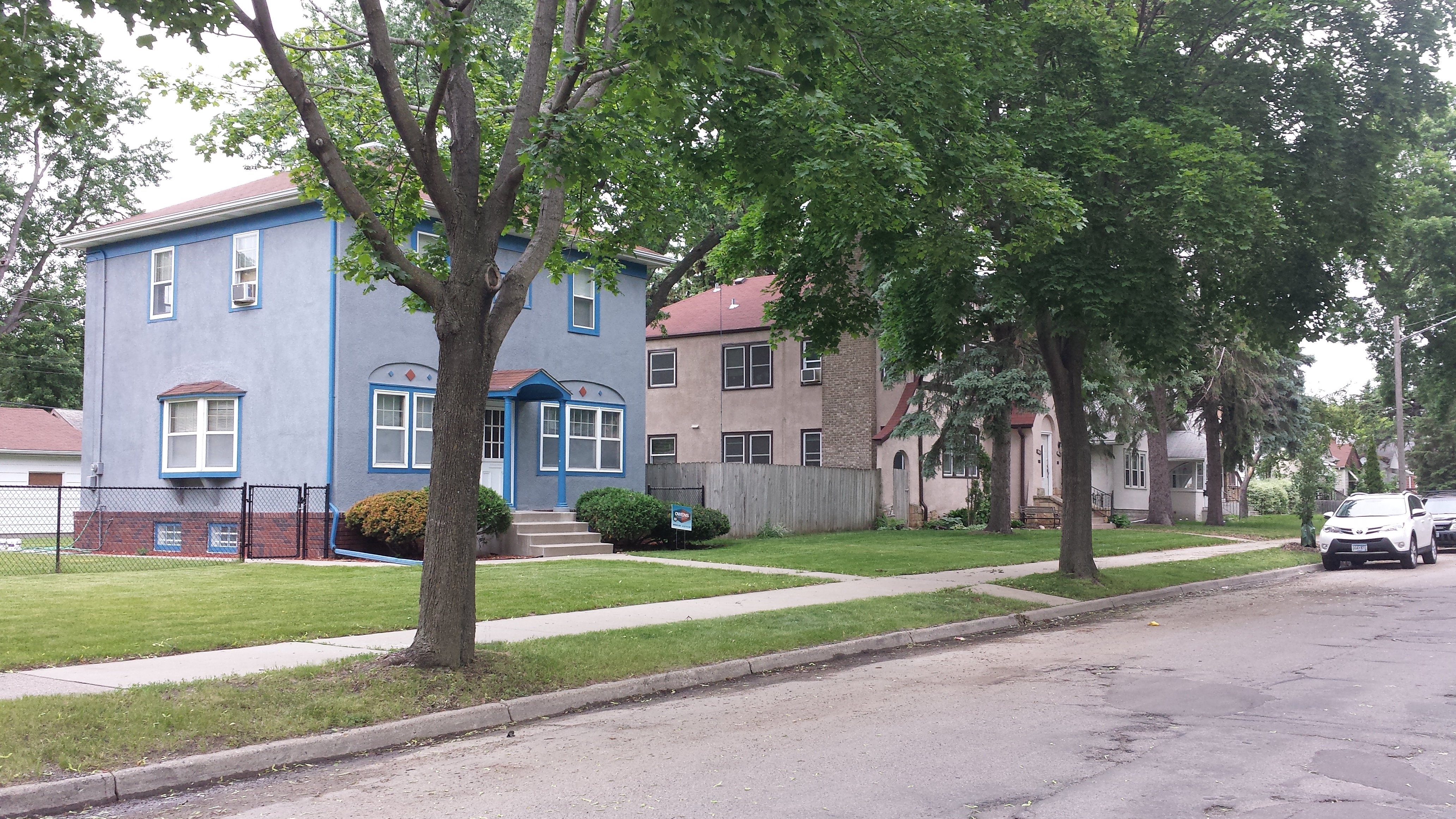
2911 and 2917 Thomas Ave. N.
In addition to showing some of the range of housing styles, there’s another detail visible in the first of those two photos. The house at 2754 Thomas Avenue North has a sign out front announcing that the Twin Cities chapter of Habitat for Humanity is making it available for affordable purchase. Presumably they did some rehabilitation work on it. Just a bit north of there on the other side of Thomas Avenue, the same organization is building a new home, having only reached the floor truss stage when I walked past. Later in the walk, I saw more of their construction sites that were further along. So clearly they are active in this neighborhood.
This illustrates a broader point that’s becoming increasingly clear to me as I walk through various neighborhoods. Before I saw what is happening on the ground, the macro-level statistics on Minneapolis’s persistent shortage of affordable housing lead me to view it as an unaddressed problem. Now I have seen very clear signs that quite a few different organizations are quite actively addressing the problem using various strategies to provide housing of various kinds. The fact that the housing shortage remains simply means that all of these ameliorative efforts put together still don’t suffice. More strategies need to be added to the mix, likely including some that reach deeper to the roots.
Once I reached Lowry Avenue, I first did a one-block spur eastward, which brought me to the School-Readiness Learning Academy, then returned westward to Upton Avenue North, where I turned south again. Although I could only stay on Upton for two blocks before its tee intersection with 29th Avenue North, that was enough for to shift my focus again. Because the houses on Upton are similar to those on Thomas, I paid more attention to the gardening. After a long colorless winter, I’m apt to notice bright flowers. But flowers may hog too much of the limelight. Leaves can be pretty amazing too, as with these hostas.

Hostas, 2900 Block of Upton Ave. N.
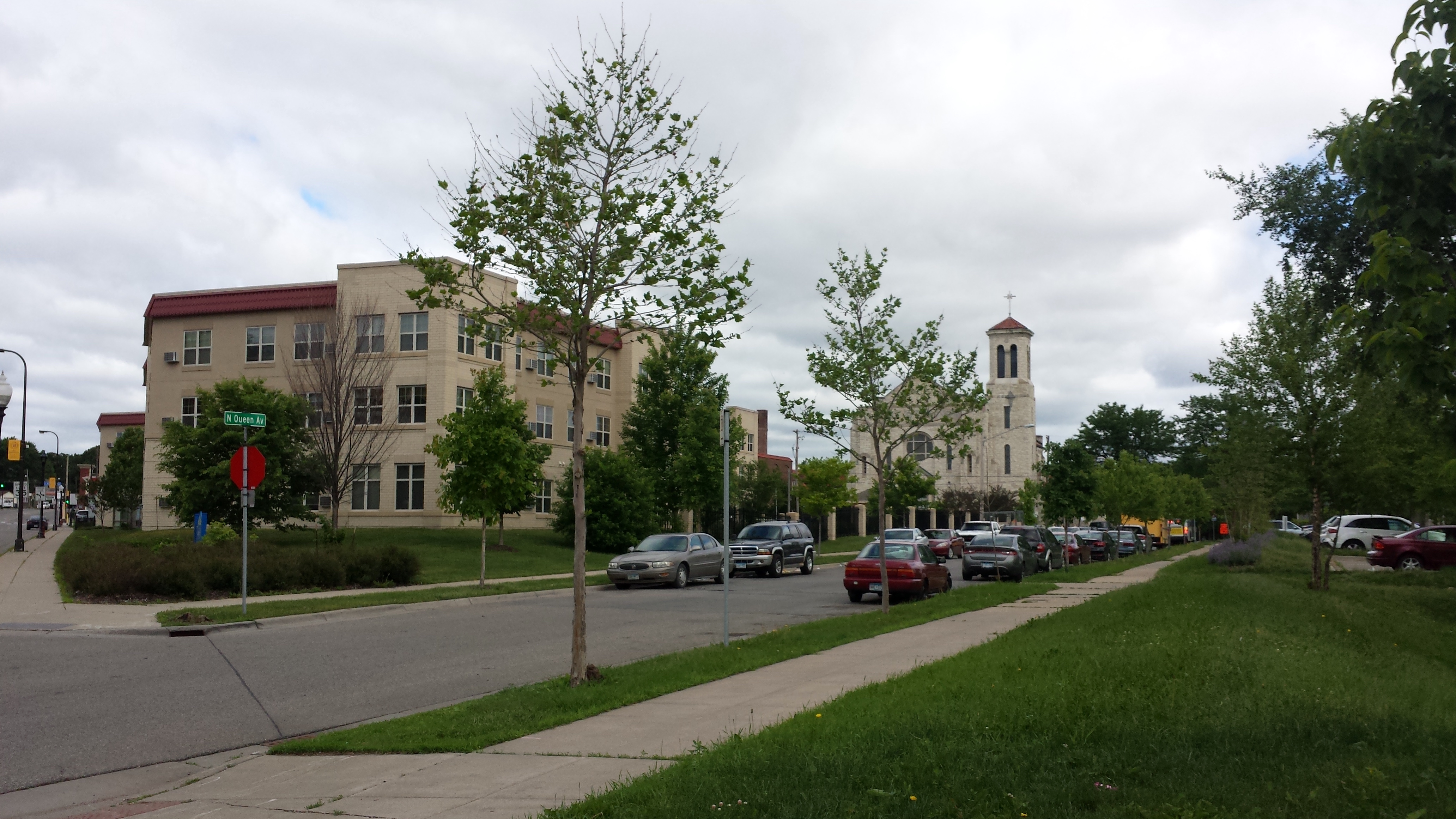
After bouncing off of West Broadway, I took 29th Avenue east to Penn, then 27th Avenue back west to West Broadway. Before returning to snaking through the residential area, I explored some of West Broadway itself. Initially I walked as far Queen Avenue North, then returned to Sheridan Avenue North to start my next northward pass. The portion of West Broadway between 26th and Sheridan Avenues is home to a 21st-century big-box store, a CVS pharmacy. Depending on where you live, this may seem unworthy of notice. However, pharmacy deserts are every bit as real as food deserts, even if not so famous. For neighborhood residents, this store is likely quite important.
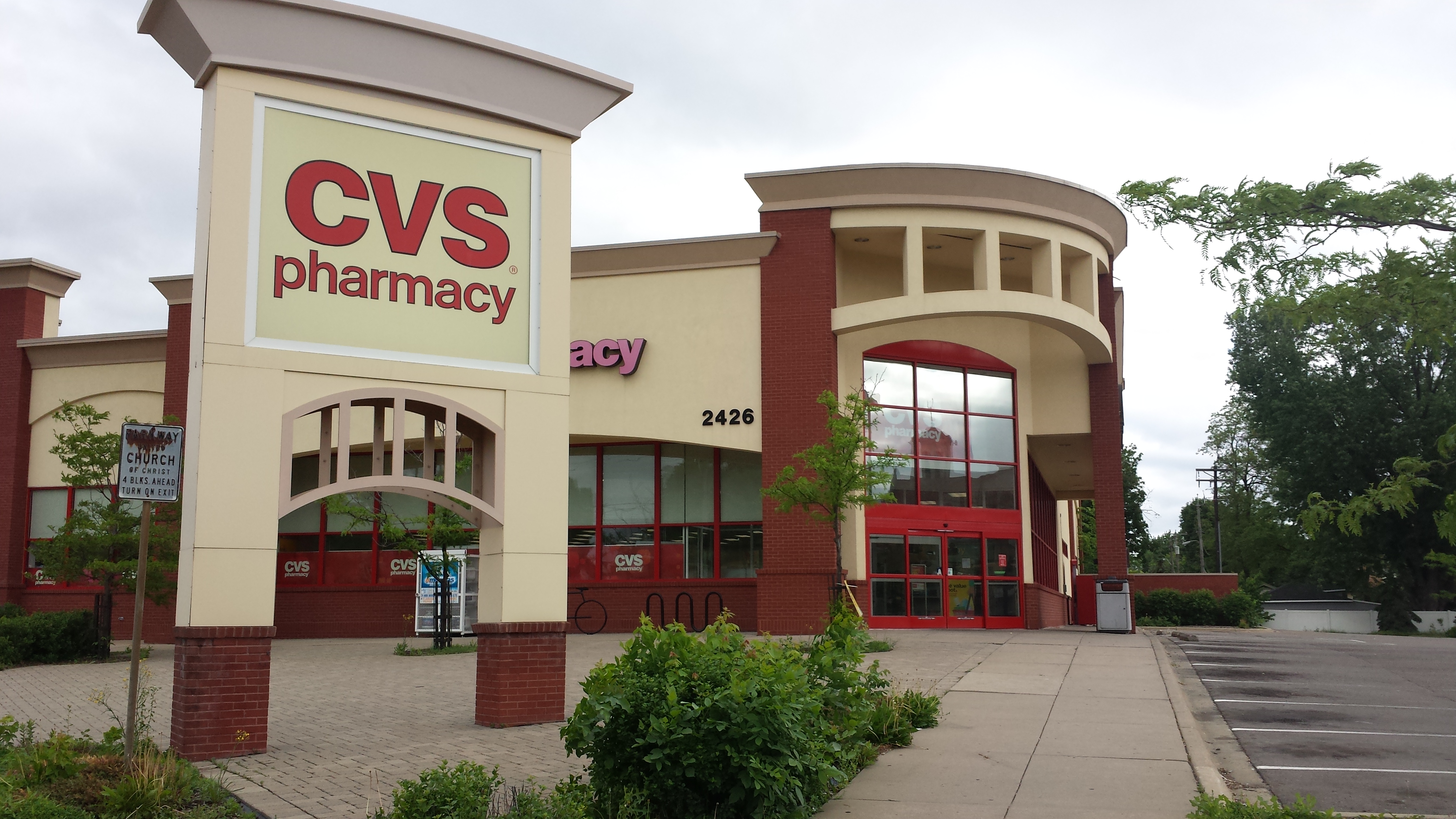
CVS Pharmacy, 2426 West Broadway Ave.
Sheridan to Lowry was another residential street, and Russell Avenue back southward largely so as well. However, I did pass three institutional buildings. First, on the northwestern corner with 30th Avenue, was The Purpose Church. It was dormant as I passed southbound on Russell, but when later in the walk I passed it again headed west on 30th Avenue, families were arriving and being warmly greeted outside the door.
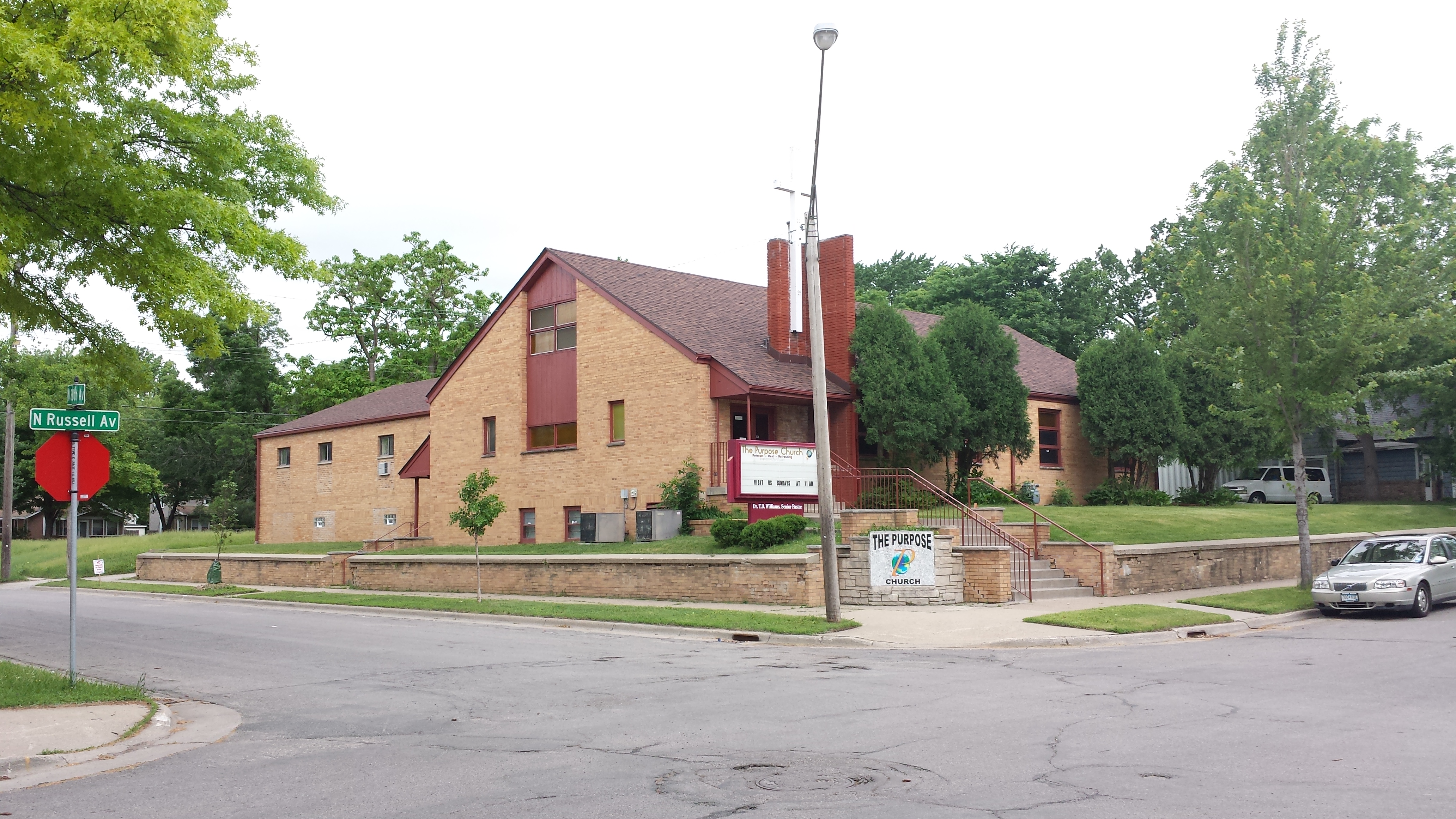
The Purpose Church, 3001 Russell Ave. N.
Next, on the east side of the 2600 block, I saw my first couple elements of the larger St. Anne’s complex. St. Anne’s Place was clearly built as a convent associated with the adjoining catholic school. Since 1990 it is an “emergency shelter for women-led families experiencing extreme poverty and homelessness” operated by Haven Housing. Although the sponsoring organization has only been called Haven Housing since 2017, it dates back to the early 1980s when it was founded by the Sisters of St. Joseph of Carondelet. (Quite a few social-service organizations in Minnesota trace their origins to this one religious order.)
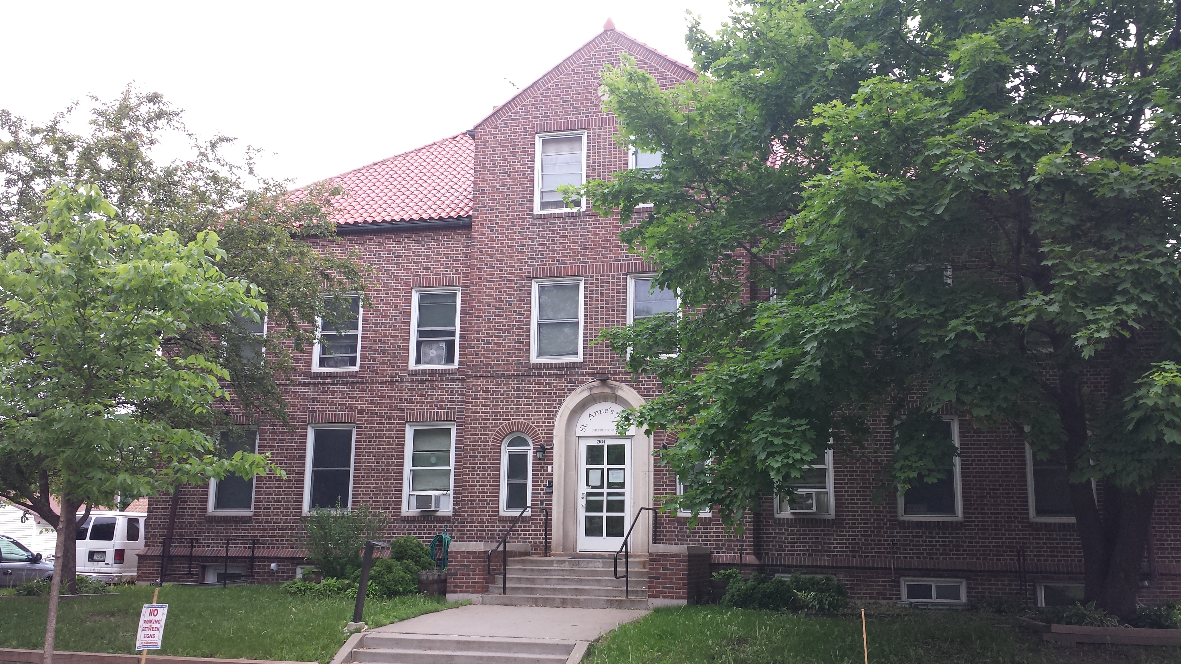
St. Anne’s Place, 2634 Russell Ave. N.
The space between the former convent and 26th Avenue is occupied by the School of Saint Anne building. Although it doesn’t seem to be functioning as a school any more, it’s still clearly in use for church-related functions. As I passed, I first saw a group gathered around a banner of the Phong Trào Liên Minh Thánh Tâm Hoa Kỳ (Sacred Heart Movement of America), then an entrance decorated with a Vietnamese-language welcome for a women’s Cursillo weekend.
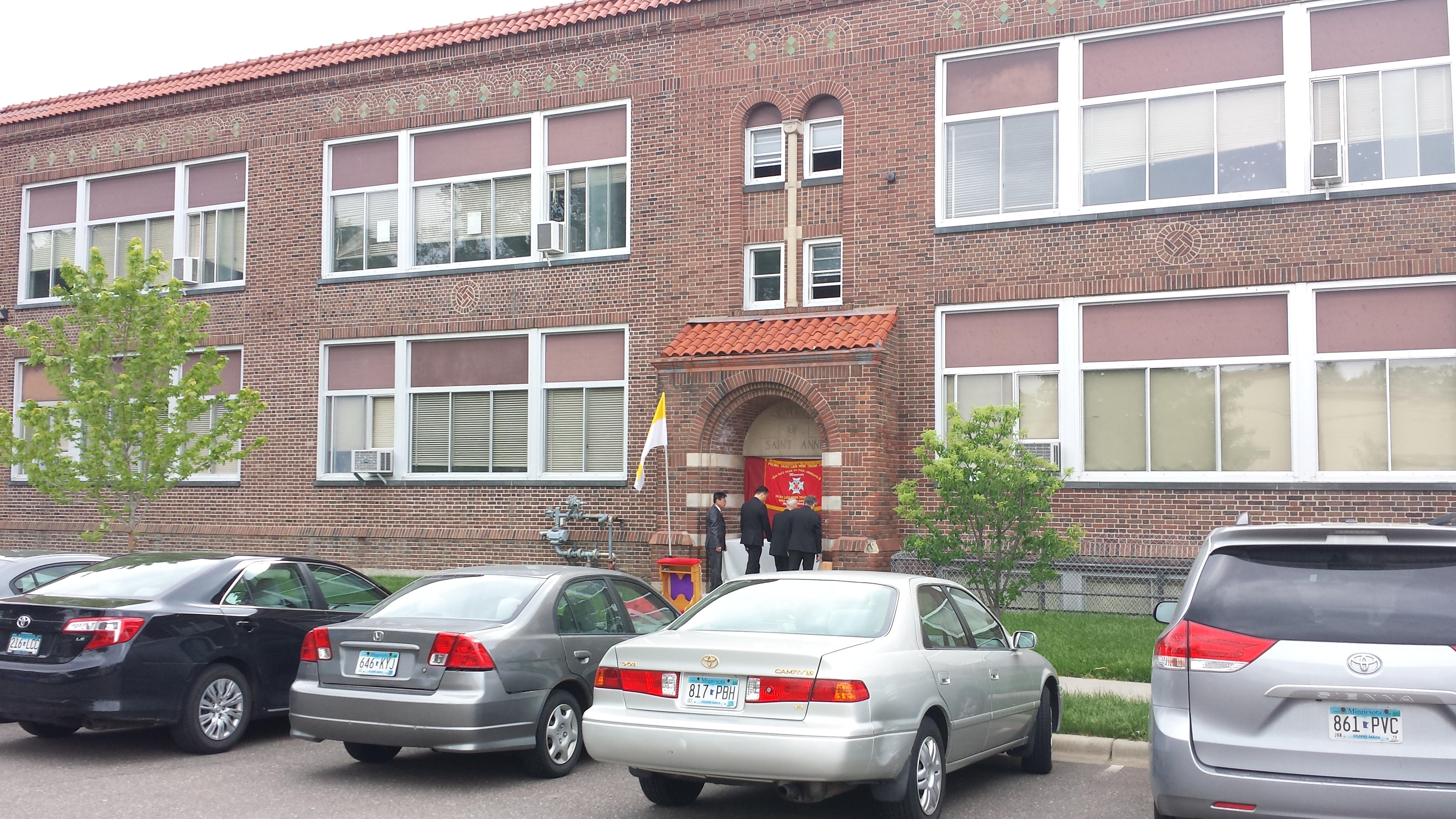
Sacred Heart Banner at School of Saint Anne
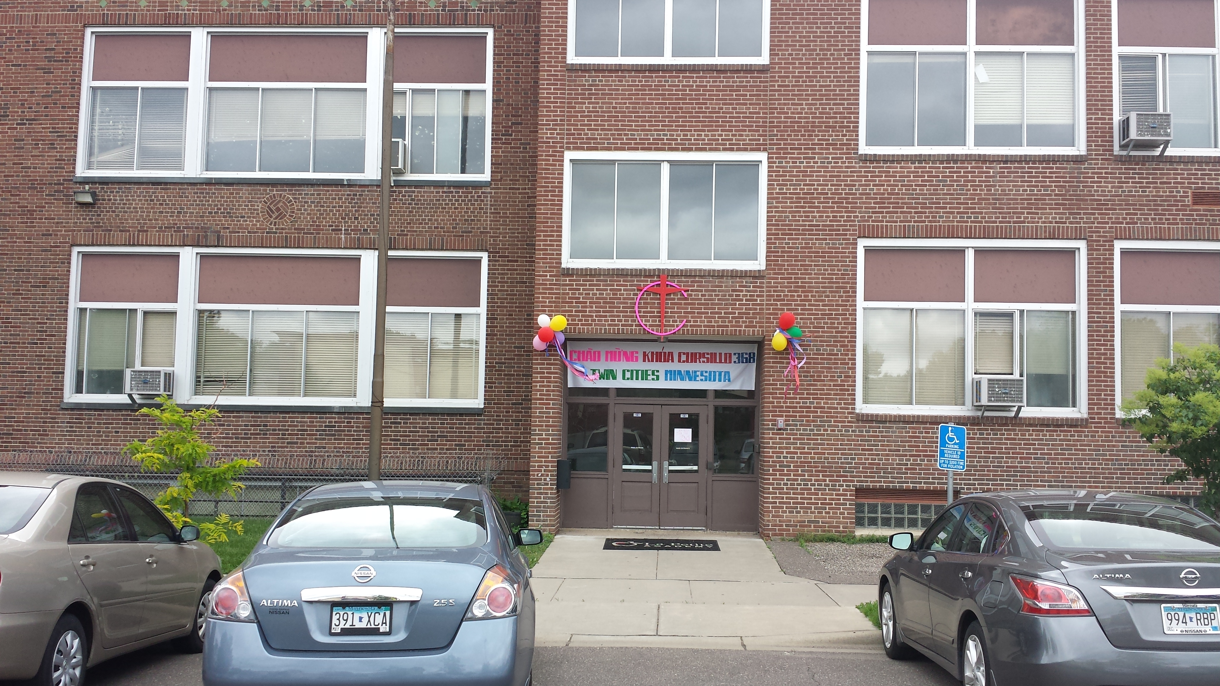
Cursillo Entrance at School of Saint Anne
Finally, after I turned onto 26th Avenue, I passed the church itself, which since a 2005 merger is known by the conjoined name of St. Anne-St. Joseph Hien Catholic Church. The latter portion of the name recognizes a 19th-century Vietnamese martyr, reflecting the largely Vietnamese-American congregation. In the short interval between when I passed the church on 26th Avenue and when I passed it again in the perpendicular direction on Queen Avenue, the arrival of congregants for the 10:30 mass significantly ramped up. And although I got no closer than a couple blocks away from the church once the service started, I could hear a drum and gong joining many human voices in making joyful noises.
St. Anne-St. Joseph Hien Catholic Church, 26th Ave. N. at Queen Ave. N.
In between my two encounters with the church, I used Penn Avenue to return to West Broadway. In the block of Penn to the north of West Broadway, I took two more-or-less westward spurs that depart from Penn at essentially the same point, but in different directions: due west on 25th Avenue versus southwest on Willow Avenue, which parallels West Broadway. These two were a gentle introduction to the Forest Heights portion of the neighborhood, the non-grid area east of Penn and south of 26th Avenue. The fingerprint-like whorl at the core of that area, nestled above West Broadway’s bulge, would have to wait for my second day in Jordan. One highlight from the first day’s preliminary probes was the heavily tree-shaded triangle formed by 25th, Hillside, and Newton Avenues.
A Forested Triangle in Forest Heights
The portion of West Broadway I now explored, first down to Logan Avenue, then back up to Queen Avenue, has a lot of visual texture from the combination of new development, spruced-up facades and amenities, and preserved historic detailing. An example of the latter would be the colored tiles set into the brick facade of a 1925 two-story mixed-use building.
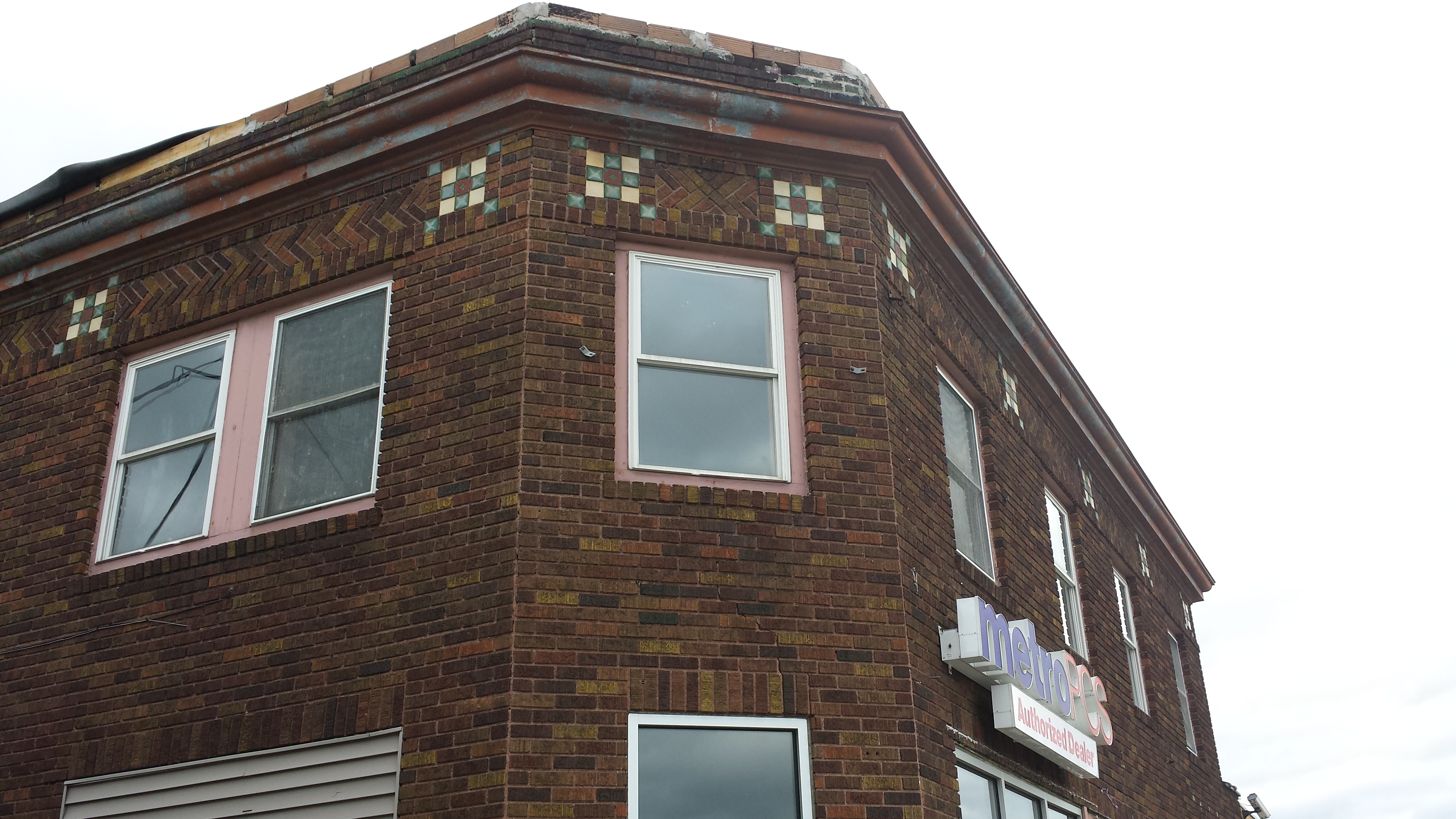
2100 West Broadway Ave.
The southeastern extremity of this day’s walk was the corner of West Broadway and Logan Avenue, the site of Freedom Square. The plaza is used for multiple purposes; the banner visible in my photo mentions just one, the farmers market held on Fridays from 3 to 7 PM. The 2018 season opens on June 15th.
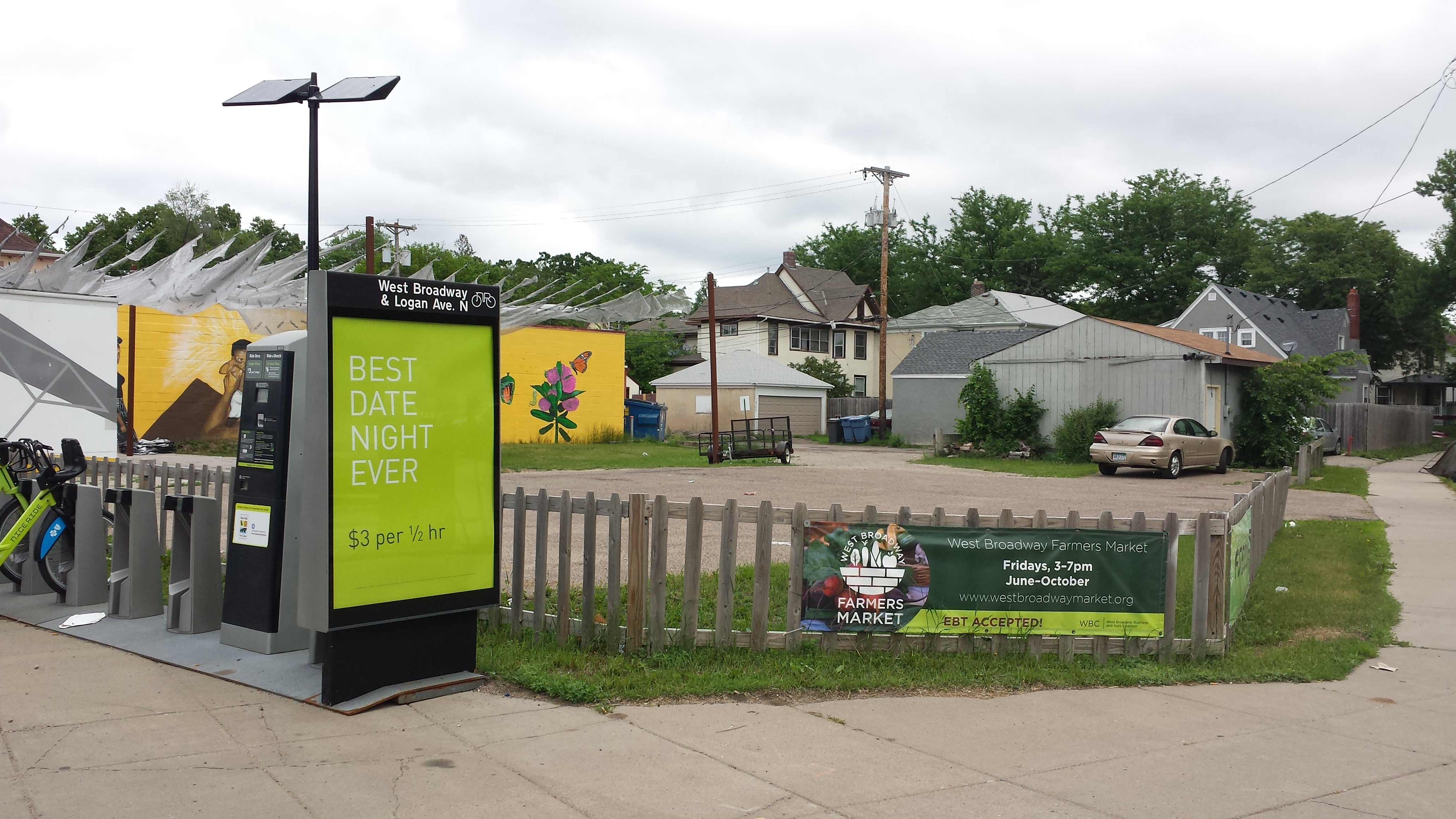
Freedom Square
As I returned northwest toward Penn Avenue, I came face-to-face with the broad expanse of colorful mural on the side of the Clippercuts Plus Hairstylists building. It reminded me a lot of the mural panels by Melodee Strong and community members that I saw on Lowry Avenue when walking the Folwell neighborhood. And sure enough, she designed this mural too in conjunction with the FLOW Northside Art Crawl and MCAD. I appreciate her permission to include this photo.
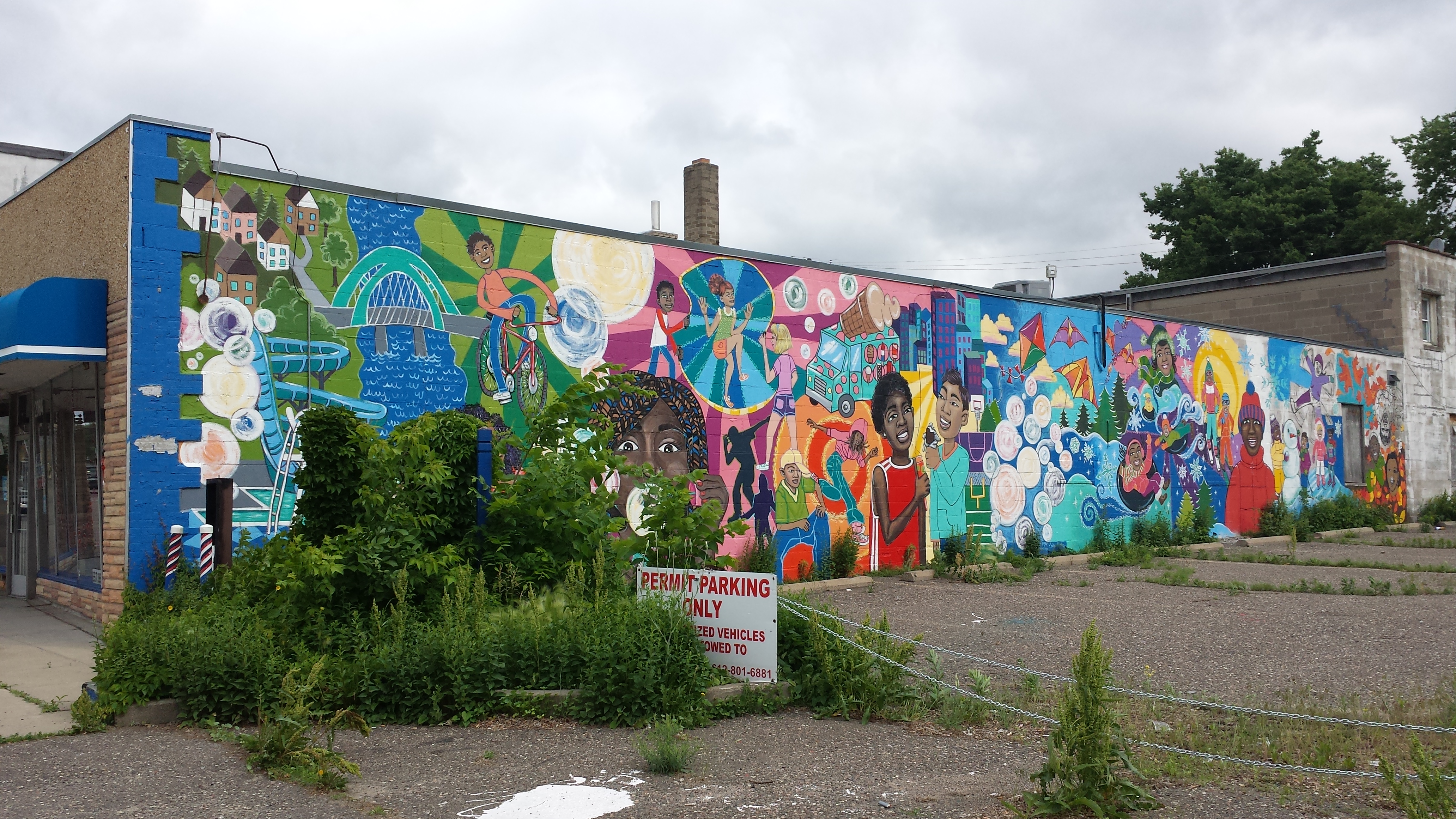
Community Mural at Clippercuts Plus, 2064 West Broadway Ave.
At Penn Avenue, I temporarily crossed to the far side of West Broadway in order to better photograph the restored storefront facades to the southwest of Penn and the recently constructed mixed-use building to the northeast, which includes Broadway Liquor Outlet and the Broadway Flats. Of the facades to the southwest, “Dr. L.A. Otieno Dentistry was one of the earliest Great Streets facade improvements. The intricate metal work featuring the moon, sun and a tree of life has stood as an example to its neighboring businesses as a way to incorporate artistic elements into a facade project.”
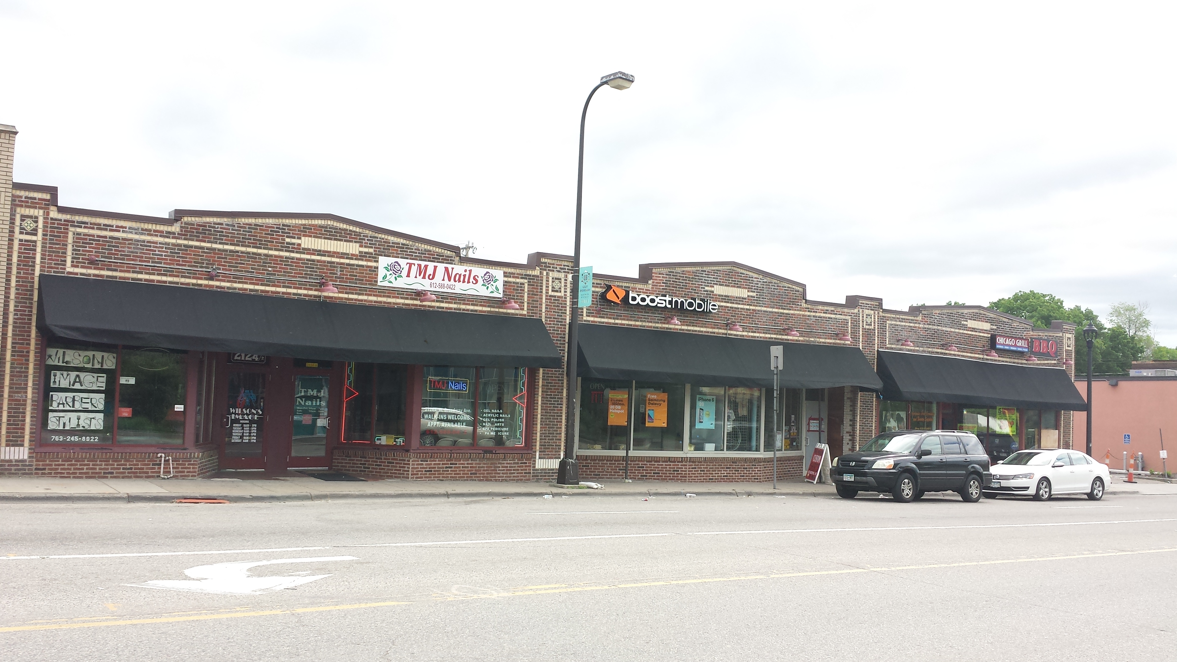
Storefronts in 2100 Block of West Broadway (1929)

Dance Studio and Office Space, 2100 Block of West Broadway (1930 and 1927)
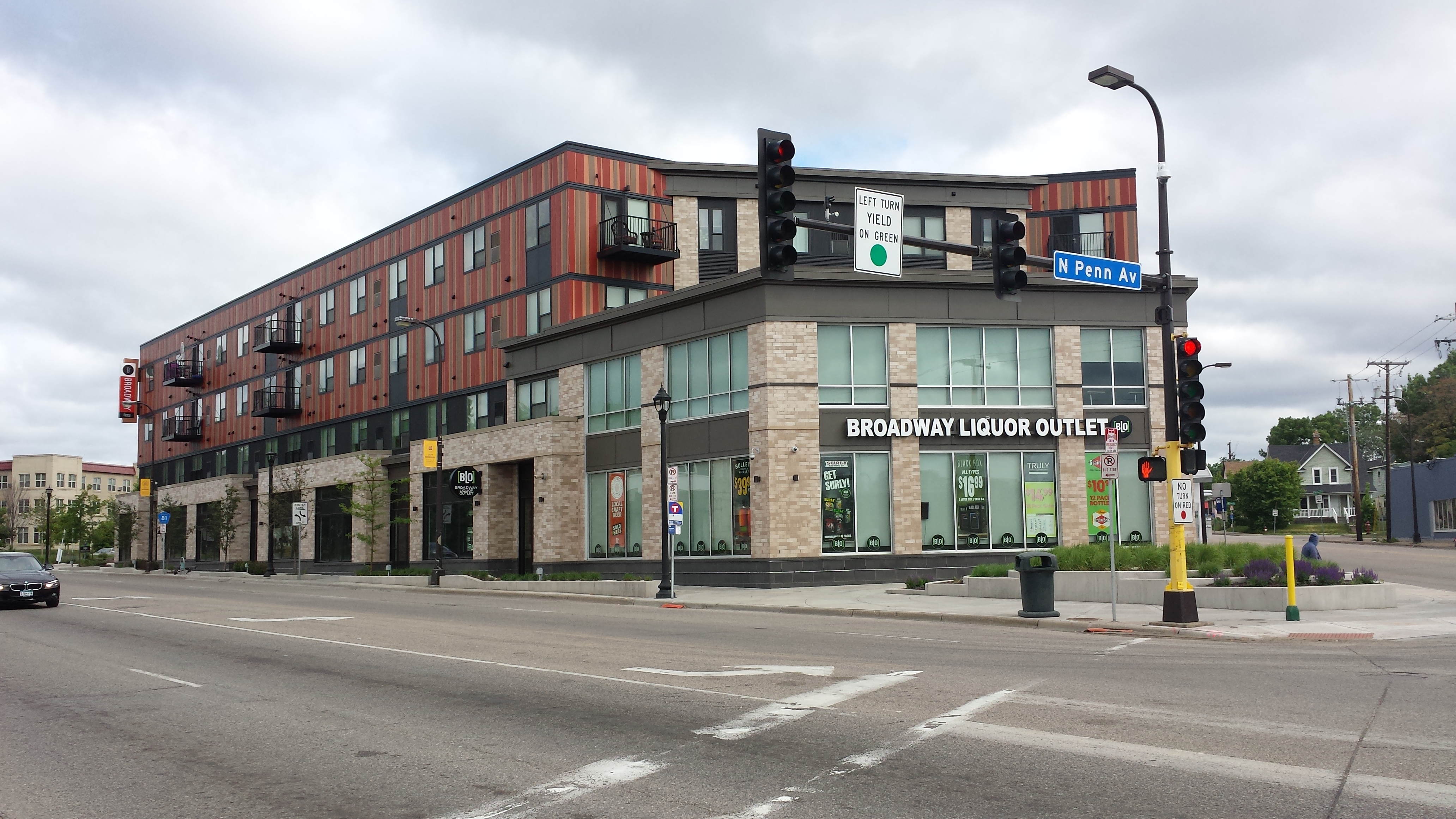
Broadway Liquor Outlet and Broadway Flats, 2220 West Broadway Ave. (2015)
Turning north on Queen Avenue, I got a new perspective on the St. Anne’s Senior Community, which I had walked past on a previous spur down West Broadway. Looking up Queen Avenue, I could appreciate how well the apartment building harmonizes with the church.
St. Anne’s Senior Community and St. Anne-St. Joseph Hien Church
Further north on Queen Avenue, I saw a pair of buildings under construction that are another Habitat for Humanity site, in this case in partnership with the Ryan Companies. They are visually striking because of the blue foam insulation with furring strips over it. This is an innovative “OptiMN” wall system developed by the University of Minnesota for efficient cold-climate construction. Habitat is partnering with the university to test it out.
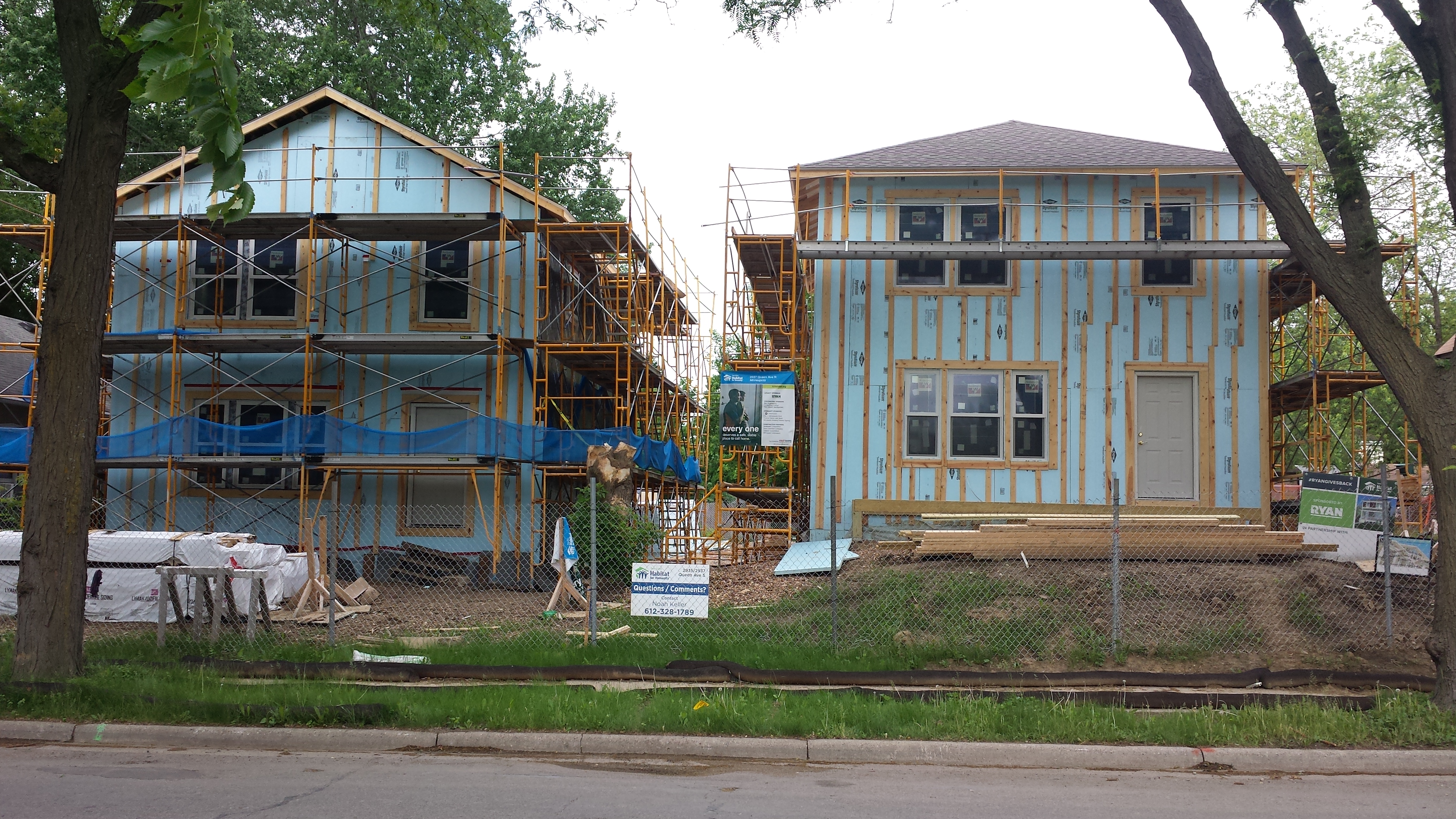
OptiMN Habitat Houses, 2935–2937 Queen Ave. N.
Looping from northbound Queen Avenue to southbound Penn Avenue via Lowry Avenue gave me a chance to stop in at The Lowry Cafe. They serve both their breakfast and their lunch menus the entire time they are open; I opted for a second breakfast. In particular, I ordered the Corned Beef Hash Super Food Skillet, in which the corned beef hash is served in the classic style with two eggs (cooked to order) and the diner’s choice of toast. However, this isn’t just any corned beef hash. The house-made corned beef is itself quite noteworthy, and the hash goes way beyond the usual potatoes and onions. Those ingredients are there, but they are dominated by a colorful medley of brussels sprouts, kale, red cabbage, and carrots. This is my kind of cooking: combining quality ingredients to make a dish as tasty as it is healthy.
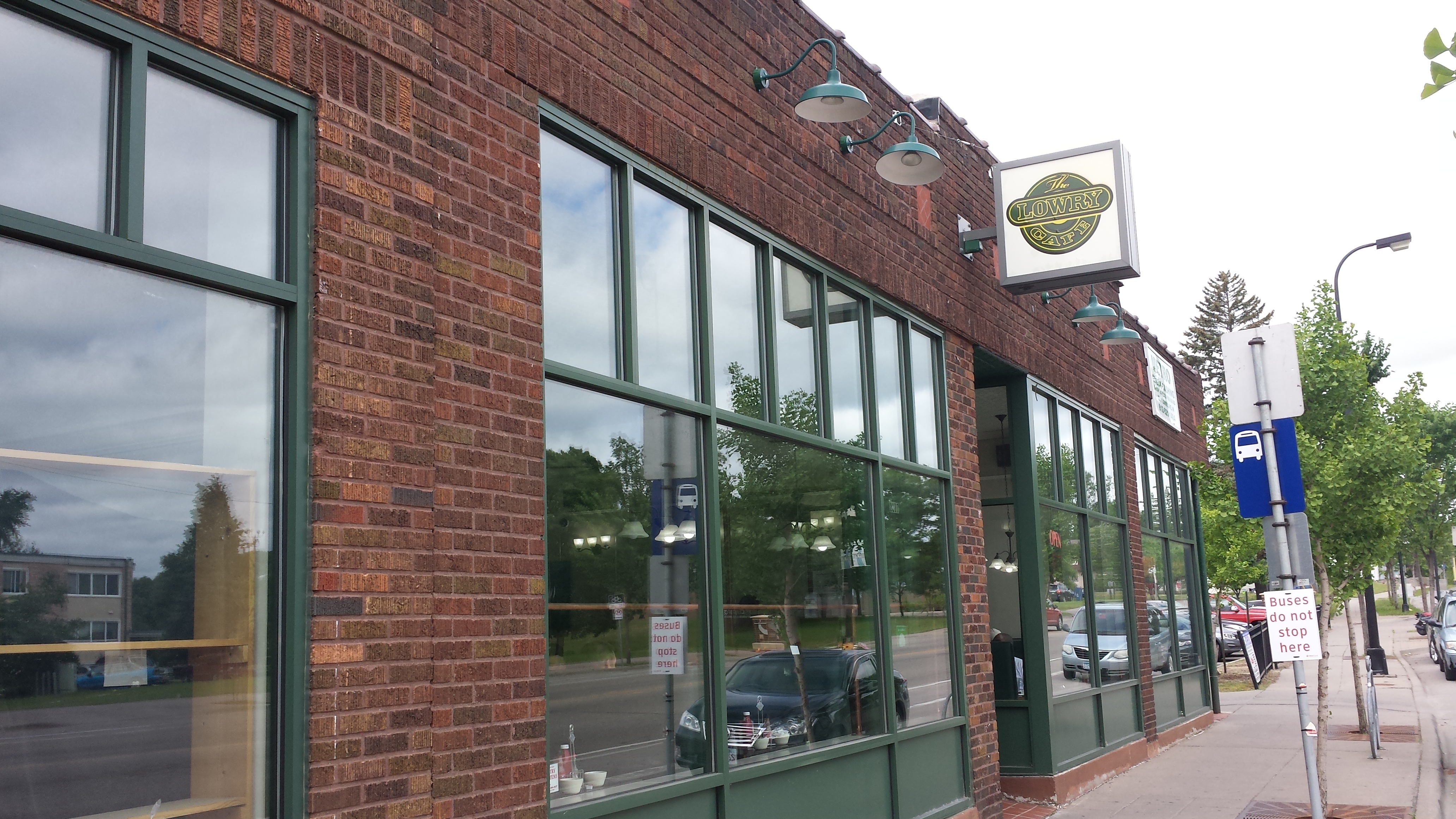
The Lowry Cafe, 2207 Lowry Ave. N.

Corned Beef Hash Super Food Skillet at The Lowry Cafe
A purely optional digressive paragraph: My only regret is that I ordered the eggs over easy. That’s how I always order them, so of course I did. Habit is strong. But sunny-side-up eggs would have made the photo so much better. Besides, I like eggs that are sunny side up. I just never order them that way. It goes back to my childhood. Not that I was squeamish about yolks then. In fact, at home fried eggs were always sunny side up, without being called that. (Home cooking was not done to order.) But once when my family was traveling, I overheard someone at another table order their eggs “over easy.” Their order really impressed me; it was the insider argot that only truck drivers and other real men knew. And so I mimicked it for my own order and have been ordering it ever since, even though I like yolks and think they make attractive photos. Habit is strong.
Returning to my walk, I turned south on Penn Avenue from Lowry. This intersection is a major commercial node. Around the corner from The Lowry Cafe, North End Hardware is a longtime landmark, and across Penn there’s an Aldi grocery store. There are other businesses on the block too. But what caught my attention most was a particularly nice community garden.
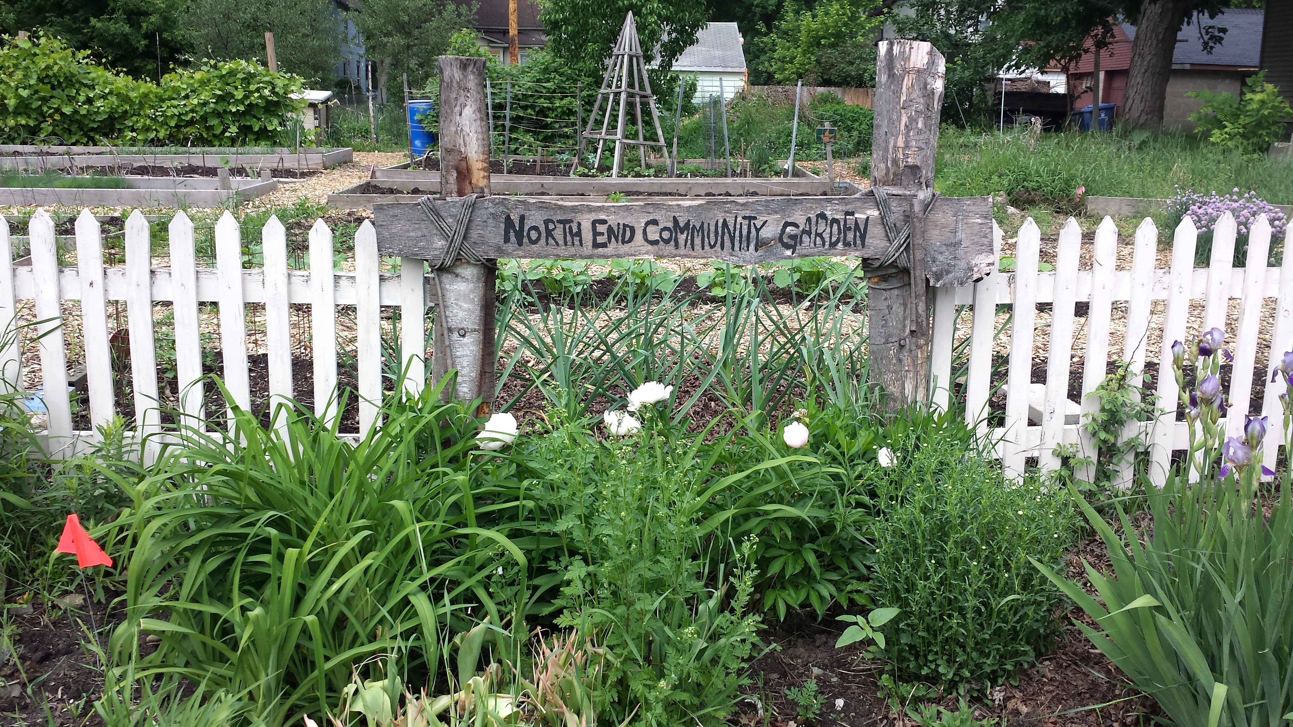
North End Community Garden, 3027–3031 Penn Ave. N.
After winding around through the area bounded by Lowry and 26th Avenues and Penn and Newton Avenues, I found myself turning from Newton onto 29th Avenue. The southwest corner of that intersection is occupied by another church building. Built in 1954 by Holiness Methodist Church (as a major addition to an earlier building), it now houses Beacon of Hope Church and Redeemer Evangelical Church, the latter having a Liberian-American cultural connection.
Beacon of Hope / Redeemer Evangelical Church, 2827 Newton Ave. N.
At this point, I was headed primarily westward to return to my starting point. Only the first two blocks of this westward trek were on 29th Avenue, though. At that point, I used Penn Avenue to switch to 30th Avenue for the rest of the way. Penn Avenue itself was closed to automotive traffic for construction. Despite having encountered this closure at several previous points, I waited until now to mention it so that I could do so in the context of a really cool piece of equipment. The new concrete curbs and gutters on Penn are beautifully smooth. Now I saw what created them: a Miller Formless M-1000 Slipform Paving Machine. The name “Formless” is a misnomer. You can see the form at the bottom right of the photo. It just is a slipform rather than a fixed form that needs to be constructed on site. I’m always amazed how many activities are becoming more capital intensive and less labor intensive. No wonder this is a particularly good time to be a capitalist rather than a laborer.
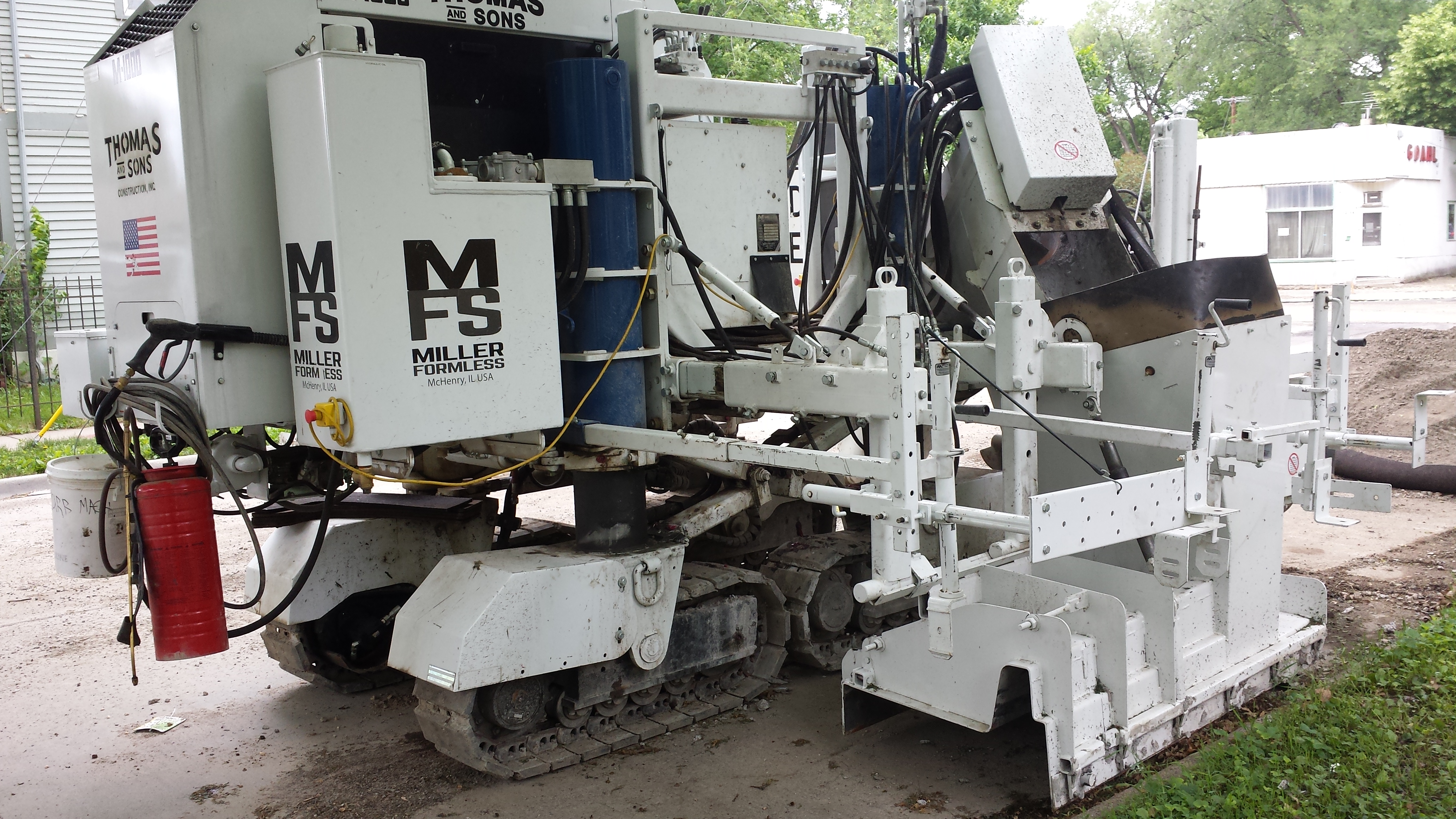
Miller Formless M-1000 Slipform Paving Machine, 29th and Penn Aves. N.
Finally, here’s the neoclassical church I saw from the back near the start of the walk. Does it look more like a church or a mortuary? Without the garage, the answer isn’t so obvious.
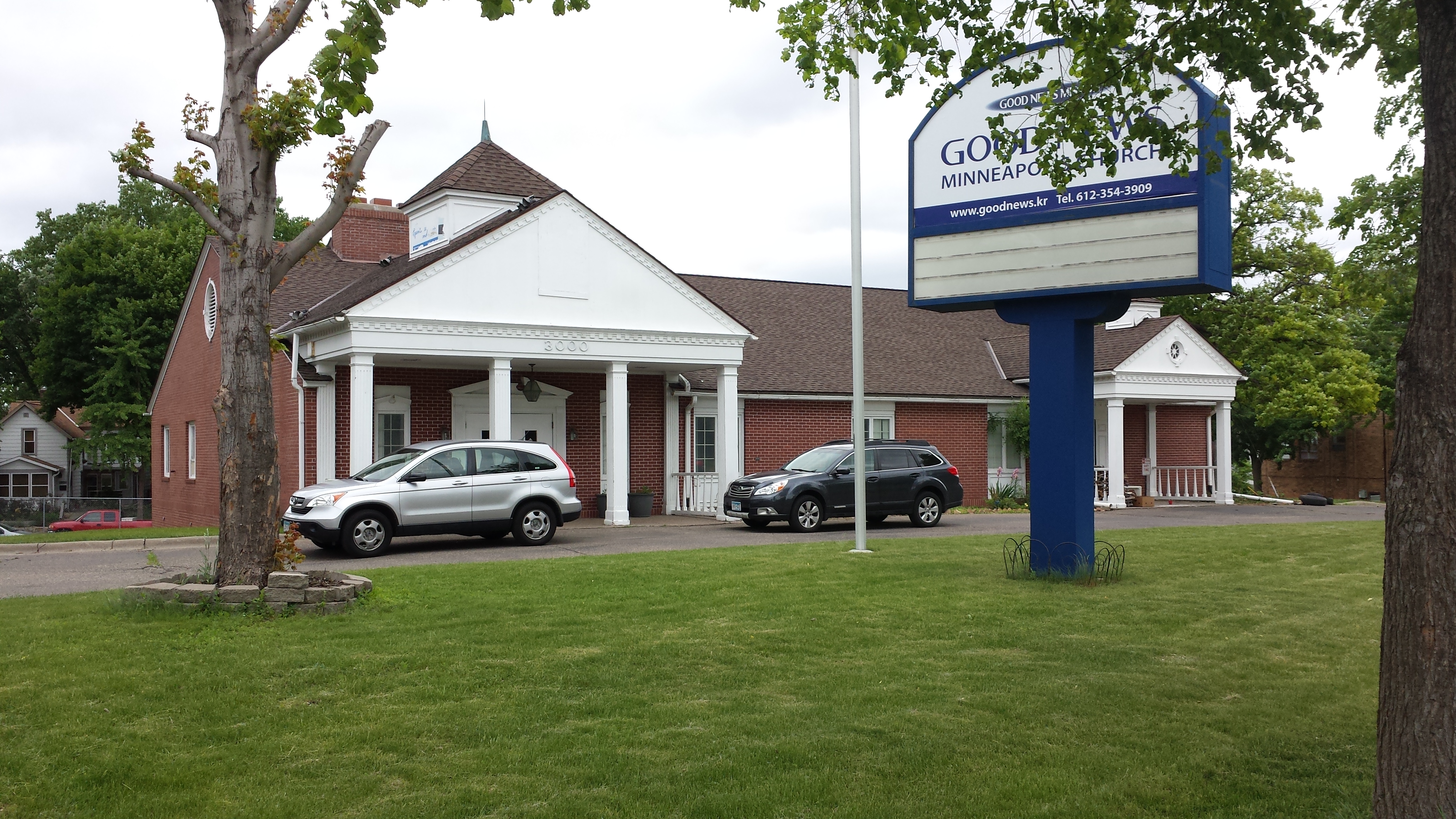
Good News Minneapolis Church, 3000 West Broadway Ave.