


Another Fair banner oversees an parking lot.

The residents of 1380 Snelling advertised for Fair vendors to set up on their front lawn.

Looking south on Snelling. The Fairgrounds are on the right.


A couple more of the Snelling Avenue homes hoping to rent space to vendors during the Fair.

Asbury Street was named in 1881 for Bishop Francis Asbury, one of the first two bishops of the Methodist Episcopal Church in the United States. So says Don Empson in “The Street Where You Live.” Empson adds that the bishop’s name was attached to the street due to its proximity to Hamline University, which got support from the Methodist Episcopal Church.

Como Park Lutheran Church, 1376 Hoyt at Sheldon Street.

The original Chelsea Heights building and Horace Mann Elementary in Highland Park, also a Wigington design, are nearly identical.

A creative soul at Chelsea Heights noted the summer break in a fun way.

The 1953 addition to Chelsea Heights.

The school was expanded again in 1974. It included a new gym and playground which are part of the Northwest Como Recreation Center.
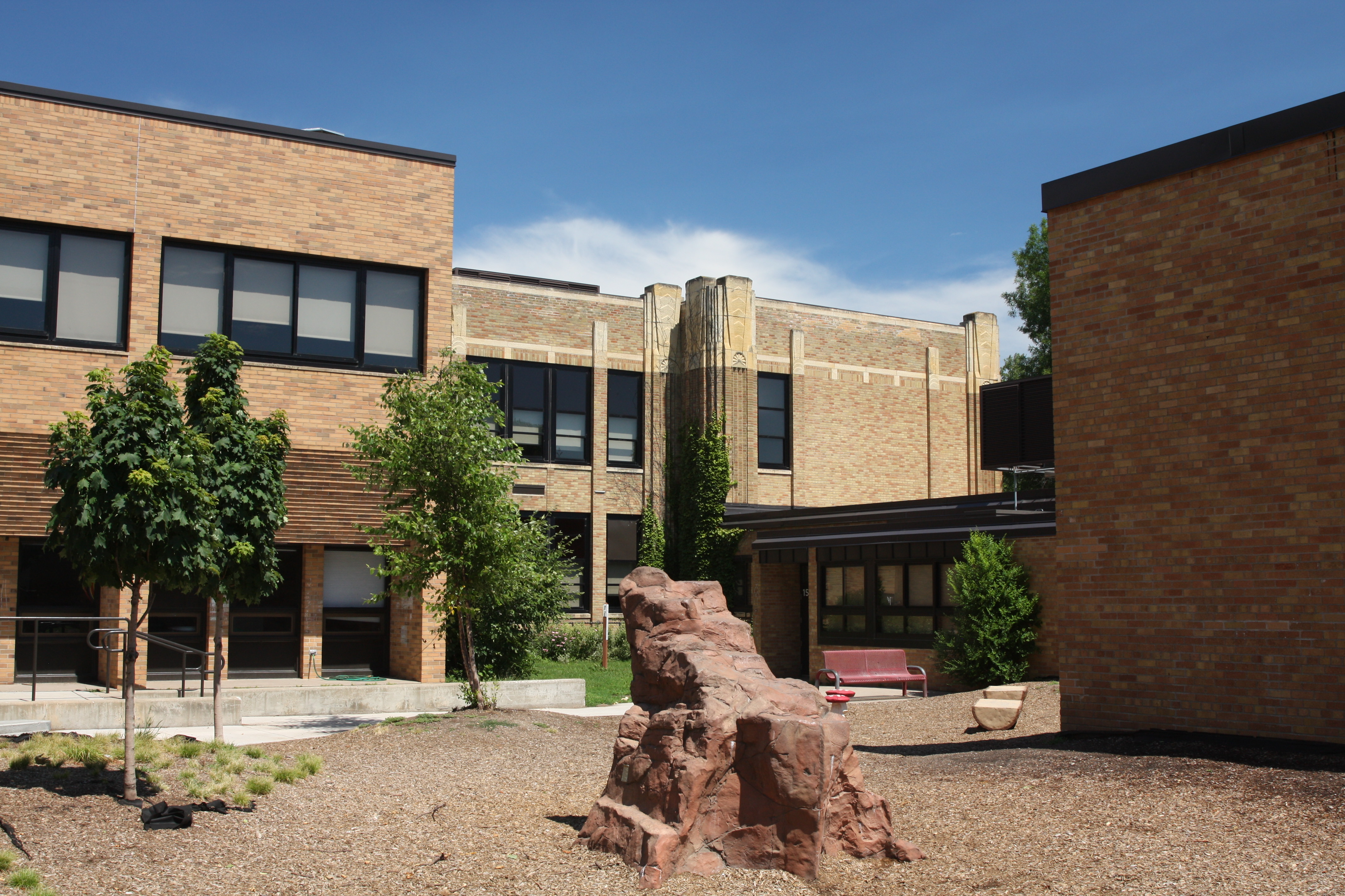
The original part of Chelsea Heights (center), the 1953 (center right) and 1974 (left and right) additions are visible in this picture.

Looking south along Hamline Avenue into Saint Paul from just inside Falcon Heights.
West Larpenteur Avenue looking east from the Saint Paul (south) side of the street.

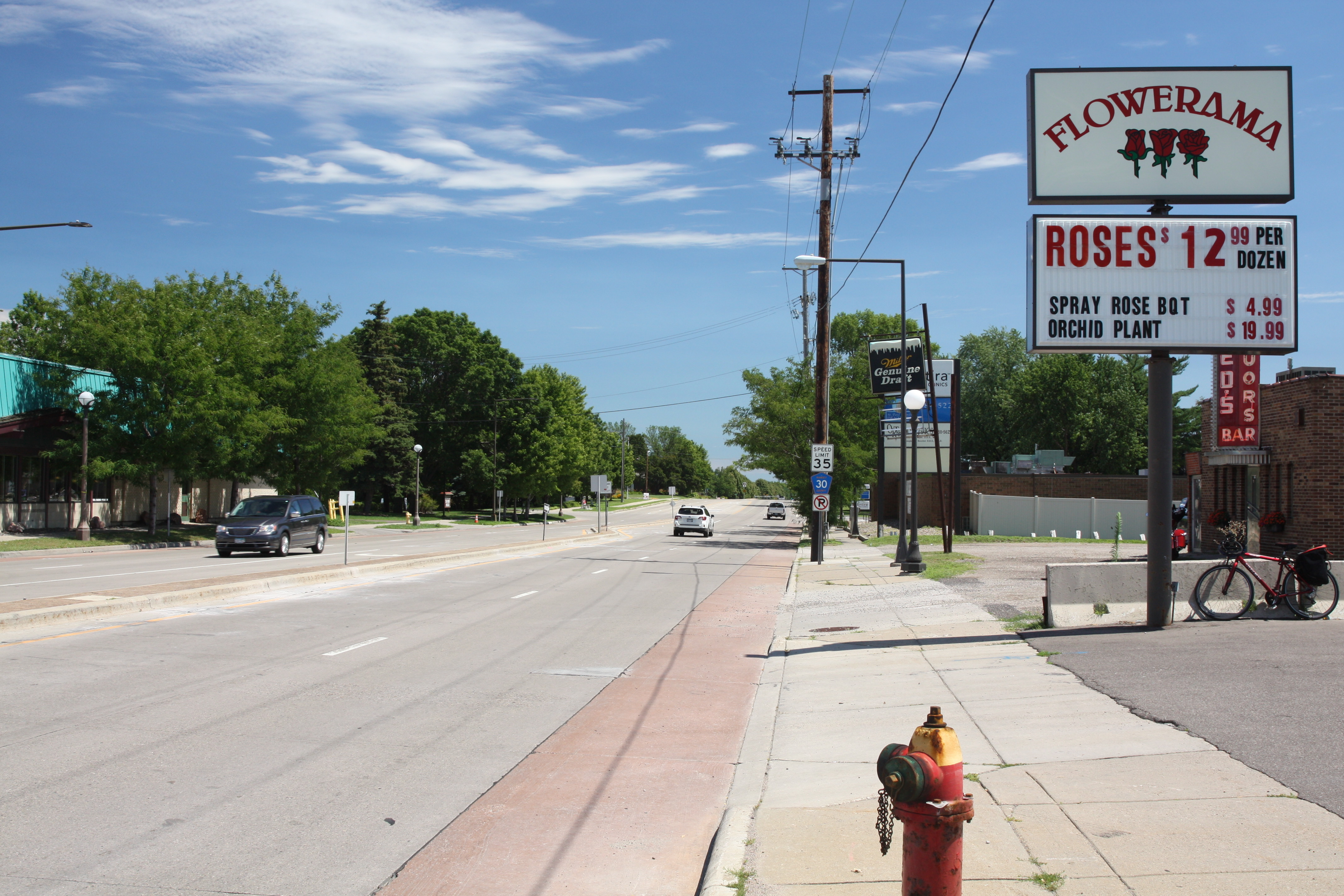
One of the coolest looking bars in Saint Paul is Ted’s at 1084 Larpenteur. From the neon sign, to the metal door and the overhang above, this is a gem from a bygone time.

Check out the gorgeous neon and just below, the decorative overhang.

Less than a block east, Larpenteur becomes a residential street lined with single family homes, including the noticeable 968, one of the older houses along the street.

Many of the homes along Larpenteur are of the post-World War II vintage.

Mailboxes and a Little Free Library in the 800 block of Larpenteur Avenue West.

Elmhurst Cemetery, a final resting spot for Lutherans, sits on some 100 acres bounded by Larpenteur on the north, Dale Street to the west, Nebraska on the south and Mackubin on the east.

The open spaces at Elmhurst are home to an assortment of wildlife.

The large swath of asphalt sat idle, just like the building in the distance.

The sign shows no ill effects from two and one-half years of non-use. A parrot named “Baby” was a resident of the greenhouse and the company mascot.

From outside, it was difficult to tell how long Linder’s had been closed.

One of the few signs I noticed warning people to stay out.

The interior of Linder’s was in rough but recognizable shape.

Concrete pads which may have been covered by greenhouses, perhaps appropriately continued to host flora. Beyond the concrete slabs were fields where Linder’s grew some of the plants they sold.

The former store building looking from the concrete slabs to the south.

Additional land and other buildings on the far south end of the Linder property.

1674 Marion Street was obviously abandoned.

Realty records indicate that 1674 Marion Street was all of 400 square feet, with one bedroom and one bath. It was built in 1949.
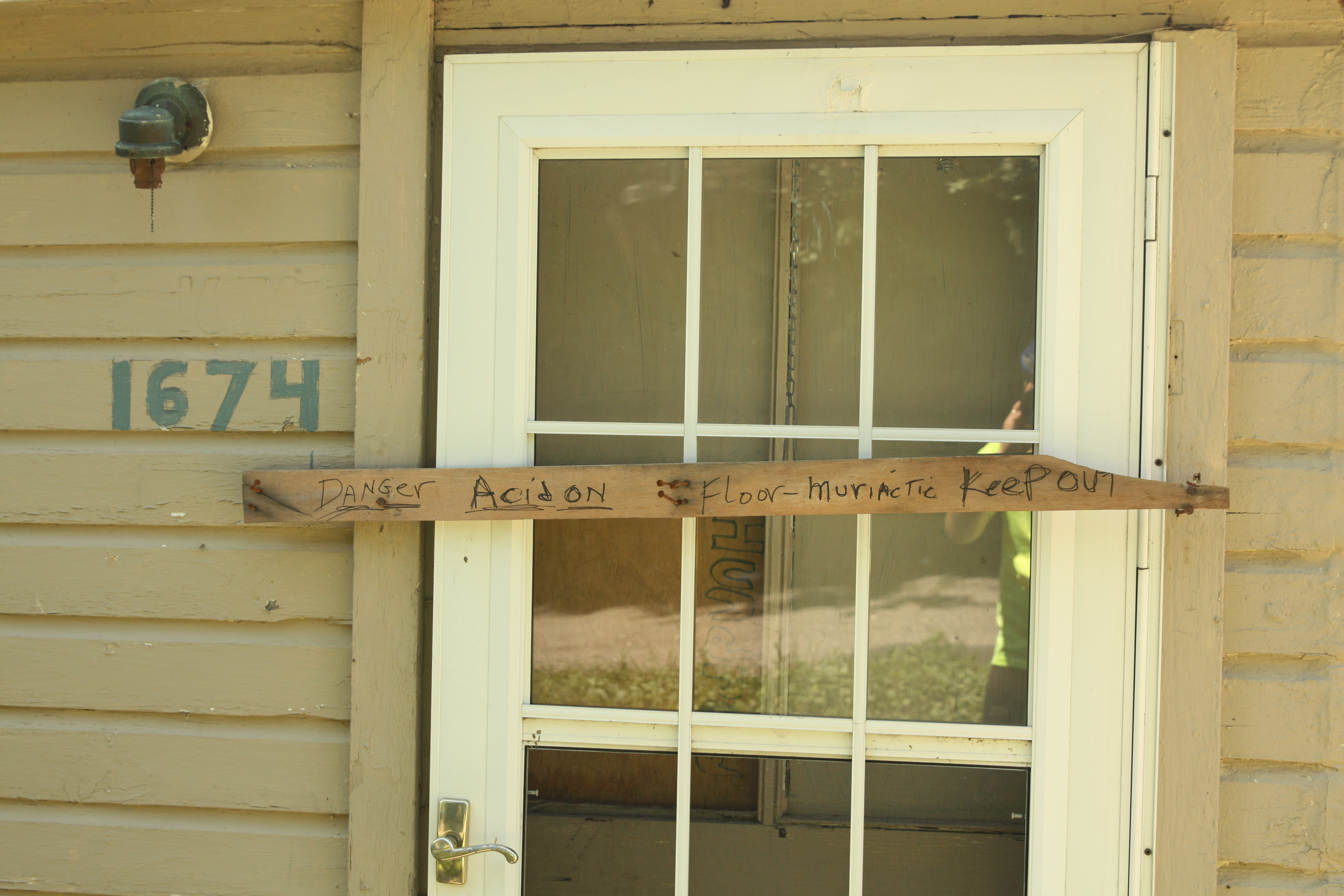
Any interest in a close look at the house disappeared when I noticed the warning on the back door. Muriatic acid, similar to hydrochloric acid, is frequently used to kill and remove mold on concrete, bricks and tile.

Along Wheelock Parkway on the far south end of the Linder property, more abandoned buildings and growing areas.

These deteriorating buildings at 275 Wheelock Parkway held part of Linder’s wholesale business.

Inside one of the former wholesale buildings.

The remains of one greenhouse and support structures. It is remarkable how quickly nature takes over a deserted place.

The disintegration of the wholesale building is apparent from this view.

Albert Linder picks celery from his field in 1920. Courtesy Pinterest/Sharon Amorosa

More celery from the Linders circa 1935. Courtesy Pinterest/Sharon Amorosa
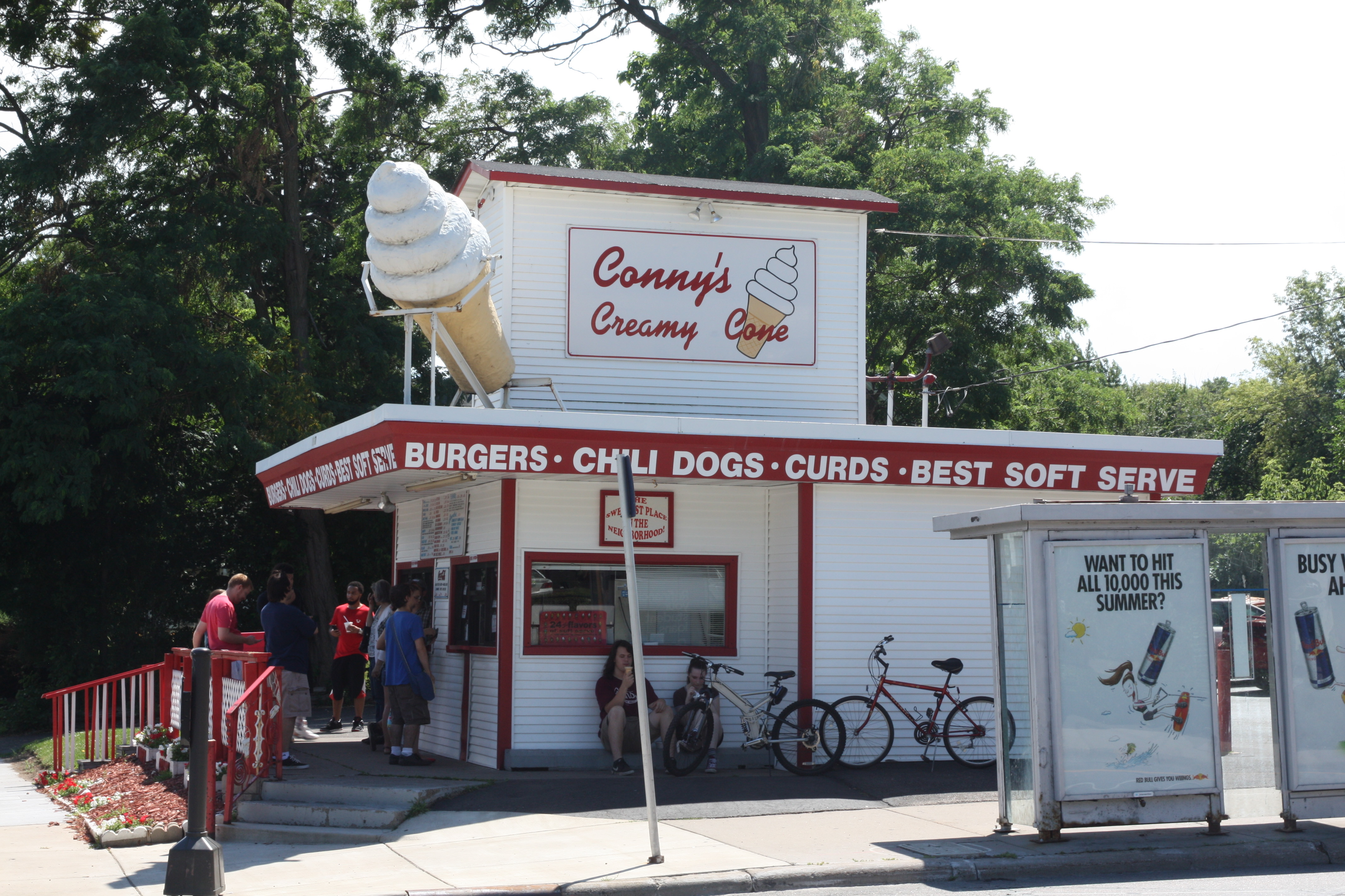
There seems to be a line all summer at Conny’s Creamy Cone.

The giant ice cream cone is one of the convivial aspects of Conny’s.

Another is the 24 flavors of soft serve.


It goes without saying (so why did I say it?) that Como Lake and Como Lakeside Pavilion are the two best known features of the park.

Hiking is popular among dogs and their humans. This peninsula, called Duck Point, is on the eastern side of Como Lake.

A handful of stand up paddle boarders meandered around the lake on this nice day.


More than 30 years ago this commemorative plaque was placed on a rock along the walking path that goes past the Como Lakeside Pavilion. The Sterks have multiple connections to Como Park.

Nearby is this stunning flower garden with dozens of flowers still blooming.

 The Como Lakeside Pavilion has been the hub of organized activities at the park for more than a century.

Kayak, canoe and other watercraft can be rented behind the pavilion.

There are hangout spots galore here too.

The Pavilion, rebuilt in 1992 based upon architectural drawings of the 1905 structure, is very similar but with updates to accommodate modern demands of a public building.
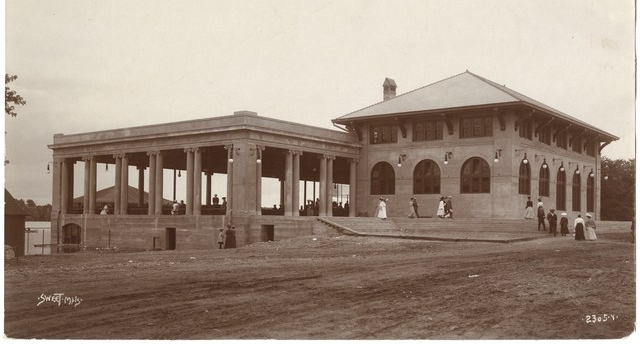
When this picture was taken in 1906 the original Como Park Pavilion was brand new. Photo courtesy MNHS

The attention to the details, such as you see in the lights, contribute to making the Pavilion such a delightful building.
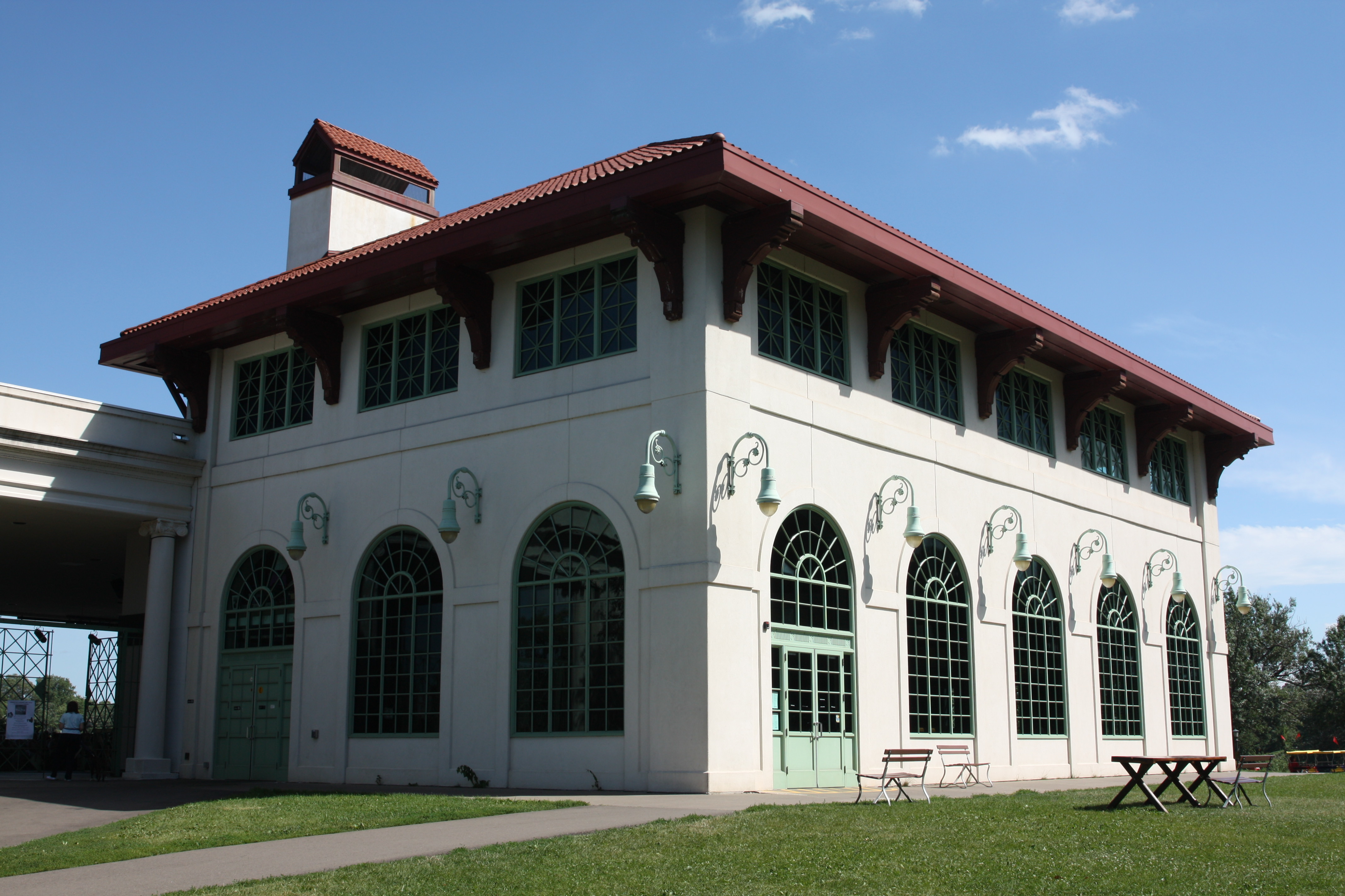
The Spring Cafe occupies the main floor of the Pavilion, and the second floor can be rented for weddings and other events.

A window reflects a pillar and a section of the roof of the stage area.

A good crowd turned to enjoy this band concert.

The Minnesota Chemical Building was showing some age but its beauty still shows through.
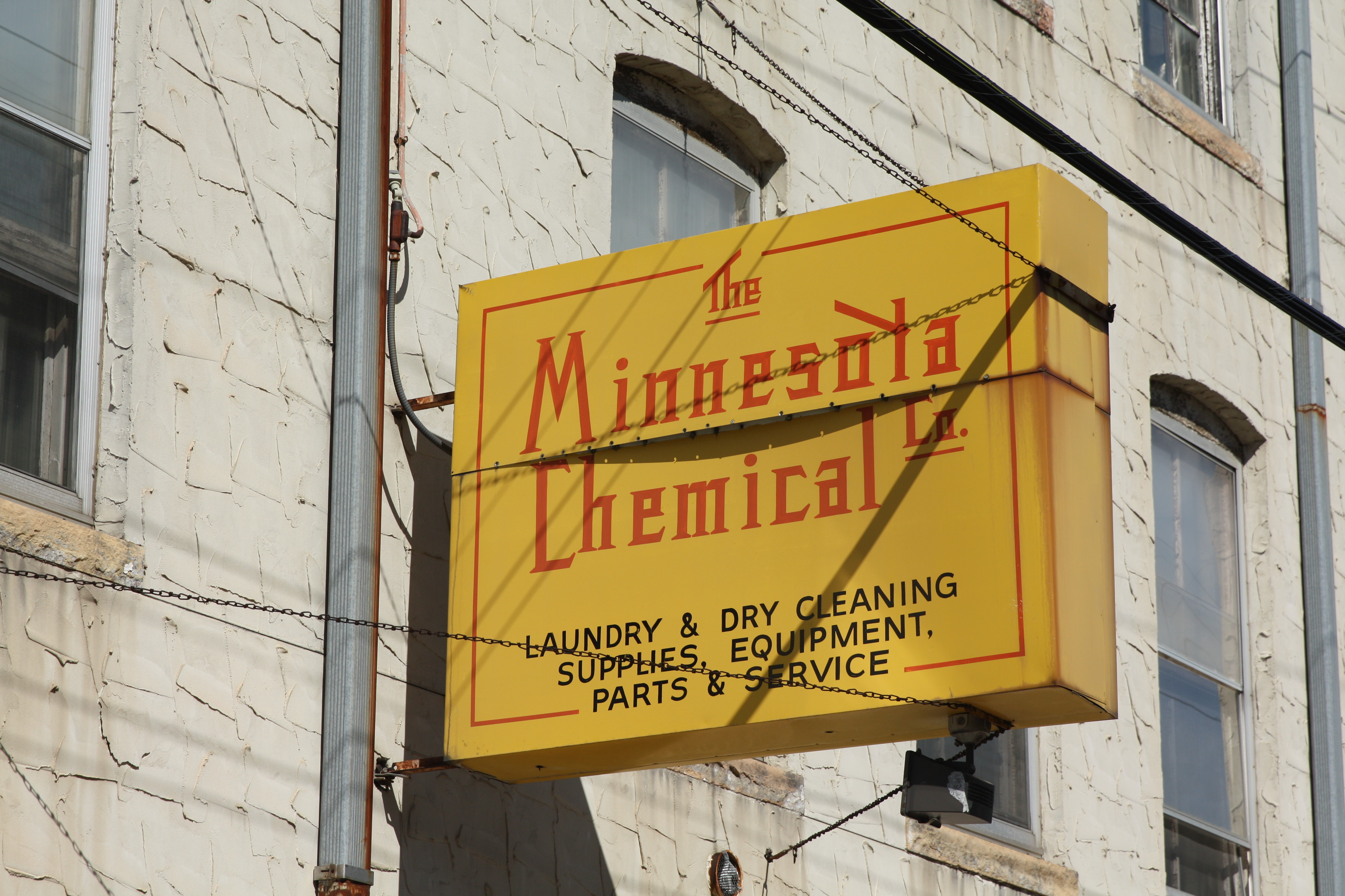
And look at the sign. It’s a gem.

Minnesota Chemical circa the 1930s in its original building. Courtesy Minnesota Chemical Company