Taking a New Path

West End, Downtown, West Side

24.6 Miles

September 1, 2021

When it comes to bike rides for the blog (which I call “Official” rides), regular readers know I do the majority of my biking on St. Paul streets. (The word ‘street’ is in the subtitle of the blog, after all.) I’m not averse to dedicated bike paths. I actually love them, especially on those crazy busy streets where it is dangerous to ride on the road. Think the Sam Morgan Trail next to Shepard Road in Highland Park or the Fish Hatchery Trail along Warner Road and Highway 61 on the East Side.

In late July 2021, stories appeared in several local media outlets about a newly completed bike trail on the West Side. The buzz about this particular trail, the Robert Piram Regional Trail, seemed to be considerably louder than usual. Although it took just over a month to do so, the chatter about the Robert Piram Trail sparked a trip to investigate it. But first I had the ride there.

West End

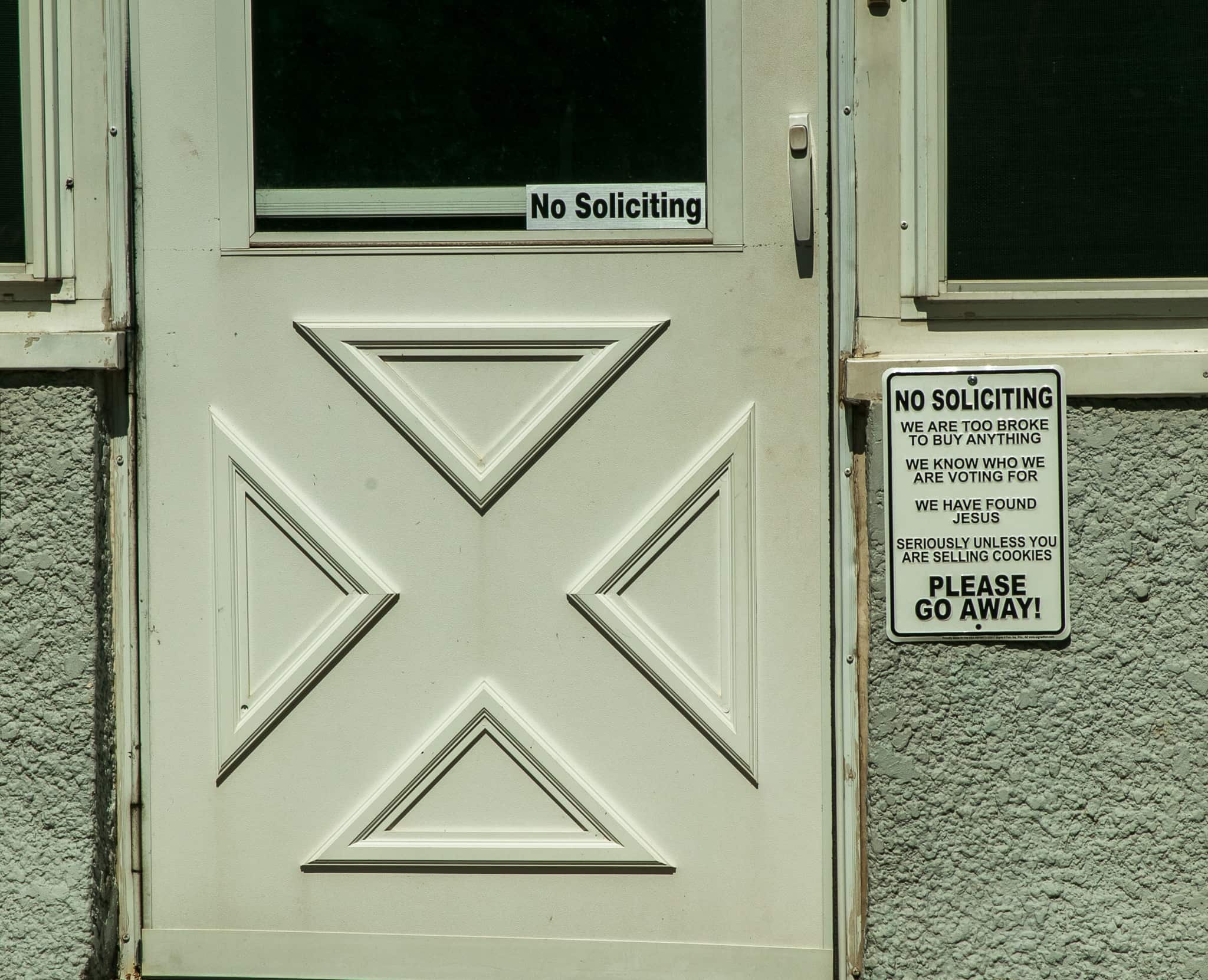
Jefferson Avenue is one of the major east-west thoroughfares I frequent on rides to the West End, West Side, Downtown/Lowertown and Battle Creek/Highwood neighborhoods. The home and yard of 687 Jefferson have been tricked out with novel, entertaining decorations for as long as I can remember. Today I belatedly interrupted the trek to shoot a few photos.

Just another day at 687 Jefferson, where skeletons hang from the roof and a bald eagle perches atop the American Flag.
With this guy imploring you, you’ve got to smile big and wide.
With this guy imploring you, how can you not smile big and wide?
Canada geese guard the eastern property line at 687 Jefferson.
No telling whether the gorilla or skull live here or are just visiting.
Perhaps a distant relative of Oscar the Grouch, this dude keeps his eyes on uninvited guests.
Arrrr you delivering the mail?
It's crystal clear that the homeowners do not need anything.
It’s crystal clear that the homeowners do not need anything…except cookies.
Skeletons guard the playhouse.

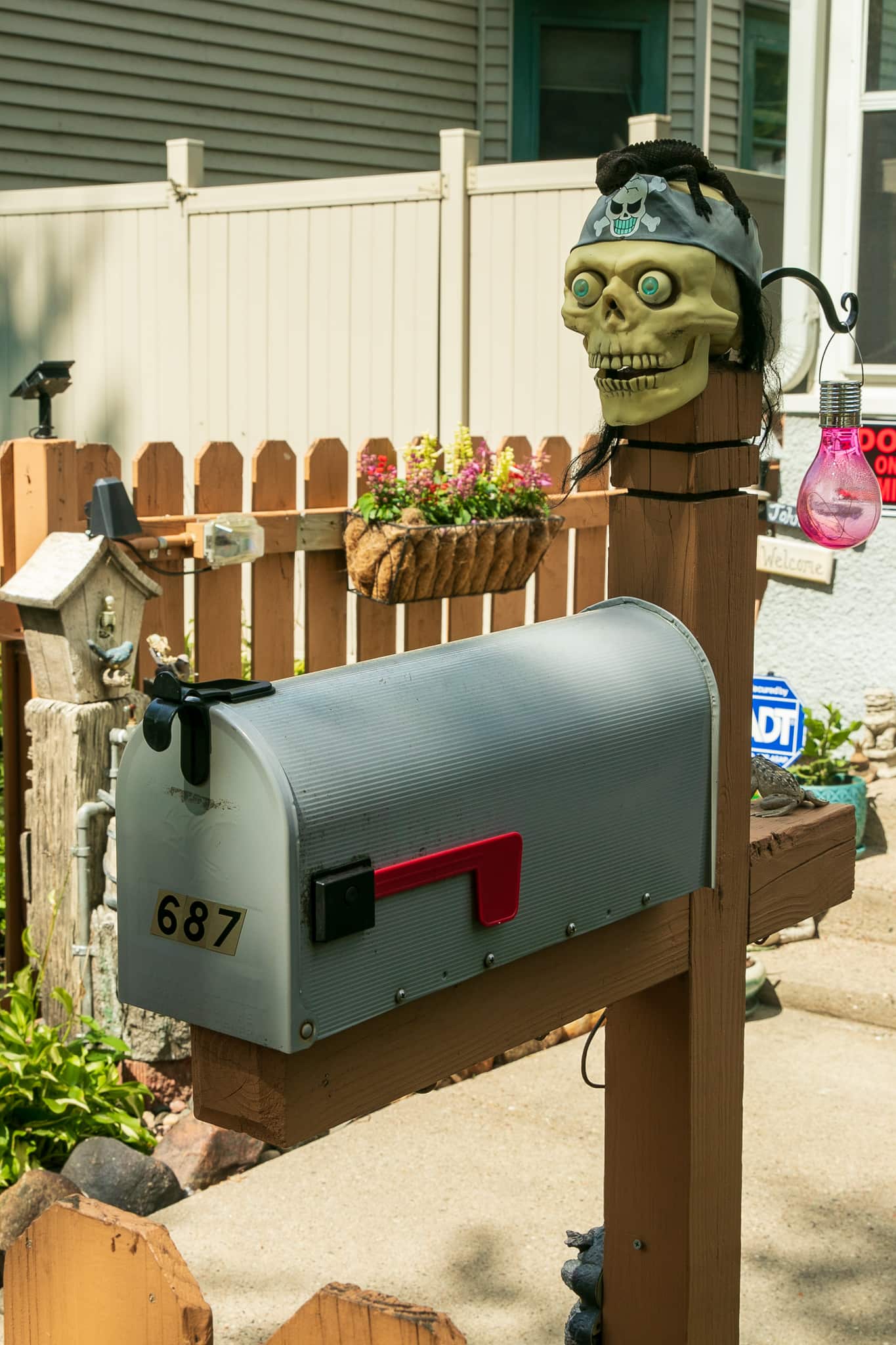
Like you, I have questions galore for the folks living at 687 Jefferson. I hoped they’d notice me feverishly photographing and come out to talk, but alas, no luck there. Another time I’ll risk the wrath of the skeletons by knocking on the door.

West Side

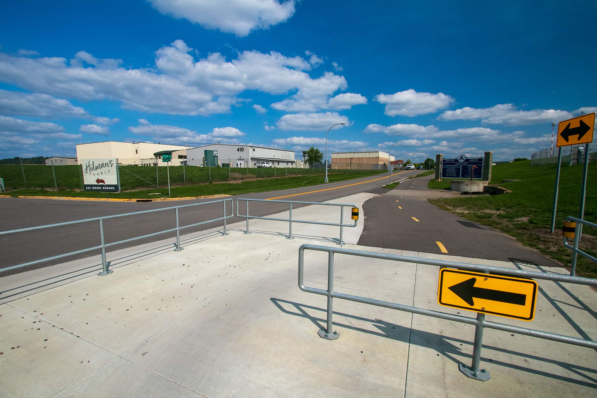
Migrating from the West End through Downtown to the West Side, I stopped to consider the prodigious signage at Wabasha Street at Plato Boulevard.

The bountiful signage for bikers and walkers at Wabasha Street and Plato Boulevard.

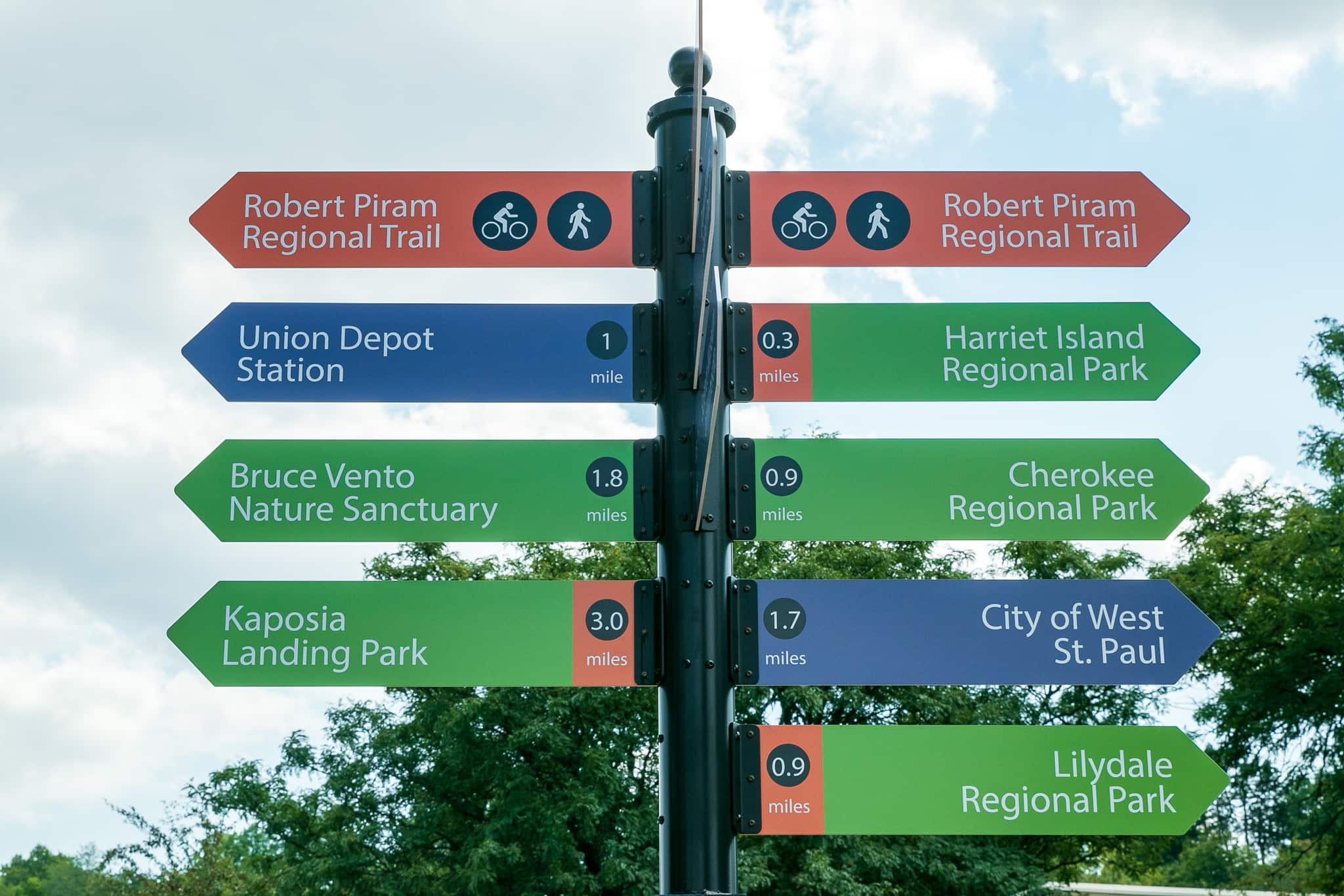
I got on the Robert Piram Regional Trail (which runs along the north side of Plato Boulevard here) by taking a right and riding toward Harriet Island Park and the Piram’s west trailhead.

The Robert Piram Regional Trail is on the right and Plato Boulevard is on the left. The real reason I took this shot is because I’d never seen anyone clean railroad crossing lights.
The Robert Piram Regional Trail is on the right and Plato Boulevard is on the left. The real reason I took this shot is because this is the first time I’d seen anyone clean railroad crossing lights.

Heading back east, the scenery along the trail was a mix of interesting old repurposed brick warehouses, spiritless light industrial buildings and bland office structures.

The concrete curb and about four feet of grass provide a decent buffer between the trail and Plato Boulevard traffic. The overpass in the background is Highway 52.

The east-west section of the trail, between Dr. Justus Ohage Boulevard in Harriet Island Park and East Lafayette Frontage Road, is slightly longer than a mile. The trail ends its flirtation with Plato Boulevard at East Lafayette Frontage Road where it turns to the south.

A biker follows the Piram Trail as it turns west at the intersection of Plato Boulevard and East Lafayette Frontage Road.

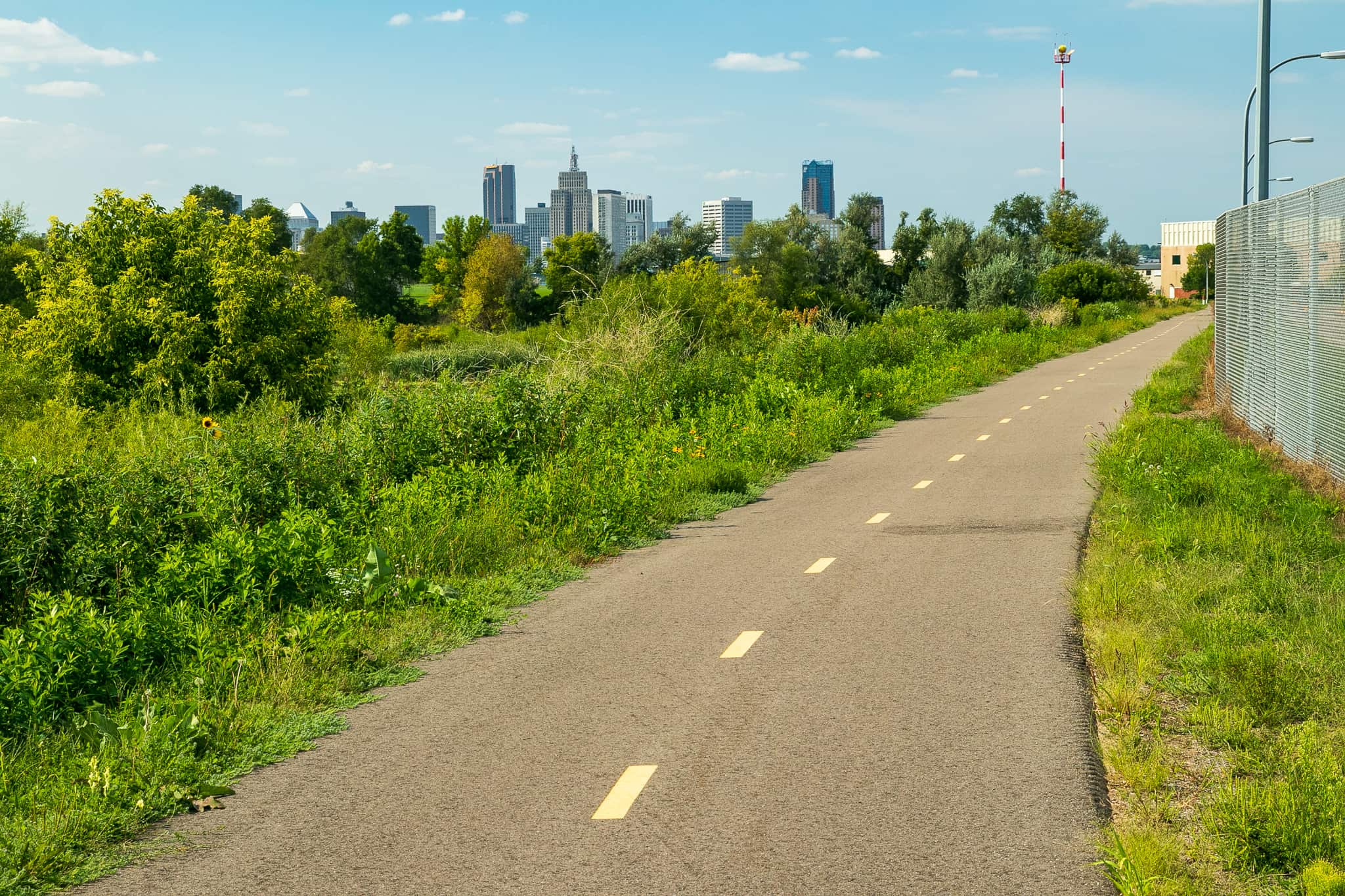
The addition of the Piram Trail to this area is a vast improvement in several ways. Most importantly, safety is dramatically enhanced for bikers and walkers. The trail is a designated place for them to avoid the hectic northbound Highway 52 frontage road/freeway on-ramp where cars zip past at 40 or 50 miles per hour and sometimes faster. Travelers, especially commuters, between Downtown St. Paul and South St. Paul, Inver Grove Heights and other Dakota County communities, now enjoy a safe, smooth well-publicized route.

Still, this is not the most attractive part of St. Paul with the noise and bustle of the Lafayette Freeway (Highway 52) and frontage road just to the west, and more tedious industrial warehouses and lightly used parking lots to the east.

The two lane road to the left of the bike trail is Lafayette Freeway Frontage Road and on-ramp. Lafayette Freeway is to the left of that. In the background, The Airye Condos are the tallest building, Galtier Towers Apartments, in the shorter tower, and Custom House Apartments and Hyatt Place Hotel are in the building in front.
The two-lane road to the left of the bike trail is Lafayette Freeway Frontage Road (the official name) and on-ramp. Lafayette Freeway is to the left of that. In the background, the tallest building is the Airye Condos, Galtier Towers Apartments occupies much of the shorter tower, and Custom House Apartments and Hyatt Place Hotel are in the building in front.
This is Chester Street. The driveway to a deteriorating parking lot on the left (east) and behind it, the distant control tower for the St. Paul Downtown Airport. A light industrial building is to the right.
This is Chester Street. The driveway to a deteriorating parking lot on the left (east) and behind it, the control tower for the St. Paul Downtown Airport. A light industrial building is to the right.
This shot gives a more accurate view of how close the airport really is to Chester Street.

Chester Street, an atrophying road that provides access to the Riverview Business Plaza and a couple warehouses, is basically a north-south street that connects the east Lafayette Frontage Road to Plato Boulevard.

The Riverview Business Plaza as seen from Chester Street, and…
The Riverview Business Plaza as seen from Chester Street…
…from a parking lot looking west toward Chester.
… and from a parking lot looking west toward Chester.
On the back side of the Riverview complex, an earthen levy built to keep the Mississippi River from flooding airport runways.

Continuing south, the Lafayette Freeway Frontage Road and freeway on-ramp entrance is a third of a mile south, at Eaton Street. Here the Robert Piram Trail turns east and quickly enters St. Paul Downtown Airport (Holman Field) property. This is where the scenery morphs from dull to utterly engaging. Whether your preference is ponds, the Mississippi River, boardwalks, woods, heavy industry, flora, airplanes, trains, fauna, remnants of days gone by or a smorgasbord of those, you’ll find it along the enthralling last mile or so of the Robert Piram Regional Trail.

Metal guides force bikes to slow down as they approach a railroad crossing and the entrance to airport property. Notice the airport hangers in the background.

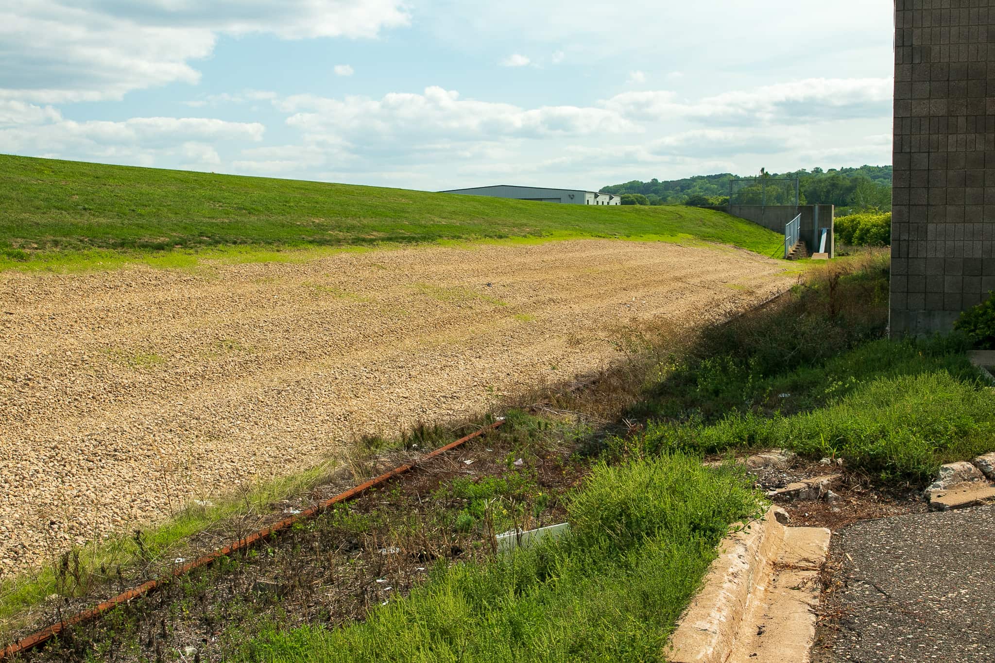
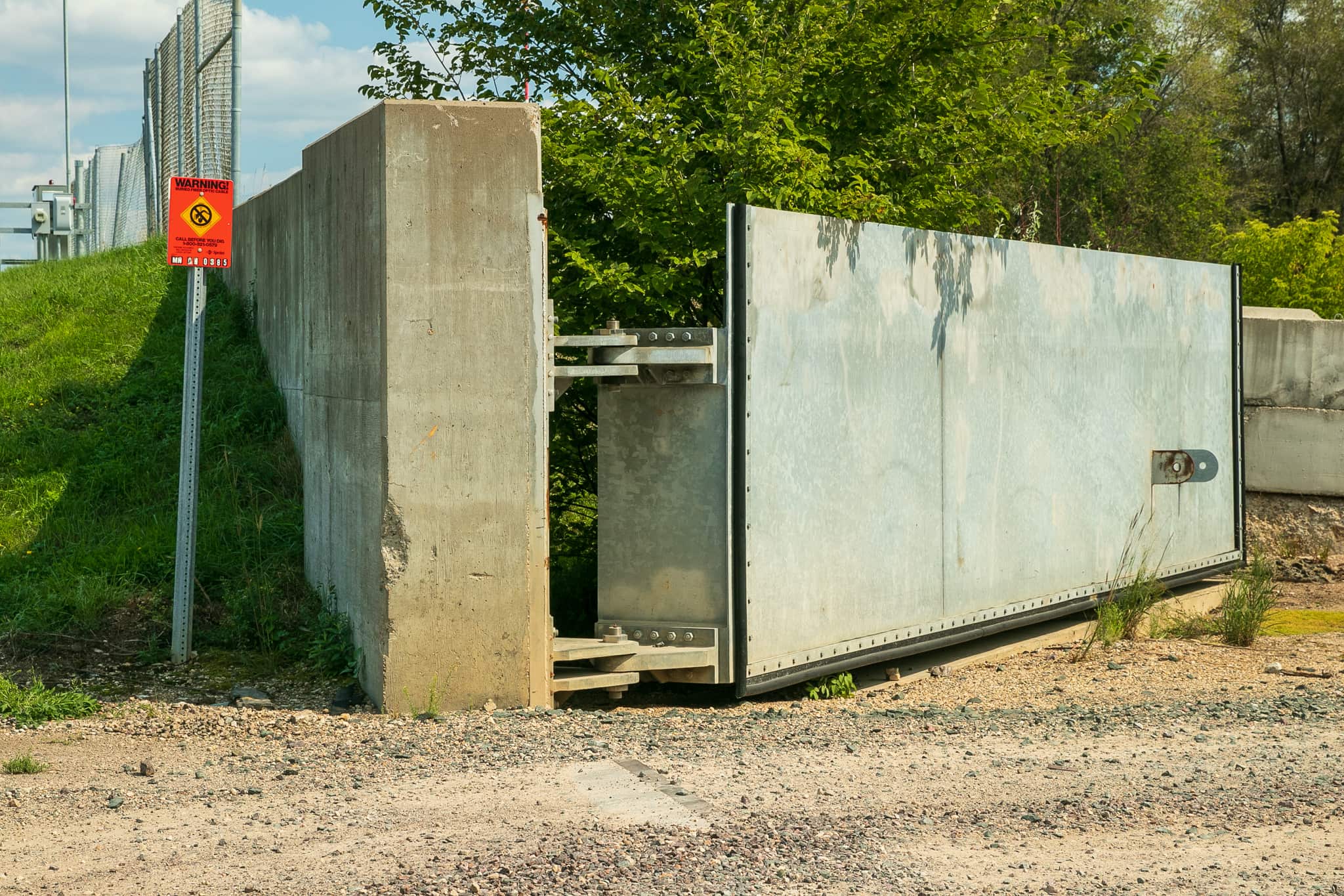
Right off the bat, there’s the unusual massive flood gates, which work in tandem with the levy behind Chester Street and other parts of the $50 million flood abatement system, to reduce the chance of a Mississippi River flood closing airport runways.

Movable metal flood gates at the railroad crossing are open so trains can move through the area, unless flooding is imminent.
Movable metal flood gates at the railroad crossing remain open so trains can move through the area unless flooding is imminent.
The right flood gate...
The right flood gate…
…and left flood gate are about six feet tall.

Several other airport structures, including the State Patrol flight office, came into view to the east, while, to the west, a pond teeming with insects and birds – ducks, green herons and red-winged blackbirds – flitting around.

The unnamed pond is home to dozens of birds and a multitude of insect species. The building and airborne dust in the background are from a metal recycling plant on Robie Street.
The unnamed pond is home to dozens of birds and a multitude of insect species. The building and airborne dust in the background are from a metal recycling plant on Barge Channel Road.
Many well-known local corporations have planes based at St. Paul Downtown Airport. A corporate or charter jet sits on the tarmac awaiting its next flight. The road in the foreground is the private section of Eaton Street within the airport property.

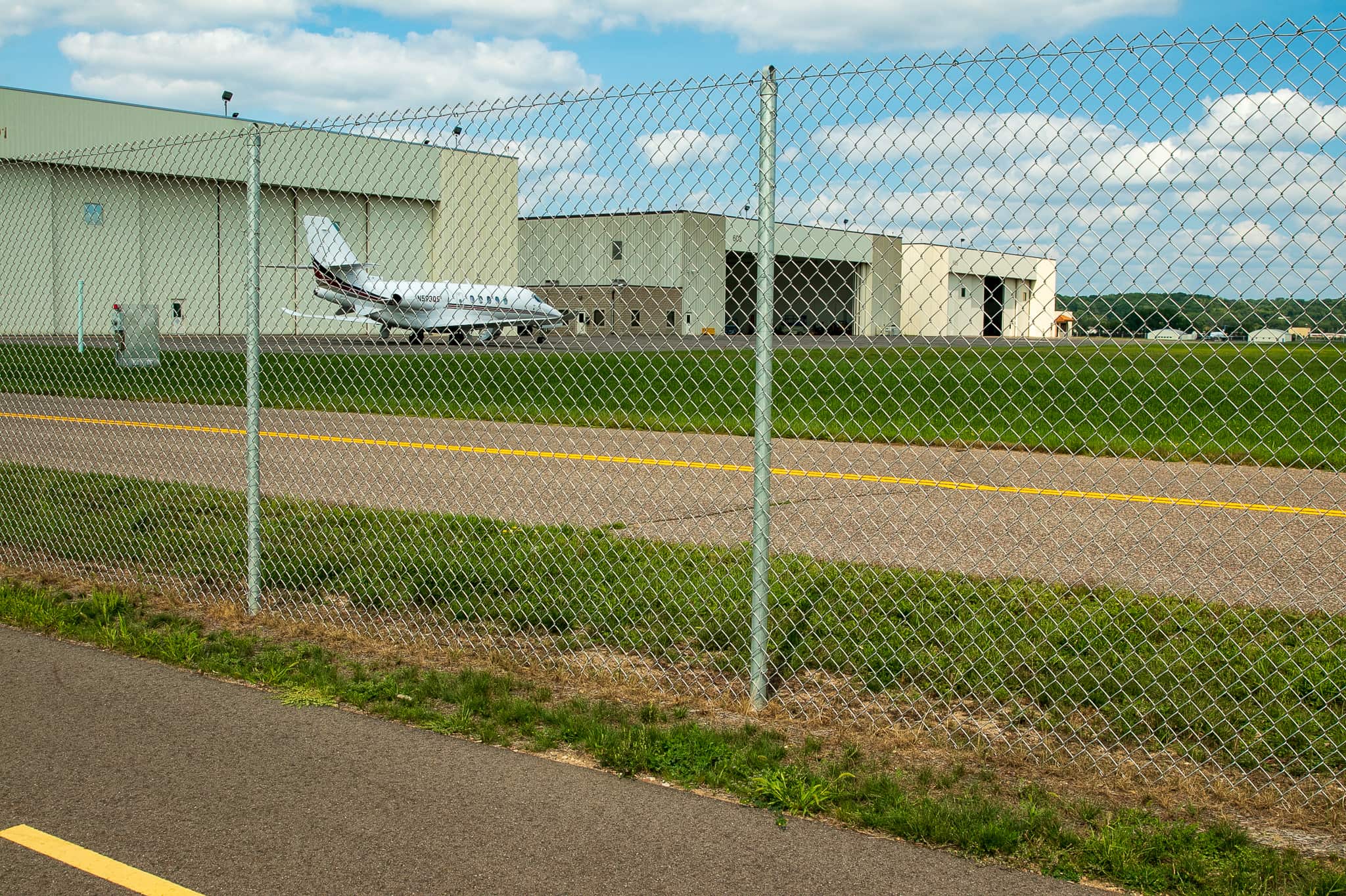
I continued south, away from the airport, crossed the first of two boardwalks and paused. Glancing back from where I came, two hangars and an aircraft tail stood in plain (sorry) sight.

Boardwalk number one of two along the Piram Trail. A couple of hangers are visible to the north. The tail of an aircraft peeks above the trees on the left.
Boardwalk number one of two along the Piram Trail. A couple of hangars are visible to the north. The tail of an aircraft peeks above the trees on the left.

Moving ahead, I was pleasantly surprised by the almost instantaneous transformation in the terrain.

Just across the boardwalk the airport and ponds give way to a dense forest on both sides of the path.

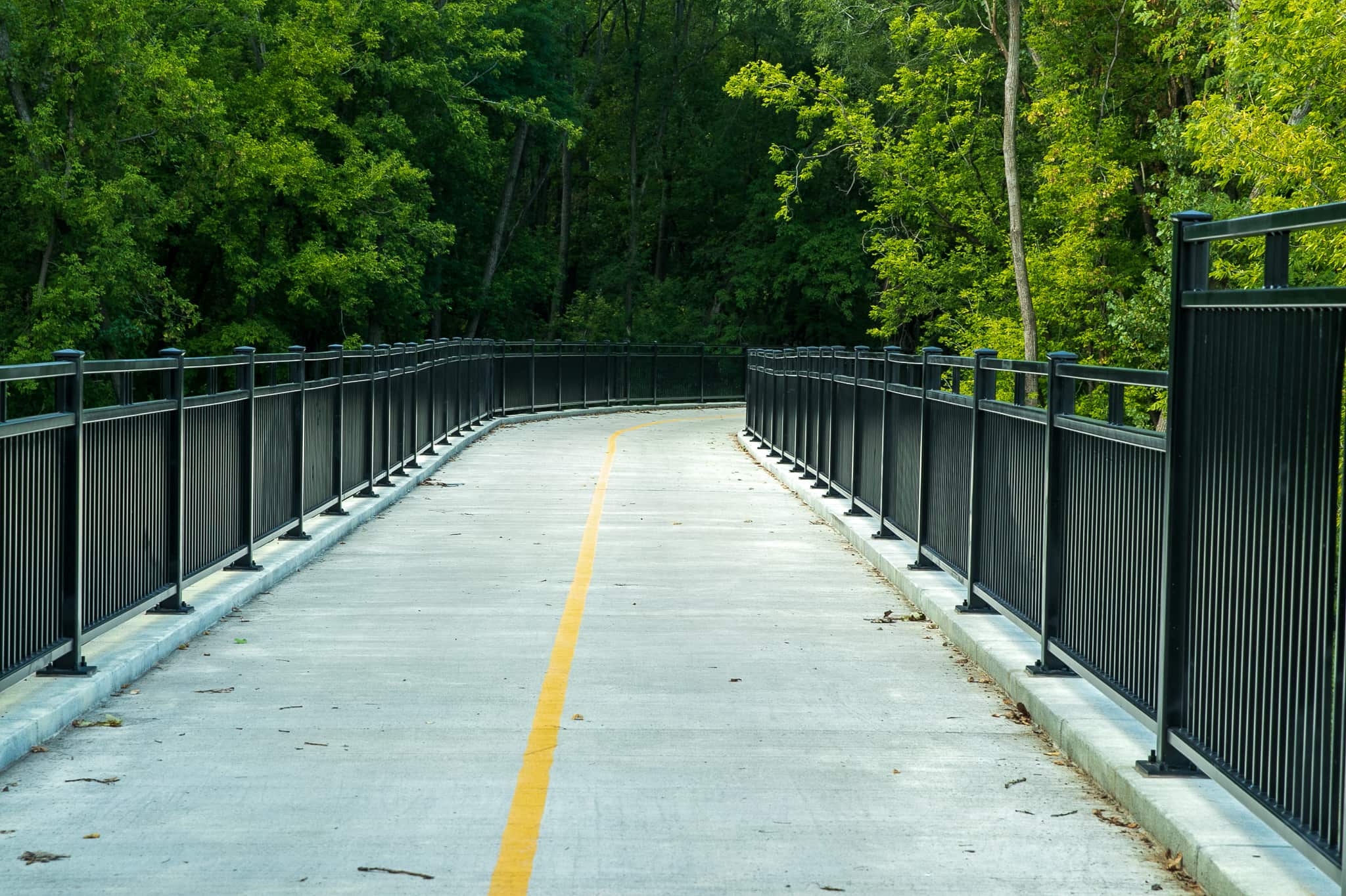
Onward to the south, the path continues its undulating route through the forest and across the second boardwalk.

The second, southernmost boardwalk on the Robert Piram Trail. The first boardwalk is visible if you click the picture and look closely.

On the far side of the boardwalk another transformation occurs as the forest gives way to a glade.

Marshland created by Mississippi River backwater stretches to the east. The Battle Creek and Highwood neighborhoods are in the background.
Marshland within a Mississippi River backwater stretches to the east. The Battle Creek and Highwood neighborhoods are in the background.

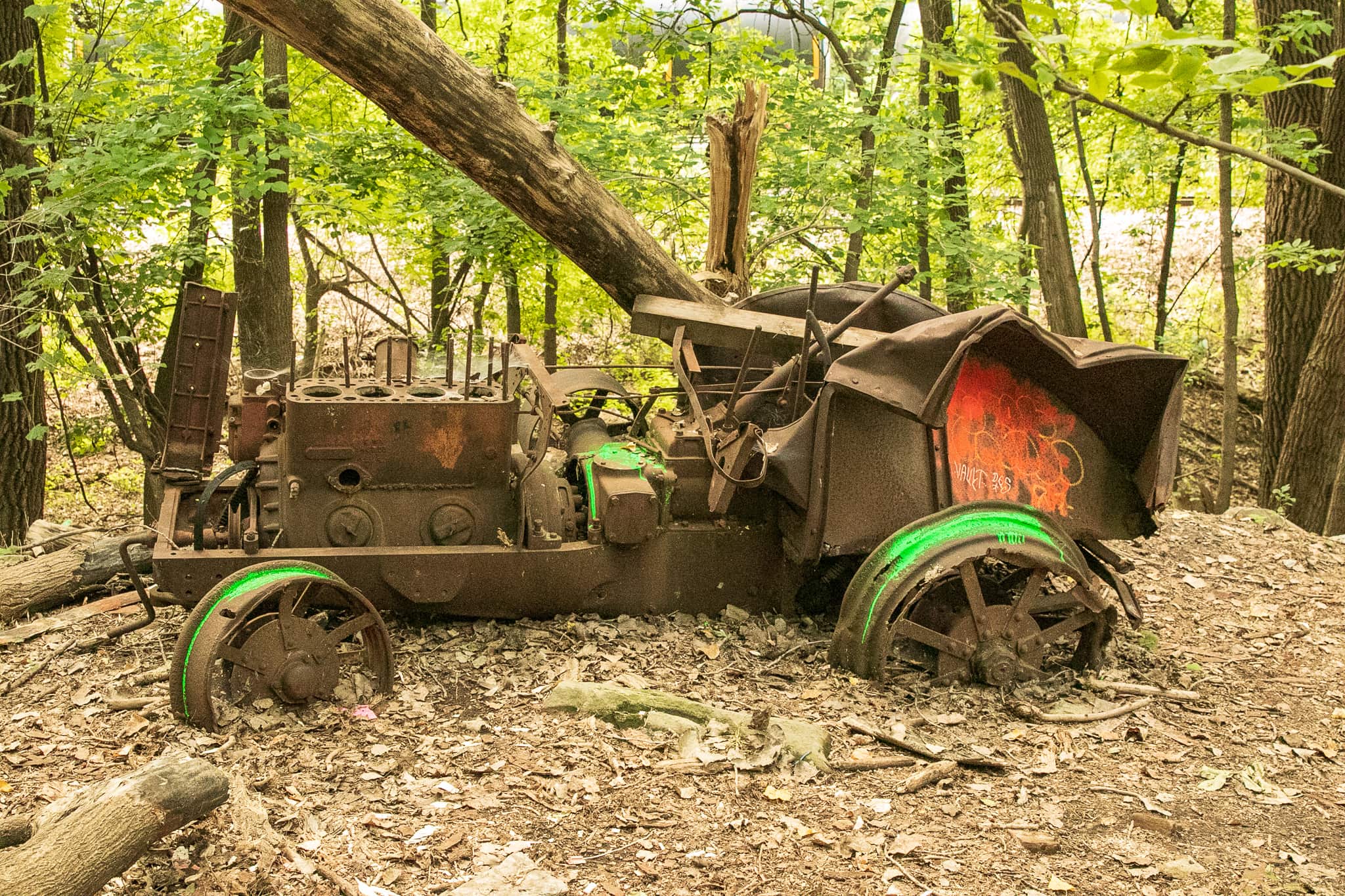
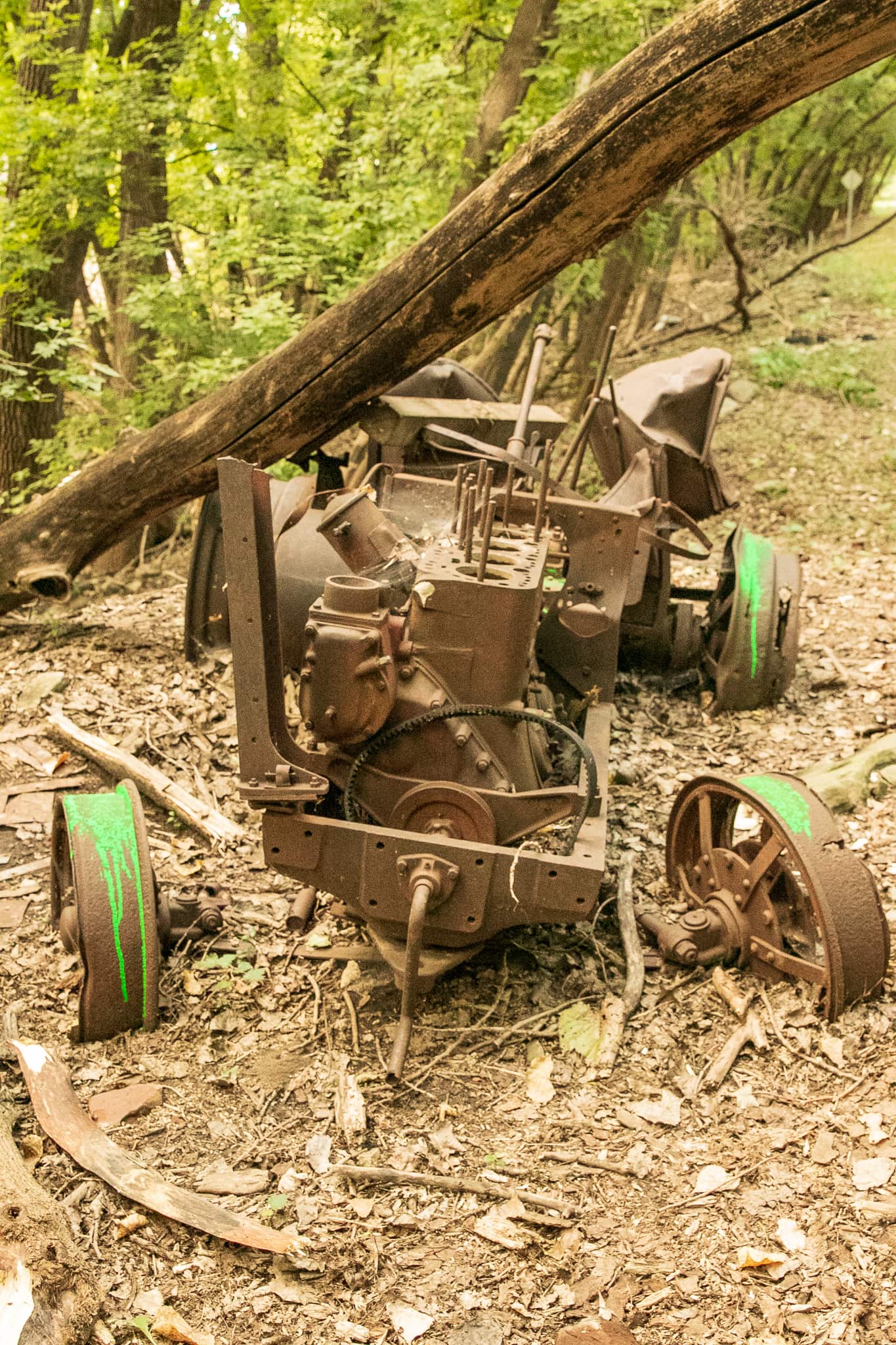
Beyond the marsh it becomes forest again, but with a difference. Several unusual concrete structures five feet wide and three or so feet tall rise as if growing from the forest floor. I jumped off the bike to scrutinize them with the hope of uncovering their one-time purpose.

This odd cement structure offered nary a clue as to its purpose. It appears to have partially sunk into ground.
This odd cement structure offered nary a clue as to what it was or is. It appears to have partially sunk into ground.
This structure had not deteriorated as much as the first one but it was no more helpful in figuring out its use.
This structure had not deteriorated as much as the first one but was no more helpful in figuring out its use.
A look at one of the concrete structures from the other side. The open side of all of them face the water.
A look at one of the concrete structures from the other (back?) side. The open side of all of them faces the water.

Two larger vertical structures are in the same vicinity but off to the south, or right. The concrete tower (immediately below) is on the edge of the woods. The fancier brick assemblage is about 20 feet south, on the edge of a marshy area.

This concrete structure sits in proximity to the smaller concrete boxes. The large opening on the right must have been a door.
Was this small brick building used in tandem with the cement structures? Because of the marsh I was not able to get a closer look.

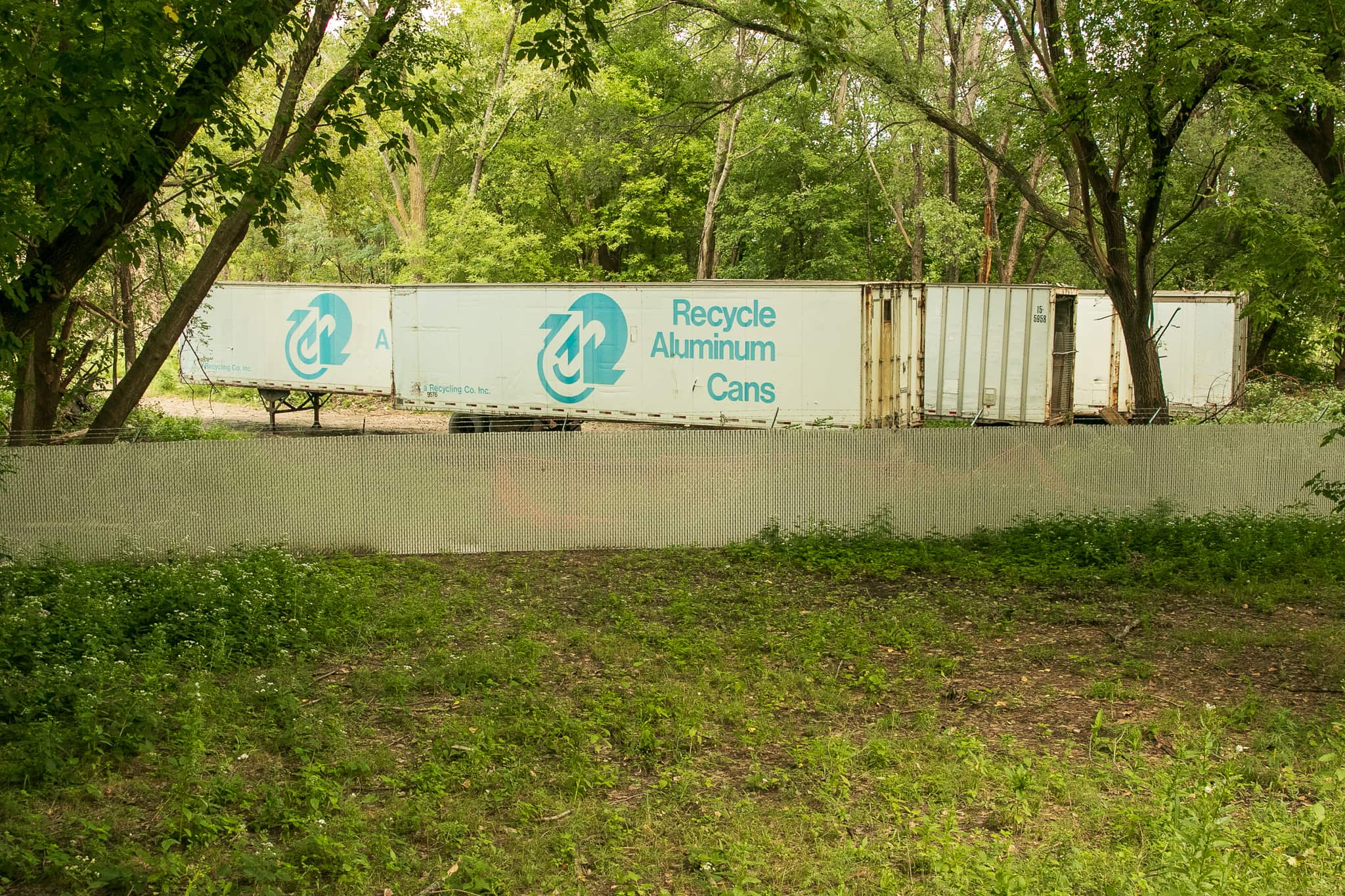
Riding on, it’s a replay of the frequently changing scenery. The trail dips into the forest for a short run before it emerges along Barge Channel Road, a throughway busy with scrap metal recyclers, a Mississippi River barge loading dock, a chemical distributor and the intensely unpopular police department impound lot, the destination for many a towed vehicle.

A trucking company and another metal recycler share this building, situated on the highly industrial Barge Channel Road.
A trucking company and a metal recycler share this building, situated on the highly industrial Barge Channel Road.
The Piram Trail and signage for trail users. This short section runs along Barge Channel Road.
Behind the screened cyclone fence a backhoe separates rebar for recycling.

By this point I should have expected to wander back into the woods, which is exactly what happened.

An unexpected relic, the rusting carcass of a vehicle - perhaps a tractor - sits just off the trail.
An unexpected relic, the rusting carcass of a vehicle – perhaps a tractor – sits just off the trail.
Lacking any knowledge of farm machinery, I can’t confirm the vehicle is a tractor. An interesting note is the hand crank starter on the front.
Being a farm machinery rube, I’m unable to confirm the vehicle is a tractor. An interesting note is the hand crank starter on the front.
Four semitrailers clad with fading recycling slogans and logos sat awkwardly on a gravel lot. By appearances, the trailers hadn't seen any over-the-road travel in a long time.
Just down the path four semitrailers clad with fading recycling slogans and logos sat awkwardly on a gravel lot. By appearances, the trailers hadn’t seen any over-the-road travel in a long time.

At this point I could see a clearing ahead. It happened to be a bridge over several busy Union Pacific Railroad tracks. The St. Paul-South St. Paul border passes through this immediate area.

The cement bridge is approximately where the border of St. Paul and South St. Paul is.
The cement bridge is approximately where the border of St. Paul and South St. Paul is. It takes users over a series of busy railroad tracks.

The Robert Piram Trail comes to an end about a quarter mile farther south, where it meets Kaposia Landing in South St. Paul. I expeditiously talked myself out of continuing to Kaposia Landing and instead turned back north on the trail, retracing my route. One thing became clear – why there’s so much interest in the trail.

Heading home, the Holman Field is behind the fence on the right and the Downtown skyline is ahead.
Heading home on the Robert Piram Trail, Holman Field is on the right behind the fence and the Downtown skyline is ahead.
A small field of wild sunflowers sprouted in a habitable spot between the trail and the earthen berm of the airport.
A small field of wild sunflowers sprouted in a habitable spot between the trail and the earthen berm of the airport along East Lafayette Frontage Road.

The exploration of the Robert Piram Regional Trail, especially the southern mile or so, fascinated me on many levels. So many refreshing changes in surroundings, sounds, even smells, elicited more questions than I had prior to the ride. Among them: Who is Robert Piram? What were the low-slung concrete structures? What is the rusting vehicle and why was it left to languish? How was this unusual route selected? Who is behind this exceptional trail?

It took another month, a respectable amount of research and another ride here, but I got the scoop. And I’ll share it in a future post.

All photos are by the author.

Wolfie Browender

About Wolfie Browender

Pronouns: He/Him/His

Wolfie Browender has lived in Saint Paul with his wife, Sue, since 1986. His two adult daughters also live in the Capital City, one Downtown and the other on the East Side. Wolfie bikes for fun and exercise. Follow his travels along the more than 800 miles of streets in his quest to ride every block of every street in Saint Paul on his blog Saint Paul By Bike at SaintPaulByBike.com.