
Editor’s note: In the 1960s, construction of Interstate 94 took nearly 400 structures and changed three neighborhoods west of Lexington Parkway in St. Paul. St. Paul resident Barb Thoman wrote this article, based on a presentation she has given at Union Park District Council and elsewhere, and Lisa Nelson, co-chair of the UPDC transportation committee, collaborated on research, writing, layout, and map making.
The section of Interstate 94 between Minneapolis and St. Paul opened to traffic in 1968, 20 years before I moved into a house three blocks south of the highway. I think of I-94 as a good and bad neighbor. When I am driving, it provides fast access to destinations near and far. But when I am walking or bicycling, the highway and its connecting roads are often choked with traffic and are a barrier to getting around. Most days, I hear noise from traffic on I-94. When the wind is from the north, it’s especially loud. Occasionally, I smell auto exhaust when I am in my yard, and I wonder with unease what decades of living here might be doing to my health.
The Minnesota Department of Transportation is planning the first major reconstruction since I-94 opened. This got Lisa and me thinking about what our neighborhoods were like before the highway was built. Inspired by the extensive research available on the history of the Rondo neighborhood, we began to look for information about our own neighborhoods but found little information about the structures that had been demolished to make way for the highway.
I-94 and the Rondo neighborhood

The Past Prosperity Study, conducted by ReConnect Rondo, and other studies have documented the racial injustice, losses and devastating impacts of I-94’s construction east of Lexington Parkway through the historic African American neighborhood called Rondo in St. Paul. In Rondo, 700 homes and 300 businesses were removed and destroyed to make way for the highway. Taken was an entire business district along Rondo Avenue, plus churches, a neighborhood school, and cultural and civic organizations and resources. Families and individuals lost jobs, livelihoods, and the cultural and social cohesion of living in this vibrant neighborhood. Rondo residents were not given a fair price for their property, and discriminatory policies and practices such as restrictive housing covenants and redlining made relocation difficult if not impossible. Additional information about Rondo can be found in the St. Paul African American Context Study.
Photo: I-94 Construction in the Rondo neighborhood, at St. Anthony Avenue and St. Albans Street. Courtesy of Minnesota Historical Society.
The effects of highway construction on the Rondo neighborhood are well-documented so we restricted our research to the neighborhoods within the boundaries of Union Park District Council, one of St. Paul’s 17 planning districts.
Over the past year we worked to learn more about neighborhood history prior to highway construction, to count as accurately as possible the number and types of structures that were removed during construction and to gain an understanding of how the highway construction affected neighborhoods afterward and today.

Almost 400 Structures removed within Union Park district
Over the past year, we have reviewed numerous articles, historical maps and photographs. I talked with two former residents who lost homes to the highway in the Union Park district. We estimated the number of structures lost by cross-referencing historical maps, documents and aerial photographs.

| Neighborhood Section | Estimated structures lost |
|---|---|
| Minneapolis border to Pelham | 7 |
| Pelham to Cretin/Vandalia | 55 |
| Cretin/Vandalia to Cleveland | 23 |
| Cleveland to Prior | 45 |
| Prior to Fairview | 61 |
| Fairview to Aldine | 66 |
| Aldine to Snelling | 64 |
| Snelling to Hamline | 53 |
| Hamline to Lexington | 6 |
| Total structures lost | 380 |
We found that nearly 400 structures — houses, apartments, businesses and institutions — were demolished to make way for the highway. This is certainly an underestimate of the total housing units and businesses that were lost; lacking specific information about many of the buildings, we have generally counted only one structure per lot, except in the case of multiple structures on larger commercial/industrial lots. Many of the residential structures were multi-family units, including apartment buildings. Commercial buildings often held more than one business. The demolitions and the highway that replaced them changed lives, eliminated local jobs and reduced community cohesion.
Merriam Park history
The Merriam Park neighborhood and the area to the north now known as Iris Park were first developed in the late 1800’s. These were commuter suburbs between the cities of St. Paul and Minneapolis. They boasted a 12-minute trip on a passenger train on the Milwaukee Road’s Short Line railroad to either downtown and jobs within walking distance in the Midway area.

Annotated illustration of the Merriam Park neighborhood, 1886, looking south from the Merriam Park train station (lower center) toward Marshall Avenue (at the top of the map). Courtesy of Minnesota Historical Society.

Annotated map showing the street grid corresponding to the area shown in the 1886 illustration. Courtesy of Lisa Nelson.
The earliest development in the neighborhood centered around Merriam Park Station, which was located at what is now the corner of Prior Avenue and Gilbert Avenue, and gradually spread outward. (For a detailed history of the Merriam Park neighborhood, see the Historical Survey completed in 2018.)

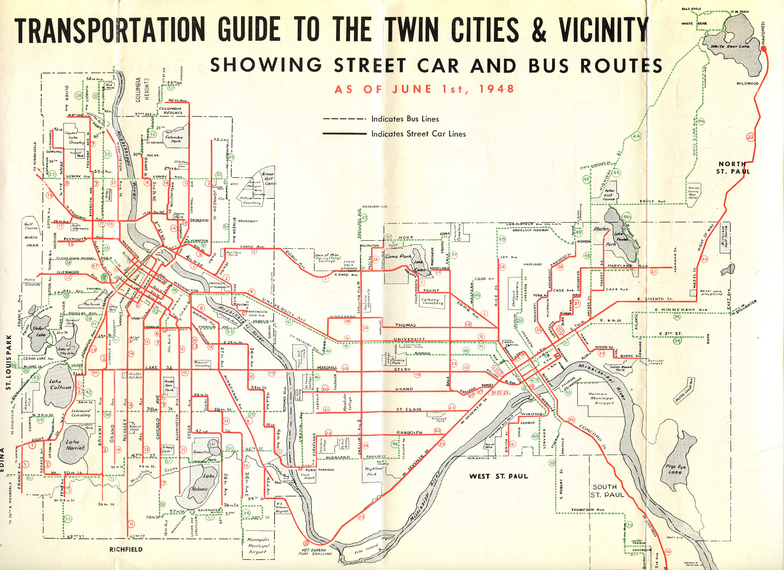
Construction of streetcar lines beginning in the late-1890s led to additional development in the neighborhood. Through 1938, a streetcar line operated by the Twin City Rapid Transit Company ran on Prior Avenue between University and Marshall avenues. In later years it was replaced by a bus line.


I-94 planning, opposition and construction
In the 1940’s the federal government adopted plans for a nationwide system of interstate highways. Although construction of I-94 was supported by federal, state and city government, plus business interests, truckers and labor, there was opposition. George Harrold, St. Paul City Engineer, advocated for a northern alignment instead of old St. Anthony and Rondo avenues. In 1947, the St. Paul City Council quietly approved a plan for I-94, including an alignment along old St. Anthony Avenue.
The Rondo neighborhood was the first to organize formal opposition once the full extent of the demolition plans within the city were made more public, creating the Rondo-St. Anthony Improvement Association in 1955. The Association pushed successfully to have the highway below grade rather than elevated at Victoria Street and Lexington Parkway. It also advocated for fair housing practices, unfortunately without success.
Passage of the Federal Aid Highway Act in 1956 established a robust funding source for highway projects nationwide. With funding available, the Minnesota Department of Highways (MDH) could begin demolitions and construction.
Residents of the Merriam Park neighborhood organized to oppose both the location and design of the proposed highway and formed the Merriam Park Residential Protective Association (MPRPA) in 1959. Initial efforts to get the highway moved north to another part of town were unsuccessful. After three years of lobbying and organizing, the MPRPA was able to secure political support to drop plans for a mile-long section of elevated highway at Fairview Avenue and eliminate an exit at Prior Avenue.

By 1961, construction of I-94 was completed from downtown St. Paul through the Rondo, Lexington-Hamline and Snelling-Hamline neighborhoods to Snelling Avenue. In 1962, MDH began buying structures in Merriam Park and neighborhoods to the west within today’s boundaries of Union Park District Council. By 1964, all structures in the highway’s path through St. Paul had been removed and all properties had been cleared.
Loss of commercial nodes
Within the Union Park district, I-94 followed and replaced a thriving east-west commercial corridor known as St. Anthony Avenue, which intersected with Rondo Avenue just west of Lexington Parkway. Many commercial nodes, major businesses and institutions, and homes were located along old St. Anthony Avenue, primarily at intersecting north-south streets. Today there is a non-contiguous frontage road called St. Anthony Avenue, which bears no resemblance to old St. Anthony Avenue.

These commercial areas were destinations where jobs, services and shopping could be accessed by transit and walking. The intersection of old St. Anthony and Prior avenues was the commercial and social center of the Merriam Park neighborhood. There were two- and three-story buildings on the four corners. Tenants included Cut Price Marketgrocery, Gambles Hardware, Erickson’s Drug Store, a hair salon, an event center called Woodruff Hall, The Park Café, a bar, a barbershop, a plumbing company, Brainerd Bait shop, Zack’s Shoe Repair, Evelyn’s Sewing Supply Store and more. Several of the buildings had apartments on the second and third floors.


Another commercial hub at the intersection with Cleveland Avenue (see a 1963 photo of this intersection here) included the Corner Inn, Ken’s Service Station, Hasset Oil Company, a window shop and Haver Manufacturing. A plumbing business and Jack’s Manufacturing, which made cleaning products, operated at old St. Anthony Avenue and Wilder Street. There were two freight businesses at Prior and Milwaukee avenues.

Mayers Grocery and Shaller Foods were located at the intersection with Fairview. A dry goods store, a barber shop and a dozen apartments were in a cluster of commercial buildings at old St. Anthony Avenue at Merriam Terrace.


An expansive enterprise, Merriam Park Floral Company, was located where the Cretin/Vandalia interchange at I-94 is today. The business, with its 23 greenhouses, a private home and a floral shop had been in the same location for 75 years. The business was started by Max Kaiser, an immigrant from Bavaria, Germany. When Kaiser retired after 45 years, he sold the floral company to his foreman, Julian Bilski. The business was demolished in 1959 to make way for I-94.


Home demolitions
The houses demolished to make way for the highway included some of the oldest in Merriam Park. Milwaukee Avenue and old St. Anthony Avenue had been among the first areas in the neighborhood to be developed. The houses razed for the highway included Queen Anne-style homes from the late-1800s.


Lost was a majestic house at old St. Anthony Avenue and Wilder Street that had been divided into apartments. The house was built in 1875 by a fur trader. Other houses removed from the area were more modest; a row of nearly identical houses along old St. Anthony Avenue (addresses 1911-1927) had been built in 1889 as rental properties. The majority of the nearly 400 structures removed were homes of various types: owner-occupied, rental, apartments and boarding houses.


Bill Casey, a Merriam Park resident whose family home was in the path of the highway, reported that they got a fair price for their house. Mary Meyer, whose family rented a home in the path of the highway, stated, “No one wanted to leave their community with all its convenient amenities.” Since most residents and business owners within the boundaries of the Union Park district were white, finding new housing was easier and possible, unlike the situation faced by the African American residents displaced from the Rondo neighborhood.

Much of the north portion of Desnoyer Park was still undeveloped in the early-1960s so fewer structures were taken there. In the stretch from Fairview Avenue to Pascal Street in the Lexington-Hamline neighborhood, most structures lost appear to be homes. East of Pascal Street to Lexington Parkway, the area that became the highway was largely industrial or undeveloped. Concordia College lost a football field to highway construction just west of Lexington Parkway; it was condemned in 1961 and the college was paid $320,000.
Neighborhoods disconnected

More than a dozen streets in the Union Park district were severed for construction of I-94 includingRaymond Avenue, Hampden Avenue, Howell Street, Ferdinand Street, Dewey Street, Wheeler Stret, Herschel Street, Aldine Street, Pierce Street, Fry Street, Asbury Street, Syndicate Street, Griggs Street and Dunlap Street.Several other streets were removed entirely. Today the highway can be crossed in only 11 places along the entire 3-mile corridor discussed here, including two pedestrian- and bike-only crossings. Neighborhoods that were once connected are now divided and full of dead-end streets, making travel more difficult and limiting neighbor-to-neighbor connections.

Conclusions and what comes next
Doing the research for this article gave Lisa Nelson and I a greater appreciation for what our neighborhood was like before the highway came through and what was lost. Homes that people owned and rented were demolished (a few were moved) and residents had to find new housing. Business owners had to relocate if they could. Some businesses disappeared. We lost so many commercial nodes that provided shopping and services to which people could easily walk or bike. Street connectivity was greatly reduced — burdening the remaining streets with more traffic. For decades now and continuing to today, I-94 has generated noise, traffic and harmful emissions. The question now is: What comes next?
Understanding what the neighborhood was like before highway construction provides context for imagining what the neighborhood could look like in the future. How can the damage be undone or lessened? Can the commercial centers of old St. Anthony Avenue be resurrected? Can the historic and ongoing harms, particularly to marginalized communities, be repaired? Can traffic be slowed to quieter and safer speeds? Can one or more highway caps be constructed? Could the highway be changed to a multi-use boulevard? Can the corridor be made greener and healthier? Can neighborhoods be reconnected? It will be important for residents of Minneapolis and St. Paul to make their voices heard in the coming months and years as planning for I-94’s reconstruction continues and design begins.
Research for this project is ongoing. We welcome ideas, questions or corrections. Share memories of how highway-adjacent neighborhoods have changed in the past 60 years and dreams of what could happen in the next 60 years in the comments below.
Sources and resources
-
- Map from 1957 before the highway was fully built.
-
- Ramsey County aerial photographs from 1953
-
- Map from 1964 before highway fully built.
-
- Map from 1969 after highway construction.
-
- Minnesota Department of Transportation maps.
-
- Carson Map Company Inc. LaFeria Texas, Platbook of the City of Saint Paul in Ramsey County, Minnesota Purchased from Athea Maps and Prints, 1750 Selby Avenue, St. Paul, MN.
-
- G.M. Hopkins Co, Ramsey County – St. Paul and Suburbs 1928 Revised 1959.
-
- Barb Thoman conversations with Bill Casey on 3/7/2021, 1/20/2022 and 1/24/2022. Mr. Casey grew up on Milwaukee Avenue (now Gilbert Street) in a house built in 1881.
-
- Barb Thoman conversation with Mary Meyer on 9/27/2022.
-
- Patricia Cavanaugh, Politics and Freeways: Building the Twin Cities Interstate System, Center for Urban and Regional Affairs, University of Minnesota, 2006.
-
- Tom O’Connell and Tom Beer, Preserving a “Fine Residential District”: The Merriam Park Freeway Fight, Ramsey County Historical Society, Ramsey County History, Winter 2013, pages 3-13.
-
- Paul Ceplecha, “Coming of Freeway Brought to a Close Greener Day for Merriam Park,” article about Merriam Park Floral Company published in the Highland Villager ca.1980.

Barb spent her working days promoting active/low carbon transportation and recycling. Barb tends a big pollinator garden and is a Minnesota Water Steward.