Editor’s Note: Max Hailperin is walking each of Minneapolis’ 87 neighborhoods, in alphabetical order. He chronicles his adventures at allofminneapolis.com, where the original version of this article was published May 6, 2025.
Because this fifth walk in Minneapolis’ Near North neighborhood picked up where the fourth one left off, it includes the eastern fringe of the Oak Park area, Knox Avenue North through Humboldt Avenue North. However, this walk is quite different in character because eastern Oak Park is only one of the four strips surrounding a street-less superblock, all of which I walked, as shown in the route map.
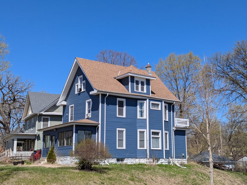
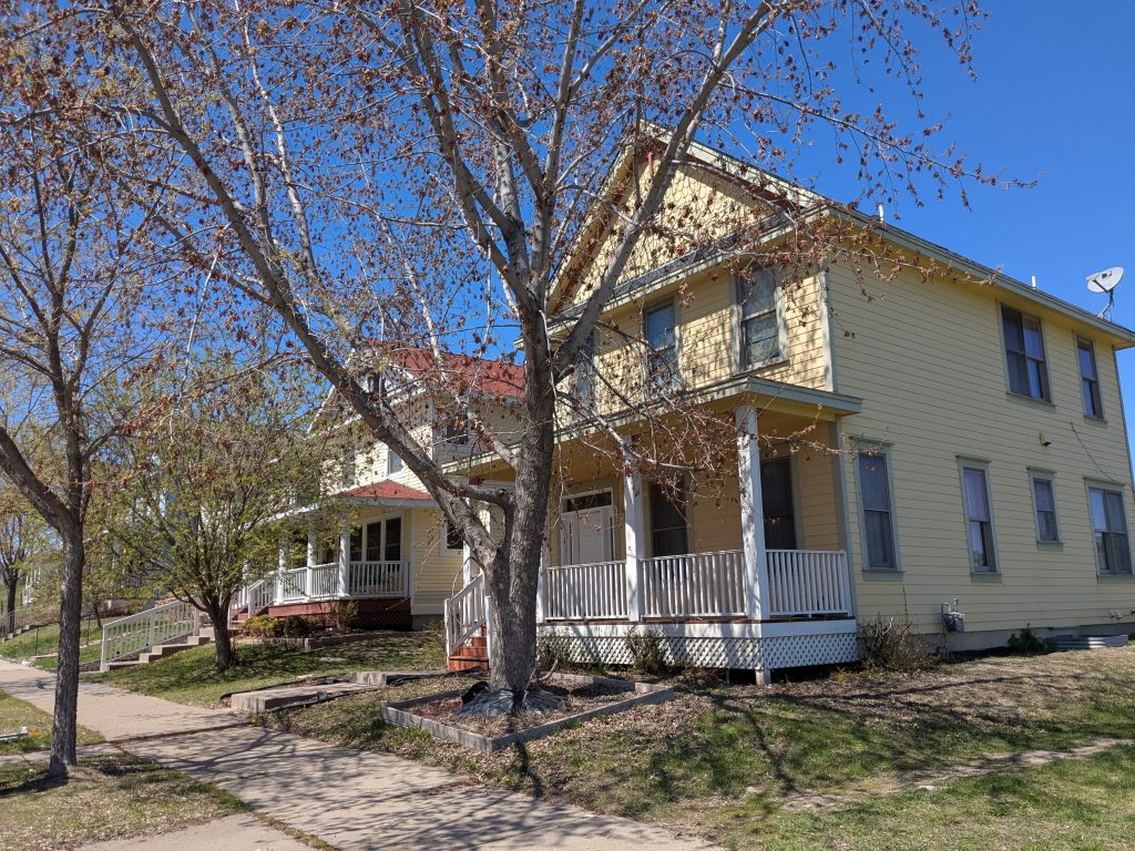
One consequence of this difference is that I largely saw newer structures, dating either from redevelopment around 1970 or from a later wave of re-redevelopment around 2000. However, the start of my walk was in the Oak Park area, and indeed the house on the corner of Elwood and Irving avenues was one of the oldest I saw, dating to 1904.
Rather than continuing straight up Irving to Plymouth Avenue, I initially turned east on Eighth Avenue. This allowed me to walk the little loop near the south end of the route map, part of the overall main loop of the walk, shown in blue. But at least as importantly, that led to several of the forward-and-back spurs, shown in red.
In particular, where Eighth Avenue reached its tee intersection with Humboldt Avenue, I initially turned north for a spur up Humboldt to 12th Avenue.
Actually, given that I’m a pedestrian, the tee intersection isn’t truly a tee. There’s a path along the Eighth Avenue alignment that cuts through the superblock, dividing the southern edge of Bethune Park from the other land uses in the southernmost part of the superblock.
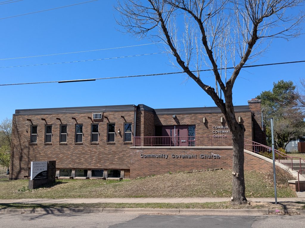
But never mind that, because I didn’t walk that path. I turned onto Humboldt. In addition to some more single-family housing, this brought me past the Community Covenant Church. This brick-clad building from the mid 1960s is sufficiently neutral in form that I checked the building permit index card to see whether it was initially constructed as a church. Yep.
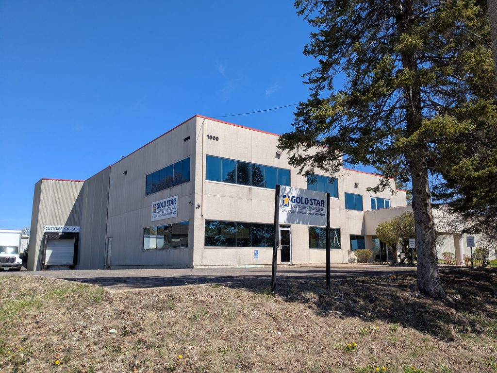
The east side of Humboldt’s next block north, between 10th and 11th avenues, is entirely occupied by Gold Star Distribution. Their sign describes them as a distributor of “general merchandise,” which is not a very helpful clue for this outsider to the business. Judging from their website, they wholesale the goods a convenience store would stock.
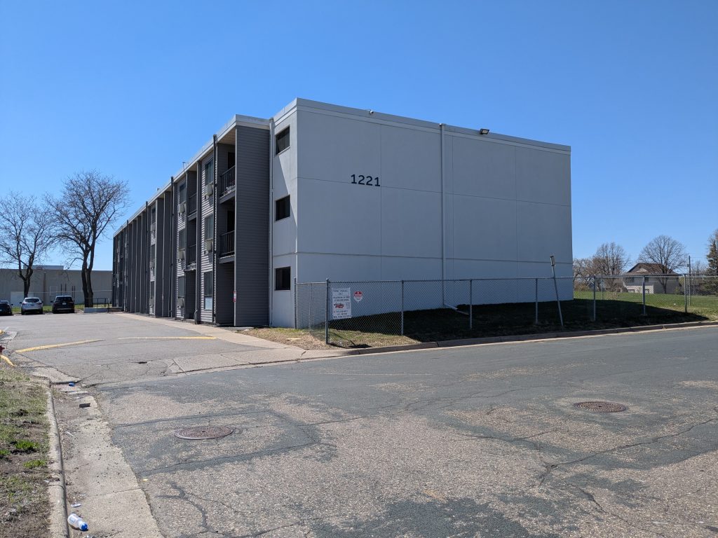
Yet further north, I used a short spur off of my long Humboldt spur in order to walk the cul-de-sac, Banneker Avenue, that leads to the Parkview Apartments. This affordable housing complex, originally developed in the early 1970s as Bethune Park Apartments, combines three low-rise apartment blocks with a high-rise tower. The complex was renovated in 2019.
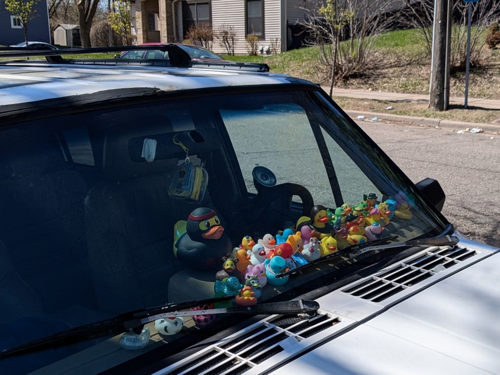
As I returned south on Humboldt Avenue, still using the sidewalk on its east side, I passed the same parked vehicles as I had northbound. However, now I was approaching each of them from the front rather than the rear. That makes a difference when one of them has a dashboard full of ducks. According to a news report, “it’s part of a game essentially meant to brighten someone’s day.” Well, it brightened my already bright day. And I hope it will brighten your day too.
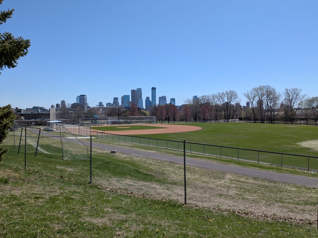
I also paused my southward walk just after crossing 10th Avenue so that I could look out over Bethune Park from its northwest corner. In particular, this provided a view of the ballfield diamond, a brand new feature constructed in summer of 2024 with finishing touches in spring of 2025.
Once I passed Eighth Avenue, I was no longer on the spur portion of Humboldt. Instead, I was back on my route’s main loop, just for one block, though, to the tee intersection at Seventh Avenue. At that point, before continuing the loop westward, I did another long spur eastward as far as Van White Memorial Boulevard. This took me along the southern edge of the superblock, allowing me to see the portion south of Bethune Park.
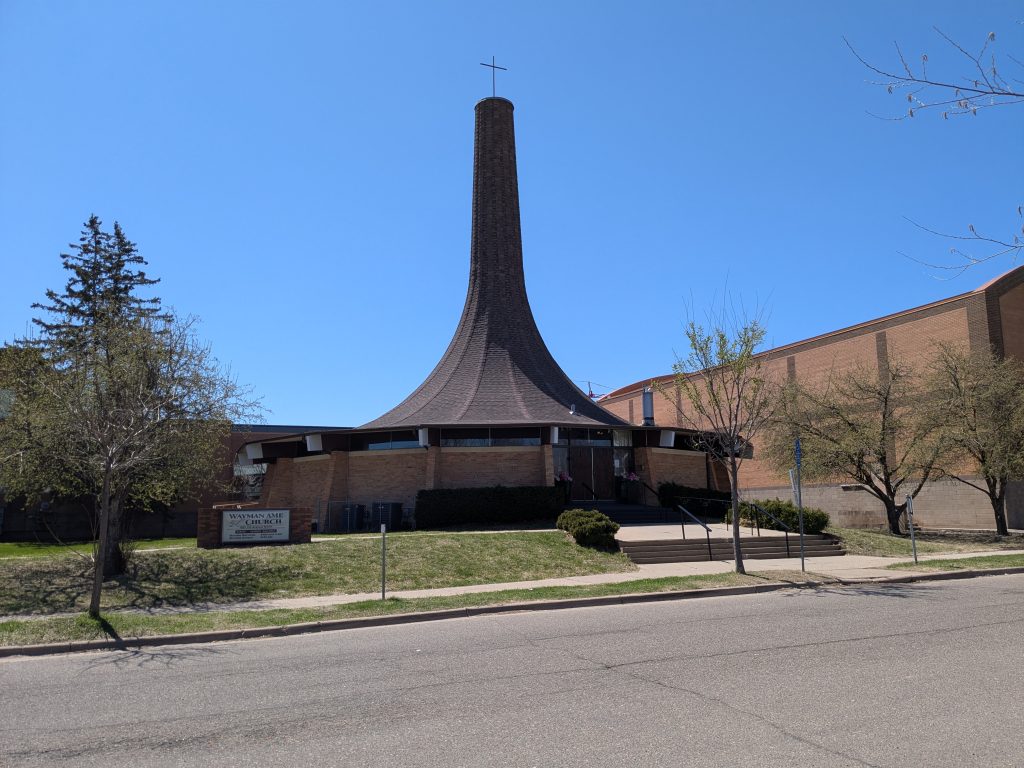
I also got a view of the narrow strip south of Seventh Avenue and north of Olson Memorial Highway. That includes the striking Wayman African Methodist Episcopal (AME) Church. I’ve seen a number of round churches from the late 1960s, but this one is distinguished by the integration of roof and steeple into a single entity shaped like the bell of a horn. In the background of the photo is a connected school building, which I saw from the other side at the end of the walk.
On the north side of Seventh Avenue, the western two thirds (from Humboldt to where Fremont would be) is occupied by the Donald M. Fraser Early Childhood Family Development Center, a Head Start center operated by PICA (Parents In Community Action).
The center was named for the mayor at the time of its construction, but not until later—this isn’t self-promotion. The original name was Grant Park Early Childhood Development Center, reflecting the earlier name of Bethune Park.
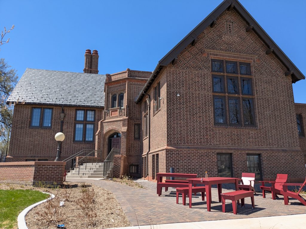
Although the center’s address is on Humboldt Avenue, its main entrance is on Seventh Avenue, as shown in the photo.
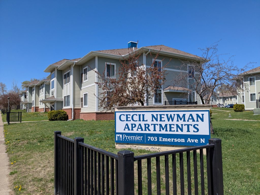
Continuing along the north side of Seventh Avenue, the other one-third of the superblock, from the missing Fremont Avenue to Emerson Avenue, is occupied by Cecil Newman Plaza, also known as the Cecil Newman Apartments. Like the Parkview Apartments, this is an affordable housing complex from circa 1970 that has been recently renovated.
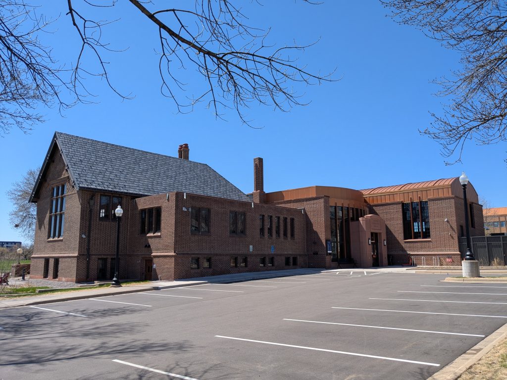
Sumner Library is located across from Cecil Newman Plaza on the south side of 7th Avenue. It is surrounded on three sides by Seventh Avenue, Van White Memorial Boulevard, and Olson Memorial Highway. The original 1915 main entrance faces toward the intersection of the other two streets, but a 2004 addition included a new main entrance on this north side of the building.
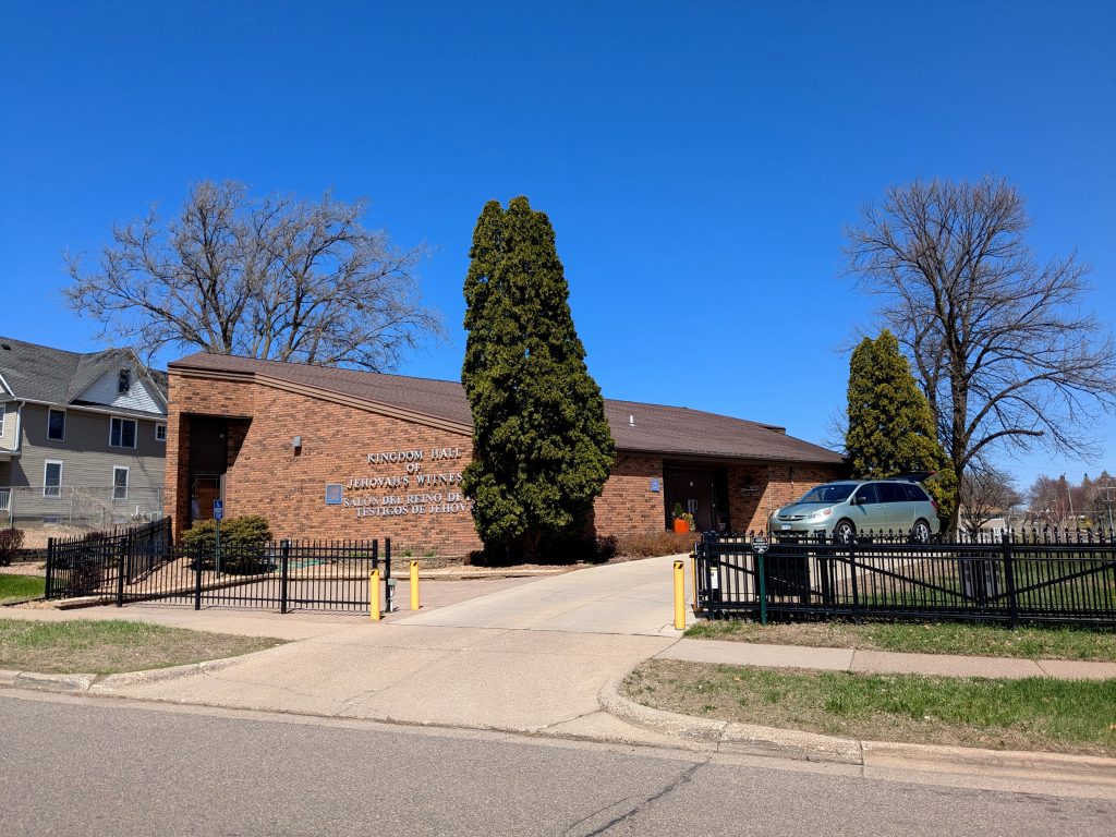
At this point, I was done with the eastward spur on Seventh Avenue and so retreated to rejoin the main loop at Humboldt. On the northwest corner of Humboldt and Seventh avenues is the Kingdom Hall of Jehovah’s Witnesses, dominated by its pitched roof and accented by an angular protruding side entrance.
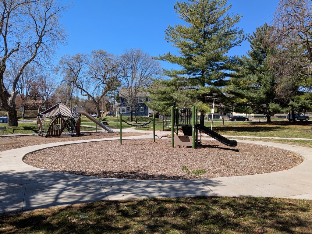
Continuing from Seventh onto Elwood Avenue, I passed my starting point on the small Barnes Place Park. Once I got to Eighth Avenue and turned east, I was finally able to return to Irving Avenue, where I had left it at Eighth. There, I resumed heading north, which brought me by another small park, Lovell Square.
The southern end of this park features a play area constructed in 2020. The photographs show it both from the Irving Avenue side and, closer up, from the James Avenue side.

In addition to the streets surrounding Lovell Square, this portion of my route took me through several other blocks of Oak Park, which were generally consistent with what I’d seen before.
Where I saw something qualitatively different was once I headed east on 11th Avenue, out of Oak Park, past Gold Star Distributing and Parkview Apartments, and to the easternmost block of southern Near North, the block between Fremont and Emerson Avenues.
That block of 11th Avenue contains a small portion of Heritage Park, a 2005 re-redevelopment largely located within the Sumner-Glenwood neighborhood on land previously redeveloped as the Sumner Field, Olson, Lyndale, and Glenwood housing projects, which were demolished as part of the Hollman v. Cisneros consent decree. As you can see from the photo, the single-family houses in this part of Heritage Park were designed to resemble those built a century earlier in Oak Park.
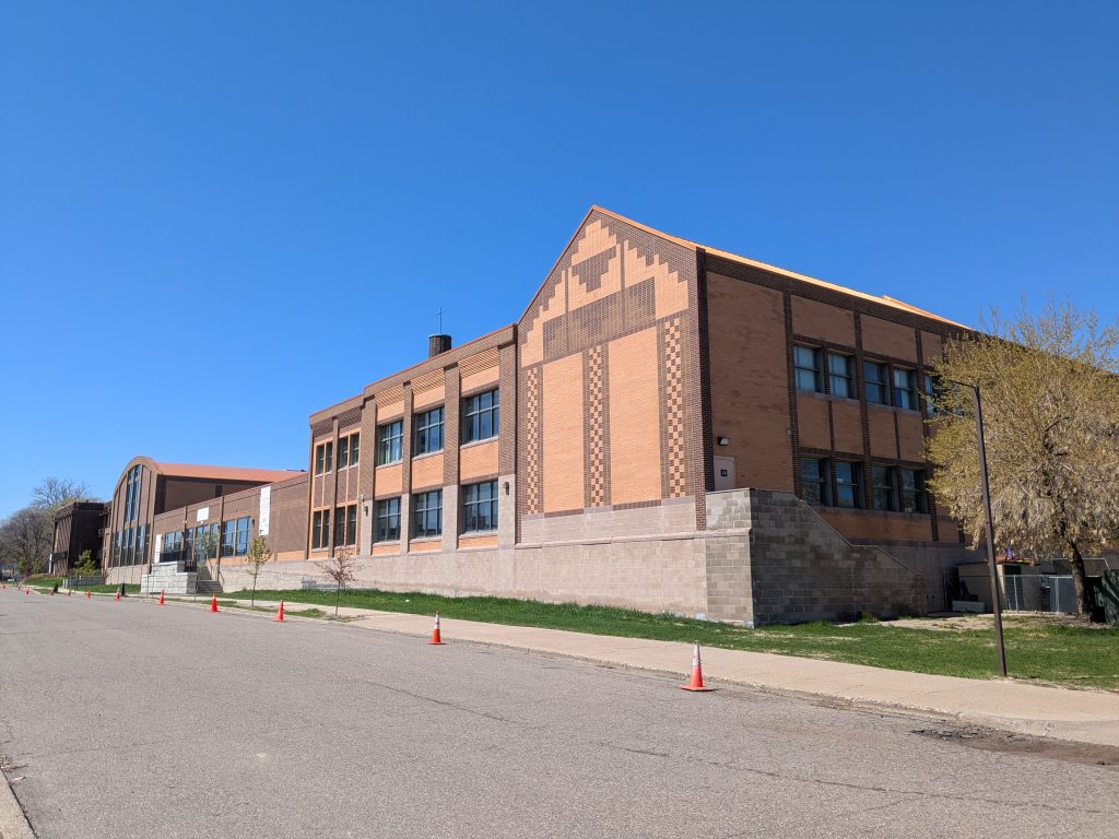
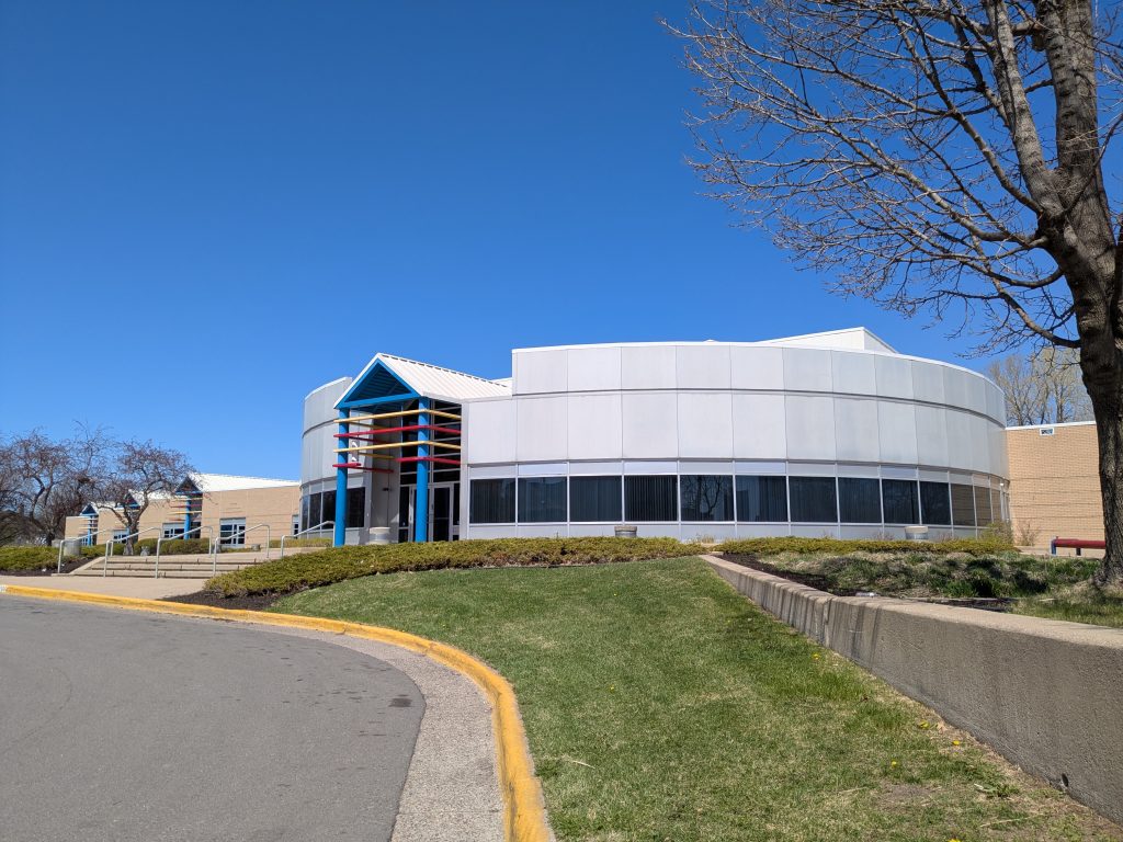
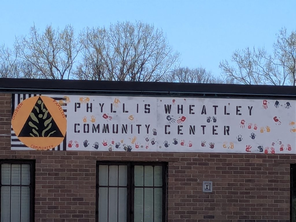
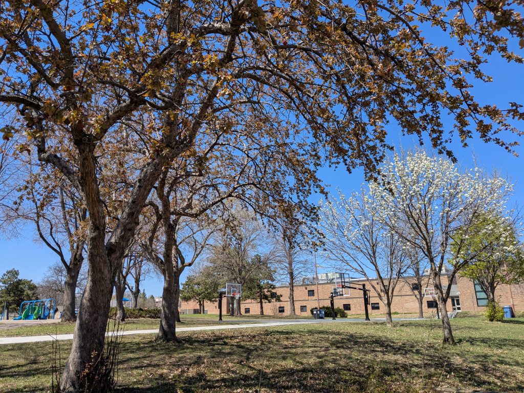
I wrapped around via Van White Memorial Boulevard to Fremont Avenue, which brought me to 10th Avenue where the Phyllis Wheatley Community Center is located behind Bethune Arts Elementary School. This pair of institutions is tucked into the northeast corner of Bethune Park. The second photo, taken from Emerson Avenue, shows how the school fits into the park setting.
Emerson Avenue connects via a small segment of Van White Memorial Boulevard to Olson Memorial Highway, right where the Sumner Library is located. Thus, I was able to see the library a second time, now from the side that reflects its original Carnegie-funded design.
Likewise, as I neared the end of my walk, I got a second view of the school at Wayman AME Church. From the south, one can clearly see how the former nursing home from 1970 (in the distance at left) is the small acorn from which a much larger school grew by addition.