
Editor’s Note: Max Hailperin is walking each of Minneapolis’ 87 neighborhoods, in alphabetical order. He chronicles his adventures at allofminneapolis.com, where the original version of this article was published May 11, 2025.
Nicollet Island — East Bank is unusual among Minneapolis’s neighborhoods for both its small size and its division into two distinct portions. And so even though covering it all in one walk would be quite feasible, I focused initially on the Nicollet Island portion. It’s quite unlike other parts of the city, and this walk was quite unlike my other All of Minneapolis walks.
One distinction between this walk and my others is the delay in writing it up. The others have ranged from a few hours to a few weeks, with one week being typical. But the photos below date from July 20, 2022. Why did I walk the island so far ahead of its place in the alphabetical order of neighborhoods? Because of an offer I couldn’t refuse.
Although most of my walks are solo, I’ve enjoyed company on a number of them. And although I stay focused on my own approach to appreciating the city, I’m aware of others who have done their own comprehensive tours, and I’ve been in touch with a few of them. But this time the two factors coalesced: I was in touch with another cataloger of the city who suggested we take a walk together. He was so far ahead of me that I had to cast aside my usual adherence to order. I had to jump ahead to Nicollet Island. It was an enjoyable experience, and now you can compare my photos with his.
We met at the tee intersection of Grove Street and Island Avenue West, the point marked on the route map with A and B for the start and end of the walk. The blue lines show the route’s main loop, which in this case was a figure eight, traversing first the larger northern portion clockwise, then the southern portion counter-clockwise, and ending with a second westward pass across the waist of the eight before returning to B. This was interrupted by the various forward-and-back spurs shown in red.
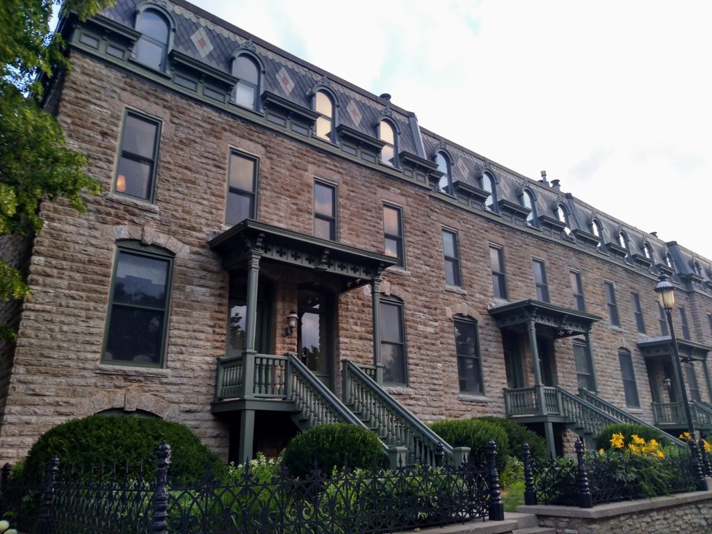
Late July is a good time for early-morning walks, and we decided to start this one at 6:30 a.m. to fit it in before work. If the lighting seems different from many of my other walks, that’s the explanation. The ethereal tranquility suits the historic character of much of what we saw, such as the Grove Street Flats at our starting point. These condos have quite a story, which thankfully Cynthia Sowden has told in the Northeaster.
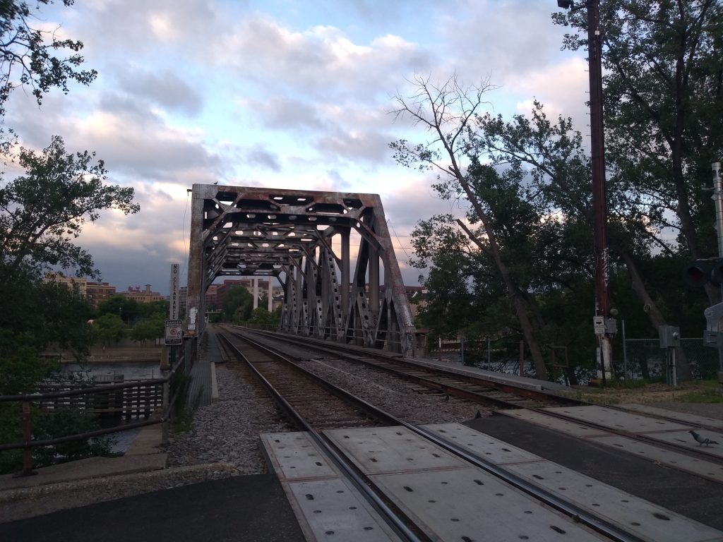
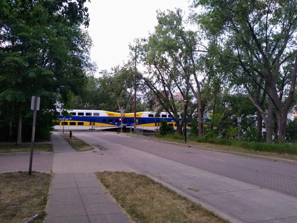
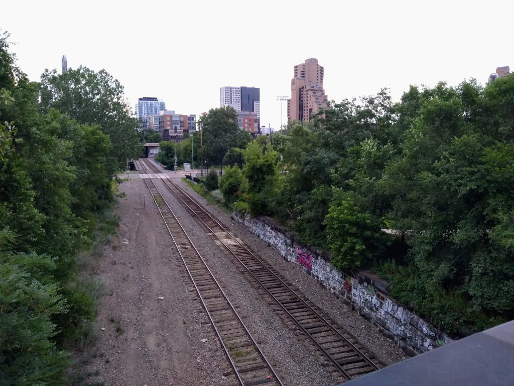
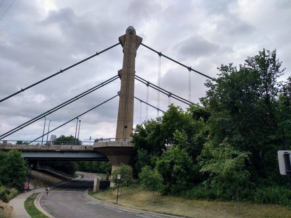
The island’s industrial past is well hidden, but the parklike atmosphere is still pierced to a certain degree by the transportation corridors that pass through on their way from one river bank to the other. Most Minneapolis residents are familiar with the Hennepin Avenue Bridge, but the rail crossing is no less significant. The rail bridge connecting to the west bank has been modified a number of times, as John Marvig explains.
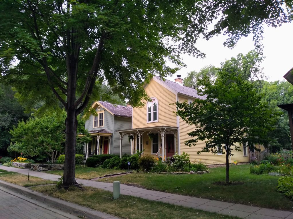
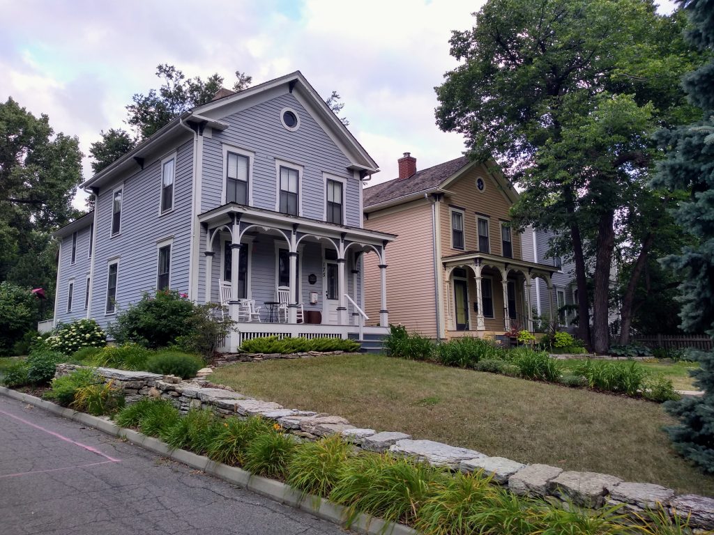
As to that parklike atmosphere: most of the island is in fact a park. That includes even most of the residences, which sit on land leased from the park board. It was impressive to see so many lovingly restored structures from the 19th century.
Only later, when writing up the walk, did I learn that this doesn’t reflect a wholesale preservation of the island’s history. Rather, a number of the houses were recently moved in from elsewhere in the city so as to fill in the gaps between the survivors.
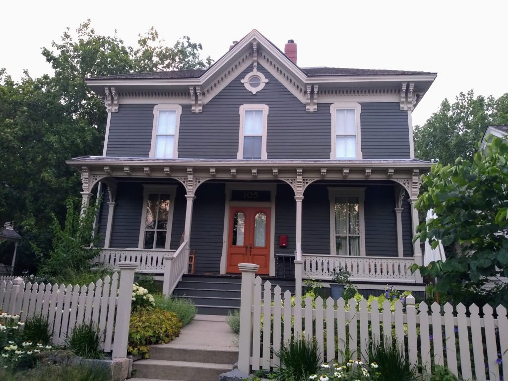
The first house shown below is an example: the Meader-Farnham House began on the southern edge of downtown, at 913 5th Avenue South and remained there (rather miraculously) until 1985, when it was moved to the island and restored. Despite this disruption of historical context, the house features as the cover illustration of “Architecture and Historic Preservation on the Minneapolis Riverfront,” a valuable report and the source for most of my information.
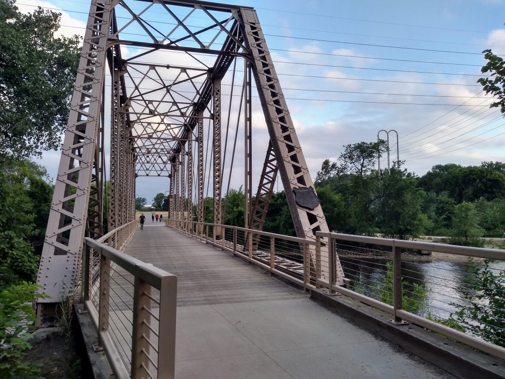
At the northern tip of the island, the Boom Island Bridge is a silent reminder that both Nicollet Island and Boom Island were bustling centers of rail-carried commerce. This steel truss wasn’t constructed to support the pedestrians and bicyclists that cross from park to park.
Near the northern end of Island Avenue East, we branched off onto the first of the spurs, Maple Place, which spans between the East and West sides of Island Avenue and provides access to Nicollet Street, the central spine of the island north of Grove Street.
A number of the residences in this area are not only original to the island but also connected by a common historical thread, having been rental properties owned by Franklin C. Griswold. That includes the duplex he occupied with his own family until he built another one, as well as the smaller Backe-Barquist and John Mayall houses, which he purchased.
Earlier, we saw the railroad’s grade-level crossing of Island Avenue West. But here on Nicollet Street, we had the benefit of an overpass. This provided an elevated vantage point from which to see the double tracks heading east, crossing Island Avenue East again at grade level (the light-colored patch), and then exiting the island via an undistinguished bridge over the east channel.
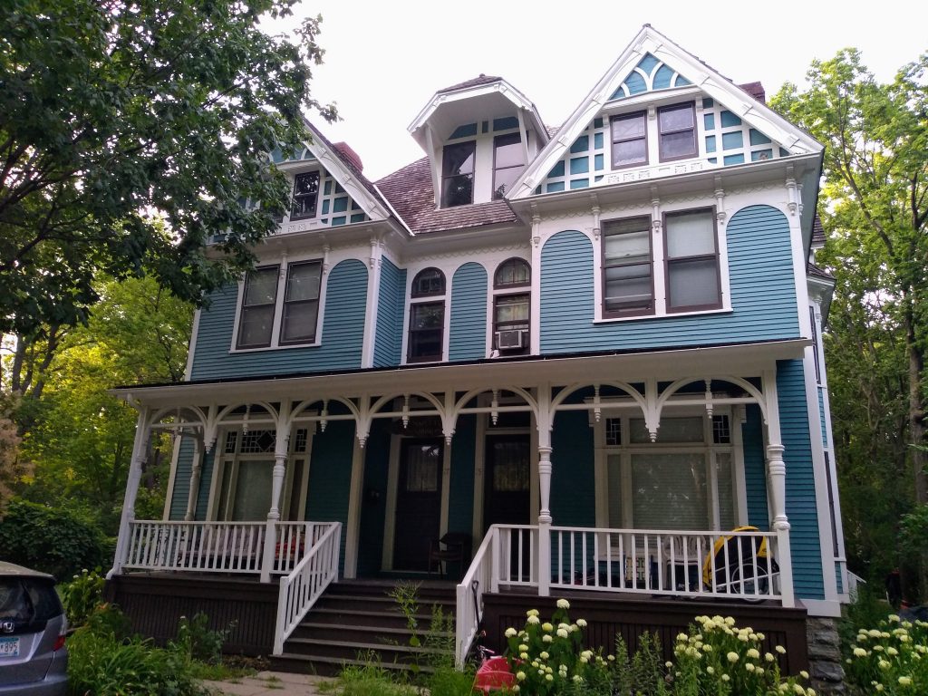
After we returned from these spurs and were headed south on Island Avenue East, something about a pair of two-story houses with Greek-revival styling caught my eye. As it turns out, they began their lives side by side on Cedar Avenue in the mid-1870s, owned by a pair of brothers, and were moved here in 1990.
On the east side of the island, the Hennepin Avenue Bridge divides in two, one branch carrying eastbound traffic onto Hennepin Avenue East and the other bringing westbound traffic from 1st Avenue Northeast. Had we continued south on Island Avenue East, we would have passed beneath these two bridges.
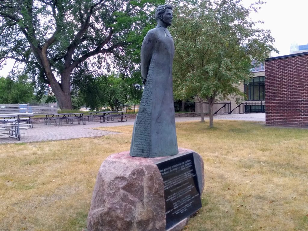
But instead, in keeping with the figure-eight route plan, we turned west just north of the bridges on DeLaSalle Drive. This provided access to the 1st Avenue side of the bridge as well as being our connection to Eastman Avenue, running along the front of DeLaSalle High School.
As we turned that corner, a plaza was evident on the elevated ground where the high school meets its associated athletic field. And there we saw a statue dedicated to the Brothers of the Christian Schools (generally known as the Christian Brothers), an order founded by Jean-Baptiste de La Salle. The sculptor, Jerome Cox, was both one of the Brothers and a 1956 alumnus of the high school. The inscriptions honor all the Brothers who share that linked tradition and feature a famous saying attributed to La Salle: “The greatest miracle you can perform is to touch the hearts of your students.”
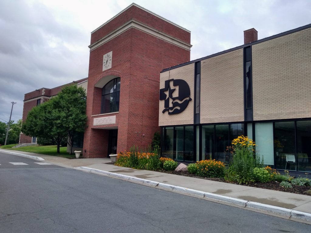
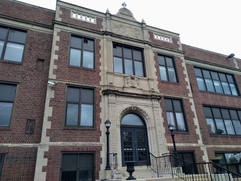
The following photo of the high school makes clear that it is an assemblage of buildings of varying age. The 2016 and 1960 buildings are in the foreground at right, with the 1923 building peeking out at the left. A better view of the 1923 building comes at the end of the walk.
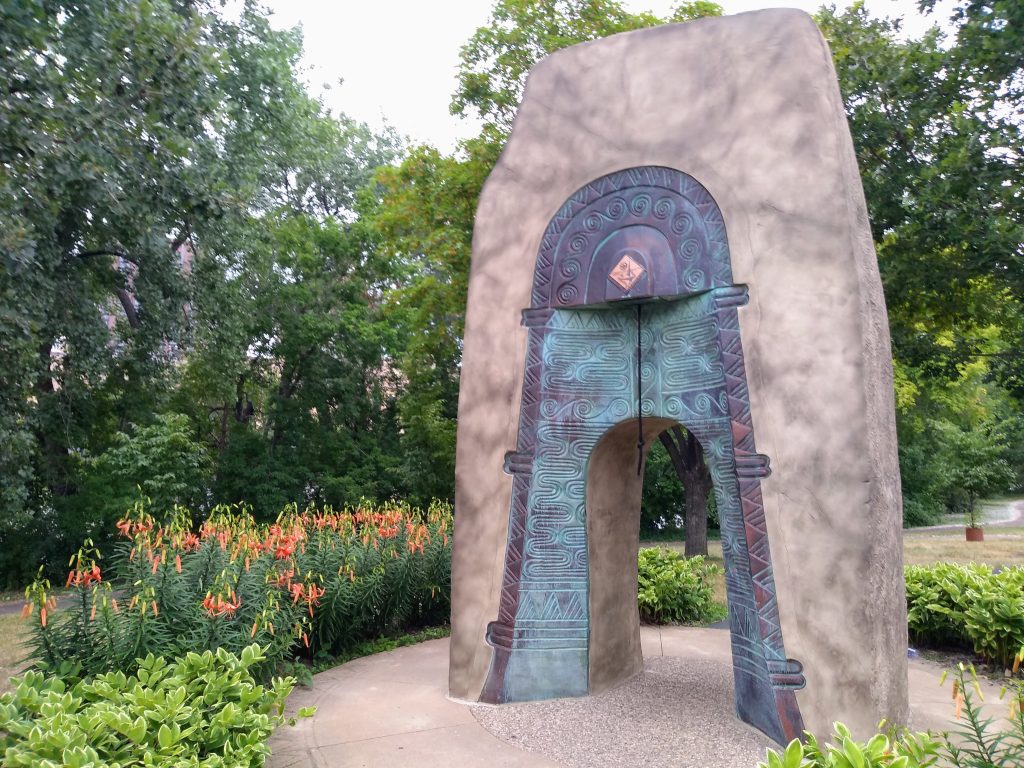
From this first westward walk on Eastman Avenue, we turned south on Island Avenue West, taking us under the Hennepin Avenue Bridge and into the most traditional part of the park, where Karen Sontag Sattel’s Bell of Two Friends (2001) stands as “a monument to friendship and peace … commissioned by Ibaraki, Japan, Minneapolis’ Sister City.”
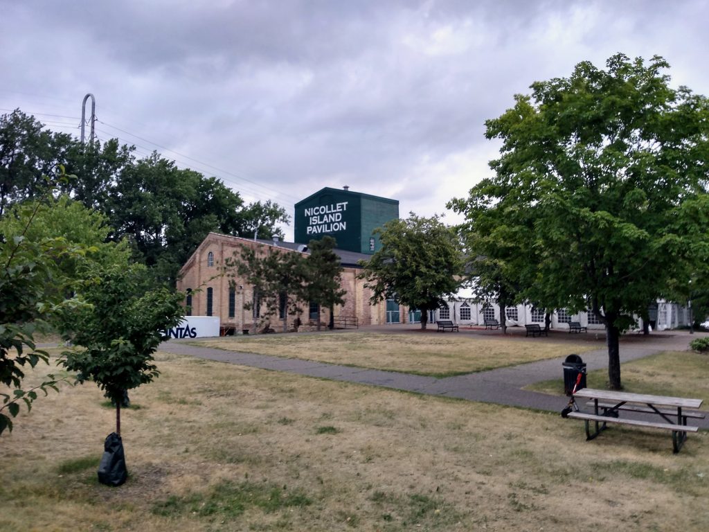
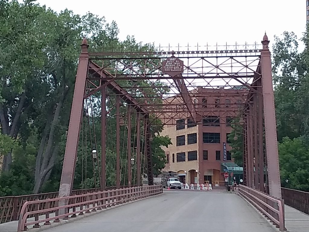
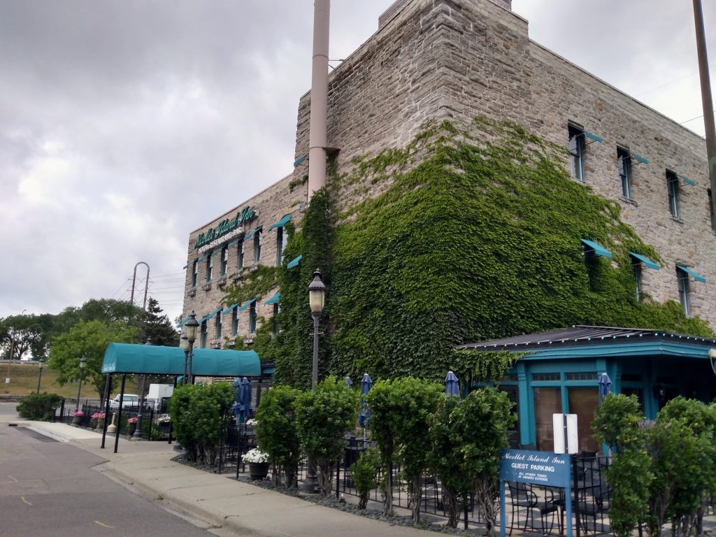
This southern part of the island also includes two historic industrial sites converted for recreational use, Nicollet Island Pavilion, originally the William Brothers Boiler Works, and the Nicollet Island Inn, originally the Island Sash and Door Company. And just as several of the historic houses are recent transplants, so too this end of the island features an 1887 bridge that only came here in 1987.
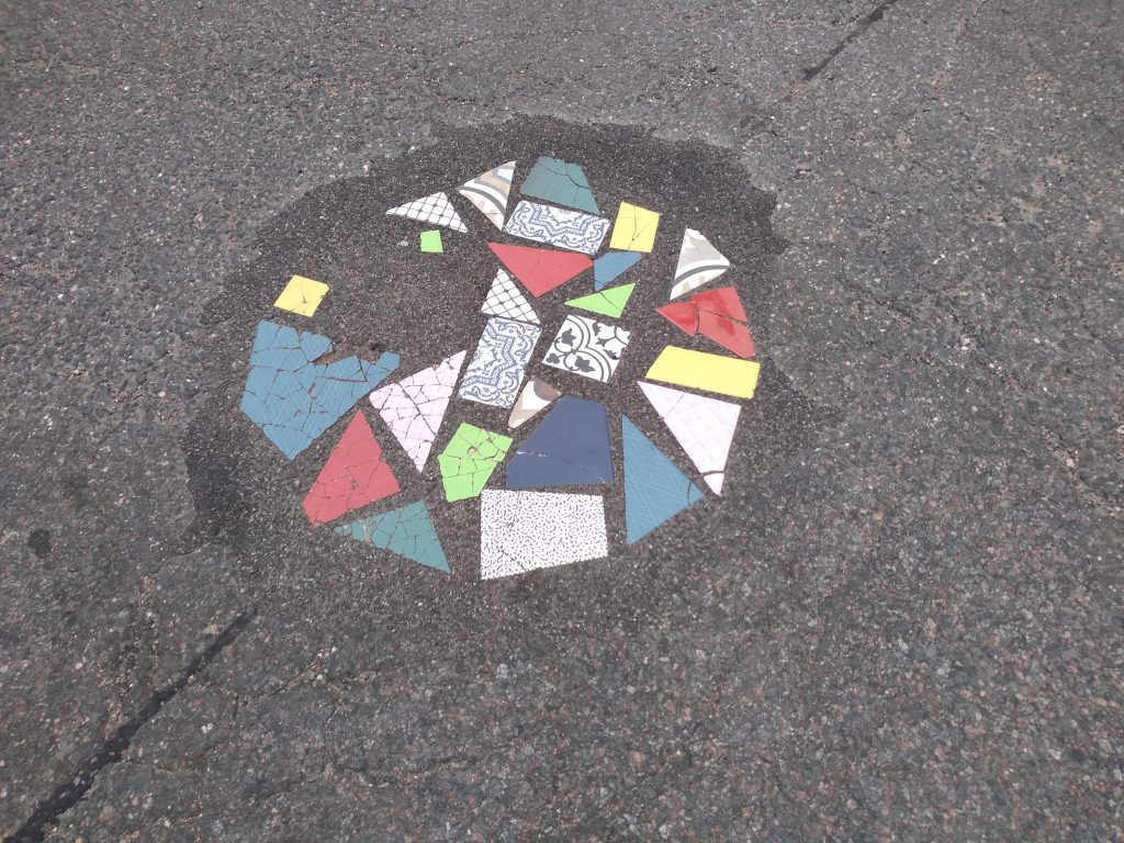
We then walked past the high school a second time, but this time turned north rather than south onto Island Avenue West. At that tee intersection, a hole in the pavement had been patched in unusually artistic fashion with ceramic shards positioned within the asphalt. I’m fairly sure that sometime within the intervening years I had found the story behind this, but I’m not putting my hands on it now. If any reader can help out, I’d appreciate it.
From Island Avenue West, the oldest still-standing building of the high school comes into clearer view, looking much like many other catholic schools of the 1920s (and aside from a few religious elements, much like many public schools of that decade).
At this point, we were almost back to our starting point at Grove Street. Along the intervening stretch of Island Avenue West, just north of the 1920s building, the DeLaSalle campus includes a grassy plaza area where the original building once stood. That plaza features another sculpture of La Salle himself, this one in sandstone. However, my photos didn’t turn out so well as of the Christian Brothers sculpture, so I’ll link to a photo from the high school instead.
All photos are by Max Hailperin.