Editor’s Note: Max Hailperin is walking each of Minneapolis’ 87 neighborhoods, in alphabetical order. He chronicles his adventures at allofminneapolis.com, where the original version of this article was published June 5, 2025.
“The Wedge” is widely understood as the neighborhood formally named Lowry Hill East. Heck, the informal name even featured in a trademark dispute between a respected independent journalist and someone else. But the east bank has its own wedge, just waiting for some fool to call it that. Some fool like me.
The east-bank wedge is the portion of the Nicollet Island — East Bank neighborhood that isn’t Nicollet Island. One border of the wedge is formed by the side channel of the Mississippi River that divides Nicollet Island from the mainland. Another is the right-of-way where Second Avenue Northeast would be, had it not been vacated in favor of the BNSF railway. The final border is a portion of Central Avenue.
The beginning and end of my route, marked as A and B on the map, both lie on that Central Avenue border, where I arrived by bus on Fourth Street and departed by bus on University Avenue. The red back-and-forth spurs constitute the majority of the mileage in this walk, in part, due to the borders formed by a railway and river.
Right off the bat, I got to experience this area’s characteristic mix of 19th- and 21st-century development, together with its prevalence of broad arterial streets. The photo below shows the intersection of two of those streets, Fourth Street and Hennepin Avenue, with the 1891 Odd Fellows’ lodge on the corner and the 2019 Odin Apartments a block away. At the time of its construction, the Odd Fellows’ lodge was at Fourth and Central, not Fourth and Hennepin, due to the change in street names.

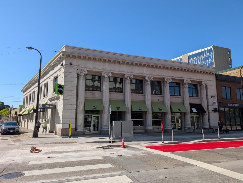
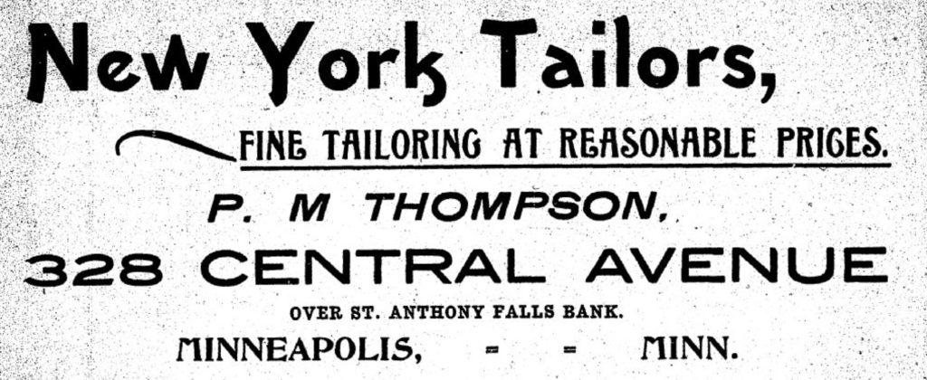
Looking back at the diagonally opposite corner, an 1893 building (with quite a few alterations since) looks like a former bank — and indeed it is, having originally housed the St. Anthony Falls Bank. More recently, the major tenant was Masu Sushi and Robata. However, it always had additional tenants beyond the main one, as exemplified by an 1894 advertisement for a tailor shop above the bank. The typography of that ad is remarkable, blending Art Nouveau (then literally new) with the Grotesque and Slab Serif styles from earlier in the century.
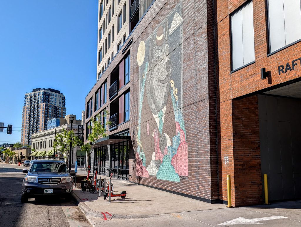
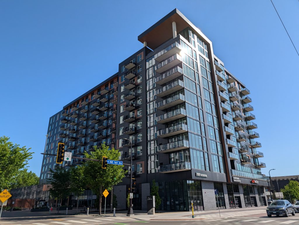
I knew what was coming, so I can’t exactly claim whiplash, but, turning to face the Rafters Apartments across from the Odd Fellows and St. Anthony Falls Bank buildings, entailed jumping forward 125 years. I’m not sure what in the interior of the building accounts for the big brick area between the window-studded portion of the facade and the parking garage entrance, but commissioning a mural for it was a smart move.
The final dead-end block of Fourth Street Northeast, between First Avenue Northeast and the railroad, is straddled by two similarly recent apartment buildings, Odin and NordHaus. Having previously shown the Odin Apartments looming behind the Odd Fellows Lodge, I’ll follow up now with a closer view.
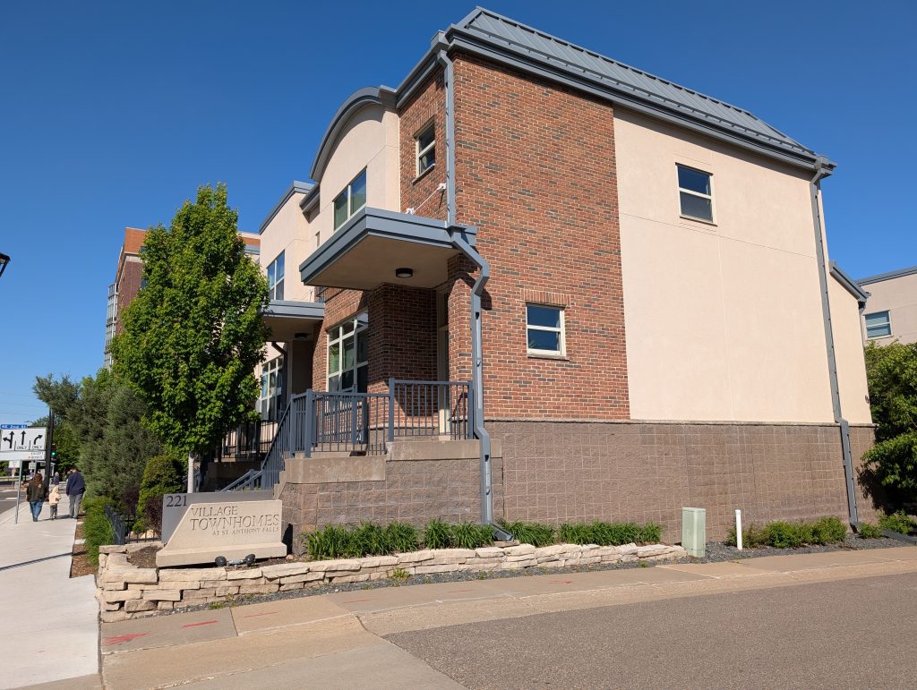
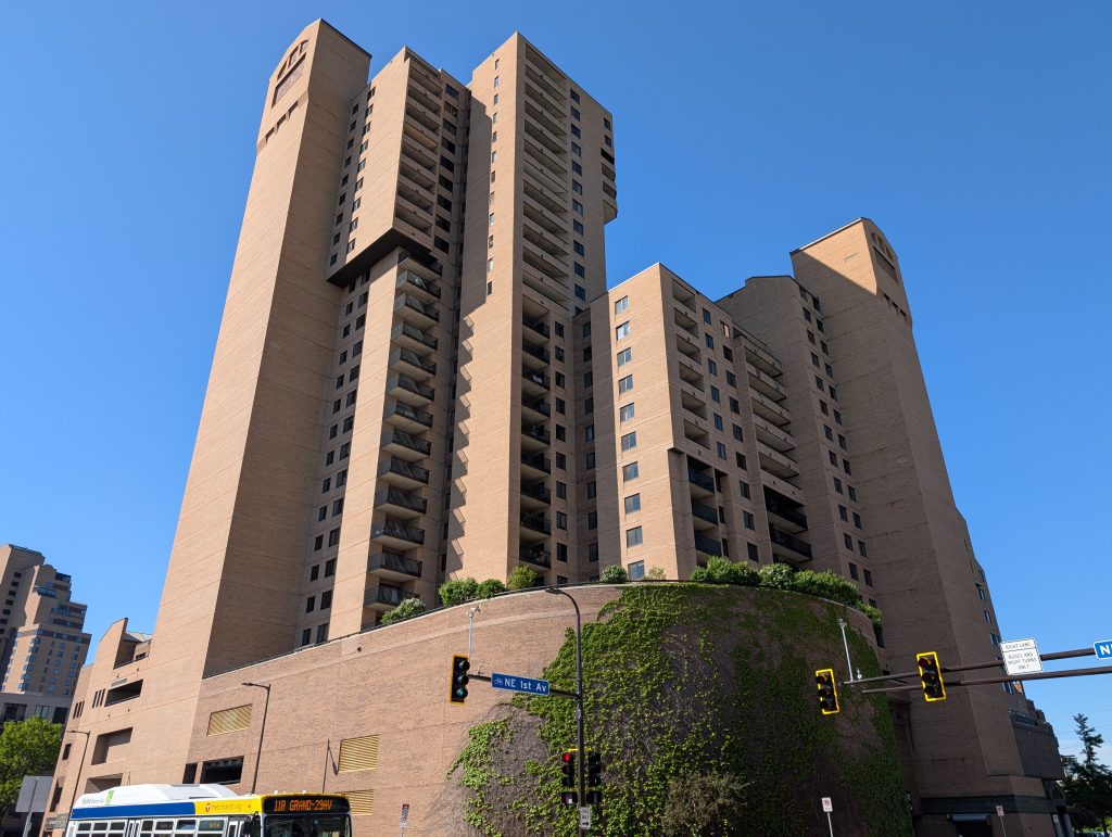
A one-block forward-and-back spur away from the river on First Avenue Northeast didn’t reveal anything particularly photogenic, but, once I turned toward the river, I was rewarded with more of the housing styles found in the neighborhood. In particular, the block of First Avenue Northeast between University Avenue and Second Street Northeast runs alongside a 2002 cluster of townhomes and ends at a high-rise condo complex from the comparatively early date of 1983.
Turning in the downriver direction on University, I passed between two long-standing retail landmarks on one side (West Photo and Surdyk’s) and a smorgasbord of more recent food-service establishments on the other (STEPCHLD, WildChld, Pa Tea & Poke, Arturo’s Pizza and Flamin’ Thai).
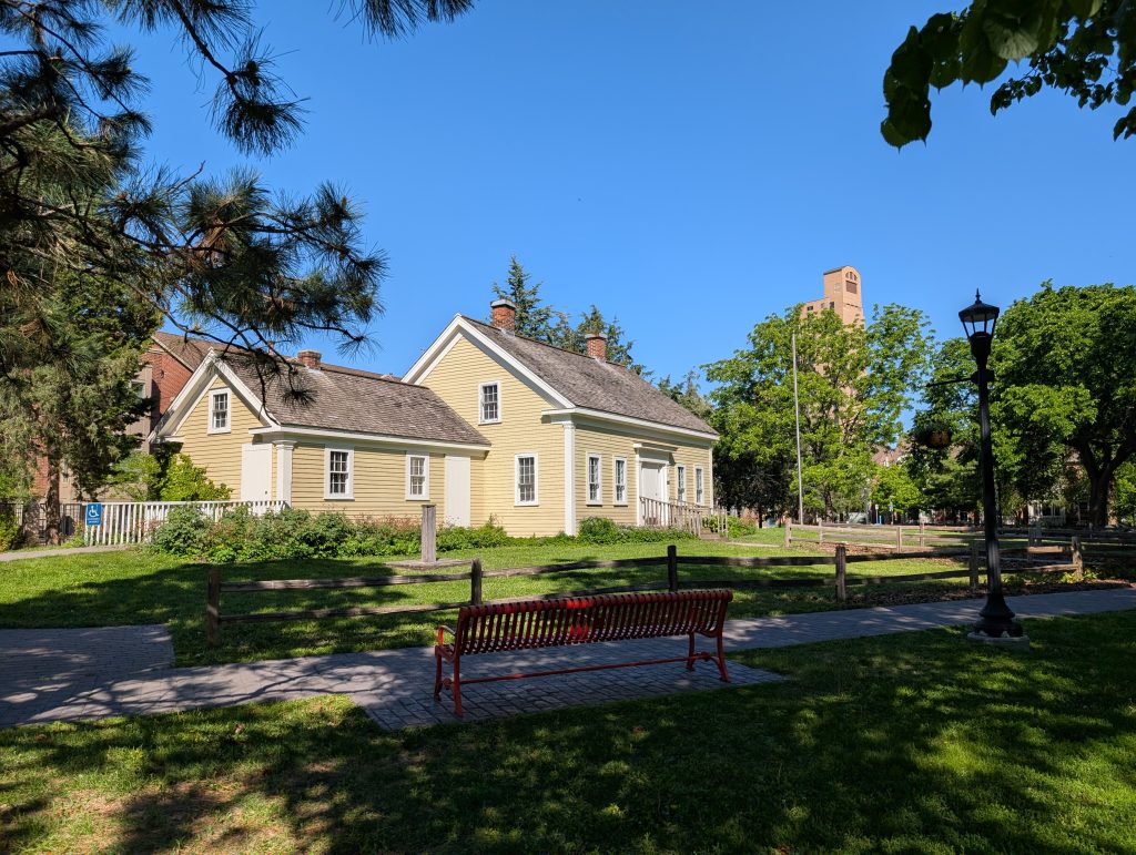
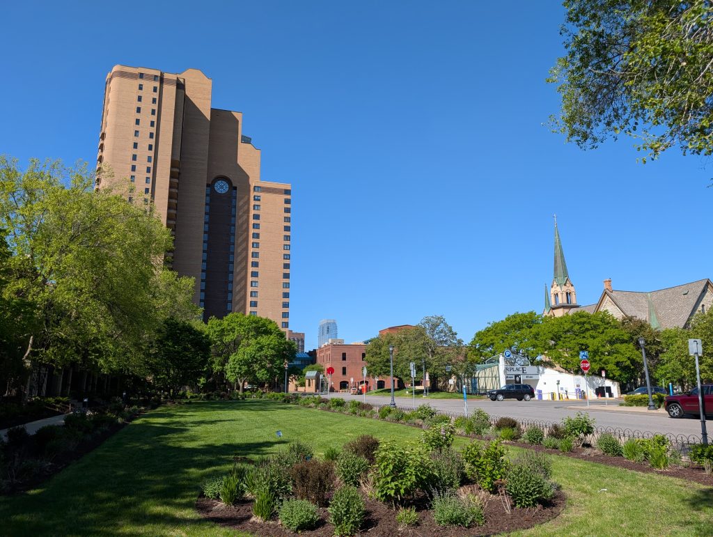
The recent development didn’t go away when I crossed Hennepin Avenue, but I quickly found myself confronted with the oldest of the old, the Ard Godfrey House in Chute Square. Although one needs to keep in mind that 1848 was only the original construction date of the house — it wasn’t moved to this location until the park’s creation in the first decade of the 20th century, and the kitchen wing is a 1985 replica.
Chute Square is bounded on two sides by the arterial University and Central Avenues, and on the other two sides by the much smaller Bank Street and Ortman Street. (All of these have the Southeast directional suffix.)
Each of those two small streets features in my route as a forward-and-back spur. I left Bank Street for later but walked Ortman from Central Avenue to Bank Street, which provided a view of the landscaped area and La Rive Condominiums, another 1980s highrise. History is not far away, however: one can see the steeple of Our Lady of Lourdes.
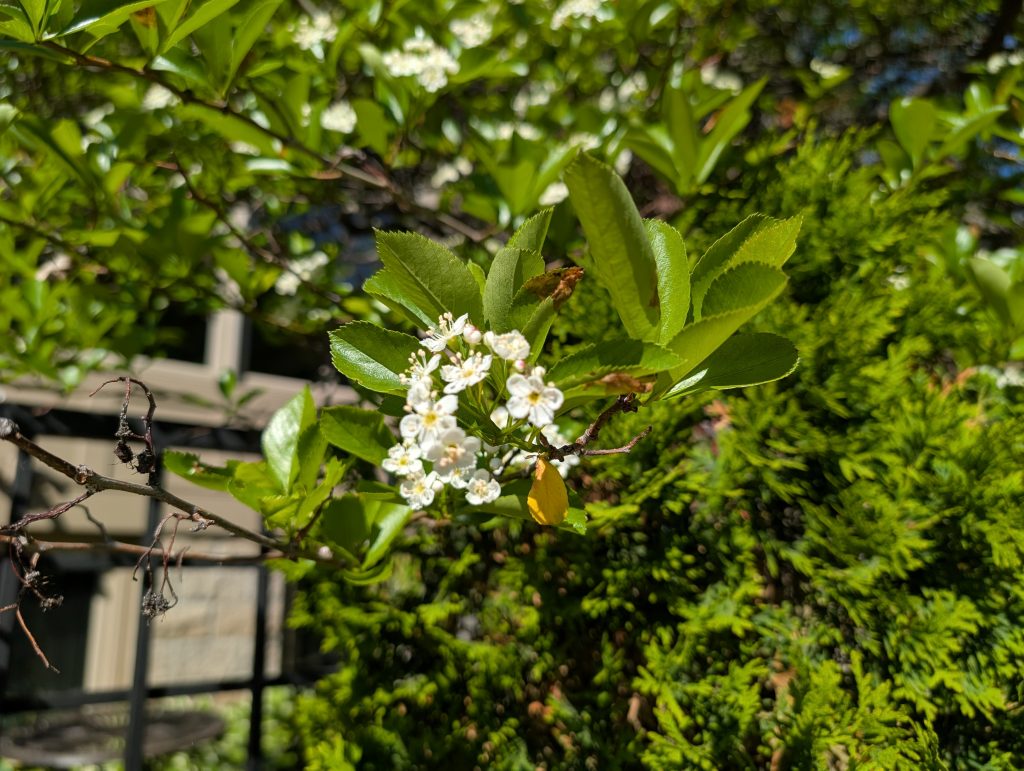
At a more fundamental level, this whole area bounded by Ortman, Bank, and Main Streets and Central Avenue is a historic space: the void left behind where the Industrial Exposition Building had been. In addition to the highrise condos, that space is now filed by the 1994 Lourdes Square Townhomes. Returning to Central Avenue along Ortman Street, I paused to admire the blossoming greenery that screens the townhomes from the street.
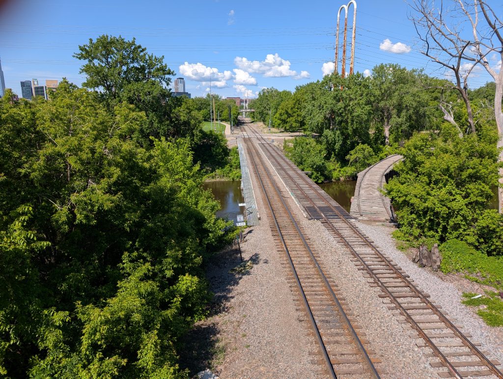
After leaving Ortman Street, Central Avenue carried me out onto what is called the Third Avenue Bridge, based on its other end. From there, I was able to look upriver at Nicollet Island and the channel dividing it from the mainland, including seeing the Merriam Street Bridge.
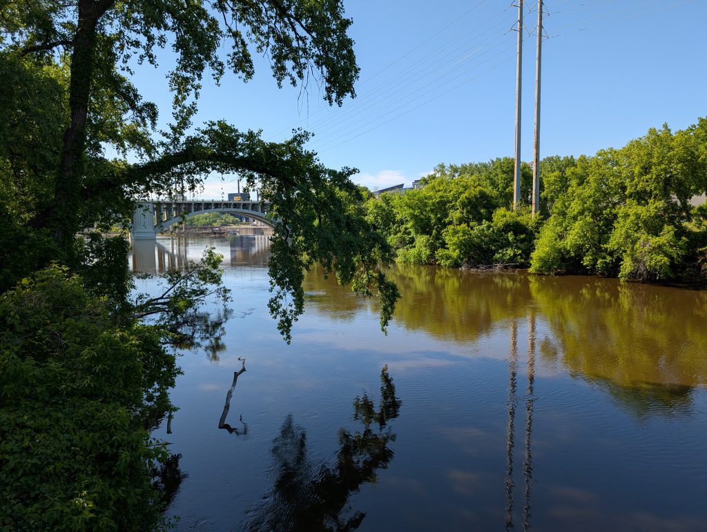
Symmetrically, once I had returned from the Third Avenue Bridge, descended stairs to Main Street and walked a short ways, I was able to go out onto the Merriam Street Bridge and look back at the Third Avenue Bridge, where I had just been. Nicollet Island is at the right of the photo, on the other side of the tranquil water. The Guthrie Theater is in the distance.
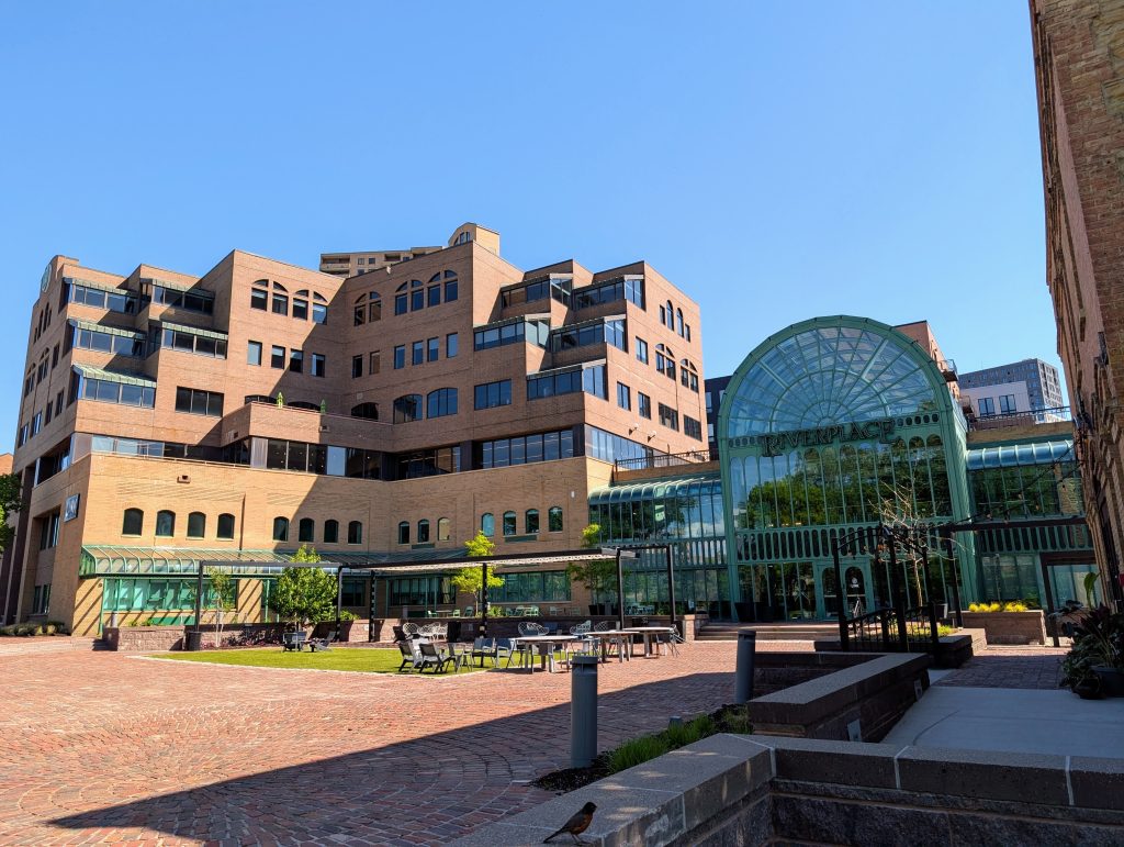
Main Street was an early focus of redevelopment in this formerly industrial area, and one example of that is the Riverplace office complex at the corner of Main Street and Hennepin Avenue. The clear message of the 1984 design is that the river itself is principal among the complex’s amenities.
Just as I walked out over the river on Central Avenue and Merriam Street, I did the same at Hennepin Avenue and First Avenue Northeast. But the most interesting bridge to Nicollet Island was the one I couldn’t walk on but rather had to photograph from the Main Street overpass at the wedge’s border: the BNSF railroad bridge.
I had seen the other end of this on my prior walk, but that view didn’t make evident the vestigial segment of track curving away from the main line. That was the Wisconsin Central Railway’s access to its Boom Island yard via the bridge between Nicollet Island and Boom Island that now carries pedestrians.
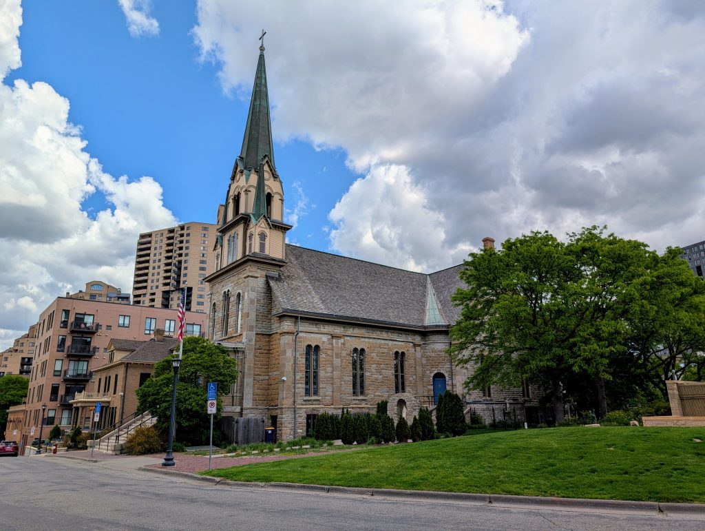
Because the railway marked the neighborhood border, I retreated to First Avenue Northeast and turned inland to continue my main loop. Second Street took me back to Bank Street, near where I had encountered it at the end of Ortman. Bank Street, in turn, curved into Lourdes Place, which historically was called Prince Street. The current name reflects the presence of Our Lady of Lourdes Catholic Church, a true neighborhood landmark visible from all directions.
The architecture of the church is quite interesting from a historical perspective. At its heart is a very basic rectangular greek-revival building, the 1857 meeting hall of the First Universalist Church. But then the Catholics took over and added to both ends around 1880: a transept on the end away from the river provides the cruciform shape, while the vestibule on the end toward the river supports the main bell tower and the two smaller steeples that flank it. Today it would be hard to imagine the church without those.
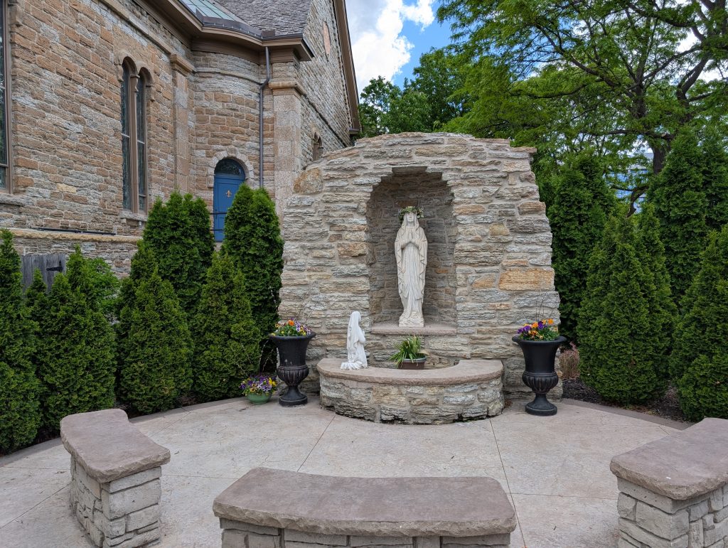
The name “Our Lady of Lourdes” is made concrete by the grotto next to the church, which depicts the visions Bernadette of Lourdes had of a lady, identified as Mary, mother of Jesus, in a grotto. At the time of the church’s founding, these events were quite fresh.
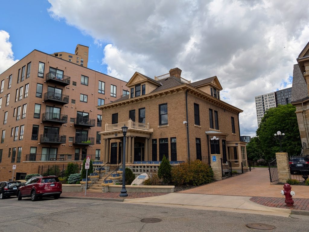
The church property also includes a building constructed as a rectory in 1903, which stands as further counterpoint to the neighboring multi-unit buildings of recent vintage.
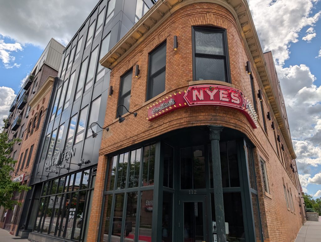
Speaking of the contrast between early 20th and 21st centuries, there may be no more intimate intermingling of them than the block of Hennepin Avenue that I turned onto from Lourdes Place. Until 2015, an assemblage of buildings of varying age housed Nye’s Polonaise Room. Now, the 1907 bar on the corner remains, as does a 1904 three-story “harness shop” a couple buildings further into the block, now holding a virtual bank on the ground floor. The remainder of the block was demolished and replaced.
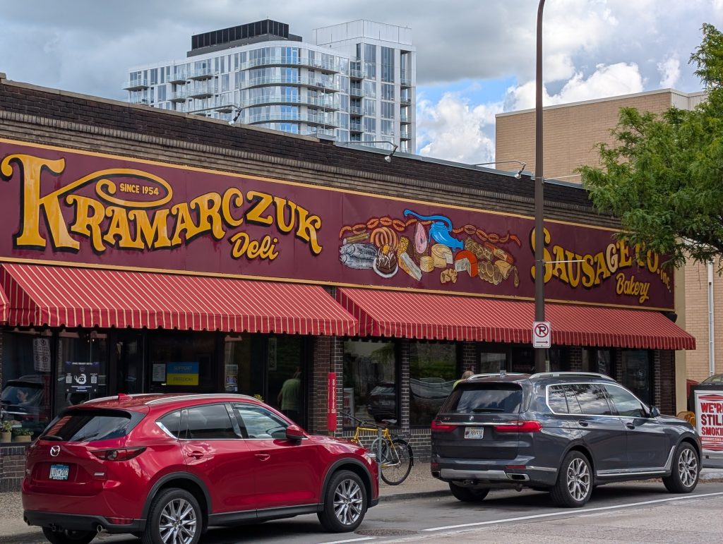
A recent article by Carly Pruszinske in Racket opens with a quote attributed to Art-A-Whirl cofounder Doug Padilla: “We used to say there was an imaginary line between Kamarczuck’s and Nye’s. We called it ‘the sausage curtain’ because people from downtown would not come further into Northeast — they felt it was too dangerous.”
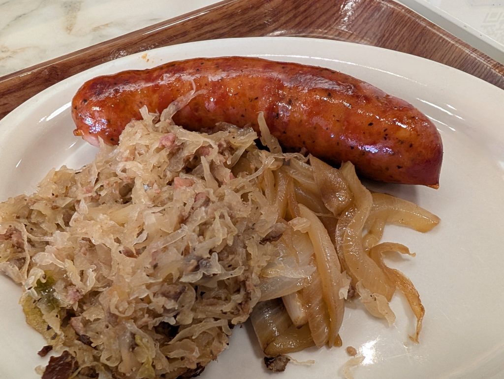
And so, appropriately enough, I walked from Nye’s to Kramarczuk’s on the opposite side of the next block and enjoyed a tasty sausage. The Ukrainian sausage has enough seasoning to accent the pork but not so much as to overwhelm it. Speaking of overwhelming, the restaurant has a manageable range of options, but the adjoining bakery and deli area is truly overwhelming. Once the shock fades a bit, one can count on walking out with a number of serendipitous purchases beyond what they came for.
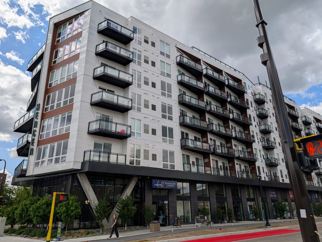
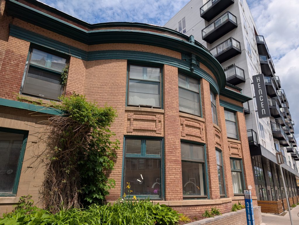
Hennepin and Central Avenues meet at Fifth Street, a wedge within the east-bank wedge. Since 2021, that wedge-shaped spot has been occupied by the wedge-shaped Hencen Apartments. More recently, in 2025, the ground-floor retail space has been home to Inkwell Booksellers. I inspected it closely enough to determine that apartment residents can use their digital key fob to get back and forth to the retail space without going outside. That’s a seemingly obvious feature that not all recent-vintage apartment buildings offer. And this one has a bookstore with espresso bar.
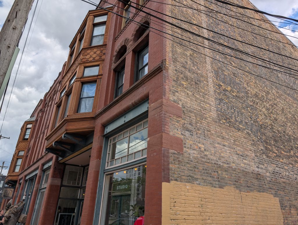
Turning in the upriver direction on Fifth Street past Conga Latina, I came across an interesting three-story mixed-use building from 1890, with an eclectic mix of architectural details, including bay windows, romanesque arches, pilasters and quoins. It reflects the influence of the contemporaneous Richardsonian Romanesque but with a more workaday character.
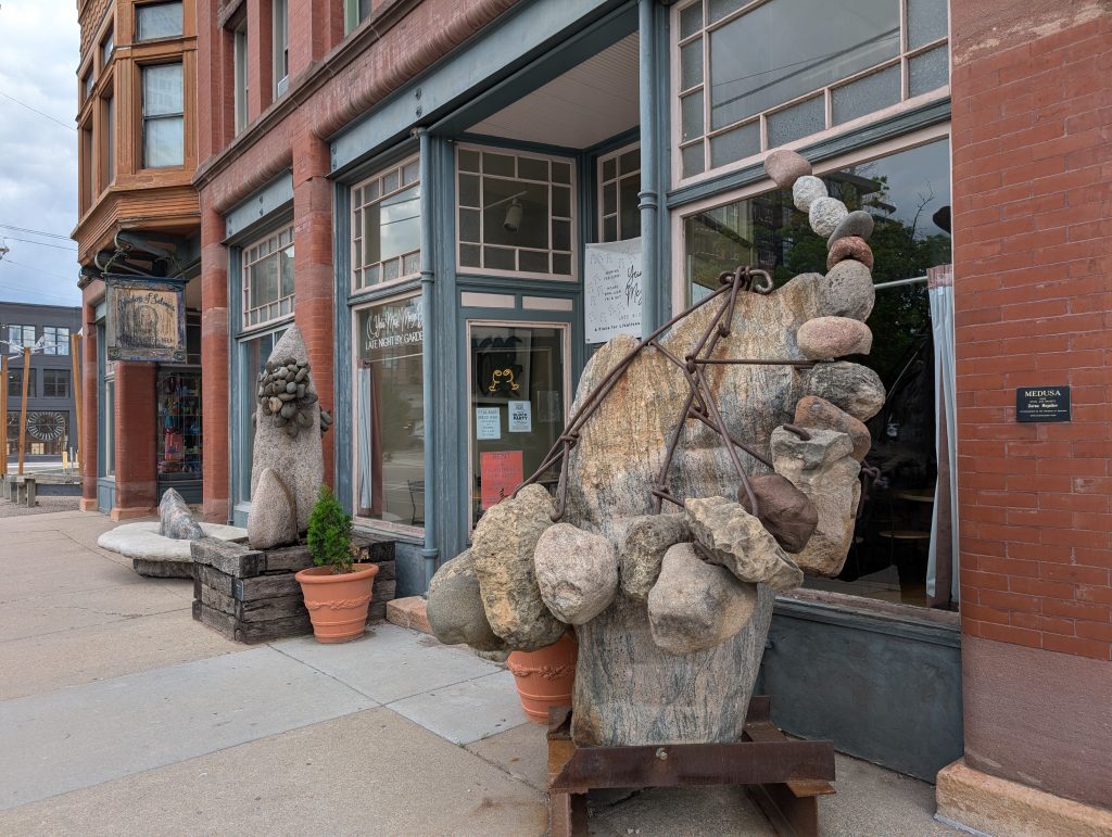
The largest ground-floor occupant, the Gardens of Salonica restaurant, is less venerable than the building by a century, but their 1991 founding date is still quite a few years ago, by the standards of the restaurant business. As a visible sign of their landmark status, they were among the earliest patrons of noted local sculptor Zoran Mojsilov and display several of his works, including the steel and granite composition in the foreground of the next photo, Medusa.
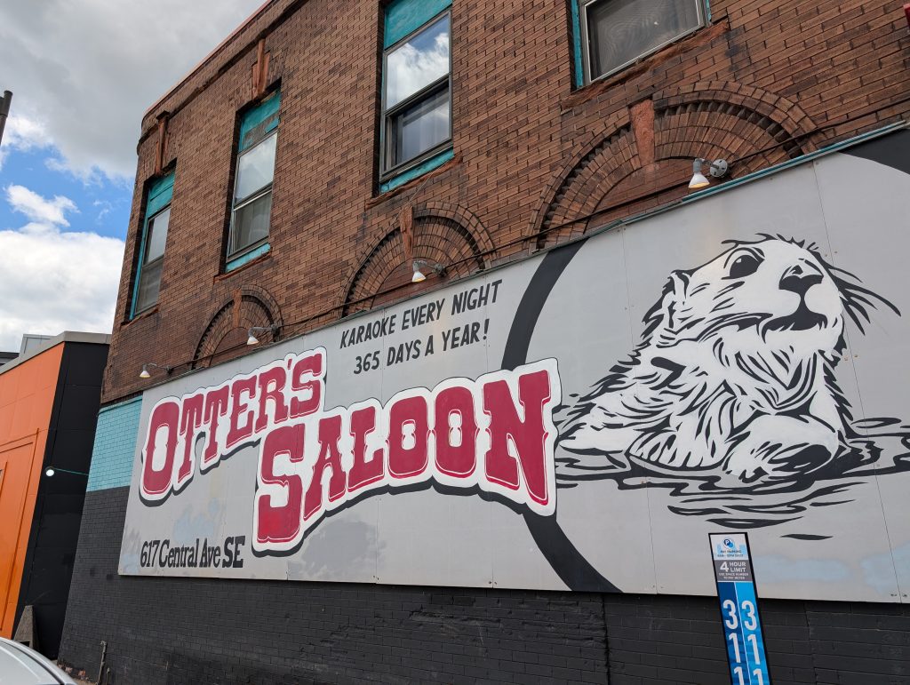
Not counting the forward-and-back spurs shown in red on the route map, the turning point of my route was the sharp corner where First Avenue Northeast meets Central Avenue — another of the wedges nested within the east-bank wedge. This time the wedge-shaped building is considerably older (1898) and is dominated by its ground-floor occupant, Otter’s Saloon. For anyone comparing the photo with the caption, yes, we have a disagreement over whether their address is Southeast or Northeast.
Returning on Central Avenue to my ending point at Chute Square, I passed by an interesting building in the 400 block that I’d seen from my starting point on Fourth Street. It was difficult to photograph, due to the street construction in front of it, but I did my best.
You can see that Hencen neighbors it on one side. On the other, there’s a 1924 two-story office/retail building on the corner of Fourth Street and Central Avenue, St. Anthony Place. That latter neighbor helps explain the most notable feature of the facade I photographed: it has no entrance. Instead, just visible at the lower left of the photo, there’s what looks like a later modification to where an entrance had been. Apparently, this building was turned into an extension of St. Anthony Place and is accessed through it.
Back when this bow-fronted facade was at the front of a stand-alone building, what purpose did that building serve? This is one of the places where my research was temporarily confounded by the street renaming. The stuff that had been at 409 Central Avenue in the early 20th century made no sense. That would have been what we now call Hennepin Avenue East. I needed to look for 409 First Avenue Southeast. That was the Second Precinct Police Station until its 1931 move to its current location at 19th Avenue Northeast.
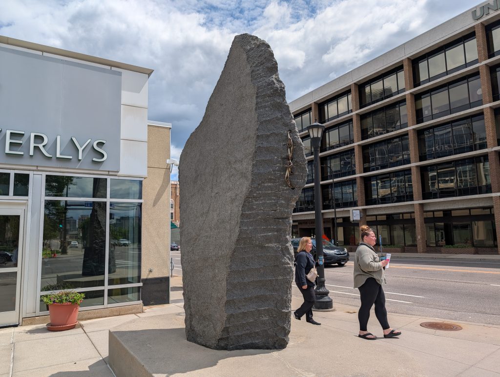
The final block of my walk, from Fourth Street Southeast to University Avenue Southeast along Central Avenue, extends along a large-scale condominium building with a Lunds and Byerlys grocery store on the ground floor. In 2006, this took advantage of the large footprint that had previously been occupied by the Winthrop School (from 1867), East High School (from 1900), and Eastgate Shopping Center (from 1951).
I didn’t find the building itself particularly amenable to photography, but, on the corner across from Chute Square, I was able to capture one more Zoran Mojsilov sculpture, Blade.