I recently attended the open house where St. Paul city staff presented the plans for the reconstruction of Pelham Boulevard. The open house was well-attended, and I saw many familiar faces, including others wearing face masks like my own in light of the unhealthy air quality on the day of the event.
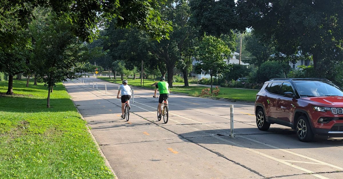
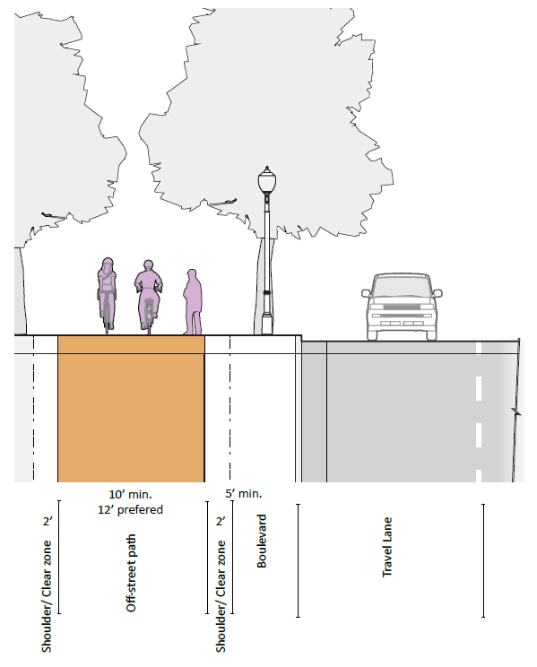
In summary, the reconstruction plans include converting the current flexpost-separated bikeway along this section of the St. Paul Grand Round into an off-street trail, similar to those along Como Avenue or Wheelock Parkway. Generally speaking, this is a good thing, as it will put more distance and a curb between the bikeway and auto traffic lanes. Outdated sidewalks will be rebuilt, and a new section will be added along the east side of the boulevard between Mississippi River Boulevard and Beverly Road.
All good stuff so far. But digging into the details revealed some concerning aspects.
Concerning Design Features
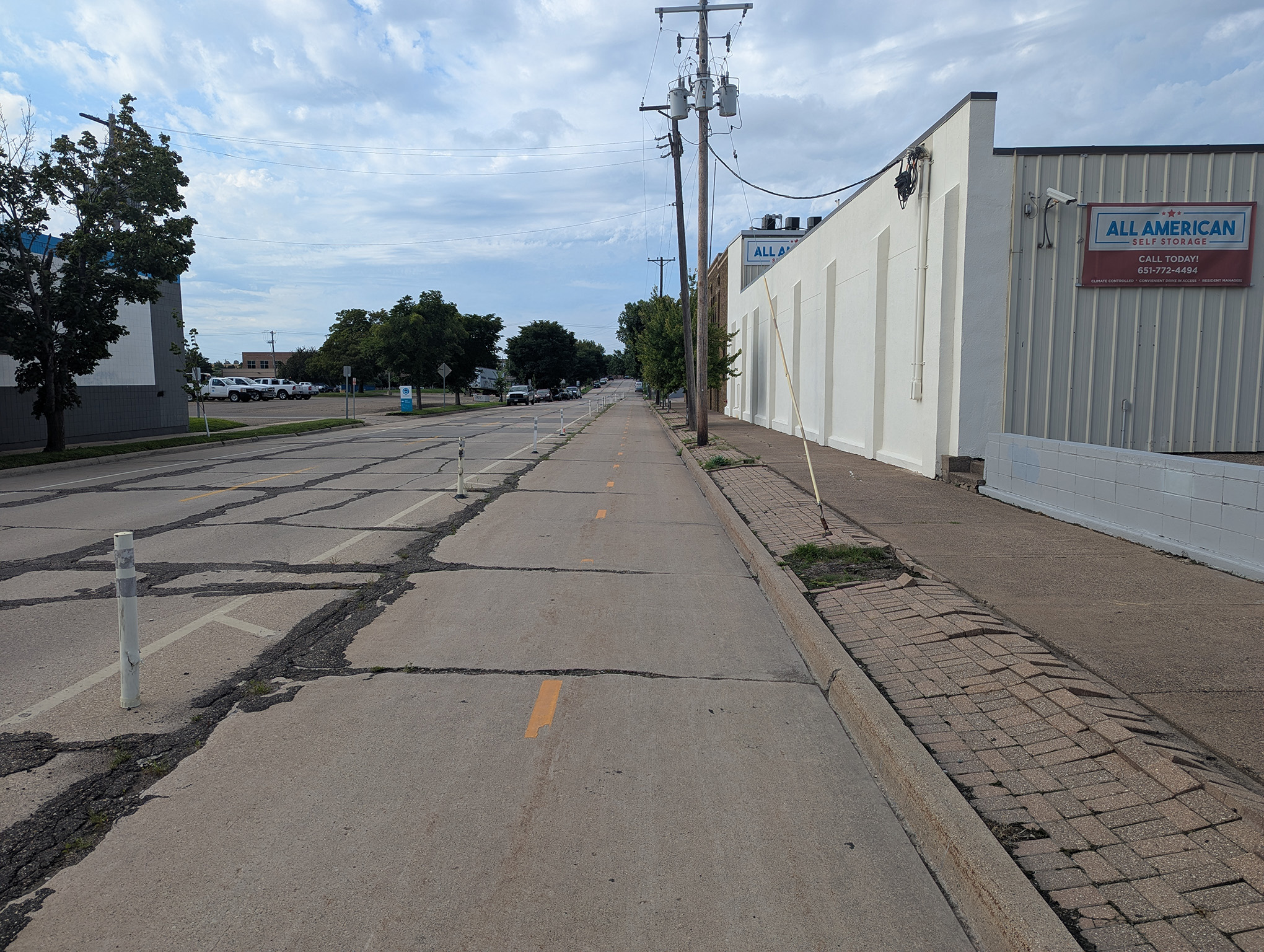
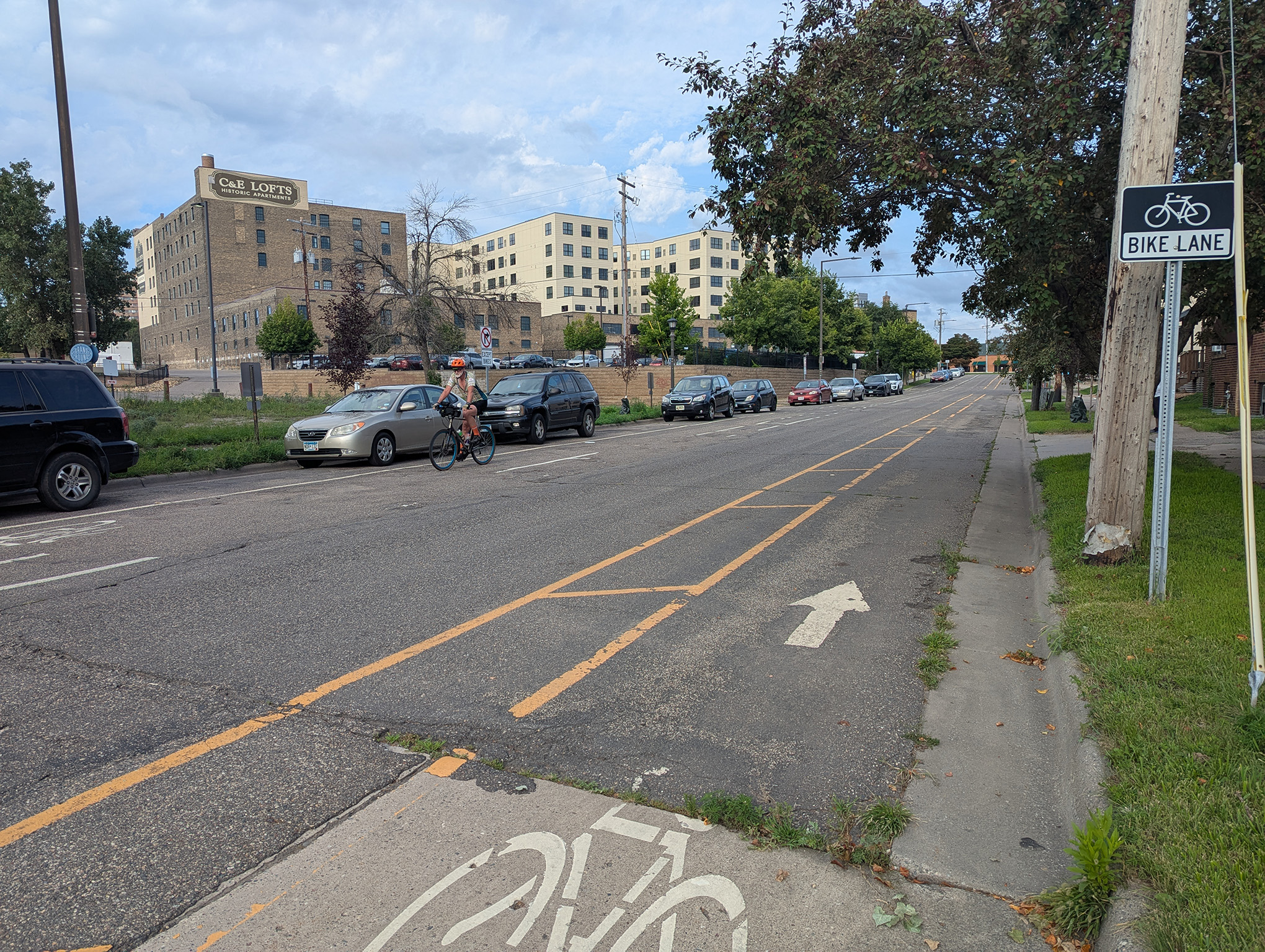
First: The bikeway is being narrowed, from 11 or 12 feet, down to 10 or even 8 feet in some sections. Between Wabash and Myrtle avenues, in particular — a well-used section — the bikeway is proposed to narrow from nearly 12 feet to 8 feet. According to the city’s own street design manual, 10 feet is the minimum for off-street bikeways (page 52), so the proposal for 8 feet is functionally obsolete and substandard, compromising cyclist safety without a convincing justification for the roughly 33% reduction in width.
For some reason, an unnecessarily wide 7-foot boulevard space is proposed instead of an adequately wide and safe bikeway, and the sidewalk is proposed to be wider than required and just as wide as the bikeway from Wabash to Franklin avenues, despite most of the stretch being industrial in nature (the largest frontages are a storage facility and parking lots).
The substandard bikeway width seems staff-imposed, rather than geometrically required. For comparison, the paths around Lake Como and Lake Phalen, which are considered to be wide enough for only one-way traffic, are each at least 8 feet wide. Given that cyclists traveling downhill toward Mississippi River Boulevard between Beverly Road and Otis Avenue can pick up considerable speed, a width beyond the bare minimum would help promote safety.
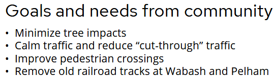
Second: Car lanes are proposed to be widened. Currently, the car lanes are listed as 11 and 12 feet, but are proposed to both be 12 feet for much of the corridor. This is despite top concerns of community respondents being preserving trees, reducing vehicle speeds and cut-through traffic, and improving pedestrian crossings, none of which will be supported by a wider footprint for cars.
Staff insisted that state aid roadway standards require 12-foot lanes, but reading those statutes, that’s unclear. According to the statute, “ten feet may be considered where truck or bus volumes are relatively low, rights-of-way are constrained, and design speeds are 35 mph or less.” That should apply to most of Pelham.
Also, there shouldn’t be a need for a reaction zone/gutter where there’s parking: “curb reaction must be provided only where parking is not provided.” So, it should be possible to include 10-foot lanes plus 1-foot gutters for the no-parking sections and 10-foot lanes for the sections with parking, even without a variance.
Plus, on top of all of this, there’s the ever-present, “Engineering judgment may be used to choose a lane-width dimension other than the widths indicated in the chart for roadways. Factors to consider include safety, speed, population/land use, benefit/cost analysis, traffic mix, peak hourly traffic, farm equipment, environmental impacts, terrain limitations, bicycle traffic, pedestrian traffic, other nonmotorized uses, functional classification, or other factors” (emphasis added).
Given that much of Pelham fronts a popular neighborhood park, doing whatever we can to keep speeding to a minimum seems prudent. Even if a variance has a low chance of acceptance, we should still request it, if for no other reason than to make clear the desire for more flexibility and local control of street design.
Third: Limited to no traffic calming proposed. As I’ve noted, the auto-traffic lanes are proposed to be widened, which generally leads to faster and unsafe speeds, the opposite of what the community desires. Some proposals include adding two four-way stops at the intersections of Pelham with St. Anthony Avenue and Beverly Road. But stop signs are not traffic–calming, and too many used in the wrong places can often lead to intentional running of the stop signs. Hopefully traffic calming — such as tabled intersections — get clarified later, but presented plans currently don’t specify this.
Fourth: Minimal commitment to address cut-through traffic. Another primary concern of the community was to limit cut-through traffic on Pelham Boulevard. One intersection option (“Alternative 2” in the supplied documents) proposed a median at Pelham and Doane Avenue, which might offer some limitations on cut-through traffic. But otherwise, virtually no aspect of the proposed design does anything to address cut-throughs.
Fifth: Missed opportunities for improved connections. The plan fails to address at least two low-hanging-fruit opportunities for improving connections on streets adjacent to Pelham.
- The current situation with a door-zone painted bike lane and buffered contra-flow lane on Myrtle should be consolidated into a two-way, flexpost-separated bikeway between Pelham and Raymond.
- Beverly Road should also see a two-way flexpost-separated bikeway added between Pelham and the sidewalk/pathway just before the intersection with St. Anthony Avenue.
Each of these projects could reuse the flexposts currently on Pelham, thereby requiring only restriping lane markings on Myrtle and adding new bikeway striping on Beverly, adding quality bikeway connections in an extremely economical fashion.
Additional Concerns
Open house logistics: Only one map of the corridor was provided, and it was extremely crowded to access it, making it difficult to see the small details and ask staff questions. More space was given to a rehash of what outreach was done, which people are going to be less concerned about at this point compared to what the proposal actually looks like.
Lack of expertise on the project: Staff didn’t know answers to basic questions about the design proposals and were unable to clarify why the car lanes needed to be so wide. For example, one staff member said that though it’s not a truck route, Pelham might periodically be used by moving trucks, so it’s justified to make the lanes wider for the tiny fraction of times a larger vehicle might use them.
Staff also cited snowplows, but didn’t know the width of plows and how that compared to the proposed lane width. I don’t expect someone to have all the answers immediately, but if you’re going to justify something with examples, you should have the data and knowledge to back up your assertions. No offer was made to follow up with the answers to these questions or other concerns.
Additionally, in follow-up discussions with other staff, the focus has too often been on trying to technically justify bikeway widths in the project by contorting bikeway definitions within the design manual without reflecting back on the main questions: Are these design decisions supporting a safe and comfortable facility that also advances city policy goals?
Public Works’ own mission states, “Public Works designs, builds, and maintains safe, sustainable, and equitable public infrastructure and services to meet the needs of Saint Paul for today and into the future.” Such a mission should mean that we implement robust traffic calming measures, maximize attractiveness for low-carbon transportation (biking and walking) and do so in a financially sustainable way.
Wider car lanes will actively undermine this mission, and the other current proposed design features don’t do enough to support it. Every extra foot of car pavement in the street is a prolonged liability for a city already feeling a huge financial pinch and failing to meet its transportation-related climate ambitions. We need real answers to why such changes are being proposed, not just lazy excuses of, “We’re just following the standards.”
Clearly, looking around at the state of our streets, the standards have been a failure, and it’s well past time to be bolder and more creative in order to challenge the status quo.
What to Do Next
Email the project staff, Jary Lee ([email protected]) and Jimmy Shoemaker ([email protected]), Public Works Director Sean Kershaw ([email protected]) and the Ward 4 office ([email protected]), where newly elected councilmember Molly Coleman will take office on August 27. (Until then, Matt Privratsky holds the seat.) Encourage them to prioritize non-car travelers for safety, according to city policies that already exist.
You can also fill out the project survey by August 31 linked on the project website: https://www.stpaul.gov/projects/public-works/pw2026pelhamblvdreconstruction
I suggest four possible points:
- Maintain existing bikeway width, especially from Wabash to Myrtle.
- Include more features aimed at traffic calming and diversion and safe crossings that community feedback requested.
- Narrow (or at least don’t widen) car lanes wherever possible within existing standards.
- Request a variance in order to narrow lanes to a more appropriate 10 ft or less.
Alternatively: Review the plans, bike the boulevard and come up with other suggestions of your own. This affects all of us who care about bicycle safety and transportation equity in St. Paul.
All photos by Zack Mensinger