Editor’s Note: Max Hailperin is walking each of Minneapolis’ 87 neighborhoods, in alphabetical order. He chronicles his adventures at allofminneapolis.com, where the original version of this article was published August 31, 2025.
Minneapolis’s North Loop neighborhood extends from the Mississippi River, between Plymouth and Hennepin Avenues, to the crotch of Interstates 94 and 394. Historically, it was settled in distinct areas, including a warehouse district and the exclusive Oak Lake residential neighborhood. Today, the mix is no less eclectic, including loft apartments, sports venues, transit and public works bases, a farmers market and transitional and supportive housing. In the map below, the light blue tint indicates the full neighborhood.
The route map also shows that on this first day, I emphasized the southern portion of the neighborhood. I walked 5th Street and nearly everything further from the river than it, but only a little of what’s closer to the river. (You can also see that the neighborhood contains a mix of Minneapolis’s two styles of street grids, one oriented to the river and the other oriented to the compass.)
Even with this restricted scope, my route was composed of three distinct loops. The first began on 5th Street, where I arrived by light rail at Target Field Station Platform 1, marked A. Eventually, I wound up back at Platform 2 of the same station, marked B. This loop extended as far from the river as 7th Street. There, I connected via 5th Avenue to a second loop, in the former Oak Lake area between 7th Street and Glenwood Avenue. And at the farmers market, I branched off from that second loop to a third, located south of Glenwood.
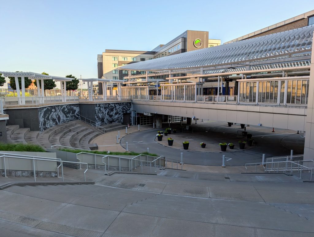
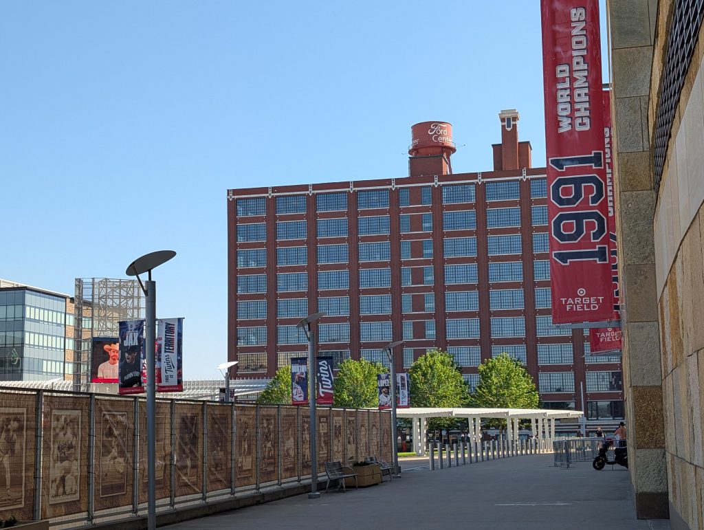
Early in the day, the light can be tricky but rewarding. I enjoyed pivoting around from the cool shadows of Target Field to the warm sunlight bathing the neighboring Hennepin Energy Recovery Center (HERC) and the split-level view of Platform 2 glimmering over the shadowy stairs leading down to 5th Street North and 5th Avenue North. (I’ll henceforth resume omitting the “North” directional, which applies to nearly all the streets and avenues in this area.)
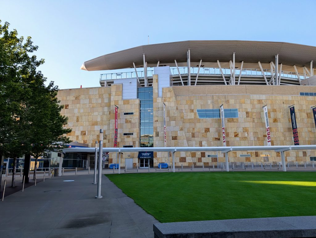
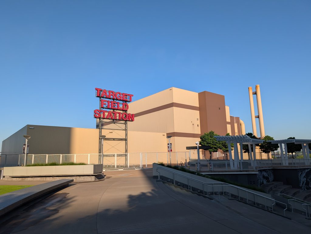
Target Field and HERC are two examples of the large-footprint facilities that have taken advantage of the North Loop’s extensive redevelopment.
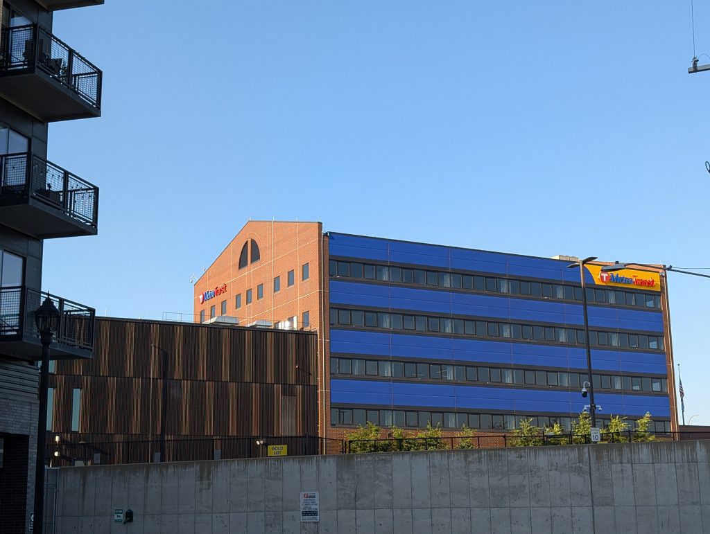
Overall, the largest footprint belongs to Metro Transit, which has facilities occupying nearly the entire area from 6th to 11th Avenues between 5th and 7th Streets. My first glimpse was on my spur down 7th Avenue: a good view of the office portion of the Fred T. Heywood Office Building and Garage. With the garage, this 1983 facility occupies a not inconsiderable 286,276 square feet — but it’s outmatched by the nearby 350,000 square-foot North Loop Garage opened 40 years later. And there are a few smaller structures in between, plus surface lots.
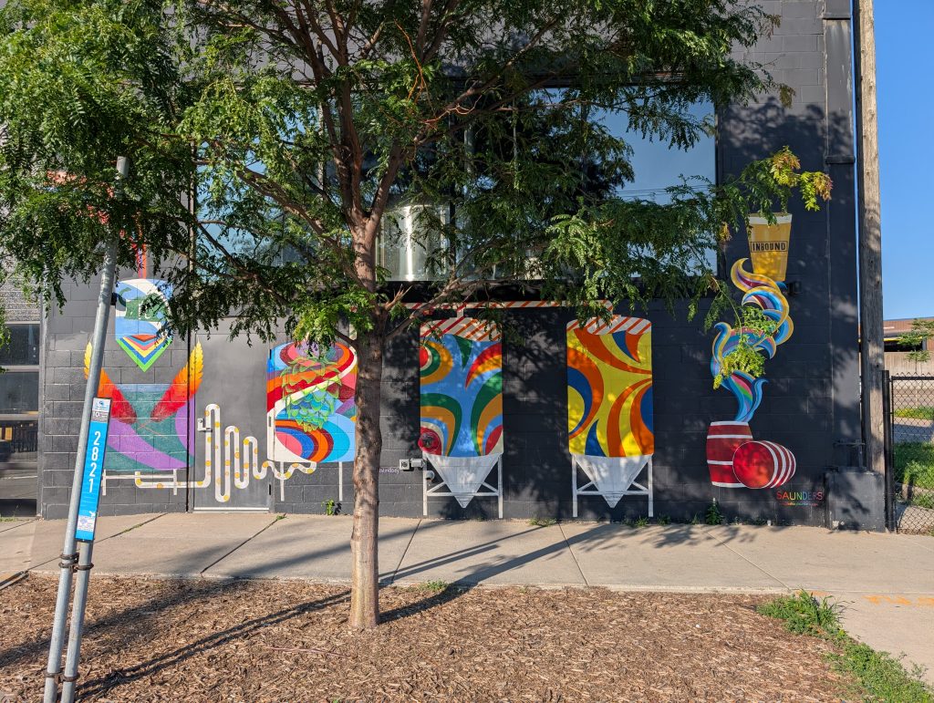
Returning from this 7th Avenue spur and continuing upriver on 5th Street, the corner of those two streets is occupied by Inbound BewCo. Of particular note is the 2019 mural by Lindsey Saunders, which combines the literal with the figurative: a technical depiction of the equipment found inside the building with a colorful evocation of the spirit presumably also found inside.
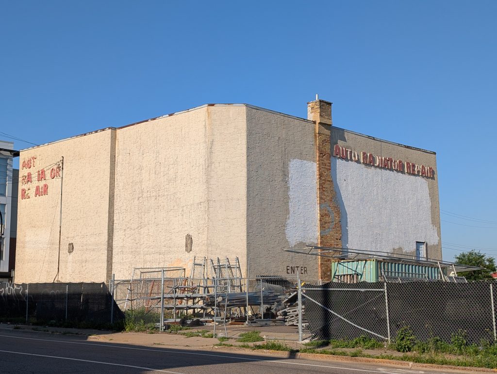
In contrast with the short spur on 7th Avenue, I was able to follow 8th Avenue all the way through the Metro Transit area to 7th Street before turning back. At the end of this longer spur, I spotted a picturesque remnant of this area’s heritage in the auto-parts sector, most significantly as the home of NAPCO Industries.
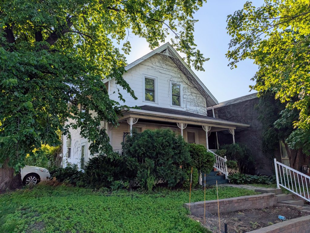
The auto radiator shop isn’t the only small-scale building to survive the area’s waves of clear-cutting. Back on 5th Street, I saw a 1927 warehouse building converted for retail use and 1914 two-story residence holding out against the changes that have swept around it.
A bit short of where 5th Street is truncated by I-94, there’s an intersection with 6th Street — which ought to be parallel. To further confuse matters, the street that continues colinearly with the 5th Street I had been walking is labeled as 6th Street, whereas to continue on 5th Street, I needed to turn the corner (after a back-and-forth spur on 6th). This all results from the transition between the river-oriented and compass-oriented street grids. It makes more sense on a map from before I-94 was constructed, when the two streets continued further north rather than each quickly ending.
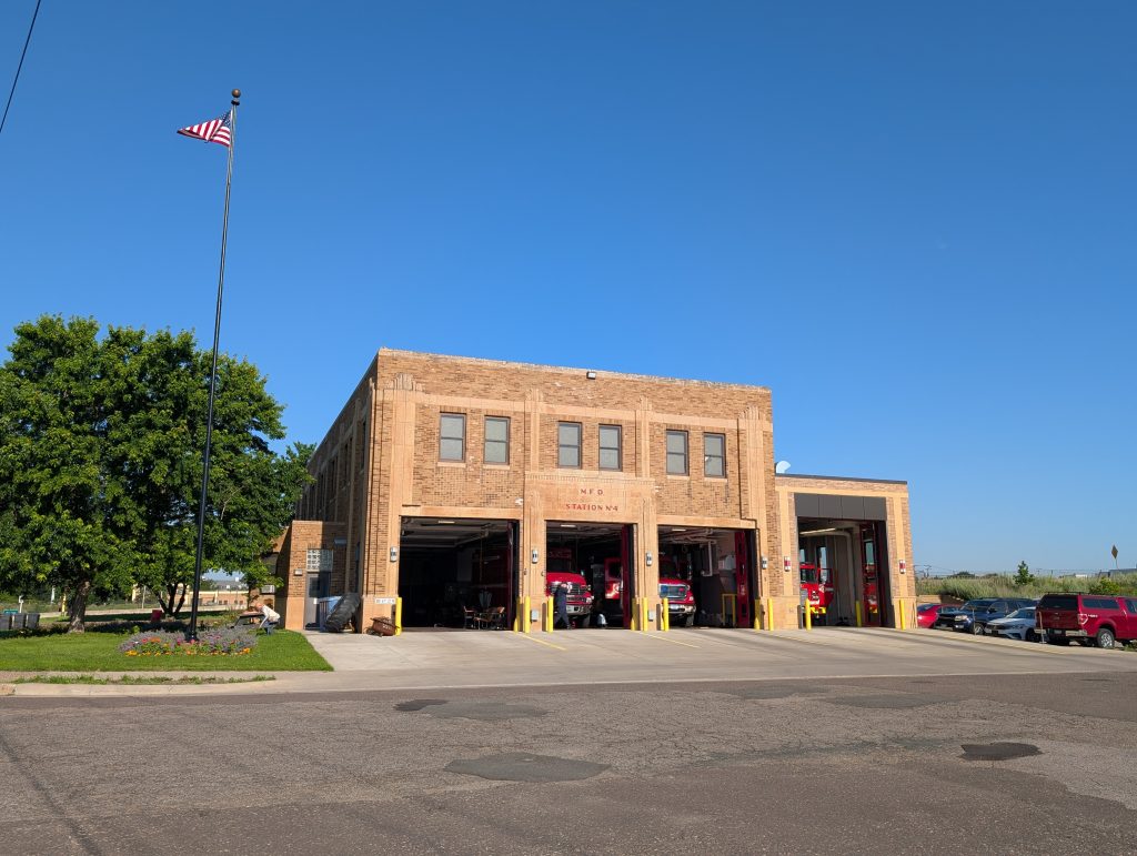
Aside from the strange street layout, another remnant of the pre-freeway days left largely cut off from north Minneapolis is a 1940 fire station. In the current configuration, it’s not exactly on a cul-de-sac, but it certainly would qualify as a backwater.
Another occupant of this area where streets and freeway collide is an adjunct to the nearby Metro Transit garages: a garage and lot for Transit Team, which operates Metro Mobility and Transit Link services under contract.
But honestly, one of the highlights of this area for me was wildflowers growing on the embankments. And I got to see even more — likely an intentionally created pollinator habitat — once I reached the empty area in back of Metro Transit’s North Loop Garage, where I rounded the corner from 11th Avenue to East Lyndale Avenue. The photo below shows the bee balm; another standout was the purple prairie clover.

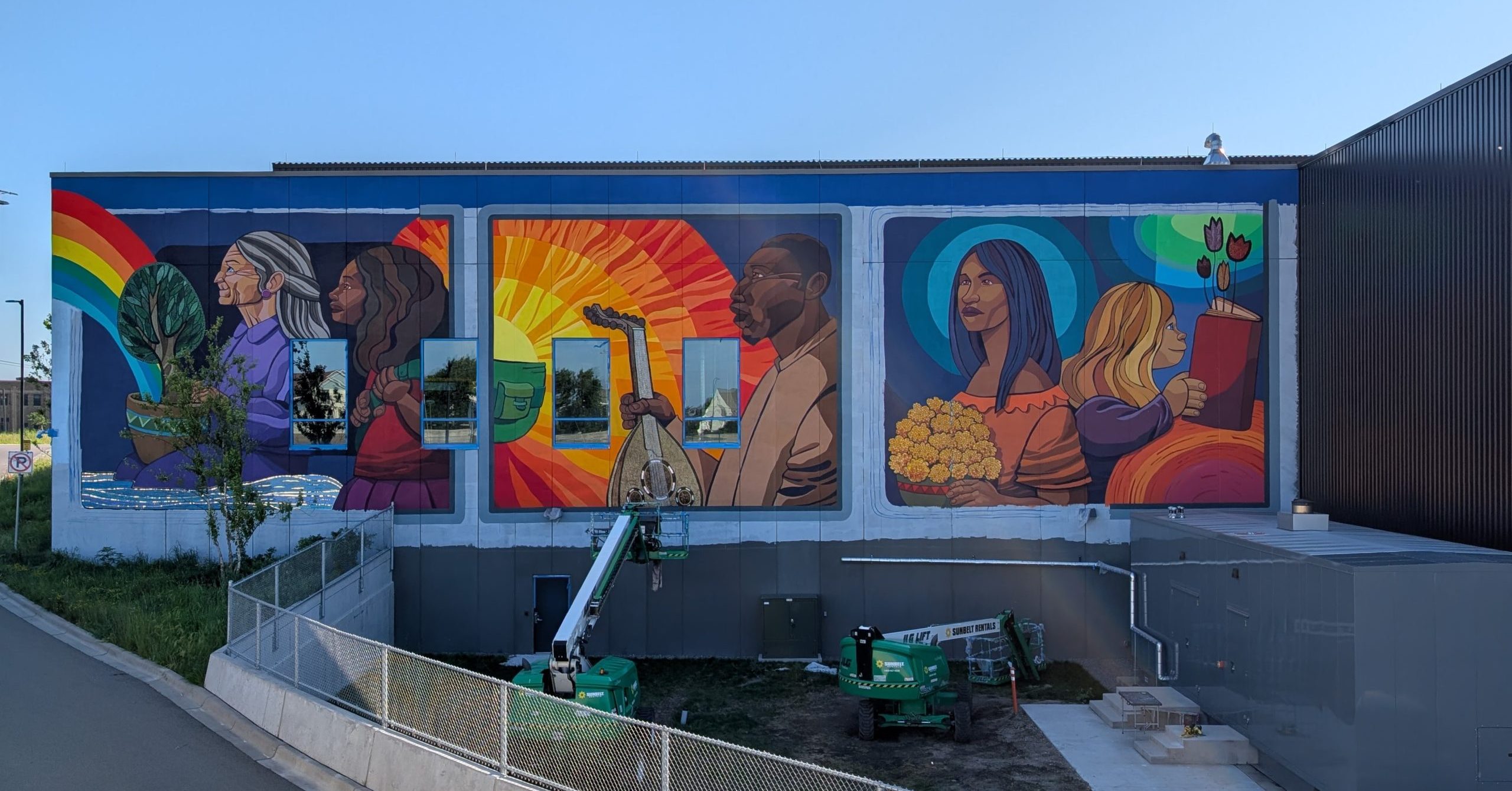
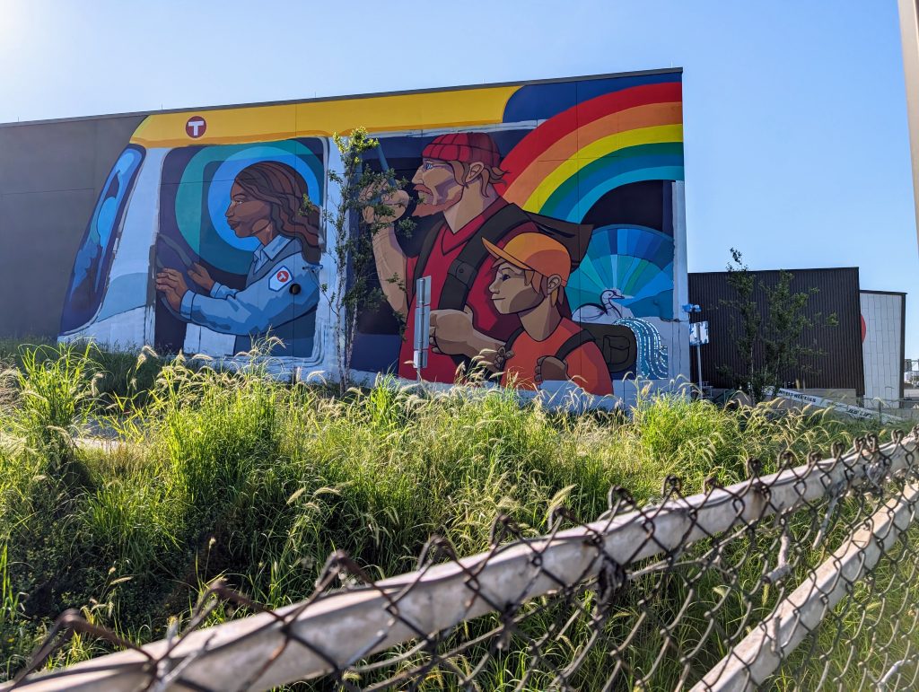
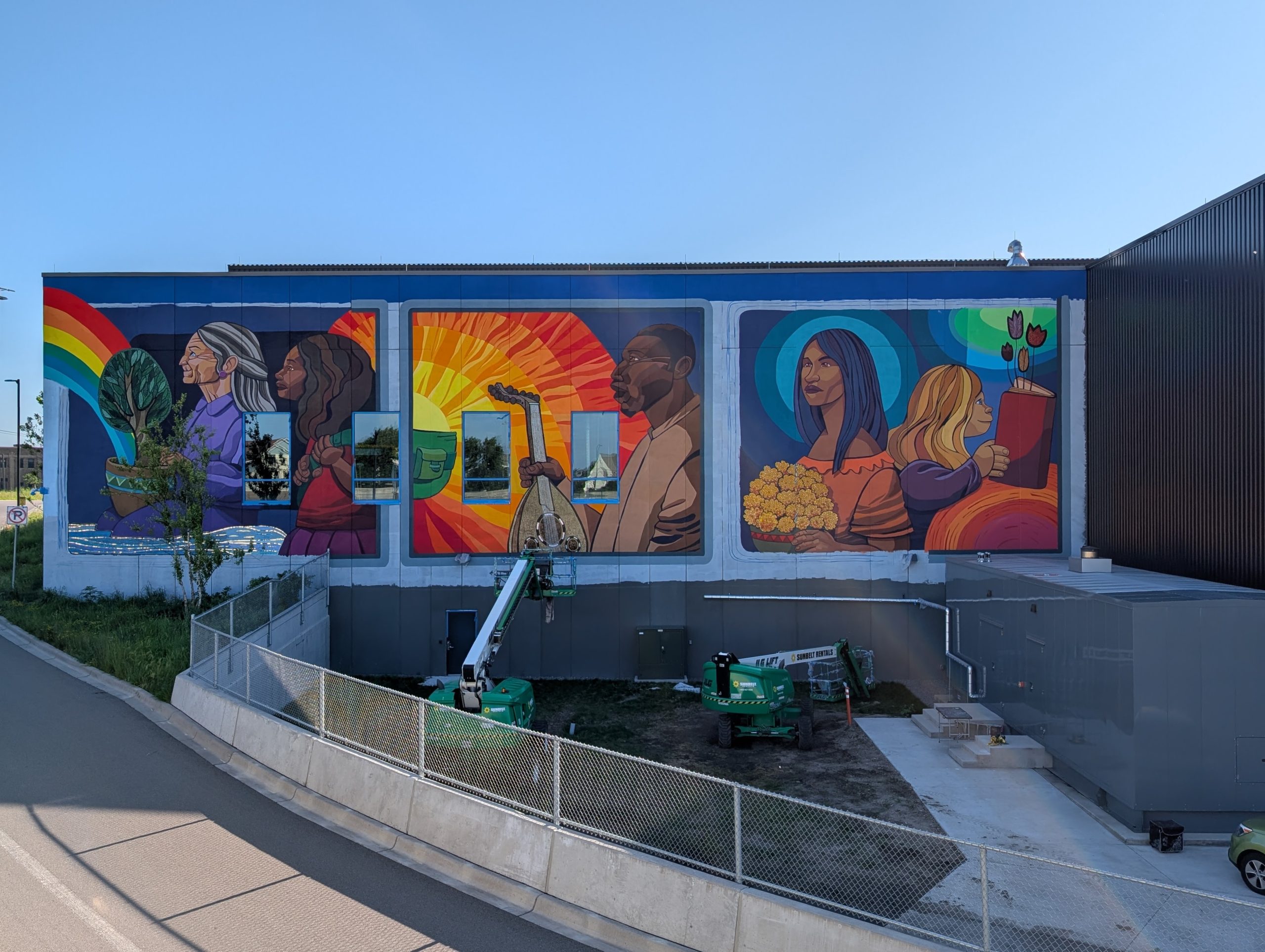
As to the garage itself, it is far too large a structure to photograph in its entirety, but the southwest corner has a striking mural wrapping around it. (Finishing touches were in process at the time of my walk.) I present the photos here in the order I saw them — first the front of the bus, then the back. But automotive traffic would all be flowing in the opposite direction, and I suspect the mural was designed for that. Seeing the back of the bus first, one might not initially recognize it as a bus with magical activity visible through its windows. And then the front would come into view and make the premise clear.
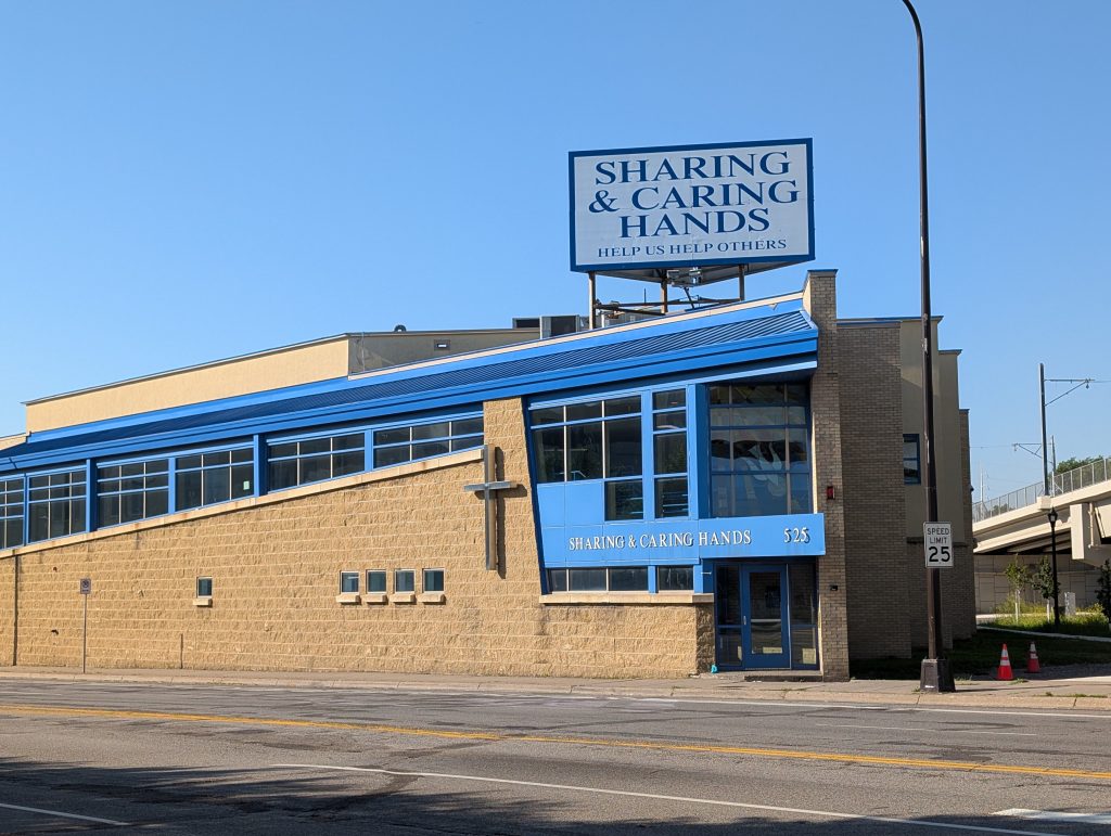
South of the garage, there’s an odd little triangle of land bounded between 7th Street, 5th Avenue and Royalston Avenue — odd because the triangle doesn’t quite close at the top, and made more odd by the light rail line currently being added across that pinch point. The lot hasn’t gone to waste, however, being home since 1988 to Sharing & Caring Hands. The affiliated Mary’s Place transitional apartments are just south of there, on the other side of 5th Avenue.
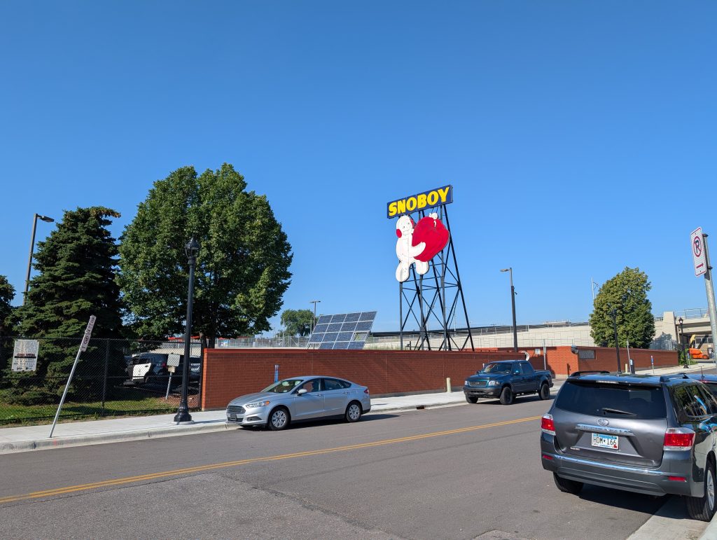
Taking the one block stretch of 5th Avenue leading to Royalston Avenue was necessary as part of my route plan — it’s the connection between the first loop and the second loop, so I’d also come back over it again later in the opposite direction. But it also gave me an important view of the City of Minneapolis’s Royalston Maintenance Facility. Important not because one can see the facility particularly well from this side, but because the 1954 Snoboy sign is such a distinctive landmark, a relic left behind by the produce company formerly headquartered here. It’s a very tangible reminder that this neighborhood derives much of its character from the large-scale turnover in land uses.
Nor is the evolution at an end — I saw work underway on Royalston Square, an “immersive entertainment venue” that surely was catalyzed in part by the imminent opening of an adjoining light-rail station.
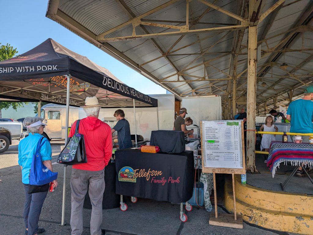
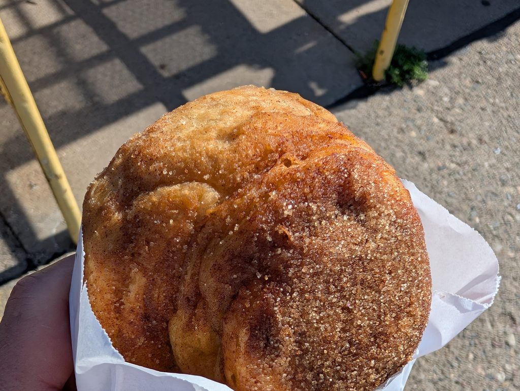
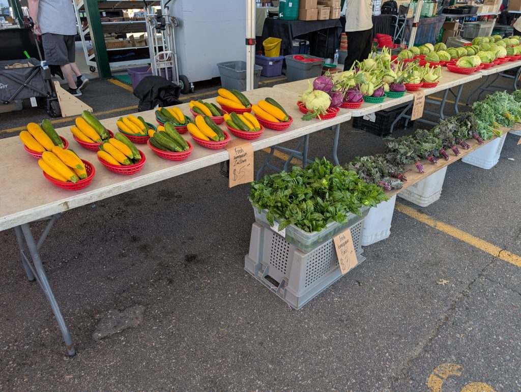
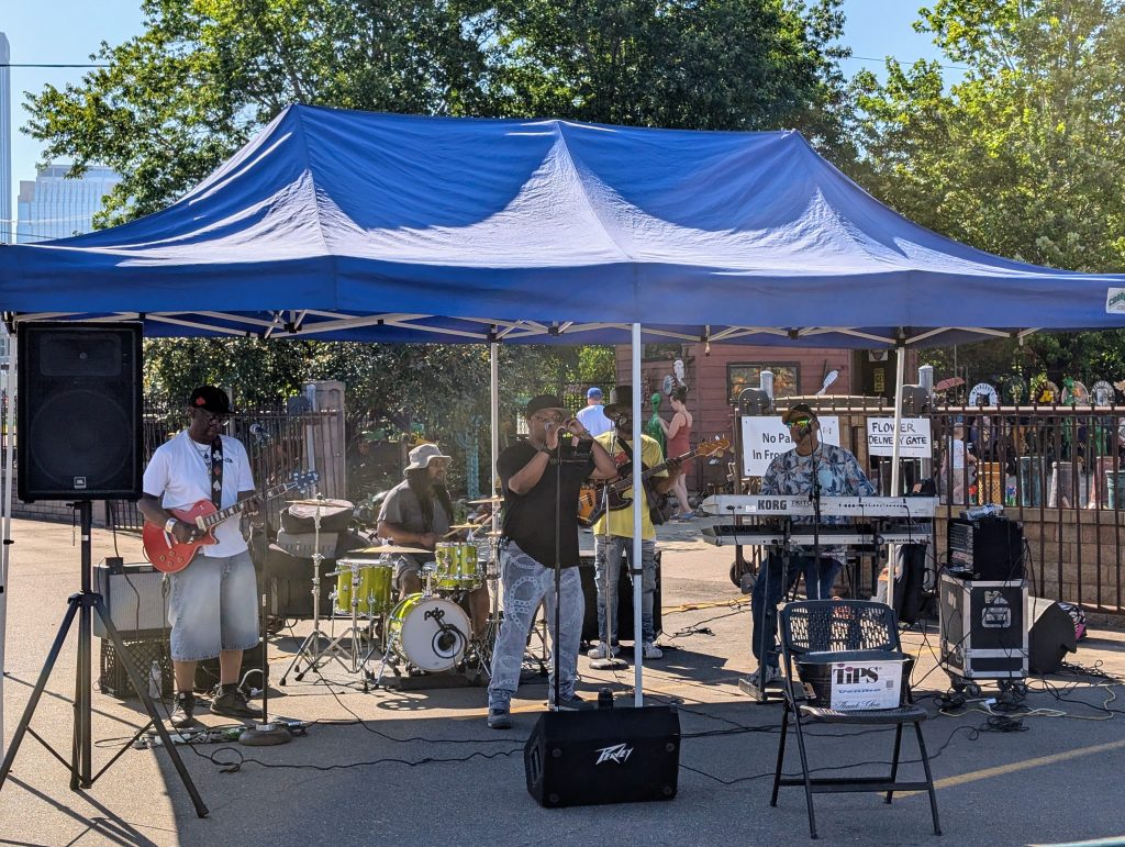
But for the moment, the biggest public gathering space remains the one that’s been in this area since 1937: the farmers market. I feasted my eyes and ears on its sights and sounds — and my mouth on a morning bun.
From the farmers market, I continued south on East Lyndale. That was my second connection from one of the route loops to the next — I needed to explore the area south of Glenwood Avenue before returning to the farmers market and continuing onward from there.
As in the other parts of my walk, a considerable amount of the land area is given over to the folks who keep our city humming — in this case, Xcel Energy’s Chestnut Service Center and the city’s Currie Maintenance Facility. However, I found a number of smaller points of interest to photograph.
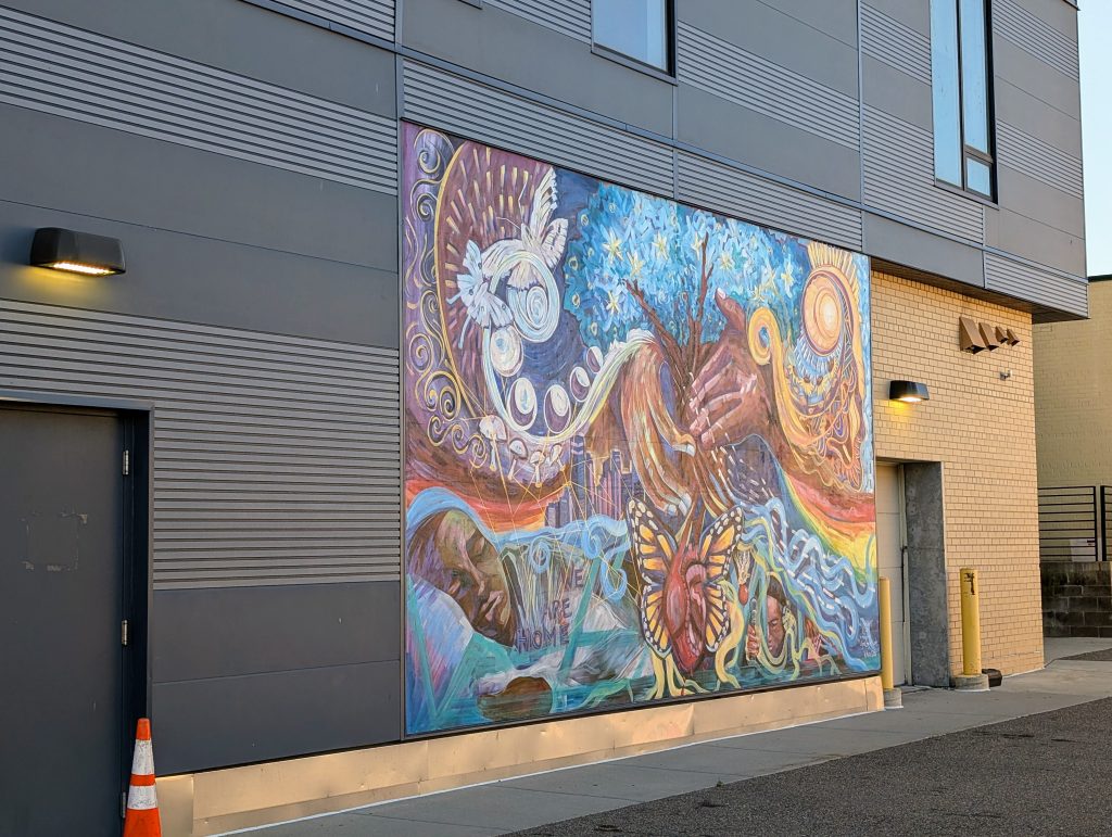
After I rounded the Xcel Energy facility at the southwest corner of the neighborhood and was headed east on Chestnut Avenue, I came first to the back side of a 47-unit apartment building, Downtown View, developed jointly by Project for Pride in Living and YouthLink in 2018 to serve young people experiencing homelessness. From this side, the notable feature is a mural, “We Are Home,” produced by GoodSpace Murals and Kulture Klub Collaborative.
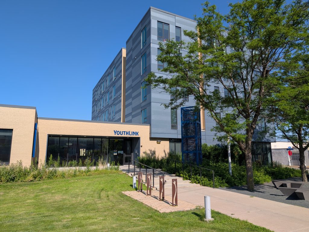
Once I was around the corner on 12th Street, I could see how Downtown View connected with YouthLink’s headquarters. The bicycle rack in the foreground is an interesting detail, weathering steel sheets incised with hands reaching upward on sinuous arms, suggestive of resilience that bends rather than breaking.
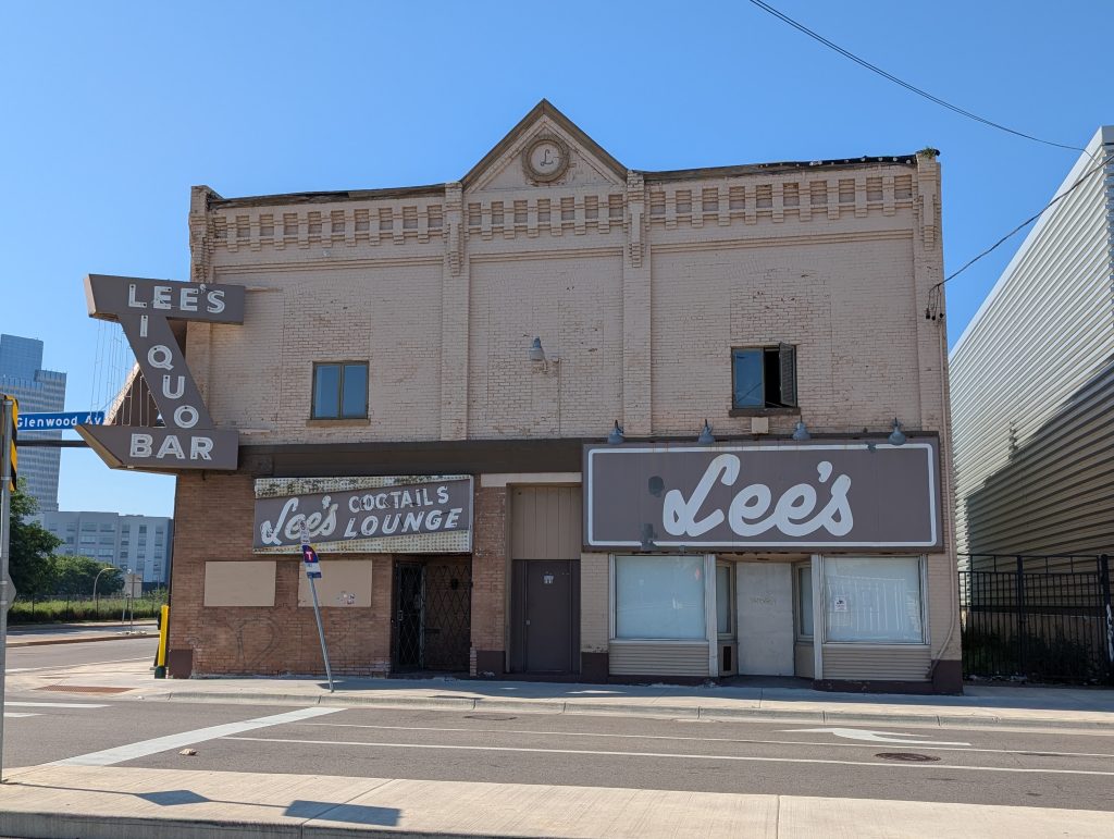
North of there, on the southwest corner of Glenwood Avenue and 12th Street, the shuttered Lee’s Liquor Lounge is one of the oldest buildings in the area. How old? My best guess is 1876. The building permit index begins with repairs in 1888, which would imply original construction was before the 1884 start of the index. Accounting for the fact that Glenwood Avenue was originally Western Avenue, the earliest city directory entry I’m finding for this address is 1876. A newspaper article about the venue closing in 2019 described it as a “1891 building,” but I’m not seeing anything in the building permit index to correspond with that. The only thing I can say for sure is that it existed in 1931, because it was photographed then. At any rate, it was for decades a beloved business and is now an empty, deteriorating property for sale. Will this prove to be a nadir before a rebirth? Only time will tell.
Once beyond this 50-foot-wide storefront and the far larger expanse of the surrounding Currie Maintenance Facility, the rest of Glenwood Avenue’s south side leading up to Lyndale Avenue is given over to Catholic Charities’ campus, comprising the 2012 Higher Ground Minneapolis Shelter, shown here, as well as the older Glenwood and Evergreen Residences.
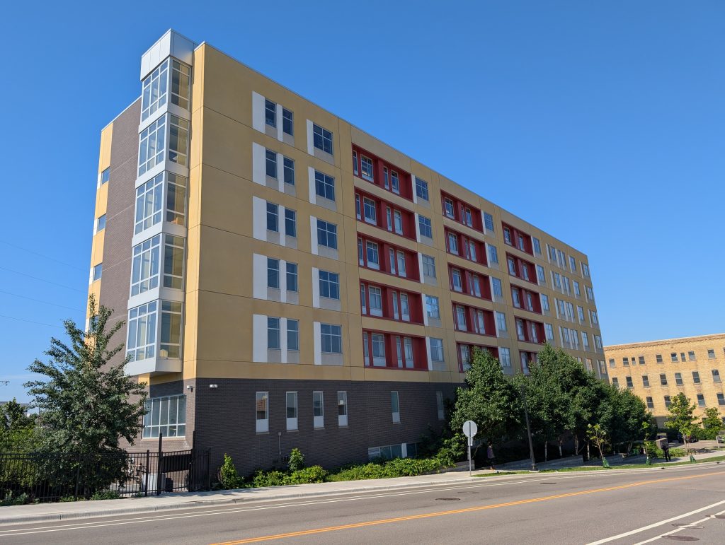
Across on the north side of Glenwood Avenue at the corner with Lyndale, an even more recent building (2023) provides affordable housing as Shelby Commons. I was particularly interested in the view from the rear that I saw after passing back through the farmers market and onto Border Avenue. (What does Border Avenue border? As best I can tell, the former Oak Lake Park.)
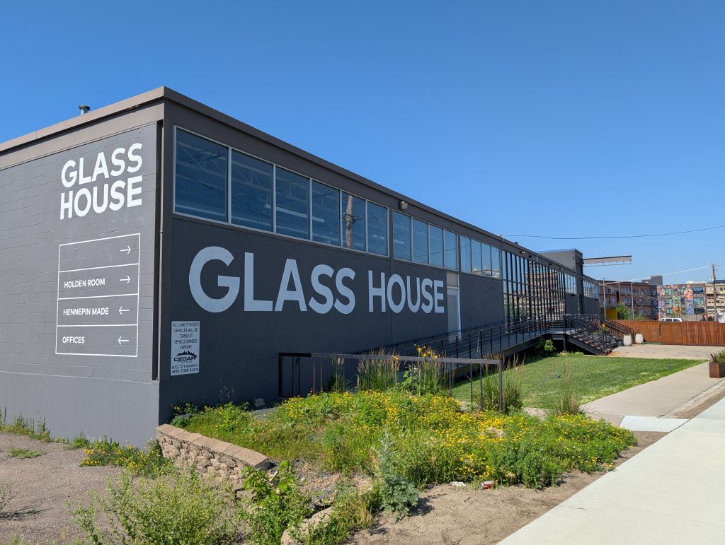
Once around the bend from southbound Border Avenue to eastbound Holden Street, I got a closer view of the intriguing Glass House, which I had first seen from the other side on Glenwood Avenue. Having started in 1955 as an industrial glass-blowing facility, it was revived in 2016 by Hennepin Made, an “artisan glass lighting brand” that had the novel idea to combine in one building their studio and an event venue that would showcase their work.
A few more zigs and zags took me back to Target Field, which I walked three sides of: 7th Street, the walkway where 4th Avenue might have been and 5th Street. On the walkway, I paused to take a photo of Ford Center on the other side of 5th Street — a 2011 office-building adaptation of a 1914 Ford plant that was “obsolete before it even opened.”
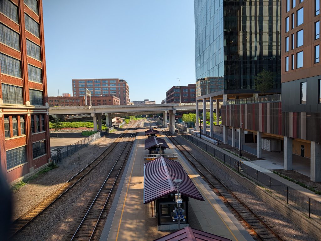
Turning in the downriver direction on 5th Street required crossing over the railroad tracks used by the Northstar Commuter Rail, allowing me to see the associated platform — also called “Target Field Station,” although distinct from the light-rail platforms of that name. Commuter rail service is currently scheduled to end in January of 2026.
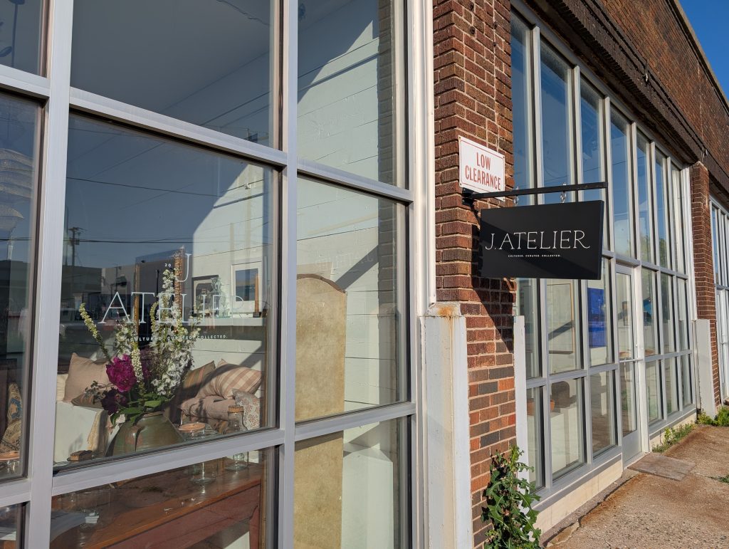
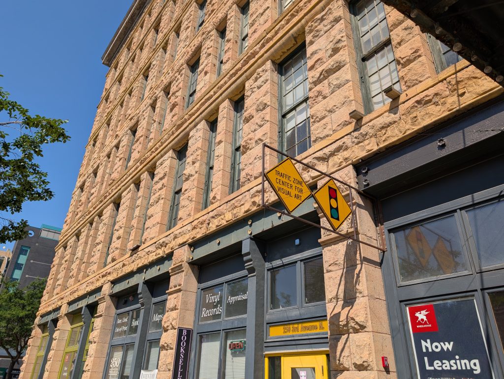
I turned left on 3rd Avenue and, as I neared Washington Avenue, was rewarded by the sight of a six-story limestone building from 1886, now home of Traffic Zone Center for Visual Arts and James & Mary Laurie Booksellers. The building has quite a history, ranging “from the latest in farming needs in the 1880s to unusually fresh baked goods at the turn of the century, to a home entertainment revolution in the 50s and 60s.” And in 2025, it has a new owner looking for new tenants.
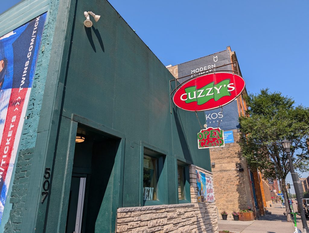
Not all 19th-century buildings are so visually apparent. A block away on Washington Avenue, Cuzzy’s stands out for its sharp color scheme, not for any indication of significant age. But that’s because both the left half and the top half were chopped away, leaving only a quarter of the original massing, minus all the decorative details up top, and to further the disguise, the facade’s been totally covered over. You can see the comparative photos in one history published by the neighborhood association (written by Mike Binkley), while another by Andy Sturdevant that they redistribute from The Growler goes into greater depth on the early decades in particular.
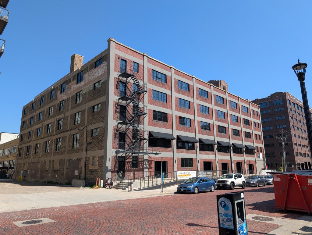
This last part of my walk, along Washington Avenue and then back to Target Field Station via 6th Avenue, 4th Street and 5th Avenue, is likely the part most people would think of as “North Loop,” a gentrified warehouse district full of apartment buildings, some of which are adaptive reuses of warehouses as lofts, others of which are new construction.
I suspect I’ll get a lot more photos of this style of development on my second day in the neighborhood. Therefore, to avoid duplication and keep this first installment focused more on the area further from the river, I’ll close with just three photos that sum up for me the feel of this area — bagels that I needed to wait in line for (but were worth it) and one of each generation of building.

All photos by Max Hailperin
[Update: a video released after this post describes the mural’s creation and credits the artists, Daniela Bianchini, Pablo Kalaka, Gabriela Sepúlveda, and DAKA Studio.]