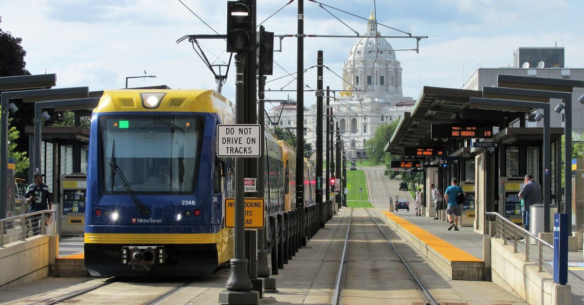
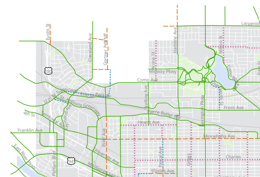
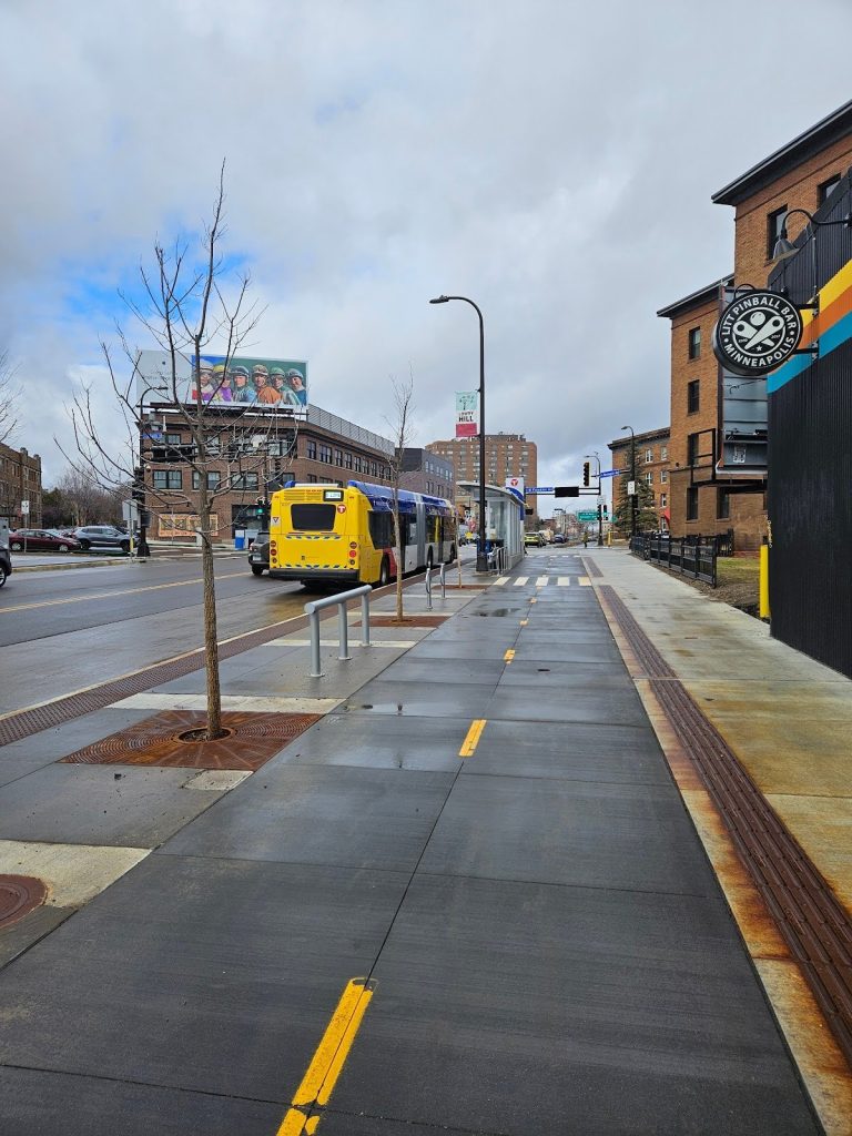
On March 23, Metro Transit released the H Line Draft Corridor Plan. The H Line is one of the next arterial Bus Rapid Transit (aBRT) routes being built out in Metro Transit’s successful in-house bus-rapid transit program. These types of aBRT routes now span the Twin Cities, so many people have become familiar with aBRT’s upgrades: improved stations and bus fleet that’s optimized for efficient stopping, featuring upgraded bus stops with real time information, improved communication infrastructure and payment that happens off the bus. aBRT also minimizes the time stopped and maximizes the time moving, with strategic use of transit signal priority, bus lanes and other technical features that can speed up bus travel times by 25% compared to local routes.
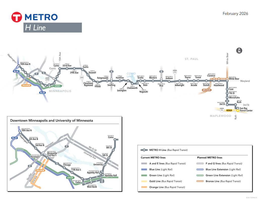
The H Line will substantially replace and upgrade today’s Route 3, serving the North Loop and Downtown Minneapolis, the University of Minnesota Twin Cities campus in both Minneapolis and Saint Paul, and Como Avenue and Maryland Avenue in Saint Paul, with the eastern terminus at the Sun Ray Library and Transit Center.
As authors of this piece, we are Route 3 riders and in support of the H Line. We support the H line and want to see it constructed on time.
However, we have one concern with the H Line plan as presented in the Draft Corridor plan: The location of the station platforms within the Saint Anthony Park neighborhood of Saint Paul; most crucially, the platform at Doswell and Como.
A missing link
The westbound platform (on the north side of the street) leaves room for only a sidewalk along Como Avenue.
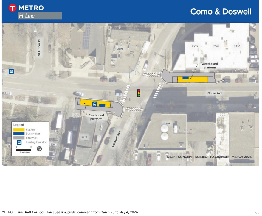
This is a problem, and the story that follows will emphasize that this problem will not become better with age. The platform on the north side of the street does not leave room for an offstreet bikeway — not in one direction, and certainly not in two. This is not just a problem for the bike lanes that are currently on Como Avenue, but because a better option for this bike connection is available.
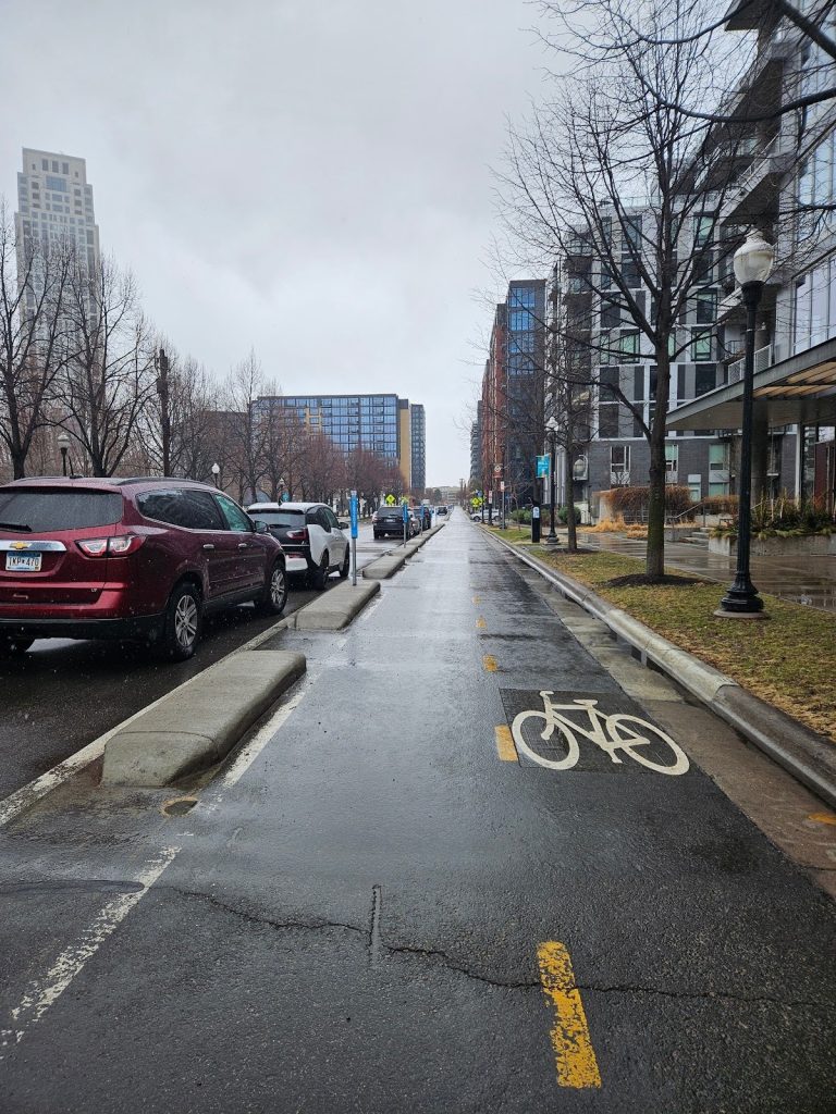
Como Avenue is a somewhat unconventional street, stretching from the State Capitol to Como Lake, and then through Saint Paul and across the Minneapolis/Saint Paul boundary nearly to Downtown Minneapolis in the Dinkytown neighborhood where it comes to an abrupt end at Interstate 35W. Como Avenue currently has a bikeway between Cleveland/Raymond Avenue in Saint Paul and Como Park. It’s a two-way bikeway along the north side of the street, and forms part of Saint Paul’s Grand Rounds, a circular system of parkway that circles the city, nearly all of it on infrastructure that separates bikes and pedestrians from cars.
The planned Como and Doswell Station is roughly 800 m (2,628.95 ft) west of the beginning of the existing bike trail along Como. If Metro Transit builds a bus platform in this location on the north side of Como Avenue, Saint Paul will have excluded a chance to connect the commercial core of north Saint Anthony Park with one of Saint Paul’s singular park amenities.
However, the failure to plan for a bikeway along the north side of Como Avenue through Saint Anthony Park is even more glaring considering what is happening to the west of Saint Paul in conjunction with the H Line project.
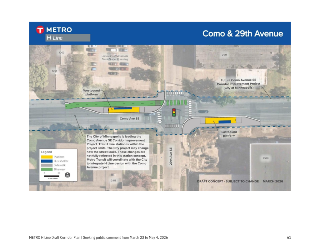
The H Line will also travel along Como Avenue SE in Minneapolis. Because of the H Line, the City of Minneapolis is piggybacking off the changes to put in a two-way bikeway on the north side of Como Avenue SE for its entire length in Minneapolis, from 10th Avenue to 33rd Ave SE. You can learn more at the Minneapolis project page for Como SE.
Failure of planning, making it work
This would feel like a glaring gap when the H Line has its planned opening in 2029, but will be made all the worse if the H line bus platform(s) are put in the planned location on the north side of Como Avenue, and then stand there for a generation. Generally, aBRT platforms include concrete bases for bus shelters and fiber-optic communication cable for real-time information signage. If Saint Paul decides to install a bikeway on the north side of Como Avenue under these conditions, it is not sustainable to demolish the bus stop and rebuild it in a new location from either an environmental or fiscal perspective.
It’s worth naming the City of Saint Paul for the lack of foresight and effort here. The H Line was approved as an alignment as part of the Network Next process all the way back in 2019. Como Avenue was included as a corridor for a separated bikeway through Saint Anthony Park in the Saint Paul Bicycle Plan, which was most recently updated and approved with a full council vote in 2024. The City of Saint Paul had plenty of time to anticipate this, and seemingly has chosen to do nothing.
That is why, as advocates from Minneapolis and Saint Paul, we are asking for Metro Transit to do no harm with these H Line stations. Specifically, we are asking Metro Transit to forgo constructing the westbound platform at Como Avenue and Doswell until Saint Paul decides how they will implement the separated bikeway or path included in the bike plan they updated in 2024.
This should not delay construction of the H Line. There is abundant precedent for temporary stations being constructed in aBRT projects: the recently opened E Line features temporary stations along Minnesota Department of Transportation right of way along University and 4th SE, the D line has temporary stations at 38th and Park and Portland, and the C Line has had three temporary stations along Olson Memorial Highway since 2019 while the future of Olson Memorial Highway is up for debate.
We have ideas for how Metro Transit and the City of Saint Paul could solve this. Community members within Saint Anthony Park support moving the station a block east within the business district to Como and Carter, which may allow more space for a future off-street bikeway on the north side.
We recognize that Como Avenue was recently reconstructed, which is why we are not asking for a full reconstruction of Como Avenue to implement a two-way bikeway on the north side of Como Avenue on the timeline of the H Line. Rather, we are asking that Metro Transit to not make that impossible with the construction of the H Line.
The City of Minneapolis has excelled in recent years implementing bikeways during the course of regular asphalt street resurfacing, such as on 2nd St S in the Mill District. Minneapolis has purchased a concrete extruding machine, essentially a mobile 3D printer for concrete, that enables the city to put a curb on an asphalt roadway for a cost dramatically lower than reconstructing a street, and does not involve paying construction contracting firms. Saint Paul could get their own concrete extruder, or they could look into using Minneapolis’s, since Como Avenue does cross between the two cities, after all.
The future of Como Ave.
While our ask is to build a temporary station at this time, we emphasize that there are future opportunities to improve the Como streetscape. As part of the 2023 Transportation Sales tax, the Metropolitan Council now has increased funding for active transportation that’s distributed on a competitive basis. Saint Paul could and should attempt to fund a Como Avenue bikeway with this new funding source. Between the commercial core of Saint Anthony Park, the activity centers of the Minneapolis and Saint Paul branches of the University of Minnesota, the gosh darn great Minnesota get-together and future residential redevelopment of the Luther Seminary campus, Como Avenue is a regional bikeway and should be planned and treated as such.
It may seem like a tall ask to include a high-quality bikeway along Como Avenue in addition to aBRT, private automobiles, and parking — but it should not be. The most disappointing aspect of this failure of imagination is that a better bikeway with better buses along Como should not be unimaginable. Como Avenue today includes buses, private automobiles, parking and bike lanes in each direction, sheltered by a generous urban canopy. The future of Como should be simple enough to rearrange these aspects to be the best possible for each mode. But for reasons that were entirely within control by the the City of Saint Paul, we write today asking you to urge Metro Transit to delay fully constructing aBRT platforms along Como Avenue in Saint Anthony Park.
What you can do
Comment on the H Line Plan: oppose the location of the current westbound station at Como and Doswell. Ask for a temporary station, or relocation of the station on the block to Como and Carter. Comments are due by May 4.
(Take a look at the rest of the plan! There’s a lot to love and support, including great bike accommodations elsewhere, such as along Washington Avenue in the North Loop!)
If you are a Saint Paul resident: Urge your City Council member to support the implementation of the Saint Paul Bike Plan, or at the very least, prevent the non-implementation of the plan. Get involved with the Saint Paul Bicycle Coalition and/or your local District Council Transportation Committee.