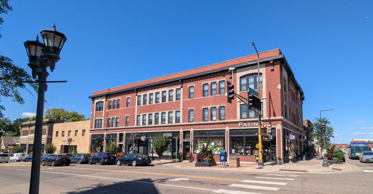
Last week, I shared the great news that the City of Saint Paul is studying the possibility of rezoning land along a handful of streets served by high-frequency bus routes into the Traditional Neighborhood zoning districts (“T Districts”), which enable and encourage compact, pedestrian-oriented development and a mixture of housing and commercial spaces. I explained the key qualities that distinguish the T Districts from other zoning districts in Saint Paul, and the differences between each T District.
In this piece, I’ll make a simple argument: as a general rule, the City of Saint Paul should rezone land along high-frequency transit corridors into the T3 zoning district. Parcels of land currently occupied by single-family homes may warrant an exception to this general rule, and be rezoned into the T2 zoning district instead.
Rapidly growing the tax base
In a recent essay, I argued that Saint Paul urgently needs to expand its tax base, and that the best way to do so is to encourage the development of compact, land-efficient buildings. I showed that “dense” real estate development produces far more Tax Value Per Acre than sub-urban styles of development with large surface parking lots and lawns, and I showed examples of five- and six-story buildings that generate far more Tax Value Per Acre than one- and two-story buildings. I argued that Saint Paul needs to legalize higher levels of development intensity in more places. Rezoning land along high-frequency transit corridors into the T3 zoning district is the specific action that the City should take towards that goal.
In a way, this is an argument about – you guessed it! – Floor Area Ratios (FAR). In my previous essay, I showed the maximum Floor Area Ratios in each of the T Districts:
- Maximum FAR in T1: 1.0
- Maximum FAR in T2: 2.0
- Maximum FAR in T3: 3.0
- Maximum FAR in T4: no maximum
Simply put: I think that a Floor Area Ratio of 2.0 would be an unacceptably low maximum to impose on land along our City’s best transit routes. One could argue that we shouldn’t impose a maximum at all – that we should let market forces become the factors that limit the intensity of real estate development, instead of limiting our own potential with arbitrary rules. Given how urgently Saint Paul needs to expand its tax base, such an argument would be very reasonable.
And yet I’m making a more modest argument: that it should be legal (for example) to construct buildings that are three stories tall, whose developed square feet exceed two-thirds of the lots they occupy, and devote that square footage to things like housing.
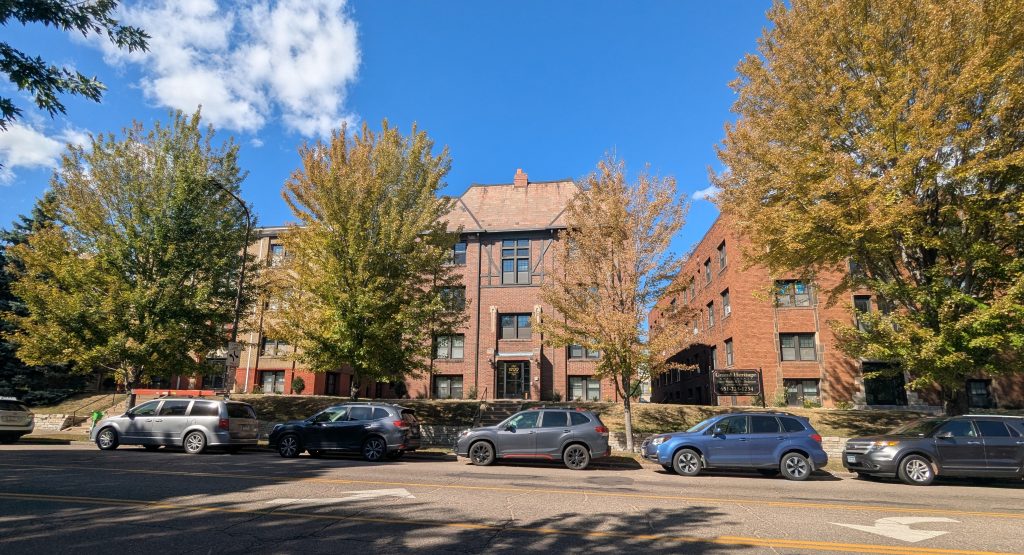
A row of lovely old apartment buildings on Grand Avenue provide a helpful example. You can see from the street that these buildings each have three equally-sized floors. From an aerial view, it’s easy to see that they each occupy more than two-thirds of the lots they occupy. Admittedly, it’s not possible to know the FAR of these buildings for sure, since we don’t know how much of the built square footage is devoted to uses that are excluded by the Zoning Code’s definition of Floor Area. Still, at a glance, each building appears to have a Floor Area Ratio greater than 2.0 – perhaps closer to 3.0. If that’s the case, they wouldn’t be legal to build today if their lots were zoned T2 – but they would if their lots were zoned T3.
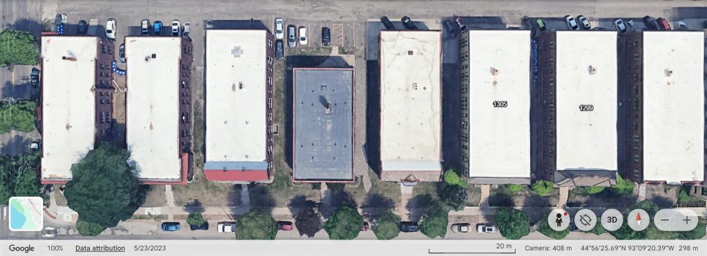
Buildings like these – which utilize nearly all of the land they occupy, and are three stories tall – should be allowed on nearly every parcel of land along our Bus Rapid Transit corridors. I don’t think this is a radical proposition.
Although it’s obvious, it’s worth stating that if the City rezones land along transit corridors into the T3 district, it’s likely that many buildings would be developed at a T1 or T2 scale (e.g. Floor Area Ratios under 2.0) instead of a T3 scale (e.g. FARs of 2.0-3.0). Great! The point is that our zoning rules ought to generously accommodate the possibility of abundant housing and commercial spaces along the Study corridors (by allowing taller and thicker buildings), with the goal of enabling more people to live close to frequent transit stations and expanding the tax base. The T1 and T2 districts don’t adequately accommodate this possibility; the T3 district does. And so the City should treat the T3 district as the “default” choice for rezoning most parcels of land along the transit corridors.
Here are two more quick examples of the kinds of buildings that I believe should be allowed by right on any lot along Saint Paul’s high-frequency transit routes. (The same caveats about the difficulty of knowing the exact FAR of a building apply to these, as with the Grand Avenue example above.)
989 Payne Avenue
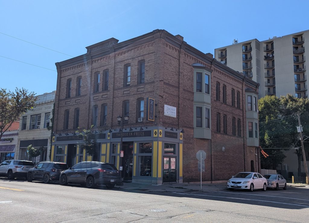
The three-story building at 989 Payne Avenue is home to a great restaurant Tongue in Cheek. From an aerial view, you can see that the building covers nearly all of the parcel it occupies. With three equally-sized floors, its FAR would seem to be higher than 2.0 – perhaps closer to 3.0. A footnote in T2 bumps the maximum to 3.0 for buildings with “no parking”: it’s unclear if this would qualify. (It seems silly that a building could be legal or illegal to build depending on whether a single off-street parking spot is provided in the back.) Based on its 2025 assessed market value, 989 Payne generated a Tax Value Per Acre of $14,371,460.
170 Dale Street and 610 Selby Avenue
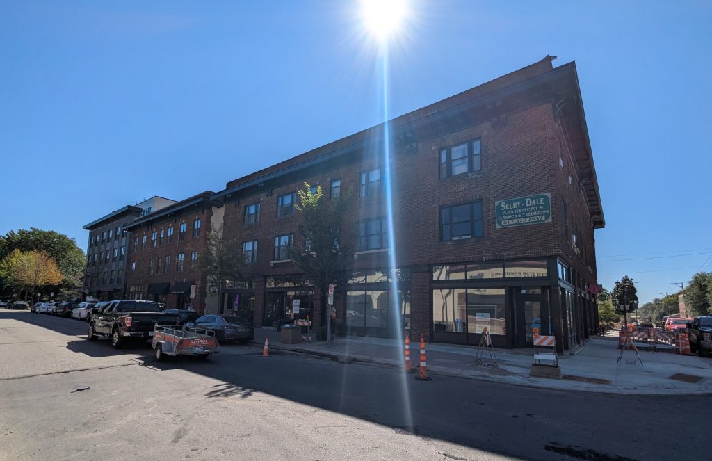
At 170 Dale Street and 610 Selby Avenue are two three-story buildings at the southwest corner of Selby Avenue and Dale Street, housing Mango Thai restaurant, Wee Claddagh Coffeeshop, and other charming businesses. From above, it sure seems like these two three-story buildings cover 75-90% of the lots they occupy. It seems likely that each building’s FAR is above 2.0: this would make them legal to build in T3, but not T2. Based on their 2025 assessed market values, the smaller building has a Tax Value Per Acre of $18,072,289, and the larger one has a Tax Value Per Acre of $11,903,013.
T3 zoning and affordable housing
Another reason to rezone land along Arterial Bus Rapid Transit (aBRT) corridors into the T3 district is to facilitate the development of subsidized affordable housing. This insight comes from my friend Ben Werner, who works for an affordable housing development company on the East Side of Saint Paul called Dayton’s Bluff Neighborhood Services. (He has been deeply involved in housing issues on Saint Paul’s East Side for years; when I met him, he led a housing justice program at the East Side Freedom Library.) Ben tells me that the T1 district’s limitations on building heights and lot coverage make it more difficult to build affordable homes on T1-zoned land, and that T2 isn’t much better. He shares my feeling that land along the Study corridors should generally be rezoned into the T3 district; it will increase the number of locations where the numbers work to construct affordable homes for rent or purchase, and the number of homes that can be built in those locations.
The intersection of University Avenue and Dale Street is a good example: mid-rise buildings with subsidized affordable housing occupy T3-zoned land at three of the intersection’s four corners. All three buildings include wonderful street-level destinations that serve the neighborhood: the Rondo Community Library (temporarily relocated during renovations), Flava Coffeeshop, restaurants, a convenience market, and the offices of the Neighborhood Development Center. If these parcels had been zoned in a lower-intensity zoning district, it would not have been possible to enliven this important intersection with so many residents, businesses, and services.
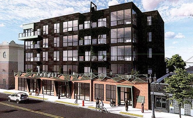
It’s worth noting that the T3 district (like the T1 and T2 districts) incentivizes the production of affordable housing with “density bonuses.” (You can find the full text of footnote (e) at this link, if you’re interested.) Basically, if a developer contractually agrees that they’ll set the rents for at least 10% of the units in a proposed building at or below 60% of the Area Median Income (AMI) for at least ten years, they can bump up the maximum allowable Floor Area Ratio for their building by 0.5; that FAR bonus can increase to 1.0 if they contractually promise that the rents for 20% of the building’s units will be 60% AMI affordable for ten years. This incentive is obviously more meaningful in the T3 district than it is in T1 and T2, because the height and FAR limits in T3 are more permissive to begin with.
T3 and T4: Density desperately needed

Although I have argued that the City should consider the T3 district to be the default choice for rezoning land along aBRT corridors, there’s a distinct possibility that the Planning staff will propose a more modest approach (e.g. T2 as the general default). With that possibility in mind, I want to identify three types of locations where it’s especially important that the City opt for the T3 district (or even the T4 district) instead of a lower-intensity district:
- Lots located at “Neighborhood Nodes” and aBRT stations
- Lots that will entail extraordinary redevelopment costs (e.g. former gas stations)
- Locations where high rents and land prices signal a need for more housing (and the greatest potential to build the tax base)
#1. Neighborhood Nodes and aBRT station areas
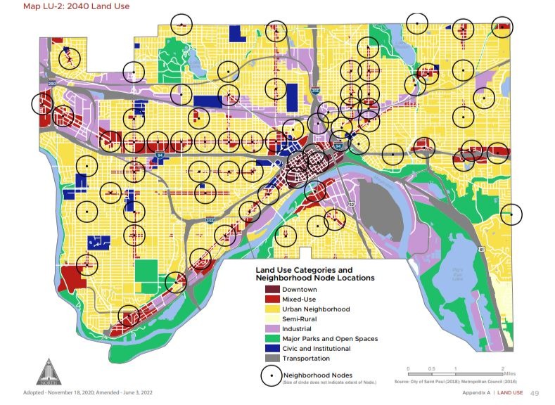
In 2019, the Saint Paul City Council formally adopted its “2040 Comprehensive Plan,” a lengthy document that details the City’s plan for growth and change until the year 2040. (The Metropolitan Council requires all municipalities in our region to publish a new Comprehensive Plan every ten years.) In the 2040 Plan, the City identified dozens of “Neighborhood Nodes,” intersections throughout the city where clusters of commercial activity have become focal points for their surrounding neighborhoods. The map below shows all of the officially recognized Nodes:
Several policies proposed in the 2040 Plan and policies that have since been enacted by the City make reference to these Nodes. The “Intent” statement for the T3 zoning district includes one such reference:
“Sec. 66.314. – Intent, T3 medium-intensity traditional neighborhood district.
“The T3 traditional neighborhood district provides for medium-intensity residential and commercial mixed-use development in higher intensity neighborhood nodes and transit corridors. It encourages transit-oriented development with a variety of land uses and higher density housing types to accommodate households of varying sizes, ages, and incomes” (emphasis mine).
To my knowledge, neither the 2040 Plan nor the Zoning Code explicitly specifies which of the Neighborhood Nodes are deemed “higher intensity.” But this “Intent” statement says that T3 should be used at “higher intensity nodes and transit corridors,” so I think it’s reasonable to infer that parcels located at designated Nodes along aBRT routes are the prototypical places for T3 zoning. As you’ll notice on the map above, there are several Nodes along the Study corridors: Maryland Avenue, White Bear Avenue, Rice Street, Robert Street, Selby Avenue, and West Seventh Street.
Parcels of land within a close proximity of all existing or planned aBRT station areas along the Study corridors – Node or not – ought to be zoned T3. The “Intent” statement for the T3 district calls for its use along “transit corridors:” why not along our City’s highest-frequency bus routes?
Our region has invested tens (if not hundreds) of millions of dollars into providing better, faster transit service along all of these corridors. Legalizing lots of housing in the vicinity of the bus stations along those routes seems like an obvious opportunity to maximize the future success of those public investments (by increasing the number of nearby residents who would find it convenient to use those transit routes). And the inverse is also true: at least in theory, our region’s investment in aBRT routes should increase the value of the land near the stations, such that it could attract private investment to build lots of housing. We should aim to unleash every ounce of potential that the land along these routes have to drive housing development, tax base growth, and transit ridership – and that means upzoning a lot, not just a little.
In that same spirit, there’s an argument to be made that some of the land at some of these Nodes and aBRT station intersections ought to be rezoned into the T4 district, instead of T3. Take a look at the “Intent” statement for T4:
“Sec. 66.315. – Intent, T4 high-intensity traditional neighborhood district.
“The T4 traditional neighborhood district provides for high-intensity, transit-supportive, pedestrian-friendly mixed-use development. It is particularly intended for use near existing and planned transit corridors where more frequent transit service and reliance on transit make high-intensity mixed-use development possible and desirable.”
All of the Implementation Study corridors have “frequent transit service” by Metro Transit standards, and many of them have a relatively high “reliance on transit.” On their own, those two factors are probably not enough to “make high-intensity mixed-use redevelopment possible.” Several other stars must align as well: developers’ ability to secure financing (whether for market-rate or subsidized affordable housing), interest rates, lumber prices, the cost of construction labor, and so on. But in locations where the City is most confident that high-intensity development is “possible and desirable,” T4 is a better choice than T3. (I’ll say more on a related topic, “high rents and land prices,” below.)
#2. Lots that will entail extraordinary redevelopment costs
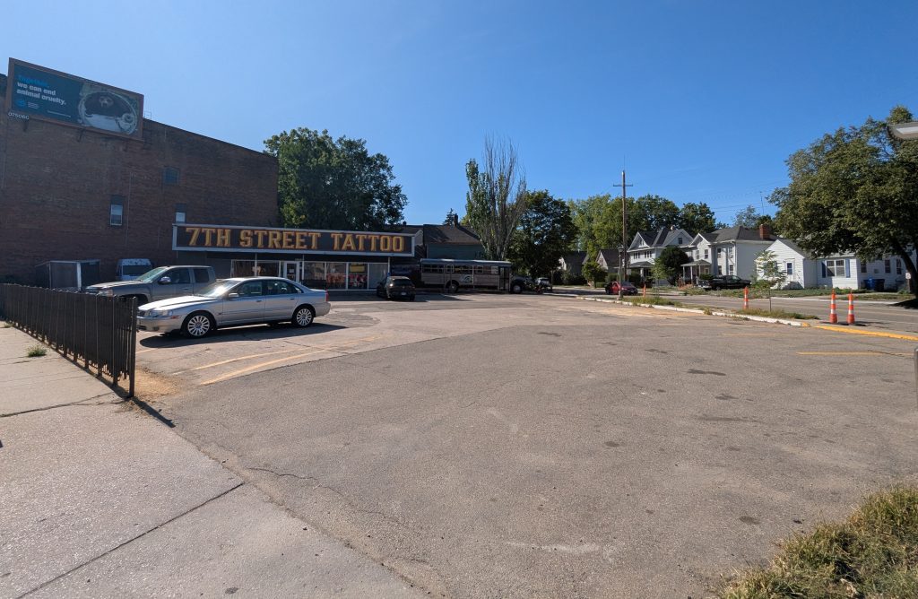
There are many parcels along the Study corridors which were once gas stations. I am told (and have no trouble believing) that it’s very costly to dig up and remediate the site of a large, underground tank where gasoline was stored for many years. This is a key reason why former gas stations can go for years and years without being redeveloped: the costs are higher than they are for sites that don’t require expensive remediation and site preparation. Zoning lots like these for medium- and high-intensity development increases the likelihood that a developer can make the numbers work to build something new.
#3. Locations with high rents and land prices
For me, this is easily the most important criterion that should cause the City to rezone a parcel into the T3 district instead of T2. If rents, housing prices, and land prices are already high in a particular area, it is a strong signal that there are probably more households who want to live in that area than there are homes to accommodate them. It also signals that real estate developers might be able to make the math work to build new market-rate apartments in that location.
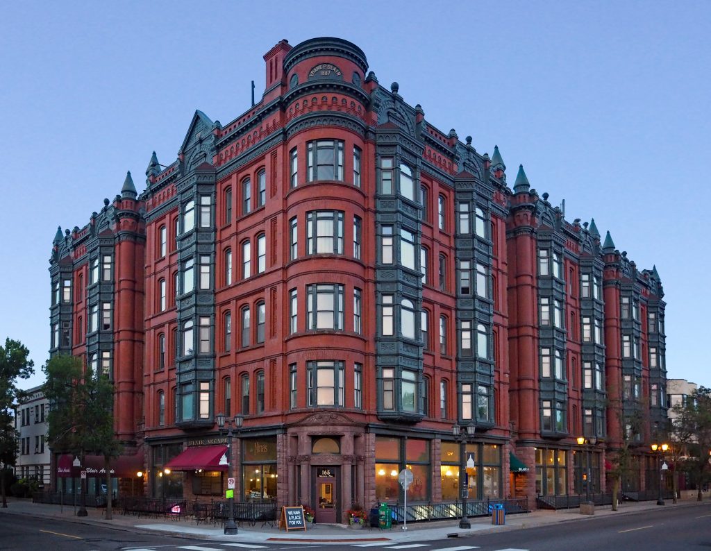
Locations where new market-rate housing development is financially viable are relatively scarce in Saint Paul. Considering how scarce they are, the City should not hesitate to rezone them into the T3 and T4 districts to make such development possible. Given how urgently Saint Paul needs more homes (both market-rate and subsidized affordable) and given how desperately it needs to increase its tax base, it cannot afford not to.
Put another way, Saint Paul’s most expensive and desirable neighborhoods don’t just have the capability of absorbing more medium- and high-intensity development: they have a certain responsibility to do so, for the sake of all homeowners and renters in Saint Paul who are burdened by the rapid pace of property tax increases.
Homeowners and renters across Saint Paul – especially low-income residents who live in disinvested neighborhoods and Areas of Concentrated Poverty – have struggled to keep up with steep property tax increases in recent years. The best way the City can alleviate the burden that tax increases have on such residents is to increase the tax base. And the way to do that is to legalize medium- and high-intensity market-rate development in the areas of the city where such developments pencil out: the most expensive and desirable neighborhoods. Simply put: new development in any neighborhood benefits residents in every neighborhood.
I also believe that legalizing more housing development in places where people want to live is a matter of welcome. Many Saint Paulites take pride in the idea that their city is a welcoming place to all kinds of people. If we are truly committed to welcome as a matter of principle, we ought to support policies designed to create more places for people to live in our neighborhoods – to enthusiastically accommodate more neighbors. (And beyond this principle, there are strong reasons to believe that new development and new neighbors will make our neighborhoods more vibrant, interesting, prosperous places to live.)
I think that along the Study corridors, the places where relatively high land prices and rents probably justify the rezoning of some lots into the T3 and T4 districts are:
- Selby Avenue (especially between Dale Street and Western Avenues, and between Hamline and Lexington Avenues)
- West Seventh Street (especially between downtown and Saint Clair Avenue, but also further south)
- East Como Boulevard, at the far western end of Maryland Avenue facing Como Lake
Places well-suited to T1 and T2
It has been pointed out to me that single-family homes and duplexes are not included on the List of Permitted Uses in the T3 and T4 zoning districts. And so if lots along the Study corridors currently occupied by single-family homes were rezoned into T3 or T4, those homes would suddenly become “non-conforming uses.” This does not mean that those houses would become “illegal”; the Zoning Code’s non-conforming use rules protect this. Still, something about re-categorizing dozens (hundreds?) of homes on streets like Maryland Avenue and White Bear Avenue to become “non-conforming” uses feels like poor form – and it could create unnecessary administrative burdens for planning staff in the future.
It makes sense to rezone land along the Study corridors currently occupied by single-family houses and duplexes in the T2 district, since single-family homes are on T2’s List of Permitted Uses. I prefer T2 over T1, since it allows more uses (including bars and restaurants) and slightly taller and thicker buildings.
Where, then, does T1 belong? Personally, I like the idea of applying the T1 district along streets that are perpendicular to the Study corridors, within one or two blocks of each Arterial Bus Rapid Transit Station. For example: aBRT stations are planned along White Bear Avenue at the intersections of Case Avenue, East 7th Street, and Minnehaha Avenue. Parcels of land along those streets would be great places to apply the T1 district; the buildings on those parcels could eventually be converted into shops and offices to serve people walking to the bus stops. (Eventually, I can imagine T1 getting used on quiet residential streets to enable little coffeeshops and boutiques and convenience stores– but that’s for another day.)
Get involved
I hope that many readers will share my vision for how Saint Paul should approach the project of rezoning transit corridors into the T Districts. More than that, I hope that many readers – those who agree with me, and those who don’t – are better equipped to participate in the Planning Department’s upcoming community engagement sessions about their Implementation Study. (Engagement has already begun! You can learn more at the City’s project webpage.)
Want to collaborate with others who are advocating for more housing, more businesses, and more walkable places along Saint Paul’s transit corridors? Fill out this form to connect with Sustain Saint Paul, and someone from the Housing, Zoning, and Land Use committee will reach out. (Also be sure to subscribe to Sustain Saint Paul’s email newsletter.)