
Highland Park, Mac-Groveland, Merriam Park, Lexington-Hamline, Frogtown (Thomas-Dale), North End, Payne-Phalen, East Side
July 30, 2017
31.7 Miles
This ride turned out to be one of the longest ever for the blog, passing through eight of Saint Paul’s 17 District Councils areas and many more neighborhoods. It was also my second and last ride of 2017. News reports of the impending shuttering of the Hillcrest Golf Club spurred this ride. I wanted to see this historic golf course before it closed for good on October 31, 2017.
Lex-Ham (a.k.a. Union Park)

The sidewalk approaching the Aldine pedestrian and bike bridge over I-94 and the surface of bridge became a painters canvas a few weeks before this ride. According to mnartists.org, artist Emily Hoisington and the Union Park District Council worked together with volunteers to create and paint the mural. It’s a nice break from the standard concrete ribbon that is most sidewalks.


Frogtown (Thomas-Dale)
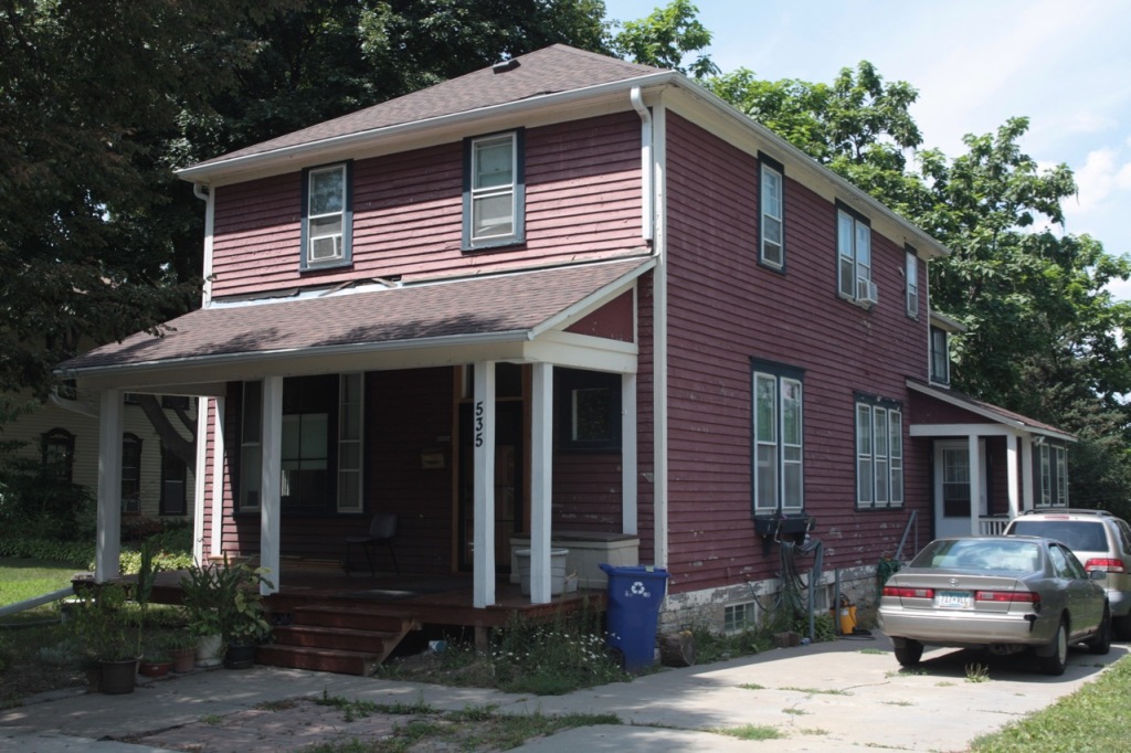
Thomas Avenue provided several engaging stops. The brick building at 1033 Thomas, at Oxford, has held at least four unique types of businesses since it was built in 1911. In 2016 Rift Valley Transportation provided vans for student transportation from here. Rift Valley’s website tells a nice story of Ebisso Uka, an Ethiopian immigrant who started the company in 2005 with him as the only driver of its one van. Rift Valley has grown more than 80 vans and 100 drivers.
Universal Signs had the building prior to Rift Valley. In the late 50s, Christensen Electric was headquartered at 1033 Thomas. The best use was what it was originally built for – a creamery.

A block to the east at Victoria and Thomas is Billy’s Victorian, a small neighborhood bar, or tavern, as it would be called in my native Milwaukee. “The Vic” has been a bar since the mid-1930s, according to its website, which claims the building at 859 Victoria was a grocery store prior to becoming a public house.

Neighborhood folks have enjoyed a park at Thomas Avenue and Avon Street since about 1983. The name was changed to Ryan Park to honor Dennis Patrick Ryan, an area businessman who was shot and killed during a robbery of his plumbing store at 811 University Avenue in 1984, according to Historic Saint Paul’s Tour Saint Paul Frogtown.
Benjamin Drew Elementary, an eight-room school, was built on the site in 1895 for 320 students. The school was named for the man who was the first Superintendent of Ramsey County Public Schools and the first principal of the St. Paul Public Schools.

The impressively styled three story schoolhouse was designed by local architect Clarence H. Johnson. As enrollment grew, it was enlarged twice. Although the City condemned Drew Elementary in 1972, it remained open for two more years.

The City of Saint Paul purchased the property in 1977 planning to build single family homes. However, strong outcry from neighborhood residents forced the City to abandon that plan. The property remained vacant until the 1983 conversion to a park.

Another bar, Willard’s Liquors, is a block east of Ryan Park at 738 Thomas (at Grotto Street.) Willard’s is, according to Saint Paul Historical, the second oldest bar in Saint Paul. I was unable to confirm that but I did glean that a William A. Kohls was the owner of a restaurant and bar at 738 Thomas in 1918.

Notable is the mural painted on the east side of Willard’s where a dozen people in silhouette are reaching skyward.


The final Thomas Avenue stop was at the historic Church of Saint Agnes, with its 205 foot bell tower that has watched over Frogtown since church construction was completed in 1912. After seeing Saint Agnes up close for the first time, I am convinced this is one of the two or three prettiest churches in Saint Paul.


A priest noticed me taking pictures of the exterior. Unexpectedly, he invited into the chapel to get some interior shots between services.


Whether history, architecture, photography or religion are your interest, St. Agnes is an essential stop. It is a place I plan to visit again, hopefully coupled with a tour of the landmark, for another blog post.
After more than 50 minutes there, I pedaled east along Thomas Avenue another two blocks before hanging a left to go north on Western Avenue.

The North End
Continuing north on Western into the North End, I went east on Jessamine Avenue West for three blocks and paused at Matilda Street.

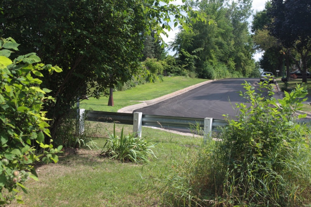
I continued along Jessamine for about a mile, until it came to a dead end. Between the shine on the silver barrier and the fresh white curb, it was evident that this was a relatively recent change to Jessamine Street.

I hopped over the metal barrier to see what lay beyond the trees. About 30 yards farther I came to a bluff, overlooking a bike path on the edge of a meadow.


I couldn’t spare the time (or energy) to properly explore Trout Brook Nature Sanctuary on this ride. Touring the Sanctuary is on the list of a future outing. With close to six miles more to go to get to my destination I needed to continue moving.


Six-block long Brainerd Avenue is an anomaly because of its 45 degree southwest-northeast angle. Adding to the oddity is that most homes are aligned in a north-south direction rather than at the 45 degree angle of Brainerd Avenue. However, several homes scattered along the six block run were built rotated so the fronts of them are parallel to the street.

The Ann Charlotte and Jacob Hinkel House, built in 1872 at 531 Brainerd, stands out not only among the homes on this street, but also throughout Saint Paul. The 1977 National Historic Register nomination form calls the structure “a rare example of a wealthy man’s country estate” and says it is the only wood-frame house with a cupola in Saint Paul.
Jacob’s time in the home was short – he moved out in 1875, a year after the death of his wife Ann Charlotte. Hinkel lost the home and his business holdings a year later, the result of the Panic of 1873.

Modifications and additions were made to the home by its owners over the next 100-plus years. Then James B. and Karen Sullivan purchased the home in 1970. Six years later, following extensive research and planning, historic restoration began, which resulted in the impressive and historically correct home as it looks today at 531 Brainerd.


Payne-Phalen

The Payne-Phalen neighborhood starts where Brainerd Avenue ends on the east, at Ivy Avenue. Another block east, at Ivy and Payne Avenue, there were several items of interest that brought me to a stop. The Bird’s Nest and its unique sign was the first.

While the building at 1324 Payne still has the creative Birds Nest sign, the store closed in February 2019.


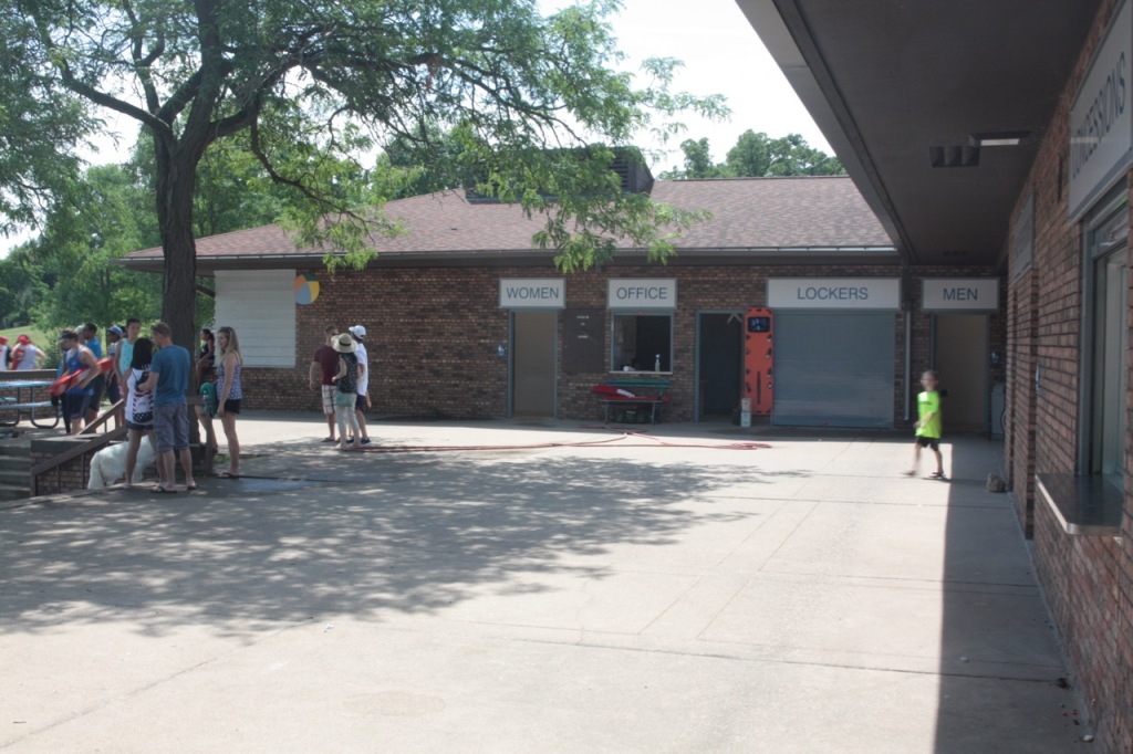
From Payne to Phalen, Lake that is, and the park’s Beach House and swimming area. It was a great spot to top off my water bottle. This was my first visit to this part of the expansive Phalen Park during swimming season, so I took some time to take it in. The beach itself was small, but very clean and inviting. The designated swimming area comfortably handled the crowd on this Sunday but would likely be stretched to its limits (or beyond) on a 90-plus degree day with high humidity.

Bouncing back and forth between looking at the lake and beach and taking photos of them, a woman seated nearby and I struck up a conversation. Dorothy Gaul, at Lake Phalen for a wedding, reminisced about coming there when she was 14. “In the late 40s we came to Phalen Beach but it was nothing like it is now. I lived out on Rice Street. I’d take the streetcar Downtown and catch the Phalen streetcar coming out here. It ran on Arcade. And then walk two or three blocks to the beach.”

Dorothy continued, “Of course we had to wear our clothes on the streetcar and then we would change. They had a building – nothing like that,” pointing to the locker rooms. “Then we’d do our swimming and stuff and then we’d have to dry off and then get back in our clothes and go home.”

Visits to Lake Phalen were an occasional thing, according to Dorothy. “It wasn’t a daily thing. We were working in those days. The War was on and we had jobs when we were young.
When I asked Dorothy what she and her friends did when they came to Lake Phalen, she explained, “Just fool around in the water or sit and talk.” So I pushed a bit and asked if she and her friends looked for boys? “Well, there were a few around,” she admitted and chuckled knowingly.

Another Phalen Park memory Dorothy shared with me was her first taste of Dairy Queen. “When Dairy Queen first came out, some fella, he worked at the new Dairy Queen, and he brought a bunch of ice cream and we came out here just to eat the ice cream. There was a patrol that came along and said, ‘You kids aren’t supposed to be in the park after dark.’ And so we left. With the ice cream. It was a real treat then. In those days it had just come out. It was a new thing.”
Curious about the job Dorothy had when she was 14, I asked for details. “I worked at Bethesda Hospital, first in the dishwashing room and then in the dining room. I served the doctors and nurses in the dining room.” Dorothy recalled that she worked at Bethesda for two or three years. She moved on from Bethesda to work at Montgomery Wards. “If you wanted to do things you had to get your own spending money. So that’s what we did, several of us who were about that age. Then later, when I was in high school, I worked at Wards (on University Ave.)” Dorothy’s job at Ward’s is one that was eliminated decades ago. “I worked in the Index Department. It was recording all the people’s sales from five different states. I recorded their purchase, the date and how much they spent.” Dorothy recalled that all the ‘girls’ in the Index Department had to meet quotas. “We had to do so many every 20 minutes. I don’t remember how many it was but you had to keep working. Sometimes you’d work kinda fast so you could have a little break to talk to your friends around you, ‘cause several girls worked there.”
With the start of the wedding imminent, Dorothy excused herself and I got back to riding. Moving southeast along Wheelock Parkway past the south end of Lake Phalen, to East Shore Drive. I turned left and cruised along the east shore of the lake until I came to an arch cut into a 15 foot tall cement and stone wall.


I continued east on Arlington to its end at Winthrop Street, where I went north for two blocks until it ended at Hoyt Avenue. I didn’t realize that Winthrop Street bordered the western edge of Hillcrest Golf Course.

Winthrop Street and Hoyt Avenue, both of which end where they intersect, was an interesting spot. First and most noticeably was the large rectangular open area of grass just to the north.


Between the empty bird feeder and the rough condition of the bench and table, I wonder if the person who created the refuge had abandoned it.
My exploration continued west on Hoyt to Furness Path and then Furness Parkway which were once part of the streetcar line that went from Saint Paul to Mahtomedi.
After four blocks I came to Larpenteur Avenue, the road that is Saint Paul’s northern border on the East Side. Traveling three blocks east I came to Larpenteur and McKnight Road, the northeast corner of Saint Paul. I’m not sure what I expected but it’s fair to say I was underwhelmed in what I saw.


Little did I realize the history of Hillcrest Golf Club, 110 acres of green, rolling hills and mature trees, that had been here since 1921. This part of the East Side was another place in the city I’d never set foot before.

Hillcrest Golf Course was one of a dozen or more Minnesota courses designed by Tom Vardon. Hillcrest was a municipal course from its opening in 1921 until 1945 when it was purchased by a group of Jewish businessmen. who privatized the club. At that time, anti-Semitism was rampant and many private golf clubs banned Jews, so they formed their own club.
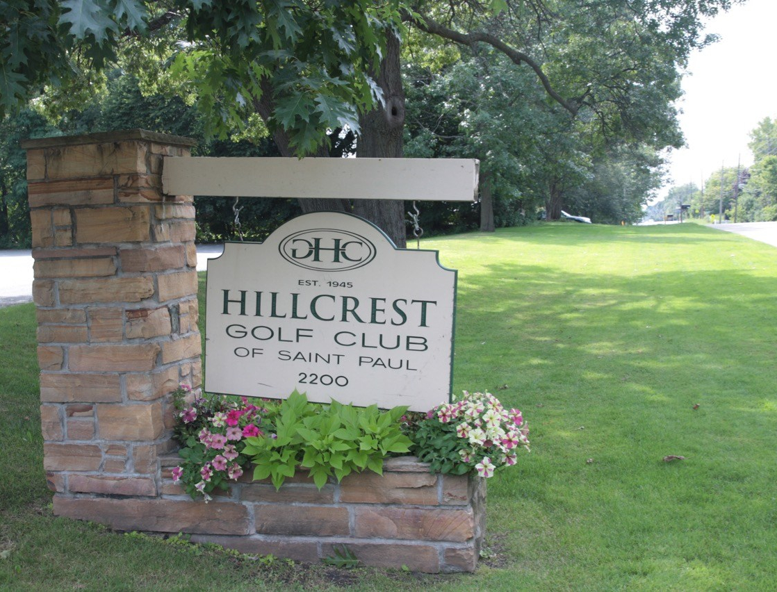

Sometime during the 1970s, though it’s not clear exactly when, Hillcrest opened to the general public as an “unrestricted” club.

A well-appointed $2.8 million clubhouse opened in 2000, finally replacing the previous structure that was damaged beyond repair in 1962. The high cost of the clubhouse and the decline in popularity of golf put the Hillcrest Golf Club in a financial hole it was unable to escape.

The 2011 sale of Hillcrest to the unlikely St. Paul Local 455 Steamfitters/Pipefitters Union for $4.3 million postponed but couldn’t stop the club’s inevitable closing.


As of this writing, the 110 acres that were Hillcrest Golf Club are not on the market but are expected to be sometime in 2019. Given the nature of the surrounding neighborhoods, the former golf club’s redevelopment most likely will be primarily residential.
A final note about Hillcrest Golf Club. Although never officially confirmed, multiple media reports from late 2008 claimed that members of Hillcrest (and the predominantly Jewish Oak Ridge Country Club in Hopkins) lost between $100 million and $300 million they invested with Bernie Madoff.
The return trip began with a look at an unlikely stretch of Winthrop Street – the part gravel, part asphalt 1600 block, which has merely two homes on it, is off Larpenteur.


The next stop was at a Saint Paul Sewer Utility holding pond on Ivy Avenue, not because it was that interesting, but because it is named.


Back on Clarence Street, there were two housing complexes to check out. The first was Etna Woods Townhomes, 20 units of affordable housing.


The Lake Phalen Townhomes are cross Clarence Street from Etna Woods. Twenty-nine in number, the Lake Phalen Townhomes had well cared for, fenced yards, front decks and attached and tuck-under two-car garages.


The Lake Phalen Townhomes redevelopment was a cooperative effort by the City of Saint Paul, a neighborhood nonprofit and the builder.

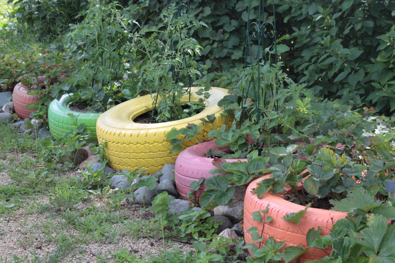
752 Jessamine Avenue East was missing its house. Paths led me through and around charming decorative gardens growing from planters, pots, the ground, even tires. Benches and chairs dotted the lot inviting visitors linger within the colorful space. Dubbed Stonegarden on Jessamine, the lot was converted to a small park by volunteers in 2013.


Water breaks became more necessary as the mileage and my fatigue grew but Stonegarden proved to be the last stop of the ride worthy of mentioning or photographing. As usual, there is a map of this ride but I’ve added the notes about the stops so you’ll get a better understanding of the trek.