
The Duluth Waterfront Collective is a group of planners, designers, thinkers, and others united in our desire to create a more livable, equitable and sustainable Duluth. Our plan, entitled Highway 61 Revisited, takes an eraser to a one-mile stretch of Interstate 35 and will use a community engagement process to draw in the blank space as a more physically and culturally connected downtown.
Part Two – The Concept
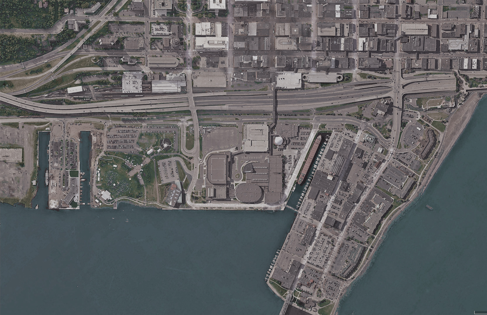
Imagine for a moment that by some circumstance Duluth’s downtown was suddenly absent of all I-35-related infrastructure. No ramps, bridges, concrete, nothing. Instead, we see 44 acres of empty, level ground within the core of the city. Downtown is just a short walk away, and the waterfront is close enough to hear sails flapping in the wind. Suddenly a blank canvas emerges within the core of our city, with the community wielding the brush that could paint a better picture. As a project, Highway 61 Revisited is all about discovering what that picture could look like.
Right off the bat, I would like to make it clear that we are not advocating for tearing down I-35 tomorrow. We want to see the interstate live out its useful life as much as it makes financial sense to do so, but once that life is complete, opt for a solution that responds to the unique challenges of our city.

The primary goals for this project are to increase safety and mobility, spur economic growth, generate green space, and create a unified downtown. This concept is a first stab at accomplishing these goals, but is simply intended to start a conversation– we know there is still much work to be done. The design will continue to evolve as interest in the idea grows and the community provides feedback and input. This isn’t the final answer, but a starting point.
One of the first ideas we considered was to tunnel the interstate, which produced a number of red flags. Lowering the grade of the roadway would come with serious expenses. It doesn’t take a detailed cost-analysis to know that digging a tunnel into solid rock below water level isn’t going to be cheap. Alternatively, decking over the existing freeway is also expensive and would create additional issues. While the hill could gracefully come up to meet the grade of the deck on one side, the scale of the elevation change on the lake side would surely discourage its use. Unless we could lift Canal Park 16 feet in the air, the connectivity issues would continue.
Removing or retrofitting the interstate is the best option to reach the goals listed above. This idea removes all of the ramps, overpasses, and frontage roads (including Railroad Street), opening up 44 acres of space in downtown Duluth, 20% of the total surface area of the neighborhood.

Some form of transportation infrastructure needs to be in place to handle the 32,000 east-west daily trips that I-35 accommodates. Our solution? A parkway. No longer limited by the strict access controls of the interstate system, the parkway would provide multi-modal opportunities for cars, transit, bikes, pedestrians, rail, and more while taking up considerably less space. Because the parkway would only be a mile long, it would not adversely affect commute times, and could could potentially improve traffic for those accessing Canal Park & Downtown.

The parkway concept alleviates bottlenecks caused by the onramp system and stretches the grid of Downtown into Canal Park, stitching the two areas together. These new cross-streets allow traffic to flow more naturally and provide new points of connection for bikers and pedestrians, leaving a considerable amount of space open for other uses. Visitors in Canal Park can now easily walk to downtown businesses, and those living in the hillside can safely access the waterfront.

This new street infrastructure would occupy roughly one third of the 44 acres available, leaving plenty of space for other uses. In a city that lies between rocks, hills and water, this sort of level acreage is hard to come by. As Downtown grows, new construction is currently forced to expand outward into residential neighborhoods. This concept creates space for Downtown to expand inward, displacing lanes of concrete and parking lots instead of homes and businesses.

At present, Duluth’s waterfront to the east of the project consists of a series of parks strung together by the Lakewalk. To the west, Bayfront Park sits along the harbor. This concept joins the eastern network of parks to Bayfront Park through a series of green spaces. “Slip View Park” would become a central urban park, while “The Link” would provide an elevated bike & pedestrian connection over the parkway reminiscent of the bridge that existed there before the construction of the interstate. The Link would be a direct visual and physical connection between Downtown’s main intersection and the Aerial Lift Bridge and connect to the existing Sister Cities Park and Giche-Ode Akiing.
While high-quality public spaces are important, the ability to create resiliency in the face of climate change is equally so. While many have labeled Duluth as “climate-proof,” this is deliriously false. The city has already begun to witness the adverse effects of climate change, most notably in the form of increasingly fierce Lake Superior gales which damage public spaces and flood waterfront businesses. The string of proposed green spaces at the foot of the hillside would capture stormwater from Downtown and Canal Park and process it through bio-remediation, both cooling down and cleaning water before it reaches Lake Superior. These spaces would provide a stage for education on the fragility of our north woods climate while providing an example of how former industrial areas can be restored into environmentally resilient landscapes.

The Highway 61 Revisited concept provides a new look at what our downtown could be. While it certainly represents a significant investment, keeping the interstate the way it is will also require considerable resources with none of the improvements. Looking at a land-use breakdown of the existing area vs the proposed concept, we see a considerable increase in revenue generating spaces and public amenities and a decrease in long-term expenses (roads, parking, etc.). The financial gain of this project is twofold: it would create new tax revenues to offset the cost of the initial infrastructure investments, and provide a steady fund for creating and maintaining the proposed public amenities.

As this idea continues to spread, we hope to see the concept evolve and change to better reflect the interests of the broader community. From the feel of the parkway to the uses of the developable spaces, we hope to use a thorough and complete engagement process to gather ideas from community members and hopefully connect them with the resources to make their ideas happen. We want to see a stronger, more resilient and equitable downtown which encourages health and happiness in it’s citizens — how that looks isn’t nearly as important to us as long as it’s successful. That said, seeing is believing, and we need as many believers as we can get.

The entirety of Duluth’s stretch of Interstate 35 is expected to be studied by MnDOT as soon as this year. While buildable changes to our specific stretch of the interstate aren’t scheduled at present, decisions are being made right now that have the potential to make or break this idea. We hope to build a coalition of passionate, forward-thinking individuals similar to the one which kept Interstate 35 out of Lake Superior nearly 50 years ago. We are proud to have some of those same people supporting this idea today.
The past year has thrown the spotlight on the broken nature of the way things are. In times of big issues such as COVID-19, racial injustice, and the climate crisis, we are seeing that our society will need to change much faster than we anticipated. Shouldn’t we have a collective vision of the tomorrow we’re rapidly moving towards? While it may be hard to see a brighter future with all that is going on in the world, now more than ever, we are required to come together, think outside the box, and dream big.