
Author’s note: I have biked and walked on the Midtown Greenway many hundreds of times over the years that I have lived in the area. I have always wanted to see photos and learn more about the former railroad trench in earlier times. This started a months-long project of searching through hundreds of newspaper archives, books, photos, video and other documents, learning more as I went. This ambitious research piece satisfies my itch for the history of this great bikeway and how it came to be before the railroad was abandoned. Part two covers the changes to the corridor over time.
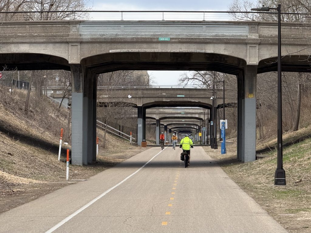
The Midtown Greenway is a unique and important commuting and recreational corridor for biking, walking, running and rolling across South Minneapolis. This corridor is largely 22 feet below grade in a trench that the Milwaukee Road built from 1912 to 1916. This corridor has an interesting history as a railroad mainline, and glimpses of its past are present when you look for them. The first part of this article focuses on the history and legal battle. The construction and latter parts of the article feature lots of photos and fun facts.
The Chicago, Milwaukee and St. Paul Railroad (CM&StP), also known as the Milwaukee Road, built a mainline known as the Benton Cut-Off as part of the Hastings and Dakota division (H. & D.) through South Minneapolis from 1879 to 1881. In 1883, the City of Minneapolis annexed the territory south of the tracks, including Lake Harriet and Bde Maka Ska. By 1890, the city annexed all the way south to 54th Street. As the city grew, so did industry, population and the need to cross the tracks.
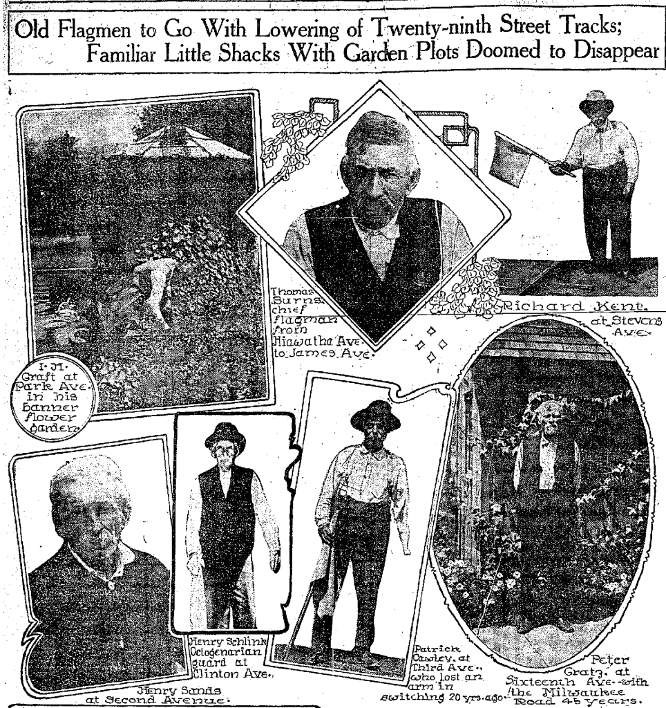
There were 33 at-grade crossings on this segment of the line. Trains were limited to 6 miles per hour, and streetcar crossings were established at Hennepin, Lyndale, Nicollet, Fourth, Chicago, Bloomington and Cedar avenues. Each crossing had a flagman (at the time, each person was likely male) who would manage the crossing and alert the public when a train was coming (33 flagmen from Hiawatha Avenue to James Avenue). In 1909, Milwaukee Road completed its line to the Pacific, and traffic increased to two dozen trains a day, a mix of freight and passenger.
Lowering at Hennepin Avenue
By the 1890s, Hennepin Avenue was a busy road with horses, carriages, bicycles, streetcars and trains, all of which needed to cross the Milwaukee Road track at 29th Street. In 1895, a streetcar collided with a freight train at Hennepin Avenue. Other articles from that time mention the danger of schoolchildren needing to cross the line. In the 1890s, not every road had been extended across 29th Street, but by the late first decade of the 1900s most had been extended to at least Lake Street.
In February 1896, a Minneapolis City Councillor introduced an ordinance to bridge Hennepin Avenue over the tracks by lowering them ten feet and raising the road by four feet, in order to improve safety of the then at-grade crossing. The Minneapolis Tribune said the crossing had been one of the most dangerous ones in the city for years. Moving the water main at Hennepin Avenue ahead of the construction reportedly employed 12 people and cost over $200. The Milwaukee Road paid for most of the project, except for the bridge abutments, for which the city paid. The Minneapolis Tribune reported over 200 men were working on the grade change and bridge work by May 1896.
“A great change is being wrought in the face of the landscape at Twenty-ninth street and Hennepin boulevard, and when through traffic is resumed at this point people will fail to recognize the place. No improvement of recent days has met with more general approval than the bridging of the Hastings and Dakota tracks across the boulevard, at which point there is a constant stream of travel, especially in the summer time. The old arrangement was a constant menace to life and limb. There have been dozens of narrow escapes on the tracks.”
The Minneapolis Tribune. Publish Date May 16, 1896
The bridge opened in the middle of June 1896 and was said to be “fast becoming a thing of beauty.” It was replaced in 1980 by the one that stands today, later expanded to include the Uptown Transit Station in 2000 and most recently updated in 2024 to add a bike path.
Legal Battle
Much discussion, debate and legal wrangling went into the eventual depressing of the tracks. This section is largely informed by articles in the Minneapolis Tribune, back when it was the city’s morning paper, and the Minneapolis Star was the evening paper.
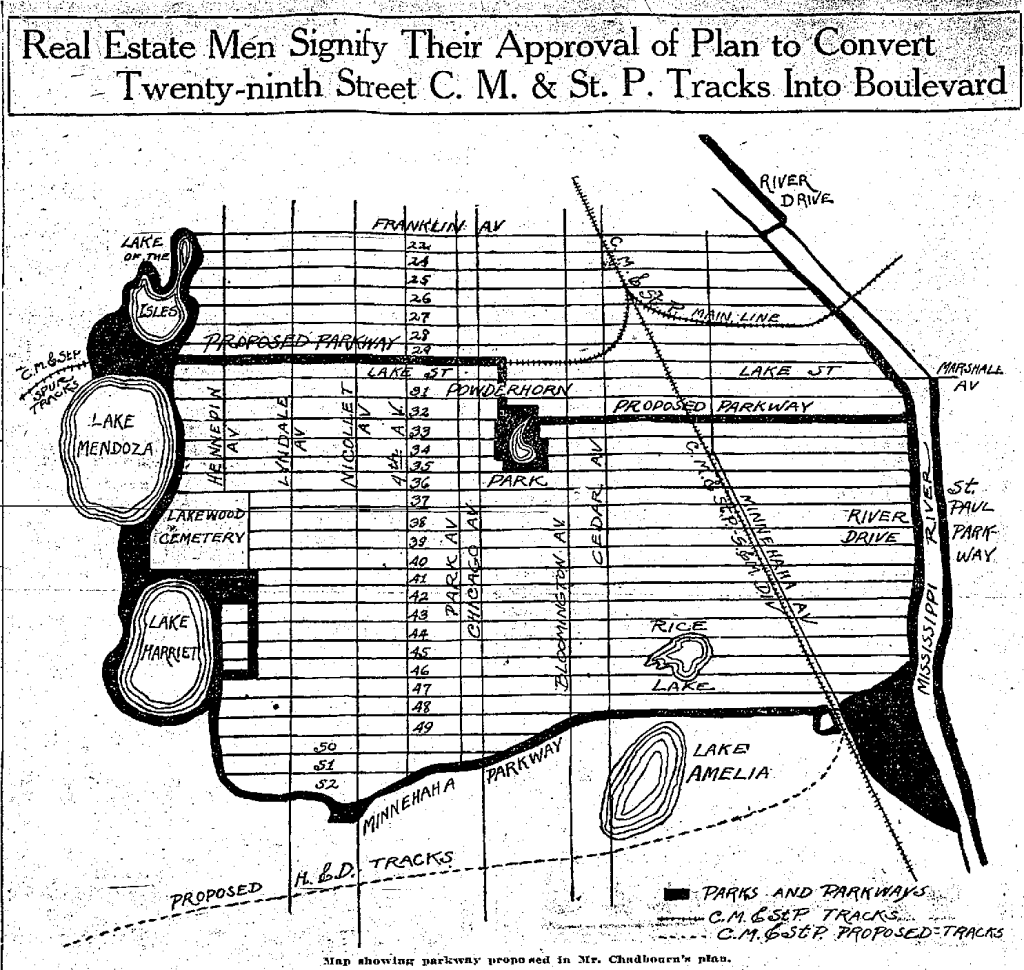
In January 1905, there was a special council meeting, with support from Mayor David P. Jones, addressing petitions and complaints to the city about grade crossings in the city, contributing to safety concerns, delays and accidents. Late in the first decade of the 1900s, several newspaper articles described debate and discussion on whether to remove the tracks, elevate them or depress them. Some groups proposed to move the Hastings and Dakota line to south of Minnehaha Creek and turn the tracks to the west of Powderhorn Park into a parkway.
On April 26, 1909, a U.S. Supreme Court case set the stage for the eventual depression of the 29th Street tracks. Minneapolis City Attorney Frank Healy went through district court and the Minnesota Supreme Court twice, before finally appearing before the nation’s highest court, which decided in St. Paul, M. & M.R. Co. v. Minnesota Ex Rel. City Of Minneapolis, 214 U.S. 497 (1909) that railroad companies must pay for bridges, viaducts and safety improvements at crossings.
“Thirty-Five Danger Spots in City to Be Abolished”
The Minneapolis Tribune, April 28, 1909
Just days later on April 30, Alderman A.P. Oriquist started a campaign to abolish grade crossings for the Milwaukee Road between the passenger depot downtown and the South Minneapolis shops (where Hiawatha Avenue from 26th Street to Lake Street is today). A special committee was appointed with members of the city council and the railroads committee to report back on a recommendation on how to proceed.
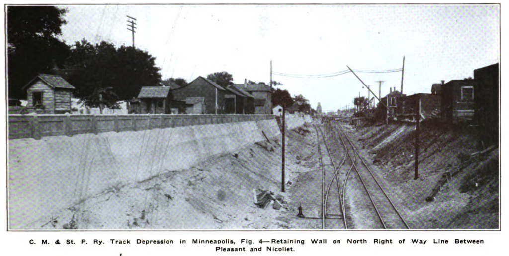
Continuing until the end of 1910, the special committee of the City Council on grade crossings, business groups, resident groups, the mayor and the Milwaukee Road discussed and discussed and discussed and discussed and debated how to address the grade crossing problem in the city and along the 29th Street corridor. The Milwaukee Road submitted plans to depress the tracks that year. This resulted in an ordinance the City Council passed on Dec. 30, 1910, which required the railroad company to depress the tracks between Hennepin and Cedar avenues (nearly 2.5 miles) at a depth of 20 feet, to begin in six months and to be completed in five years. The railroad company later accepted this in the middle of February 1911. Excavation work started on June 10, 1911 at the west end from Hennepin Avenue to Dupont Avenue.
District Court
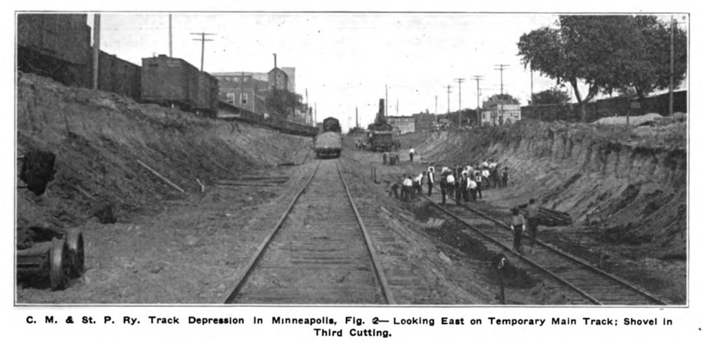
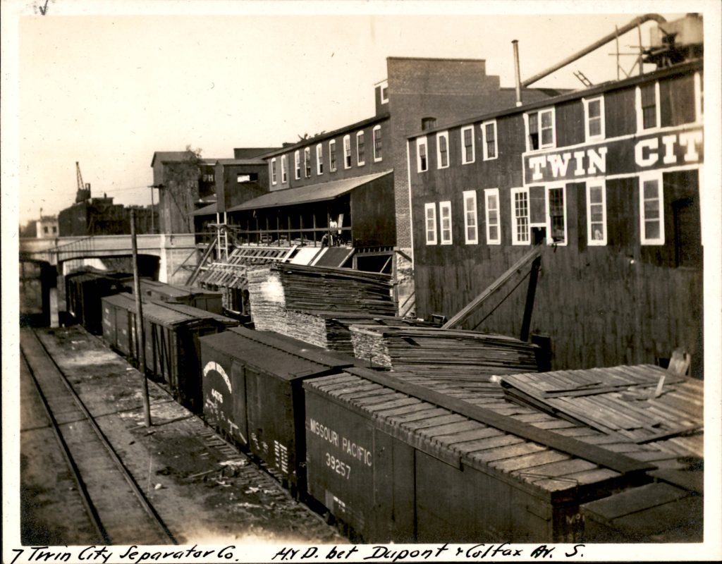
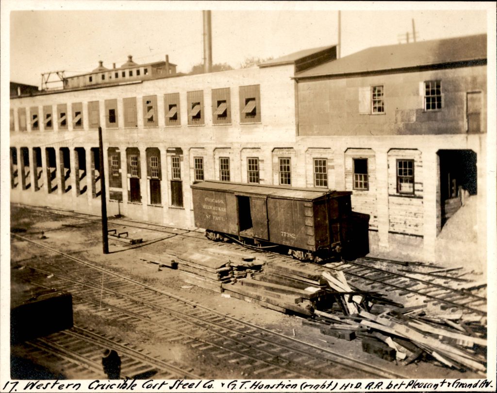
However, the Twin City Separator Company and 70 other industries filed suit to halt excavation on June 23, 1911, in district court. The temporary restraining order was granted by Judge John H. Steele. The industries were represented by the same attorney, Frank Healy, who retired as city attorney in January 1911. The Minneapolis Tribune reported on Sept. 17, 1911 that the industries argued the ordinance for the track depression was a railroad scheme “passed for the purpose of securing the aid of the city to enable the company to deprive industries along its right of way of their property without compensation and process of law…” The day before, the newspaper published a (very juicy) article where the industries argued that “…the public is fully protected; that no accidents have occurred at crossings in the alleged ‘death trap’ district in the last 15 years.” The city and railroad company were sided together against the industries. On Oct. 20, 1911 the Minneapolis Tribune reported on the district court case and that Judge William Edward Hale upheld the ordinance and refused to grant a permanent injunction. The industries filed an appeal to the Minnesota Supreme Court.
The articles reported in the Minneapolis Tribune during the district court case are quite interesting! F.W. Root, attorney for the Milwaukee Road, said, because of the ongoing litigation in the courts, work on the depression may be delayed until 1914. Attorneys for the industries said they would appeal to the Minnesota Supreme Court and eventually to the U.S. Supreme Court. The district court appeal with Judge John H Steele decided in favor of the city and Milwaukee Road in denying an injunction preventing the track depression on Jan. 29, 1912.
On Feb. 18, 1912, newspapers reported the Milwaukee Road decided it was safe enough to continue excavation in the spring after the ground thawed. F.W. Root, general counsel for the railroad, said the case was not settled, and it was taking its chances with continuing construction. The railroad had paused any construction until the previous temporary restraining order dissolved in October 1911, to which the chairman of the railroad committee said the railroad was showing good faith.
On Feb. 29, 1912, the Minneapolis Tribune reported the railway and warehouse committee held a two-day hearing for a petition by the industries along the corridor, and how they would be run out of business if cut off from their track spurs. The railway council paused work so the city engineer and chief engineer of the Milwaukee Road could attempt to agree on plans on lowering track from the downtown depot to the South Minneapolis yard (this was a contentious case that went to the U.S. Supreme Court, as well). The city attorney disagreed with the council and said the railroad had shown good faith so far, and, by requiring it to lower the main tracks to downtown in addition to the tracks along 29th Street, it might be found unreasonable by the courts. General counsel for the road, F.W. Root, said, “We are not anxious for litigation, but, if the main tracks are ordered lowered at this time, we will fight it and we will beat the ordinance in the courts. Keep your hands off until we are finished with the H. & D. lowering.”
Minnesota Supreme Court
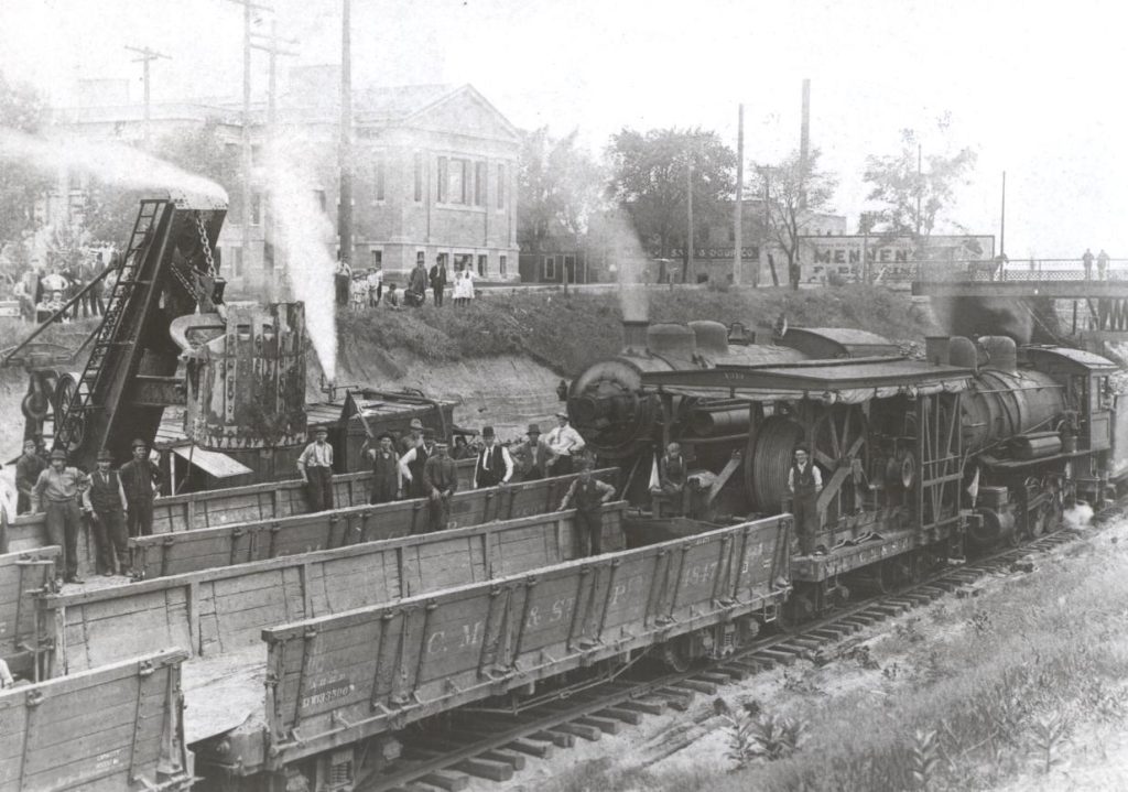
On May 8, 1912, newspapers reported the Minnesota Supreme Court denied the appeal to halt the excavation ahead of hearing the case. That same article says the large steam shovel was moved to Colfax Avenue that day in order to prepare to resume work, but would likely not start work until the court made a decision in the case.
On July 11, 1912, the Minneapolis Tribune reported that the Attorney General and state Railroad and Warehouse Commission released statements that they would take no actions to resist the track depression work.
Factory Men ‘In Tears’ as Tracks Are Torn Up
Headlines from The Minneapolis Morning Tribune, July 11, 1912
Industries Along Twenty-Ninth Street Excited When They See the Rails Go.
Twin City Separator Firm, Leader in Resistance, Is First to Lose.
Big Steam Shovel Referred to as “Corporation Steam Roller.”
On July 12, 1912, the Minnesota Supreme Court decided in the case Twin City Separator Company et al. vs. Chicago, Milwaukee and St. Paul Railway Company, 118 Minn. 491 that the Milwaukee Road had the right to remove track sidings, but industries may seek damages. The Minneapolis Tribune printed the entire case syllabus on July 13. The railroad said they planned to cut as far as Blaisdell Avenue or Nicollet Avenue that year (however, they only made it a little past Lyndale Avenue). The Tribune reported on July 19 that the state Railroad and Warehouse Commission dismissed proceedings from a petition by the industries about abandonment of spur and track sidings.
As an aside, there was a related U.S. Supreme Court case decided in 1914 that clarified that canals and waterways were also a railroad crossing type that fell into the authority of the city. This case decided that the Milwaukee Road would need to pay for the bridge over the new canal that the city planned to dig between Lake of the Isles and Bde Maka Ska, replacing a 3-foot culvert. This is the second bridge west of the 29th Street corridor (after the one crossing Bde Maka Ska Drive) and is still in place today carrying the Midtown Greenway.
Construction
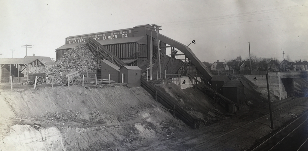
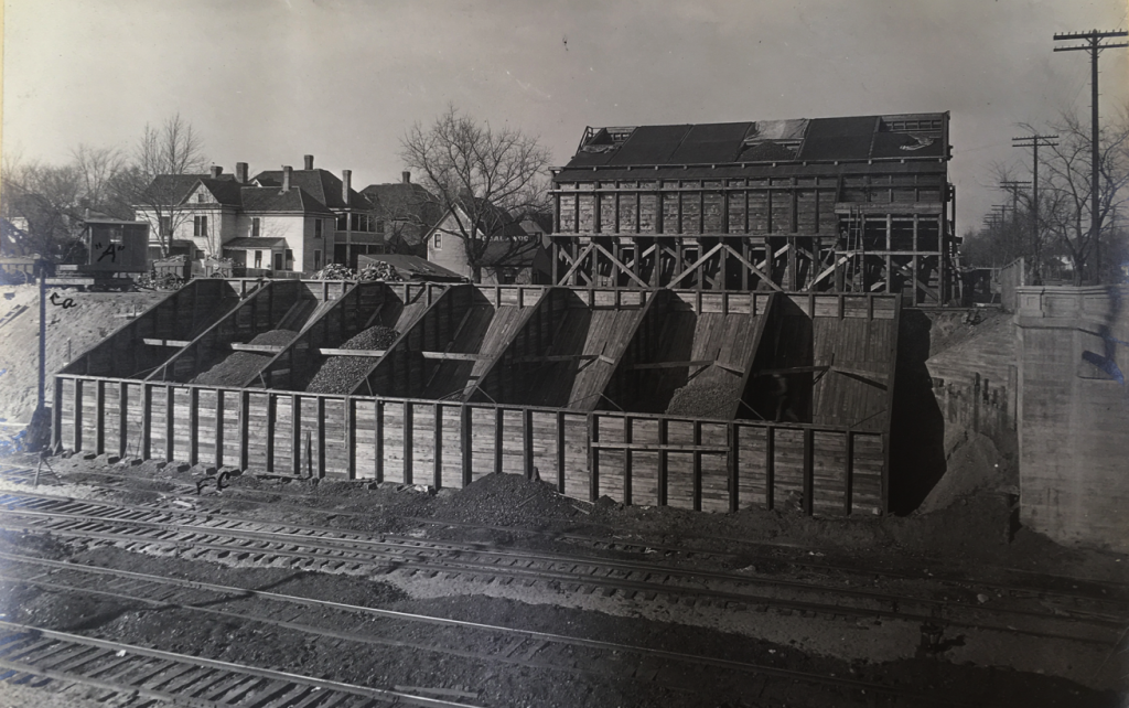
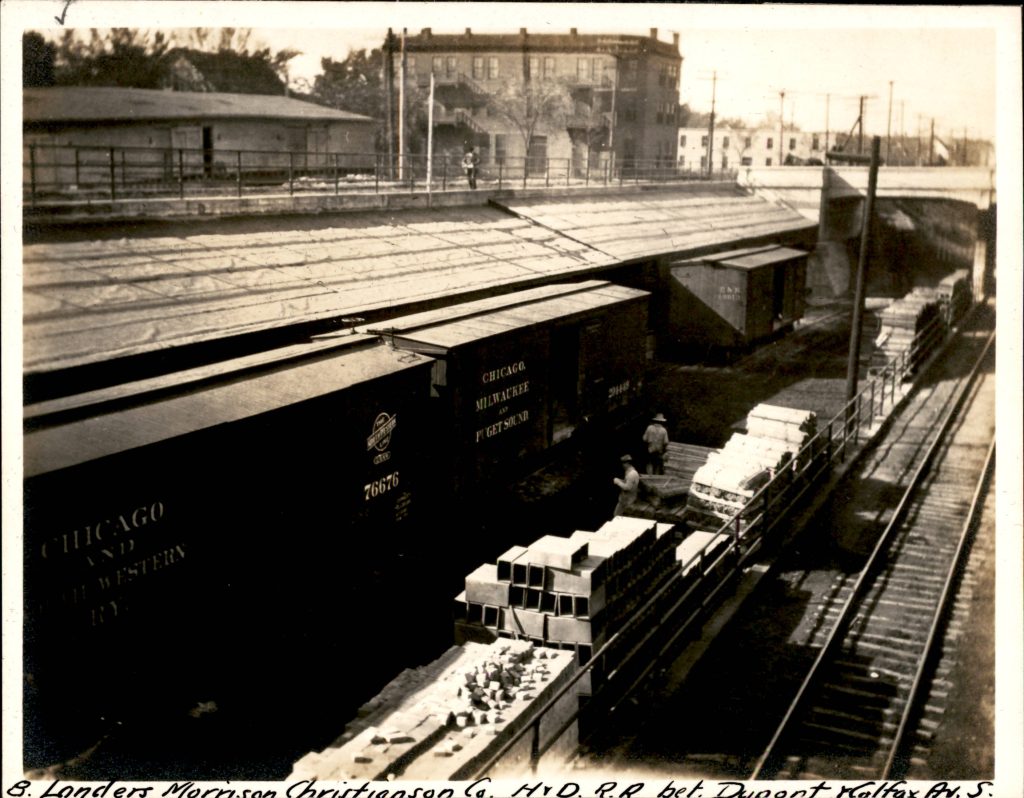
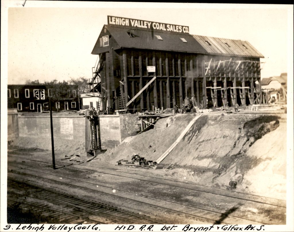
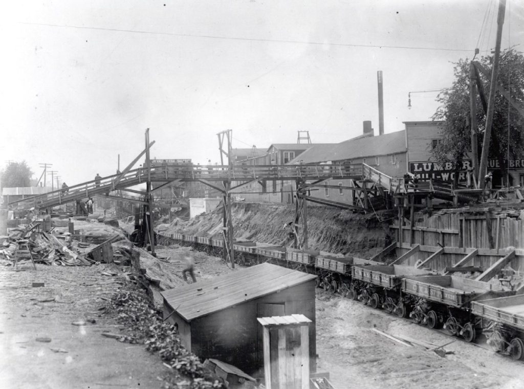
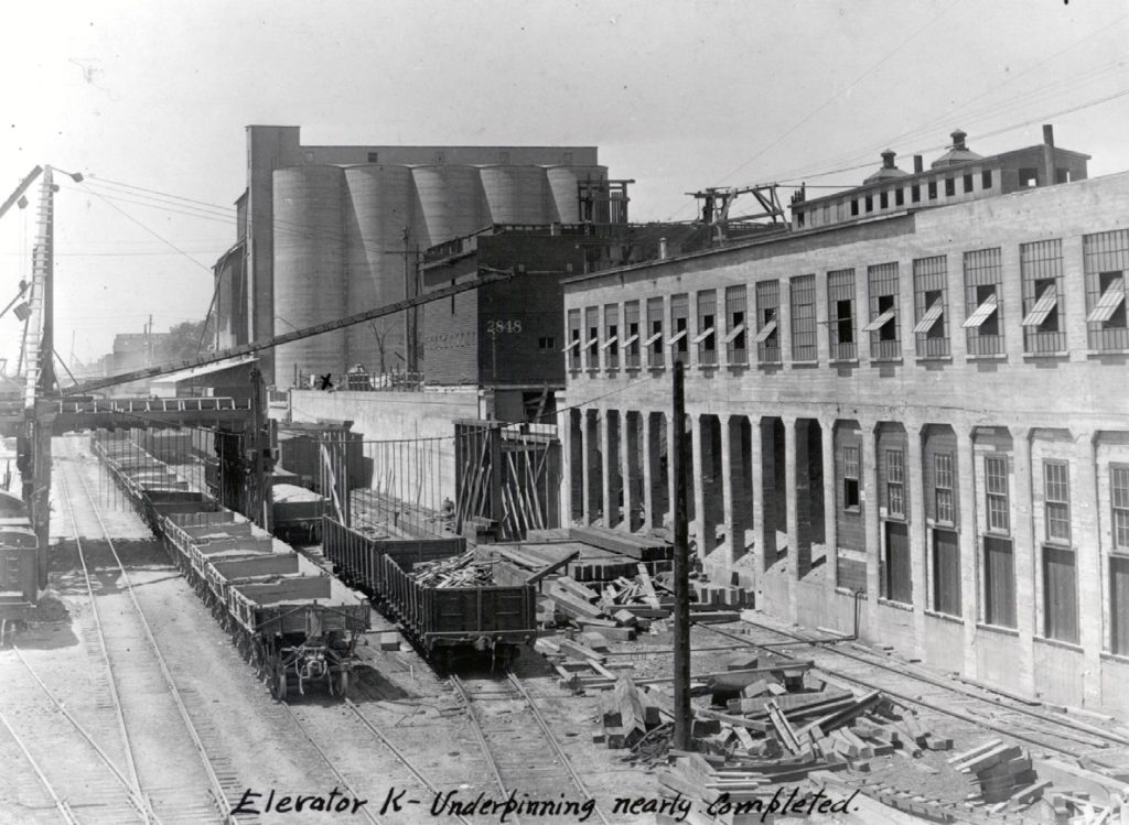
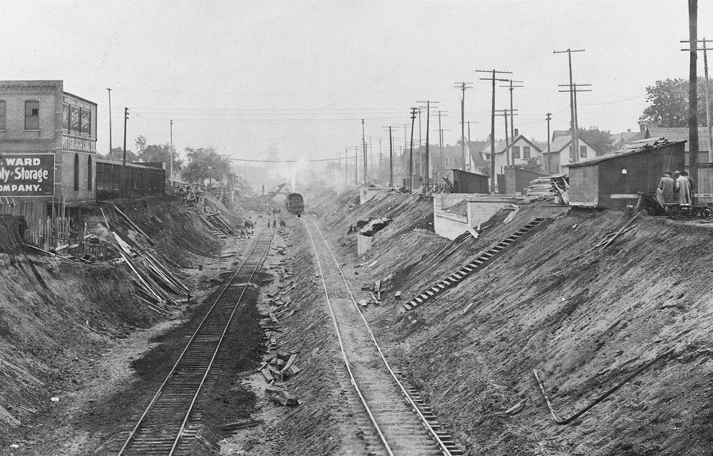
Newspapers published many articles during the years of construction that informed how the depression was built and impacted life for people and industries in the area. Industries built basements and retaining walls, and installed elevators, conveyors, and other improvements to move materials in and out of railcars via new sidings.
The cutting of the depression started from the west, so the earth could be more easily moved out, as the large Minneapolis yard was at the eastern end. Removed material was used to fill in swampy areas and assisted in the expansion of the Bass Lake yard, which opened in 1913.
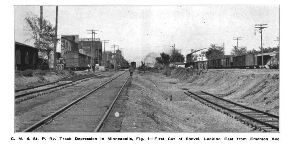
Industries announced plans and worked on construction to add elevators, new structures and retaining walls to access the lowered tracks. Excavation was set to resume after the winter in March 1913. The Minneapolis Tribune reported on April 6, 1913 that work would resume when the ground thawed. By this point, work had begun in 1912 at Fremont, Emerson and Dupont avenues.
Construction cut off streets until the bridges spanning the trench were completed. Temporary footbridges were installed at many crossings, but streetcar lines were interrupted, forcing passengers to cross the trench on foot to make the connection on the other side. A change at Lyndale Avenue in the summer of 1913 had a flagman controlling the stub-ended streetcars and permitted delays in the streetcar schedule so that riders could span the trench and transfer from one streetcar to another. The streetcar drivers had previously been so punctual with their schedule that riders often missed their connection by “fifths of seconds” when crossing the trench.
In removing the grade crossings, the 33 flagmen/crossing guards were put out of work. There’s a touching piece about some of them, their shacks and gardens from The Minneapolis Sunday Tribute on July 13, 1913.
Due to the legal delays, by the end of 1913, only a small amount of progress on the project was completed. For the winter of 1913-14, a temporary connecting track from the original track to the newly completed track was laid out between Pleasant and First avenues at a steep 3% grade.
In 1914, after an agreement with the Milwaukee Road and the Twin Cities Lines, a temporary bridge was installed at Nicollet Avenue for streetcars to cross until the permanent bridge was finished. By the end of 1914, Milwaukee Road records stated that 35% of the project had been completed.
Work in 1915 was slated to start in the middle of April, with a crew of 500 people, and was projected to excavate to Bloomington Avenue by the end of the summer. By the end of that season, project completion had moved to 64%.
By the end of September 1916, The Minneapolis Tribune reported the Cedar Avenue bridge was far enough along in construction to start running streetcars across. At this point, the trench had been cut, and only four bridges remained to be completed.
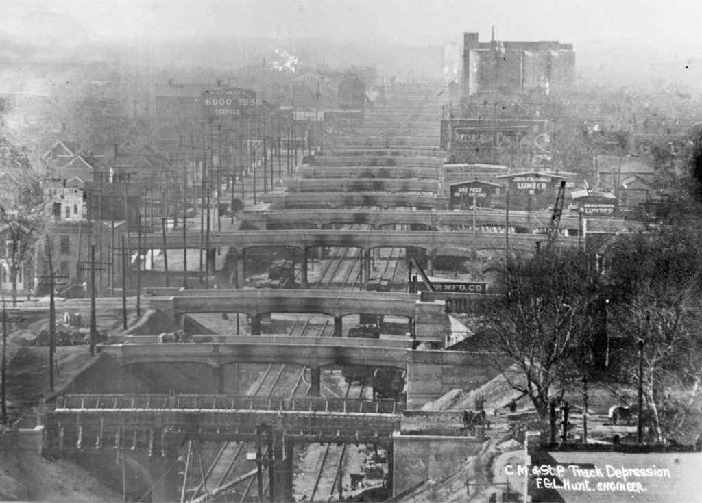
“Probably the most serious trouble came through encountering irregularities of quicksand at varying depths, from 8 to 16 feet below the surface; this sand was considerably finer than the ordinary sand and as distributed in beds of varying depth, directly above a strata of clay…”
Railway engineer F. G. L. Hunt. CM&StP Railway Engineer’s 29th Street Track Depression Notebook, 1917
Corridor Features
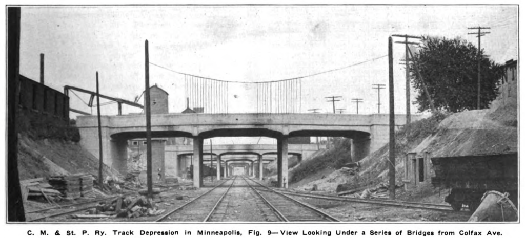
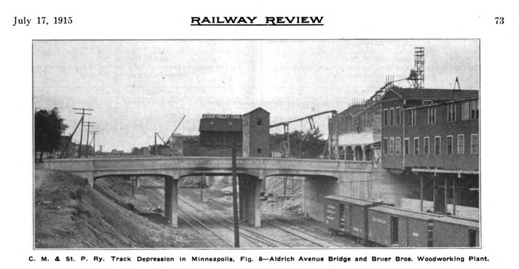
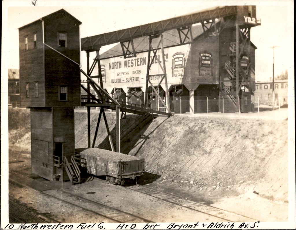
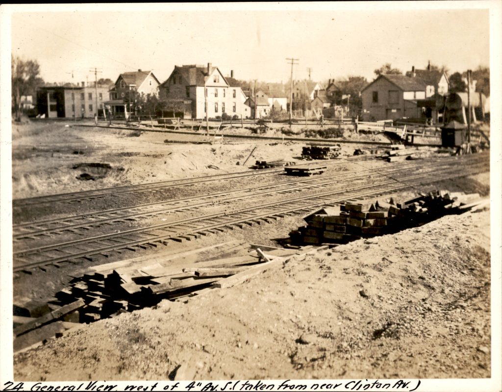
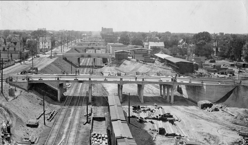
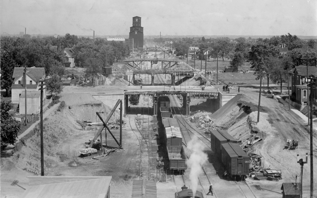
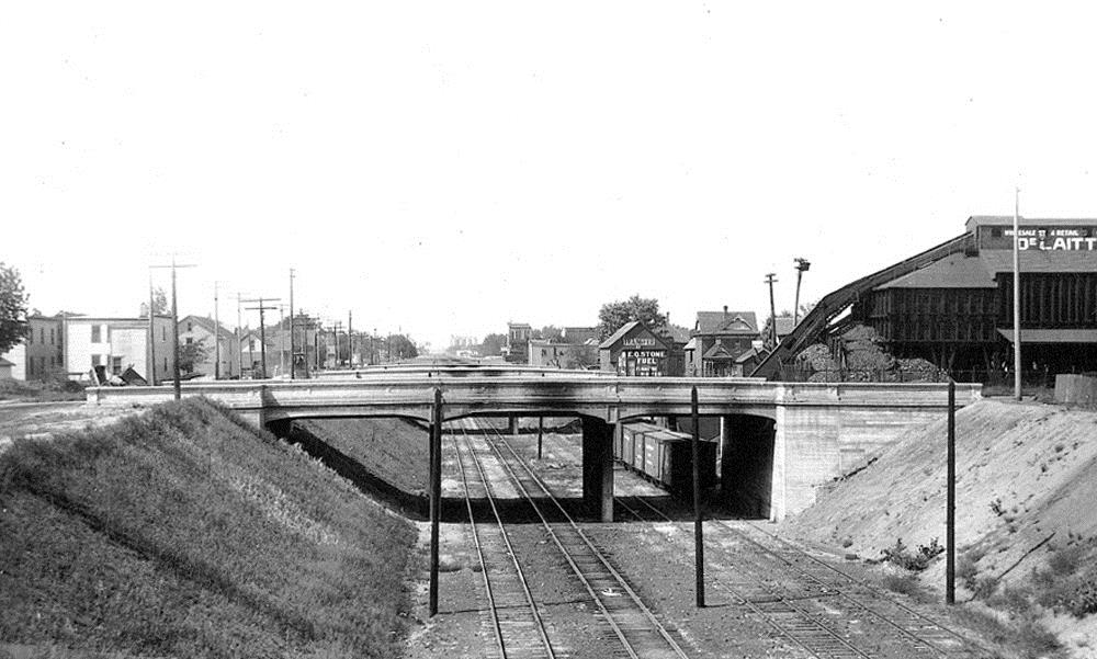
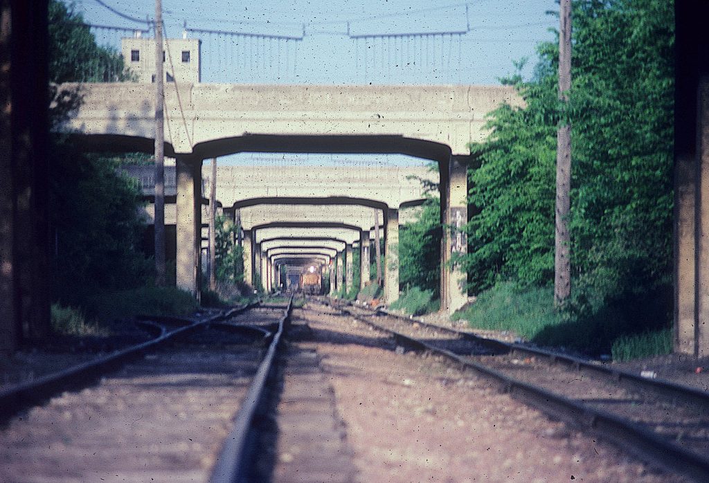
At the time of completion in 1916, the corridor featured a 2.8-mile-long, 22-foot-deep trench and 37 newly built concrete bridges. Only the Hennepin Avenue bridge had been constructed before this project. The line featured two mainline tracks (before the project, there was only one mainline track) and numerous sidings along the corridor, especially at the western end, by Midtown Exchange, and a yard at Third and Fourth avenues. An additional bridge was constructed at West 29th Street between Dupont and Colfax avenues to allow access to industry south of the street.
to the south (left). City of Minneapolis Transportation Department photograph collection.
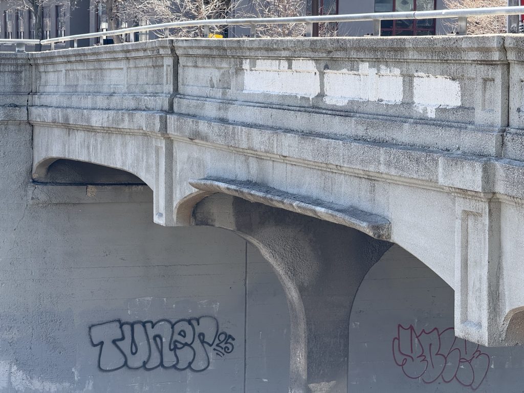
The bridges crossing the approximately 120-foot trench are continuous reinforced concrete girder bridges and were cast in place. All but two of the bridges have three spans of roughly 30 feet. The Clinton and Fourth Avenue bridges were longer, at six and ten spans, respectively, to cross the rail yard below. Each bridge has four columns in each pier. Most bridges are about 50 feet wide to accommodate two lanes and two eight-foot sidewalks, with the exception of bridges where streetcars needed to cross, which were wider. The bridge decks were originally made from wood block pavers on a sand bed, but were later replaced with a bituminous or concrete overlay. The bridges all featured concrete smoke shields to protect the parapet from smoke stains.
The bridges had 18 feet of clearance for railcars, shorter than standard, so straps were installed to alert workers of an upcoming bridge. Photographer Robert Rivard told me, “It is called a ‘tell-tail’. A remnant from the days when a brakeman would be on the roof of a box car. Leather straps hang from the wire and brush the brakeman to get his attention about a bridge or a tunnel.”
The ground around Fourth Avenue was at a natural low point, so it was filled in to raise it to an elevation equal to the new depression and keep the crossing at grade.
Check out Part Two of this series to learn about the changes to the corridor over time!
Resources
Author’s note: I recommend reading through the PDFs linked below, which are largely government-funded research, related to the historic district. These contain many photos and more interesting facts. Also linked in them are more sources from the City of Minneapolis, CM&StP Railroad, and other railway and bridge publications from the earlier 20th century that I didn’t look at myself.
- “Track Depression Work of the C. M. and St. P. Ry. at Minneapolis.” Railway Review, July 17, 1915.
- “Dreams, Disasters, and Demise: The Milwaukee Road in Minnesota: by John C. Luecke, 1988
- “More Milwaukee Road in Minnesota” by John C. Luecke, 2010
- National Register of Historic Places Nomination (2005) (PDF) https://edocs-public.dot.state.mn.us/edocs_public/DMResultSet/download?docId=24720708
- Cultural Landscape Management and Treatment Guidelines For the Chicago Milwaukee and St Paul Grade Separation (2008) (PDF) https://www.hennepin.us/~/media/hennepinus/residents/transportation/midtown-community-works/cultural-landscape-guidelines-2008.pdf
- Midtown Corridor Bridge Management Plan (2015) (PDF) https://edocs-public.dot.state.mn.us/edocs_public/DMResultSet/download?docId=24720705
- Chicago, Milwaukee and St. Paul Railroad Grade Separation Historic District Reevaluation (2017) (PDF) https://www.lrl.mn.gov/docs/2017/other/c170018.pdf
- Digging the Midtown Greenway trench, Southwest Journal (2019) https://web.archive.org/web/20220924005024/https://www.southwestjournal.com/focus/2019/10/digging-the-midtown-greenway-trench/
- Hennepin County Digital Collections https://digitalcollections.hclib.org/digital/custom/home
- Minnesota Historical Society Collections Online https://www.mnhs.org/search/collections
- Historical Marker Database
- Building the Corridor, The CM&StP Grade Separation, Midtown Corridor: CM & St P Grade Separation Historic District https://www.hmdb.org/m.asp?m=201047
- The Railroad and the City, Midtown Corridor: CM & St P Grade Separation Historic District https://www.hmdb.org/m.asp?m=200506