Editor’s Note: This is the third in an ongoing series of articles touching on aspects of the City of Minneapolis’ planned reconstruction of 35th and 36th streets in South Minneapolis. We encourage residents and users of these streets to weigh in with city officials.
When it comes to streets, the devil’s always in the details. As the City of Minneapolis plans its full reconstruction of 35th and 36th streets, one of the more under-the-radar policy considerations bearing on the project is the roadways’ designation as “Municipal State Aid Streets” (MSAS) under the Minnesota Department of Transportation’s (MnDOT) State Aid for Local Transportation program.
Municipal State Aid Street, you say? What’s that, and how does it affect this corridor?
“Library kids have told me that they either don’t feel safe biking to the library or their parents don’t let them. I personally don’t feel safe biking to and from work via 35th or 36th streets.”
— Anna Van Sice, librarian at Hosmer Library
What Is Municipal State Aid?
To better understand State Aid, I went digging through MnDOT’s online resources and picked the brain of State Rep. Katie Jones (DFL-Minneapolis), a policy expert and longtime advocate for multi-modal transportation solutions at the local and state level.
The Municipal State Aid Street (MSAS) program apportions money to cities and towns of at least 5,000 residents based on need and population, and using Minnesota Highway Users Tax Distribution funds to help them maintain or rebuild roadways.
Cities choose which streets in their network to designate as MSAS streets within a set of criteria. The money usually goes to collectors and arterials. But with that money comes a set of design rules municipalities must follow. As Jones told me, “The state basically said, ‘hey, cities and counties, if we give you money, we want to have some level of uniformity of these collector streets.’”
State statute requires that cities and towns follow MSAS rules. Those rules were first founded in 1957 and were updated in 2017 (they were in the process of being rewritten as I wrote this blog; find a link to August 2025 updates here). Those 2017 design standards lingered on for years, even as more progressive design manuals came into usage elsewhere in the transportation sector. In an interesting twist, Jones told me, MnDOT’s own design guide, which is distinct from the State Aid design rules, “is now more progressive than the MSAS standards.”
The uniformity attached to State Aid funding — and how up-to-date the rules underlying that uniformity are or are not — make it challenging to achieve the safe, neighborhood-oriented, multi-modal goals that residents deserve, which are key to delivering on Minneapolis’ Transportation Action Plan and are embodied in the city’s stated project goals for the rebuild of 35th-36th.
What Does This Mean for 35th and 36th?
MnDOT refers to State Aid-designated roads as “community-interest streets” — but are the standards imposed on those streets in the community’s interest?
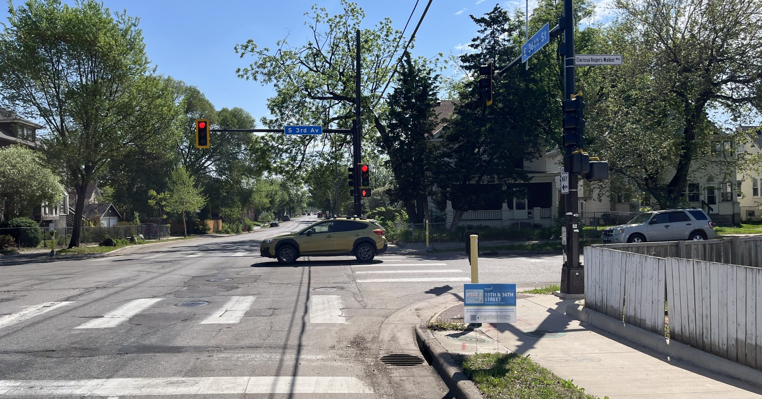
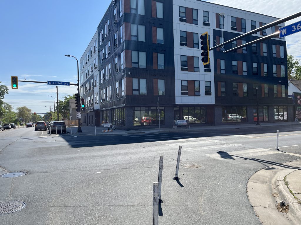
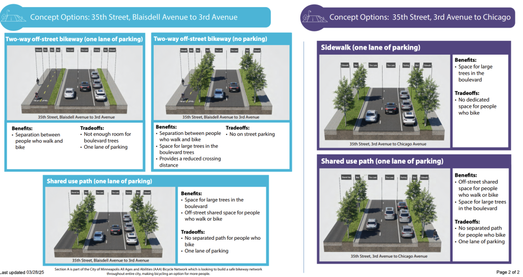
Let’s take a look at how those standards would apply to 35th and 36th streets between Blaisdell Avenue and Chicago Avenue. According to what I found in the State Aid Rules and what city staff shared with me, here’s how the MSAS “minimum design standards” for an urban reconstruction would currently apply to 35th and 36th:
- One-way streets must have at least two through-traffic lanes
- Eleven-foot-wide travel lanes*
- Minimum “design speed” of 30 to 45 mph
*City staff shared the 11-foot figure with me. The rules do state that “Ten feet may be considered where truck or bus volumes are relatively low, rights-of-way are constrained, and design speeds are 35 mph or less” (see page 45 here) — some of those conditions would likely not apply to this corridor, even in a safer rebuild.
If 35th and 36th streets were rebuilt according to these rules, what might the impact be?
- Two through traffic lanes for one-ways: This stipulation means that an alternate scenario of creating two twin Blaisdell Avenue-like streets, one in each direction, with each having a single through lane, turn lanes at intersections, bicycle facilities (sidewalk-level, though!), greenery and a curbside zone, is not to be. I’m unsure if such a road diet could have managed traffic flow on the street segments closest to 35W (city documents report the streets carry 4,200 to 10,000 vehicles per day, and we still live in a reality of forced car-dependency and long commutes). I suspect a road diet could work between Third Avenue South and Chicago — but it’s prohibited under MSAS rules.
- Eleven-foot-wide travel lanes: Since wider travel lanes are correlated with higher speeds, this rule mandates more dangerous conditions. It’s a point Rep. Jones underlined when I spoke with her: “Why do we still have 11-foot lane widths in urban areas? We have examples all across the Twin Cities that [show that] 10-foot lanes are just fine.” Experts agree that 10-foot lanes are enough: Offering extra feet encourages drivers to zip along faster and takes away space that would better be allocated to widening a 3-foot grass-boulevard into a 5-foot boulevard that could support shade trees. Or implementing a separated sidewalk and two-way bikeway, rather than forcing those walking and biking onto the same shared-use path.
- Design speed: As best I can tell, State Aid rules impose a “design speed” of between 30 and 45 mph. The City of Minneapolis sets speed limits of 25 mph for “larger, arterial city-owned streets,” and that’s the limit on 35th-36th. While posted speed limit is one thing, the bigger determinant of driver behavior is likely design speed — how a roadway is geometrically designed, which shapes the visual and spatial cues drivers absorb and respond to. MSAS rules prevent our planners and engineers from rebuilding the streets at a design speed that would match the stated speed limit. That’s a big problem, and all the more so as cars and trucks get bigger, heavier and taller.
Across Minnesota, as Jones attested, collectors and arterials are the main State Aid-designated roadways. It takes only a glance at a map of high-injury streets to understand that those roadways’ design makes them among the most dangerous of any city — including Minneapolis.
It’s easy to see how rules like those listed above contribute to the problem. That’s one reason why Jones has been working with State Senator Scott Dibble (DFL-Minneapolis) on legislation to update State Aid standards to be more context-sensitive. After all, 35th and 36th have a density of pedestrians and destinations unlike that of other State Aid roadways in suburban or rural areas. Their bill (see Senate and House versions), which didn’t make it into law this past legislative session, would have granted “local design control” enabling municipalities to employ alternative design approaches and manuals.
As State Aid reform efforts chug along in the background, the city’s reconstruction planning for 35th and 36th streets continues apace. Lane width, design speed and the number of through travel lanes will be critical factors in whether these streets retain their dangerous and unwelcoming position on our high-injury network or are rebuilt into something much, much better.
“On a recent walk, I saw a memorial on a tree outside a home at 36th Street and Second Avenue. Days earlier, two drivers crashed their cars and apparently that led to the death of a young person. Stuffed animals and small soccer cleats hung from the tree, a reminder of a life lost too soon.”
— Tim McLaughlin of Walking Minnesota
A Call to Action: Appeal for Variances!
Given the Municipal State Aid rules, is there any hope in realizing a safer and more sustainable corridor?
The well-known adage has it that “you can’t fight City Hall.” But you can appeal MnDOT for a variance to Municipal State Aid standards.
And for that, we can draw encouragement from the precedent set by Hennepin Avenue South (where, as I write this, the soil is flying in the final phase of a multi-modal reconstruction).
In order to make room for all the desired amenities on Hennepin, the city appealed to MnDOT to install a concrete median narrower than the 4-foot median MSAS design standards would have dictated. Reading through the City Council’s variance request gave me a frisson of Minneapolitan pride: The list of whereases is a veritable rundown of the city’s progressive transportation policies and multi-modal aspirations.
Through the same appeal process, we can meet those aspirations on 35th and 36th, too.
Based on my longtime experience navigating 35th and 36th streets, as well as insights from walk audits and organizing efforts there, here are some common-sense design variances residents and advocates could push city officials to pursue:
- Appeal for fewer than two through-travel lanes, if and where it may be helpful
- Narrow through-traffic lanes from 11 feet to 10 feet
- Lower the target design speed to 20 to 25 mph
How You Can Get Involved
Seeking a variance from key design elements could free up Minneapolis to pursue a reconstruction that calms traffic, reduces crashes, makes conditions safer for those walking, biking, rolling and driving, increases space for trees and stormwater treatment, and so on.
Here are some ways you can help make that happen:
- Sign up for project updates to stay up-to-date on city plans and outreach efforts.
- Email your City Council Member: Ward 8 and Ward 9 residents, in particular, live within the reconstruction area. The Council’s Climate & Infrastructure Committee will eventually vote on whether to approve final concepts. You can find relevant emails at the links. Add a personal note about how you use the streets, state what you would like to see in a final design, and request that they work with city planning staff on variance requests.
- Contact city planning staff (scroll down to the bottom of this page) and make a similar request.
- Sign up to get involved with grassroots organizing for a better corridor by emailing 35th.36th.advocacy [at] gmail [dot] com.
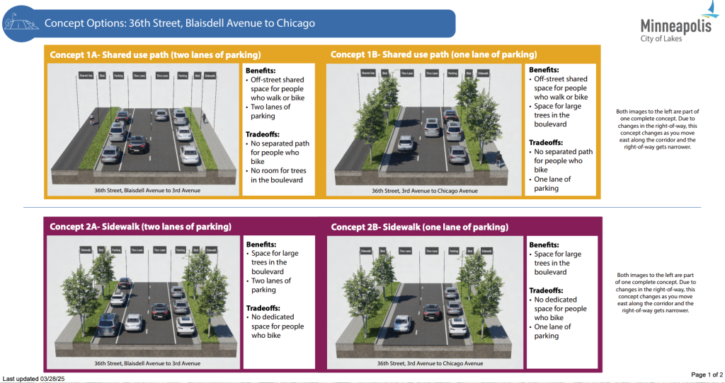
What a final design looks like is to be determined; the city’s current design alternatives are only at the stage of 15% concept layouts (see screenshots above). While I’ve thrown out a few ideas, at the end of the day, seeking design variances will give the City of Minneapolis much-needed flexibility to pursue designs that meet their own stated goals for the project — and the needs of those who live, work, play, shop, go to school and own businesses along the corridor.
How 35th and 36th streets’ State Aid designation plays out is critical: It can either be part of the problem or part of the solution, hindering or helping realize the corridor’s potential as a pair of vibrant, neighborhood-oriented streets.