
Editor’s Note: This is the second in an ongoing series of articles touching on aspects of the City of Minneapolis’ planned reconstruction of 35th and 36th streets in South Minneapolis. The first installment was published on April 28, 2025: Weigh In on Minneapolis Rebuild of 35th and 36th Streets
It was a beautiful Saturday morning late last October — the sun bright, the sky blue and temperatures seasonably cool but comfortable.
A perfect setting for the 12 of us taking to 35th and 36th streets for a “walk audit” along that stretch of roadway. We comprised neighbors, community members, active transportation professionals and even a community-engagement consultant working with the City of Minneapolis on its planned full reconstruction of the corridor. And we were there to walk, talk, listen and observe.
For me, this day had been a long time coming. In my decade living in the Lyndale neighborhood, 35th and 36th have always been central threads in the surrounding urban fabric.
When I taught elementary school in South Minneapolis, I’d cross 35th and corner 36th and Nicollet every morning on my bike ride to school. Many of my students lived in the Central neighborhood, and I’d stop by for home visits to connect with their families. There were afternoons at Hosmer Library. Door-knocking the streets for a policy campaign. Happy hours at Pat’s Tap. Bites at Hola Arepa.
I first learned of the 35th Street and 36th Street project through my participation on the Lyndale Neighborhood Association’s Housing Committee. I was also supporting a Safe Routes to School project at Lyndale Community School, whose attendance zone covers most of the roadway the city plans to rebuild. As a natural extension of all that, I found myself walking the streets with a fresh eye last October.
Opportunity in the Face of Challenge
What we saw, heard and felt that morning — and in subsequent walk audits — reinforced what so many people who live, work, play, shop, learn, worship and do business in the corridor must contend with every day. Thirty-fifth and 36th streets offer a distinct opportunity to connect neighborhoods full of assets and amenities and human spirit, but navigating them is too often a dangerous and degrading experience.
(And although I intend, with this piece, to capture a sense of the variety and conditions of 35th and 36th — informed by those walks, community voices and my own experiences — I don’t pretend this is “the whole story” of the corridor. I hope readers who know these streets will be inspired to bring forth their own voices and impressions; feel free to email me directly at 35th.36th.advocacy [at] gmail [dot] com or comment on the Streets.mn pages on Bluesky or Facebook.)
Directly on 35th and 36th, one finds Green Central Dual Language Elementary School, Hosmer Library, Pillsbury House + Theatre and business nodes at Chicago Avenue and Nicollet Avenue. Not far away is George Floyd Square and the once and future thriving Black 38th Street Cultural District. Five years on from Floyd’s murder, it presents a searing and poignant reminder of Minneapolis’ (and the nation’s) broken promises and struggles for liberation.
Whether new-to-country or generationally rooted, countless renters and homeowners call these streets and surrounding neighborhoods home. School buses chug along, and heavily used Metro Transit lines like Routes 18 and 11 and the D Line BRT criss-cross the corridor. When school at Green Central lets out, hundreds of kids fan out to their families, catch a ride home or race down Fourth Avenue and up the steps to stately Hosmer Library.
There’s a lot going on! But rather than function like connective tissue across an area riven by highway and high-speed roads, 35th and 36th streets too often aggravate those very divisions.
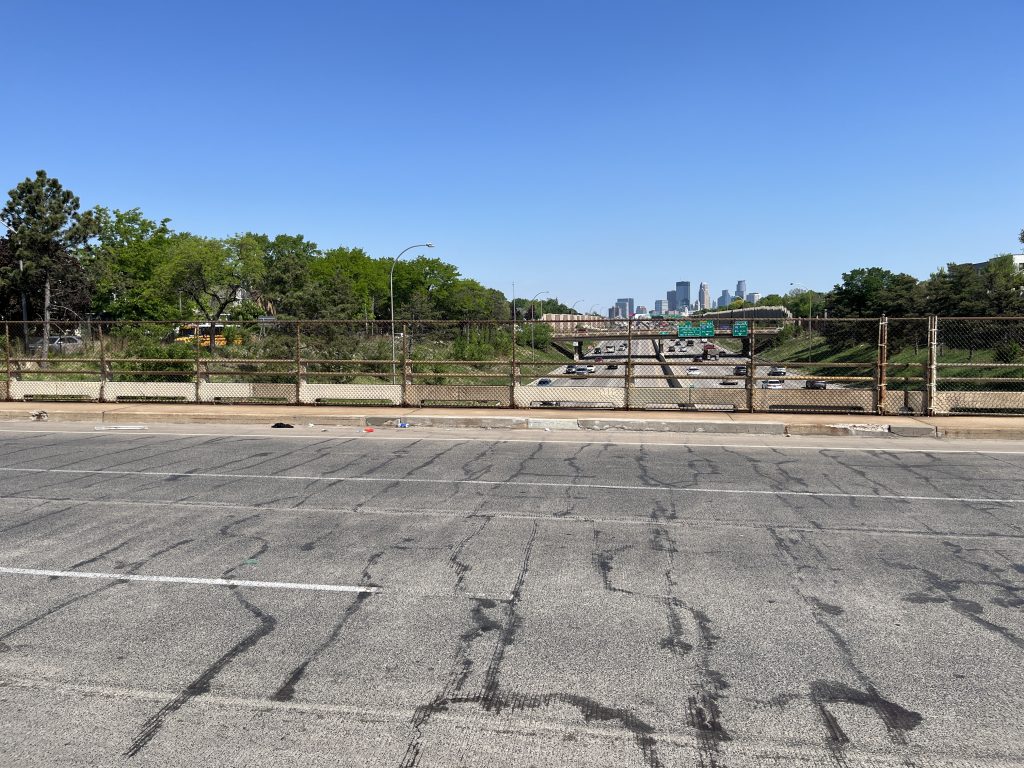
Constructed in the 1960s, at the height of “urban renewal” schemes in which planners, public works agencies and highway departments paved wide and fast-moving roadways through urban cores (very much including the Twin Cities and Southside in particular), 35th and 36th streets are key arterials in a series of high-speed feeder streets oriented around Interstate 35W in South Minneapolis. Indeed, they span the freeway that bulldozed through the Southside beginning in the late 1950s, a vibrant neighborhood that highway planners targeted.
The historical backdrop, freeway proximity and current street design come together to form a toxic brew of treacherous conditions.
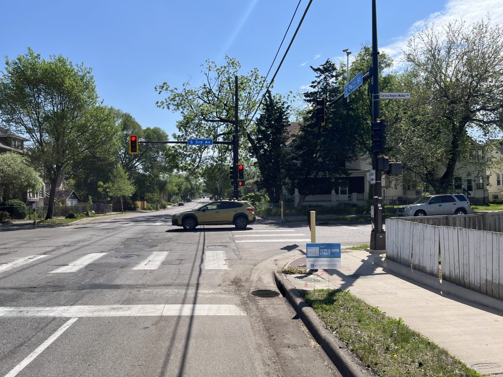
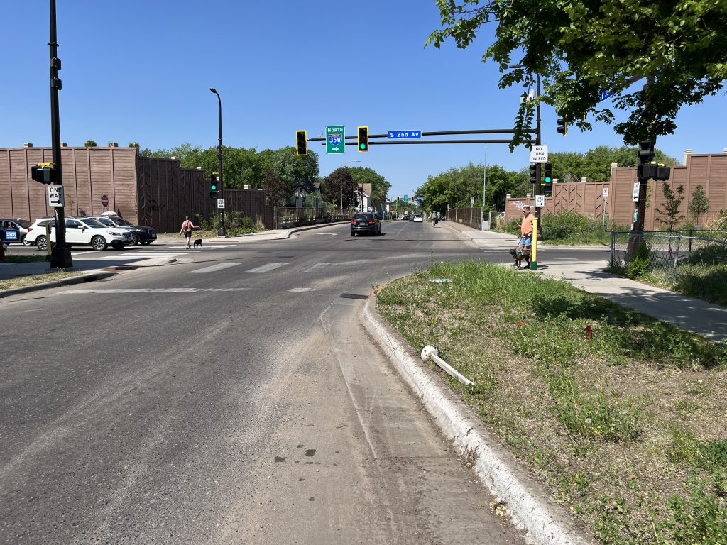
For most of the planned reconstruction area — from Blaisdell Avenue at the west to Chicago Avenue at the east — the roadways are two-lane, one-way streets, a design known to be dangerous, especially in urban areas. As numerous participants in the walk audits could attest, having multiple lanes in the same direction encourages all manner of risky swerving, merging, revving and turning by drivers. When traffic flows freely on 35th and 36th, vehicles pass through with such speed and aggression that crashes are a constant backdrop. When the streets are congested, aggression doesn’t abate so much as get channeled differently, with frustrated drivers zooming into pockets of space and through yellow and red lights.
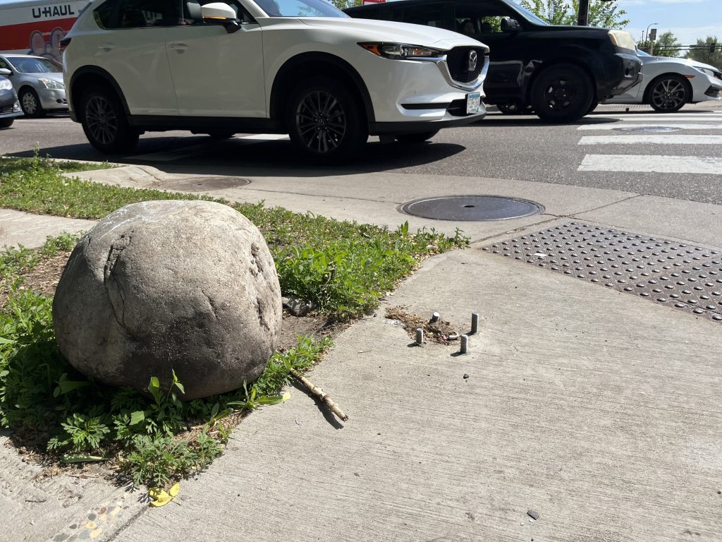
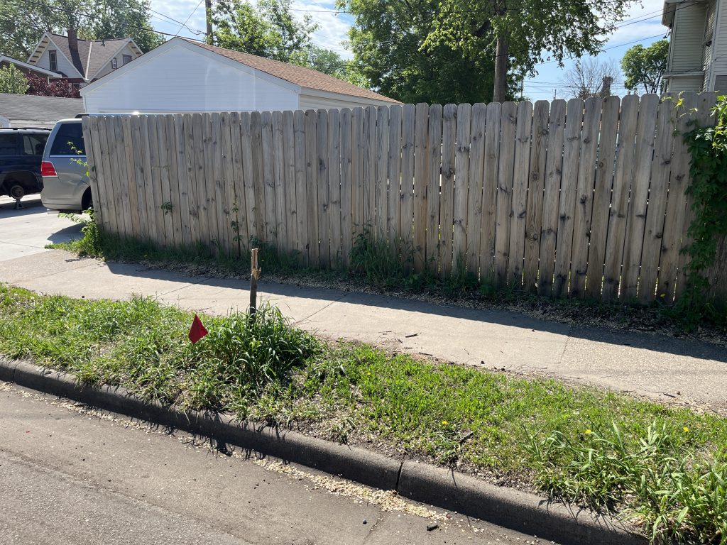
One subtle effect of a street design that favors aggression was pointed out to me on one of our walk audits. Corner property owners have erected barricades, from large stones to fencing to the extreme concrete-block fortifications, to protect their homes. It’s a sad residual of our built environment that, once noticed, is hard to unsee.
At Your Peril: Walking, Rolling and Biking
Unsurprisingly, this harsh urban fabric renders walking, rolling and biking uncomfortable and unsafe.
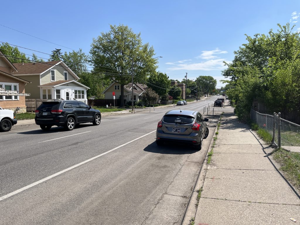
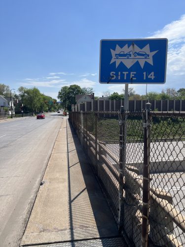
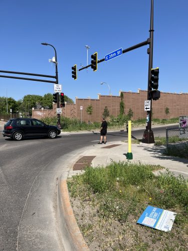
For much of the corridor, sidewalks are just a few feet wide, and overgrown landscaping frequently encroaches on them. One audit participant ruefully commented on how hard it was to simply walk side-by-side! To cross the highway, pedestrians are forced onto narrow, crumbling, chain-link-flanked sidewalks on the aging 35th and 36th street bridges, as cars whip by, mere feet (or inches) away. (The bridges were among the few in South Minneapolis not rebuilt during MnDOT’s extensive 35-W project from 2017-2021 — but the state did restripe the pavement to increase the bridges’ capacity from two to three lanes, drawing traffic even closer to pedestrians.)
At Stevens and Second avenues, which tightly parallel the highway, people on foot must scurry across in the face of turning drivers who may be more focused on getting to (or from) I-35W. On nearly every crossing, I could feel my body tense, on full alert for oncoming cars and trucks. And during one walk, I witnessed a mother hustling her young kids across the street, one of them clutching her mom’s shopping bag — a vivid illustration of how crucial a “caregiving” lens is for understanding the full impacts and possibilities of our built environment.
Walkability is compromised by the design of the surrounding streets, and other aspects of streetscaping and placemaking don’t help much. A canopy of mature street trees can give pedestrians a sense of protection and enclosure, slow traffic, and offer shade that mitigates highway emissions and reduces the significant urban heat-island effect.
Some parts of the corridor are blessed with mature trees, but long stretches have little shade and are populated by sparse, small trees struggling to grow in narrow boulevards (see this interactive map for an illustration of the relative lack of canopy, especially compared with wealthier neighborhoods nearby).
Meanwhile, the City of Minneapolis provides few trash or recycling cans, benches or water fountains, or much wayfinding or signage that would welcome visitors to the neighborhoods (though it must be noted that posters seeking public engagement on this very project are, at the moment, placed in numerous locations). Much of the corridor is poorly lit at night.
Conditions may be even more unwelcoming for folks riding a bike. One day a few months ago, a friend texted me an account of the closest call of her biking life — an impatient and aggressive driver zipping by her on 35th Street, inches from taking her down.
It’s an all-too-common feeling. Given that 35th and 36th lack any on-street or sidewalk-level bike facilities, riders must mix it up with weaving 30-mph-plus traffic and slalom around potholes. A heart-in-the-throat ordeal for even the most confident bicyclist and completely inhospitable for a kid, an elder, a parent on a cargo bike or trike, or just about anybody who wants to roll comfortably around the neighborhood.
No Driving Paradise
Indeed, the challenges of 35th and 36th fall most heavily on the streets’ most vulnerable road users — those walking, biking and rolling, whether that’s pushing a stroller, perambulating with a walker or moving in a wheelchair. That points to the possibilities that a strong redesign might offer. But as somebody who’s also driven on the streets, I can attest that these conditions aren’t even good for drivers.
While many residents surely depend on cars to get around, and city estimates claim the street design handles between 4,200 and 10,000 vehicles daily, that brings a big cost to the neighborhood. The crashes, backups and near-misses, the jarring lane jockeying, the congestion around rush hour, the grinding waits at signals, the confusing lane assignments onto the bridges, the drivers turning the wrong-way onto the one-ways.
For all the volume these streets handle, they still don’t handle it well. Cars leaving the highway mindset aren’t met with a clear demarcation that would naturally guide them into a neighborhood mindset. In their current design, 35th and 36th are more befitting of extended on- and off-ramps, rather than the family- and business-friendly neighborhood streets they could be.
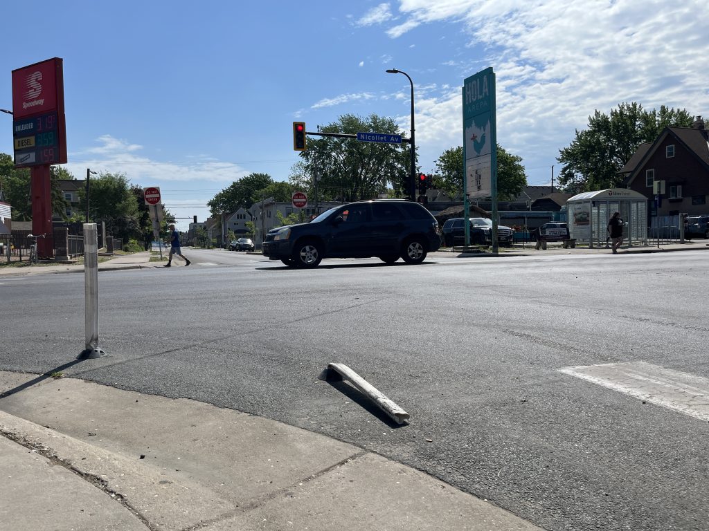
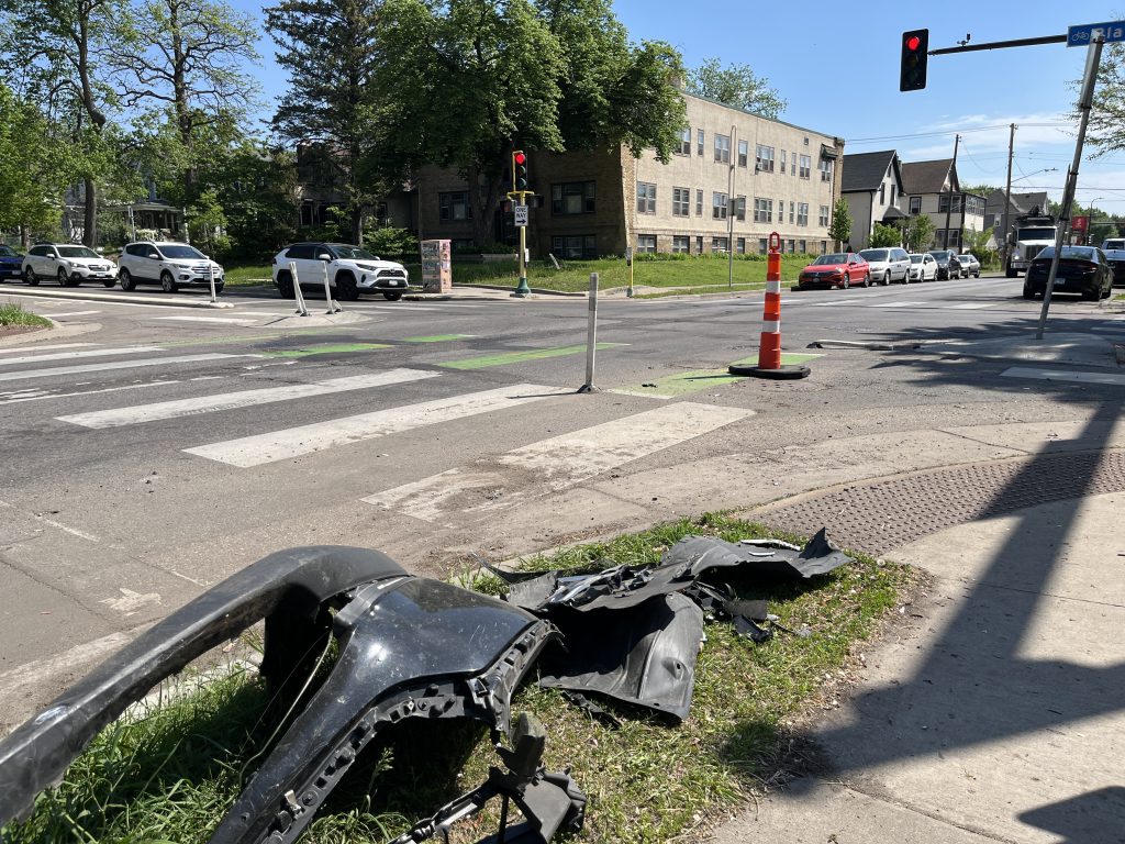
At the commercial nodes I know best, 35th–Nicollet and 36th–Nicollet, intersections that might otherwise offer a pleasurable walker’s delight are instead often beset with snarls of traffic, along with more than their fair share of collisions (even rollovers), which contribute to both streets’ ignominious inclusion on Minneapolis’s high-injury street map.
We Can Advocate for Better
Despite this dire portrait, there’s room for hope! A few months ago, the city released its phase 1 engagement summary — produced by some of the very staffers who have walked shoulder to shoulder with community members during our walk audits.
The city’s diagnosis accorded with what I’ve seen, felt and heard. Some nuggets that stood out to me:
- “Residents feel that the current street design does not reflect the residential nature of the neighborhood.
- “Community members want more space for biking, walking and greenery.”
And at just the 15% design phase, with high-level concepts released for public engagement, much room for feedback and advocacy remains. You can view design alternatives here, sign up for updates here and contact city staff (scroll down to the bottom of this page).
Also, keep an eye out for future pieces in this series, which will dive deeper into those design concepts, investigate the history of the corridor and share a broader array of community perspectives.
It’s Minnesota, so not every day will be as bright and sunny as that October morning last fall. But with enough hard work and community advocacy, there could be blue skies ahead for 35th and 36th.
All photos by the author.