Editor’s Note: Max Hailperin is walking each of Minneapolis’ 87 neighborhoods, in alphabetical order. He chronicles his adventures at allofminneapolis.com, where the original version of this article was published November 8, 2025.
The river-adjacent portion of Minneapolis’s North Loop neighborhood, which was the focus of this walk, largely corresponds to the Minneapolis Warehouse Historic District, as entered in the National Register. However, the route also does briefly loop through the area further from the river that had been the focus of the prior walk. In the route map, the blue line shows the main path from A to B and the red lines are forward-and-back spurs.
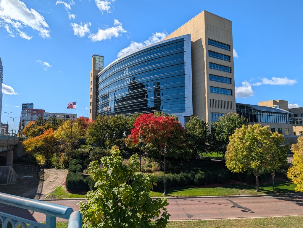
As soon as I hopped off the Number 6 bus at 1st Street North and Hennepin Avenue, I could see the weather was favorable, with the Federal Reserve building standing in majestic relief against the deep blue sky.
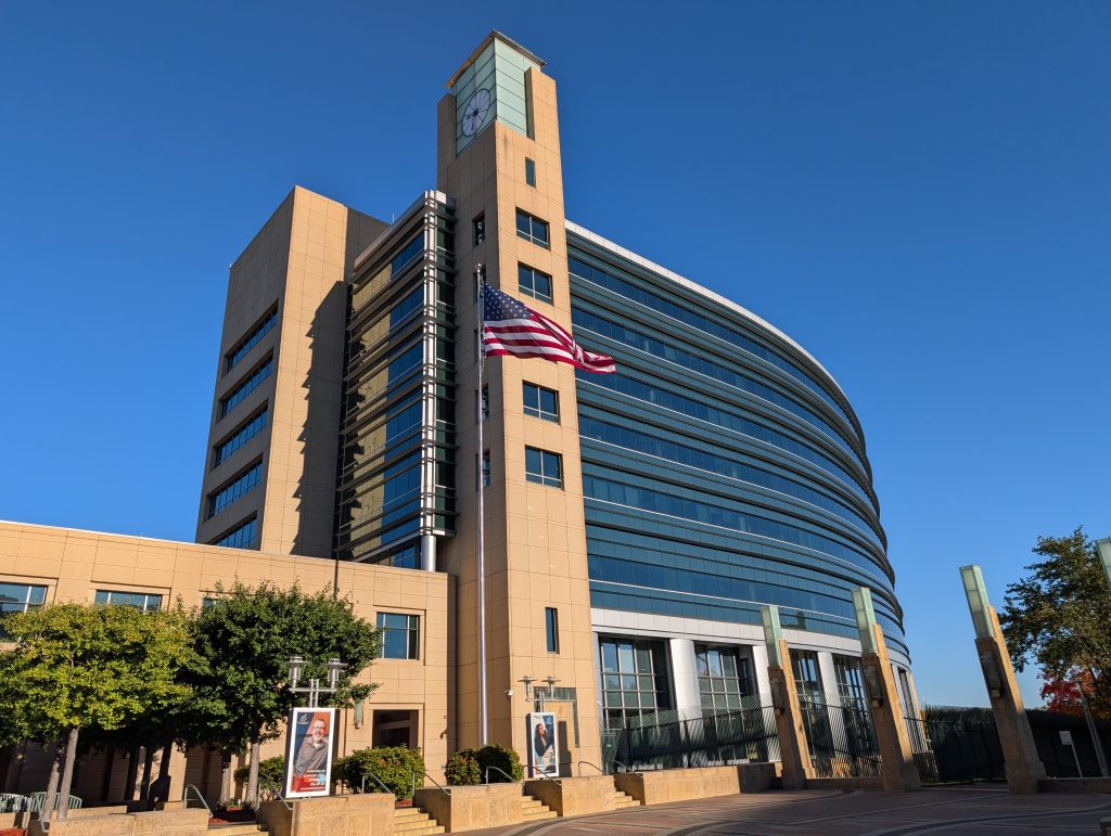
The Fed also serves as a good introduction to the paradoxical nature of this neighborhood’s recent trajectory. Historic preservation and radical transformation have been intertwined, and it’s unlikely so much capital would have been invested in the preservation had the Fed not pioneered the transformation with their 1997 move to the former Great Northern Depot site from the central business district on the downriver side of Hennepin.
When the railway site was a railway site, the warehouse district was a district of warehouses. When the railway site became a redevelopment opportunity, so too the warehouse district. And although it has its share of buildings as gleamingly new as the Fed, much of the redevelopment I saw took the form of adaptive reuse of warehouse buildings.
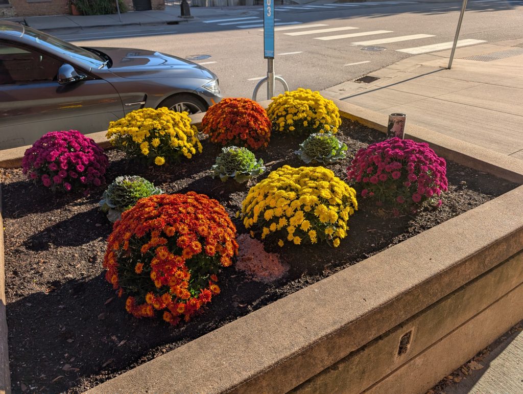
The sun was still low in the sky as I started out, adding some richness to the color of the chrysanthemums and the sun-drenched side of the red brick Lindsay Brothers Warehouse, which popped out from the shadows.
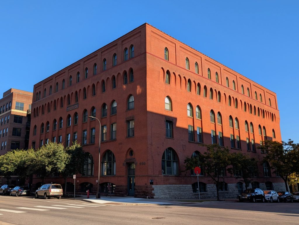
Apparently the Lindsay Brothers would mean something to me if I were familiar with farm implement distributors. They were a big deal. But I was more interested in the building’s reuse “among the first in the North Loop to be converted into residential units” in the 1980s, which provides another deeper layer in the story of how pioneers catalyzed the area’s redevelopment before it became seemingly self-evident.
I was also interested in the architectural details that adorn this big brick box. My immediate impression was that it is somehow Richardsonian Romanesque in style despite having gothic arches. And sure enough, when I turned to the writeup in the National Register of Historic Places, I see that a more educated eye than mine had described it as containing “elements of Richardson’s style” despite having “replaced Richardson’s rusticated stone and round Syrian arches with brick walls and pointed Gothic arches.”
The 4th Avenue corner where the Lindsay Brothers warehouse stands also marked the end, for now, of my upriver progression on 1st Street. I backtracked to 3rd Avenue and there turned away from the river to Washington Avenue. (I’ll cease including the directional indicator North on streets and avenues, given their ubiquity in this walk.)
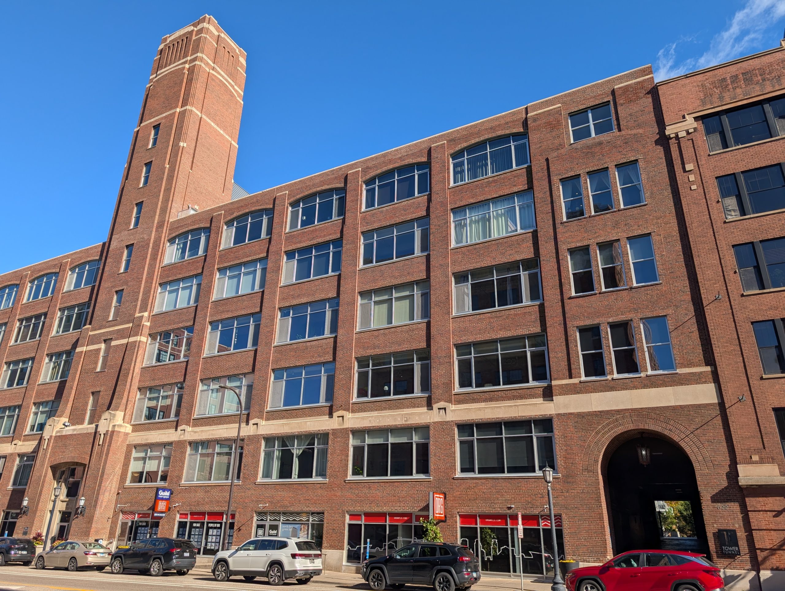
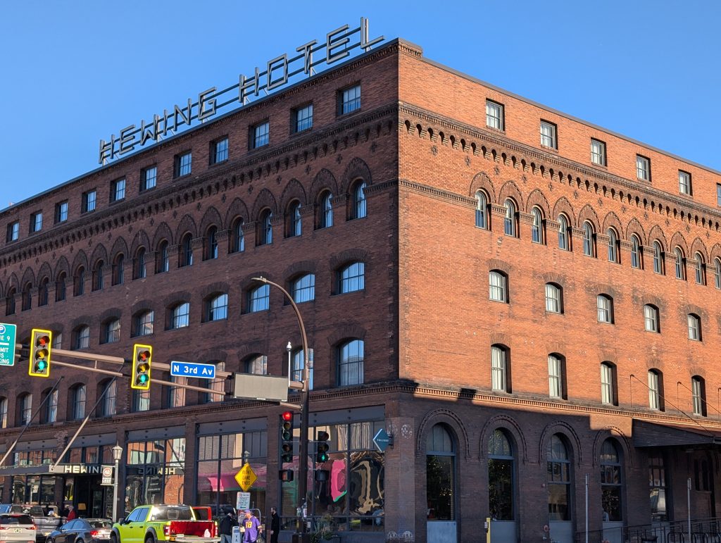
Where I turned from 3rd Avenue onto Washington, another late 19th century brick box riddled with arches now houses the Hewing Hotel. (And it too has a fifth story added later, though not so harmoniously as on the Lindsay Brothers building.) Again, this played a role in Minneapolis’s regional dominance in distributing agricultural implements, ranging from twine to wagons and windmills.
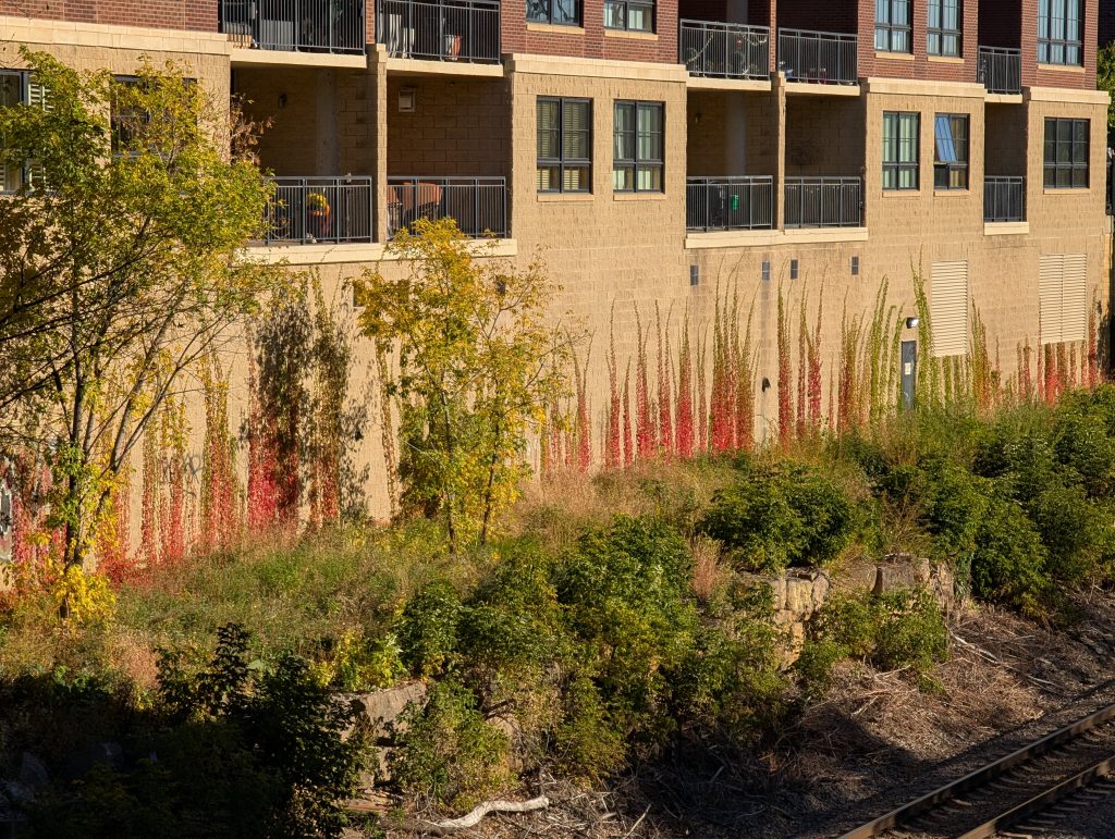
Earlier in the walk, I had reached the Lindsay Brothers building by crossing over the railway trench between 3rd and 4th Avenues, which also contains a portion of the Cedar Lake Regional Trail. Once I had looped through 2nd and 1st Avenues, I headed back upriver on 2nd Street and again crossed this trench, now with a colorful view of the vines growing on an apartment building wall.
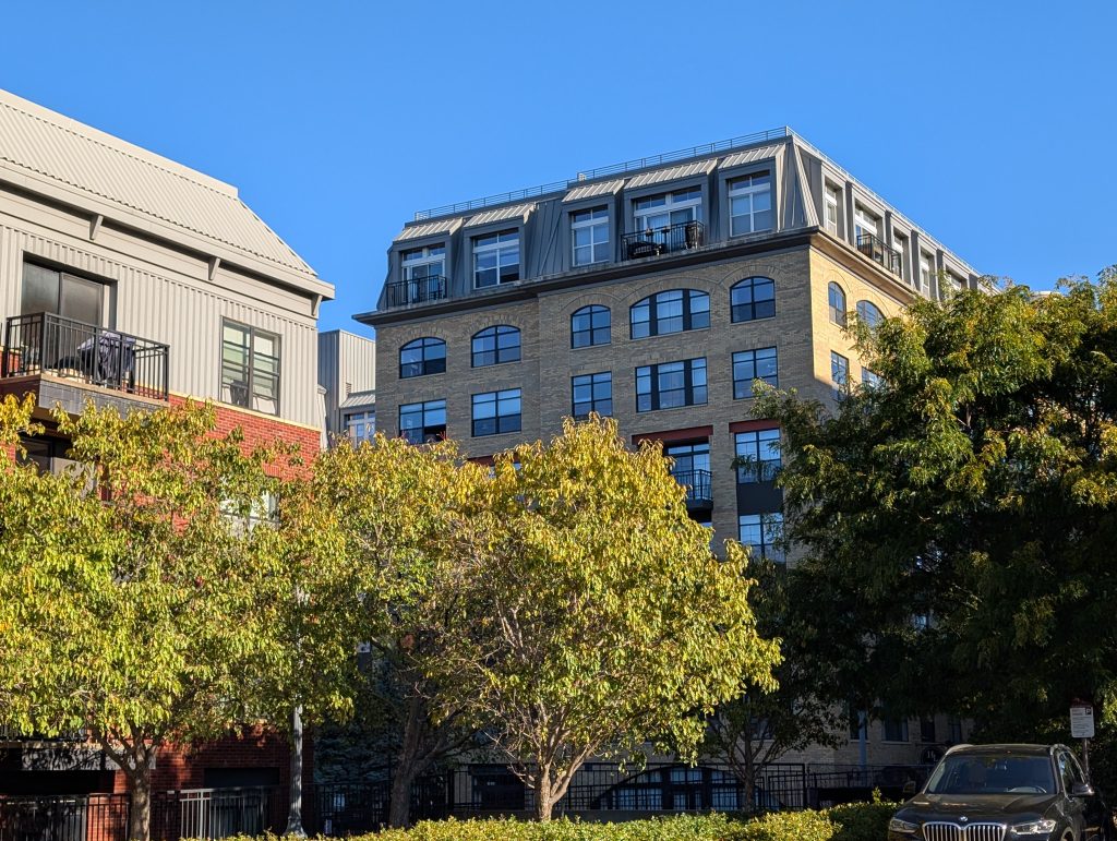
I saw a number of newly constructed apartment buildings; once the neighborhood became attractive, the repurposed warehouses didn’t suffice. Some, like the vine-clad Paxon, make no pretense of historicity, whereas the somewhat earlier (2000) eight-story portion of Heritage Landing nods to the setting with its brick and arches. The mansard roof seems at home on the building, if not in the district. And the four-story portion of that same apartment complex, just visible at the foreground left, occupies a middle position within the spectrum from unabashedly contemporary to echoes of heritage.
After an about-face turn at the tee intersection with 5th Avenue, I turned from 2nd Street onto 4th Avenue toward the river. After passing the Lindsay Brothers building and the FreightYard Townhomes and Flats that lie behind it, I came to one of the entrances to the private streets serving The Landings, “Your own private neighborhood, combined with all the big city amenities.” Fittingly enough, the entrance was guarded, although that was only a pre-Halloween decoration.
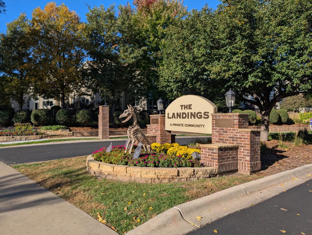
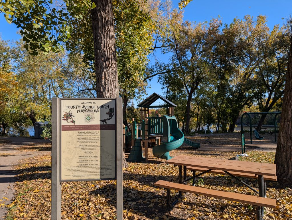
I don’t need a skeletal dog to keep me out of a private space. The big-city amenities I focus on are the welcoming ones, such as the playground where 4th Avenue tees into West River Parkway.
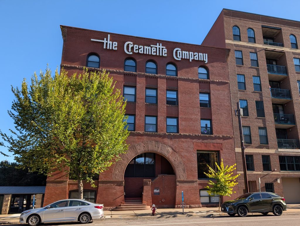
At long last, I picked back up on 1st Street, which I had started at the very beginning of the walk. Just upriver from 4th Avenue is a more pure example of the late 19th-century Richarsonian Romanesque style. The building was designed by noted architects Long & Kees as yet another farm implement warehouse, as memorialized in the name “CHAMPION BUILDING” still visible in the main archway. However, it’s real claim to fame came from its later life as a pasta factory.
Walking such a richly endowed neighborhood on such a sunny day, I came back with more photos than I could possibly include here. For example, this stretch of 1st Street also includes the Minnesota Opera and the Itasca Lofts, another neighborhood pioneer of adaptive reuse. But I don’t want to just harp on how the late 19th-century buildings were repurposed a century later. Instead, I want to turn to a technology that has proven as transitory as horse-drawn buggies: newspaper printing.
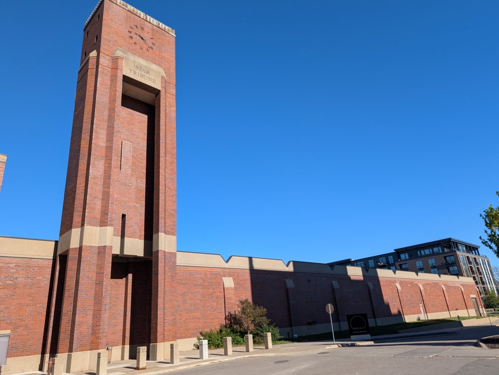
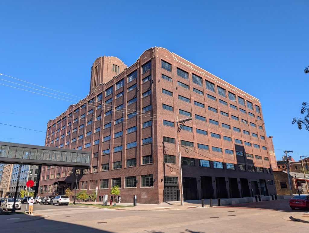
Well into the 20th century, 1st Street continued all the way to Plymouth Avenue. But today it is blocked at 8th Avenue by the nearly 400,000 square-foot Heritage printing facility that the Star Tribune constructed in 1986. A facility that size, with a railroad siding leading directly in at one end of the backside and loading docks at the other, is essentially a pump for newsprint, designed to move enormous quantities of paper from arriving “web” rolls to departing stacks of printed, cut, and folded sheets.
The design of that newsprint pump would have been sized for the Sunday edition, the largest of the week. A quick perusal of publicly available statistics suggests that in 1986, the Star Tribune was printing about 5 times as many copies of their Sunday paper as they do now, with each of those copies having roughly 10 times as many pages. And each page was about half again as large. Multiply that out and you’ve got 75 times more newsprint flowing through than today.
True, the printing plant has taken on contract work, such as the Pioneer Press and USA Today. But that can’t be enough to render it anything but grossly oversized for present needs. And that explains why it is slated to close at the end of the year, printing being yet further consolidated elsewhere. This is just too much land to sit on for so little purpose. Its redevelopment will surely be of the teardown variety; no one would find living in a cavernous printing plant as charming as in a building from the days when even industry relied upon natural light and ventilation.
After walking 2nd Street between Plymouth and 5th Avenues, I turned away from the river on 5th Avenue, following it as far as 4th Street. That’s the corner occupied by Graze Food Hall by Travail, which for the second walk in a row, I arrived at shortly before opening time. Not to worry, in this neighborhood other opportunities to eat and drink would follow.
Instead, I turned back to 3rd Street, where I’d resume walking in the orientation parallel to the river. This also brought me past another establishment not yet open, this one worth photographing from the outside: the Modist Brewing taproom.
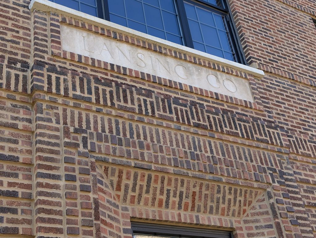
Third Street has quite a few warehouse-era buildings. I was particularly taken by the brickwork on the former Lansing Company building, now joined with its neighbor as the Bookmen Lofts, named after a company that used the buildings from the 1960s until 2002. The Lansing Company was formerly the Lansing Wheelbarrow Company and sold “Wheelbarrows, Wheel and Drag Scrapers, Steel Nose Trucks, Reynolds Trucks, Concrete Equipment, Etc.”
Kitty-corner from there, another much larger and slightly later warehouse building has also been converted into lofts, named for the Hall Hardware Company, which had the building constructed for its use. Renamed as Our Own Hardware Company in 1949, it was merged in 1998 into the present-day Do It Best.
I continued on 3rd Street until its dead end, passing such additional sights as the former Lavoris mouthwash factory, before turning up 9th Avenue to Washington.
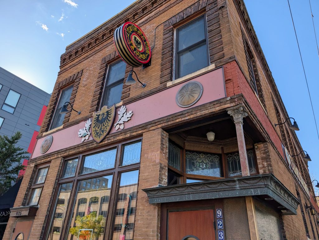
My main route proceeded in the downriver direction on Washington Avenue, but first I walked a one-block spur upriver to 10th Avenue, the corner on which stands the 1906 Hirth & Zehrendt Saloon, strilking for its many architectural adornments, including stained glass that incorporates six-pointed stars amidst geometric latticework. More recently, the building was occupied by Clubhouse Jäger, which closed after all its employees quit following the revelation of the owner’s white-supremacist politics.
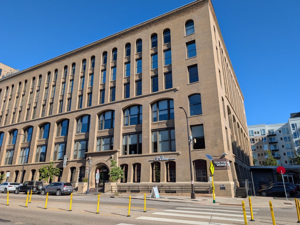
One of the defining buildings of the warehouse district is surely the TractorWorks Building on the corner of Washington and 8th Avenues, built in the first decade of the 20th century following a Kees & Colburn design as the massive distribution point for John Deere farm equipment. And though the present-day North Loop neighborhood has innumerable pioneers of one kind or another, the 2009 opening of Bar La Grassa in this building was a key milestone on the road from scruffy to sophisticated.
A block further downriver, the former Northern Bag Company (now Tower Lofts) shows what a difference a couple decades can make in architectural styles. The National Register describes it as combining “elements of the English Medieval Revival Style, such as its tower, with Commercial Style elements such as curtain wall construction and large industrial windows. … The Medieval character of the building is also noted in the polychromatic details in brick and stone and the large two- story arched openings on the ground level, one of which contains a lantern.”

Seventh Avenue is also where I would turn away from the river again. But first, I walked a spur to 6th Avenue and briefly around the corner there. This particular spur had a very practical side effect in that it brought me past Smack Shack, where I stopped in for brunch.
The interior looks like a mashup between a Maine lobster shack as imagined by a restaurant designer and a 1920s industrial garage. And indeed, the city directory for 1928 lists this address as home to the Minneapolis branch of the Highway Trailer Company.
More important, though, was the food. I ordered Pauly’s Jambalaya Hash and was impressed with how each element was cooked to the proper doneness. Yolks that run, potatoes that are smashable, shrimp that’s tender, celery that still offers some resistance: To simultaneously achieve all of these is noteworthy. And the service was executed with the same craftsmanship.

When I take these All of Minneapolis walks, I look up more often than when I’m just walking to get somewhere. My goal is typically to see the upper portions of a building, but a nice side effect is that I wind up seeing the sky more. Sometimes the interaction between sky and building makes me grateful to have looked away from my feet; the following photo is a good example.
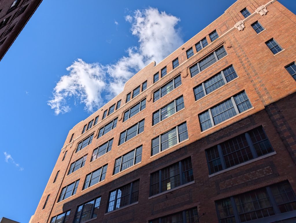
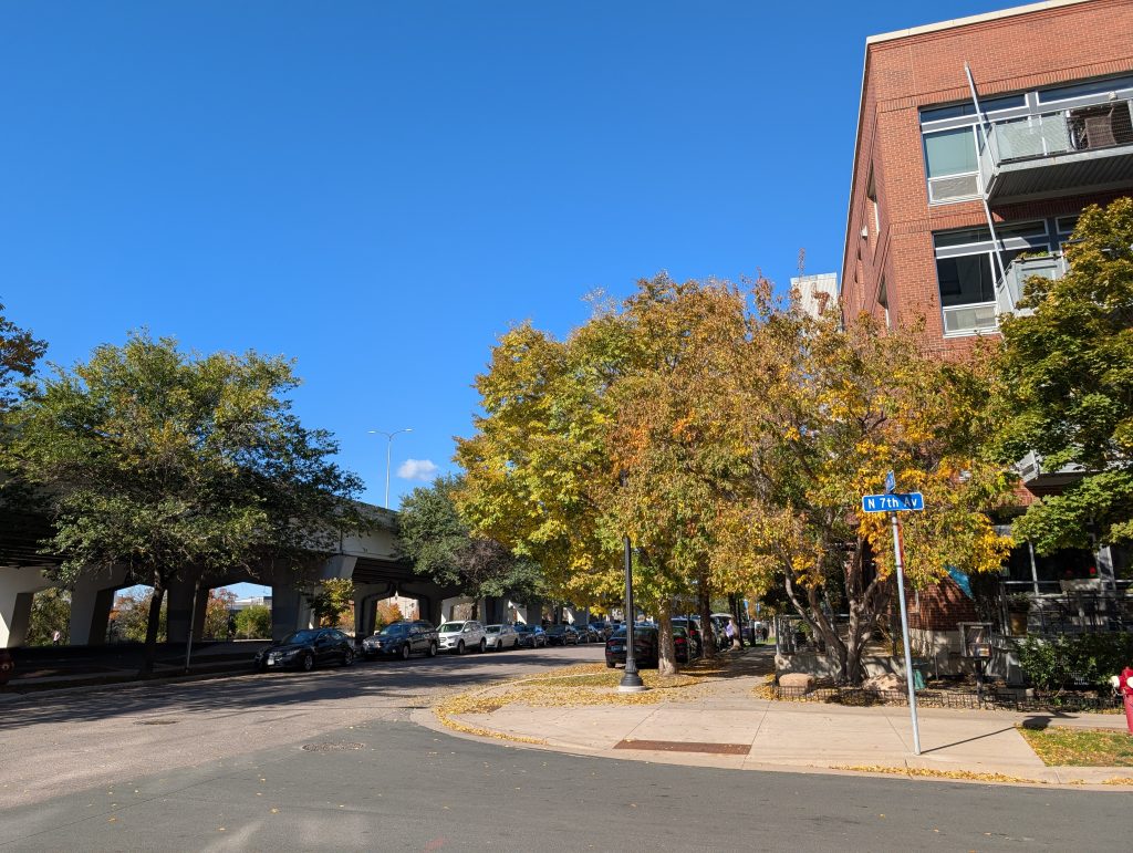
When I reached 4th Street on 7th Avenue, I turned first upriver for a spur all the way to 10th Avenue before returning past 7th to 6th Avenue. This portion of 4th Street runs along an elevated freeway ramp, so I anticipated a pedestrian-hostile environment, but the tree-lined scene as I turned the corner showed this expectation to be incorrect.
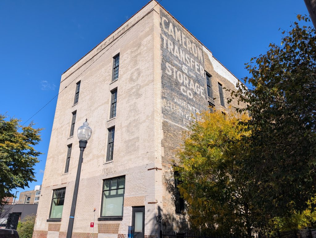
Most of the buildings along this street are new construction, but The Cameron was created in 2016 by adaptive reuse of what the ghost sign still proclaims to be the Cameron Transfer & Storage Co. The building was financed using a mix of historic-preservation and affordable-housing credits and designed by Urbanworks to take advantage of its historically significant mix of structural systems.
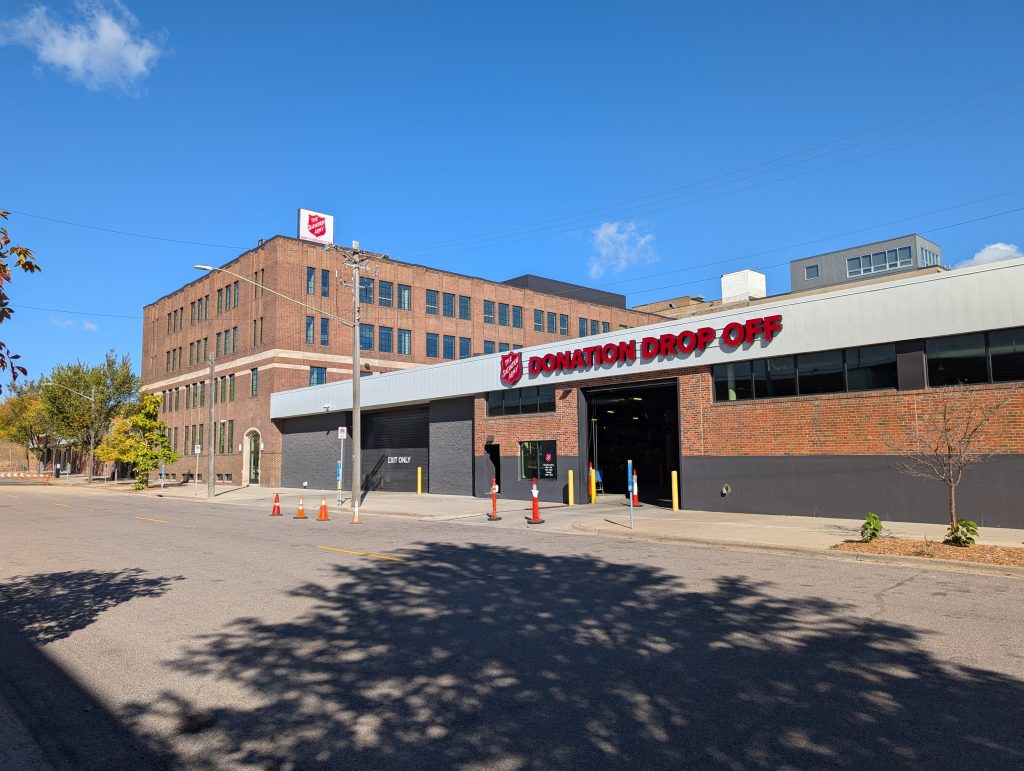
The second half of this spur is lined by the sprawling Salvation Army campus, which includes donation drop off, adult rehabilitation, and a thrift store.
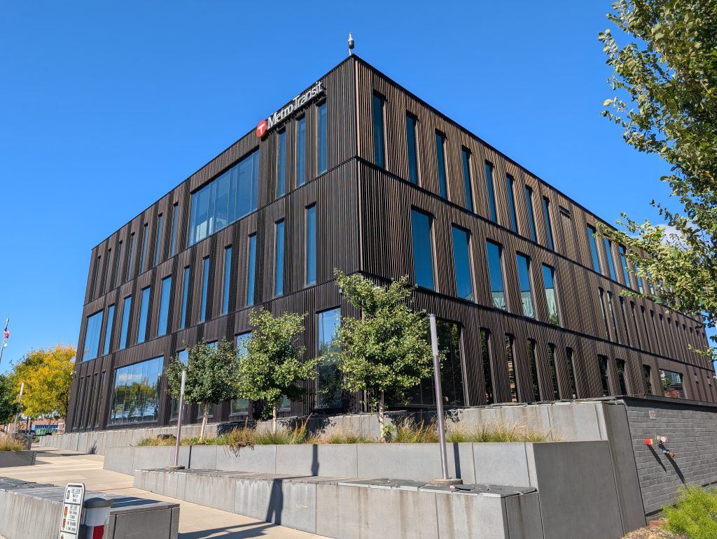
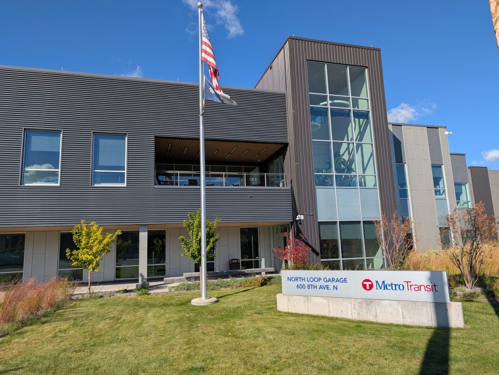
Once I was back to 6th Avenue, I passed under the freeway ramp and into the other portion of the neighborhood, the part I had focused on in my first walk. By the time I returned via 10th Avenue, I had been as far south as the farmers market and had passed back through the Metro Transit area, where I was able to supplement the photos I took last time. In particular, I got good views of the 2019 addition to the Heywood Office Building and the human-oriented side of the North Loop Garage, including a patio.
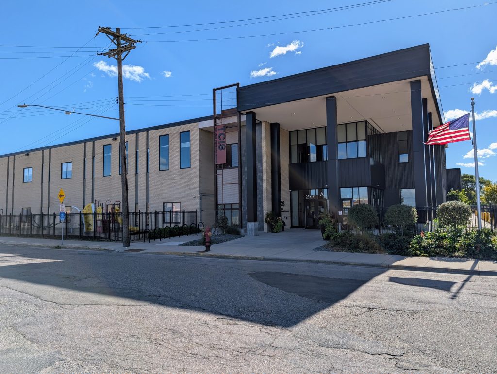
Once I returned on 10th Avenue, I didn’t immediately turn back downriver into the historic warehouse district with its upscale redevelopment. Instead, I first visited the area between 10th and Plymouth Avenues, where the street grid trasitions from river-aligned to compass-aligned. This area has a more industrial character, and indeed the one photo I came away with is a building significant for its industrial history, though it now contains a charter school.
In the aftermath of civil unrest on Plymouth Avenue in 1967, William C. Norris, the CEO of Control Data Corporation, a major computer company based in the twin cities, decided to take action. He directed the company’s resources (together with government subsidies) toward addressing social problems rather than only the bottom line. In particular, he had an additional manufacturing facility constructed, the “Northside Plant,” specifically in order to provide job training opportunities near what he described as “disadvantaged” residents. Neither that facility, nor the other social endeavors, nor the corporation itself have survived, but the building is still standing, providing mute testimony to the possibility of corporate social responsibility.
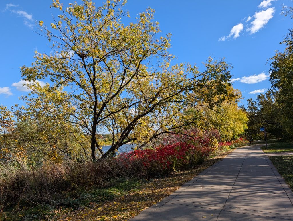
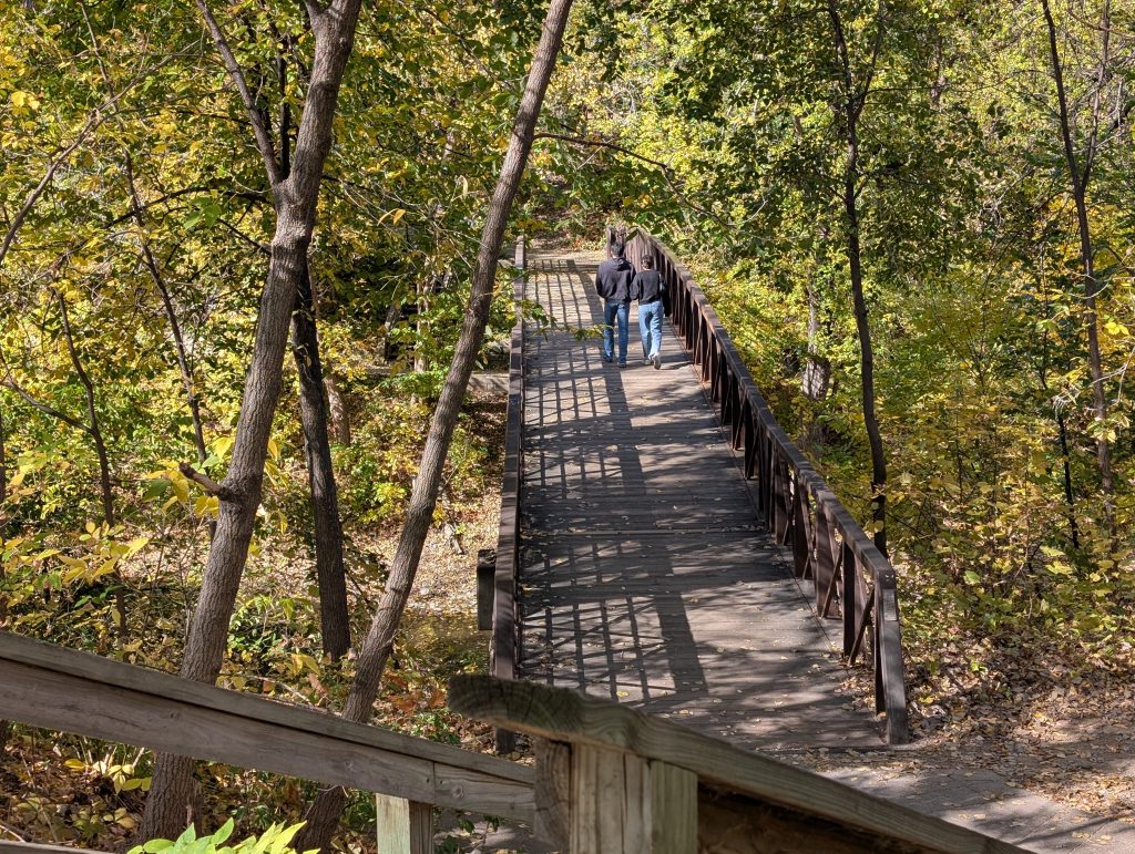
Plymouth Avenue is a main point of connection between North Minneapolis, the North Loop, and Northeast Minneapolis. For me, it was the connection to the lovely pedestrian path that leads alongside West River Parkway, back to Hennepin Avenue and my bus home.
All photos by Max Hailperin