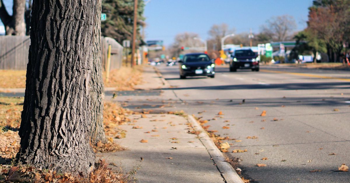
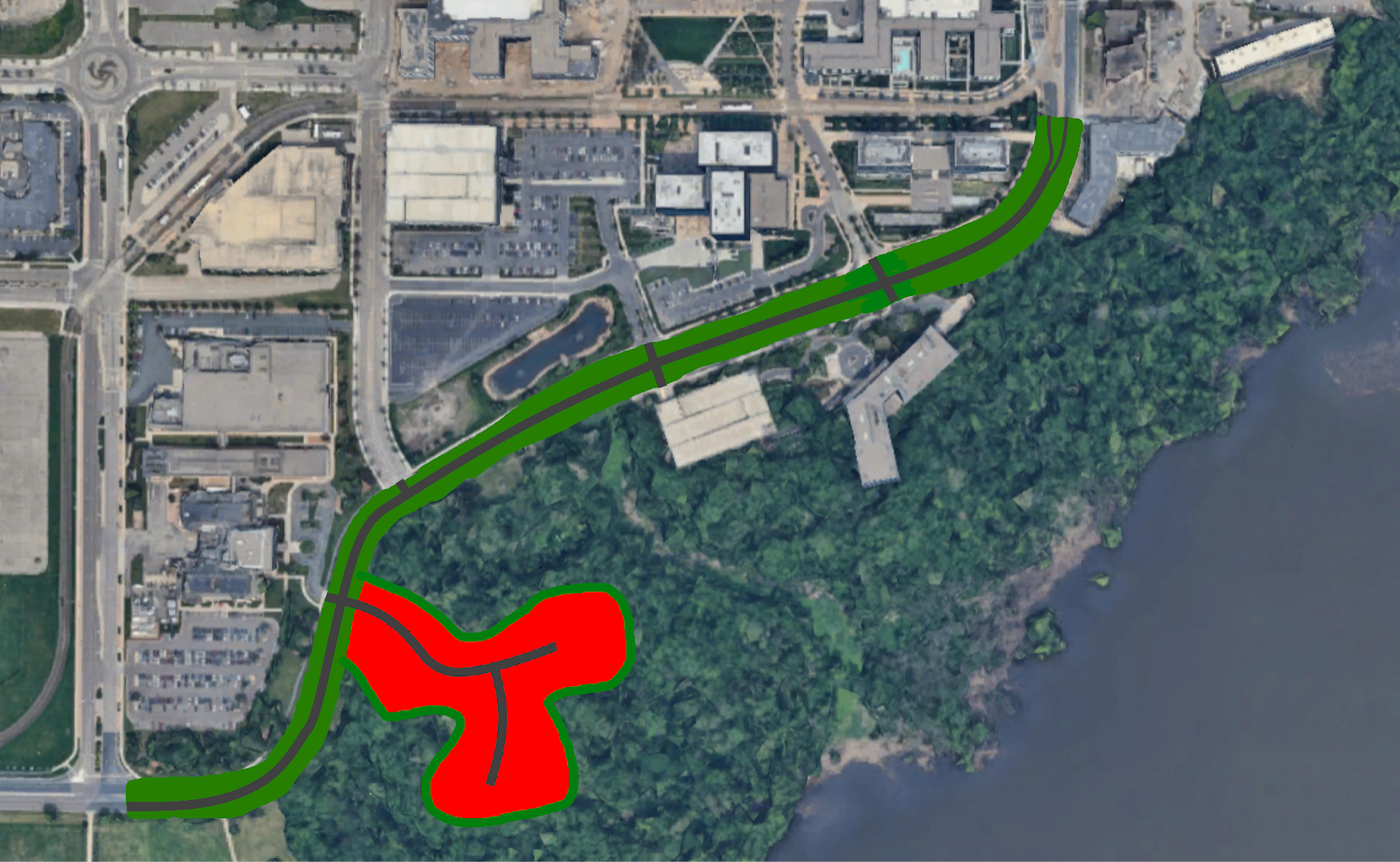
A few years back, before I got into urban planning, I recall a bike ride that took me near the Mall of America in Bloomington’s South Loop neighborhood, just south of the airport. The ride took me along Old Shakopee Road between American Boulevard and 24th Avenue on the sidewalks in the area. Even at the time, on a bike, I thought to myself, “My goodness this is very wide and feels dangerous to cross.” Anyone who’s been there on foot would agree.
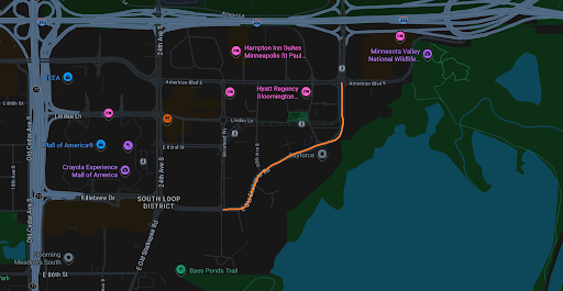
After getting more into urban planning, I came to see that there is extensive infill development happening, thanks to light rail access and otherwise scenic views. It certainly does seem strange to have such a large road more or less cutting much of the neighborhood off from the river valley. Later, I became curious about how much traffic Old Shakopee Road sees on this stretch. Given the proximity to the airport, mall, and other large businesses, one would think that the traffic levels are very high and warrant such a road.
To set the stage, let’s review the Federal Guidelines for lane dieting. Typically, if a road sees less than 25,000 average annual daily traffic (AADT), then you can diet a road down to two lanes (one each direction) and there’s little to no issue that dieting would pose.
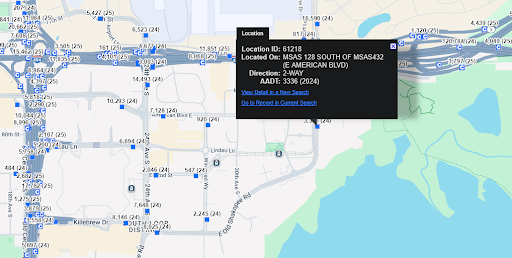
So what is the actual traffic on this stretch? 25,000? Maybe even higher, given the airport proximity?
Try fewer than 4,000 vehicles per day, according to MnDOT, when measured just south of the American Boulevard intersection.
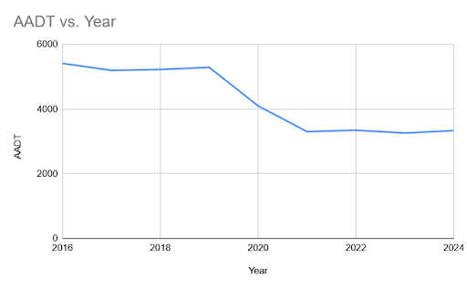
That’s right. A seven-lane urban road sees fewer than 4,000 vehicles per day on average. Even the long-term data shows that traffic has been on the decline for some time, peaking in 2019.
With so much infill potential in the neighborhood, one has to ask why such a road is there. It certainly doesn’t need to be so overbuilt for such a small, declining traffic volume. I would imagine the residents would very much enjoy a narrowed road for less noise, safer crossing, and easier transit access for the American Boulevard Station on the Blue Line.
Certainly a two-lane, proper street with narrowed crossings would be welcomed by local residents, who are very likely to increase in number as the years go on. It would make the neighborhood more pleasant and easier to get around and enjoy the area on foot or bike.
How about an even more daring proposal: Remove this stretch of the road completely.
Ambitious, yes, but if Bloomington is looking to make the neighborhood more livable and walkable, with lots of room for growth, getting the road out of the way would open up massive land tracts that otherwise are overbuilt for cars that are no longer present in such volumes. This would actually not present large problems for the businesses in the area, since only one building directly connects to this stretch of the road; the remainder already connect to side streets.
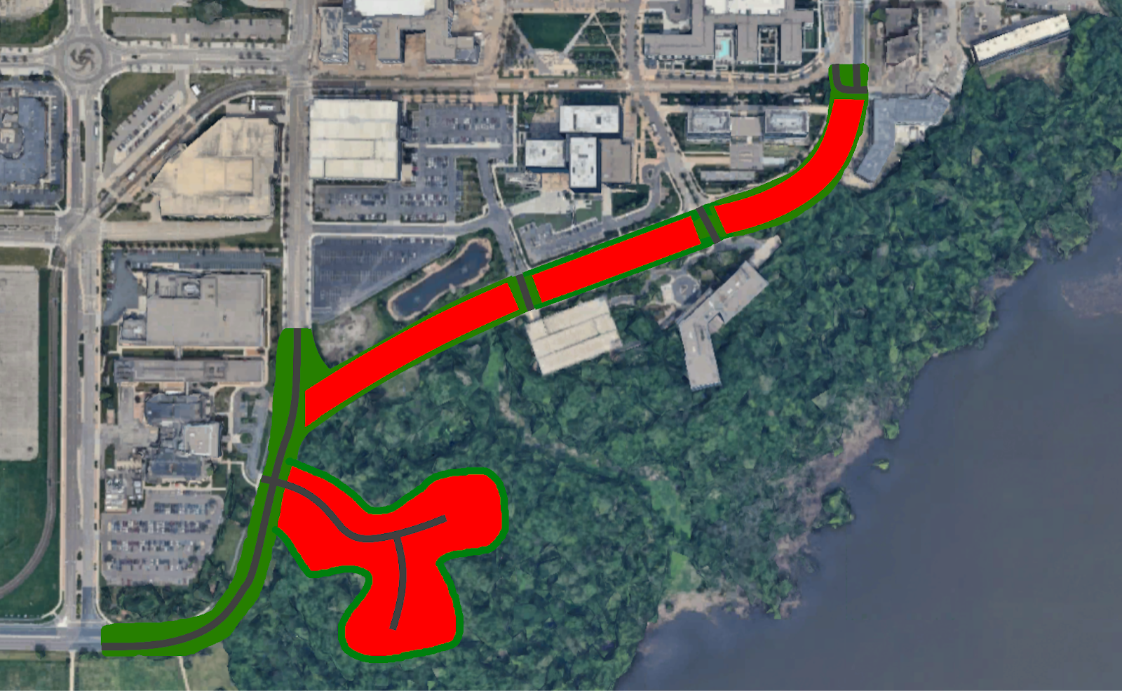
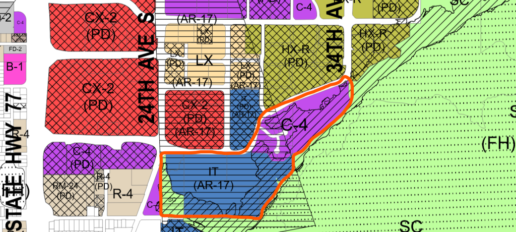
It is worth noting that the land opposite Old Shakopee Road and the open farm land to the south are currently zoned for non-residential purposes and would have to be rezoned. Also, the land largely falls under the existing runway corridor for MSP Airport, and thus height restrictions would apply.
This would certainly be a bold project in this day, but if Bloomington is looking to develop a neighborhood that is walkable and highly desirable in the long term, then they should assess and rebuild infrastructure that serves cars that are not there and rebuild it for the people that now live in the South Loop Neighborhood.