
Rondo, Downtown, West Side (West Side Flats)
July 19, 2014
29 Miles
Traces of history are all around us. Finding them can be a matter of unintentionally stumbling upon something or by consciously searching out plaques or markers. One can also be in the right place when a significant event occurs. The most deliberate and methodical approach is through researching a specific incident, place or time and visiting. Today’s ride featured examples of all these.
My first stop of the day, Central Avenue and Chatsworth Street, is the same intersection I visited on July 4th. Today, I came to experience a bit of the annual Rondo Days parade, which snakes its way east to the Rondo Education Center off Dale Street. Rondo Days celebrates the old Rondo neighborhood.

One of the many floats, this one representing Saint Paul Public Schools.

Rondo Days participants come from beyond Saint Paul. The Kappa Alpha Psi fraternity of Indianapolis, Indiana.

Vehicles of many eras are popular in the Rondo Days parade.

A Saint Paul Fire Department Rig.

An energetic drill team shows off some fine moves.

And a nice sized crowd watched it all go by.
From Central and Chatsworth, I rode south, back over I-94 via the Chatsworth Avenue bike bridge and then west a couple of blocks to Oxford Community Center, officially at 270 North Lexington Parkway.

The Oxford Community Center sign fronts Lexington Avenue.
Oxford Community Center consists of Great River Water Park and Jimmy Lee Recreation Center, which is more than a building. Great River Water Park was known as Oxford Community Pool until a 2009 remodeling and expansion. Back then, the neighboring rec center and adjacent softball fields were named Jimmy Lee Rec Center and Fields, respectively.
Jimmy Lee moved to Saint Paul in the early 1920s and before long, became a part of the Rondo neighborhood. He worked at the Hallie Q. Brown Center and was an avid baseball player. Lee got a chance to umpire softball games for the City of Saint Paul and later, added officiating at basketball and baseball games. Lee was the first African American to ump a Big Ten baseball game and eventually was inducted into the Minnesota High School Football Coaches Hall of Fame. (1)

The main entrance to Oxford Community Center is on Iglehart Avenue, on the east side of the building.
In 2013 the softball fields were converted to a wonderful modern football/soccer/softball complex with accouterments such as artificial turf, a scoreboard and bleachers. Stacey Robinson was honored posthumously when the facility was rededicated in his name.

A scoreboard and mural welcome all to Stacy Robinson Field, part of Oxford Community Center.

Stacy Robinson Field is set up for football and soccer.

The Stacy Robinson Field turf. In the background you can see part of the Oxford Community Center.
Stacy Robinson won two Super Bowls as a wide receiver for the New York Giants. Robinson played ball on the Jimmy Lee fields and graduated from Saint Paul Central High School. He was another of the elite athletes born in Saint Paul, in the same company as Dave and Steve Winfield, Jack Morris and Paul Molitor. Robinson was an executive with the NFL Players Association after retiring from playing. He died of multiple melanoma , a type of blood cancer, in May 2012.

The Oxford Rec Center playground.
This building, now the Natural Sound Studios, opened as the Selby theater in 1912. It was Saint Paul’s first theater designed exclusively for movies (2) and sits at 989 Selby.

Budding movie house mogul Ted Mann bought the Selby in 1936 and changed the name to the Oxford (2). By the mid-50s, the Oxford closed, like many other neighborhood theaters. The history of the old Oxford is fuzzy until sometime in the 1980s when it became a church. Around 2000, the building was purchased and converted to a recording studio.

The logo on the door of the Chatsworth Crossing Apartments is a reminder of the streetcars that traversed Selby Avenue until the mid-1950s. Chatsworth Crossing is one building east of Natural Sound Studios.

The Chatsworth Crossing Apartments occupy the second floor of this building. Businesses, including Northwest Architectural Salvage, are on the first floor.
The West Side Flats (south of Downtown)
All of Saint Paul’s West Side, including the West Side Flats, were part of Dakota County at one time. That changed in 1874 when the West Side was annexed from West Saint Paul by the City of Saint Paul, and at the same time became part of Ramsey County. (4)

Just south of the Mississippi River and across from Downtown is a large piece of undeveloped land. This is looking north-northwest.

The view of another portion of the land

An aerial look at American Hoist and Derrick in 1963. Courtesy Minnesota Historical Society
It’s almost impossible to believe from the way it looks now, but for a century this area hummed with the industrial activity of American Hoist and Derrick. American, or “The Hoist”, as the company was sometimes called, built heavy equipment primarily for the construction and mining industries.

When this photo was taken in 1882, the company name was a few years from being changed to American Hoist and Derrick. Photo courtesy Minnesota Historical Society.
The story of American Hoist and Derrick is all too familiar to Saint Paul-a manufacturing giant for decades, with thousands of good paying jobs, gradually succumbs to the changing economics that lured those jobs, and eventually the company itself, to the southern US. North Carolina to be exact, in 1985.

Construction of an American Hoist and Derrick plant circa 1895.
Photo courtesy Minnesota Historical Society.

American Hoist and Derrick workers posed for this picture in 1899. Photo courtesy Minnesota Historical Society
Oliver T. Crosby and Frank J. Johnson started American’s predecessor, the Franklin Manufacturing Company, in 1882 to maintain and repair logging and iron ore mining equipment, (5) Ten years and two name changes later, the company bore the American Hoist and Derrick moniker. The Panama Canal and Mount Rushmore are two well-known projects that used American Hoist equipment.
I biked along several roads that crisscrossed much of the former American Hoist and Derrick land and I saw no telltale signs of the one-time industrial giant. No dilapidated buildings, no rusting equipment pieces hidden in the scrub-covered earth.

Much of this open space is waiting for a developer.

The U.S. Bank West Side Flats Operations Center at 60 Livingston Avenue.
Still, not all of the old factory site sits idle and covered in weeds. The U.S. Bank West Side Flats Operations Center and parking ramp occupy some property between Robert Street and Livingston Avenue.

St. Paul Union Pacific Vertical-lift Rail Bridge. That’s a mouth full.
The vertical-lift Rail Bridge, while not built for American Hoist, has bisected the former company’s land since being put up for the Chicago Great Western Railroad in 1913. Now called the St. Paul Union Pacific Vertical-lift Rail Bridge, it handles about 10 freight trains each day. The neighboring Robert Street Bridge, constructed in 1926, had to be carefully designed and built over and around the vertical-lift bridge.


Looking west along the riverwalk, which travels through Harriet Island and into Lilydale Park. (The Robert Street Bridge is in the background.) The riverwalk is nicely landscaped, well-lit and has many benches to rest or watch the river roll on by.
One very nice improvement to the acreage is a riverwalk (and boat docks) along the southern bank of the Mississippi.

If you’re a train-lover, this is a great spot to watch because you can get very close to passing freights.

This is the line that passes over the St. Paul Union Pacific Vertical–lift bridge.

Flooding in the spring left tree branches and other debris in the wood fence that separates the Mississippi navigational waterway from another channel.
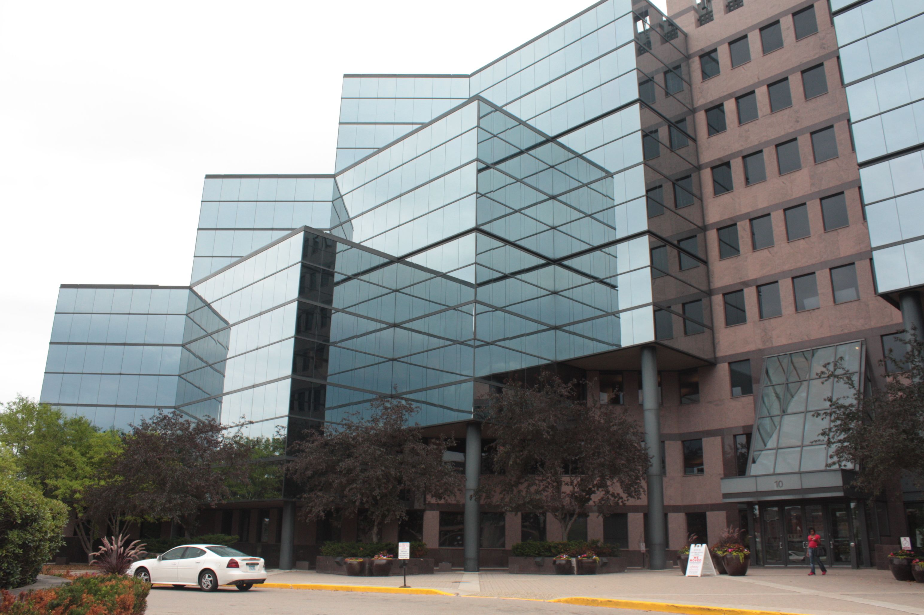
Comcast’s regional headquarters are the major tenant in this building.
There is a large area east of Robert Street, between the river and Plato Boulevard, that is nearly all industrial. The River Park Plaza building, just east of Robert Street, is one of the few non-industrial tenants on the West Side Flats. It’s likely you’ve never traveled to this corner of the West Side unless you’ve visited either Comcast or the Saint Paul Downtown Airport, Holman Field. The Saint Paul Pioneer Press newspaper owns a couple of facilities in the area that I visited on the ride. I am unable to determine exactly what the Twin Cities Newspaper Service at 220 Fillmore Street does or did.

The odd spacing between the words “Saint Paul” and “Pioneer Press” undoubtedly once was occupied by the name of the afternoon newspaper, the Dispatch, which ceased publication in 1985.

Behind the building about a dozen delivery trucks sat, presumably awaiting the next load.
Some of the heavy industry located in the area is a metal casting company and a barge maintenance corporation.

Pier Foundry does metal casting for many industries. According to the company website, the factory remains in the same place as the original building which opened in 1889.
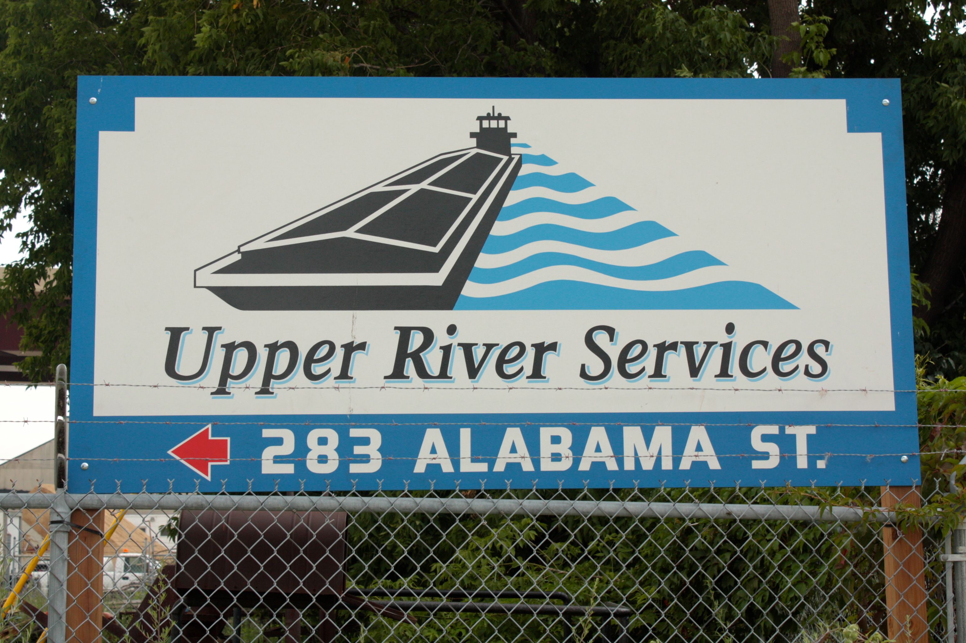
Upper River Services has two facilities in Saint Paul. This one handles the barge cleaning and repair and has a dry dock.

A quintessential American Hoist and Derrick 5299 crawler crane.
Coincidentally, less than half a mile from the former plant site, an American Hoist & Derrick model 5299 crawler crane in the company’s iconic yellow, black and white paint scheme is part of the construction of the new Lafayette Freeway bridge. In the background a freshly poured bridge supports is encased in a concrete form.

A view of the back of the model 5299.
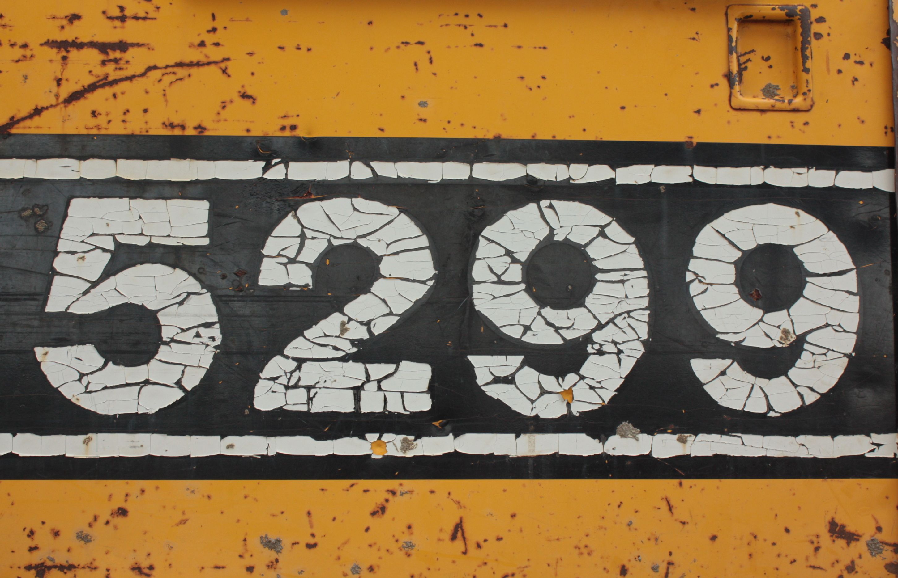
This American crane is between 30 and 50 years old, and is still mechanically sound, despite scratches, rust and peeling paint.

A block east at 50 Chester Street is a CHS (Cenex-Harvest States) crop nutrients warehouse which handles bulk fertilizer and phosphates. The building doesn’t look like much from this direction but the 1944 section to the east is rife with photo ops.

This part of the CHS warehouse is visually appealing because of all the textures, angles and shapes.

It’s an all-you-can-eat buffet for birds in front of the CHS building where grain has spilled from railroad cars.
The industrial nature of the West Side Flats is due to the nearly annual spring deluge of water from the Mississippi River. Because of the propensity to flood, as early as the 1850s, the Flats became the place in Saint Paul where the newest immigrants settled. First the French, and then the Italians and Irish moved here. Next it was Eastern European Jews in the 1880s. As they moved on, Mexican and other immigrants from Latin America moved in. Members of each group formed strong bonds within its respective group despite, or perhaps because of the poverty in which they lived.

The West Side Flats overrun by water in the 1916 flood. Courtesy Minnesota Historical Society
Many years the floods were an inconvenience, but occasionally they devastated the West Side Flats. The ruinous flood of the spring of 1952 convinced City officials to permanently relocate residents from the Flats. More than 2,600 residents of the Flats and the Upper Levee neighborhoods were evacuated. Amphibious military vehicles trudged to homes, rescuing not only people, but chickens, dogs, cows, and furniture that was stored in a downtown warehouse.(7)

A family is rescued from the flooding in April 1952.

The Mississippi River is in the foreground and the Flats just beyond in this picture taken from the First National Bank Building Downtown. Minnesota Historical Society.
It wasn’t until the end of the decade that the City began clearing the Flats of homes and it took nearly 10 years to complete the work of obliterating the West Side Flats into the Riverview Industrial Park.
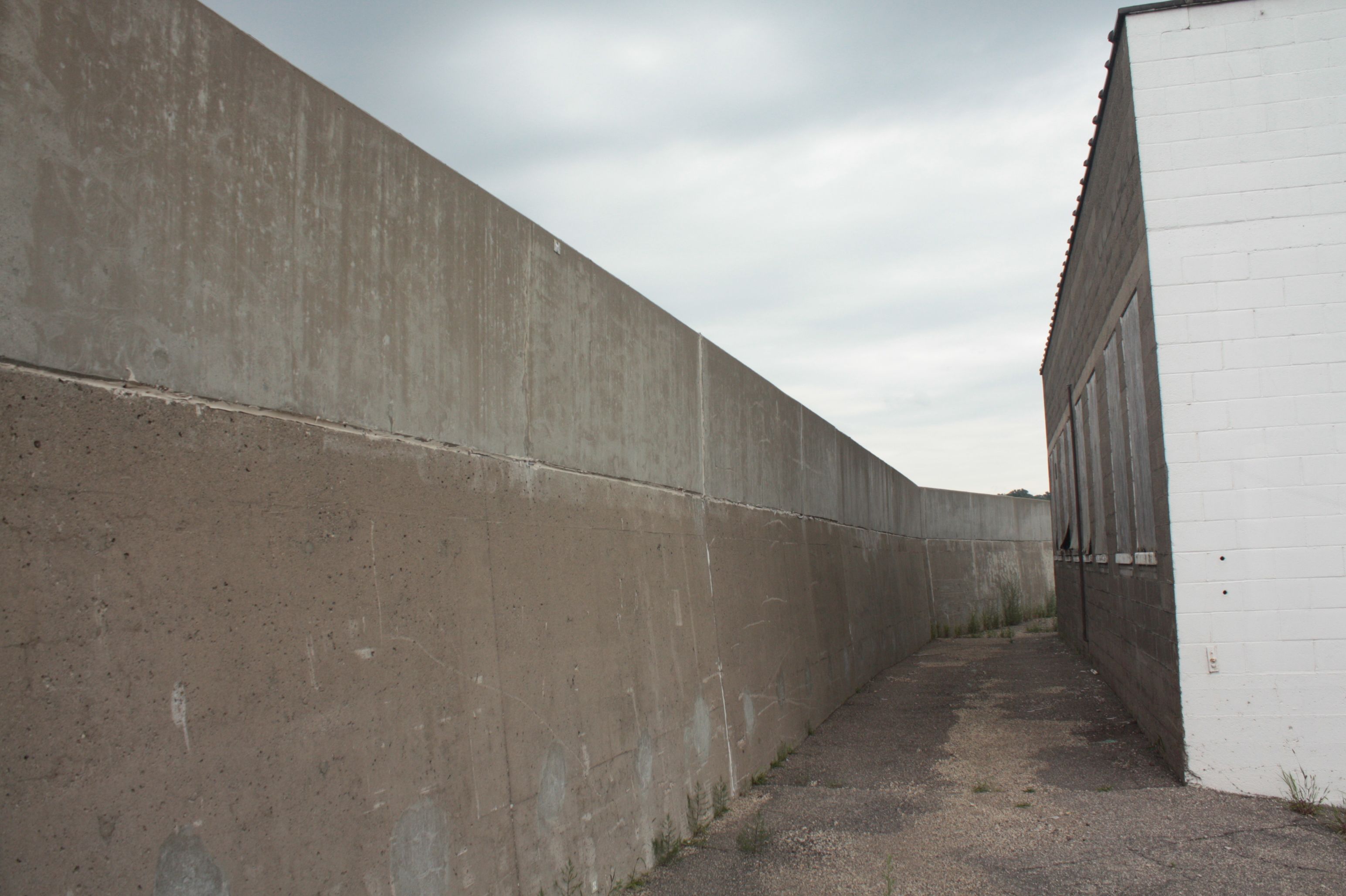
This concrete levee is one way the City, with the help of the Army Corps of Engineers, designed flood protection. The section is behind the CHS plant.

Here the concrete levee gives way to an earthen berm, also built to hold back the waters of the Mississippi.
Alabama Street turns to gravel here and ceases to be an official road, according to several maps. Road or not, it serves as a holding area for old railroad ties.

Discarded railroad ties are piled high along the gravel-covered extension of Alabama Street.

The main entrance to the now quiet Pioneer Press printing plant.
This is the other Pioneer Press facility on the West Side. It was the newspaper’s printing plant until February 2014 when the Pioneer Press turned production over to the Minneapolis StarTribune. At the time of this writing, the building at 1 Ridder Court (named after long-time PP publisher Bernard Ridder) remains for sale. Price $3.4 million.)

Perhaps a sign of the health of the Pioneer Press? Dozens of discarded paper boxes line the parking lot behind the former Pioneer Press printing plant.

Although only a mile away, Downtown looks farther away than that.
Remnants of the newspaper’s printing presses sat in a large, vibrant, gooey heap just outside the building. Ignoring the ecological questions this raises, the ink-slathered hoses created exotic designs which kept my camera and me busy for more than 15 minutes.
I got back on my bike and noticed to my displeasure that I came away with a magenta souvenir. The bottoms and a bit of the sides of both shoes, my bike pedals and some of the frame were coated to one degree or another with magenta printer ink. I learned quickly it is not water-based.
I rode to the east a short distance and headed onto Saint Paul Downtown Airport property, more commonly known as Holman Field.

Getting close to Holman Field on Bayfield Street, which becomes a private road just past the railroad tracks.

The berm through the middle of the picture is part of the flood protection for Holman Field.

Holman Field is busier than you’d think than this list of tenants would lead you to believe. There are more than 69,000 take offs and landings each year according Metropolitan Airports Commission figures.
Most people give Holman Field barely a thought, if that. Yet, the assemblage of history here surprised me.

The north-south runway is in the foreground and the control tower and private hangers can be seen in the background.
The City of Saint Paul opened the Saint Paul Municipal Airport in 1926 with a single grass runway.
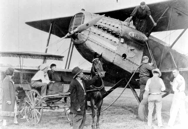
A family rode its horse-drawn buggy to visit the Saint Paul Airfield. This occurred when the airfield was relatively new as the runway still hadn’t been paved. Minnesota Historical Society

WPA workers take a break during construction at Holman Field about 1940. This is likely part of the filling in of Lamprey Lake to create more space for the airport.
Two asphalt runways replaced the grass landing strip in 1928, only two years later.

Works Progress Administration participants pave a runway about 1940. Minnesota Historical Society
In 1930, Northwest Airways (later Northwest Airlines) built a hanger at Saint Paul Municipal and moved its operations there, where it remained for the next 30 years.

Part of the Northwest Airlines fleet of Lockheed Electras sit on the tarmac in 1935. Minnesota Historical Society

Holman Field is named in honor of Charles W. “Speed” Holman, famed pilot who died when his plane crashed during an Omaha, NE airshow in 1931. Holman, a Bloomington native, flew air mail planes for Northwest Airlines and worked as the airline’s operations manager. Holman is standing in front of his mail plane about 1930. Minnesota Historical Society

The limestone airport building is another of the many structures in Saint Paul designed by Clarence “Cap” Wiggington and built as a WPA project. It opened in 1939.
In response to a critical need for indoor workspace to shield planes and workers from the weather, two new hangers, dubbed “Riverside,” were built on the eastern edge of Holman Field property.

During World War II, Northwest employed as many as 5,000 people at Holman Field, where they modified B-24 Liberator bombers for photographic reconnaissance. (8)

The Riverside hangers today as seen from the south, east and north.

Up close, the steep pitch of the Riverside roof is evident.

Today 3M uses one of the former Riverside Hangers.
The City of Saint Paul still owns the largest parcel of airport land, about 383 acres of 576 total. Although commercial airlines no longer serve Holman Field, it has an airport code-‘STP.’ That code is the three letter designation that represents the name of airports on tickets and baggage.

The airport had an operational seaplane harbor from 1922 to 1997.

Today, there are recreated access stairs to what was the seaplane loading dock. This is part of the 2009 flood diversion project.
Prior to the construction of this floodwall, the airport was forced to cease operations for days or weeks almost yearly. Years with heavy flooding left Holman Field closed for upwards of 80 days, a huge impediment to customers and the National Guard company stationed here.

The floodwall constructed in 2009 is an effort by the Metropolitan Airports Commission to minimize the time Holman Field is closed by flooding. The metal sections are temporary, put up only when there is a good chance of flooding.
Further south along Bayfield Street is a memorial to “Speed” Holman.

This serene spot at the southeast corner of the airport carries the dispassionate name of the Holman Airfield Floodwall Overlook. One can bike, drive or hike to this pleasant setting to watch planes take off and land, barges float by and birds flutter past. It is a great, but little-known spot that offers relative quiet and solitude.
The last stop on this ride was the Brown and Bigelow plant at 345 Plato Boulevard East.

Brown and Bigelow is a national distributor of promotional products, according to the company website.
Brown and Bigelow is best known for the calendars it’s published for nearly 100 years. In 1925, the company started printing calendars for the Boy Scouts of America. The illustrator of many was Norman Rockwell. Today some of the best known and most valuable are the “Dogs Playing Poker”, Norman Rockwell Boy Scout and pinup calendars. Playing cards and greeting cards are other products that have been made by Brown and Bigelow.
Brown and Bigelow’s continues to print calendars under the HotLine Products banner today but Its main business is distribution and sales of promotional products.
A couple of final thoughts about today’s ride, the link to the route map and footnotes:
- History happens everywhere but Rondo and the West Side Flats have experienced more important and disruptive events than most.
- The details of the days gone by at the Saint Paul Downtown Airfield/Holman Field touch upon the prescient days of flight beyond Minnesota.
- The riverwalk just south of the Mississippi and the Holman Airfield Floodwall Overlook are worthy of more time.
http://www.mapmyride.com/workout/868485633
Footnotes
-
Twin Cities Daily Planet website; February 20, 2013 by Charles Hallman Originally published in the Minnesota Spokesman-Recorder
-
“Tour Saint Paul Selby Avenue” by Historic Saint Paul
-
“Twin Cities Picture Show: A Century of Moviegoing,” By Dave Kenney
-
National Park Service National River and Recreation website http://www.nps.gov/miss/planyourvisit/kapoindi.htm
-
Ramsey County Historical Society
-
AOL Crane History; http://www.aolcrane.com/cranehistory.html
-
National Park Service National River & Recreation Area Minnesota website
http://www.nps.gov/miss/historyculture/1952relieffo.htm -
Accentuating the Positive: The Role of Northwest Airline’s Modification Center in WW II by Johannes R. Allert