
Recently on Bluesky, someone said it would be a good idea to create a “snapshot in time” of the neighborhoods destroyed by I-94, using census records, old phone directories and the Sanborn fire maps. As many Twin Cities readers know, Rondo has done much of this research for their community. Merriam Park’s lost business district has been documented here on Streets.mn as well.
One area that has not been documented is the area of South St. Anthony Park leveled to create Highway 280, which was built to connect I-94 to I-35W and Highway 36.
Highway 280 was authorized in 1949, before the interstate system was created. It was intended to “enable truck drivers to move into truck terminals in the Midway area without traveling through present traffic-congested streets” (June 1954, Minneapolis Star). However, by the time 280’s construction was well underway in the mid-1950s, the interstates were being planned.
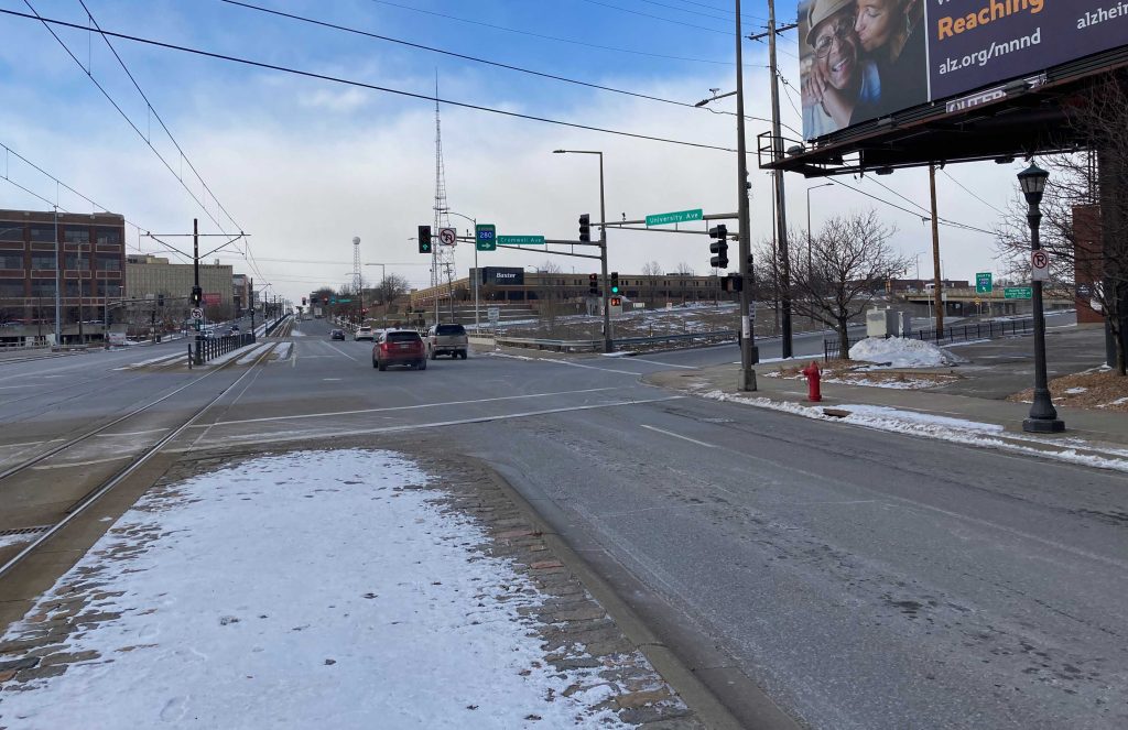
A November 1957 Minneapolis Star article said it would “knife” through the area, and that’s how it feels here in the neighborhood. It disconnects us. Almost no one realizes the area west of Highway 280 is part of St. Paul, let alone St. Anthony Park — that the highway is not the boundary between the cities.
The north part of 280 — north of the rail yards that divide North and South St. Anthony Park — opened in the late 1950s, connecting then to Highway 36, before I-35W opened. That north portion was built on land that was essentially undeveloped. I’m not totally sure why the land was undeveloped, but my guess is that it was a wetland, part of the Bridal Veil Creek watershed, which should have been protected but was instead turned into a highway.
The portion of South St. Anthony Park designated by the State Highway Department to become 280, on the other hand, had been densely developed. The two blocks on the north and south sides of University Avenue were mixed-use, with many businesses and some apartments. The four blocks north and south of there were a mix of single-family houses, duplexes and smaller apartment buildings, with a few commercial buildings mixed in.
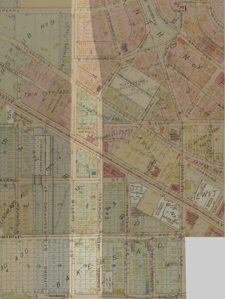
The highway alignment was designated between Eustis Street on the west and Cromwell Avenue on the east. Every building along those streets and on all the cross streets between them — Pearl, Bayless Place (previously called Cudworth), University, Franklin, Myrtle — would have to be removed.
What Was South St. Anthony Park?
South St. Anthony Park was built to be a place where working class people could live close enough to walk to their jobs or take the streetcar along University Avenue. By 1950, many people worked in the nearby factories, Waldorf Paper and International Harvester.
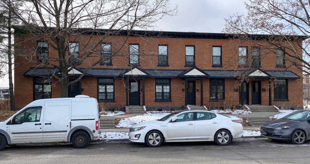
As today, there were swaths of the neighborhood filled with industrial buildings, but, in 1950, there were also large residential areas. Some of those areas still exist today, such as the area around Hampden Park. Another residential area contained the blocks south of University between Eustis and Pelham, with an additional two blocks on Curfew Street to the west.

Some of the homes that were torn down to make way for Highway 280, documented in the neighborhood booklet “Down Memory Lane,” belonged to or were rented by streetcar conductors and men who worked at Montgomery Wards or the Ford plant. One person mentioned in the booklet worked at both a theater and drugstore in the neighborhood. Another family operated a small grocery store.
Census records for 1950 show a total of 121 people living in the buildings north of University Avenue and 414 south of University. That’s 535 people who had to find new homes by the next census when they were being told to vacate to make room for the highway.
They lived in 94 houses (quite a number were duplexes) and 8 apartment buildings. Many were families with children, and many also had boarders or older relatives living with them.
The destruction also leveled one church and at least nine commercial buildings.
The highway blighted the neighborhood in ways that led to further destruction in the 1970s, when HUD removed 60-plus other houses. It was only through major neighborhood opposition that every house in the place wasn’t condemned in order to convert the whole area into industrial zoning. Houses near 280 were still being torn down into the 1980s.
What Was Destroyed?
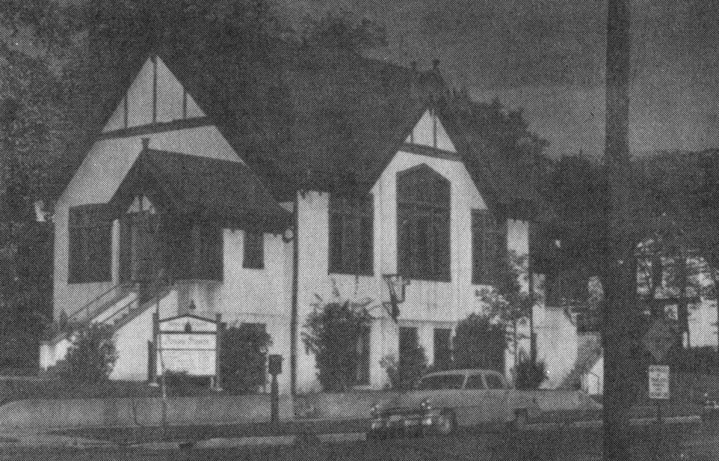
At the northwest corner of Territorial and Cromwell (where the northbound Territorial ramp is located today) was the Immanuel UCC church, as well as its parsonage a few doors over. The church was known for its beautiful stained-glass windows. According to neighborhood historian Kristin Anderson, the congregation was organized in summer 1913, and the building permit was pulled that November. She believes the congregation started because the original St. Anthony Park Congregational Church, located north on Raymond near the railroad tracks, was going to move north to Commonwealth and build a new church. By 1919, Immanuel had 225 members, she said. In 1948, it left the Congregational Church denomination and became an independent church.
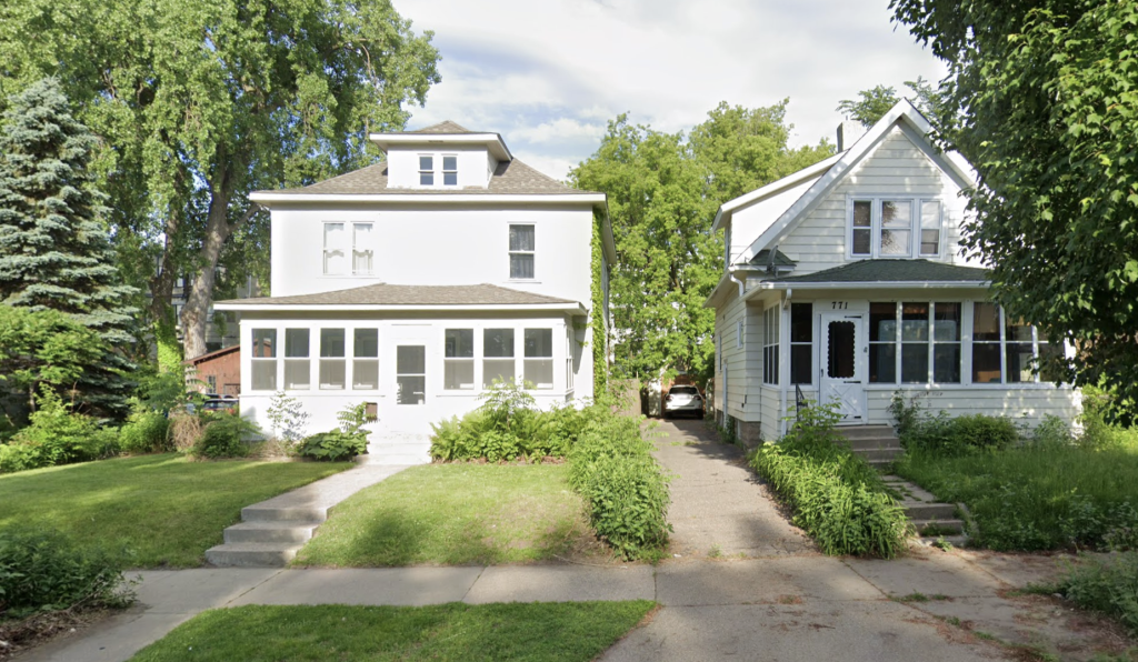
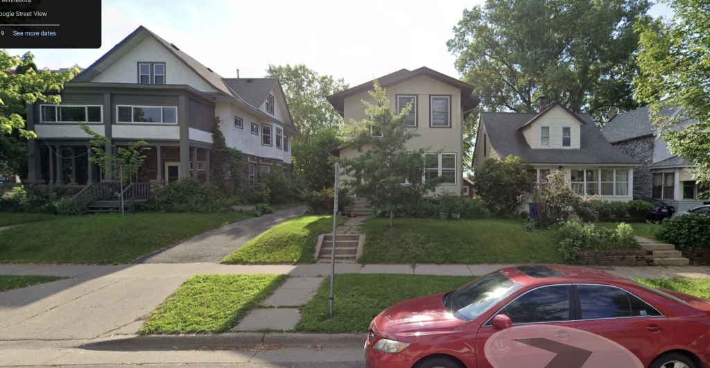
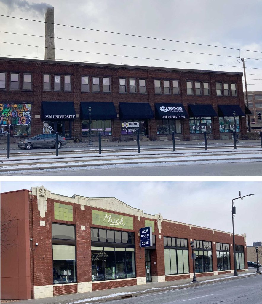
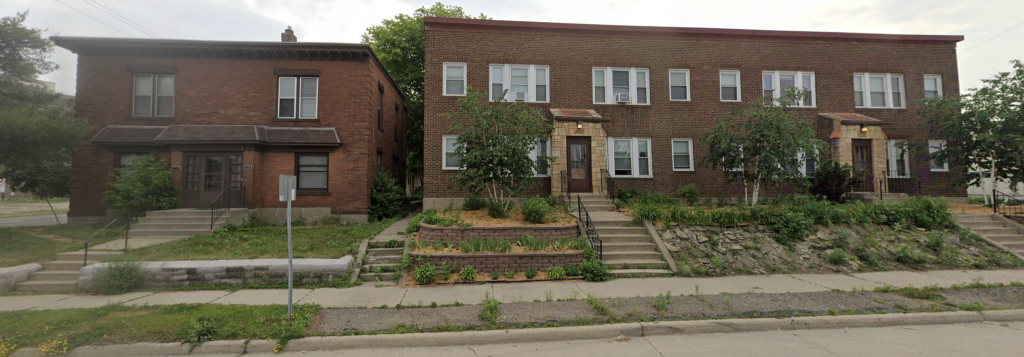
There are almost no photos of the eight commercial buildings that were leveled. Two surviving buildings that are immediately adjacent, however, are the Triangle Building and the Mack Building on the east side of Highway 280 at Cromwell, which give an idea of what the area looked like.
In 1950, there were at least 34 businesses in those commercial buildings: two restaurants, a labor local, several printers, and a number of food-related businesses, including Red Star Yeast on the south side of Franklin Avenue (where the current on-ramps to I-94 are located).
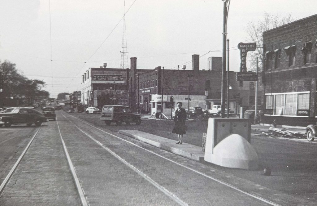
The other buildings beyond Eustis — the hulking U.S. Steel plant and the one in the foreground with the Macent Branca neon sign — were torn down years after Highway 280 was built. U.S. Steel was part of the Port Authority’s Westgate redevelopment project. The Macent Branca building, which had a storied history in the neighborhood as a theater and many other uses over the years, finally became the Cromwell Bar and was torn down in the 1990s. It’s now a parking lot with a huge billboard in it.
There was a 12-plex apartment building at the northwest corner of University and Eustis (just east of the U.S. Steel building), and a six-plex on west side of Eustis across from the Triangle Building.
Census research tells us who the residents were. They were working class people, many of them immigrants or children of immigrants, generally from northern Europe. Some had large families in small spaces. Many had boarders or extended family living with them.
Cromwell south of Myrtle is a good exemplar. It held a lot of built use diversity.
The Dial N‘ Dine (sic) restaurant was located on the southwest corner of Cromwell and Myrtle. There were three “Kurth” apartment buildings across the street and just north of that — one 8-plex and two 4-plexes. On the same block, there were also 16 houses (eight on either side of the street), some of which were duplexes. There were two printing businesses and a metal-stamper half a block north on the way to Franklin.
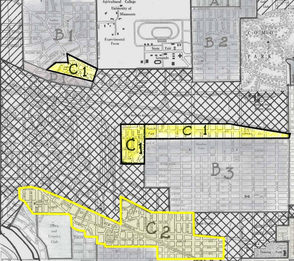
It’s notable that none of South St. Anthony Park’s residential areas were even acknowledged as existing in the city’s redlining maps — the whole area was marked industrial.
The closest area with a label, south of St. Anthony Avenue in Desnoyer Park, was labeled C2, so it seems likely that South St. Anthony Park’s housing would probably have been rated similar or worse, since it was older. C2 was described this way:
“a very old part of St. Paul ranging in age from 25 to 50 years. Rehabilitation and wrecking is necessary. Prices range from $2700 to $4500. The laboring class predominate here. The homes are one and a half and two story of frame and stucco, with frame predominating. The owner occupancy is about 45%. Rentals range from $20 to $40. The depreciation is 60% with a recovery very low, not to exceed 10%.”
The people who lived in the houses and apartments had varied occupations. There were a number of retired people and women who didn’t list an occupation (either as housewives, or keeping boarders), but there were also quite a number of working women.
Women worked in department store sales, machine operating, bookkeeping, stenography, credit-investigating, stock-checking, weaving and assembling, and as mechanics, newspaper reporter, telegraph operators, clerks, waitresses, nurses, teachers and long distance operators.
Men were most often machine operators, mechanics, printers, railroad workers, laborers or drivers (often of trucks), but other occupations included welder, St. Paul police detective, foreman, draftsman, painters, candymakers, grain shoveler, actuary, lab tech, civil engineer, carpenters, table pad cutter, lineman, shipping manager, office manager, accountant, dental tech, sales clerk, conductor, bricklayer and union vice president.
What Finally Happened?
It’s hard to tell what happened at what time to the people who lived in those six blocks of Cromwell, Eustis, and the streets between.
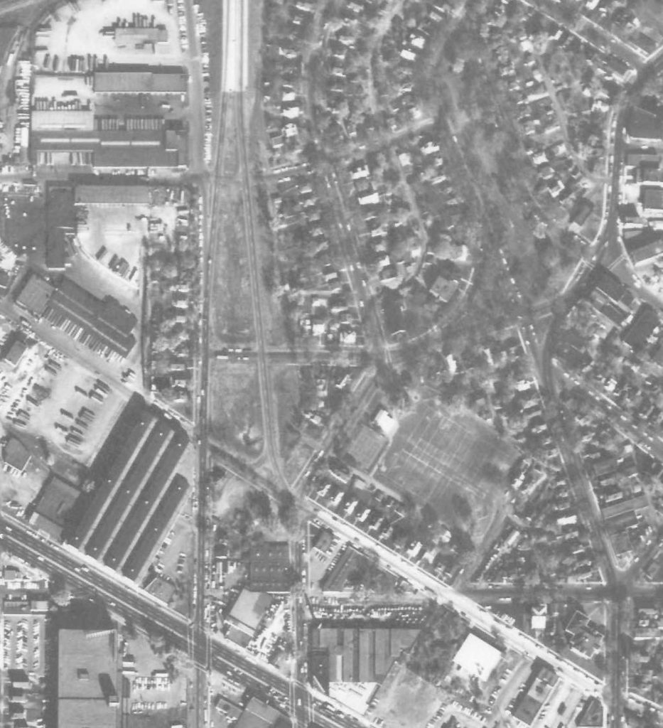
The south side of Territorial Road and north of there were cleared earlier — definitely by 1964 — as seen in this aerial photo. It shows Cromwell and Eustis north of Territorial had been turned essentially into ramps to and from the finished highway 280, visible to the north. The records of Immanuel Church show that they started to build a new building in Roseville in 1960, so that may be when all the occupants from Territorial north were being evicted.
All or most of the buildings south of Territorial still existed in 1964. It wasn’t long after that, though, when the South St. Anthony Park portion of Highway 280 opened, since it was connected to I-94 by 1968, after the interstate’s segment west of Snelling Avenue opened.
When the wrecking ball finally came for South St. Anthony Park, it probably happened fast. As far as I’ve been able to tell, no one wrote a word about it in the newspapers.