I’m relatively new to Minneapolis. I moved here in the summer of 2024 and didn’t get a chance to go to Art-A-Whirl until this year. Something I picked up on quickly as an urbanist nerd who regularly read Streets.mn in the leadup to moving here from Iowa is that Northeast Minneapolis has a cool vibe but it’s car dependent as hell. After visiting the area myself multiple times, what I’ve heard has sadly been confirmed. To travel the area safely and in a way that’s time-effective, it often feels like you have to drive.
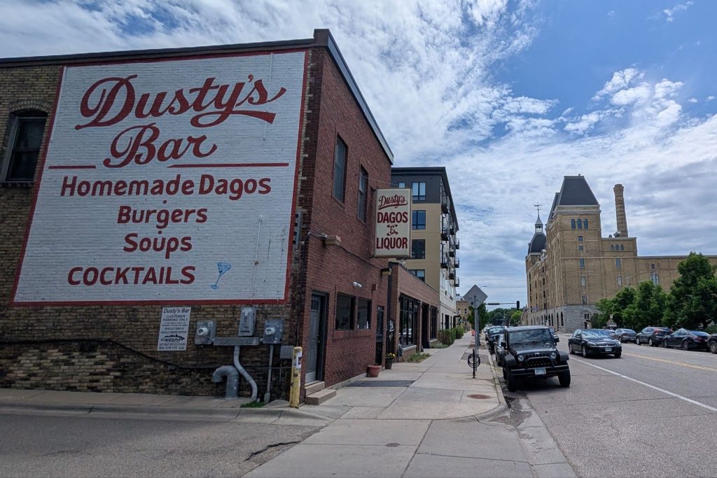
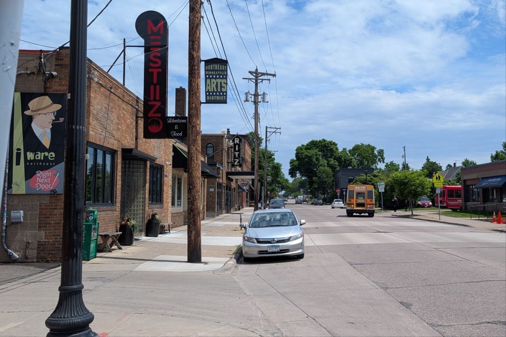
Northeast Minneapolis has an attractive urban form in a lot of areas, especially the Arts District where Art-A-Whirl is held. Old storefronts with their vintage signs, converted industrial buildings with their brick walls and the plethora of other historical buildings with a few modern buildings sprinkled in are a true vibe. I often say to friends that Northeast would be a lovely place to live if it weren’t so car dependent. The area deserves more love from street redesign to frequent transit.
Traveling To/At/From Art-A-Whirl
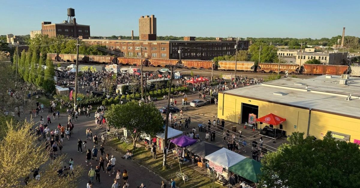
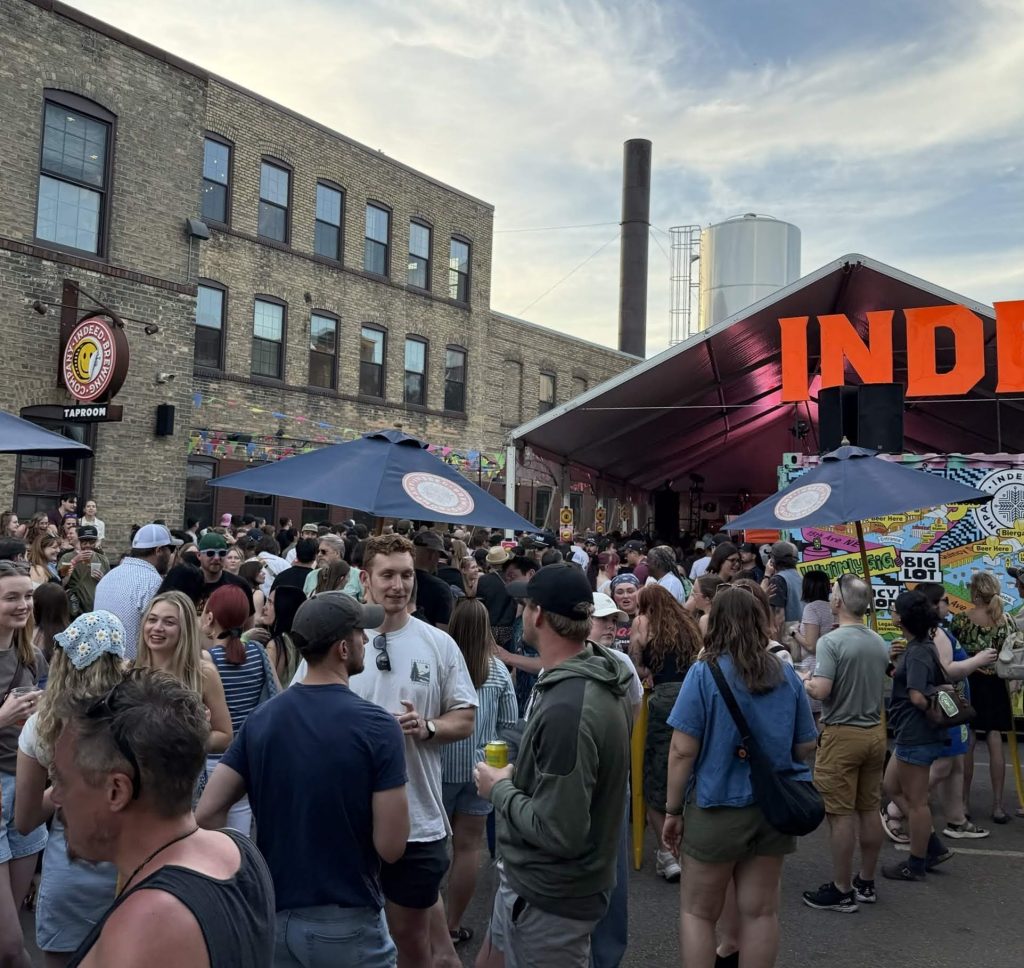
Art-A-Whirl is a beloved yearly arts festival with well-deserved hype. It brings together hundreds of local artists for the community to view their works and patronize their items up for sale. I biked there with a friend and it was a bit scary, to be honest. As I’ll dive into deeper later, Northeast has poor bike infrastructure. On the way there we had to battle deadlocked traffic, but thankfully the best part about biking is being able to maneuver around vehicles. We frequently had to share the road with cars and there were a couple points where I noticed there used to be an unprotected bike lane on the road but the paint had long been worn away. As a result, cars occupied more space in the lane than they should have; they were in a bike lane without knowing it. There were dangerous drivers here and there, likely fed up with traffic in an area they were trying to go through and didn’t choose a different route to go around the area instead. Broadway Street in particular was congested as the main arterial that went along the southern portion of the event area. I hope traffic control was paid well, as I saw multiple drivers ignore their directions (especially to stop) no matter how many times traffic control whistled.
There was also a small trolley bus system (not the overhead electrically powered kind I’m fond of, just the tourist buses with a trolley facade) that circulated the core area in a one-way loop (ugh!) with a scheduled frequency of 5-10 minutes. I expect the bus experienced a decent amount of delays, as it had to travel in traffic with no exclusive right-of-way. We considered taking transit, but there weren’t frequent or fast enough routes to take us to and from areas we wanted to visit even with the circulator trolley supporting the larger transit system. Biking is the best form of transportation in situations like this. If you timed a bike and car door-to-door from home to the event within 5 miles, I expect the bike would win almost every time due to parking and traffic congestion.
In a time crunch, my friend and I went to Quincy Street with its dense collection of artists and stands. Aside from some of the challenges getting there, biking was a pleasant experience. The views of downtown when crossing the Mississippi River are always awe-inspiring. There were SO many bike racks on Quincy Street and we immediately found spaces to lock up our bikes. Vehicle traffic from drivers attempting to park as close as possible with no concern for parking fees (one area I saw had a flat rate of $20) was at a standstill. Hundreds of people were walking nearby, blocking the entrances to the lots as a moving mass collectively headed north. Thankfully, I never saw anyone with road rage attempting to enter a parking lot. Instead, they waited in boredom for a gap in pedestrians as cars piled behind waiting for their turn (I think the drivers reached the acceptance stage of grief at that point). As we passed, my friend and I were thankful we don’t drive, especially to events. When I used to drive as my primary form of transportation in Iowa, I would get so stressed driving. Owning a vehicle is so expensive from maintenance to parking to insurance to the now spiking fuel costs — MEGA STRESS! After living car-free for two years, I can’t imagine going through the headache and hours of time lost navigating the hell of pre- and post-event parking again.
Walking around events like this feels great. Pedestrianized spaces with stands, art everywhere, bricks under your feet, and a mixture of architecture to house it all are the kinds of things we love. There’s a reason why Americans love visiting Disney World and Europe — getting a break from the car, both in sight and mind. You don’t have to worry much about two-ton metal boxes moving around as you’re trying to enjoy the plethora of sights and sounds. You can just enjoy the moment with an easier sense of mind rather than being hyper-aware of cars with their deafening noises and the unpleasant smell of exhaust. Let’s make more of these lovely pedestrianized spaces permanent, shall we?
After eating tasty food, enjoying lots of art, and buying more than we expected, my friend and I headed out. The way back was about the same: steering around cars and potholes and navigating the poor patchwork of bike infrastructure.
Navigating Northeast As A Bicycle User
Northeast is spread out, which makes me inclined to bike around. There’s multiple places I love and would love to visit in the area. I hate driving and I don’t want to spend a lot of time walking the long distances required if I take transit. However, there are wide streets and stroads with fast-moving traffic throughout the region with little bike infrastructure. What does exist is poorly maintained: the pavement is riddled with potholes on streets and paths, lane markings for unprotected bike lanes (or the more common sharrows) are heavily faded, streets regularly have small debris like broken glass, wide streets encourage vehicles to speed and the patchwork of bike infrastructure is disconnected (looking at you, Missing Link). New trails that do exist are primarily along the Mississippi River as recreational trails, like the new Graco Park. This makes biking feel unsafe and challenging outside of recreational areas. Currently, if you want to go anywhere in Northeast at some point (more often than in many other parts of the city) you will be forced to share the road with cars, dismount, or bike on the sidewalk (try not to be that guy, but if it’s too dangerous on the street just don’t bike fast on the sidewalk).
I would give Northeast slack for being a former industrial hub — that’s why its roads are so wide — but the area has had years to improve its streets as uses for the area have evolved. For every project Southwest Minneapolis gets (and I am very grateful for them as a resident), it feels like Northeast just gets another delay on projects already in the pipeline. How many more years do we have to wait for the 140-year old Grand Rounds Missing Link to be filled?
There are few dedicated bike paths and most of the bike infrastructure in Northeast is unprotected. This makes it hard to navigate and it feels dangerous with how fast cars tend to go in the area. The safest I’ve felt cycling on the streets in Northeast was when traffic was deadlocked with cars trying to find parking during Art-A-Whirl because they weren’t really moving. The best you’ll get in a commercial corridor is an unprotected bike lane on Central Avenue. Kids can’t bike safely to school and adults can’t bike safely to commercial areas to shop.
Traveling in Northeast shouldn’t feel this dangerous by bike. There are lots of things that are attractive about the community and the lack of bike infrastructure and traffic calming measures make the area less accessible to people without cars.
Navigating Northeast As A Transit User
Since bike infrastructure is poor, I would lean towards using transit to get to Northeast, but there are issues there too. Existing transit options for the area are connected when you look at a map, but many routes are so infrequent that it makes trips and connections time-consuming. Northeast also has a lot of routes with dreaded split route service where routes have good frequency for the core of the route but outside of that frequencies are halved (think Route 17). This results in either high levels of bunching in the core service area to maintain high frequency or low service outside the core on the split route. Usually it’s the latter, and in Northeast’s case it’s the norm.
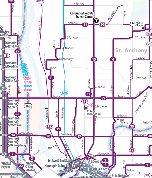
Credit: Metro Transit
Weekday peak periods have the following average headways: Route 30 (Broadway Street) 30 minutes, Route 32 (Lowry Avenue) 20 minutes, Routes 4B and 4P (Johnson Street) 30 minutes, Routes 17D and 17W (Washington Avenue) 15 minutes, Routes 11A and 11C (2nd Street NE) 15 minutes, and Route 10 (Central Avenue) 10 minutes. As you can see, transit in Northeast is in desperate need of frequency improvements. Outside of these peak times – particularly on weekends when most folks are free to visit the area – transit is infrequent. 30 minute headways are the norm aside from the 10 and 11 which maintain 10 and 15 minute headways, respectively. This means any connections off of Central or 2nd Street NE deeper into the community using the 30 or 32 could easily be missed due to the small connection time between them in areas with high levels of traffic congestion. All this adds up to decreased transit ridership and increased car dependence — it’s a nasty cycle.
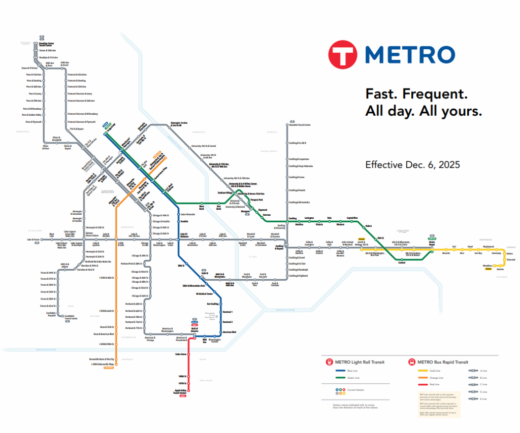
If we look at Metro Transit’s service map, you can see a noticeable hole in the Minneapolis portion of the METRO network. Every other quarter of the city has at least one rapid transit line, whether it be a type of BRT or Light Rail. Northeast only has the end of the E Line along its southern edge with nothing going into the heart of the community. Currently in the works is the METRO F Line, which will replace the 10 with a more reliable service. According to crowd-sourced data from Transit, the 10 has an on time performance rate of 70 percent. Construction is slated to take place in 2028. This is all good, but there needs to be broad scale improvements to better connect the area. What about connections to the A Line in the east and the C and D Lines across the Mississippi in the west? The Lowry arterial BRT candidate corridor would provide fantastic connection, but scored poorly in Metro Transit’s January 2026 Corridor Prioritization Memo. Lack of existing infrastructure was cited as a big concern, which just proves how crucial it is that Northeast receives more investments!
In Conclusion
Northeast is a wonderful part of the city, but it desperately needs upgrading. Infrastructure is years behind and transit feels neglected. You cross the river and it quickly feels like a different city from the conditions and dimensions of the streets. Traveling around Northeast without a car should feel safe and comfortable, not like a suburb hostile to all but car users.
Art-A-Whirl showcases Northeast’s astonishing lack of connectivity with the rest of the city. Once you leave old Main Street by the Stone Arch Bridge to travel into the core of the region, you find an area that prioritizes car users in almost every way. However, Art-A-Whirl also showcases what Northeast Minneapolis could be: an area with attractive, bustling pedestrianized spaces. With the support of a strong network of bike, transit and pedestrian infrastructure, Northeast could be unstoppable.