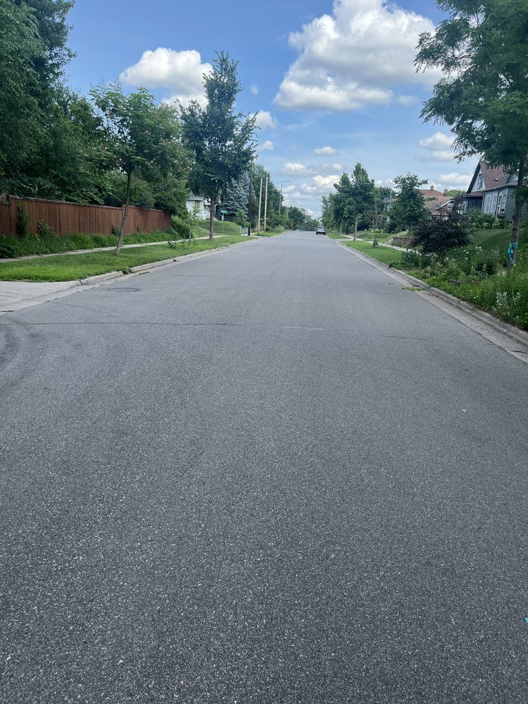
For years, Minneapolis has been winning accolades for its protected bikeway network, with new and upgraded routes popping up year after year. I see it in construction crews retrofitting and reconstructing our streets. I feel it when I glide down Bryant Avenue with my kids en route to summer camp, pedal up Dunwoody Boulevard to play ball at Harrison Park, or traverse University Avenue to catch a game at the U. And, of course, I read about it right here at Streets.MN, as with Conrad Zbikowski’s recent feature of how the City of Lakes is continually extending its All Ages and Abilities (AAA) Bicycle Network.
Minneapolis’s Grand Rounds, Midtown Greenway, and overall system of protected bikeways rightly garner a lot of positive attention. But it’s also worth shining a light on another layer of our bike network: neighborhood greenways, the potential connective tissue passing through lower-traffic residential areas.
As the City’s Public Works department embarks on the 34th Street Neighborhood Greenway project this summer, Minneapolis has an opportunity to build an elite neighborhood bikeway. One that not only provides a key east-west link through South and Southwest Minneapolis, but also raises the national standard for how neighborhood greenways fit into a larger AAA bike network.
About the 34th Street Neighborhood Greenway
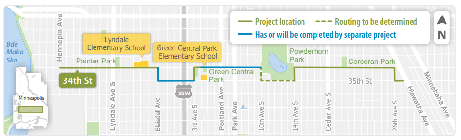
The 34th Street neighborhood greenway will run on an east-west route nearly four miles, between Hennepin Avenue and Hiawatha Avenue, intersecting numerous parks and schools — but it’s not a totally straight shot.
Since there’s currently no bridge over I-35W at 34th, the greenway will detour south for a block at Blaisdell Avenue and 3rd Avenue, as shown in the image below, crossing the freeway via a two-way bikeway that will be installed as part of the City’s separate reconstruction of 35th Street in 2027-28. There’s also a question about whether the greenway can be routed through or must pass around Powderhorn Park, as the dashed green line below shows. Finally, the greenway will make one last turn south at yet another state-owned highway barrier, going from 34th Street down to 35th Street at Hiawatha Avenue.
Neighborhood greenways are similar to bicycle boulevards, but with a twist. The City of Minneapolis’s Street Design Guide defines them as “low-stress All Ages and Abilities bicycling routes installed on low-volume Urban Neighborhood streets. Design treatments for neighborhood greenways are intended to manage motor vehicle volume and speed while optimizing travel for people walking, biking, and rolling.”
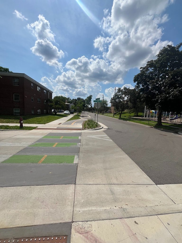
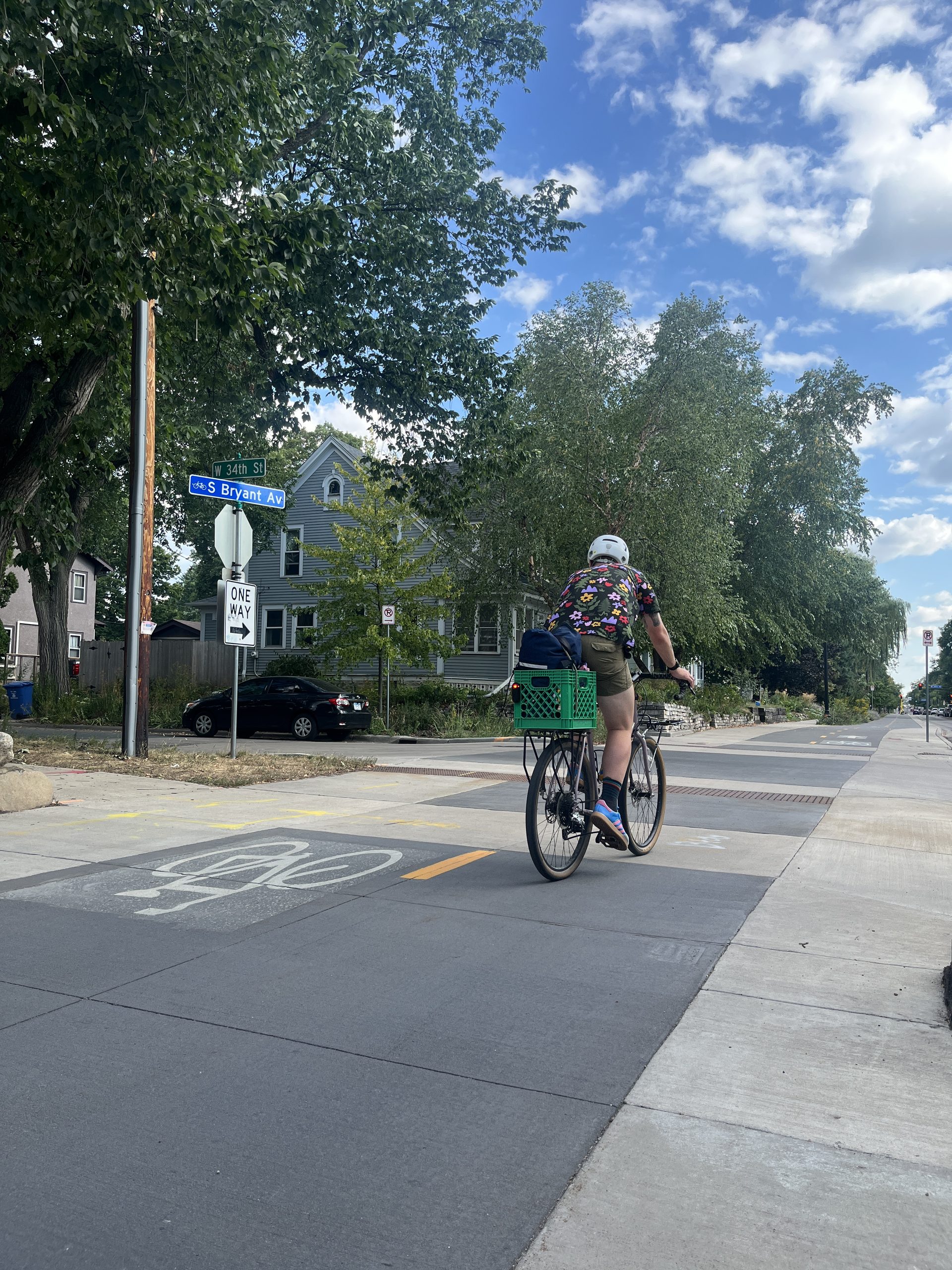
Minneapolis’s greenways can employ both “full greenway” or “bicycle boulevard” treatments — and a single project might vary between the two depending on the context of different street segments. A full greenway adds an on-street trail, most likely protected by a concrete curb, “while limiting or eliminating access to motor vehicles,” which could include green infrastructure or converting a street from two-way to one-way traffic. (One portion of 34th Street has already been completed, the section of on-street trail stretching from Green Central Dual Language Immersion School to Powderhorn Park, as seen below).
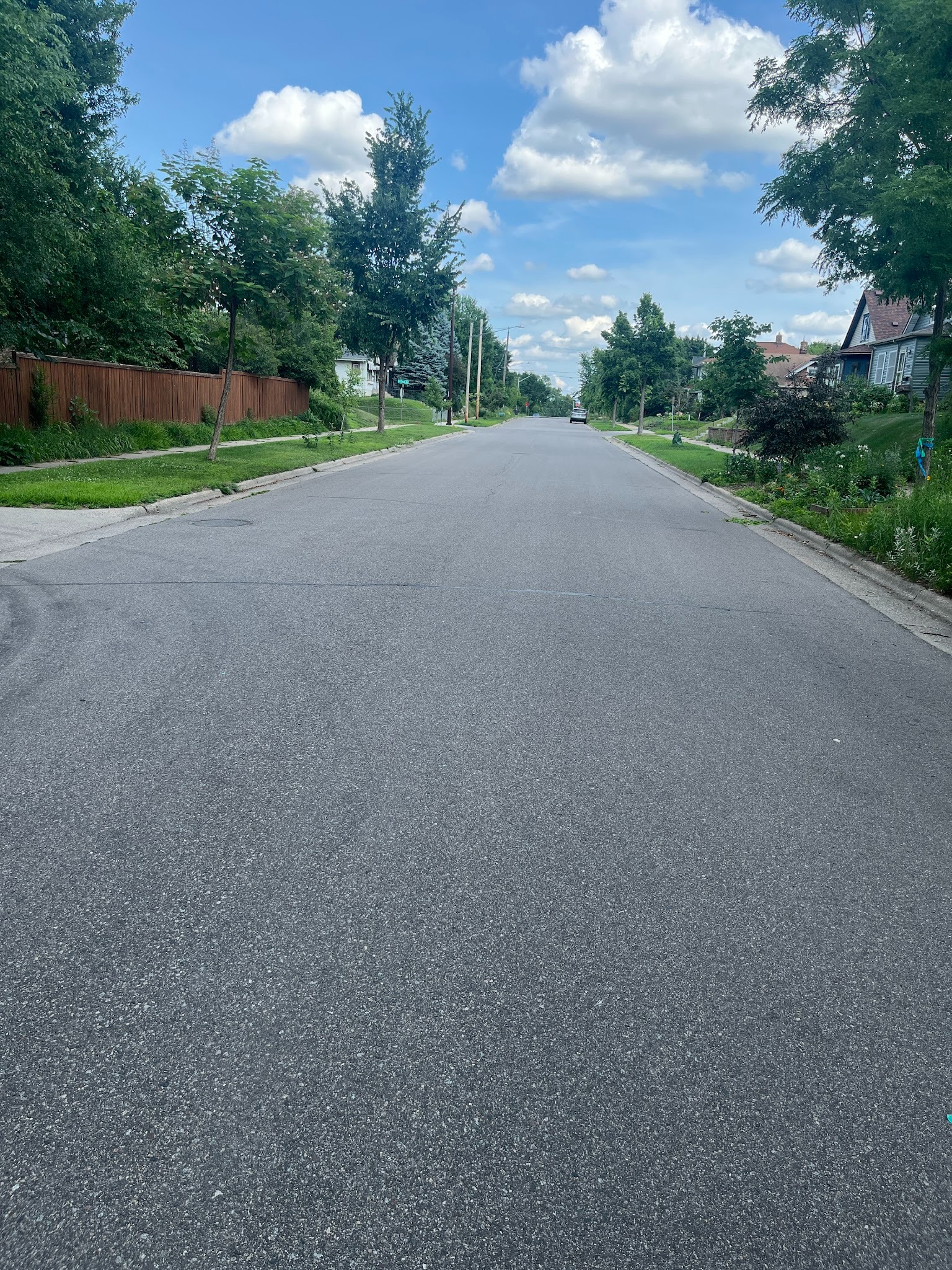
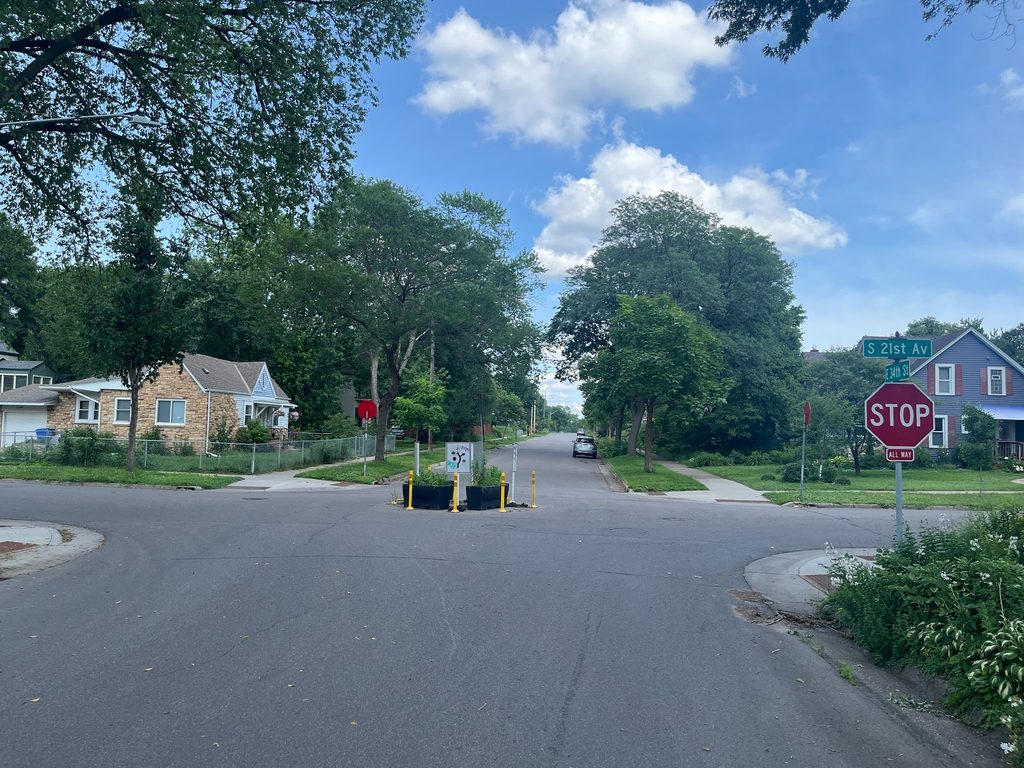
A bicycle boulevard, in contrast, has bicyclists “typically share traffic-calmed space with motor vehicles,” but includes things like diverters, speed bumps, and median refuge islands to manage traffic speeds and, at least in theory, make the traffic mixing manageable for those outside of cars. Parts of 34th Street already have some of these elements, particularly where they cross existing north-south bicycle boulevards (see photos below) — but as a whole, the street is far from a full bicycle boulevard in its current existence.
A Personal Connection
This summer and fall, City staff are beginning the community engagement and design phases of the 34th Street project, with construction planned for 2029.
I heard about the greenway a couple months ago. And for a few reasons, I can’t stop thinking about it.
First, having lived about two blocks from 34th Street for more than a decade, the street is an almost-literal “memory lane.” When I taught in South Minneapolis, on evenings and weekends I’d fuel up and plan lessons at 34th and Lyndale’s Bull Run cafe (now Five Watt Coffee). Across the street, Painter Park is where I’d stroller my infant twins to crawl around a blanket; several years later, they’ve now aged into accessing the playground, skate park, and vending machine. Down the street one way is their church, the other way, their school. A little past that is the Blaisdell YMCA, with its cross-sectional slice of South Minneapolis life, and the pool where I sit and write while my kids learn to swim.
Second and related, to contemplate this project is to imagine the very real benefits for my family, and families across the South Side. My kids, who are nascent city bike riders, are soon to enter the phase where they could conceivably reach places on their own. The stuff that’s more than a one- or two-block walk from home, yet not so far as to necessarily require adult supervision. Even considering giving more autonomy to my kids can seem like a privilege, yet I know there are countless families for whom increased children’s autonomy is simply the necessity borne of our society’s tenuous wages, long work hours, and inadequate childcare.
The park, the school, the cafe — can kids get there safely? The thought of children intersecting or mixing with vehicles that are taller and heavier by the year strikes fear in the heart. We owe it to every family to build the infrastructure that gives them safe options they need to thrive in Minneapolis.
Third, the 34th Street project is a test of Minneapolis’s commitment to transportation equity. Folks in every neighborhood deserve safe and comfortable (and joyful!) ways to get around. Different communities will experience the built environment in different ways, and the nuances of what residents in one area want may differ from what residents in another do.
Yet in South Minneapolis, the infrastructure often varies considerably between neighborhoods east of I-35W and west of it. Lingering differences that underline how neighborhoods like the Old Southside were racially targeted and torn asunder by state transportation planners. West of the freeway has Bryant Avenue and the Whittier-Lyndale Bikeway along Blaisdell and 1st Avenue. East of the expressway there are buffered bike lanes on the dangerous Park and Portland Avenue speedways, with their long-overdue safety improvements mostly yet to come. The 40th Street bikeway is flexpost-protected on the west side (and soon to be upgraded), but gives way to an unprotected boulevard with only painted “bicycle boulevard” markings through the Bryant Neighborhood. Roadways like 26th, 28th, 35th, and 36th streets have dangerous multi-lane one-ways stretching for long distances east of the freeway, while they tend to be either one-lane one-ways, or a safer two-way format, the farther west they go.
Encouragingly, the section of 34th Street greenway that’s already complete is a lovely on-street trail through the Central Neighborhood east of I-35W, completed as part of a Safe Routes to School project in recent years. Will the remainder of the project fully honor the aspirations of communities and deliver benefits fairly across the entire corridor?
We Can Have Amazing Greenways
34th Street is part of a larger conversation about neighborhood greenways, which includes City-led projects as well as initiatives sprung from the grassroots, like Northside Greenway and Southside Greenway.
In the bicycling section of Minneapolis’s Transportation Action Plan, Strategy 1 includes: “51 miles of new neighborhood greenways that manage motor vehicle volume and speed, improve safety at major crossings and reduce stopping at minor crossings. Start with the Northside Greenway and the Southside Greenway.”
Our city’s policy framework is inspiring — and our future greenways can be, too. When I think about the possibilities for 34th, so much comes to mind. Safe and calm crossings. Lush greenery. Public art and poetry. The sparkle of flying bike spokes.
Above all, I think about outcomes: What would it take to create a 34th Street that is filled with young and old, rolling, riding, and walking, to the splashpool or cafe, to the community center or the guitar lesson?
A Call to Action
In a few years’ time, Minneapolis could boast a world-class neighborhood greenway along 34th Street. But to achieve that, the City will need the input from the residents and users who know this street best. And that’s where you come in!
If you, too, imagine great things for the 34th Street Neighborhood Greenway, then here are three immediate ways to get involved:
- Join a Bike Audit: This fall, I’m planning to co-lead a few bike audits along 34th Street (dates TBD). In partnership with neighbors, city staff, and community organizations, these audits will be rolling opportunities for folks to identify the challenges and opportunities for this corridor and to share their aspirations for what a future greenway along 34th Street might look like. If you’d like to roll, reflect, and rally for change, email me at [email protected]. (If you’d like to help lead a ride, snap photos, or take notes, please note that in your email!)
- Email City Staff: Let planners with the City of Minneapolis know what you’d like to see, feel, and experience along 34th Street. Find staff contacts here (scroll down). Be specific: say where you live, what segments or intersections you traverse, how you use them, and what changes would resonate for you personally.
- Spread the Word: As you pass in and around 34th Street, let residents, neighbors, passersby, and the staff of businesses or community spaces you frequent know about this project.