May 4, 2014
9.8 miles
Macalester-Groveland, Union Park (Merriam Park, Midway)
Snelling Avenue is one of Saint Paul’s best known, most diverse and busiest streets. Snelling is slightly more than six miles from Saint Paul’s border with Falcon Heights on the north to the southern end at West 7th Street. Also known as State Highway 51, everything from homes, apartments, restaurants and schools, to churches, hardware stores and two colleges line Snelling Avenue in Saint Paul.
Today I rode two different segments of Snelling totaling about a mile and a quarter.
An old neon sign for Betty and Carl Cafe is the first site that stopped me. The sign sat on the lawn outside an antique store at Snelling and Palace. I stumped Google trying to find a clue about where the Betty and Carl Cafe is or was.
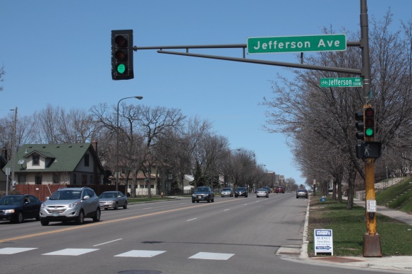
The building that now holds a nail salon and fitness center at Jefferson Avenue and Snelling previously was home to Macalester Bike and Skate. Although it closed at least 20 years ago, the business’s old sign clings tenaciously to the south brick wall.

This is how the intersection of Snelling Avenue at St. Clair looked in 1952. Photo courtesy Minnesota Historical Society.
In the days of the streetcar, multiple businesses sprang up at the corners of intersecting lines. Snelling Avenue and St. Clair Avenue is a good example. In many cases, apartments were constructed on the second floor of the buildings.

St. Paul Corner Drug hugs the northeast corner of St. Clair and Snelling. Other business there include an Italian restaurant, a veterinary clinic and an Oriental medicine clinic.

The businesses in the complex on the southwest corner of Snelling and St. Clair. The Snelling Apartments are on the second floor.
The Macalester College, a.k.a. “Mac,” campus occupies seven blocks along the west side of Snelling from St. Clair to Summit Avenue. Macalester was established in 1874 as a liberal arts college by the Reverend Edward D. Neill. The college relocated from Minneapolis to the present location in 1885.

Macalester had the windmill installed in 2003. There isn’t much electrical generation happening today.

The view westward at Snelling and Grand Avenues. The two buildings on the right are part of Macalester.

The northeastern edge of campus at Snelling and Summit. The brick building in the background is the bookstore.
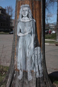
At Summit Avenue, I went west two blocks and traveled north along Pierce Street until I came to a curiously painted and long-dead tree in front of 1664 Hague Avenue. Three portraits of exotic, and possibly mythical women adorn the trunk.

The Amtrak train “Empire Builder” (named after Saint Paul’s James J. Hill) crosses Pierce Street about six hours late on its way east to Milwaukee and Chicago.
.
Back on Snelling where, just north of I-94, a digital display and orange cones and warning signs foretell more Midway construction and congestion. Chicago-based Walsh Construction is ripping up and replacing faulty concrete panels that the company screwed up at Snelling and University. Green Line officials aren’t saying what mistake Walsh made to cause cracks in the concrete at this and 10 other intersections along University Avenue but have been quick to say the construction company is paying for the fixes.

The zoom lens used to take this picture compressed the 1.7 mile distance along Snelling between University Avenue and the State Fairgrounds. The State Fair Space Tower and water tower are in the background.
A large tract of land surrounded by cyclone fence sits immediately east of the digital warning sign. Nearly two blocks long and a block deep, the area served as the staging area for light rail construction equipment and supplies. Now, many remnants of the project are haphazardly situated along the fence next to Midway Center.

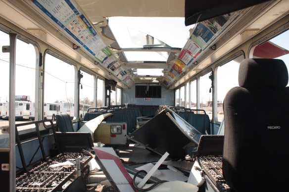
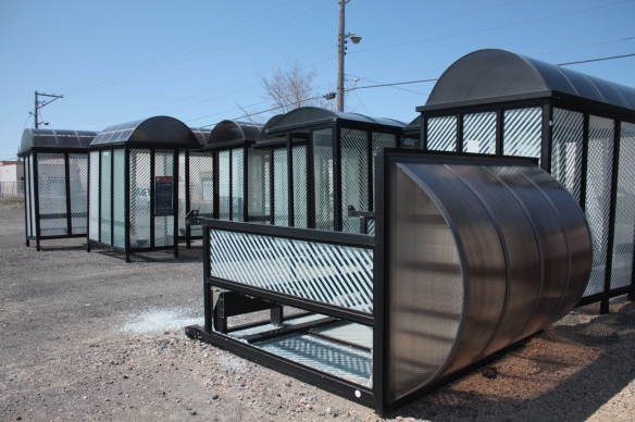
The eastern portion is a temporary graveyard for old Metro Transit buses and shelters, while the largest section of the lot sits virtually empty, an unsightly but valuable wasteland; prime property begging for redevelopment.

The view south across the large parcel of land that stretches from Midway Center to St. Anthony Avenue. Light rail construction equipment is on the left and the homes and building in the background are on Concordia Avenue, on the south side of the I-94 corridor.

It’s the end of the line for these decommissioned Metro Transit buses, which are reflected in a large puddle.
This tract of land (and the area now occupied by Midway Center) used to be home to the main streetcar manufacturing, repair and storage facility.

The Snelling shops in 1953, about a year before streetcars were replaced with buses in the Twin Cities. Photo courtesy Minnesota Historical Society.
A block west of Snelling, two churches occupy corners of the intersection of Shields Avenue and Roy Street.
Bethlehem Lutheran Church In-The-Midway (as it’s called to differentiate from another Bethlehem Lutheran on the East Side) is on the northeast corner and Central Baptist Church sits just across Shields on the southeast corner. Considering the extreme difference in architecture of the churches I am surprised they were both built in the early 1910s. Central Baptist is one of the few Prairie Style churches in Saint Paul. An addition, now the main part of Central Baptist, was built in 1974.
Across the street, 6-year-old Zakias was riding his scooter along the sidewalk with his mom, Zuki Ellis, when we struck up a conversation. The neighborhood is very quiet, despite being within two blocks of I-94 on the south, Snelling to the east, and University to the north. Zuki told me it’s one of the things she loves about the area. “It’s so funny because he (Zakias) said, ‘Look! There are people!’ because you usually don’t see kids unless it’s early in the morning catching the bus. During the weekend it’s usually pretty quiet.”
Another thing Zuki really appreciates about the neighborhood is that so much, including the grocery store and the doctor’s office, is close enough to walk to.
 Zuki added she just enjoys walking Snelling Avenue to see its slow evolution.
“I was just walking down that way (south) on the other side of the freeway and they’re doing all of this construction. And I was like, ‘When did that start?’ Because I guess I hadn’t even been down that way. And then this way (north) walking in the opposite direction toward Minnehaha and toward Midway Hotel and there was a coffin store. At first I thought I read that wrong and I was like I have to check that out when I come back this way. It’s always changing down Snelling, both ways.”
Zakias wanted to start another lap around the block so Zuki and I said our farewells and I rode the opposite way, to Midway Center.
Midway Center, on the southeastern corner of Snelling and University, is one of several large shopping districts nearby along University Avenue. Like the others, it features mostly national and regional chain stores, a phenomenon I call “Anytown U.S.A.” The Midway Center property went from the main mass transit hub in the Twin Cities to retail center in 1960, after buses replaced streetcars.

The Snelling-University intersection and streetcar shops in the mid-1920s. Photo courtesy of the Minnesota Historical Society.

A billboard announced the pending development of Midway Center. Photo courtesy of Minnesota Historical Society.

The recently opened Midway Center in 1960. University Avenue is in the foreground. Photo courtesy of Minnesota Historical Society.
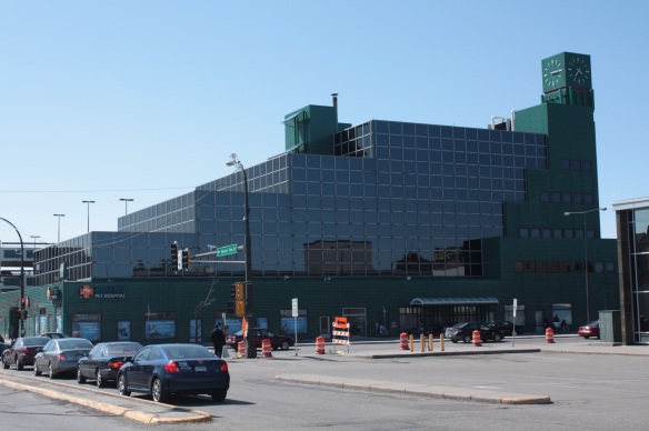
Despite its sprawling size of Midway Center, it is overshadowed by the nearby Spruce Tree Center, the peculiar Kelly green office building on the southwest corner of Snelling and University. Distinctive doesn’t quite capture the feeling. With its blocky design, including the tiles, windows and sections of the building, there is nothing like it in Saint Paul and likely far beyond. Although not obvious to me, Spruce Tree Center’s design resembles a spruce tree, according to a 2008 article in the “Midway Monitor”.

A test train eastbound on University awaits the green light at Snelling Avenue. Spruce Tree Center is in the background.
The light rail tracks on University have been placed in almost the exact position of the Twin City Rapid Transit Company streetcar tracks that were removed some 60 years ago.

Metro Transit employees ready a broken down bus for the trip to an East Side maintenance base. One of the mechanics told me an average of one bus a day breaks down on routes in Saint Paul.
Buses still roam University Avenue, at least for the time being, although this one, not so much.
There were a lot of sights packed into today’s relatively short ride. One last one is the beautiful 30-plus year old “woody” station wagon parked on Herschel Street.

I love “classic” cars like this Chevy Malibu Classic Estate station wagon with faux wood paneling. It’s a 1978, ’79 or ’80. Hershel Street, slightly north of St. Anthony Avenue.
Click on the link below to view a map of today’s ride.

